| Previous :: Next Topic |
| Author |
Message |
RichP
Member


Joined: 13 Jul 2006
Posts: 5634 | TRs | Pics
Location: here |
|
RichP
Member
|
 Sat Sep 02, 2023 7:38 am |
|
|
Across from Resort Creek Pond on NF 4832 a trail heads up to the point overlooking I-90 above where a snowshed covered the freeway for 64 years. It was removed in April 2014 but some of the devices used for avalanche control are still present on top which is informally called "Snowshed Head." Platforms, cables and winches line the top of the ridge. How they were used is unclear to me so if anybody knows the process, please post here. I assume explosives were manually lowered by cable to where snow accumulated and detonated.
I tried coming up last year but the area was under a wildlife closure until Aug 20 of this year.
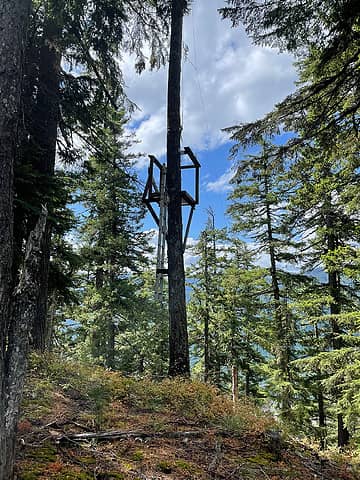 One of several platforms 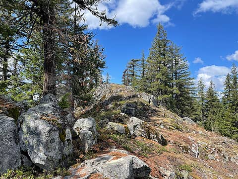 To the western summit 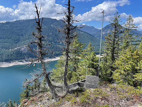 On the western summit 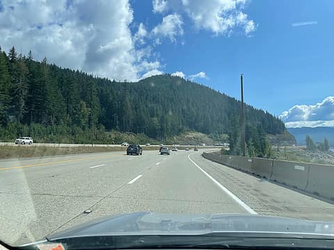 Snowshed Head
 jaysway, jstern, lopper, mosey, JimK, Bramble_Scramble, car68, Pyrites jaysway, jstern, lopper, mosey, JimK, Bramble_Scramble, car68, Pyrites
jaysway, jstern, lopper, mosey, JimK, Bramble_Scramble, car68, Pyrites |
| Back to top |
  
|
|
puzzlr
Mid Fork Rocks

Joined: 13 Feb 2007
Posts: 7220 | TRs | Pics
Location: Stuck in the middle |
|
puzzlr
Mid Fork Rocks
|
Sun Sep 10, 2023 12:04 am |
|
|
Cool discovery Richard! Did you know this was there?
|
| Back to top |
|
|
RichP
Member
Joined: 13 Jul 2006
Posts: 5634 | TRs | Pics
Location: here |
|
RichP
Member
|
Sun Sep 10, 2023 6:13 am |
|
|
|
| Back to top |
|
|
fourteen410
Member

Joined: 23 May 2008
Posts: 2628 | TRs | Pics
|
I was up there last summer and wondered the same thing. Although isn't that area closed now because of the new wildlife corridor?
|
| Back to top |
|
|
RichP
Member
Joined: 13 Jul 2006
Posts: 5634 | TRs | Pics
Location: here |
|
RichP
Member
|
Tue Sep 12, 2023 7:19 am |
|
|
fourteen410 |
| Back to top |
|
|
pipedream
Member

Joined: 14 Oct 2012
Posts: 228 | TRs | Pics
Location: Formerly Seattle |
Pre-wildlife closure we jokingly referred to that zone as the "tits" because the view is "tits" from up there for how little effort you expend to get to it and because from across the valley on the way down from Silver Peak it looks like the profile view of a pair of knockers. It was a favorite lazy afternoon hammock spot of mine - just go up there to get away from it all, drink some cold ones and read a book.
I believe those avalanche control mechanisms are still used, albeit rarely, these days as the new bridge over the avalanche paths those were used to control is typically sufficient. But when a lot of snow builds up in the late winter, WSDOT will close the highway east of the summit and go up there via snowcat and detonate explosives. The bombs themselves are typically 40lb bags of ANFO that are clipped to the cables, lowered via the crank mechanism and then detonated roughly a meter above the snow surface (this is the technique they invented at Alpental in the 90s and it's now used worldwide). Of course, those platforms aren't very high above the snow level, if at all, when they're used.
There are similar platforms and cables near the radio tower at the top of Summit West. They get considerably more use during the winter to knock snow down above EB I-90 (it's typically caught behind the wall above the freeway). Sadly, the tank has been removed - that was a favorite safety meeting location during ski season. If you feel like adventuring further afield, you can find similar "bomb trams" along the FS road that heads downhill from the outlet of Rockdale Lake below the slopes of Radio Mtn. That one has one of the stationary bicycles they use to "pedal" the clipped on bags of explosives uphill, like the ones along the highway just west of the summits of Snoqualmie & Stevens passes
RichP
RichP |
| Back to top |
|
|
|
|


