| Previous :: Next Topic |
| Author |
Message |
Paul M
Member


Joined: 15 Jul 2008
Posts: 371 | TRs | Pics
|
|
Paul M
Member
|
 Mon May 10, 2010 9:53 am |
|
|
With the gate now open and the forecast for improving weather Stu and I decided it was a good time to do this climb (a seasonal game closure of the upper Wynoochee River Road from October 1 to April 30 can add and extra 7.5 miles rt and 800 ft to this trip). We went Friday due to other commitments on the weekend and were surprised to find major road construction underway on the Wynoochee River Road. It turns out that some of the federal stimulus money has been put to work and the state will soon have 10+ miles of newly paved county road extending all the way to Wynoochee Lake. We were also surprised to find that the washout at Copper Creek has been repaired and a large new culvert installed, enabling you to drive another ¼ mile and gain ~200 ft elevation in your vehicle (if you dont mind a few branch smacks on the overgrown road and having to back down this last part).
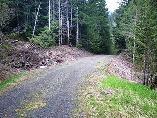 Repaired Copper Creek 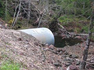 New culvert at Copper Creek 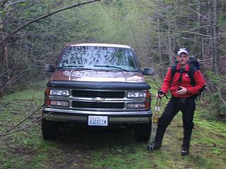 Stu and Big Red at the end of the road 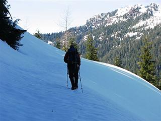 Spur road at 3500 ft 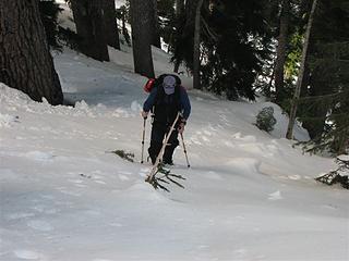 Open forest at 4100 ft 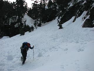 Punching steps to the saddle 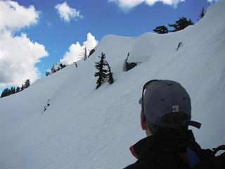 Below the COHP near the dead snags 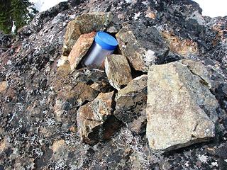 Grays Harbor COHP 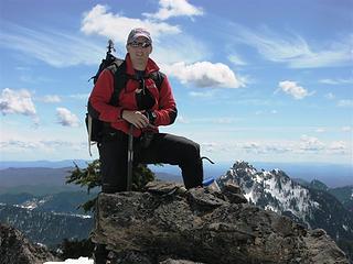 Stu at COHP 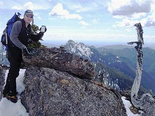 Paul at Grays Harbor COHP 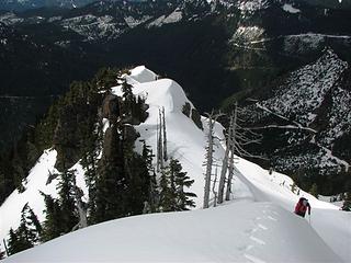 Ridge above the COHP 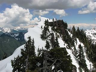 Cornice on Wynoochee Point 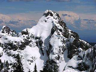 Capitol Peak 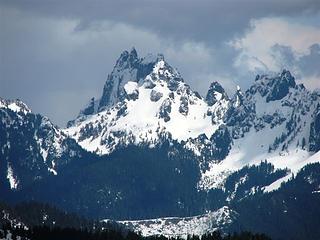 Mt Cruiser 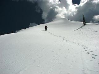 Descending from Wnoochee 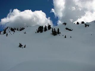 The COHP is by the snags in center of the picture 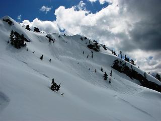 Route to final ridge crest 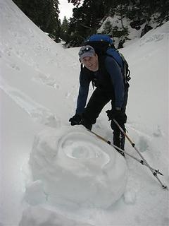 Pinwheels 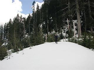 Road saddle at base of NW ridge
|
| Back to top |
  
|
|
Eric
Peak Geek

Joined: 21 Oct 2002
Posts: 2062 | TRs | Pics
Location: In Travel Status |
|
Eric
Peak Geek
|
Mon May 10, 2010 10:42 am |
|
|
Well this is certainly an unusual location that does not see many TRs. Are you and your buddy pursuing the WA COHP list?
Yeah we never posted a TR as we should have but that Copper Creek washout was repaired when we visited on 5/18/2008. We figured the only reason they would bother was if they were going to use the road for some logging soon and that there was thus a chance that they might also brush out that road and also repair the rubble above the first switchback. But it sounds like that has not been done, at least not yet. Maybe the logging went in a different direction or hasn't happened yet.
|
| Back to top |
|
|
Paul M
Member
Joined: 15 Jul 2008
Posts: 371 | TRs | Pics
|
|
Paul M
Member
|
Mon May 10, 2010 11:24 am |
|
|
yea, we are working on the COHP list since we have already climbed a number of things on the list anyways. Here is what Stu and I have already completed in Wash.
I don't think they will repair the access road any time soon. But you may be right about extending further up the valley. We drove it a bit and someone had cut some trees across the "road" already.
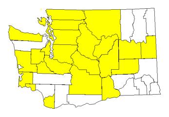 Wa completion map PEM 2010 May 25 count 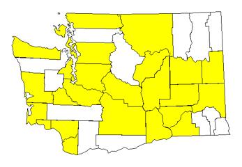 Wa State COHP completion map Stu 26
|
| Back to top |
|
|
Eric
Peak Geek
Joined: 21 Oct 2002
Posts: 2062 | TRs | Pics
Location: In Travel Status |
|
Eric
Peak Geek
|
Mon May 10, 2010 11:49 am |
|
|
Ah yes you are pretty far along then. It looks like you just have Olympus and Big Horn and then the remainder will be quick and easy. Stu looks to have a little bit more work left with Bonanza and Buckner. Although he has tagged my nemisis- Walla Walla County. I won't be finishing for years (if ever) but I try to nibble away at the COHPs here and there.
|
| Back to top |
|
|
Redwic
Unlisted Free Agent

Joined: 23 Feb 2009
Posts: 3292 | TRs | Pics
Location: Going to the Prom(inence) |
|
Redwic
Unlisted Free Agent
|
Mon May 10, 2010 1:21 pm |
|
|
Ahhh... Walla Walla County. Been there, done that, have no desire to return. Much like Douglas County's HP.  Nice maps!!! Most of the way there!!!
Thanks for posting this trip report, too. It's great beta.
Nice maps!!! Most of the way there!!!
Thanks for posting this trip report, too. It's great beta.
60 pounds lighter but not 60 points brighter.
60 pounds lighter but not 60 points brighter.
|
| Back to top |
|
|
Redwic
Unlisted Free Agent
Joined: 23 Feb 2009
Posts: 3292 | TRs | Pics
Location: Going to the Prom(inence) |
|
Redwic
Unlisted Free Agent
|
Sun May 16, 2010 11:09 pm |
|
|
It must be a popular year for this CoHP and peak.
I visited the Grays Harbor CoHP yesterday (May 15).
First, Paul & Stu had visited the CoHP the weekend before I did.
Second, Andy Boos visited the CoHP two days before I did.
I think I probably had the worst snow conditions of the three visits during the week. From Copper Creek Pass to ~4500', it was an awful snow slog. I was not aware of Andy Boos visiting the peak until I reached the summit register, and the warming trend had all but eliminated even his tracks in many places from only two days prior. I used with knowledge of past reports as well as what I considered to be my best judgement to find the best route (for me) to reach the summit ridge. The diciest spot of the entire trip was while in the steep lower forested sections when a snow embankment disappeared below my feet while traversing around a rock arete. Thank goodness I had my "green belay" in check beforehand, and I was closely watching every step and handhold the whole time.  The snow on the summit ridge was surprisingly consolidated... I could virtually run across it and around it (with microspikes on). When I got close, I temporarily stashed my gear, minus my ice axe and one trekking pole, and proceeded to visit the various peak points. I was shocked to find multiple boot paths in the snow near and on the summit ridge... more than from only two people. Once I saw Andy Boos' name on the summit register, it made sense why the extra boot paths were there. Still, I was shocked how much snow had melted in only a week. I was also disappointed to find no snow pinwheels as Paul & Stu had.
  This was not the easiest or the safest WA CoHP to reach, but it definitely has outstanding views that made the entire journey worthwhile. Also, on a side-note, I LOVED the red rocks I passed while en route to Copper Creek Pass.
60 pounds lighter but not 60 points brighter.
60 pounds lighter but not 60 points brighter.
|
| Back to top |
|
|
Redwic
Unlisted Free Agent
Joined: 23 Feb 2009
Posts: 3292 | TRs | Pics
Location: Going to the Prom(inence) |
|
Redwic
Unlisted Free Agent
|
Sun May 16, 2010 11:13 pm |
|
|
I forgot to mention in my previous post that I was so enthusiast after visiting the Grays Harbor CoHP, that I decided to visit the Grays Harbor CoGPP candidates on my return-trip to Montesano.
Then I was so enthusiastic after visiting a prominent peak, that I decided to do a WA 2kP peak while on a trip to run some errands in Leavenworth early this morning. I summited Tumwater Mountain... and HATED the massive amount of fallen timber debris on the summit ridge... but liked the large summit boulder.
60 pounds lighter but not 60 points brighter.
60 pounds lighter but not 60 points brighter.
|
| Back to top |
|
|
|
|


