| Previous :: Next Topic |
| Author |
Message |
wildernessed
viewbagger


Joined: 31 Oct 2004
Posts: 9275 | TRs | Pics
Location: Wenatchee |
Location : North of Cashmere
Access : SR 2 > Nahahum Canyon Rd > FR 7412 > FR 7415 > 7400
Map : GTM Cashmere, TOPO
Stats : 5 mi, 2000 r/t
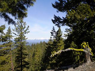
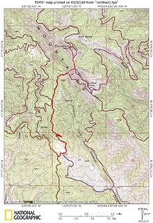 Chumstick Mountain 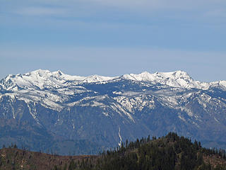 Big Lou to Big Jim 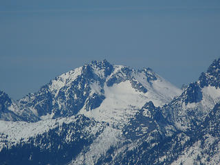 McClellan 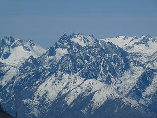 Temple Ridge area 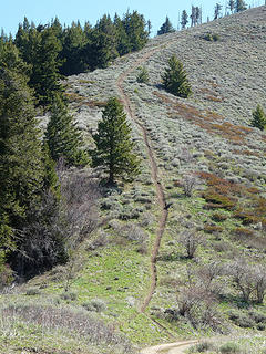 Mountain bike trail to Entiat Ridge. 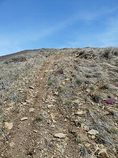 Mountain bike trail to the summit 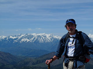 Hit the Trail 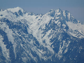 Rat Creek Drainage 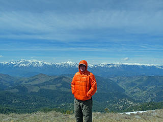 Nice day, cool winds. 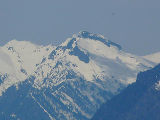 Mt. David 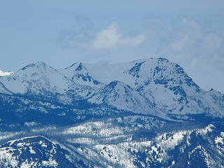 Lake Augusta Basin and Big Jim 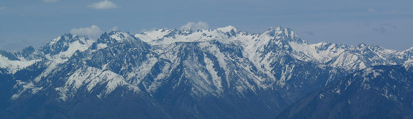 Enchantments - Stuart 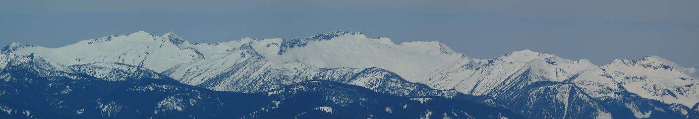 Chiwaukum Ridge 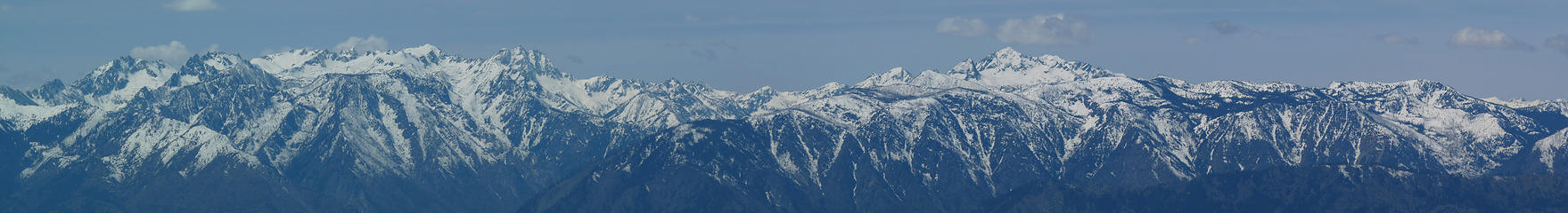 Summit Pano 1 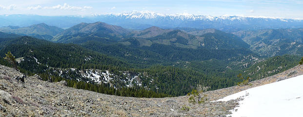 Summit Pano 2 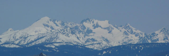 The Maude - 7FJ - Ferno w - Copper Complex
Living in the Anthropocene
Living in the Anthropocene
|
| Back to top |
  
|
|
Highwalker's Daughter
Member
Joined: 12 Aug 2006
Posts: 1575 | TRs | Pics
Location: Bothell, WA |
Looks like a lovely spot and day.
|
| Back to top |
|
|
bonobo
Owl Juggler for rent
Joined: 23 Jun 2004
Posts: 818 | TRs | Pics
|
|
bonobo
Owl Juggler for rent
|
 Thu May 13, 2010 2:20 pm |
|
|
Nice trip! Love the pics, the mountains looked so clean and sparkly yesterday. Felt like the beginning of summer around Leavenworth. The views from Chumstick are amazing!
It's starting. It's that time of year where I start worrying about where to go on the next hike because there is too much to choose from. What a beautiful thing! 
|
| Back to top |
|
|
HitTheTrail
Member

Joined: 30 Oct 2007
Posts: 5455 | TRs | Pics
Location: 509 |
Wildernessed,
Good idea, it played well. We could not have ask for better weather or vis. Also, I have not been four-wheeling like that since I was a teenager. All in all a great day with equally great company. Since my camera is not in the same league with yours I will not degrade the scenery photos by adding any of mine. That limits my contribution to a hearty thanks for the invite and a couple of snapshots.
 Glacier Peak 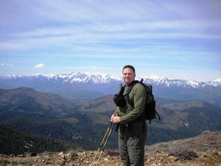 Wildernessed 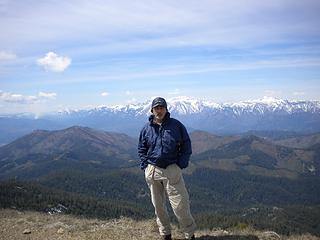 Yours Truly 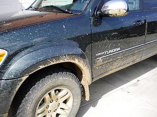 Mud Romp
|
| Back to top |
|
|
Hikingqueen
Member

Joined: 12 Nov 2007
Posts: 2946 | TRs | Pics
|
 Mud Romp! I like it! Mud Romp! I like it!
|
| Back to top |
|
|
wildernessed
viewbagger
Joined: 31 Oct 2004
Posts: 9275 | TRs | Pics
Location: Wenatchee |
These are the kind of beta shots you like to see. Here is the Rat Creek Drainage taken from Chumstick showing the route to Cannon Peak once you drop over the ridge into Cooney Lake Basin from the Mountaineer Creek approach, it shows the two couloirs you go up and the final slope to Cannons summit. Guidebook shot.
Rat Creek Drainage
Living in the Anthropocene
Living in the Anthropocene
|
| Back to top |
|
|
Layback
Cascades Expatriate

Joined: 16 Mar 2007
Posts: 5712 | TRs | Pics
Location: Back East |
|
Layback
Cascades Expatriate
|
Sat May 15, 2010 8:23 am |
|
|
Nice Rob. Great views.
|
| Back to top |
|
|
|
|
You cannot post new topics in this forum
You cannot reply to topics in this forum
You cannot edit your posts in this forum
You cannot delete your posts in this forum
You cannot vote in polls in this forum
|
Disclosure: As an Amazon Associate NWHikers.net earns from qualifying purchases when you use our link(s). |


