| Previous :: Next Topic |
| Author |
Message |
ragman and rodman
Member


Joined: 28 Apr 2005
Posts: 1219 | TRs | Pics
Location: http://rgervin.com/ |
Trailhead: From 29 Pines Campground... drive ~4 miles on the N. Fork Teanaway road... turn right just before crossing Beverly Creek and drive to the Beverly Turnpike trailhead (3600') at end of the road.
Route: Bean Creek Basin to Earl's NW ridge (6500')... follow the ridge to the summit (7036')... return to Bean Creek Basin via the summer trail route.
Patchy snow at ~4400 feet... continuous snow at the second avalanche gully (4800').
A makeshift bridge worked well for the first crossing of Bean Creek (~4100') and we used a snowbridge (~5200') for the second crossing.
Used snowshoes, ice ax and poles.
6.25 miles roundtrip, gaining 3358 feet of elevation.
Excellent views of the Stuart Range and Teanaway Peaks.
GPS route and photos of our snowshoe trip to Earl Peak.
..
|
| Back to top |
  
|
|
Type E
Member

Joined: 19 Aug 2006
Posts: 1381 | TRs | Pics
|
|
Type E
Member
|
 Thu May 13, 2010 6:43 pm |
|
|
looks like a beautiful day to be out. I am glad you found a snow bridge to make the second crossing of Bean Creek. When I did it last year I had to cross the creek and then hang upside down to hoist the beagle up. It was probably the most unnerving moment of last year for me. I am going crazy today stuck at work looking out at the beautiful weather wishing I could be out. Glad you could at least make it out.
E
|
| Back to top |
|
|
TrailPair
Member

Joined: 17 Apr 2005
Posts: 1699 | TRs | Pics
|
A few years ago (in May) we ran the ridge from Bean to Earl Peak, and really enjoyed it. How stable did the snow seem? That is a hike we would like to repeat. 
This thing called work is interfering with my play
This thing called work is interfering with my play
|
| Back to top |
|
|
Slide Alder Slayer
Member

Joined: 14 Jan 2002
Posts: 1960 | TRs | Pics
|
|
| Back to top |
|
|
ragman and rodman
Member
Joined: 28 Apr 2005
Posts: 1219 | TRs | Pics
Location: http://rgervin.com/ |
| TrailPair wrote: | | How stable did the snow seem? |
From 6000 feet to the ridge (6500') the snow conditions were variable... we were on snowshoes... sometimes sinking 5 inches... and sometimes very little.
The snow on the ridge was firm, but forgiving... snowshoes worked fine.
There was very little evidence of slide activity, however, we were glad to reach consistent snow conditions on the ridge.
|
| Back to top |
|
|
silence
Member

Joined: 25 Apr 2005
Posts: 4420 | TRs | Pics
|
|
silence
Member
|
Fri May 14, 2010 1:59 pm |
|
|
we were up in the basin skiing last weekend .. our 1st bc adventure .. so we didn't even think about doing earl (way beyond our skill level) ... except to think .. man that would be fun to climb .. we gotta get back there
btw the better skiers were all over it .. apparently great spring conditions with good corn
PHOTOS
FILMS
Keep a good head and always carry a light bulb. Bob Dylan
PHOTOS
FILMS
Keep a good head and always carry a light bulb. Bob Dylan
|
| Back to top |
|
|
Arete
Member

Joined: 29 Oct 2006
Posts: 137 | TRs | Pics
Location: Bothell, WA |
|
Arete
Member
|
Fri May 14, 2010 7:58 pm |
|
|
Thanks much for the report - looks like fun! We're off to the Teanaway tomorrow (south ridge of Iron) and it looks like we'll bring our snowshoes! 
|
| Back to top |
|
|
BarbE
Member

Joined: 28 Jul 2006
Posts: 1153 | TRs | Pics
|
|
BarbE
Member
|
Sun May 16, 2010 10:23 am |
|
|
My first time on Earl and the timing was excellent.
Mount Stuart clearly was the star of the show with a great line-up of peaks, blue skies and cloud formations as the back drop.
Ragman's route to the summit was absolutely straight, thrilling and direct.    We took the somewhat more gradual route near the summer trail down.
A few more pictures.
We took the somewhat more gradual route near the summer trail down.
A few more pictures.
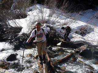 creek crossing 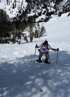 steep and straight up 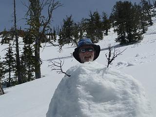 Snow/ragman 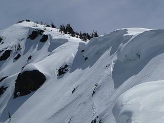 cornices near summit 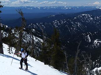 up 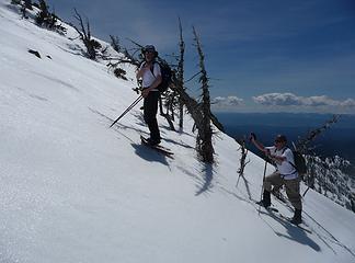 straight up 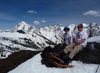 Relaxing near Earl summit 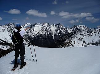 Ragman pointing at his next destination 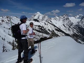 the summit 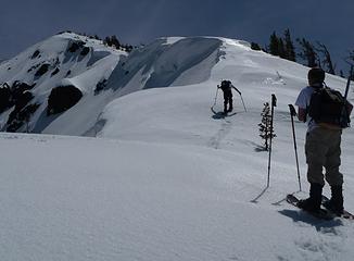 getting closer 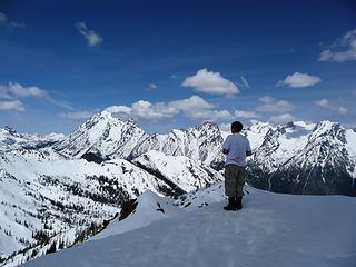 Rodman in awe 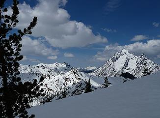 Bean, Volcanic Neck & Stuart 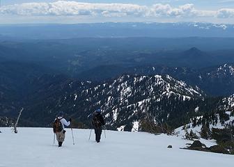 leaving the summit 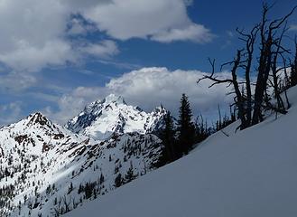 Bean & Stuart 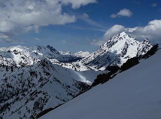 one more shot of Stuart 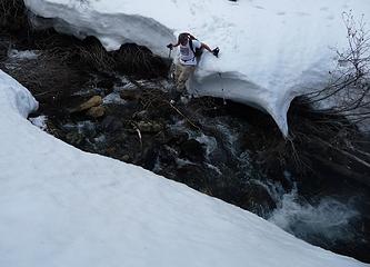 one more creek crossing 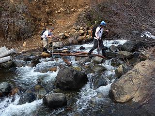 last creek crossing 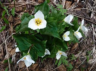 Trillium cluster
|
| Back to top |
|
|
|
|


