| Previous :: Next Topic |
| Author |
Message |
Flora
Enjoying the Sun!


Joined: 25 Mar 2007
Posts: 1035 | TRs | Pics
Location: Land of many waters |
|
Flora
Enjoying the Sun!
|
 Sun May 16, 2010 3:16 pm |
|
|
While not strictly a hike, we fulfilled a long-held wish of mine to visit the John Day Fossil Beds and to explore the rugged John Day Country and Southern Blue Mountains of NE Oregon. We headed down Hwy 395 from Pendleton, passing through the last of the wheatfields around Pilot Rock, and into the Southern Blue Mountains of Oregon. At Ukiah, we stopped briefly to buy a new trailpass and national forest map. Back on the road, we soon encountered the impressive North Fork John Day River. Then we headed to over the Meadowbrook Summit, dropping down into the Middle Fork. We passed through the tiny settlements of Long Creek, Monument and Kimberly to approach the Blue Basin Unit of John Day Fossil Beds.
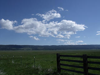 The Southern Blues of Oregon has vast tracts of rolling mountains covered with timber, as well as the unexpected vast open tracts of meadow land covered in season with wildflowers. 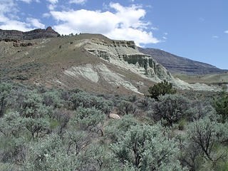 Forsee Area 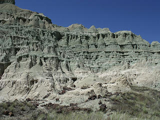 Part of the Forsee area of the Sheep Rock Unit, John Day Fossil Beds 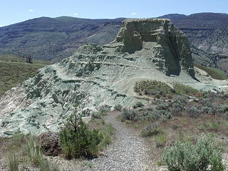 Forsee Area has two short trails and picnic area. It's located on Hwy 19 near Dayville, OR and is part of the John Day Fossil Beds. 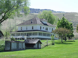 James Cant Ranch, old headquarters for the Sheep Rock Unit, John Day Fossil Bed National Monument. Peaceful ranch belonged to Cant family for 70 years, raising mostly sheep. 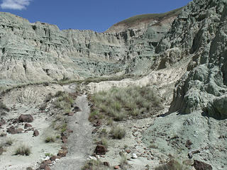 This eerie landscape is Blue Basin, part of the John Day Fossil Beds, located near Dayville, OR, off of Hwy 19/26. 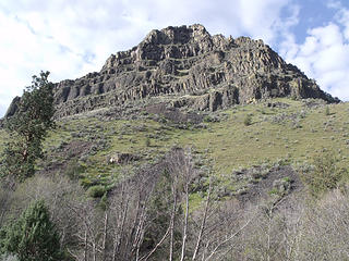 Cathedral Rock, off Hwy 19, near Kimberly, OR 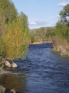 John Day River in late afternoon sunlight, near Mt. Vernon, OR. 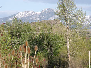 Strawberry Mountain looms up above the John Day River Valley near Mt. Vernon, OR 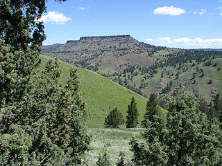 Junipers reign supreme in the arid and rugged John Day Country of Eastern OR 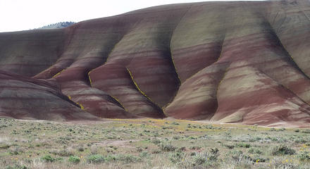 The Painted Hills Unit of John Day Fossil Beds. Golden Bee Plant lines the gullies of this clay formation in the spring. 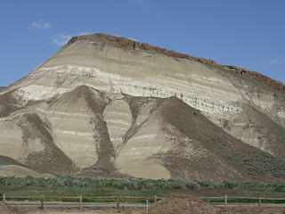 Carroll's Rim looms above the Painted Hills Unit, displaying layers of ash and clay capped with basalt. 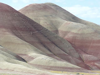 Part of the Painted Hills Unit of the John Day Fossil Beds National Monument 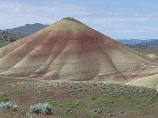 View west from the Painted Hills Overlook Trail. 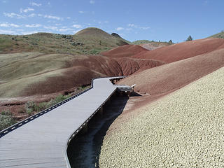 These ashey hills are very fragile. A boardwalk leads the visitor around the Painted Cove Trail 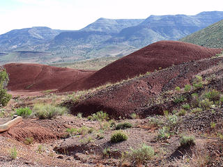 The Painted Hills and Stratton Mountain in the distance. 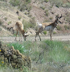 A pair of curious antelope greeted us on the access road to the Painted Hills. 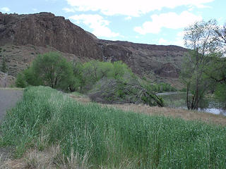 The John Day River and its tributaries are oases in this arid rocky landscape near Service Creek, OR. The John Day is a wild, scenic river flowing all the way to the Columbia River without a single dam.
|
| Back to top |
  
|
|
Hiker Mama
Member

Joined: 25 Jun 2006
Posts: 3451 | TRs | Pics
Location: Lynnwood |
Very nice! I haven't been to that area since I was a child.
|
| Back to top |
|
|
Flora
Enjoying the Sun!
Joined: 25 Mar 2007
Posts: 1035 | TRs | Pics
Location: Land of many waters |
|
Flora
Enjoying the Sun!
|
Sun May 16, 2010 4:17 pm |
|
|
Thanks, Hiker Mama.
It was a fast visit of a huge area. Lots of ground to cover. And the weather is getting warm. It was in the lower 80's (at 3,000 feet elevation) on Friday.
This was a scouting trip for (hopefully) future camping and hiking trips, including some backpacking.
I enjoyed it very much.
|
| Back to top |
|
|
Scrooge
Famous Grouse

Joined: 16 Dec 2001
Posts: 6966 | TRs | Pics
Location: wishful thinking |
|
Scrooge
Famous Grouse
|
Sun May 16, 2010 4:20 pm |
|
|
That's two nice reports on the John Day area, Flora.  It's gotten quite a lot of (well deserved) attention here on the forum lately. I suggest that anyone interested in seeing more run a search for "Painted Hills" or "John Day", here on nwhikers It's gotten quite a lot of (well deserved) attention here on the forum lately. I suggest that anyone interested in seeing more run a search for "Painted Hills" or "John Day", here on nwhikers
Something lost behind the ranges. Lost and waiting for you....... Go and find it. Go!
Something lost behind the ranges. Lost and waiting for you....... Go and find it. Go!
|
| Back to top |
|
|
Flora
Enjoying the Sun!
Joined: 25 Mar 2007
Posts: 1035 | TRs | Pics
Location: Land of many waters |
|
Flora
Enjoying the Sun!
|
Sun May 16, 2010 4:31 pm |
|
|
Thanks, Scrooge.
It is an area deserving of more print in our forums. And for more purist hiker, backpacker, climber types, try out exploring the Elkhorns and the Strawberry Mountains. They're impressive. Strawberry is 9,000 feet and the tallest Elkhorn, Rock Butte, is 9,100 feet. Although less known than their nearby cousins, the Wallowas, these smaller wilderness areas do deserve some attention...but not too much. Part of their appeal is the lack of people!

|
| Back to top |
|
|
Dean
(aka CascadeHiker)

Joined: 02 Mar 2002
Posts: 1967 | TRs | Pics
Location: ex Kennewick, Wa & Lehi Utah |
|
Dean
(aka CascadeHiker)
|
Mon May 17, 2010 6:21 pm |
|
|
another steller trip report/pics. Strawberry and Rock Creek Butte are both really nice peaks to hike. Lots of mountain goats near twin lakes. Thanks Flora 
|
| Back to top |
|
|
Flora
Enjoying the Sun!
Joined: 25 Mar 2007
Posts: 1035 | TRs | Pics
Location: Land of many waters |
|
Flora
Enjoying the Sun!
|
Mon May 17, 2010 7:05 pm |
|
|
Thanks, Dean.
I'm looking forward to hiking on and around Strawberry and maybe doing the loop around Gunsight Peak in the Elkhorns. There's a lot of great country to explore. There was some snow above 5,000 feet as yet even in this arid country. There was snow on Road 52, as some of the passes were over 5,000 feet! The place is still melting out. Should be great in a month or so.
Enjoy Utah!
|
| Back to top |
|
|
bobbi
stillaGUAMish

Joined: 13 Jul 2006
Posts: 8012 | TRs | Pics
Location: olympics! |
|
bobbi
stillaGUAMish
|
Mon May 17, 2010 7:05 pm |
|
|
i love the John Day area! thanks for sharing your adventure!
i must go back 
bobbi ૐ
"Today is your day! Your mountain is waiting. So
get on your way!" - Oh, the Places Youll Go! By Dr. Seuss
bobbi ૐ
"Today is your day! Your mountain is waiting. So
get on your way!" - Oh, the Places Youll Go! By Dr. Seuss
|
| Back to top |
|
|
Flora
Enjoying the Sun!
Joined: 25 Mar 2007
Posts: 1035 | TRs | Pics
Location: Land of many waters |
|
Flora
Enjoying the Sun!
|
Tue May 18, 2010 6:54 am |
|
|
My friend tells me the best time to visit the John Day is April through June when the arid countryside is green. After that, I hope you like heat! Fall is good, too. In the wintertime, it can get cold!
P.S. Thunderstorms can happen anytime! It also snowed in John Day last week (May 16th or so). Bring layers!
|
| Back to top |
|
|
|
|
You cannot post new topics in this forum
You cannot reply to topics in this forum
You cannot edit your posts in this forum
You cannot delete your posts in this forum
You cannot vote in polls in this forum
|
Disclosure: As an Amazon Associate NWHikers.net earns from qualifying purchases when you use our link(s). |


