| Previous :: Next Topic |
| Author |
Message |
beaudaddy
Coast To Cascades


Joined: 25 Feb 2010
Posts: 401 | TRs | Pics
Location: Tulalip, WA |
|
beaudaddy
Coast To Cascades
|
 Tue May 18, 2010 6:12 pm |
|
|
So I headed out from work (Marysville) yesterday at about 4:30pm searching for a quick, tasty summit. Somehow I ended up finding myself driving eastbound HW20 looking up info on my iphone as I drove. My large map book layed open across my lap as I ate a banana and cliff bar. Takes talent right there or being really stupid.
Mount Josephine looked pretty sweet on my map and I liked the fact that you could drive pretty close (if not all the way) to the summit. This was a big turn on for two reasons. The fact that I didn't have a lot of time plus I knew that at almost 4k in elevation (3,957') to be exact, that I would hit snow. This was fine for me because I wanted to stretch the legs, not just bounce around on a logging road all evening. I didn't have any info on this peak, just an old map that I have.
So I took a left on Scott Paper Rd, took a right on Hamilton Cemetery Rd and then take a left on Medford Rd. When I got to the Horse Camp I took a right and ended up at some private campground/compound... Back tracked and took a left. I started driving logging roads and heading Northwest. I started to really gain elevation and tested every spur road that would make sense. I finally came to a good looking dead end. I looked above and there seemed to be a highpoint. I was getting frustrated on not finding the right logging road so I jumped out and went for it. I mainly made this decision because I didn't want to spend my whole evening driving down roads. I thought to myself, even if this isn't the summit it looks like it would have good views and I would be able to get a hike in before the sun went down.
I scurried down some washouts in a easterly direction, flushed up a ruffed grouse and found a good slot of timber to start going up. Once I made it to the edge of timber it turned into a pleasant bushwhack north through open reprod. Lots of Huckleberries starting to develop, saw trilliums and stream violets. Nothing too outstanding. After about .5 mile and 400' of elevation gain I made it to a road on the high ridge. I looked east to the end of the ridge at a high point. This was the highpoint that I saw from down below. Later known as point 3,210'. I raced over and climbed some rocks to the top of it. The views were really good from here. The view looking up at Mount Josephine was real FREAKING great.   I shook my head and laughed. This is exactly what happens when you head out without doing any research. I shook my head and laughed. This is exactly what happens when you head out without doing any research.
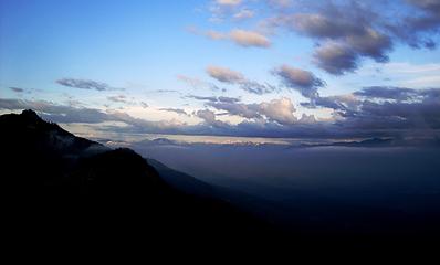 Looking east toward Mount Josephine from Point 3210 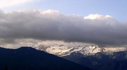 Twin Sisters Mountain from point 3210. 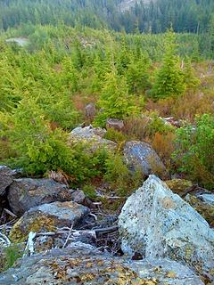 Field of Hemlock below point 3210 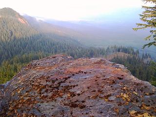 Point 3210 looking east 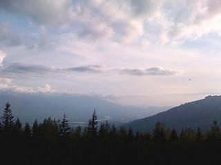 Point 3210 looking southwest 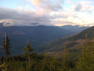 Point 3210 looking northeast. On a clear day you would see Mt Baker here. 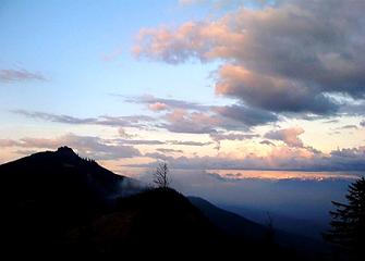 Looking over at Josephine from point 3210 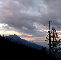 Mount Josephine seen from a lower road 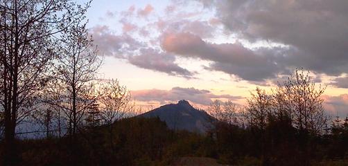 Mount Josephine seen from the 3210 ridge 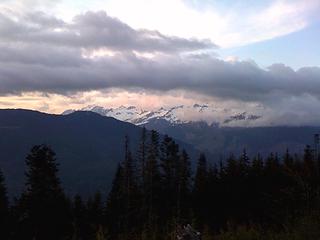 Twin Sisters Mountain seen from point 3210.  So I had a bear breaking trail for me for the next 400' of gain. I could tell that the tracks were 1-2 days old. So I had a bear breaking trail for me for the next 400' of gain. I could tell that the tracks were 1-2 days old.
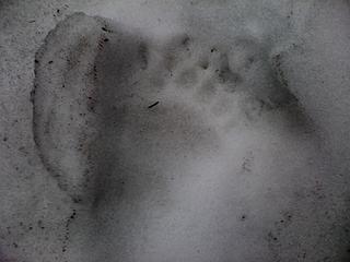 Bear Track in the snow below Mount Josephine Summit 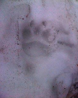 Bear Track in the snow below Mount Josephine Summit 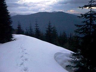 Looking back north on the ascent to Mount Josephine Summit 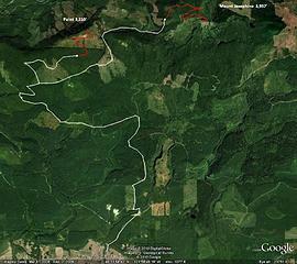 Map of Summit Route
|
| Back to top |
  
|
|
mtn.climber
Member

Joined: 29 Jul 2008
Posts: 1204 | TRs | Pics
Location: The Lost Horizon |
I wish my camera phone would take pics that good. Nice trip.
Reach for the sky, cuz tomorrow may never come.
Live the life of love. Love the life you live.
Reach for the sky, cuz tomorrow may never come.
Live the life of love. Love the life you live.
|
| Back to top |
|
|
Movenhike
\m/..mmmmetal\m/
Joined: 16 Apr 2007
Posts: 642 | TRs | Pics
Location: Leavenworth, WA |
|
Movenhike
\m/..mmmmetal\m/
|
Tue May 18, 2010 10:51 pm |
|
|
Cool title!
"Make it your Friend" -John Bull
"Make it your Friend" -John Bull
|
| Back to top |
|
|
beaudaddy
Coast To Cascades
Joined: 25 Feb 2010
Posts: 401 | TRs | Pics
Location: Tulalip, WA |
|
beaudaddy
Coast To Cascades
|
Tue May 18, 2010 11:37 pm |
|
|
| mtn.climber wrote: | | I wish my camera phone would take pics that good. Nice trip. |
you need to get one of those iPhones! They are pretty sweet. Gps and google earth work great when you have Internet... When you have Internet...  .
Thanks Movenhike!!! .
Thanks Movenhike!!!
|
| Back to top |
|
|
|
|
You cannot post new topics in this forum
You cannot reply to topics in this forum
You cannot edit your posts in this forum
You cannot delete your posts in this forum
You cannot vote in polls in this forum
|
Disclosure: As an Amazon Associate NWHikers.net earns from qualifying purchases when you use our link(s). |


