| Previous :: Next Topic |
| Author |
Message |
beaudaddy
Coast To Cascades


Joined: 25 Feb 2010
Posts: 401 | TRs | Pics
Location: Tulalip, WA |
|
beaudaddy
Coast To Cascades
|
 Tue Jun 01, 2010 5:57 pm |
|
|
I headed down Friday evening to visit my parents on the Washington Coast for the weekend. There are no big mountains in the area, just the Willapa Hills which I ran up and down as a kid. The only summit that was on my list for the weekend was Saddle Mountain in Oregon, which I planned to go up on Sunday morning. I figured it would be fun to go up, even if the weather conditions were poor. The forecast for the coast looked real nasty, but Sunday was Suppose to be the better day. However, as Saturday rolled around it turned into a beautiful day. So I got a wild hair to head somewhere high with views.
One of the highest points in the area is Radar Hill with the Cowan Point Lookout as the true summit. I love the spot because on a clear day it offers a panoramic view of the Naselle Valley, Columbia River and the Pacific Coastline.
So I talked my parents and 4 year old son into going. I figured I could get some catching up AND a summit into the mix. We left the house and headed down 101. At Johnsons Landing it turns into Highway 4 heading toward the small town called Naselle. Just before we got into Naselle, we took a left at the Naselle Youth Camp. This was once the old building used by the Air Force back in the 60s. The locals call the ridge Radar Hill, because it was a fully manned Aircraft Control Warning (AC&W) operation by the U.S. Air Force in the late 50s and early 60s. There were once massive Radar Domes on the summit, but what remains are just large concrete foundations.
The thing I enjoy about Radar Hill is all the game trails you can follow in the woods. I also love the large rock outcroppings that it has.
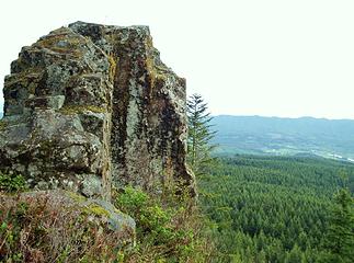 Cool Rock Outcropping On Radar Hill 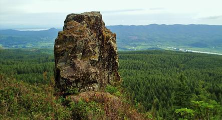 Cool Rock Outcropping on Radar Hill 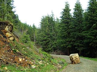 4' x 6' x 5' Boulder Fell In The Road... Ouch!!! 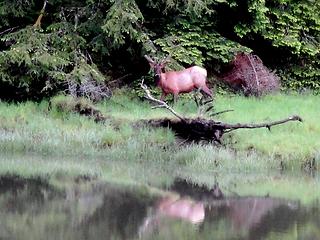 Bull Elk feeding next to the water 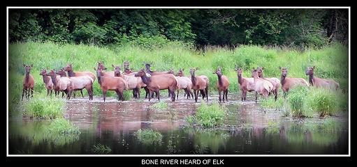 Herd Of Elk Cooling Off 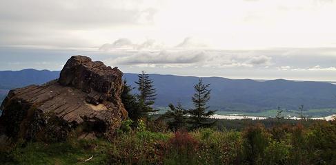 Rock Outcropping On Radar Hill And Naselle River Below 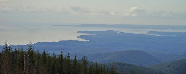 Looking Toward Willapa Bay From Radar Hill 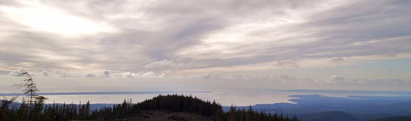 Looking Toward The Long Beach Peninsula And Willapa Bay From Radar Hill 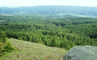 Looking South From A Rock Outcropping On Radar Hill 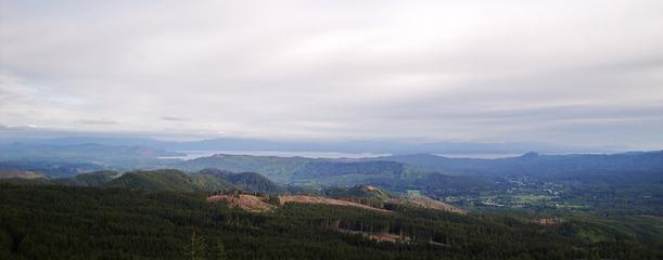 Looking Toward The Columbia River 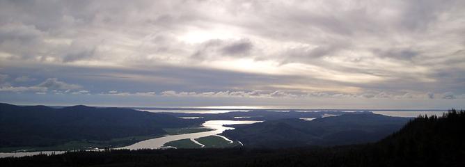 Looking Toward The Mouth Of The Naselle River and Willapa Bay 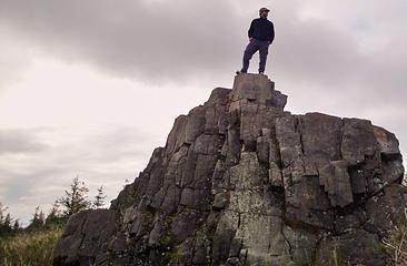 On Top Of Radar Hill Highpoint 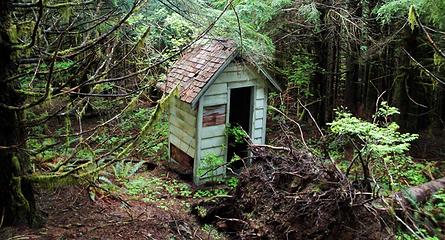 Old Outhouse At Cowan Point Lookout 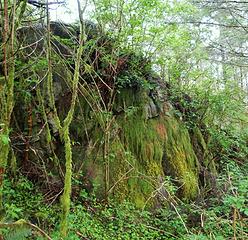 Cowan Point Lookout Summit 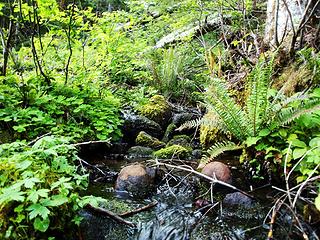 Small Spring 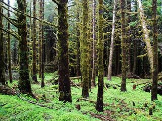 Mossy Forest 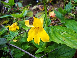 Monkey Flower
|
| Back to top |
  
|
|
Redwic
Unlisted Free Agent

Joined: 23 Feb 2009
Posts: 3292 | TRs | Pics
Location: Going to the Prom(inence) |
|
Redwic
Unlisted Free Agent
|
Tue Jun 01, 2010 7:10 pm |
|
|
Nice photos. While you were there, I was on Walville Peak. Did you see me waving?  Eric Noel recently told me that Pacific County might soon put wind towers on Radar Hill. Did you see any evidence of that?
60 pounds lighter but not 60 points brighter.
60 pounds lighter but not 60 points brighter.
|
| Back to top |
|
|
Eric
Peak Geek

Joined: 21 Oct 2002
Posts: 2062 | TRs | Pics
Location: In Travel Status |
|
Eric
Peak Geek
|
Tue Jun 01, 2010 7:57 pm |
|
|
Yeah there is a test tower at the ridgeline junction where the overgrown road to the lookout starts.
I believe that I read something in the paper where one of the backers of the wind turbine project (Grays Harbor PUD) took a pass but it was unclear if the other folks were going to still try to build it.
With the trees having grown up and the lookout tower having burnt down there aren't really any views to be had at the HP where the LO was. But Radar Hill does have quite expansive views.
I never would have guessed this one would ever see a NWHikers TR.
|
| Back to top |
|
|
beaudaddy
Coast To Cascades
Joined: 25 Feb 2010
Posts: 401 | TRs | Pics
Location: Tulalip, WA |
|
beaudaddy
Coast To Cascades
|
Tue Jun 01, 2010 9:28 pm |
|
|
Thanks Redwic!!! The wind farm is the talk of the town, however the marbled murrelets are costing millions in engineering and permitting costs. No construction has started and there are no approved permits in place. No green light yet, and maybe never. We will see. I think I saw you waving though...  Eric- I guess I'm glad I could surprise you. I have seen stranger reports on here. Um ya..... Lol. My family has lived in the area for over 100 years, and I moved away when I turned 20... Sometimes I just miss the area I guess. I spent most all of my childhood in those hills.
What would have been really surprising is if you would have posted this...
Eric- I guess I'm glad I could surprise you. I have seen stranger reports on here. Um ya..... Lol. My family has lived in the area for over 100 years, and I moved away when I turned 20... Sometimes I just miss the area I guess. I spent most all of my childhood in those hills.
What would have been really surprising is if you would have posted this...
|
| Back to top |
|
|
Magellan
Brutally Handsome

Joined: 26 Jul 2006
Posts: 13116 | TRs | Pics
Location: Inexorable descent |
|
Magellan
Brutally Handsome
|
Tue Jun 01, 2010 10:35 pm |
|
|
Thanks for the history and nostalgia Beau. 
|
| Back to top |
|
|
strider
Member
Joined: 24 Aug 2002
Posts: 464 | TRs | Pics
Location: Silverdale |
|
strider
Member
|
Wed Jun 02, 2010 3:40 pm |
|
|
There's a metallic oriented ground suck vortex on the road to Radar Hill. Given the right atmosphereic / weather conditions, vehicles will roll uphill.
It only happens when the road is dry, but it's always there given that one condition. If the road is wet, there's either too much roadstick for the vehicles' wheels to overcome gravity and break free, or perhaps the vortex is affected by humidity. Vehicles just sit there when the weather is wet.
Before you ask, the level of intoxication has no bearing or effect on the phenomenon.
Drive up the hill a couple miles. You will crest a rise and see a quarter mile long straight stretch that drops gently down into a dip, then climbs up and into a right hand curve. Go about halfway down the hill. Stop, shut off the motor, and let go of the brake.
You'll win bets with this one. I have, many times. Never had to pay.
strider
I've never been lost, but I'm frequently uncertain where my destination might be in relation to where I am at the moment....
strider
I've never been lost, but I'm frequently uncertain where my destination might be in relation to where I am at the moment....
|
| Back to top |
|
|
beaudaddy
Coast To Cascades
Joined: 25 Feb 2010
Posts: 401 | TRs | Pics
Location: Tulalip, WA |
|
beaudaddy
Coast To Cascades
|
Thu Jun 03, 2010 8:27 am |
|
|
Magellan- no prob!!! There's a lot of sweet little gems in that area as far as beautiful scenery, seclusion and history.
Strider- that's great to know especially if I need to make some extra cash... I've heard tales of such events, never have had a chance to experience though... Don't tell too many people, last thing we need is the next mythbusters filmed up in the area!!!
|
| Back to top |
|
|
|
|
You cannot post new topics in this forum
You cannot reply to topics in this forum
You cannot edit your posts in this forum
You cannot delete your posts in this forum
You cannot vote in polls in this forum
|
Disclosure: As an Amazon Associate NWHikers.net earns from qualifying purchases when you use our link(s). |


