| Previous :: Next Topic |
| Author |
Message |
Bloated Chipmunk
Cock Rock Searcher


Joined: 29 Jan 2007
Posts: 2993 | TRs | Pics
Location: Margaritaville |
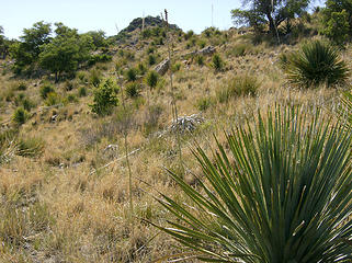
Next stop on our spring break was Table Mtn., a peak @ the west end of the Catalina Mtns. north of Tucson. This peak had evaded me & my sis a couple yrs. ago when we ran out of time due to taking the steep, brushy gully as recommended by others.  It was a huge time sucker so I was determined to avoid that route this time, plus, the "trail of sorts" that my mom said existed 35 yrs. ago....well, no longer existed as far as we could tell! It was a huge time sucker so I was determined to avoid that route this time, plus, the "trail of sorts" that my mom said existed 35 yrs. ago....well, no longer existed as far as we could tell!  I did more internet research & still couldn't find much beta on this mtn., just a couple of reports mentioning the gully & all the horrible shindaggers along the way. Shindaggers, for those of you who have never had the pleasure of encountering them, are a type of agave that reach about shin height & have no qualms about going straight through pant legs & puncturing the skin.
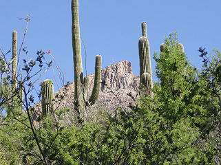
  If you can't avoid the plants, it's actually best to just step right on the center of them. Much of the slopes leading up to the summit of Table Mtn. are full of shindaggers, not to mention the other things like prickly pear, pincushion, & ocotillo, etc. Higher up there are some juniper trees. If you can't avoid the plants, it's actually best to just step right on the center of them. Much of the slopes leading up to the summit of Table Mtn. are full of shindaggers, not to mention the other things like prickly pear, pincushion, & ocotillo, etc. Higher up there are some juniper trees.  After spending a long time looking @ topo maps & the photograph of the peak in this report, I thought 'well why not leave Pima Canyon earlier & just walk up the long gentle slope that heads directly for the mtn., avoiding the gully altogether'? (as seen @ the far left center of the 2nd photo). Sure, it would mean a little more of the distance spent bushwhacking but likely faster since it would be significantly less steep. My topo map showed the long ridge ending right by the trail at about the 3,600' level, so this would make an easy & obvious place to leave the trail & head up.
So, MM & I decided to give this other route a go. We got an early start & headed up Pima Canyon. It was a nice sunny day but not too warm, which was good since much of the Table Mtn. hike is low-elevation & south-facing.
After spending a long time looking @ topo maps & the photograph of the peak in this report, I thought 'well why not leave Pima Canyon earlier & just walk up the long gentle slope that heads directly for the mtn., avoiding the gully altogether'? (as seen @ the far left center of the 2nd photo). Sure, it would mean a little more of the distance spent bushwhacking but likely faster since it would be significantly less steep. My topo map showed the long ridge ending right by the trail at about the 3,600' level, so this would make an easy & obvious place to leave the trail & head up.
So, MM & I decided to give this other route a go. We got an early start & headed up Pima Canyon. It was a nice sunny day but not too warm, which was good since much of the Table Mtn. hike is low-elevation & south-facing. 
 TH 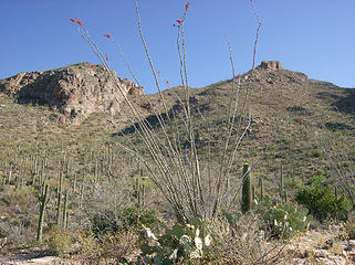 Pusch Ridge 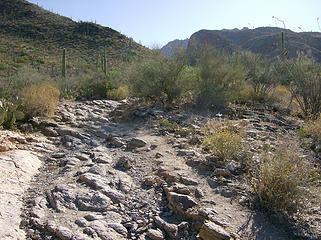 Pima Canyon ahead 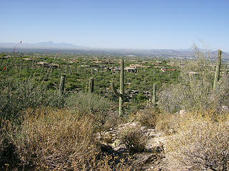 Houses in the foothills 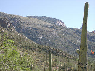 Table Mtn. 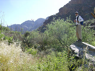 MM 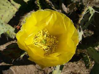 Prickly Pear cactus bloom 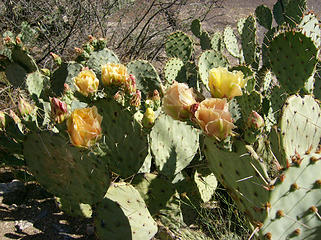 Prickly Pear cactus blooms 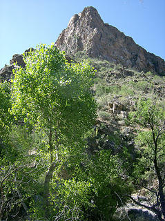 Rocky peak next to canyon  Not sure if it had been mine though. MM has photos of this (the rock, not the diaper).
We continued on, enjoying the greenery of the canyon. It was a lot greener than I had seen it in a long time probably due to 1) it was May, rather than Nov or Dec when I usually visit, & 2) Tucson actually had received a decent amt. of rain over the winter. We kept an eye on our ridge coming up, noting that it comes shortly after "The Tree" (more on that later) & when The Cleaver (see below) is seen more or less directly across the canyon. Not sure if it had been mine though. MM has photos of this (the rock, not the diaper).
We continued on, enjoying the greenery of the canyon. It was a lot greener than I had seen it in a long time probably due to 1) it was May, rather than Nov or Dec when I usually visit, & 2) Tucson actually had received a decent amt. of rain over the winter. We kept an eye on our ridge coming up, noting that it comes shortly after "The Tree" (more on that later) & when The Cleaver (see below) is seen more or less directly across the canyon.
 The Cleaver 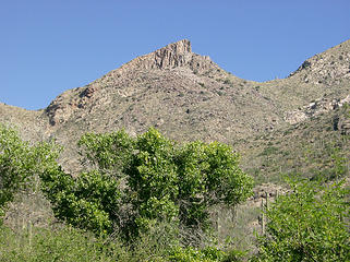 The Cleaver 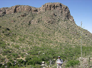 MM coming up the trail 
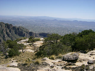
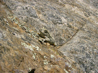 Frog 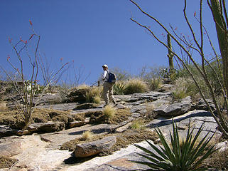 Slab walk 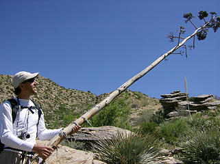 MM dreams big 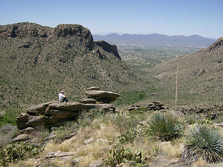 MM having a snack 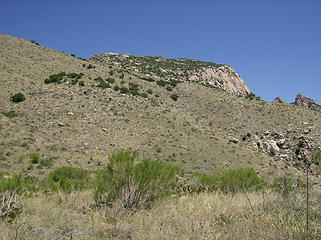 Closer still... 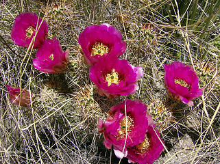 Pink blooms 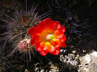 Red bloom 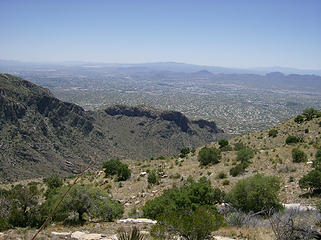 Tucson 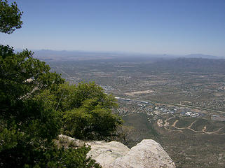 Oro Valley to the north 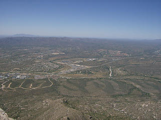 Oro Valley 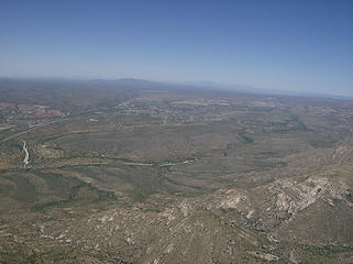 Oracle area 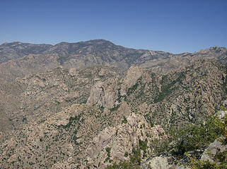 Mt. Lemmon area 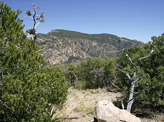 Mt. Kimball 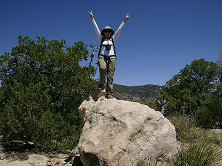 BC Nixon pose 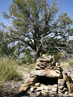 Summit cairn 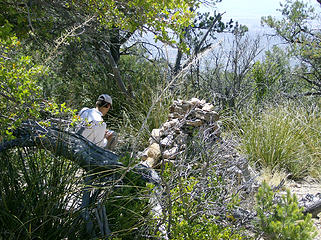 MM signs the register 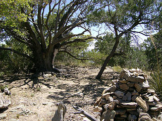 Summit area 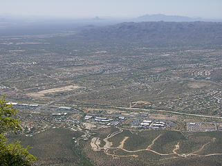 1 label Oro Valley with Picacho Pk. in the distance 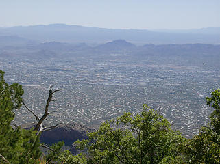 Summit views 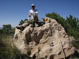 MM on summit rock  Behind Prominent Pt.  Mt. Lemmon area  Craggy pk.  Boot shot 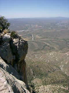 Table edge  
 Tucson far below  He recovered in good time & soon we hiked down. He recovered in good time & soon we hiked down.
 Nub 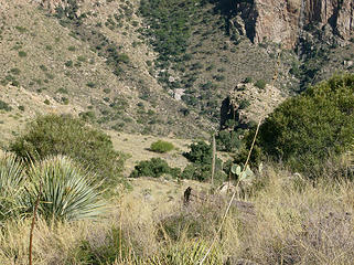 Top of Crescent Crack 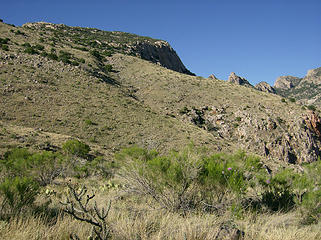 Looking back @ Table 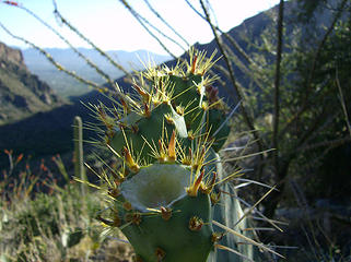 Prickly pear spines 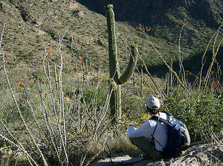 Lots more bushwhacking to do...  I have various pictures from childhood & then in subsequent yrs. when I would come back to visit...of me or others sitting in the tree. So, this time was no exception. I noticed that over the yrs. the tree became increasingly difficult to get into I have various pictures from childhood & then in subsequent yrs. when I would come back to visit...of me or others sitting in the tree. So, this time was no exception. I noticed that over the yrs. the tree became increasingly difficult to get into  but this time it was easier (though still not easy!) b/c my sis & mom had been there not long before & placed a log @ the base of it to help get a leg up. but this time it was easier (though still not easy!) b/c my sis & mom had been there not long before & placed a log @ the base of it to help get a leg up. 
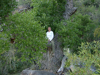 BC Tree 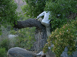 MM getting into The Tree 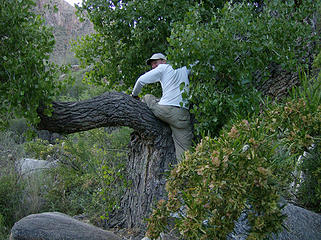 Still trying... 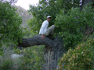 Success!! 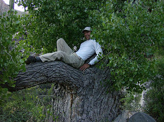 MM relaxing 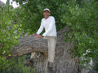 MM straddles The Tree 
 Sunset
Home is where the hiking is.
"Peaks that have come and gone four times should halt a man in his steps." -- William O. Douglas
A balanced diet is a margarita in each hand.
Home is where the hiking is.
"Peaks that have come and gone four times should halt a man in his steps." -- William O. Douglas
A balanced diet is a margarita in each hand.
|
| Back to top |
  
|
|
Cascade Hunter
Member

Joined: 08 Jun 2010
Posts: 96 | TRs | Pics
|
Those pics make me miss being home back in the deserts of CA.
|
| Back to top |
|
|
marta
wildflower maven

Joined: 07 May 2003
Posts: 1761 | TRs | Pics
|
|
marta
wildflower maven
|
 Fri Jun 11, 2010 1:00 pm |
|
|
Nice report. I've been up Pima but typically in the early spring. I've wondered what it is like later when the cactus bloom. Your pictures give me the full story. Thanks!
|
| Back to top |
|
|
MountainMan
Member

Joined: 15 Jul 2008
Posts: 365 | TRs | Pics
Location: San Diego |
Finally, we got Table Mtn.!  There's not too many places near Tucson that BC hasn't already done, but this was one of them (for good reasons, as she mentions). It sits overlooking the city and it calls to you every time you look up. BC was a little reluctant after her previous attempt, but I would keep bringing it up every time we were talking about trip ideas, so finally we decided to go for it. It was a day of very interesting bushwacking, but our plan to head up the ridge and avoid the "crescent crack" ended up working great.
Heading up Pima Canyon. There's not too many places near Tucson that BC hasn't already done, but this was one of them (for good reasons, as she mentions). It sits overlooking the city and it calls to you every time you look up. BC was a little reluctant after her previous attempt, but I would keep bringing it up every time we were talking about trip ideas, so finally we decided to go for it. It was a day of very interesting bushwacking, but our plan to head up the ridge and avoid the "crescent crack" ended up working great.
Heading up Pima Canyon.
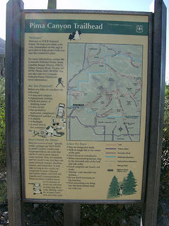
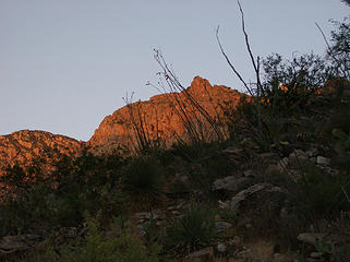
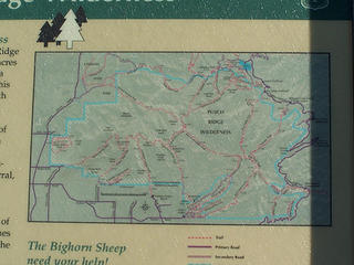 map 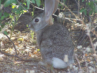 Rabbit 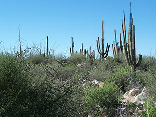 Pima Canyon trail 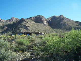 Cool spot for a house. 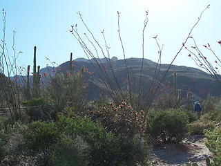 Pima Canyon trail 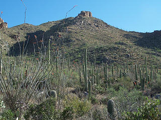 Pima Canyon trail 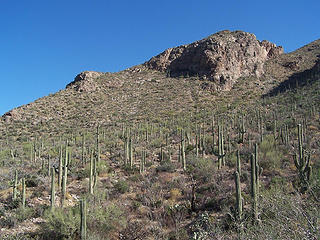 Saguaros on the hill 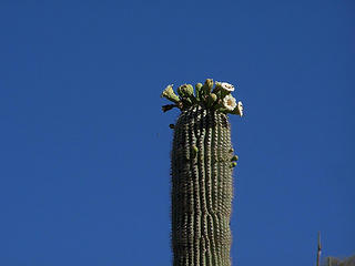 Blooming Saguaro 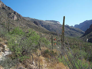 Table Mtn. in the distance. 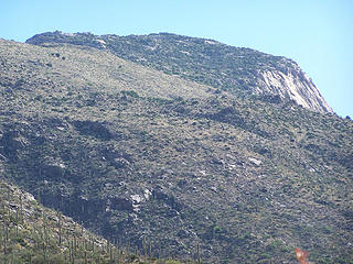 Zoom of Table Mtn. 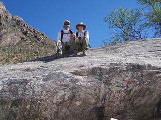 Us on "the big rock" 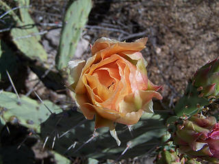 Prickly Pear bloom 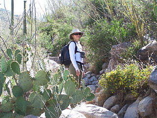 BC on Pima Canyon trail 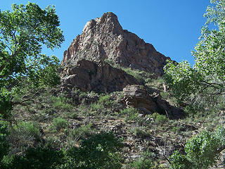 Small peak along the Pima Canyon trail. 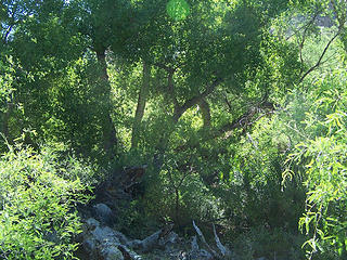 Green 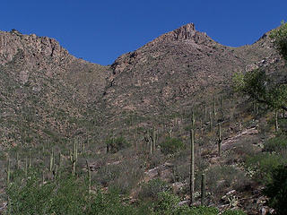 The Cleaver 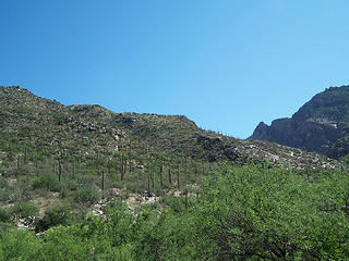 Ridge we went up. 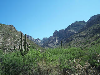 Looking up Pima Canyon and ridge we went up on the left. 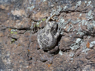 Canyon Treefrog 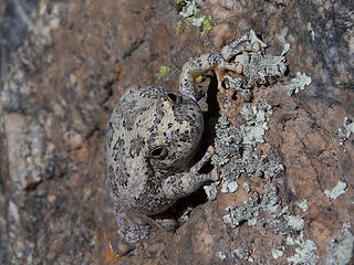 Canyon Treefrog 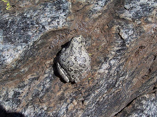 Canyon Treefrog 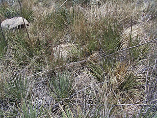 Shindaggers 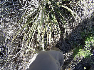 Why they're called shindaggers. 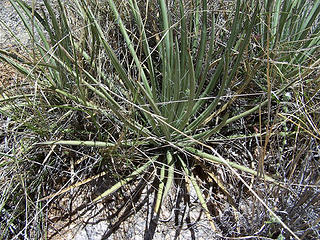 Shindagger 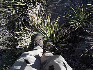 How to deal with shindaggers. 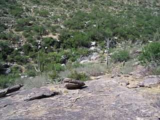 Looking down at the wash 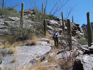 On the ridge. 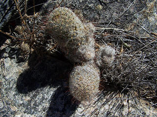 Pincusion? 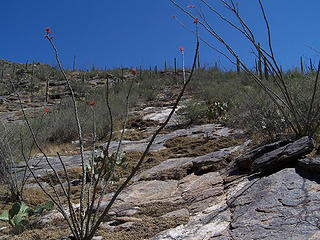 The rock slabs made it easier for awhile. 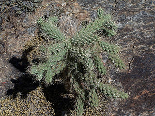 Cholla 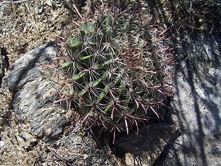 Barrel Cactus 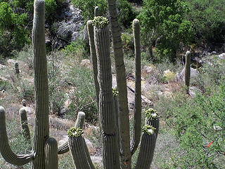 Looking down on some Saguaros. 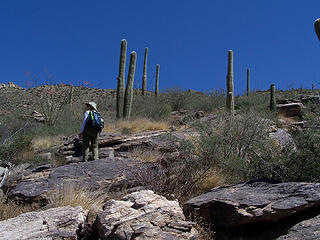 BC on rock slab. 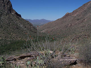 Looking down Pima Canyon. 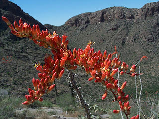 Ocotillo bloom 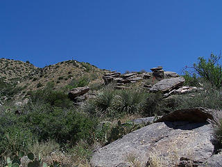 Further up the ridge. 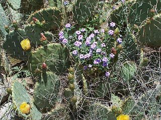 Prickly Pear and flowers 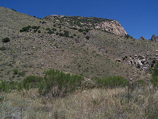 Our destination 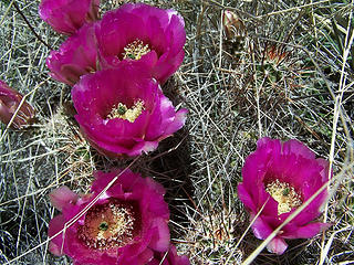 Cactus blooms 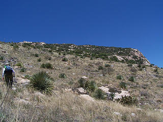 Getting closer. 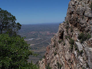 Side of the Table and Oro Valley. 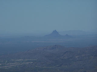 Zoom over Oro Valley of Picacho Pk. 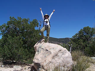 BC on summit rock. 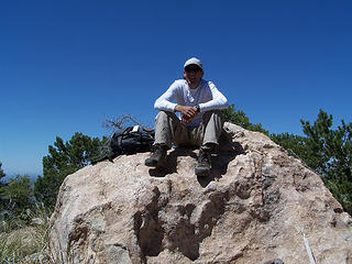 MM on summit rock. 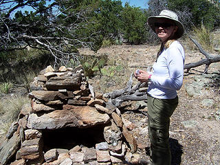 Summit cairn 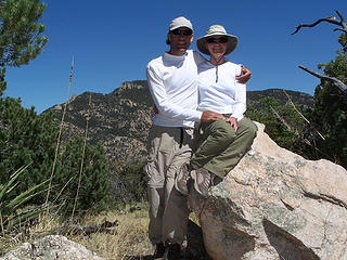 Summit pic 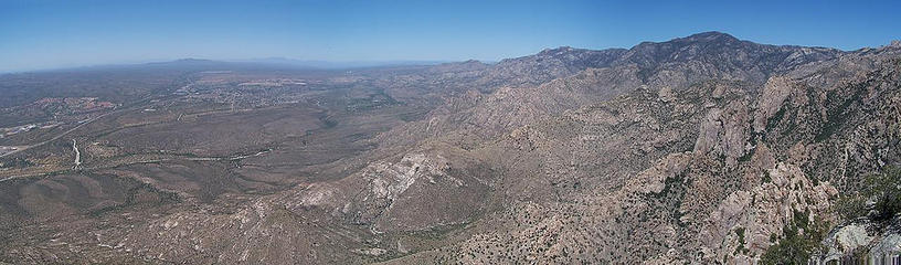 View to the NE. 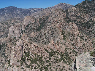 View NE 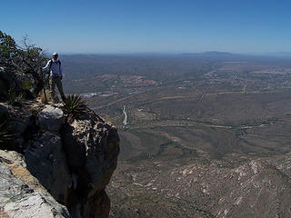 MM on the NE side of Table Mtn. 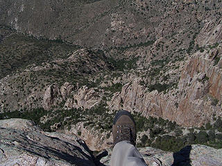 Boot shot from Table Mtn. 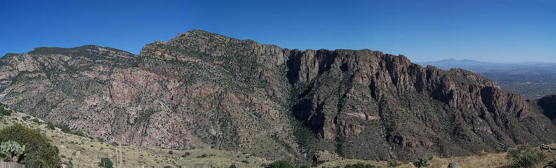 Pima Canyon hills 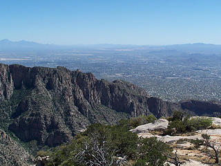 Pima Canyon and Tucson beyond from Table Mtn. 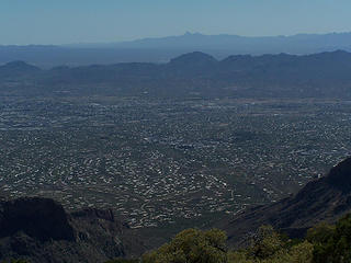 Tucson from Table Mtn. 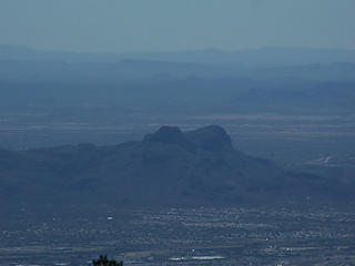 Safford and Panther Peaks 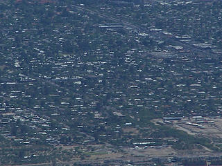 Can you see BC's Mom's house? 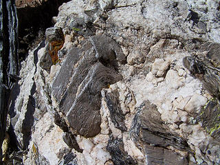 Chunks of mica 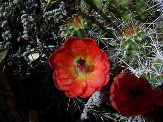 Barrel Cactus blooms 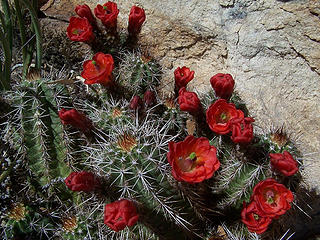 Barrel Cactus blooms 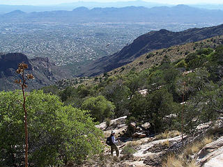 BC on the way down 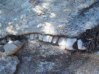 rock teeth 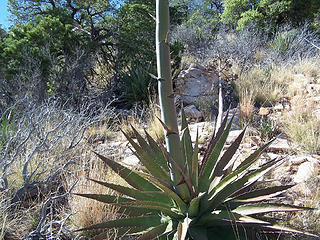 Century plant 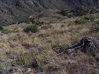 Field of shindaggers. 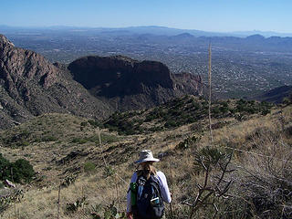 Through the shindaggers 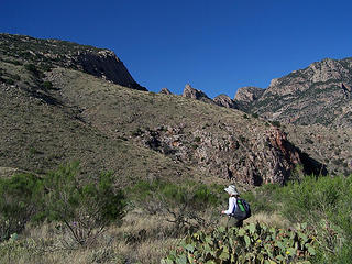 Looking back at Table Mtn. 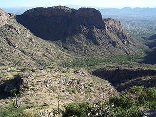 Looking down towards Pima Canyon and the way down. 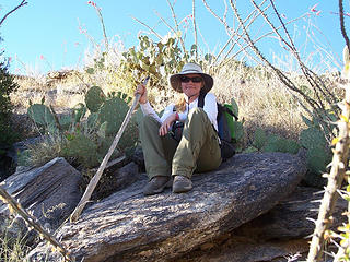 Almost back to the wash. 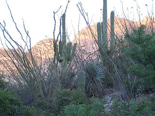 Cacti jungle 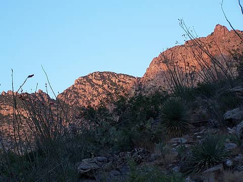 Sunset light on Pusch Ridge. 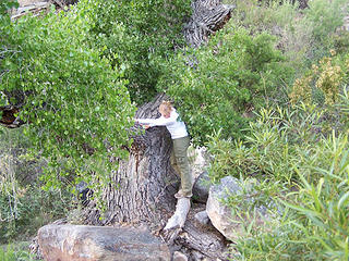 Ready 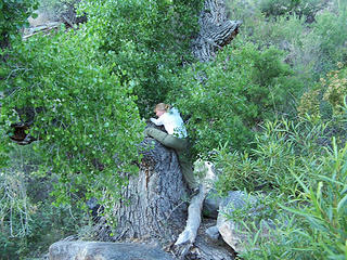 Get the leg up... 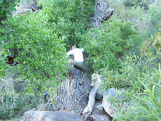 Slide over... 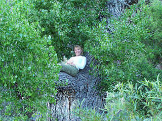 Made it! 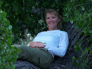 BC in the Tree. 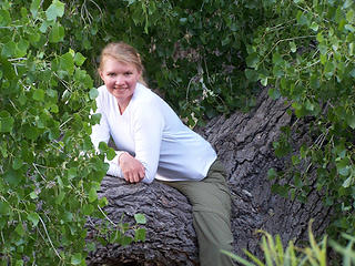 BC in the Tree. 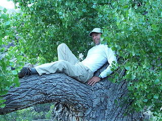 MM in the Tree. 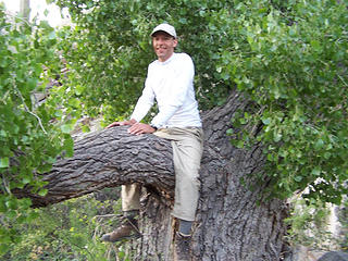 MM in the Tree.
Slow down, take notice, savor the moment, appreciate the world around you and everything that you have.
Slow down, take notice, savor the moment, appreciate the world around you and everything that you have.
|
| Back to top |
|
|
Hikingqueen
Member

Joined: 12 Nov 2007
Posts: 2946 | TRs | Pics
|
Love the summit pic of the two of you. I think that might win cutest nwhiker couple? I'm just saying..
|
| Back to top |
|
|
The Angry Hiker
SAR Blacklistee

Joined: 13 Jun 2008
Posts: 2890 | TRs | Pics
Location: Kentwila |
|
| Back to top |
|
|
MountainMan
Member
Joined: 15 Jul 2008
Posts: 365 | TRs | Pics
Location: San Diego |
Thanks HQ
AH - Yeah, it kind of sucked getting back to Seattle.
Slow down, take notice, savor the moment, appreciate the world around you and everything that you have.
Slow down, take notice, savor the moment, appreciate the world around you and everything that you have.
|
| Back to top |
|
|
|
|
You cannot post new topics in this forum
You cannot reply to topics in this forum
You cannot edit your posts in this forum
You cannot delete your posts in this forum
You cannot vote in polls in this forum
|
Disclosure: As an Amazon Associate NWHikers.net earns from qualifying purchases when you use our link(s). |


