| Previous :: Next Topic |
| Author |
Message |
boot up
Old Not Bold Hiker


Joined: 12 Dec 2006
Posts: 4745 | TRs | Pics
Location: Bend Oregon |
|
boot up
Old Not Bold Hiker
|
 Mon Feb 14, 2011 10:47 pm |
|
|
We followed in Tigermn's footsteps on this one...or at least his map. Thanks!
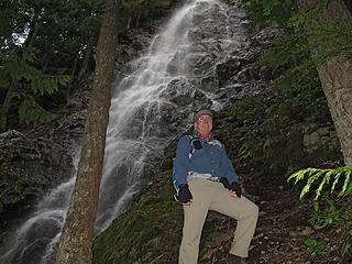 Thom at Kamikaze Falls
2/12/11 Mt Si trailhead to Kamikaze Falls. 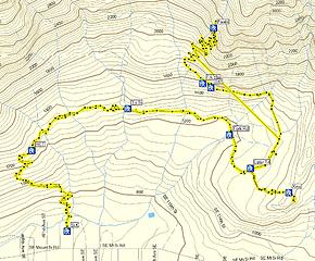 2/12/11 Mt Si trailhead to Kamikaze Falls.
9.6 miles approx (GPS died again)
2429 feet max elevation
2441 feet climbing
690feet parking lot
6.5 hours car to car 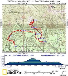 2/12/11 Mt Si trailhead to Kamikaze Falls.
9.6 miles approx (GPS died again)
2429 feet max elevation
2441 feet climbing
690feet parking lot
6.5 hours car to car 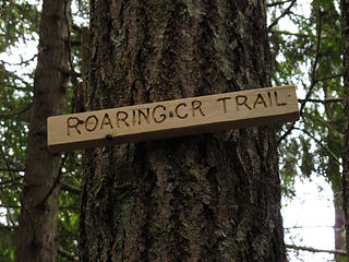 Better signage than Talus Loop trail.
2/12/11 Mt Si trailhead to Kamikaze Falls. 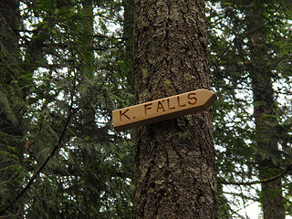 Better signage than Talus Loop trail.
2/12/11 Mt Si trailhead to Kamikaze Falls. 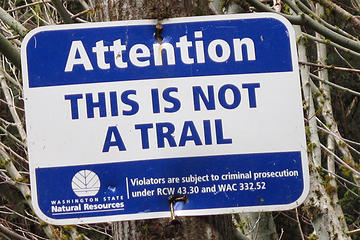 Not a trail. Rather not tell my cellmate I am in prison for hiking.
2/12/11 Mt Si trailhead to Kamikaze Falls. 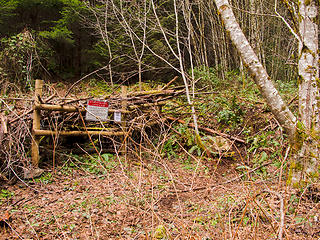 Note the well worn path going into "not a trail".
2/12/11 Mt Si trailhead to Kamikaze Falls. 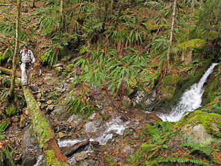 Pete getting ready to run the log bridge.
2/12/11 Mt Si trailhead to Kamikaze Falls. 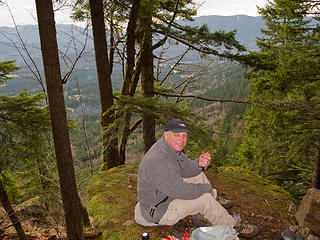 Pete at lunch rocks.
2/12/11 Mt Si trailhead to Kamikaze Falls. 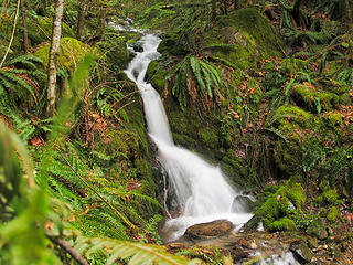 Little fall. Saw someone fall at this fall.
2/12/11 Mt Si trailhead to Kamikaze Falls. 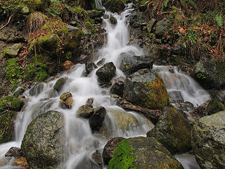 Flowy cascade.
2/12/11 Mt Si trailhead to Kamikaze Falls. 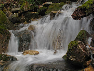 Slow Shutter.
2/12/11 Mt Si trailhead to Kamikaze Falls. 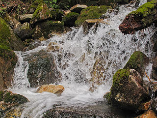 Fast shutter.
2/12/11 Mt Si trailhead to Kamikaze Falls. 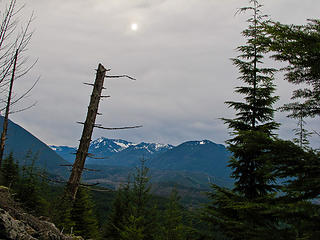 Sun trying hard.
2/12/11 Mt Si trailhead to Kamikaze Falls. 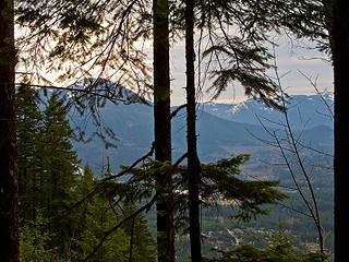 Lunch View. Too cold to lunch at the falls.
2/12/11 Mt Si trailhead to Kamikaze Falls. 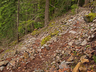 Typical section of Kamikaze new trail.
2/12/11 Mt Si trailhead to Kamikaze Falls. 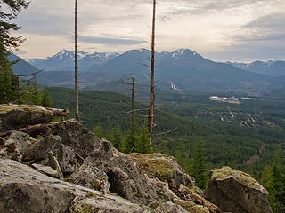 Alternate lunch spot. We stopped here, just because it was a nice place to stop and sit a bit.
2/12/11 Mt Si trailhead to Kamikaze Falls. 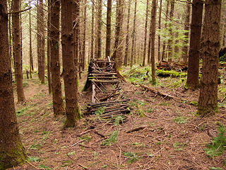 Old abandoned mtn bike park on the "Later" trail.
2/12/11 Mt Si trailhead to Kamikaze Falls. 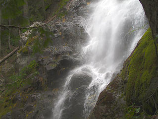 Kamikaze Falls
2/12/11 Mt Si trailhead to Kamikaze Falls. 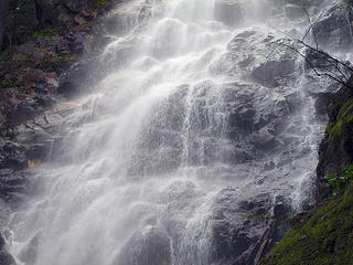 Kamikaze Falls
2/12/11 Mt Si trailhead to Kamikaze Falls. 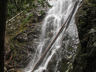 Kamikaze Falls
2/12/11 Mt Si trailhead to Kamikaze Falls. 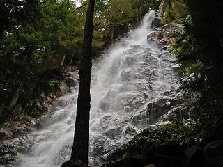 Kamikaze Falls
2/12/11 Mt Si trailhead to Kamikaze Falls. 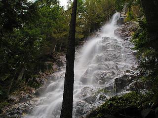 Kamikaze Falls
2/12/11 Mt Si trailhead to Kamikaze Falls. 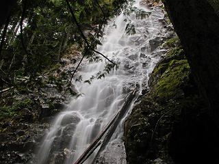 Kamikaze Falls
2/12/11 Mt Si trailhead to Kamikaze Falls. 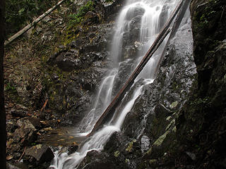 Kamikaze Falls
2/12/11 Mt Si trailhead to Kamikaze Falls.
|
| Back to top |
  
|
|
puzzlr
Mid Fork Rocks

Joined: 13 Feb 2007
Posts: 7220 | TRs | Pics
Location: Stuck in the middle |
|
puzzlr
Mid Fork Rocks
|
Tue Feb 15, 2011 12:03 am |
|
|
If I were more creative, I could write a script for the the "Bike Witch Project" and be famous for 15 minutes.
|
| Back to top |
|
|
Scrooge
Famous Grouse

Joined: 16 Dec 2001
Posts: 6966 | TRs | Pics
Location: wishful thinking |
|
Scrooge
Famous Grouse
|
Tue Feb 15, 2011 5:05 am |
|
|
"How fast is too fast?" ....... A classic example of the 'frozen wax' effect that true stop motion waterfall photography sometimes produces. It's not much closer to what we actually 'see' than the silky versions.
Pretty good compromises. A little slow, by my standards, but fast enough to retain much of the variety that characterizes what we see. ....... Quite possibly what a camera set on AUTO would record, given available light.
Something lost behind the ranges. Lost and waiting for you....... Go and find it. Go!
Something lost behind the ranges. Lost and waiting for you....... Go and find it. Go!
|
| Back to top |
|
|
boot up
Old Not Bold Hiker
Joined: 12 Dec 2006
Posts: 4745 | TRs | Pics
Location: Bend Oregon |
|
boot up
Old Not Bold Hiker
|
Tue Feb 15, 2011 1:52 pm |
|
|
I tend to agree that I really couldn't seem to hit "perfection" on shutter speed for this lighting. and I tried "auto" (basically), opening the shutter, setting for Neutral Density, and even doing an HDR combo of all of the above.
But thats interesting you thought the "frozen" one was too frozen. I thought it was a bit slow, although it was as fast as the conditions and camera would allow, not being quite "Matrix" frozen to show the engergy, and just enough blur to look like a mistake. Maybe a tiiny bit one way or the other on that small fall would have really made it a winner.
Kamikaze had me baffled. I have a few more variations that I did not post and they still seem too "in between" for type of water flow.
I consider them "OK" shots, but probably won't be printing any or see them featured on webshots. Although I am often surprised what Webshots WILL feature. I'll give them credit for featuring "fast flow" with stopped water on the Twin Falls hike, rather than going with the silky flowy out of that batch, which were all included.
|
| Back to top |
|
|
tigermn
Member

Joined: 10 Jul 2007
Posts: 9242 | TRs | Pics
Location: There... |
|
tigermn
Member
|
Tue Feb 15, 2011 4:20 pm |
|
|
Yea I remember some nicer lunch type spots on the way up to K falls. Really not much level room where you end up at the falls.
I came down Kamikaze some years ago before the new trail and slipped twice on the lower section (the section now closed/bypassed) due to steep mud. I also had a minor but nagging knee issue for the rest of the season after that June hike. It is a steep one for sure. I vowed to maybe try going up but not down again. It was snow free in June when I came down. Dunno what it is like with snow. Might be a good early season (June) trip to revisit.
Of course coming back down would involve the long road slog down or hooking back up on Si either up top or back down the road where you came from, or just parking at the Teneriffe road and circling it that way which would be shorter.
The old Kamikaze trail gained 3512 feet in 1.72 miles (2041 ft/mile). Of course the lower portion of that is now more graded.
By comparison:
Mailbox (discarding the road part and the first .25 miles of trail which aren't steep).
This is walking up the Talus field as well.
2.54 miles 3648 feet gained (1436 ft/mile)
|
| Back to top |
|
|
Snowdog
Member

Joined: 21 Jul 2006
Posts: 1028 | TRs | Pics
Location: on (& off) the beaten path |
|
Snowdog
Member
|
Tue Feb 15, 2011 6:23 pm |
|
|
you might have seen us crazies ( & lawbreakers  ) going up AND back down the KF route to Teneriffe on Sat.
Me, Rob & Isabel (border collie). I think it may have been you that commented to us on using the 'old trail' where they overlap and I said "less steps"?
I've gone up the KF route before & down the road walk too- not bad, but takes longer..... ) going up AND back down the KF route to Teneriffe on Sat.
Me, Rob & Isabel (border collie). I think it may have been you that commented to us on using the 'old trail' where they overlap and I said "less steps"?
I've gone up the KF route before & down the road walk too- not bad, but takes longer.....
'we don't have time for a shortcut'
'we don't have time for a shortcut'
|
| Back to top |
|
|
boot up
Old Not Bold Hiker
Joined: 12 Dec 2006
Posts: 4745 | TRs | Pics
Location: Bend Oregon |
|
boot up
Old Not Bold Hiker
|
Tue Feb 15, 2011 9:28 pm |
|
|
|
| Back to top |
|
|
|
|


