| Previous :: Next Topic |
| Author |
Message |
beaudaddy
Coast To Cascades


Joined: 25 Feb 2010
Posts: 401 | TRs | Pics
Location: Tulalip, WA |
|
beaudaddy
Coast To Cascades
|
 Tue Jun 29, 2010 4:55 pm |
|
|
I was sick all week with a nasty cold and the weekend was not looking good for an outdoor adventure. Once Friday rolled around I begin to feel somewhat better. So I planned on a hike that would be easy and convinced myself that I would take it slow.
By Friday night the weekend schedule was confirmed with setting in the sun Saturday on Lake Stevens and doing a gentle stroll up Earl Peak in the Teanaway on Sunday.
It ended up with a full Saturday wake surf session on Lake Stevens along with hours of sun. This resulted in a sun burn and finding some new muscles that got neglected this winter. Sunday plans turned from just doing Earl into fitting a nice ridge walk to Bean Peak up in the mix... Why drive all that way and just do EARL right?!?!
So I set off for the Eastside early Sunday morning. I left Arlington around 5am for a Solo adventure. Munched on some snacks, drank a good cup of coffee and enjoyed some Alpenglow on Rainier heading south on 405. Soon I was to CleElum and on the Teanaway road. Wow, what a crappy road full of deep holes. These holes added some time to my trip, even though I have a full size truck.
Got to the Beverly Turnpike Trail #1391 trailhead around 7:30am to about 8 cars at the parking spot. I got started up the trail around 8am. It was a beautiful day with blue skies and amazing smells in the air. I really took my time because of my cold, coughing up stuff here and there... probably why I didn't see much wildlife.
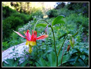 Red Columbine (Aquilegia formosa) 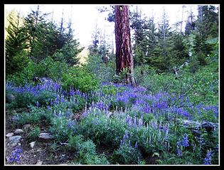 Lupine 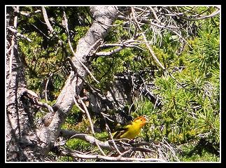 Western Tanager 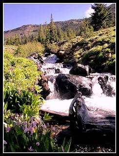 Bean Creek and Shooting Stars 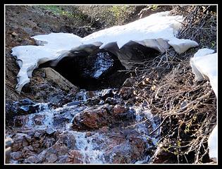 Melting Out 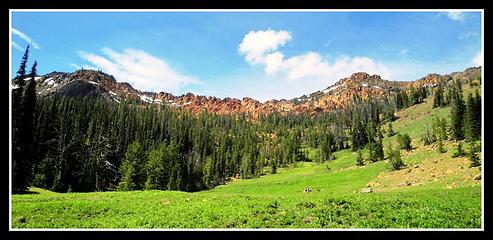 Mary Peak and Bean Peak 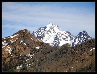 Bean Peak, Mount Stuart and Sherpa 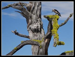 Angry Bird 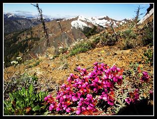 picnikfile_nXJr_P 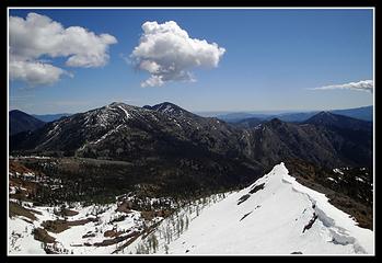 Looking toward Navaho 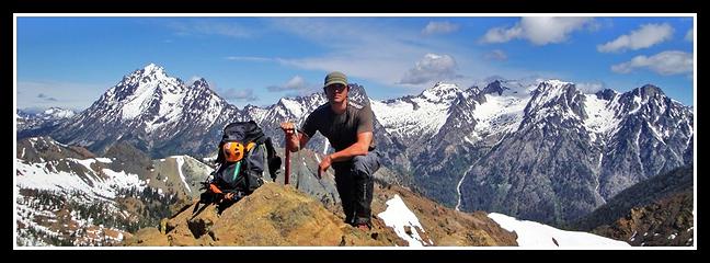 Summit of Earl Peak with Stuart Range Behind 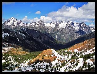 Stuart Range 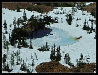 Tarn below Earl Peak 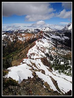 Ridge Route 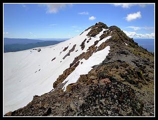 Earl Peak seen from North 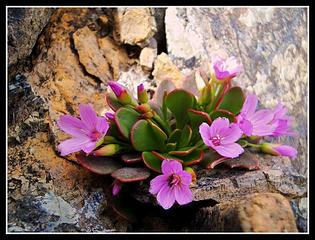 Found on high ridge 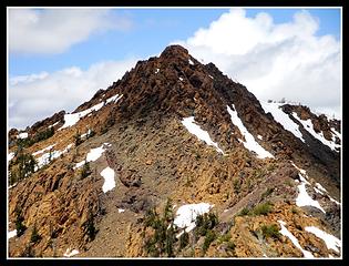 Bean Peak 6,743' 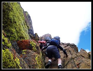 Seattle Mountaineers 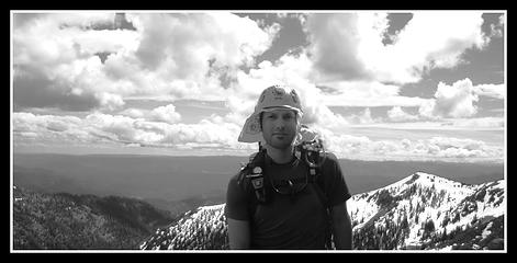 Summit of Bean Peak 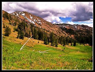 Earl Peak and the Bean Creek Meadow 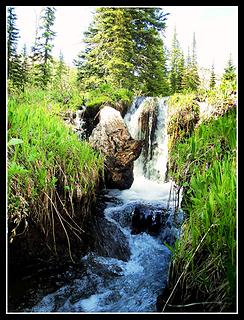 River Runs Through It
|
| Back to top |
  
|
|
Flora
Enjoying the Sun!

Joined: 25 Mar 2007
Posts: 1035 | TRs | Pics
Location: Land of many waters |
|
Flora
Enjoying the Sun!
|
Tue Jun 29, 2010 8:27 pm |
|
|
Very nice photos, Beaudaddy! That meadow is a big sponge and filled with Shooting Stars.
Thanks.
|
| Back to top |
|
|
beaudaddy
Coast To Cascades
Joined: 25 Feb 2010
Posts: 401 | TRs | Pics
Location: Tulalip, WA |
|
beaudaddy
Coast To Cascades
|
Thu Jul 01, 2010 9:33 pm |
|
|
Thanks Flora!!! Sooo many shooting stars... 
|
| Back to top |
|
|
gottahike1
Member

Joined: 20 Jul 2007
Posts: 33 | TRs | Pics
|
|
gottahike1
Member
|
Thu Jul 01, 2010 10:50 pm angry bird
|
|
|
Nice TR and beautiful pictures. The "Angry Bird" is a Clark's Nutcracker, and it wasn't angry, they just always sound that way
|
| Back to top |
|
|
beaudaddy
Coast To Cascades
Joined: 25 Feb 2010
Posts: 401 | TRs | Pics
Location: Tulalip, WA |
|
beaudaddy
Coast To Cascades
|
Mon Jul 05, 2010 1:21 pm |
|
|
Thanks Gottahike1!!! Clark's Nutcrackers are interesting birds.
|
| Back to top |
|
|
MysteryMachine
Member

Joined: 07 Aug 2009
Posts: 186 | TRs | Pics
|
nice TR!
Summit of Earl Peak with Stuart Range Behind
|
| Back to top |
|
|
beaudaddy
Coast To Cascades
Joined: 25 Feb 2010
Posts: 401 | TRs | Pics
Location: Tulalip, WA |
|
beaudaddy
Coast To Cascades
|
Fri Jul 09, 2010 12:07 pm |
|
|
| MysteryMachine wrote: | nice TR!
Summit of Earl Peak with Stuart Range Behind |
MM- Having the Stuart Range behind me sure helped... I have a 10 second timer, so my solo summit shot options are limited. Thanks for the comment!!!
|
| Back to top |
|
|
|
|
You cannot post new topics in this forum
You cannot reply to topics in this forum
You cannot edit your posts in this forum
You cannot delete your posts in this forum
You cannot vote in polls in this forum
|
Disclosure: As an Amazon Associate NWHikers.net earns from qualifying purchases when you use our link(s). |


