| Previous :: Next Topic |
| Author |
Message |
mhutch
Member


Joined: 21 Sep 2008
Posts: 168 | TRs | Pics
|
|
mhutch
Member
|
 Sun Jul 11, 2010 5:33 pm |
|
|
Decided to go up Mt. Aix friday. It was one of my favorite hikes last year (almost a year to the day) so I figured I'd go back for an overnighter. Couldn't get out of town until after 9am and made it to the TH around noon, just in time to climb 4000'+ in the heat of the day, nice. Undeterred, I packed up. Was planning to camp up on the ridge, liquid water is hard to find up there so I decided to haul a full gallon jug of water up plus 2.5L in bladders and a bottle, as that seemed more appealing than melting snow for water. There was one other vehicle at the TH, the road was in decent shape, not great, but it's better than the Teanaway rd. was before they fixed it.
Hit the trail around 12:30 and kept a good pace with several breaks to hydrate and keep cool. Creeks that were dry last year at this time were still flowing, there are a few places to get water on the way up/down. There is a lot more snow this year, it starts at around 6000' (estimate). At first just on and off, but up higher the trail was mostly snow covered. Lots of climbing/traversing over steep snowbanks covering sections of the trail, poles or an ice axe would be a good idea. Nothing extremely exposed, but some crossings run out into trees and loose rocks, until the snow melts there could be potential for injury if one slipped in the wrong spots. I dropped my gallon jug crossing one and it did not have a gentle ride, had to go downhill to get it out of some trees. Ran into a couple coming down near 7000', they were using ice axes and had enough of all the snow crossings so they turned around. Shortly after seeing them I was tired of the crossings too, so I looked around and decided to follow a faint goat path heading up over dry ground, this led me right to the Nelson ridge/Aix trail junction. The upper slopes of the ridge are melted out.
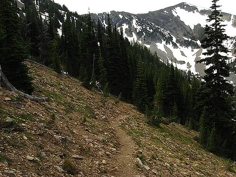 Trail up ridge 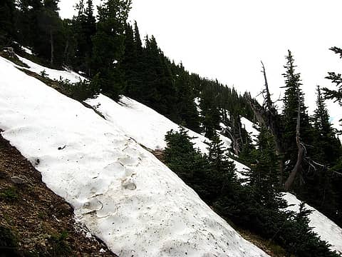 Snow crossing, there were worse ones  Start of goat path up ridge  Nelson ridge trail junction 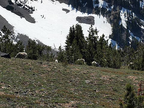 Goats on upper ridge 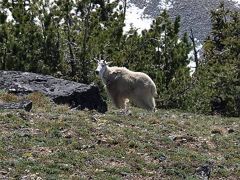 mama goat 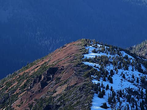 Goat herd on another ridge 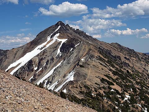 First view of Mt. Aix 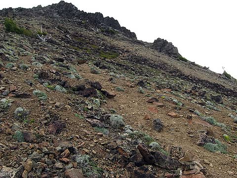 the scramble route 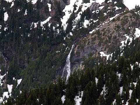 Falls in Hindoo basin 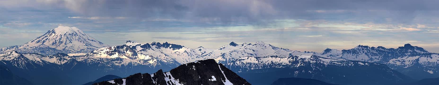 Adams and Goat Rocks pano 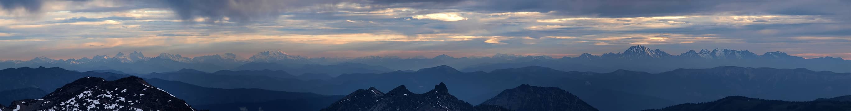 ALW peaks pano 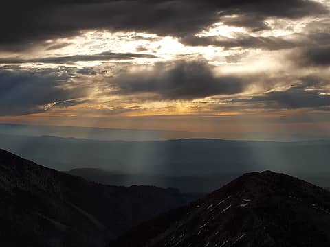 Clouds and sunbreaks to east 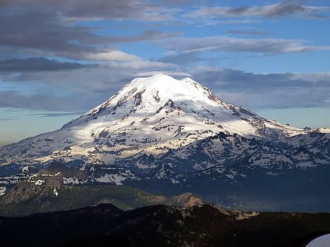 Mt. Rainier 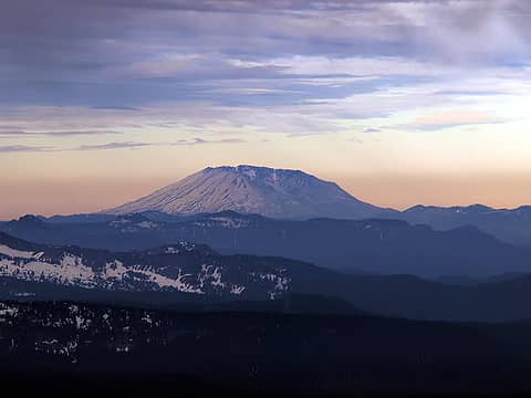 Mt. Saint Helens 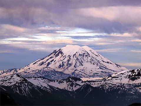 Mt. Adams 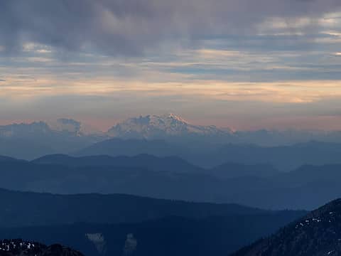 Glacier Pk. over Mt. Daniel 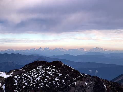 ALW peaks in pastel 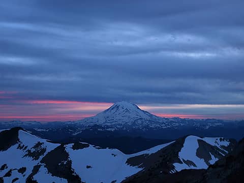 Mt. Rainier at sunset 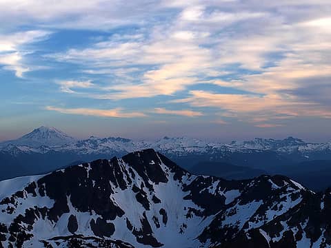 Mt. Adams and Goat Rocks at sunset 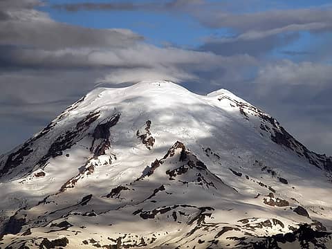 Rainier zoom 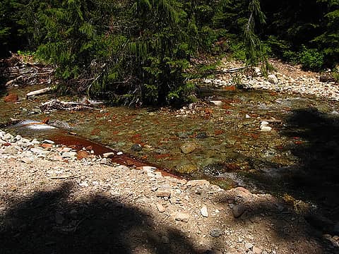 Washed out culvert 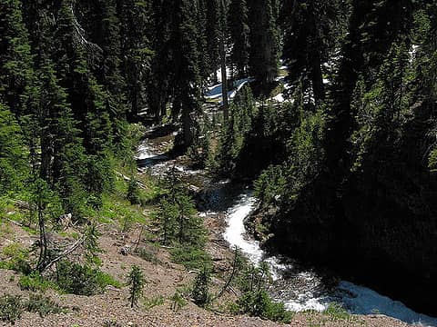 Twin Sisters outlet 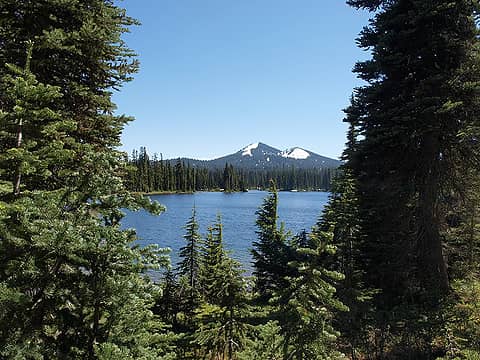 Tumac Mtn. from Twin Sisters trail 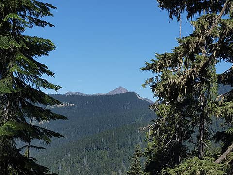 Mt. Aix from Twin Sisters Lks. trail 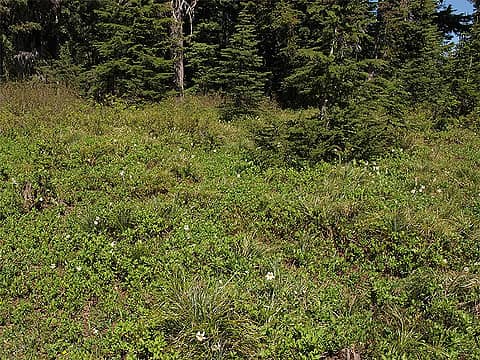 Avalanche lilies 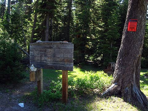 Twin Sisters Lakes TH 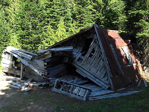 old building 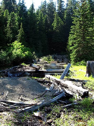 mine site I assume
|
| Back to top |
  
|
|
belowfellow
Transplant

Joined: 22 Feb 2009
Posts: 261 | TRs | Pics
Location: Seattle |
nice work  the clouds made for some exceptional lighting. great photos. the clouds made for some exceptional lighting. great photos.
|
| Back to top |
|
|
kawisk
Member

Joined: 22 Feb 2010
Posts: 92 | TRs | Pics
|
|
kawisk
Member
|
Sun Jul 11, 2010 9:53 pm |
|
|
thanks for the report. this one is on my short list.
|
| Back to top |
|
|
kbatku
Questionable hiker

Joined: 17 Sep 2007
Posts: 3330 | TRs | Pics
Location: Yaquima |
|
kbatku
Questionable hiker
|
Sun Jul 11, 2010 10:12 pm great report
|
|
|
I haven't been that way since the road washed out. They are SUPPOSED to fix it this fall (heard that before) so watch out for the crowds once they do. Last time i saw that building it was still standing - oh well... Time marches on.
|
| Back to top |
|
|
|
|
You cannot post new topics in this forum
You cannot reply to topics in this forum
You cannot edit your posts in this forum
You cannot delete your posts in this forum
You cannot vote in polls in this forum
|
Disclosure: As an Amazon Associate NWHikers.net earns from qualifying purchases when you use our link(s). |


