| Previous :: Next Topic |
| Author |
Message |
Tall Hiker Man
Member


Joined: 23 Jun 2006
Posts: 346 | TRs | Pics
Location: Cashmere |
This was a glorious day in the mountains! The air was crystal clear & the destination was unique and well worth the trip.
Kyle D & Kyle Flick joined me again for this trip. We also added Charlie another friend of mine.
Stay tuned for Kyle D's sure to be great photo's!!! I have it on good authority that he'll be posting them over the next couple days.
We started on bikes at the Icicle Road washout around 6:30. The 5 mile ride was a very nice way to start a hike. By 7:10 we were heading up the Blackjack Ridge trail. The trail was in pretty good shape. After a few miles the views begin to open up.
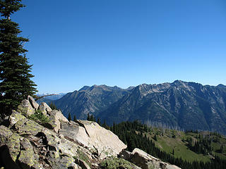 Chiwaukums & Grindstone 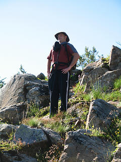 Hello Ladies! 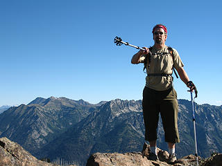 My real pants are over there!  Rainier is cool 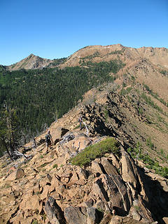 The ridge to Highchair 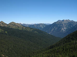 Black Pine Drainage & The Icicle 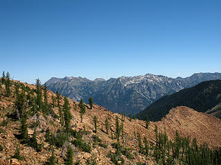 Views 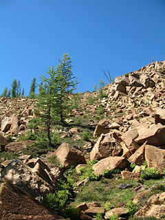 Our route to Highchair from the basin 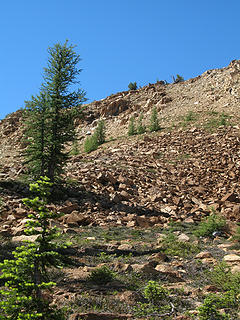 Final push to Highchair 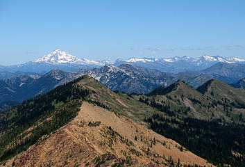 The money shot 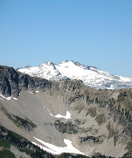 Mt. Daniel 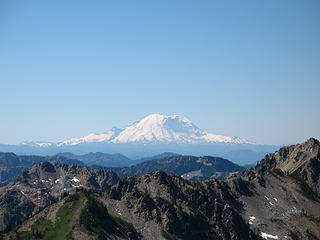 Volcano Views 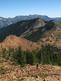 Our route from Bootjack Mtn. 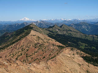 6600 Ridge & beyond 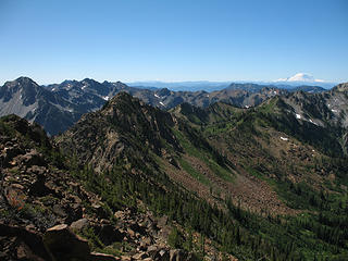 The payoff 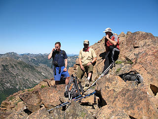 Laughs on the summit (THM, Kyle F, Kyle D) 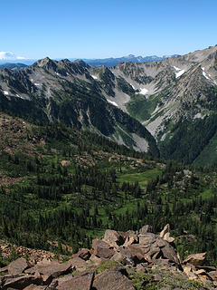 Snowall Creek 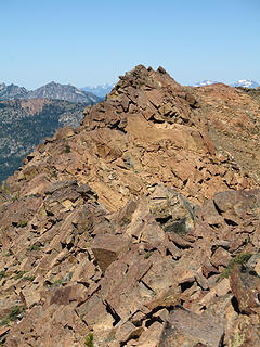 The tough spot 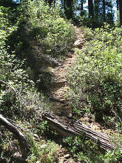 Looks like a trail... 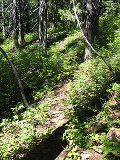 Looks less like a trail...
|
| Back to top |
  
|
|
veronika
Member

Joined: 25 Apr 2010
Posts: 3015 | TRs | Pics
Location: On the road |
|
veronika
Member
|
 Tue Aug 17, 2010 6:15 pm |
|
|
Nice! looks like fun. 
Take risks not to escape life, but to prevent life from escaping
I may not have anyone rocking my world right now but, I don't have anyone messing it up either.
Take risks not to escape life, but to prevent life from escaping
I may not have anyone rocking my world right now but, I don't have anyone messing it up either.
|
| Back to top |
|
|
the Zachster
Member

Joined: 17 Jan 2007
Posts: 4776 | TRs | Pics
Location: dog training |
I miss getting in there since the road was washed out (I'm not a biker  ). Bootjack was always a fun little hike when we were visiting Leavenworth. Thanks for the report and photos! ). Bootjack was always a fun little hike when we were visiting Leavenworth. Thanks for the report and photos!
"May I always be the kind of person my dog thinks I am"
"May I always be the kind of person my dog thinks I am"
|
| Back to top |
|
|
Magellan
Brutally Handsome

Joined: 26 Jul 2006
Posts: 13116 | TRs | Pics
Location: Inexorable descent |
|
Magellan
Brutally Handsome
|
Tue Aug 17, 2010 9:51 pm |
|
|
Nice trip. It's on the list... 
|
| Back to top |
|
|
Tall Hiker Man
Member
Joined: 23 Jun 2006
Posts: 346 | TRs | Pics
Location: Cashmere |
| rbuzby wrote: | | Way to shepherd the neophyte through the scary off trail-ness. He may have trouble going many places if he doesn't like his boots touching rock.
|
Ain't that the truth! He'll stick to established trails from this point on. It was surprising. He's in great shape and has done the Enchantments loop in a day so I thought he'd be up for this. For whatever reason though, the off-trail stuff didn't sit well with him. It surprised him too. He was never comfortable. It was a good lesson for both of us.
|
| Back to top |
|
|
kyle d
Member

Joined: 03 Jun 2007
Posts: 521 | TRs | Pics
Location: Ogden, UT |
|
kyle d
Member
|
Wed Aug 18, 2010 7:32 am |
|
|
Thanks for organizing the trip THM. Finally got some pictures uploaded. Did you even try blackmail with the "man-pris".  Here is an approximate route for the Kyles. The 6600 ridge was most diffucult right next to High Chair, then became easy meadow strolling as we moved along. The descent off the ridge went very well, there are lots of very good game trails (with their number and quality we were thinking elk, though I don't know if there are elk there). The last 300 flat yards or so near the road were dense vine maple, so if someone repeats they may want to consider a variation on the ending.
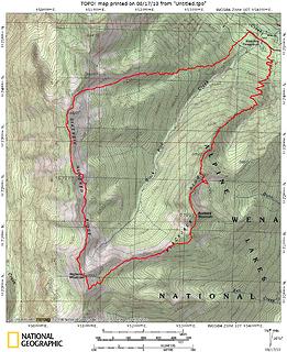 Our very approximate route. According to Topo 11 or 12 miles, and appropriately, 6600 feet of gain. 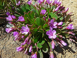 Wildflowers 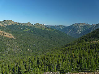 Forested valleys 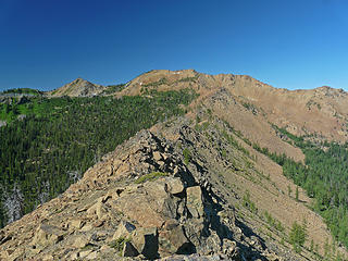 Getting closer to Highchair 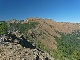 Between BootJack and Highchair 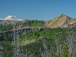 Rainier 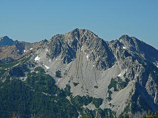 Harding with what appears to be gullies created by recent thunderstorms 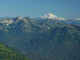 Towards Glacier Peak 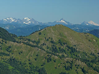 6600 ridge and the Monte Cristos to Mt. Baker. 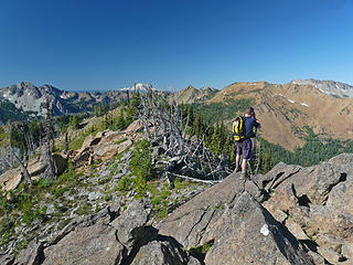 THM taking some pictures 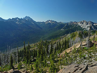 Jack Creek valley 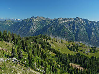 BootJack views 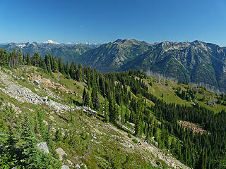 Almost to BootJack 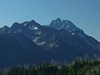 Some local peak 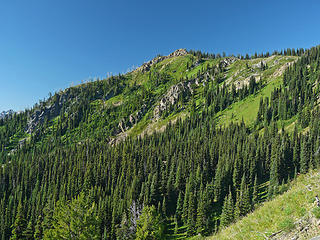 Bootjack 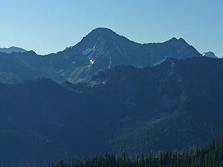 Eightmile 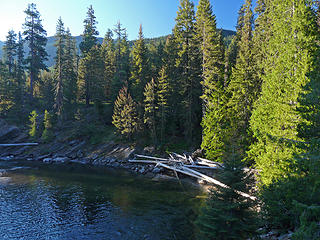 Swimming hole 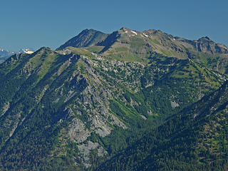 Chiwakums 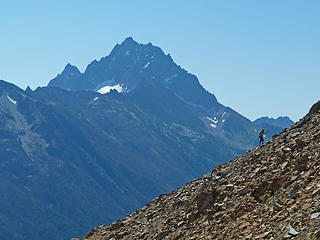 Kyle F working his way up the ridge with a small peak in the background. 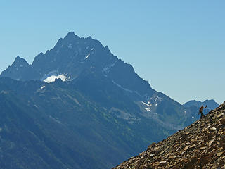 Heading up to Highchair, Stuart and Sherpa look on. 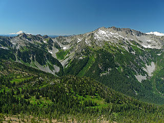 Highchair views. 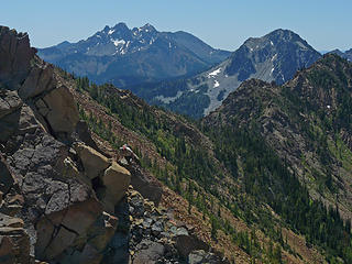 Kyle F. working his way along the 6600 ridge. Ingalls and Harding in the background. 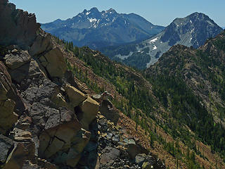 Kyle F on the 6600 ridge. 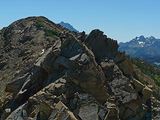 Kyle F working the 6600 ridge just beyond Highchair 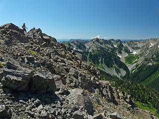 Easier ridge strolling. 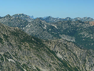 The Central Cascades 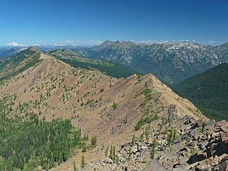 The 6600 ridge, we pretty much followed along the crest. 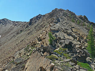 The Crux of 6600 ridge -lots of slabs 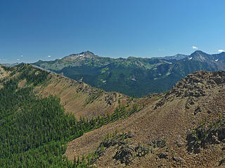 Looking back at the ridge between Bootjack and Highchair. Cashmere in the background. 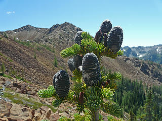 Subalpine fire cones below Highchair 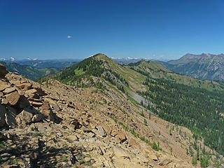 Open ridges 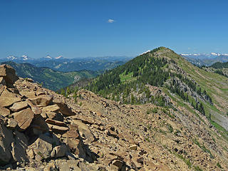 Open ridges 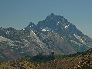 Stuart 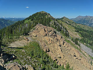 Point 68?? on 6600 ridge. 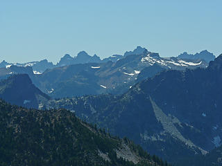 West into the Alpine Lakes Wilderness from 6600 ridge 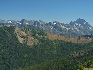 Stuart Range 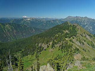 Views from point 68?? on 6600 ridge 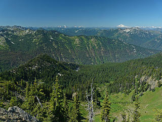 Views 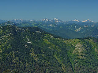 Monte Cristos, Sloan, Baker from 6600 ridge 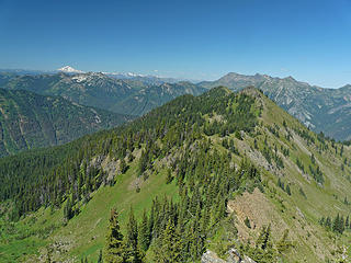 6600 ridge views, nearing the end of the ridge 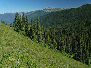 The end of the meadow hiking. Cashmere in the distance
|
| Back to top |
|
|
wildernessed
viewbagger

Joined: 31 Oct 2004
Posts: 9275 | TRs | Pics
Location: Wenatchee |
Very nice, way to close a loop !
Living in the Anthropocene
Living in the Anthropocene
|
| Back to top |
|
|
Tall Hiker Man
Member
Joined: 23 Jun 2006
Posts: 346 | TRs | Pics
Location: Cashmere |
Great Photo's Kyle!
I decided I'd rather make fun of Kyle Flick's "manpris" than blackmail him... Totally worth it!
|
| Back to top |
|
|
chiwakum
not credible

Joined: 29 Jun 2009
Posts: 980 | TRs | Pics
Location: Ballard |
|
chiwakum
not credible
|
Wed Aug 18, 2010 11:32 am |
|
|
thanks for the report and great pics from both of you. I've had my eye on this for awhile and would like to get around to doing it before they fix the road. I considering doing it as part of a longer loop backpack this fall or next year.
|
| Back to top |
|
|
Bloated Chipmunk
Cock Rock Searcher

Joined: 29 Jan 2007
Posts: 2993 | TRs | Pics
Location: Margaritaville |
I remember eyeballing Bootjack & Highchair from Harding last summer. Thanks for the informative TR.
Home is where the hiking is.
"Peaks that have come and gone four times should halt a man in his steps." -- William O. Douglas
A balanced diet is a margarita in each hand.
Home is where the hiking is.
"Peaks that have come and gone four times should halt a man in his steps." -- William O. Douglas
A balanced diet is a margarita in each hand.
|
| Back to top |
|
|
|
|


