| Previous :: Next Topic |
| Author |
Message |
Trailblazing Todd
Trail Wanderer


Joined: 26 Mar 2010
Posts: 126 | TRs | Pics
Location: Everett |
I had another chunk of time off of work just in time for another rain system to move in and get all the mountains wet. So, I picked the least amount of predictable rain. This pointed me to the Wenatchee area. The Larch Lakes trail is at the end of the Entiat River Road off of 97A. Because of the length of the drive and the total miles for this lollypop loop, I decided to make this an overnighter. This is my first solo backpacking trip! Ever!
The Entiat River Trail is the main trail that other trails shoot off from. Starting the trail around 10am, the trail is mostly flat following the river. The trail passes the Duncan Hill trail turnoff about half way to Myrtle Lake. The trail turns off and crosses the Entiat River on a bridge and goes up to Myrtle Lake. The outlet creek sort of took over some the trail, but logs are in place to walk across. I saw (and heard) a hawk fly over the lake. There were a couple of tents on the other side of the lake. I continued my way up to a junction. The marked sign that goes to the right is the Larch Lakes "hikers only" trail. The left unmarked choice goes to Cow Creek Meadows. This is the one I wanted to start the loop.
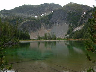
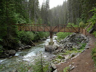 Entiat River bridge 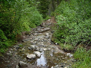 Myrtle Creek crossing 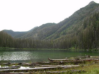 Myrtle Lake 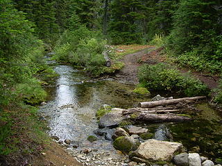 Upper Cow Creek crossing 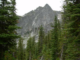 Rampart Mountain 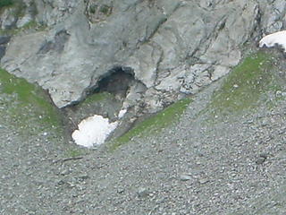 Cave at the bottom of Rampart Mt. 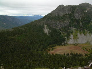 Cow Creek Meadows 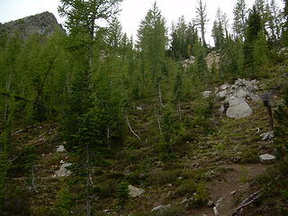 Garland Peak Junction and Fifth of July Mt. 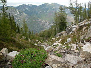 Duncan Hill view 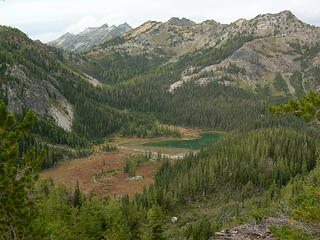 Upper Larch Lake (Chilly Peak in back) 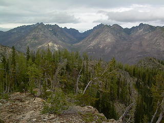 Pinnacle Mt., Milham Pass, Saska Mt., Emerald Mt, Cardinal Peak 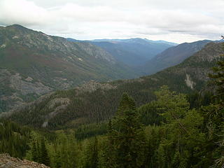 Entiat River Valley 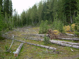 Flat clearing 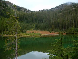 Upper Larch Lake 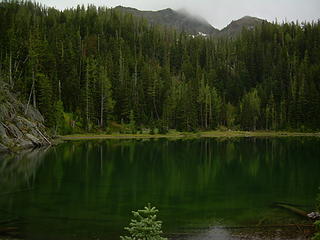 Lower Larch Lake 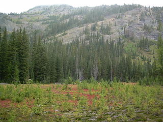 Lower Larch Lake Campground field 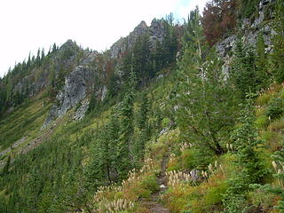 Up the ridge from Larch Lakes to Pomas Pass 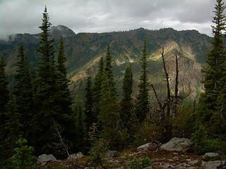 Carne Mt. ridge and Old Gib Mt. 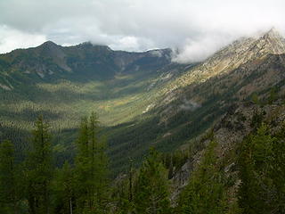 Upper Rock Creek Valley with Carne Mt. and Chilly Peak 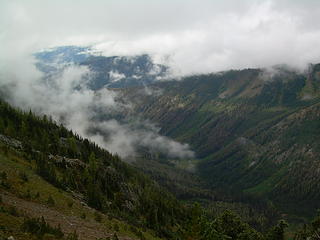 Lower Rock Creek Valley 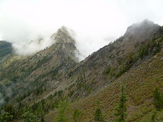 Pomas Pass 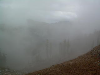 Best view of South Spectacle Butte from Pomas Pass 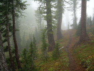 Pomas Pass 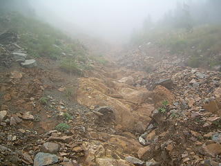 Sandstone rock gully 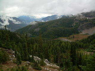 Larch Lakes and Entiat Valley 
 Upper Larch Lake 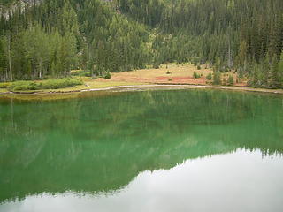 Upper Larch Lake 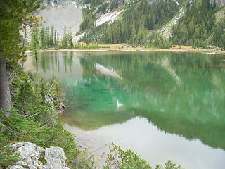 Upper Larch Lake 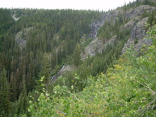 Larch Lakes Falls 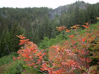 Fall at Larch Lakes Falls 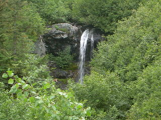 Lower Larch Lakes Falls 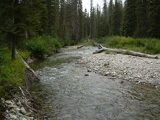 Entiat River ford crossing 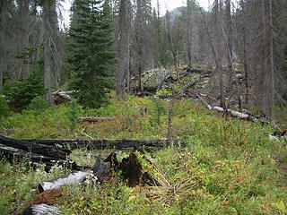 Burnt Forest 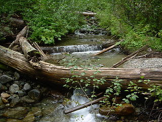 Lower Cow Creek
Wherever the trail takes me.
Wherever the trail takes me.
|
| Back to top |
  
|
|
Rainie Too!
Member

Joined: 12 Dec 2008
Posts: 377 | TRs | Pics
|
This is my first solo backpacking trip! Ever!
Warning, it is addictive! 
|
| Back to top |
|
|
HitTheTrail
Member

Joined: 30 Oct 2007
Posts: 5462 | TRs | Pics
Location: 509 |
Nice TR and photos. I just did that loop in the other direction and without the rain, but with the horses and hunters. It think it is much quieter other times of the year.
|
| Back to top |
|
|
Highwalker's Daughter
Member
Joined: 12 Aug 2006
Posts: 1575 | TRs | Pics
Location: Bothell, WA |
beautiful spot - interesting to see it without all the snow
|
| Back to top |
|
|
Sky Hiker
Member
Joined: 03 Feb 2007
Posts: 1469 | TRs | Pics
Location: outside |
Did you see any high hunters out there?
|
| Back to top |
|
|
Trailblazing Todd
Trail Wanderer
Joined: 26 Mar 2010
Posts: 126 | TRs | Pics
Location: Everett |
| Kep7790 wrote: | | Did you see any high hunters out there? |
There were the few hunters at the lower lake...and more further in towards Entiat glacier.
In the morning coming back from Pomas Pass, I chatted with a hunter who's buddy did kill a buck up on the end of a ridge I was actually thinking about scrambling to but decided not to.
On the mileage note, it is about a 17 mile loop and about a 4 mile round trip to Pomas Pass.
Wherever the trail takes me.
Wherever the trail takes me.
|
| Back to top |
|
|
|
|
You cannot post new topics in this forum
You cannot reply to topics in this forum
You cannot edit your posts in this forum
You cannot delete your posts in this forum
You cannot vote in polls in this forum
|
Disclosure: As an Amazon Associate NWHikers.net earns from qualifying purchases when you use our link(s). |


