| Previous :: Next Topic |
| Author |
Message |
Bloated Chipmunk
Cock Rock Searcher


Joined: 29 Jan 2007
Posts: 2993 | TRs | Pics
Location: Margaritaville |
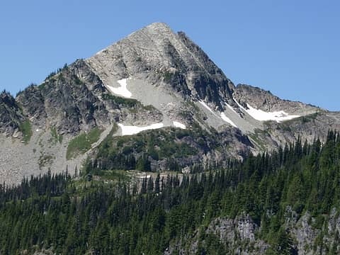
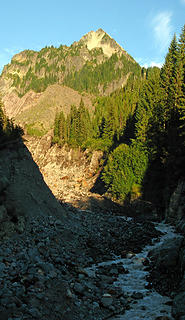
Pyramid Pk. on the SW side of Rainier had been on my list for awhile, & after my Mildred Pt. trip this summer where I got a nice close-up view of it, it moved up in priority.  I waited for a couple of sunny weekdays & invited MM, TT, & Obi Tony Kenobi. I waited for a couple of sunny weekdays & invited MM, TT, & Obi Tony Kenobi.  Pyramid as seen from Mildred Pt.:
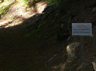
 Pyramid Pk. Definitely on the list.  After a brief stop @ the Longmire Museum, we were off & driving up the Westside Rd. to the closure, where we parked & geared up. Only 3 other cars @ the TH.
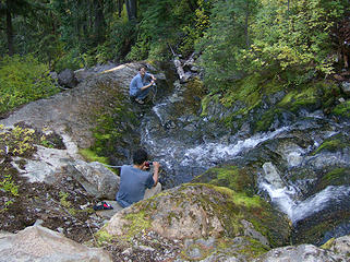
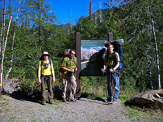
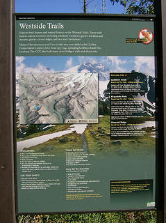 TH sign 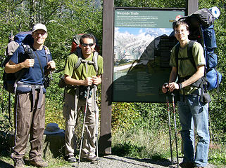 MountainMan, Obi Tony Kenobi, & Trailblazing Todd @ the TH 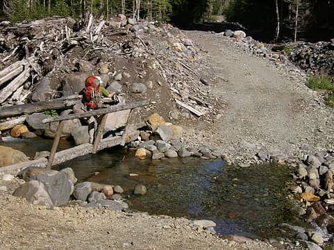 Tony crossing the bridge 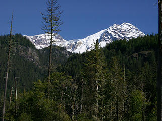 Rainier comes into view 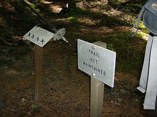 TH for the Tahoma Creek unmaintained trail 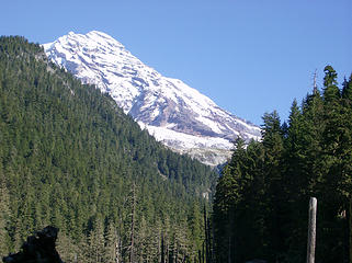 Rainier as seen from the Tahoma Crk. valley 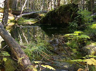 Beaver dam? 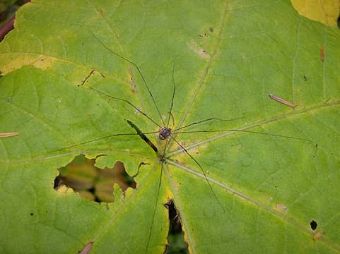 Nasty 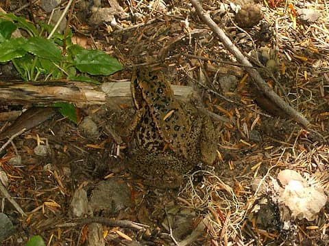 Frog 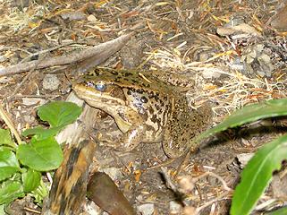 Frog 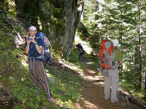 Todd holds up a big rock 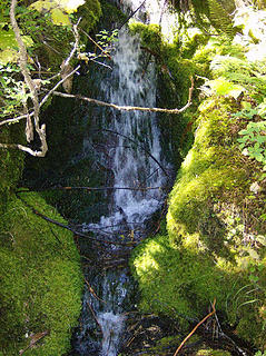 Falls 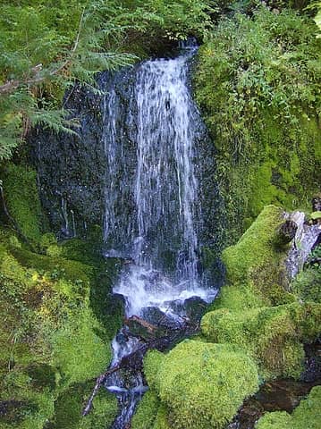 Falls 
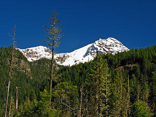
 Seemed pretty good to us 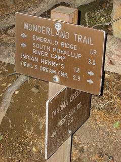 Junction 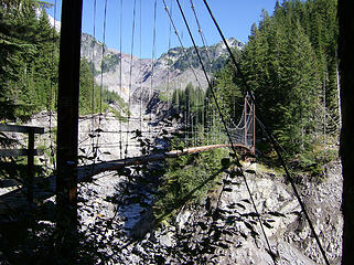 Suspension bridge 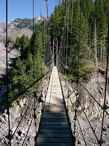 Suspension bridge 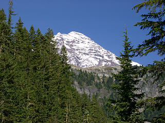 Rainier as seen from the bridge 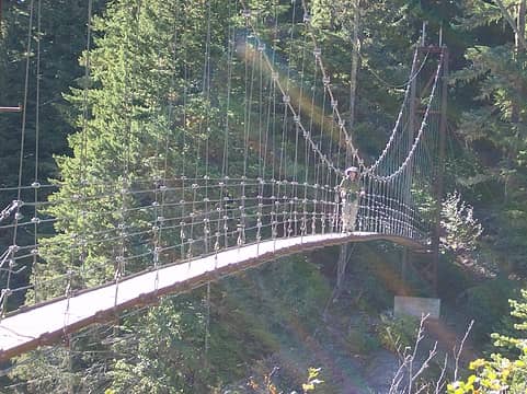 Tony coming across the bridge 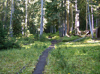 Nice trail 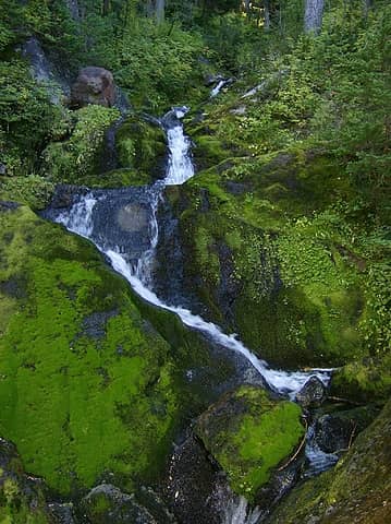 Little falls 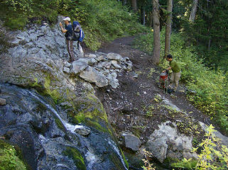 Creek crossing 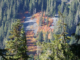 Fall color on the slopes across the way 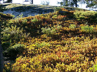 Fall color 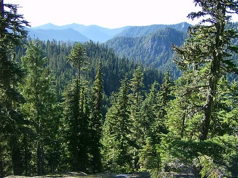 Looking back out the way we came 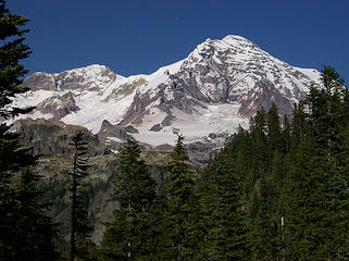 Rainier 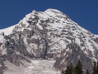 Zoom of Pt. Success 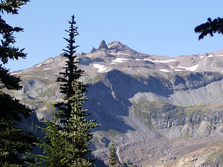 Tokaloo Spire? 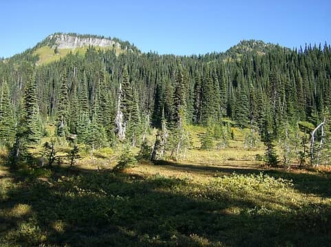 Copper Mtn. & Iron Mtn. 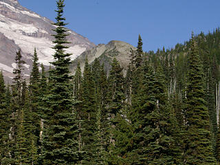 Pyramid comes into view again 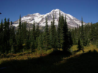 Rainier as seen from just before junction w/Mirror Lks. trail 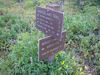 Junction w/the Mirror Lks. trail 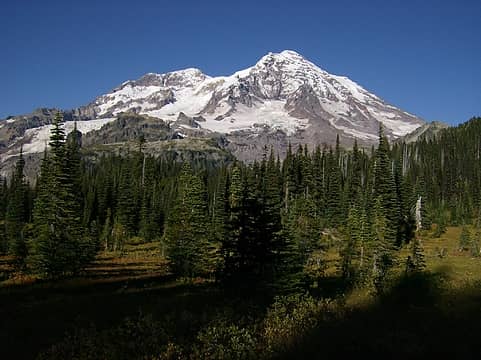 Rainier & Pyramid as seen from near junction 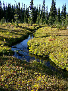 Golden meadow 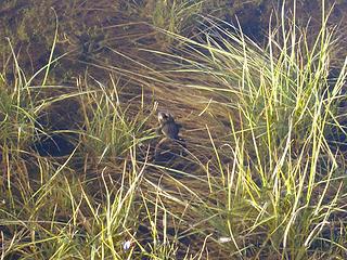 Frog  Heading toward Mirror Lks. 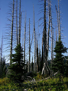 Trees that have seen better days 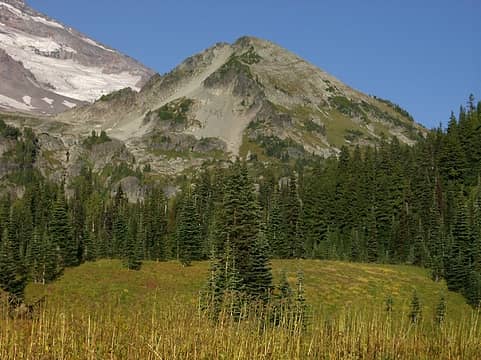 Heading toward Pyramid 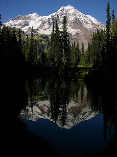 Rainier reflected in Mirror Lk. 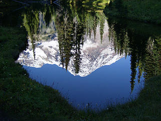 Rainier reflected in Mirror Lk. 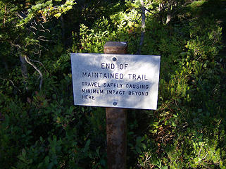 We're on our own now... 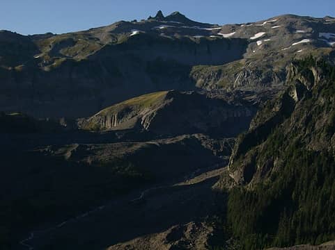 Tokaloo Spire 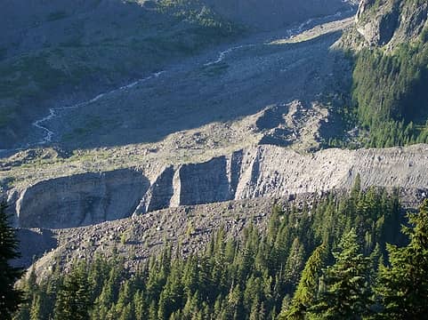 Upper Tacoma Creek 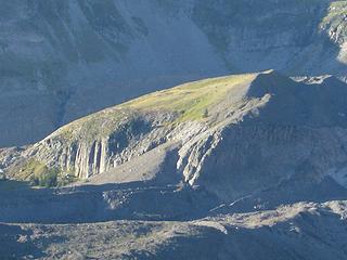 Nice green slope across the way 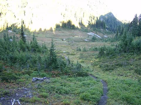 Descending into the basin below Pyramid 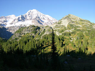 Rainier & Pyramid 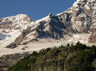 St. Andrews Rock? 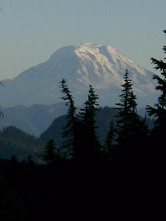 Mt. Adams 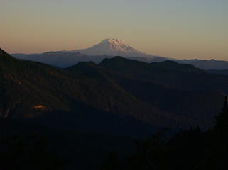 Sunset on Mt. Adams 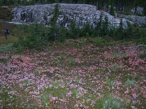 Fall color w/bad lighting 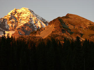 Sunset on Rainier & Pyramid 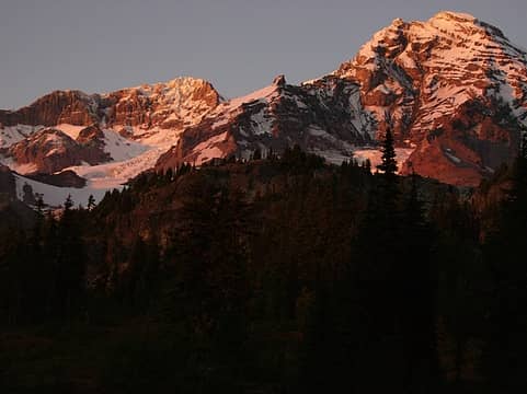 Sunset on Rainier 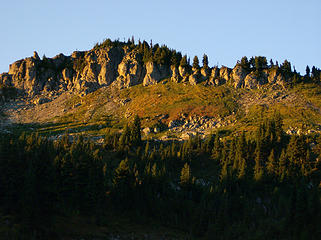 Sunrise on Copper Mtn. 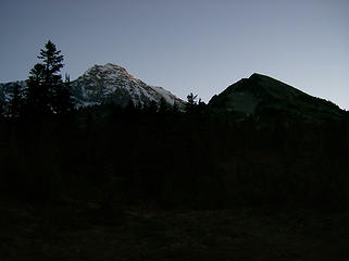 Rainier & Pyramid in the morning 
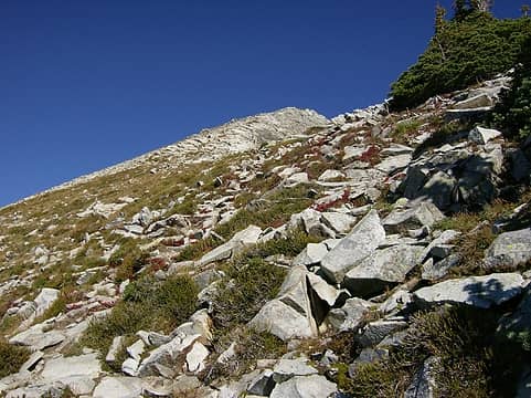
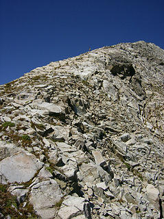
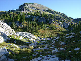 Getting closer... 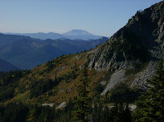 Mt. St. Helens 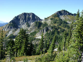 Iron Mtn. & Copper Mtn. 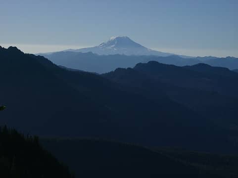 Morning light on Mt. Adams 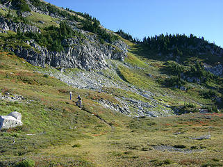 1 label Heading up to the gap in the ridge 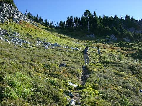 Getting closer to the gap 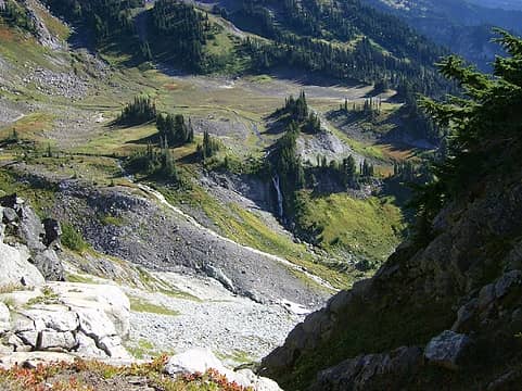 Waterfalls 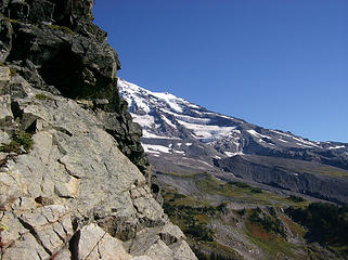 Rainier's southern slopes as seen from the gap 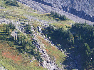 Waterfall 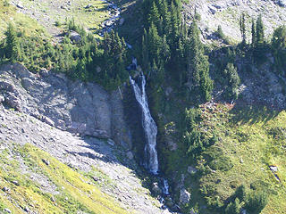 Zoom of falls  Looking down into Pyramid Park  The trail gets faint in places & the steeper parts are more of a scramble, but overall the rock is pretty safe & solid. Tony & Todd got to the summit, w/MM & I shortly behind as I breathed a sigh of relief. The trail gets faint in places & the steeper parts are more of a scramble, but overall the rock is pretty safe & solid. Tony & Todd got to the summit, w/MM & I shortly behind as I breathed a sigh of relief.  The summit is grassy & very roomy & flat, w/awesome views in all directions. The summit is grassy & very roomy & flat, w/awesome views in all directions. 
 Heading up Pyramid 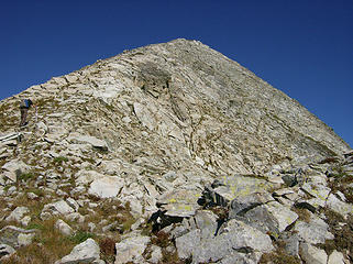 I can see how it gets its name 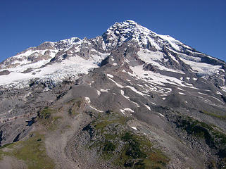 Rainier as seen from the summit of Pyramid Pk. 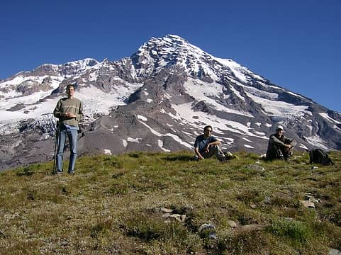 The boyz atop Pyramid Pk. 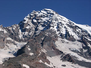 Zoom of Pt. Success 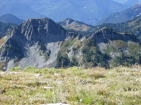 Iron Mtn., Copper Mtn. 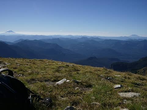 Mt. Adams & St. Helens in the distance 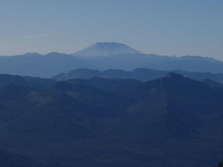 Mt. St. Helens 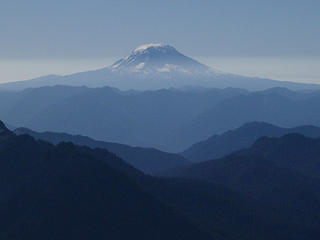 Mt. Adams 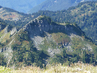 Copper Mtn. 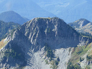 Iron Mtn.  2 lil' bumps 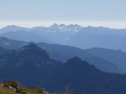 11 labels Goat Rocks, w/Plummer & Lane in foreground 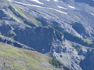 Mildred Pt.? 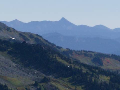 Bismarck? 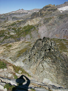 My shadow 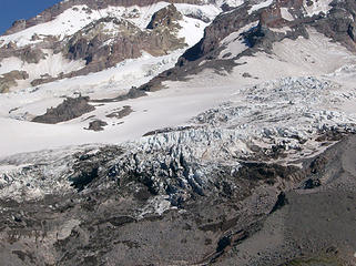 Glaciers 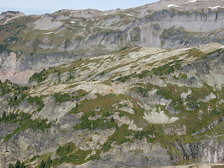 Lower part of Glacier Is. 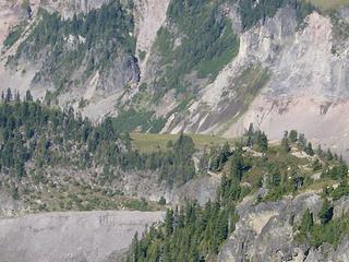 End of Emerald Ridge 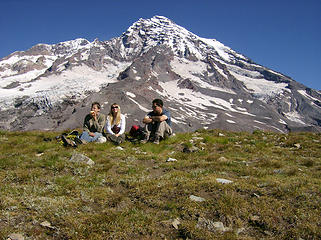 Accidental picture 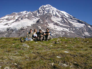 Group shot on the summit 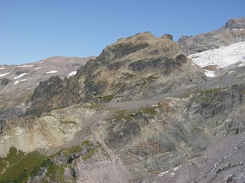 Upper hunk of Glacier Is.  St. Andrews Rock? 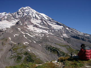 Tony getting the boot shot 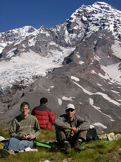 TT, Tony, & MM on the summit 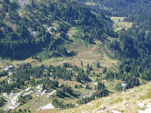 Looking down to the basin from the summit 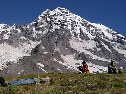 Lazin' on the summit 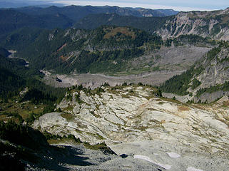 Big rocks below 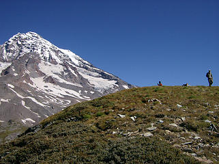 Rounded summit of Pyramid  So instead, once I got down to flatter ground I took pics of Todd & Tony coming down. So instead, once I got down to flatter ground I took pics of Todd & Tony coming down.
 Todd & Tony coming down 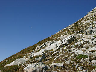 Faint crescent moon 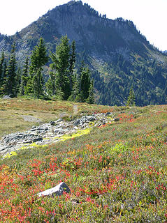 Fall color below Copper Mtn. 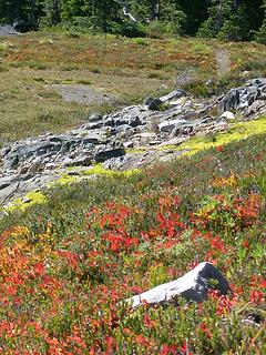 Fall color 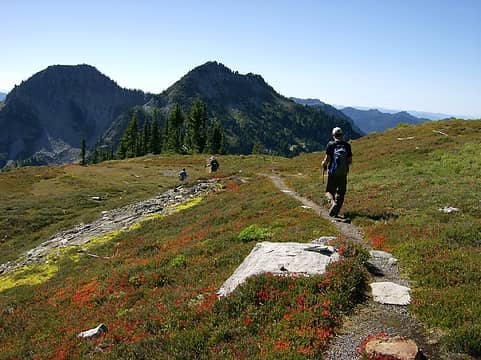 The boyz heading back down to camp 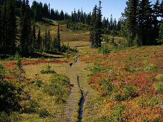 Fall color 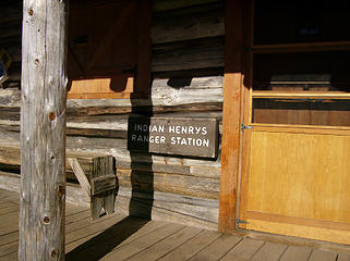 IH Ranger Station 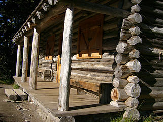 Sunlit porch 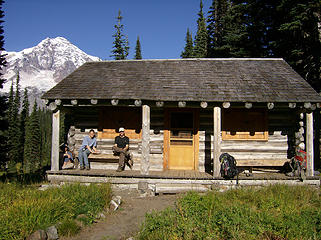 The boyz chillin' @ the cabin 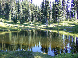 Pond by cabin 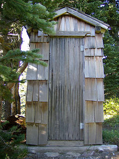 Pisser 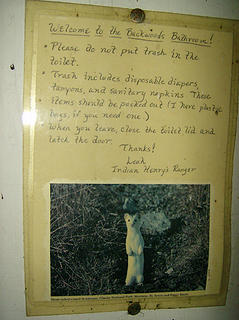 There was a weasel inside of the pisser!  From the cabin we made pretty quick time back down to the suspension bridge after a brief break to filter water. After the bridge we quickly got through the steep downhill sections to the riverbed, then busted out the headlamps for the last part of the trail & rd.
 Filtering 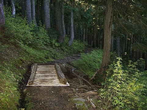 Heading down 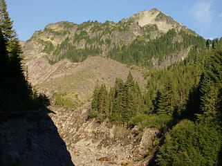 Last look @ Pyramid 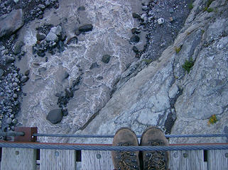 Boot shot from bridge 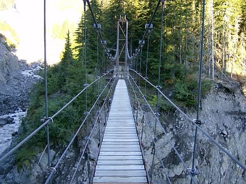 On the bridge 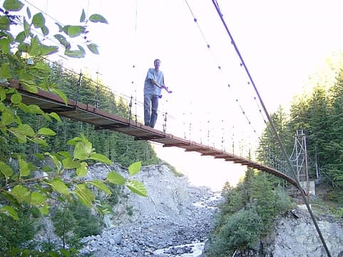 Todd on the bridge  It also appeared as though it was interested in the Jolly Ranchers & gum inside the glove compartment. It also appeared as though it was interested in the Jolly Ranchers & gum inside the glove compartment.  Other than that, we hadn't left anything edible in the car. But now we'll know that even mice like candy & gum.
Back in Eatonville we stopped @ Puerto Vallarta for dinner, where I got a mighty stiff margarita--it felt like it was 75% tequila. I'll have to remember that for next time. Other than that, we hadn't left anything edible in the car. But now we'll know that even mice like candy & gum.
Back in Eatonville we stopped @ Puerto Vallarta for dinner, where I got a mighty stiff margarita--it felt like it was 75% tequila. I'll have to remember that for next time.  Big thanks to Trailblazing Todd, Obi Tony Kenobi, & MountainMan for a great trip to a really cool place!!
Home is where the hiking is.
"Peaks that have come and gone four times should halt a man in his steps." -- William O. Douglas
A balanced diet is a margarita in each hand.
Home is where the hiking is.
"Peaks that have come and gone four times should halt a man in his steps." -- William O. Douglas
A balanced diet is a margarita in each hand.
|
| Back to top |
  
|
|
Magellan
Brutally Handsome

Joined: 26 Jul 2006
Posts: 13116 | TRs | Pics
Location: Inexorable descent |
|
Magellan
Brutally Handsome
|
 Sat Oct 02, 2010 10:59 pm |
|
|
Looks like a great place to spend a day and a half. WTF is up with the mousies breaking into peoples cars at MRNP? Some folks at Sunrise yesterday had one in their car. I guess I got lucky because I left food and crumbs everywhere in our truck.
|
| Back to top |
|
|
Chief Joseph
Member

Joined: 10 Nov 2007
Posts: 7709 | TRs | Pics
Location: Verlot-Priest Lake |
Nice pics and report, will have to put that place on my list. A hiker in blue jeans? I thought that they were extinct?
Go placidly amid the noise and waste, and remember what comfort there may be in owning a piece thereof.
Go placidly amid the noise and waste, and remember what comfort there may be in owning a piece thereof.
|
| Back to top |
|
|
MountainMan
Member

Joined: 15 Jul 2008
Posts: 365 | TRs | Pics
Location: San Diego |
Starting off:
 TH 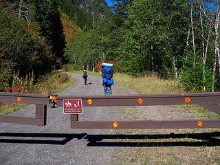 Gate 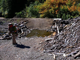 Could of driven through... 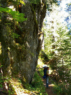 TT on the trail. 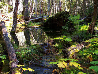 Looks like a beaver dam. 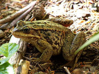 Frog 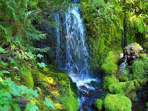 Falls ISO-800 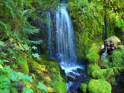 Falls ISO-100 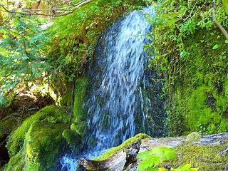 Falls ISO-800 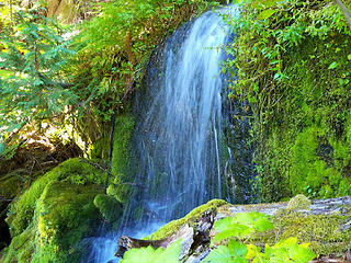 Falls ISO-100 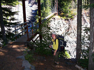 BC at footbridge. 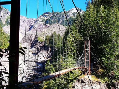 Footbridge and Pyramid Pk. 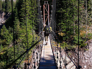 Crossing 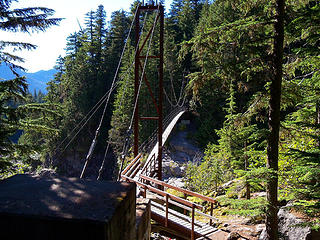 Footbridge 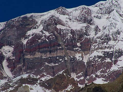 Zoom of colored bands on Mt Rainier. 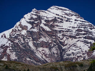 Mt Rainier 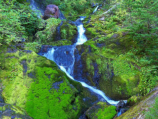 Small falls 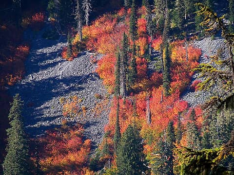 Fall colors 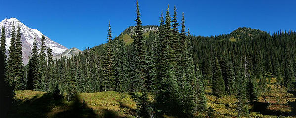 Rainier, Pyramid Pk, Copper Mtn and Iron Mtn. 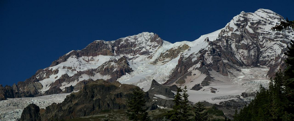 Mt Rainier 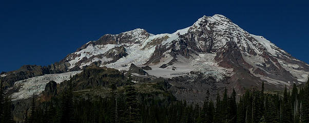 Mt Rainier 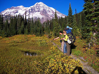 Looking at frogs. 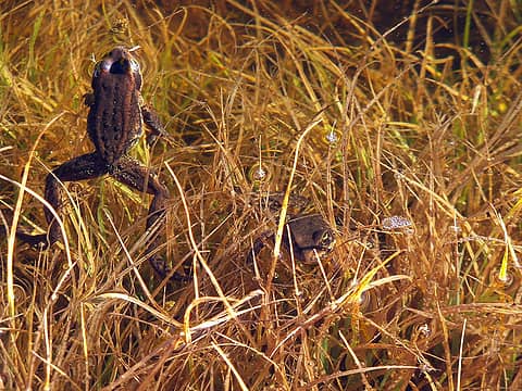 Frogs 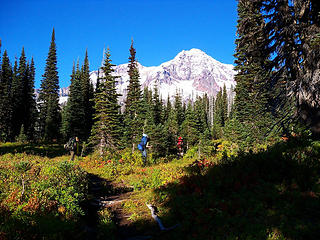 Hiking through Indian Henry's Hunting Ground. 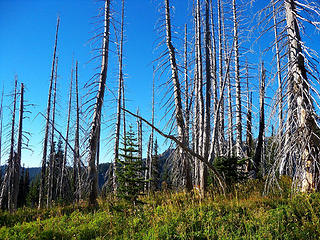 Silver trees 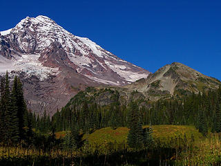 Rainier and Pyramid Pk. 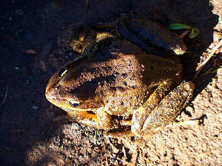 Frog 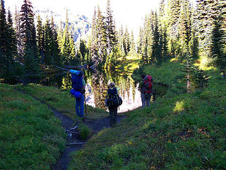 Mirror Lakes 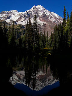 Reflections 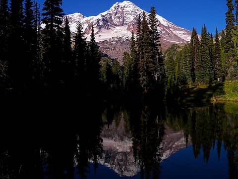 Reflections 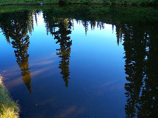 Reflections 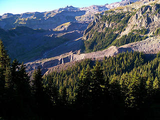 Big ditch 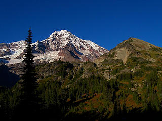 Mt Rainier and Pyramid Pk 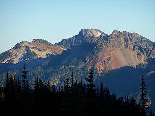 View SE 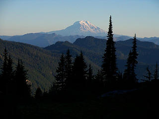 Adams 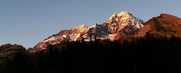 Sunset on Rainier and Pyramid 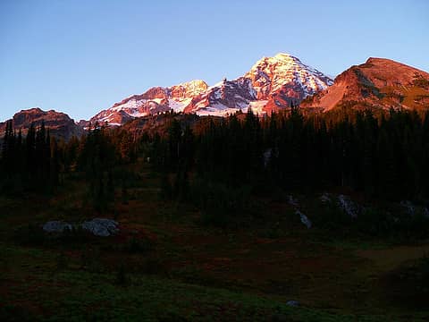 Sunset on Rainier and Pyramid 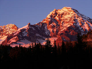 Sunset on Rainier 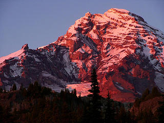 Sunset on Rainier 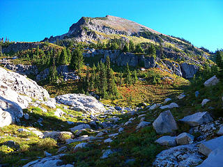 Pyramid on the way up. 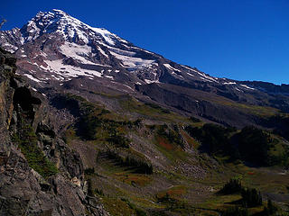 Rainier on the way up Pyramid. 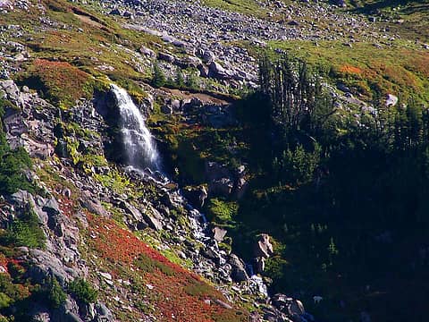 Falls 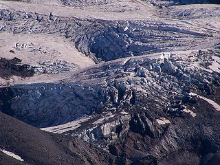 Glacier 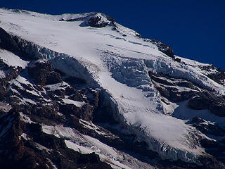 Glacier 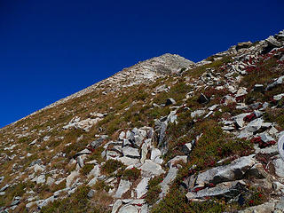 Looking up Pyramid. 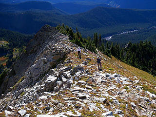 BC and Obi on the way up. 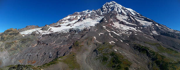 Rainier from Pyramid Pk. 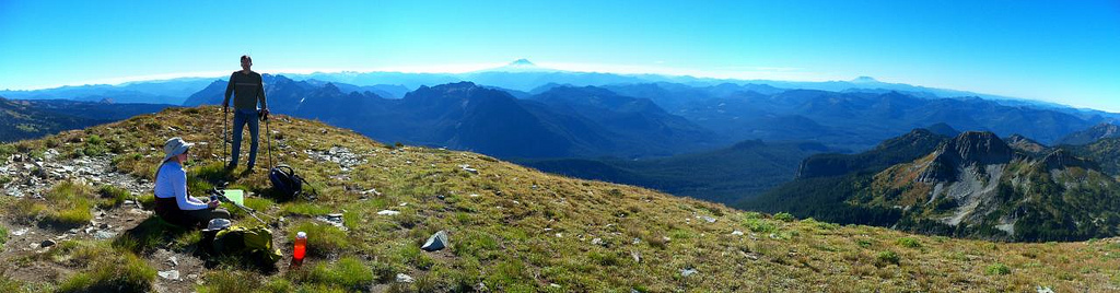 Pano looking South from Pyramid with BC and TT. 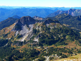 Iron and Copper Mtns. 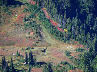 Fall colors 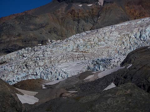 Glacier zoomed 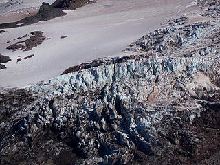 Glacier zoomed 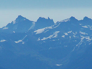 Zoom of Goat Rocks. 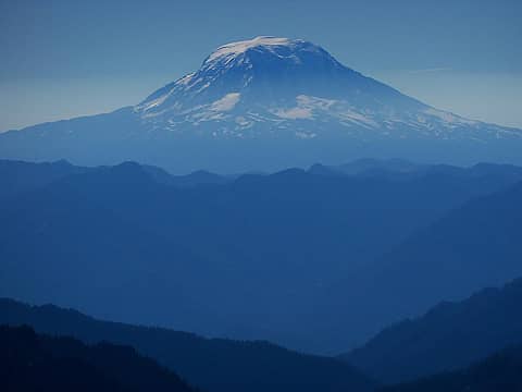 Mt Adams 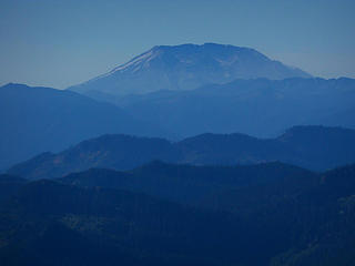 Mt St Helens 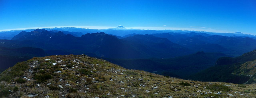 Pano looking South 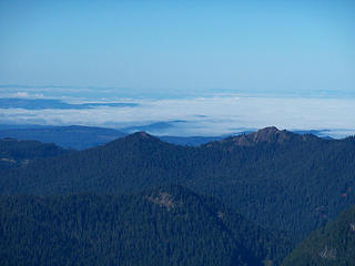 Clouds over Puget Sound. 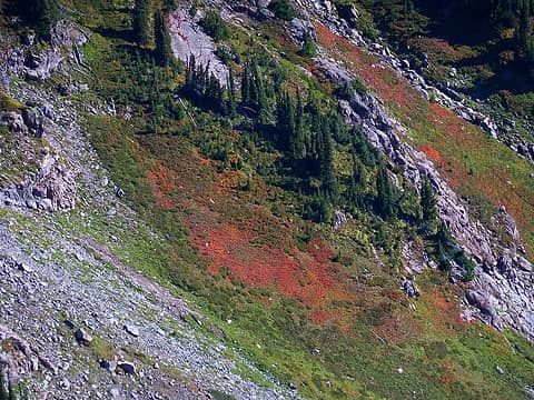 Fall color 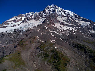 Rainier from Pyramid. 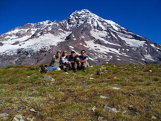 Group pic on Pyramid Peak. 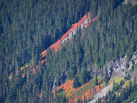 Fall colors 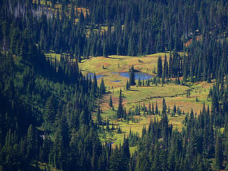 Mirror Lakes 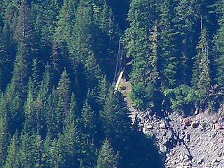 Zoom of footbridge from Pyramid. 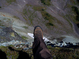 Boot-shot looking down Pyramid's east side. 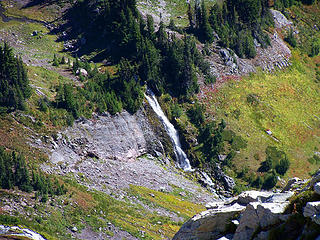 Falls 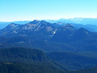 View SE 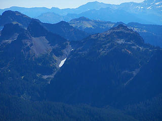 Pinnacle and Plummer from Pyramid. 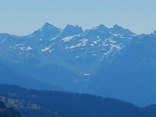 Goat Rocks 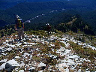 Obi and BC headed down. 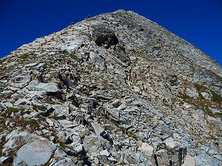 Looking back up.  TT and Obi coming down from Pyramid Pk. 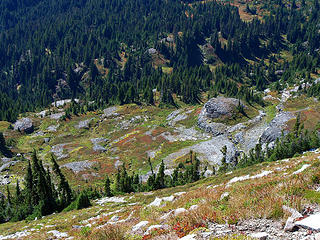 View on the way down to the west. 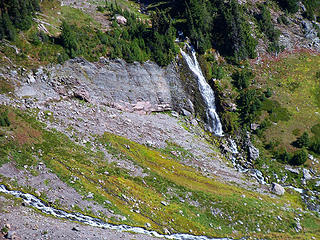 Falls 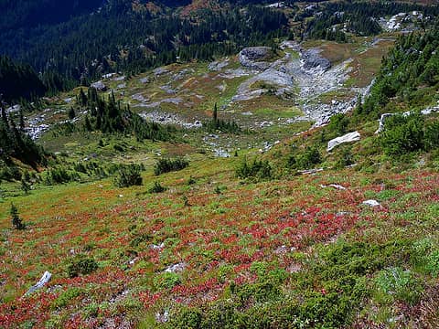 Looking down. 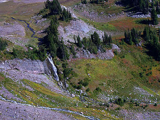 Falls 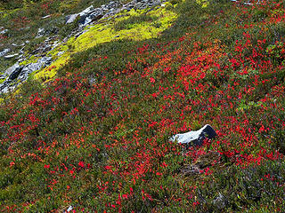 Fall color 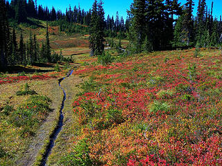 Fall colors 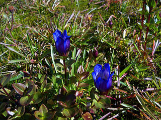 Blue flowers 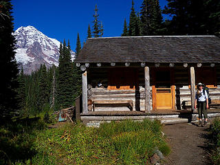 BC at Indian Henrys Ranger Station. 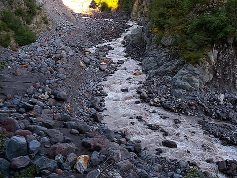 Tahoma Creek 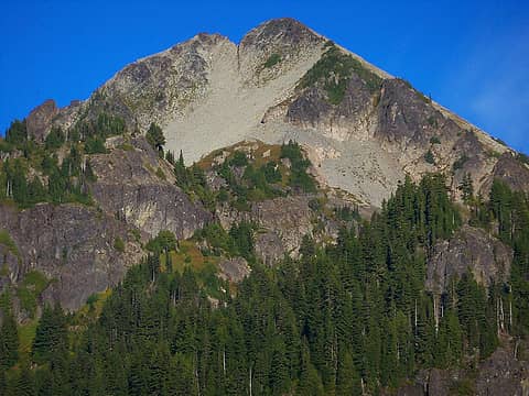 Pyramid Pk from near footbridge. 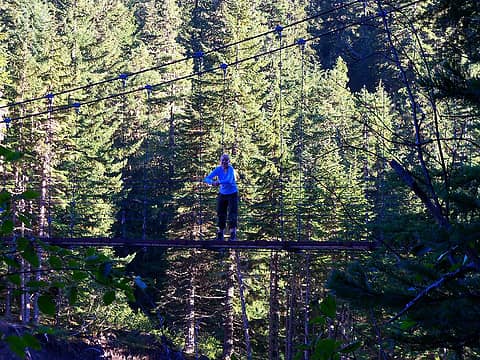 BC on footbridge. 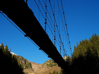 Footbridge 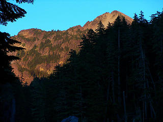 Last look at Pyramid. 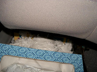 Mouse-ripped TP in car.
Slow down, take notice, savor the moment, appreciate the world around you and everything that you have.
Slow down, take notice, savor the moment, appreciate the world around you and everything that you have.
|
| Back to top |
|
|
Trailblazing Todd
Trail Wanderer

Joined: 26 Mar 2010
Posts: 126 | TRs | Pics
Location: Everett |
This was a great trip with unexpected (but welcomed) warm temperatures. I love that suspension bridge over Tahoma Creek and the views on top of Pyramid Peak. I started remembering that part of the Wonderland Trail when I did it a number of years ago. It was great to see it from a different vantage point. Many pictures already, but I will just add some more:
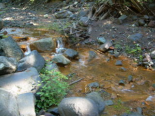 Copper stream by the road 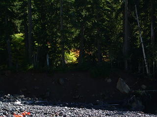 A window of a sunny autumn 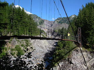 Bloated Chipmunk on the Tahoma Creek Suspension Bridge 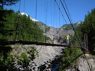 Trailblazing Todd on the Tahoma Creek Suspension Bridge 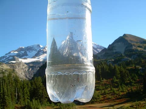 Mt. Rainier through the water bottle 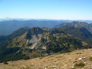 Copper, Iron, Ararat, and Wow 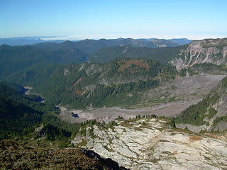 Tahoma Creek and Emerald Ridge 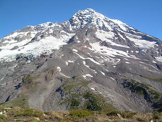 Mt Rainier (Point Success) 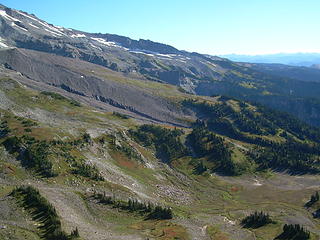 Pyramid Park 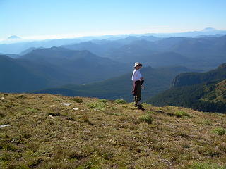 BC inbetween two volcanos 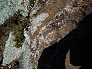 Crystal Rock 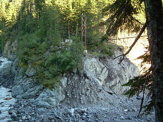 Tahoma Creek Suspension Bridge
Wherever the trail takes me.
Wherever the trail takes me.
|
| Back to top |
|
|
veronika
Member

Joined: 25 Apr 2010
Posts: 3015 | TRs | Pics
Location: On the road |
|
veronika
Member
|
Sun Oct 03, 2010 2:24 pm |
|
|
Thanks for the TR... Well done! It's great to see everyone's photos from different perspectives! Looks like a very nice trip!
I have always wanted to go across that suspension bridge.  Now I know exactly how to get there.
BTW, I have a huge hole and pile of insulation in my trunk from the critters as well. They ate all my damn bread! Now I know exactly how to get there.
BTW, I have a huge hole and pile of insulation in my trunk from the critters as well. They ate all my damn bread! 
Take risks not to escape life, but to prevent life from escaping
I may not have anyone rocking my world right now but, I don't have anyone messing it up either.
Take risks not to escape life, but to prevent life from escaping
I may not have anyone rocking my world right now but, I don't have anyone messing it up either.
|
| Back to top |
|
|
Obi Tony Kenobi
Waterfall Crazy!

Joined: 25 Jun 2007
Posts: 1899 | TRs | Pics
Location: Marysville, WA |
This is a trip I don't think I would have done if it wasn't because Bloated Chipmunk brought it up. I had no idea the trail even existed. I was especially excited because of the ranger telling us it was full of bears of at Pyramid Peak area and Henry's Meadows.
Well for a road that is closed because of washouts, I think Westside Road is drivable all the way to the TH. Even where the road crosses the creek a 2-WD vehicle could go by.
For Tohoma Creek being an unmaintained trail, this trail is in excellent shape! There is one spot where the trail goes out towards the creek but it isn't a problem and to where you have to grab on to tree roots and "crawl" up, but they aren't a problem at all.
 First view of Mount Rainier from Tohoma Creek 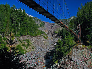 Tohoma Creek Suspension Bridge 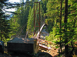 Tohoma Creek Suspension Bridge 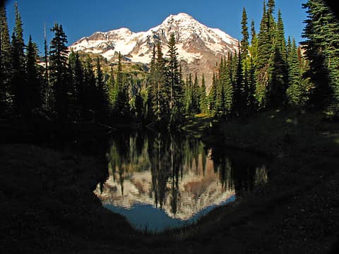 Mount Rainier and Mirror Lake 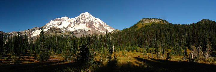 Mount Rainier and Copper Mountain 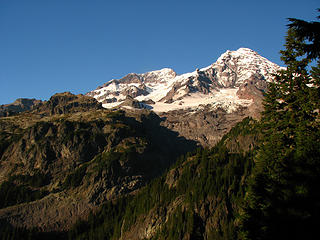 Mount Rainier's Liberty Cap and Point Success 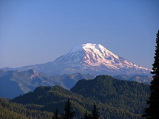 Mount Adams 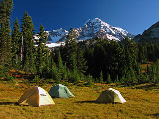 Pyramid Peak Campsite 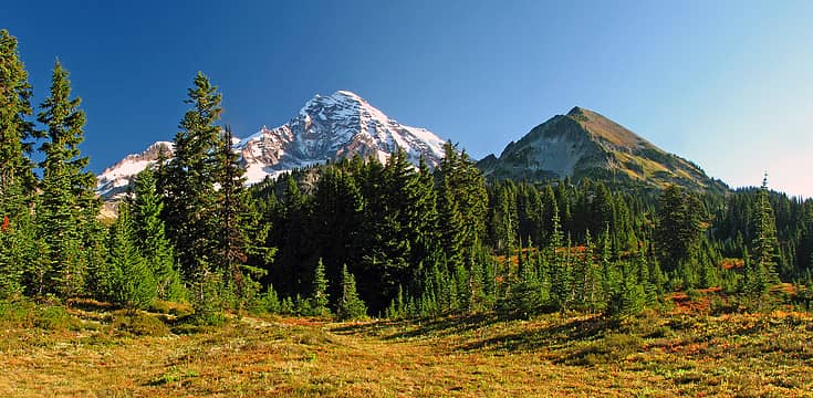 Mount Rainier & Pyramid Peak from Camp 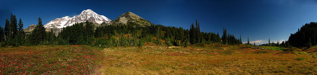 Autumn Meadow Colors with Mount Rainier and Pyramid Peak Looming Large 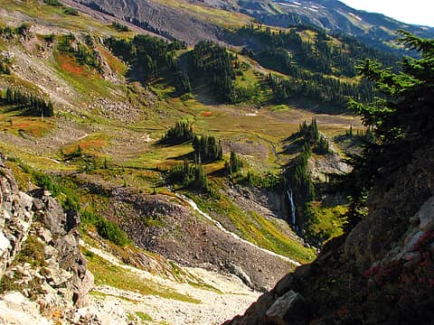 Pyramid Park with Upper Tomlinson Falls and Tomlinson Falls 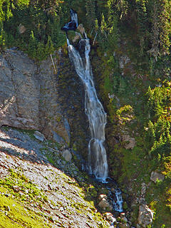 Tomlinson Falls, Pyramid Creek, MRNP 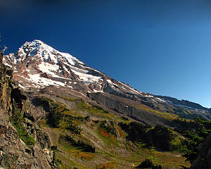 Mount Rainier and Pyramid Park 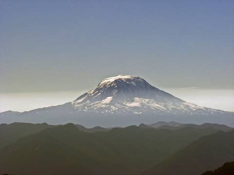 Mount Adams from the Pyramid Peak summit 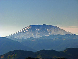 Mount Saint Helens from the Pyramid Peak Summit 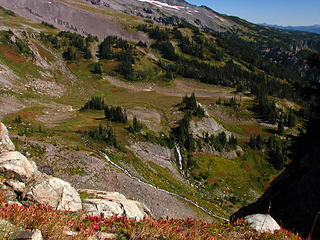 Pyramid Park and Falls 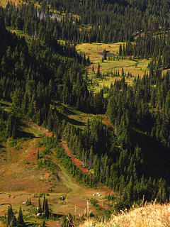 Meadows from Pyramid Peak Summit 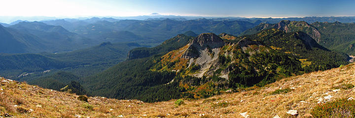 Iron and Copper Mountains from the Summit of Pyramid Peak 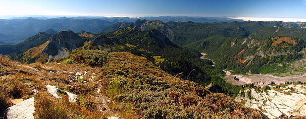 Tahoma Creek with Copper and Iron Mountains from Pyramid Peak Summit 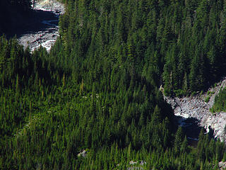 Tohoma Creek Suspension Bridge from Pyramid Summit 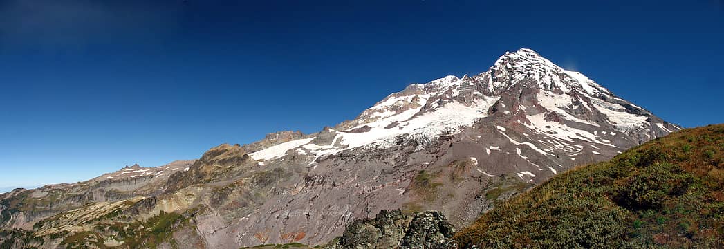 Mount Rainier from Pyramid Peak Summit 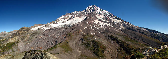 Mount Rainier from the Summit of Pyramid Peak 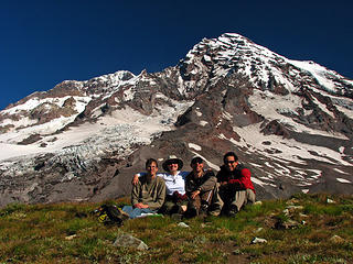 Pyramid Peak Group Summit Picture 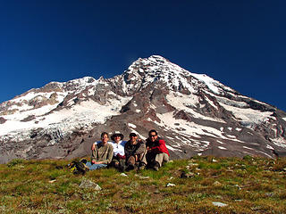 Pyramid Peak Group Summit Picture 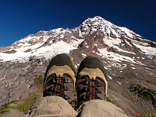 Mandatory Pyramid Peak Summit Boot Shot 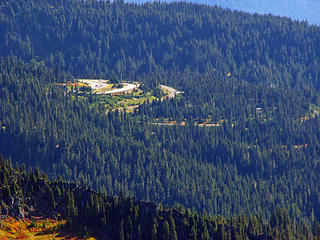 Paradise from Pyramid Peak Summit 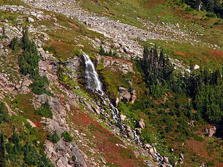 Upper Tomlinson Falls, Pyramid Creek, MRNP 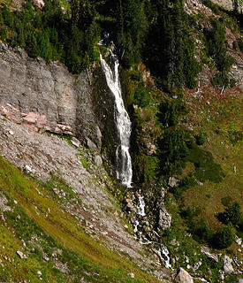 Tomlinson Falls, Pyramid Creek, MRNP Tomlinson Falls, Pyramid Creek, MRNP 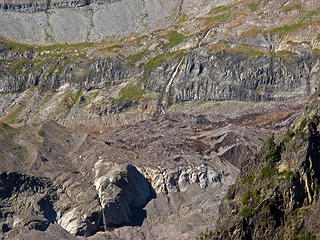 Tokaloo Falls, Puyallup River, MRNP 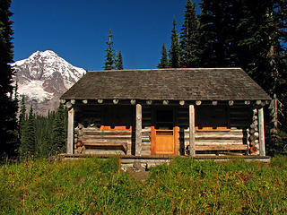 Indian Henry's Hunting Grounds Cabin  We headed back for home and just like when we went up, we never saw a soul; ok, we saw one person the whole trip.
 Tohoma Creek & Pyramid Peak from the Tohoma Creek Bridge 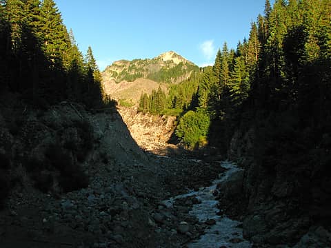 Tohoma Creek & Pyramid Peak from the Tohoma Creek Bridge
|
| Back to top |
|
|
JimK
Member

Joined: 07 Feb 2002
Posts: 5606 | TRs | Pics
Location: Ballard |
|
JimK
Member
|
Mon Oct 04, 2010 5:29 pm |
|
|
Nice weather and a great destination. Glad to hear that the Tahoma Creek trail is still passable. On my one visit to Pyramid we ran into an accidental Mountaineer mistake. Both Seattle and Everett had trips set for the same day. We were on the summit with 24 new acquaintances. After all that distance we had zero solitude.
|
| Back to top |
|
|
tigermn
Member

Joined: 10 Jul 2007
Posts: 9242 | TRs | Pics
Location: There... |
|
tigermn
Member
|
Mon Oct 04, 2010 6:20 pm |
|
|
What was the total distance in for this trip? I wondered what this approach might be like. I've heard of going in from Indian Henry's as well and doing it as a day trip. Both ways probably good long day hauls but I don't do the overnight thing.... 
|
| Back to top |
|
|
the Zachster
Member

Joined: 17 Jan 2007
Posts: 4776 | TRs | Pics
Location: dog training |
Thank you for posting this report! It's one of my favorite places (such a different perspective of The Mountain) but we've always gone in through Kautz Creek. Your report has given me more incentive to go in the other way next time. Beautiful pics, especially Mirror Lake and sunset shots!
"May I always be the kind of person my dog thinks I am"
"May I always be the kind of person my dog thinks I am"
|
| Back to top |
|
|
tigermn
Member
Joined: 10 Jul 2007
Posts: 9242 | TRs | Pics
Location: There... |
|
tigermn
Member
|
Mon Oct 04, 2010 6:27 pm |
|
|
Yea I had figured the Kautz Creek approach as well. Looks like an interesting alternative.
|
| Back to top |
|
|
raising3hikers
Member
Joined: 21 Sep 2007
Posts: 2344 | TRs | Pics
Location: Edmonds, Wa |
Nice reflection pics Thanks for the TR
|
| Back to top |
|
|
Obi Tony Kenobi
Waterfall Crazy!
Joined: 25 Jun 2007
Posts: 1899 | TRs | Pics
Location: Marysville, WA |
Tigermn, the total distance I got from my GPS which included summiting Pyramid Peak, the side trip to Indian Henry's and wondering around looking for a campsite was 16.42 miles.
If you are just going to Indian Henry's it is 10 miles rt.
|
| Back to top |
|
|
Highwalker's Daughter
Member
Joined: 12 Aug 2006
Posts: 1575 | TRs | Pics
Location: Bothell, WA |
Beautiful place! Loved the pictures and detailed report.
|
| Back to top |
|
|
Bloated Chipmunk
Cock Rock Searcher
Joined: 29 Jan 2007
Posts: 2993 | TRs | Pics
Location: Margaritaville |
Home is where the hiking is.
"Peaks that have come and gone four times should halt a man in his steps." -- William O. Douglas
A balanced diet is a margarita in each hand.
|
| Back to top |
|
|
|
|
You cannot post new topics in this forum
You cannot reply to topics in this forum
You cannot edit your posts in this forum
You cannot delete your posts in this forum
You cannot vote in polls in this forum
|
Disclosure: As an Amazon Associate NWHikers.net earns from qualifying purchases when you use our link(s). |


