Forum Index > Trip Reports > West Tiger 1,2,3 via Preston 10/27/2010
 Reply to topic
Previous :: Next Topic
Author Message
tigermn
Member
Member


Joined: 10 Jul 2007
Posts: 9242 | TRs | Pics
Location: There...
tigermn
Member
PostThu Oct 28, 2010 8:18 am 
Not really in snow mode yet so something close to home and snow free but one I hadn't done in quite this way.
West Tiger North area map.
West Tiger South area map.
Arrived about 08:15AM to the Main Tradition Lake parking lot and was on the trail by a little after 08:30. I had only recently noticed the trail leaving from the parking lot to go back down to avoid the gravel road walk.
Trail from Tradition Lake parking area back down to gate below gravel road.
This is actually a nice little trail avoiding the road that will dump you down right by the gate. Strange I had never noticed it in all the trips I've been up there.
Trail starts from paved road by gate up to Tradition Lake parking area on Tiger Mountain.
I continued down the paved road to the gate by the freeway exit that in essence marks the start of the high point trail. The trail was damp but not too muddy. Instead of the usual way up the High Point trail to take the Lingering Trail fork.
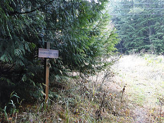
Taking the Lingering trail off of the High Point trail.
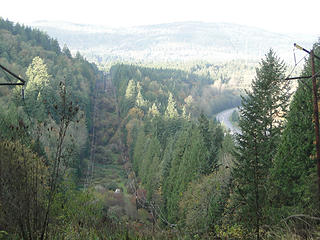
Looking back down from under the power lines on the Lingering trail.
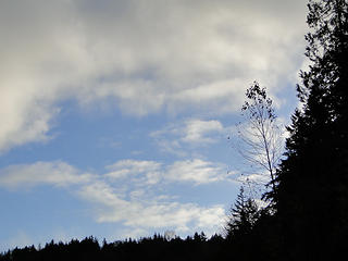
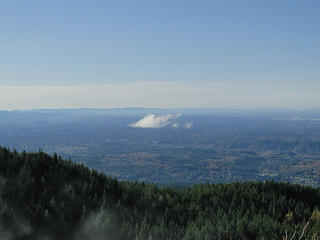
Clouds above road walking back to High Point trailhead.
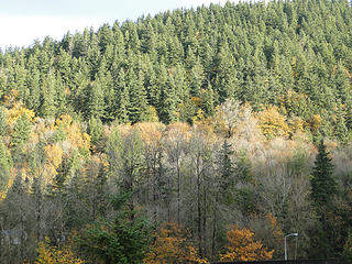
More fall colors on High Point across the freeway.
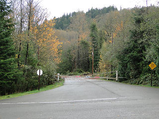
Gated road where you go to start up the High Point trail on Tiger Mountain.
For whatever reason though I missed the loop to continue on the Lingering trail and ended up walking the power line road to the Preson Junction. It was very wet in places but tolerable. I finally reached the Preston trail and started up. Fairly steeply at the get go.
Start of Preston trail under the powerlines.
I had actually done this trail on a previous trip up to East Tiger so i wasn't entirely unfamiliar. I continued straight passing where you could take the bootleg trail (not marked as a named trail).
Fork of Preston trail. Unmarked trail left is the bootleg trail.
The trail continues west before reaching another fork and starting steeper up what appears to be an old roadbed of sorts at least initially.
Forking left to head up Preston trail and eventually West Tiger 1.
Basically just a damp (vegetation) walk in the woods where you reach another junction with an option to continue up the bootleg trail or the West Tiger 1 trail. I opted for the West Tiger 1 trail as it was about a 1/2 mile shorter and I had never taken this trail.
Heading up West Tiger 1 trail.
The trail starts out climbing pretty good then eases and even goes down a little bit before the steep climb up to the Preston/RR trail junction. Now I was actually back on course for what I had originally planned to do. After more climbing I arrived at the trail just under the ridge heading west towards the hikers hut area.
Looking up at towers from connector trail on West Tiger 1.
I took the short fork up to the West Tiger 1 summit area. I also wanted to check out the view over by the lower set of towers.
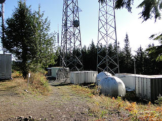
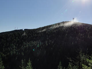
West tiger 1 summit at road end by gated towers.
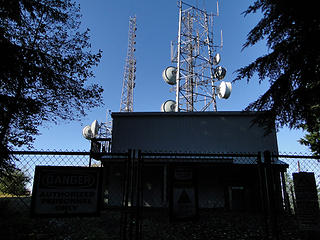
West Tiger 1 upper towers.
Views from road near 2nd set of lower towers on West Tiger 1.
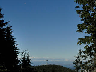
West Tiger 2 and moon from road on West Tiger 1.
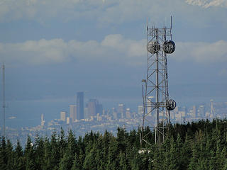
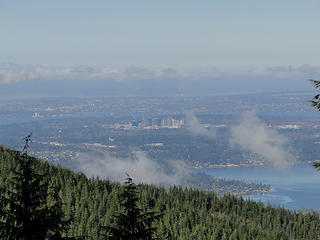
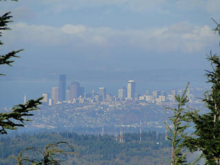
Downtown Seattle and Tower of West Tiger 2 from road on West Tiger 1.
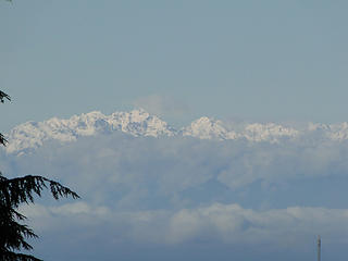
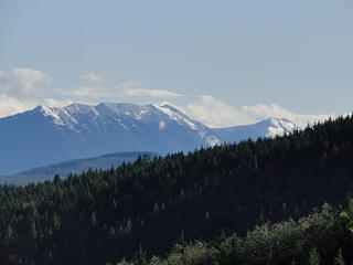
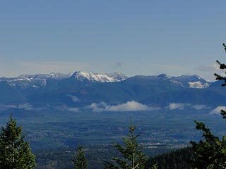
Olympics from road on West Tiger 1 near 2nd set of towers.
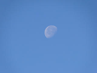
Moon above Tiger mountain.
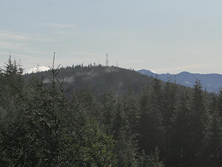
Second set of towers on West Tiger 1.
After that short diversion I headed down through the highest set of towers towards the hikers hut area.
West Tiger 1 towers.
West Tiger 1 hikers hut from road passing towers.
West Tiger 1 towers.
I sat on the bench for a few minutes to have a snack and take some pictures. I was surprised there was really no wind as I could hear some down in the trees hiking up.
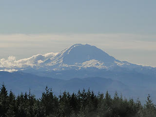
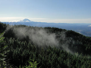
Rainier from near Hikers Hut on West Tiger 1.
East Tiger from West Tiger 1 Hikers Hut area.
Views from Hikers Hut area on West Tiger 1.
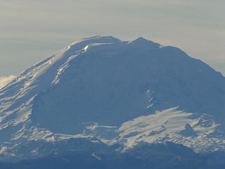
Zoom of Rainer from West Tiger 1 Hikers Hut bench.
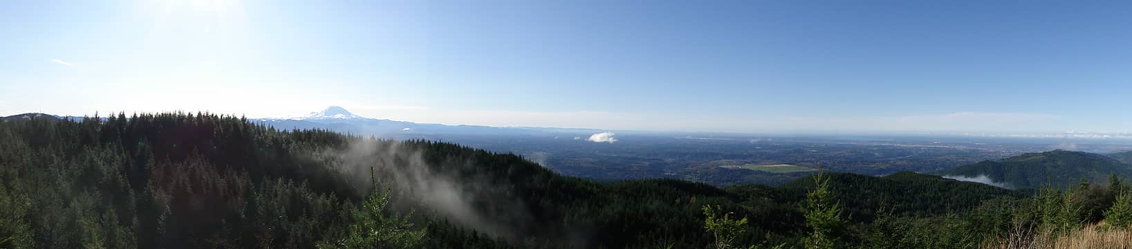
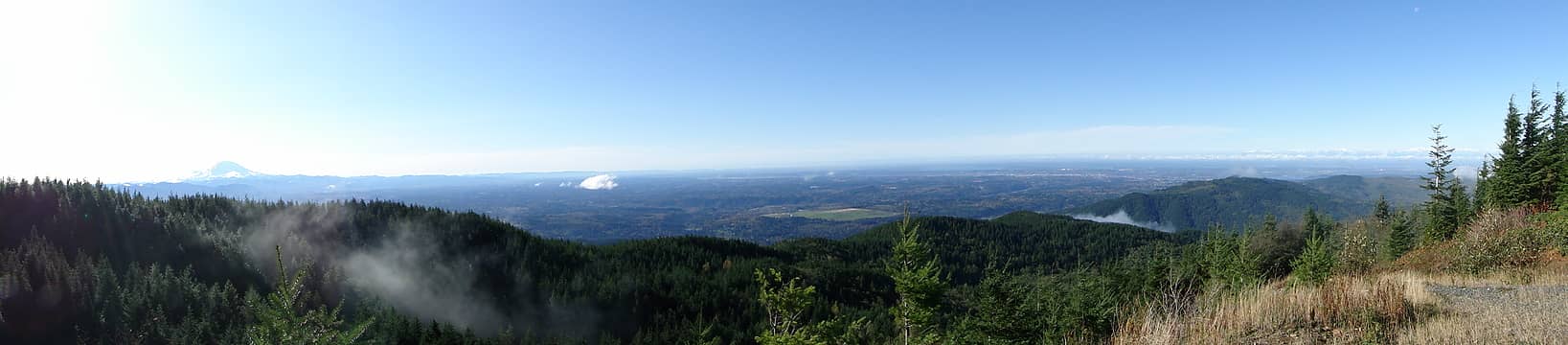
Pano from West Tiger 1 Hikers Hut area.
Views from West Tiger 1 Hikers Hut bench.
Got a few nice snow covered shots of the Olympics.
Olympics zoom from West Tiger 1 Hikers Hut area.
After the short break I headed over towards West Tiger 2 (then 3) to complete the loop.
View down road from West Tiger 1 Hikers Hut area.
Interesting the gate on the road up to West Tiger 2 was open but no one was up there.
Gate to West Tiger 2 open for some reason. No one up there though.
Tower on West Tiger 2.
Then just a hop skip and a jump over to West Tiger 3. To this point I had only seen one person all day. A runner over on the ridge trail below West Tiger 1. There were 3 people sitting in the summit area on 3. Stayed just long enough to snap a few pictures.
View from West Tiger 3.
West Tiger 2 from West Tiger 3.
West Tiger 3 summit.
Took in some views up the I-90 corridor from the stairs on the way down.
West Tiger 2 and 1 from trail heading down West Tiger 3.
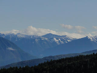
Views towards Bandara and Granite mountain from below West Tiger 3 summit.
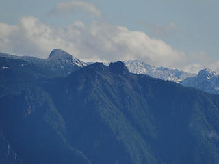
Si and Teneriffe from trail on way down West Tiger 3.
Views from trail heading down from West Tiger 3.
The rest of the trip was the easy walk down the freeway trail. I counted maybe a couple dozen people ascending the trail. The weather was getting warmer and nicer. I did happen to catch the shot of Baker from the peephole view on the way down.
Mt. Baker from spot on middle West Tiger 3 trail.
Rare blowdown on lower West Tiger 3 trail.
Back at the parking lot after just under 4 hours total.
Back to Tradition Lake/West Tiger parking area.
Not a bad loop but I'll probably not opt to walk the powerline road again anytime soon. Still always seems to be a new trail to walk in the Tiger Mountain trail system if you try.

Back to top Reply to topic Reply with quote Send private message
Cale Hoopes
On Glissade...


Joined: 13 Oct 2009
Posts: 395 | TRs | Pics
Location: Sammamish
Cale Hoopes
On Glissade...
PostThu Oct 28, 2010 8:43 pm 
This is a fantastic hike. I've hiked most of the trails on Tiger and people undervalue the hikes that aren't the typical "West Tiger 3" slog. These other trails aren't traveled as much (Preston Trail) and they are beautiful. Thanks for the fantastic report Tigermn as usual!

Cale Hoopes caledh@gmail.com
Back to top Reply to topic Reply with quote Send private message
   All times are GMT - 8 Hours
 Reply to topic
Forum Index > Trip Reports > West Tiger 1,2,3 via Preston 10/27/2010
  Happy Birthday C Dog, carlb328, mehitabel!
Jump to:   
Search this topic:

You cannot post new topics in this forum
You cannot reply to topics in this forum
You cannot edit your posts in this forum
You cannot delete your posts in this forum
You cannot vote in polls in this forum