| Previous :: Next Topic |
| Author |
Message |
iron
Member


Joined: 10 Aug 2008
Posts: 6392 | TRs | Pics
Location: southeast kootenays |
|
iron
Member
|
 Tue Dec 07, 2010 12:20 am |
|
|
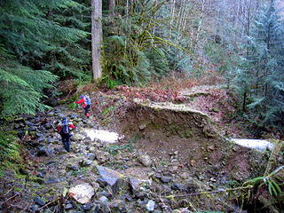
hotpantz, matt, suzy rowboat, and the good people (don and natala) and i joined forces to take a nice stroll up prairie via the NE ridge. we took the suiattle river road ~10 miles before crossing over the beautiful river on the new, not-so-beautiful bridge to FS25. don thought we'd be able to drive up FS2511 a ways, like he did some 10+ years ago, but after we passed the overgrown turnoff for it twice while on FS2510, that option was quickly altered; FS2511 is substantially overgrown with a large culvert washout less than 1/4 mile in.
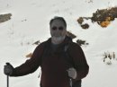
 spur road washout 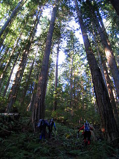 tall trees and giant sword ferns 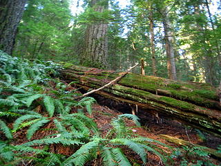 big firs 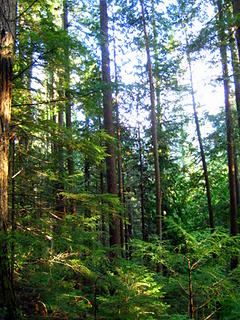 tall 'n skinny 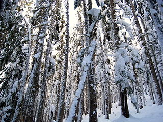 caked snow 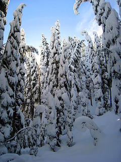 trees yielding 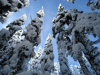 lots of blue up above 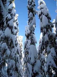 super skinny 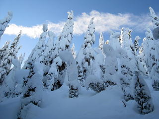 brief opening on the ridge 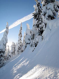 traversing beneath the ridge 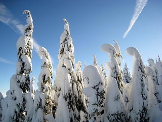 do you have cingular service? 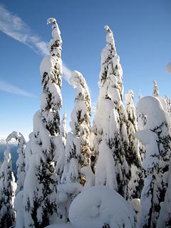 awesomeness 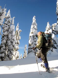 don g 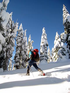 long strides for natala g 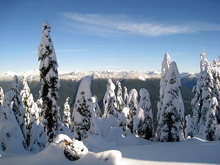 snowline 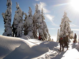 break on pt 4734 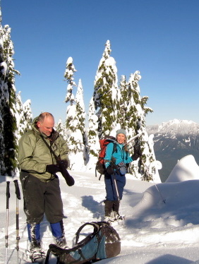 goodpeople 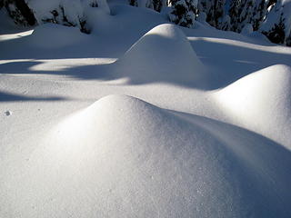 trees no more 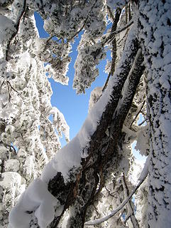 glimpse of blue 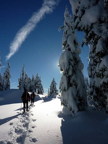 in the shadows 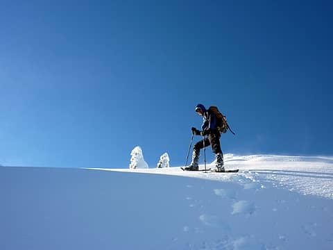 near the summit 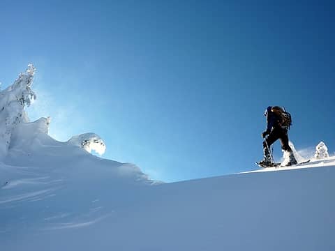 moving so fast there's smoke behind me  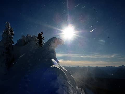 meteor shower 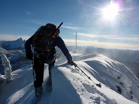 bit of a dropoff to the right and unsure what's underneath (like trees) 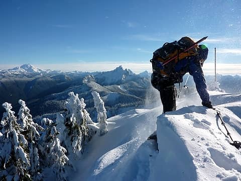 YES! peak 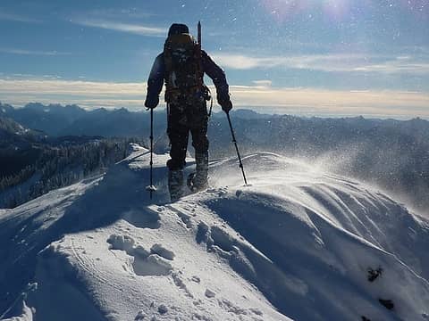 summit, albeit false 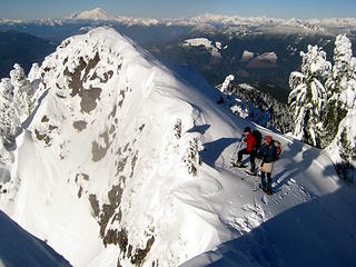 saddle at the summit --- i think we went up to the false one  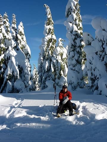 suzy rowboat 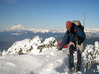 hotpantz along the summit ridge 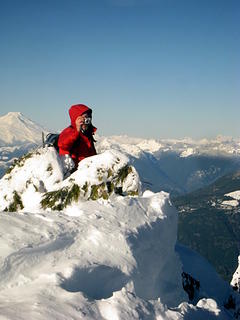 matt, shooting 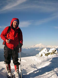 warm hands and all 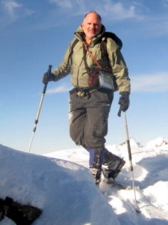 don g, posing 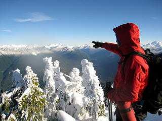 matt, naming the peaks 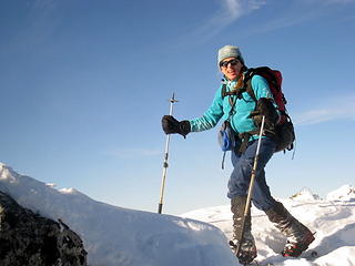 natala showing us how to hold poles 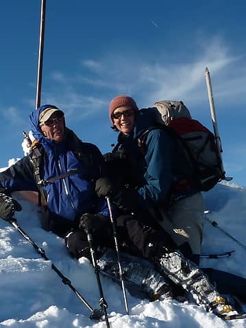 a good place to lie down 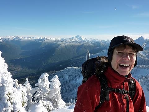 suzy rowboat 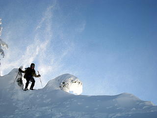 descending from the wind tunnel 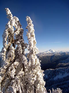 caked on 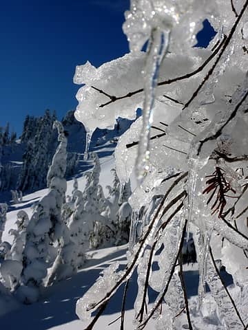 icy 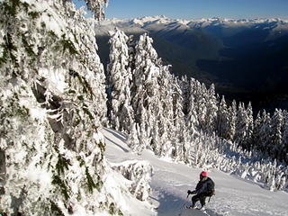 back into the forest 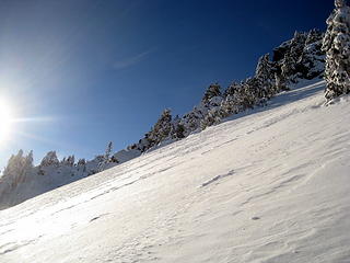 wind-scoured slopes 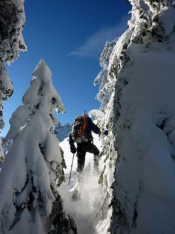 moseying through tight spaces 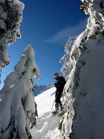 hooray for powder! 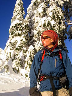 poser 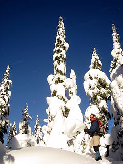 last bit of sun 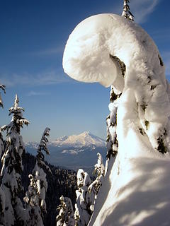 curly cue 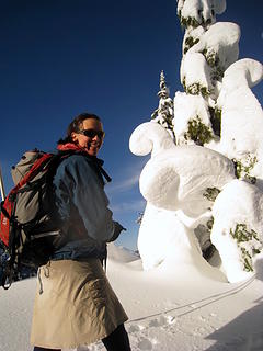 hotpantz and nature's art 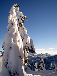 missing tree 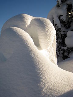 it looks like it could speak to us 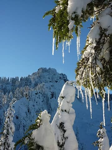 glistening 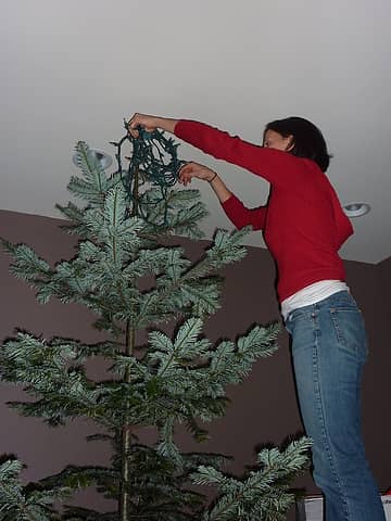 the silver part of the pacific silver fir 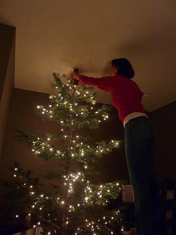 with lights 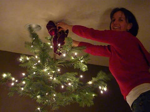 and a bow and smile 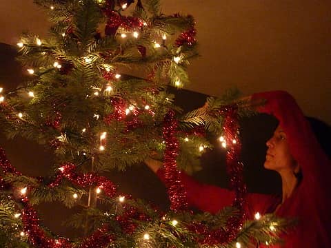 and garland
|
| Back to top |
  
|
|
Matt
Tea, Earl Grey, Hot

Joined: 30 Jan 2007
Posts: 4308 | TRs | Pics
Location: Shoreline |
|
Matt
Tea, Earl Grey, Hot
|
Tue Dec 07, 2010 12:55 am |
|
|
I'm pretty sure that was the summit. I have several photos of the other summit, which look lower. Also, Topo shows a slightly higher elevation at the southern edge of the summit contour, which is where we were (and is also the location of the benchmark).
So that makes summit #498 for me!
I'll try to get my pics posted in a couple days. It sure was pretty with the fresh snow.
Nice tree you found, especially with it almost dark already. And even nicer decorator.
As beacons mountains burned at evening. J.R.R. Tolkien
As beacons mountains burned at evening. J.R.R. Tolkien
|
| Back to top |
|
|
beaudaddy
Coast To Cascades

Joined: 25 Feb 2010
Posts: 401 | TRs | Pics
Location: Tulalip, WA |
|
beaudaddy
Coast To Cascades
|
Tue Dec 07, 2010 10:44 am |
|
|
Super Sweet!!! You guys and gals are awesome!!! I've been wondering about this peak for awhile now. Thanks for taking the time to share your adventure.
|
| Back to top |
|
|
dicey
custom title

Joined: 11 May 2004
Posts: 2869 | TRs | Pics
Location: giving cornices a wider berth |
|
dicey
custom title
|
Tue Dec 07, 2010 11:38 am |
|
|
Oh Wow! 
|
| Back to top |
|
|
Eric
Peak Geek

Joined: 21 Oct 2002
Posts: 2062 | TRs | Pics
Location: In Travel Status |
|
Eric
Peak Geek
|
Tue Dec 07, 2010 2:40 pm |
|
|
Nice TR.
The route you have drawn on the map goes to the 5586 summit which would be a full 92 feet lower than the true 5678 summit and would have led you right past the former. That large of a difference would have been clear to the naked eye. Also, the distance away is 3/10ths of a mile so much larger than 15 seconds of hiking, even at an Iron pace. The most likely explanation would be that you didn't go to 5586 and just went to 5678. And then what Matt says is correct in that you went to the 5678 summit and found an area on the left (S) that was highest and which had the rod which could be marking the Darrington TP buried under that snow. The area to the right that you disregarded would have just been some other high ground in the 5640+ contour and that sort of ground could have been such a short distance away.
|
| Back to top |
|
|
iron
Member
Joined: 10 Aug 2008
Posts: 6392 | TRs | Pics
Location: southeast kootenays |
|
iron
Member
|
Tue Dec 07, 2010 4:14 pm |
|
|
| Eric wrote: | | Nice TR.
The route you have drawn on the map goes to the 5586 summit which would be a full 92 feet lower than the true 5678 summit and would have led you right past the former. That large of a difference would have been clear to the naked eye. Also, the distance away is 3/10ths of a mile so much larger than 15 seconds of hiking, even at an Iron pace. The most likely explanation would be that you didn't go to 5586 and just went to 5678. And then what Matt says is correct in that you went to the 5678 summit and found an area on the left (S) that was highest and which had the rod which could be marking the Darrington TP buried under that snow. The area to the right that you disregarded would have just been some other high ground in the 5640+ contour and that sort of ground could have been such a short distance away. |
sounds good to me. that's the consensus with don and matt - two guys that have 20x more experience than me.
|
| Back to top |
|
|
Matt
Tea, Earl Grey, Hot
Joined: 30 Jan 2007
Posts: 4308 | TRs | Pics
Location: Shoreline |
|
Matt
Tea, Earl Grey, Hot
|
Mon Dec 27, 2010 12:59 am |
|
|
Date: 12/4/2010
Destination: Prairie Mtn 5673 (USGS Darrington)
Party: Don & Natala Goodman, Suzanne Rowen, iron, hotpantz, Matt
Ah, Prairie, where a 4600-foot scramble uphill offers a sweeping vista of . . . . beautiful downtown Darrington:
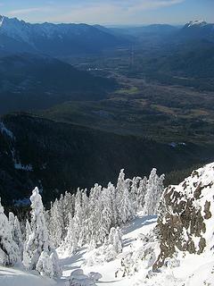 Darrington from Prairie 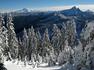 Glacier & Whitechuck from Prairie 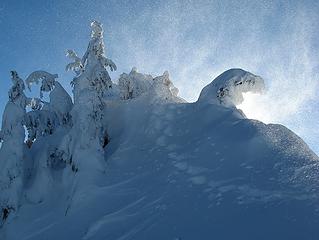 Snowblown Prairie Summit 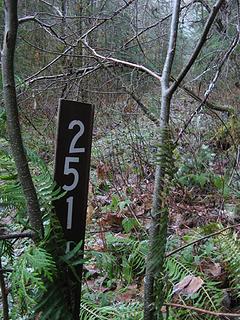 Overgrown Road 2511 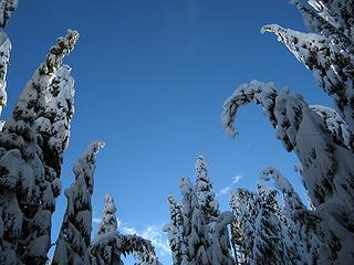 Trees bowing over a clearing 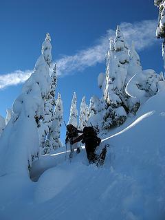 Hotpantz & Suzanne breaking trail upward 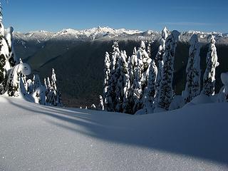 Diamond snow & view east to Chaval 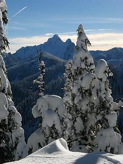 Whitechuck 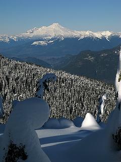 Baker 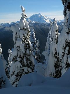 Glacier 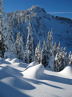 Prairie Summit 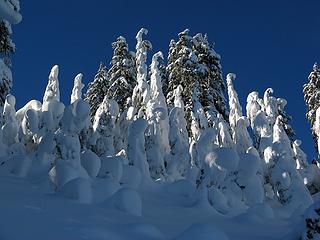 A school of fairy children trees 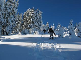 Separate trails kicked by Mike & Hotpantz 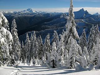 Looking back down our tracks & out to Glacier & Whitechuck 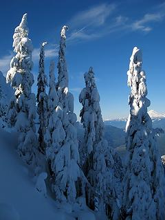 Trees catching a corner of sunlight on the steep side 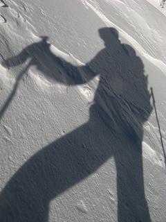 Crossing a windblown section 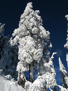 A really snowy tree, so bright against the blue sky 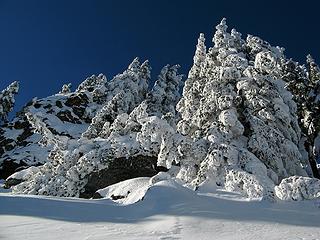 Summit area 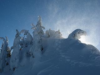 Snow Aurora 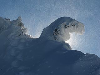 Closer backlit snow 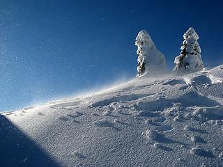 Snow on the other side of the crest 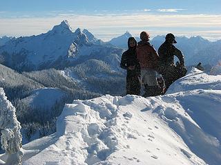 Mike, Hotpantz, & Suzanne 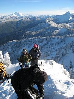 Natala & Don 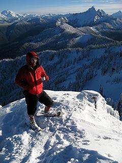 Matt 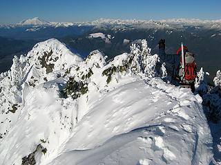 The narrow track along the edge of the summnit, looking north toward Baker 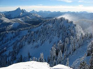 Looking south: Whitechuck & wind blowing off Point 5586 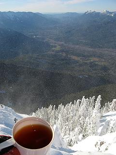 Looking west: Summit tea & Darrington 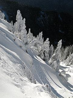 Trees below the west side of the summit 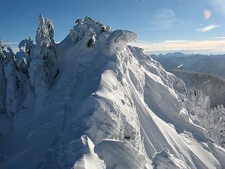 Looking back at the summit 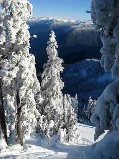 Tracks going down 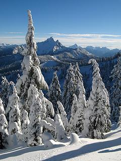 Trees saluting Whitechuck 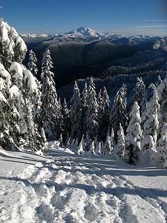 Tracks and Glacier 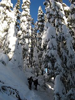 Back into the taller trees 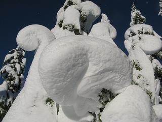 Fantatical Snow Critters 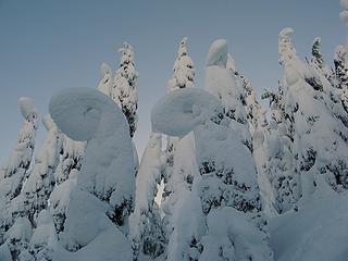 Lower fairytale trees in the soft shadows of twilight 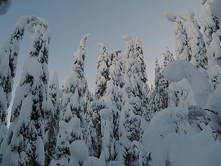 Shadowed trees all nodding to each other 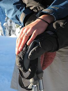 Carrie & Mike
As beacons mountains burned at evening. J.R.R. Tolkien
As beacons mountains burned at evening. J.R.R. Tolkien
|
| Back to top |
|
|
Scrooge
Famous Grouse

Joined: 16 Dec 2001
Posts: 6966 | TRs | Pics
Location: wishful thinking |
|
Scrooge
Famous Grouse
|
Mon Dec 27, 2010 6:57 am |
|
|
Iron, I'd say this was another text-book example of how to write a trip report ........ except it was way more fun than a text-book. For sure, between Iron and Matt, Flow's picture poll question should be answered.  ...
Iron, this looks like a candidate for the "Twin Peaks" thread, at least as good as Coyotebelle's "anthills".
...
Iron, this looks like a candidate for the "Twin Peaks" thread, at least as good as Coyotebelle's "anthills".  ..........................................................................
...
Carrie & Mike
"Another kind of magic"
I guess it'll be a few years, yet, before Josh can find the poetry.
..........................................................................
...
Carrie & Mike
"Another kind of magic"
I guess it'll be a few years, yet, before Josh can find the poetry.
Something lost behind the ranges. Lost and waiting for you....... Go and find it. Go!
Something lost behind the ranges. Lost and waiting for you....... Go and find it. Go!
|
| Back to top |
|
|
Boots
Gone Kayaking
Joined: 22 Aug 2005
Posts: 632 | TRs | Pics
Location: Buffalo County Nebraska |
|
Boots
Gone Kayaking
|
Mon Dec 27, 2010 2:07 pm |
|
|
Those snow-sculptures are pretty cool looking. Nice TR and Pics..

"Avoiding danger is no safer in the long run than outright exposure. The fearful are caught as often as the bold."
-Helen Keller
"Avoiding danger is no safer in the long run than outright exposure. The fearful are caught as often as the bold."
-Helen Keller
|
| Back to top |
|
|
Magellan
Brutally Handsome

Joined: 26 Jul 2006
Posts: 13117 | TRs | Pics
Location: Inexorable descent |
|
Magellan
Brutally Handsome
|
Mon Dec 27, 2010 11:53 pm |
|
|
Beautiful pictures of a worthy hike. Call me sick, but I love this picture of what used to be.
|
| Back to top |
|
|
Boots
Gone Kayaking

Joined: 22 Aug 2005
Posts: 632 | TRs | Pics
Location: Buffalo County Nebraska |
|
Boots
Gone Kayaking
|
Sat Jan 22, 2011 5:16 pm |
|
|
This one is worth another look. Those snow sculptures are so inspirational.
"Avoiding danger is no safer in the long run than outright exposure. The fearful are caught as often as the bold."
-Helen Keller
"Avoiding danger is no safer in the long run than outright exposure. The fearful are caught as often as the bold."
-Helen Keller
|
| Back to top |
|
|
|
|
You cannot post new topics in this forum
You cannot reply to topics in this forum
You cannot edit your posts in this forum
You cannot delete your posts in this forum
You cannot vote in polls in this forum
|
Disclosure: As an Amazon Associate NWHikers.net earns from qualifying purchases when you use our link(s). |


