| Previous :: Next Topic |
| Author |
Message |
Sultan Guy
Member


Joined: 22 Jul 2008
Posts: 353 | TRs | Pics
Location: Now reinforced with Concrete |
I know this is a hiking website but I thought some others might like to hear about sea kayaking and hiking on some of the San Juan Islands.
This trip is almost an exact copy of the same trip I did in 2009 so I included some pictures from both years. In 2011 we had not a drop of rain! Yeah!
In order to avoid holiday traffic and more importantly the crazy ferry waits we launch from Lummi Island ferry terminal on the mainland. Easy drive, free parking, no hassle. Spent the first night at Point Doughty on the northern end of Orcas Island. No long distance hiking from here but a great campsite. Paddlers only and one of the best sites for sunsets anywhere in the islands. No other folks were camped there Friday evening. 
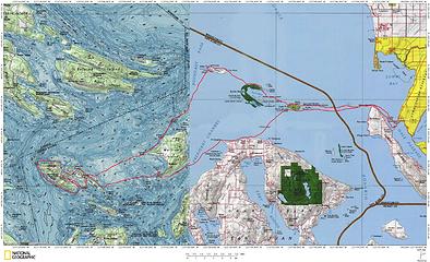 Stuart Island sea kayak 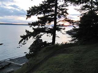 Sunset at Point Doughty 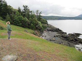 Beach at Point Doughty 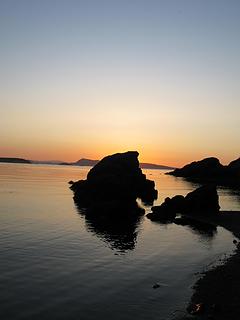 018 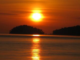 187 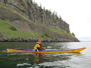 Drew near Waldron 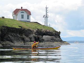 Turn Point 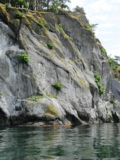 Cliffs on Stuart Island 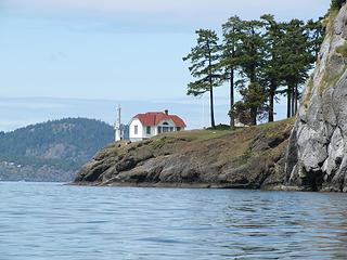 Turn Point on Stuart Island 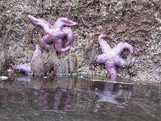 Purple starfish 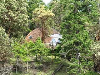 Dome house on Stuart Island 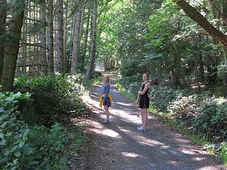 Trail on Stuart 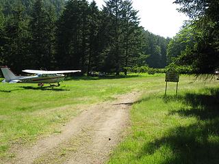 Stuart Island airport 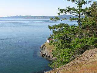 Lovers Leap 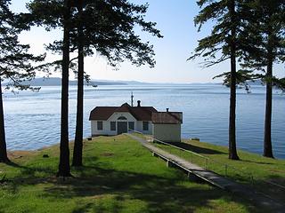 Turn Point lighthouse 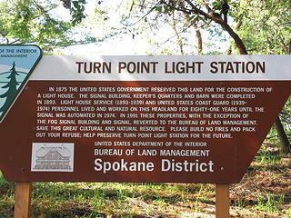 091 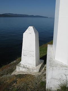 U.S, Boundary marker at Turn Point 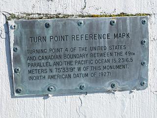 Marker wording 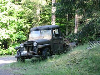 Stuart Island truck 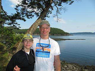 First couple of kayaking 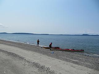 Sandy Point on Waldron Island 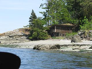 Cool cabin on Waldron 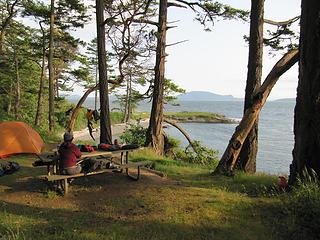 Campsite on Patos 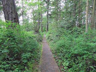 Trail to Patos Lighthouse 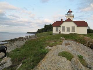 Tip of Patos 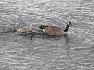 New goose 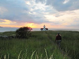 Patos Island Lighthouse 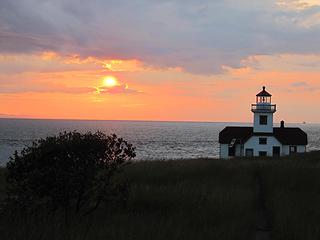 Sunset at Patos  Eroded rocks 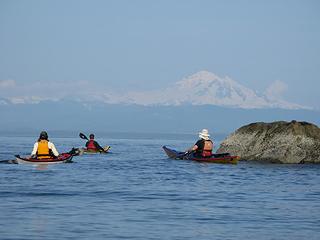 Mt. Baker 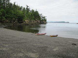 Matia Island beach
Any worthwhile expedition can be planned on the back of an envelope- H. W. Tilman
Any worthwhile expedition can be planned on the back of an envelope- H. W. Tilman
|
| Back to top |
  
|
|
Riptide Rush
Member

Joined: 21 Sep 2010
Posts: 99 | TRs | Pics
Location: Everett |
Hey Dude,
Wow outstanding shots, I love the one of Baker and the sunset ones are pretty spectacular too! Great report. While your were paddling around the sound, I was climbing Yellow Jacket Tower off Icicle creek in Leavenworth. Here are a couple of shots to get you back into the hiking/scrambling/climbing mode, that is if the snow ever melts out!
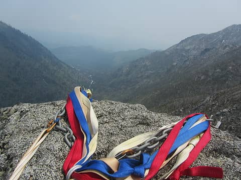 On the top
|
| Back to top |
|
|
jcocci
Member
Joined: 16 Jul 2009
Posts: 484 | TRs | Pics
Location: Longmont, CO |
|
jcocci
Member
|
 Tue May 31, 2011 10:51 pm |
|
|
Great paddle. I love Patos Island.
|
| Back to top |
|
|
Joey
verrry senior member

Joined: 05 Jun 2005
Posts: 2798 | TRs | Pics
Location: Redmond |
|
Joey
verrry senior member
|
Wed Jun 01, 2011 8:19 am |
|
|
| Sultan Guy wrote: | Campsite on Patos |
 I always like to look at kayak/hike pics.
Keep 'em coming.
I always like to look at kayak/hike pics.
Keep 'em coming.
|
| Back to top |
|
|
Stefan
Member

Joined: 17 Dec 2001
Posts: 5093 | TRs | Pics
|
|
Stefan
Member
|
Wed Jun 01, 2011 9:02 am |
|
|
Great stuff! Thanks for sharing.
|
| Back to top |
|
|
Slugman
Its a Slugfest!

Joined: 27 Mar 2003
Posts: 16874 | TRs | Pics
|
|
Slugman
Its a Slugfest!
|
Wed Jun 01, 2011 9:54 am |
|
|
Awesome.
|
| Back to top |
|
|
Grizzy
Yellow Cedar Hugger

Joined: 16 Jul 2006
Posts: 1936 | TRs | Pics
Location: Switchbacks |
|
Grizzy
Yellow Cedar Hugger
|
Wed Jun 01, 2011 10:47 am |
|
|
What a great trip! I love hiking Stuart Island, that is one of the most peaceful places anyone could imagine. I always envy the people that were stationed there long ago...That Lighthouse would have been a great place to spend time ...
PS I've also been diving under those cliffs on Stuart and they are a great dive site! It almost creates a cave as the cliff goes inward.
All the birds have flown up and gone;
A lonely cloud floats leisurely by.
We never tire of looking at each other -
Only the mountain and I. ~Li Po~
All the birds have flown up and gone;
A lonely cloud floats leisurely by.
We never tire of looking at each other -
Only the mountain and I. ~Li Po~
|
| Back to top |
|
|
kayaker
Member

Joined: 25 Apr 2011
Posts: 31 | TRs | Pics
|
|
kayaker
Member
|
Wed Jun 01, 2011 2:38 pm |
|
|
Crazy jealous. Looks like you guys had a few good size crossings. Did you have any tricky currents or navigation issues?
|
| Back to top |
|
|
mike
Member

Joined: 09 Jul 2004
Posts: 6398 | TRs | Pics
Location: SJIsl |
|
mike
Member
|
Wed Jun 01, 2011 2:45 pm |
|
|
Didn't happen to see whales did you? Transients were in that area and one group witnessed them killing a sealion on Sat.
|
| Back to top |
|
|
Scrooge
Famous Grouse

Joined: 16 Dec 2001
Posts: 6966 | TRs | Pics
Location: wishful thinking |
|
Scrooge
Famous Grouse
|
Wed Jun 01, 2011 5:05 pm |
|
|
Sultan Guy said | Quote: | | I know this is a hiking website but I thought some others might like to hear about sea kayaking and hiking on some of the San Juan Islands. |
Got that wrong, Andy.  As somebody pointed out recently, the name of our group is "nwhikers", not nwhiking. What that means is that it's a place for people whose interests include hiking and/or the Northwest to get together and talk ........ about whatever they're doing ........ about whatever interests them. As somebody pointed out recently, the name of our group is "nwhikers", not nwhiking. What that means is that it's a place for people whose interests include hiking and/or the Northwest to get together and talk ........ about whatever they're doing ........ about whatever interests them.
Turn Point on Stuart Island Tip of Patos Matia Island beach  We'd be pretty hard pressed to talk about hikes up Williamson Creek, if our trip reports didn't include canoeing on Spada reservoir. You're sea-kayaking report fits in just fine, the pictures are beautiful, and it will undoubtedly inspire others to follow in your footprints ........ errr ....... wake.
Something lost behind the ranges. Lost and waiting for you....... Go and find it. Go!
Something lost behind the ranges. Lost and waiting for you....... Go and find it. Go!
|
| Back to top |
|
|
honey badger
Member

Joined: 03 Jul 2007
Posts: 146 | TRs | Pics
Location: Mukilteo |
Thanks for sharing. Have tried talking some others into the same route, but o luck so far. The north end are some of my favs in the San Juans. Looks like you got lucky with calm seas.
|
| Back to top |
|
|
puzzlr
Mid Fork Rocks

Joined: 13 Feb 2007
Posts: 7220 | TRs | Pics
Location: Stuck in the middle |
|
puzzlr
Mid Fork Rocks
|
Wed Jun 01, 2011 9:00 pm |
|
|
Really nice shots. I looked at the big version of that "eroded rock" picture for quite a while. Nothing like a lot of time and wind/rain to expose the fine variations in hardness in what would otherwise look like a big ordinary rock.
|
| Back to top |
|
|
mike
Member

Joined: 09 Jul 2004
Posts: 6398 | TRs | Pics
Location: SJIsl |
|
mike
Member
|
Wed Jun 01, 2011 9:30 pm |
|
|
That sandstone formation runs from Chuckanut Mtn out through the Gulf Islands. Larrabee St Pk is a good place to view the wave eroded rock without taking a ferry.
|
| Back to top |
|
|
Sultan Guy
Member
Joined: 22 Jul 2008
Posts: 353 | TRs | Pics
Location: Now reinforced with Concrete |
| kayaker wrote: | | Crazy jealous. Looks like you guys had a few good size crossings. Did you have any tricky currents or navigation issues? |
Good question. You cannot kayak this route without fighting some currents and the wind. You need to be a strong paddler to go against 1+ knot current. If not then do not attempt this route!
We had some wind waves up to 2' which is pretty much the norm in this area of the islands. Again you need to be comfortable paddling for up to 5 miles in choppy water (over the deck stuff). Anyone venturing on these crossings should be well trained in both self rescue and group rescue scenarios. The water is cold.
Any worthwhile expedition can be planned on the back of an envelope- H. W. Tilman
Any worthwhile expedition can be planned on the back of an envelope- H. W. Tilman
|
| Back to top |
|
|
Z
Erratic
Joined: 28 Jan 2008
Posts: 797 | TRs | Pics
Location: Greater Orondo area |
|
Z
Erratic
|
Thu Jun 02, 2011 11:49 am |
|
|
It's hiking, no matter how you get to the trail! Keep up the good work. Some of my favorite "secret" hikes are in places only easily accessible by canoe/kayak, with only animal trails to follow.
"Einstein stating that nothing can travel faster than the speed of light, is as a blind man stating that nothing can travel faster than the speed of sound" 1979
They don't make years like they used to.
"Einstein stating that nothing can travel faster than the speed of light, is as a blind man stating that nothing can travel faster than the speed of sound" 1979
They don't make years like they used to.
|
| Back to top |
|
|
|
|


