| Previous :: Next Topic |
| Author |
Message |
Redwic
Unlisted Free Agent


Joined: 23 Feb 2009
Posts: 3292 | TRs | Pics
Location: Going to the Prom(inence) |
|
Redwic
Unlisted Free Agent
|
 Fri Jul 08, 2011 7:29 am |
|
|
Several months ago, our team of Gimpilator Adam, me, our rock climbing friend Dave, and his friend Greg was formed for a potential summit attempt of Mount Olympus during the first week of July. Then, just a few days prior to the trip, Greg had to back-out. Originally, Dave and Greg were going to traverse the Bailey Range and then meet Adam and I along the Hoh River Trail, but after Greg could not join the trip it was decided that the remaining three people would only attempt Mount Olympus and be a three-man team throughout the trip.
We were told by multiple people that the lingering deep near-record snowpack would only help our summit attempt. However, several problems also resulted from that, drawing some concern prior to the trip. First, the snow was covering much fo the Hoh River Trail above 3000' elevation, including several sketchy slopes. Second, a "snow mushroom" was seen completely surrounding the top of the summit tower. Third, the standard scramble route for the summit tower was covered as a loose, snowy ramp. Fourth, several other parties had attempted the peak during the week prior to our proposed trip and all had failed. Despite all of these things, we remained hopeful that the weather and conditions would improve prior to our trip. I contacted wilderness rangers regularly, and they even contacted me with updates as they received them.
Finally, a fantastic weather window of 3-4 days was forecasted to open-up just after a wilderness ranger contacted me to say he heard the "snow mushroom" was no longer on the summit. Although no parties had yet summited Mount Olympus this year, this was good news for us and the trip proceeded.
We met Dave in Sequim on Sunday, July 3. From there, we drove to the Hoh River Trailhead to pickup our backcountry permits. We were told that although there had been no successful summit teams yet this year, there were three teams ahead of us on the mountain. This gave us some hope for good news. We began hiking at 1:00 PM. I love this trail. I hiked to Glacier Meadows almost exactly ten years ago, and although much was familiar I would progressively learn that much was also changed on the upper landscape of the trail. We hiked to Lewis Meadows the first night. The ranger at the Olympus Ranger Station said the mosquitoes would be less annoying near the cooler-aired campsites next to the river there than in the meadows. He was right; there were not many bugs out there. We found a great campsite, and our tent was actually quite warm.
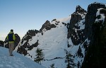
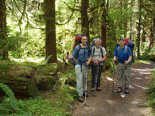 Good-Spirited Start To Trip 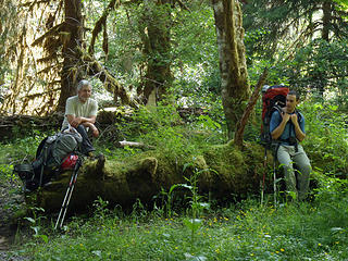 A Mossy Break 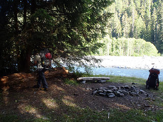 Our First Campsite 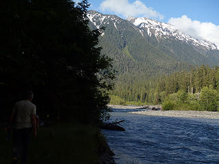 The Bailey Range As Seen From Camp 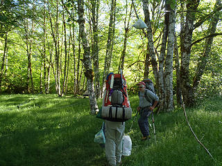 Bear Wire Fun 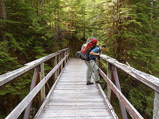 High Hoh Bridge 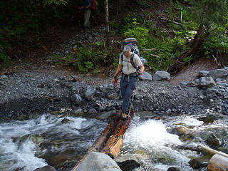 This Is Our Bridge??? 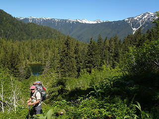 Above Elk Lake 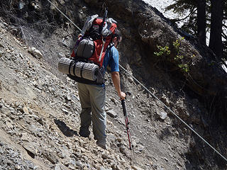 We Have To Go Down This Way??? 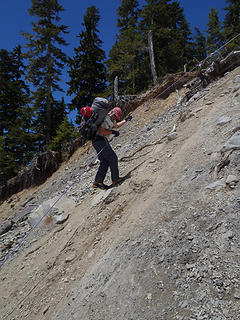 Is This The Trail??? 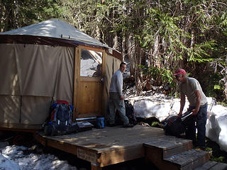 Glacier Meadows Break 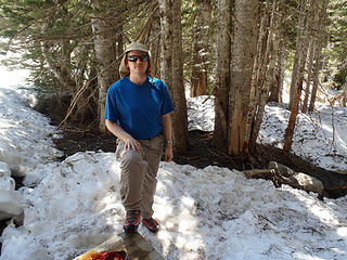 Resting At Glacier Meadows 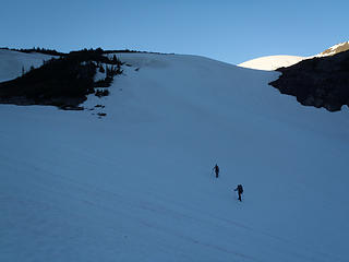 Ascending To The Lateral Moraine 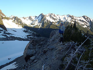 Atop The Lateral Moraine 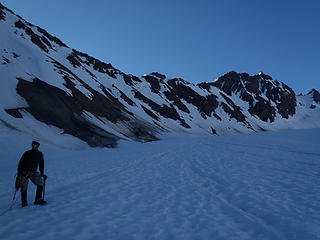 Ready For Some Glacier Travel 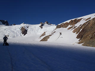 Glacial Break 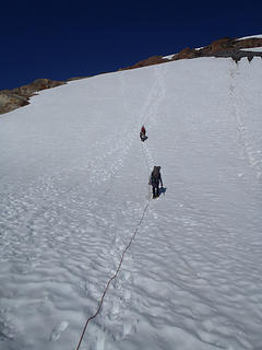 Ascending Steep Slopes To Snow Dome 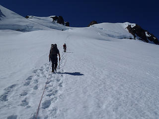 The Goal Is Near... 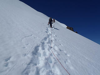 Upper Slopes... 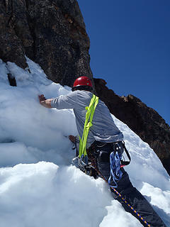 Moat-Dodging Before Rock Climb 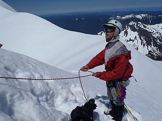 Ready For Dave's Rock Climb 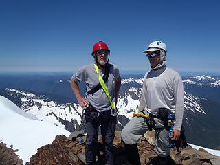 Friends On The Summit, Too 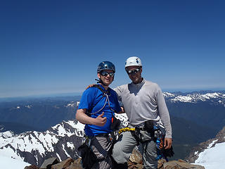 Friends On The Summit 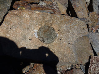 Benchmark Shot! 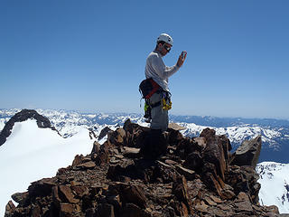 Summit Shot! 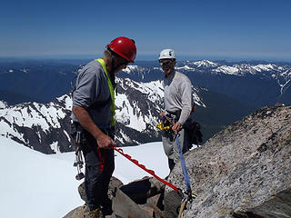 Ready To Rappel! 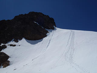 The Final Ascent... 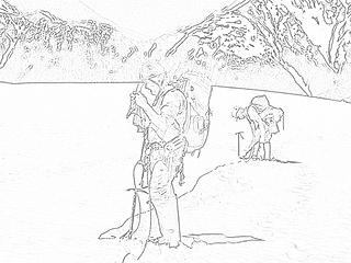 Atop Snow Dome...
60 pounds lighter but not 60 points brighter.
60 pounds lighter but not 60 points brighter.
|
| Back to top |
  
|
|
Gimpilator
infinity/21M

Joined: 12 Oct 2006
Posts: 1684 | TRs | Pics
Location: Edmonds, WA |
Here's my video account of the trip.
 Blue Glacier Icefall  Mount Mercury  The Baileys  Craig crossing the bergschrund  Dave belaying Craig  Summit Action  The North Ridge  Lower Blue Glacier  Mount Tom and the White Glacier
|
| Back to top |
|
|
Don
Member

Joined: 25 Apr 2005
Posts: 2013 | TRs | Pics
Location: Fairwood, WA |
|
Don
Member
|
Fri Jul 08, 2011 7:50 am |
|
|
Excellent trip, Redwic! Olympus is one of my favorite climbs simply due to the variety it offers, most noticeable on the exit hike it seems. I last did it two years ago with Silence under much different conditions. Your account certainly brought back a lot of memories.
How in the heck do you confuse Panic Peak with Mt. Tom???  Congratulations on an excellent adventure!
Don
Congratulations on an excellent adventure!
Don
|
| Back to top |
|
|
Redwic
Unlisted Free Agent
Joined: 23 Feb 2009
Posts: 3292 | TRs | Pics
Location: Going to the Prom(inence) |
|
Redwic
Unlisted Free Agent
|
Fri Jul 08, 2011 8:09 am |
|
|
| Don wrote: | | How in the heck do you confuse Panic Peak with Mt. Tom??? |
I suspect the rangers asked a question such as "Did you notice a research station at Mount Tom?" and when the answer was "Yes" the rangers instantly knew the calamity. "Map impaired," indeed.
60 pounds lighter but not 60 points brighter.
60 pounds lighter but not 60 points brighter.
|
| Back to top |
|
|
belowfellow
Transplant

Joined: 22 Feb 2009
Posts: 261 | TRs | Pics
Location: Seattle |
Congrats, gentlemen!  Great report and photos. Great report and photos.
|
| Back to top |
|
|
RokIzGud
Cozza Frenzy

Joined: 08 Feb 2010
Posts: 1049 | TRs | Pics
|
|
RokIzGud
Cozza Frenzy
|
Fri Jul 08, 2011 8:30 am |
|
|
Really awesome work, guys! Nice job!
|
| Back to top |
|
|
silence
Member

Joined: 25 Apr 2005
Posts: 4420 | TRs | Pics
|
|
silence
Member
|
Fri Jul 08, 2011 9:02 am |
|
|
strong work! well done men! i thought there would still be tons of snow on those avy slopes
just watched the video ... cool!
PHOTOS
FILMS
Keep a good head and always carry a light bulb. Bob Dylan
PHOTOS
FILMS
Keep a good head and always carry a light bulb. Bob Dylan
|
| Back to top |
|
|
half fast
member

Joined: 21 Mar 2010
Posts: 1392 | TRs | Pics
Location: Living the dream in my 5th Wheel |
It's all about the fun, oh and maybe the chocolate - half fast
|
| Back to top |
|
|
DIYSteve
seeking hygge

Joined: 06 Mar 2007
Posts: 12655 | TRs | Pics
Location: here now |
|
DIYSteve
seeking hygge
|
Fri Jul 08, 2011 9:14 am |
|
|
Very nice Classic route. Cool  that you got there early enough in the season to do the direct approach to the summit block that you got there early enough in the season to do the direct approach to the summit block
|
| Back to top |
|
|
Redwic
Unlisted Free Agent
Joined: 23 Feb 2009
Posts: 3292 | TRs | Pics
Location: Going to the Prom(inence) |
|
Redwic
Unlisted Free Agent
|
Fri Jul 08, 2011 9:16 am |
|
|
| silence wrote: | | strong work! well done men! i thought there would still be snow on those avy slopes according to the park updates .. but it doesn't look like it .. |
I called the Hoh Visitor Center every other day during the previous week, seeking better updates than the website provided. When we returned, they had a more updated report but still had no reports of successful summits listed. Gimpilator updated the report hanging in front of the permit desk, himself, after we noticed that.
I also gave the wilderness ranger my e-mail address in case he had further questions about the route, conditions, etc.
60 pounds lighter but not 60 points brighter.
60 pounds lighter but not 60 points brighter.
|
| Back to top |
|
|
Paul M
Member

Joined: 15 Jul 2008
Posts: 371 | TRs | Pics
|
|
Paul M
Member
|
Fri Jul 08, 2011 3:32 pm |
|
|
Congrats on the climb and in closing in on the Wash CoHPS! Oly is a great trip and great climb for sure. Glad you had such great 4th of July weather for this trip.
Here are a few pics of it as I was flying over about 2:30pm on the 5th of July on my way to Korea for work. If I look close I think I can see you guys on the glacier 
|
| Back to top |
|
|
Yet
Member

Joined: 23 Apr 2005
Posts: 2634 | TRs | Pics
Location: Happily Ever After |
|
Yet
Member
|
Fri Jul 08, 2011 3:54 pm |
|
|
|
| Back to top |
|
|
Layback
Cascades Expatriate
Joined: 16 Mar 2007
Posts: 5712 | TRs | Pics
Location: Back East |
|
Layback
Cascades Expatriate
|
Fri Jul 08, 2011 6:29 pm |
|
|
Nice work. Here's a couple images of your boot track taken from the cockpit of a single engine Beechcraft airplane on Wednesday evening. We were impressed with your effort.
Crystal Pass looked impassable to me from 500' up. There's a big windscoop/cornice blocking it's way as far as I could tell. Though I've never actually been through it so I'm not certain of it's location in the above photo.
|
| Back to top |
|
|
Gimpilator
infinity/21M
Joined: 12 Oct 2006
Posts: 1684 | TRs | Pics
Location: Edmonds, WA |
Wow!!! What, are people spying on us from the air? These birds eye views are blowing my mind.  I dare you to try that again next weekend. I dare you to try that again next weekend.
|
| Back to top |
|
|
smmslt
Prominencian

Joined: 14 Jan 2003
Posts: 89 | TRs | Pics
Location: Vancouver, WA |
|
smmslt
Prominencian
|
Fri Jul 08, 2011 7:50 pm |
|
|
Nice work guys - congrats! Great report Craig! Beautiful pix too!
|
| Back to top |
|
|
|
|
You cannot post new topics in this forum
You cannot reply to topics in this forum
You cannot edit your posts in this forum
You cannot delete your posts in this forum
You cannot vote in polls in this forum
|
Disclosure: As an Amazon Associate NWHikers.net earns from qualifying purchases when you use our link(s). |


 yummmm)

 I'm his #1 fan.
