| Previous :: Next Topic |
| Author |
Message |
More Cowbell
Warrior Princess


Joined: 01 Jul 2006
Posts: 5657 | TRs | Pics
Location: Alive on Earth |
This is prime time for Esmerelda.
7 miles RT 1700-1800 ft gain with many options for more gain and pain.
Go now! Today was glorious with a cool breeze, NOT ONE BITING BUG and full sun. All you whiners about not having anywhere to hike should just put a sock in it.
Today's drive in on the Teanaway Rd involved many animals trying to become my dinner. Cows were on the gravel section, Deer and tons of suicidal birds. Drive carefully. Things are just different with all the logging in there now.
I got a late start and the parking lot was full at 11:30 on a Friday but I only had to park a few cars down the road. There always seems to be a dog issue on these trails and today was the pooping by the TH sign brown lab from Oregon. Of course the owners didn't clean it up and oddly I never saw them on the Esmerelda trail the entire day which means that they most probably were on the Ingalls "no dang dogs" trail.
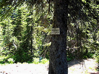
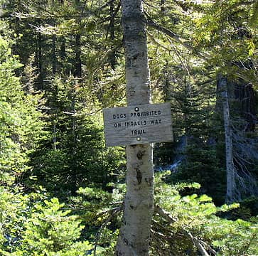 It still says "NO DOGS". Hint hint 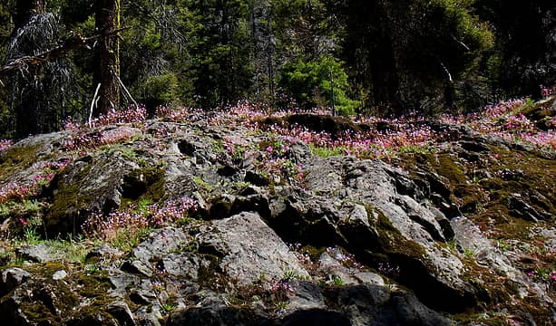 Penstemon/Columbia Lewisia Pinkness 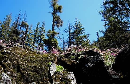 In the pink 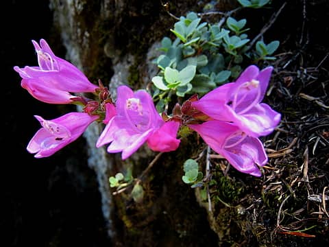 Penstemon Close Up  Penstemon Hot Pinkness 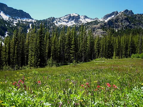 Meadow of wonder 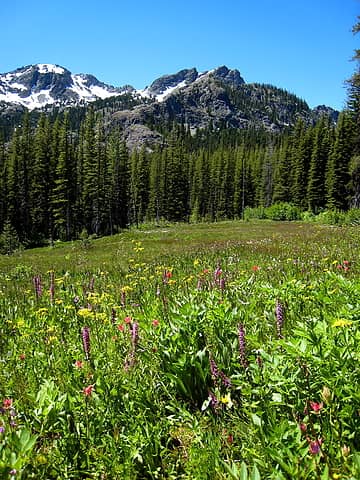 Meadow at it's peak of bloom 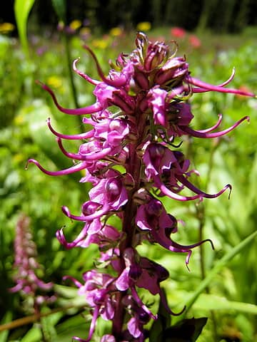 Elephants Head 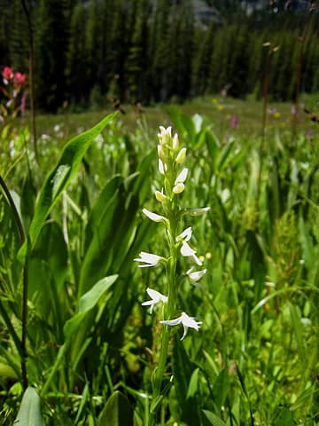 White Bog Orchid 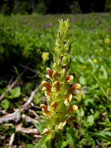 Bracted Lousewort 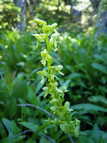 Green Bog Orchid 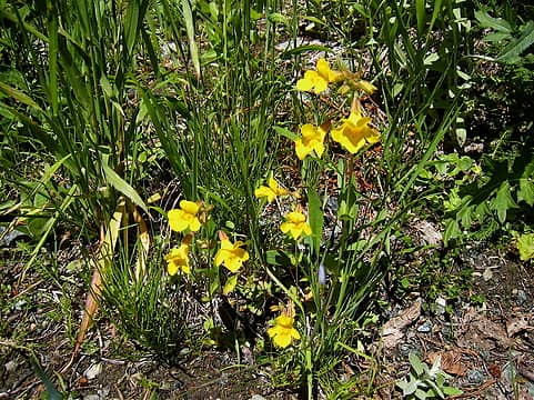 Yellow Monkey Flower 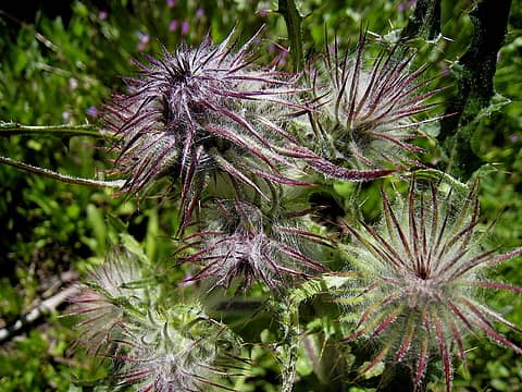 State Bird Food 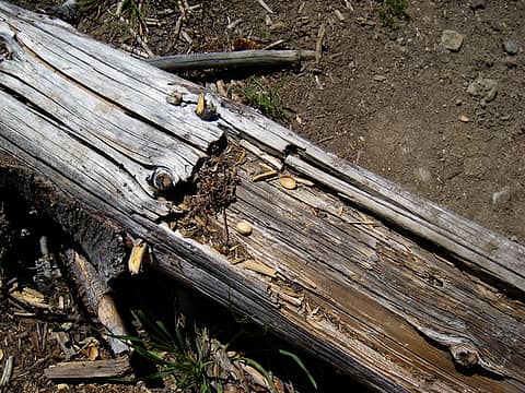 The Teanaway Pistachio Bandit  Soon you rejoin the real trail and pass a junction for an old mining area (yet to be explored by me). There's no sign pointing "thataway" just a sign for Esmerelda.
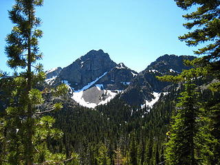
 Junction for the old mining area 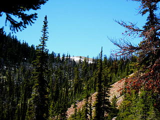 Snowy Fortune Creek Pass 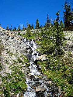 Water Water Everywhere 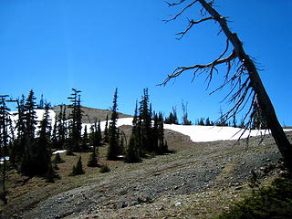 Almost to the pass 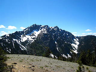 Hawkins Mt. from the pass 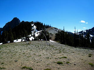 Lunch Knoll up that way 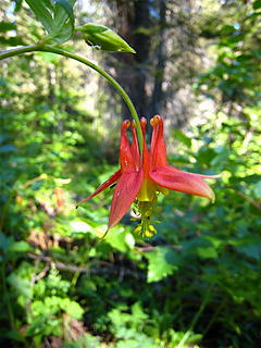 Columbine 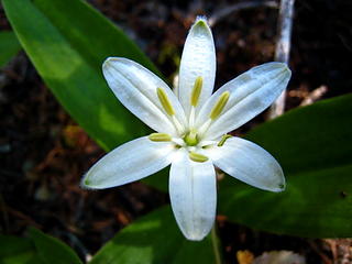 Queens Cup 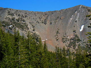 Longs Pass trail 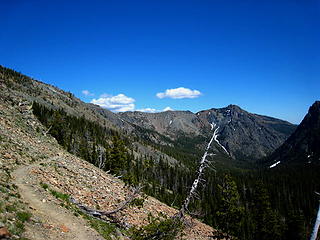 Looking towards Longs Pass
If you want to forget all your other troubles, wear too tight shoes. - Unknown
If you want to forget all your other troubles, wear too tight shoes. - Unknown
|
| Back to top |
  
|
|
ashleys237
Member

Joined: 14 Aug 2008
Posts: 46 | TRs | Pics
Location: Seattle, WA |
dogs are allowed on the longs pass trail, and all other trails in the area except the ingalls lake trail. Just FYI 
|
| Back to top |
|
|
marta
wildflower maven

Joined: 07 May 2003
Posts: 1761 | TRs | Pics
|
|
marta
wildflower maven
|
 Sat Jul 23, 2011 7:05 pm |
|
|
Great report. It looks to be prime flower time on a prime flower hike.
|
| Back to top |
|
|
More Cowbell
Warrior Princess
Joined: 01 Jul 2006
Posts: 5657 | TRs | Pics
Location: Alive on Earth |
| ashleys237 wrote: | | dogs are allowed on the longs pass trail, and all other trails in the area except the ingalls lake trail. Just FYI |
Well, Ingalls Way trail #1390 starts immediately off of the Esmerelda Trail. It would seem that if dogs were to be ok on the Longs Pass trail they would have to come in from the other side of the pass.
The FS website and the Cle Elum Ranger trail guide state that dogs are not allowed on Ingalls Way #1390 pretty clearly. But maybe I miss interpret that.
If you want to forget all your other troubles, wear too tight shoes. - Unknown
If you want to forget all your other troubles, wear too tight shoes. - Unknown
|
| Back to top |
|
|
ashleys237
Member
Joined: 14 Aug 2008
Posts: 46 | TRs | Pics
Location: Seattle, WA |
i've asked the rangers about it and you can take dogs on the trail to longs pass, they just don't want dogs at ingalls lake. i think they should have better signage for this, as us dog owners have to endure lots of mean looks and snide remarks along the way. it's worth it though, what a beautiful hike!
|
| Back to top |
|
|
joyhiker
joyhiker

Joined: 29 Jul 2007
Posts: 19 | TRs | Pics
Location: Granite Falls Wa |
|
joyhiker
joyhiker
|
Mon Jul 25, 2011 11:47 pm |
|
|
What would you suggest if a person wanted to backpack this trail? Are there any camps around the area?
Joyhiker
|
| Back to top |
|
|
More Cowbell
Warrior Princess
Joined: 01 Jul 2006
Posts: 5657 | TRs | Pics
Location: Alive on Earth |
There are many places to camp in the first 2 miles (a few more spots on the lower boggy trail). The mine trail has a huge camp spot and I would imagine more on the way in. Fortune Creek Pass is windy but also has a big area to camp.
I don't know about the area over to Lake Ann or down from Fortune Creek to Gallagher Head Lake but I would imaging there are good spots, just more motorized vehicles on the Gallagher side.
You can do a big 12 mile loop if you go up to Fortune and down to Gallagher and out to the road with a 2 mile road walk back up to the parking area.
If you want to forget all your other troubles, wear too tight shoes. - Unknown
If you want to forget all your other troubles, wear too tight shoes. - Unknown
|
| Back to top |
|
|
joyhiker
joyhiker
Joined: 29 Jul 2007
Posts: 19 | TRs | Pics
Location: Granite Falls Wa |
|
joyhiker
joyhiker
|
Tue Jul 26, 2011 10:01 am |
|
|
Thanks! The Mine trail?? Don't know about that one ...don't see that one on the green trail...I've always avoided this area because of the many cars parked @ the trailhead....am quite familiar with most of the Teanaway except this trail...Joyhiker
|
| Back to top |
|
|
Stella
Member
Joined: 23 May 2006
Posts: 113 | TRs | Pics
Location: Seattle |
|
Stella
Member
|
Tue Jul 26, 2011 8:06 pm |
|
|
I think the monkey flower is actually a rock penstemon. Encountered a similar flower on Pollalie Ridge over the weekend and found the ID on the Burke Herbarium website.
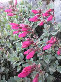 Rockpenstemon
|
| Back to top |
|
|
Quark
Niece of Alvy Moore

Joined: 15 May 2003
Posts: 14152 | TRs | Pics
|
|
Quark
Niece of Alvy Moore
|
Tue Jul 26, 2011 8:22 pm |
|
|
Because of your nice flower report, we wanted to do this yesterday. We got to the trailhead as about 25 kids and several adults were hoisting their packs for a backpacking trip. We hemmed and hawed about it and were on the fence about whether to do another trail instead, when 12 horses with riders and a mule came out of the shrubbery down the road and plodded up the trail.
That tipped the scales, and we went to Iron Pk instead.
"...Other than that, the post was more or less accurate."
Bernardo, NW Hikers' Bureau Chief of Reporting
"...Other than that, the post was more or less accurate."
Bernardo, NW Hikers' Bureau Chief of Reporting
|
| Back to top |
|
|
More Cowbell
Warrior Princess
Joined: 01 Jul 2006
Posts: 5657 | TRs | Pics
Location: Alive on Earth |
I forgot a couple of photos, not that they're all that exciting. Monkey Flower error all fixed now too. I was fooled by the color and didn't even bother to identify the petals and leaves.
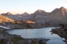
 West Esmerelda? 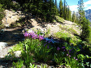 Typical scene every 5 minutes
If you want to forget all your other troubles, wear too tight shoes. - Unknown
If you want to forget all your other troubles, wear too tight shoes. - Unknown
|
| Back to top |
|
|
|
|


