| Previous :: Next Topic |
| Author |
Message |
williswall
poser


Joined: 30 Sep 2007
Posts: 1968 | TRs | Pics
Location: Redmond |
Usually I choose my WT hike time based on weather and days off, but this week my daughter and I had to stick to a specific schedule with me returning to work and her starting up HS swimming. I was skeptical that we could pull off a fastpack under current conditions so made sure I had a buddy on standby today (Sunday) to pick us up if we had to abort. Short version of the schedule: take advantage of good weather Saturday by hiking from Longmire CCW to Granite creek, a 41 mile day total. I was planning a 20 hour day with 3-4 hours of rest. Then a milder day during forecast rainy weather to stay at the North Puyallup on Sunday night. This way, if weather and/or conditions wreaked havoc on the climb to Klapatche Park, we could bail by walking the West Side road out and either regain the trail via the South Puyallup or Tahoma creek trail, or simply hitch a ride back to Longmire.
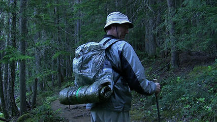
We had very light packs, my daughter's was 8 pounds and mine 5, then I carried most of the food to even it up. I had planned on field testing our Blizzard tube/Momentum liner bag/B4 combo in the lower elevation camps, but some surprises were in store for us.
 Zpacks with tube  front packs 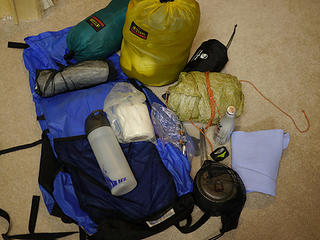 WT 2011 Cassie pack 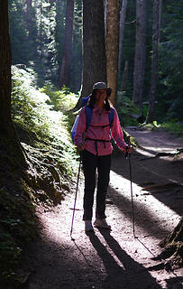 Cassie backlit 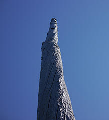 natural totem 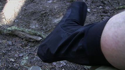 Rocky socks 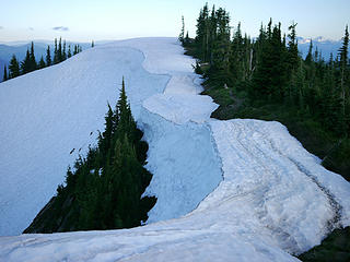 snow on the Cowlitz 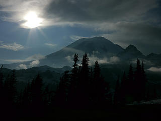 Rainier from the Cowlitz 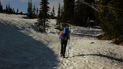 cowlitz divide 5500' 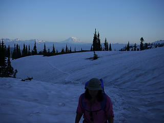 waning sun on the Cowlitz 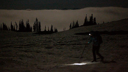 headlamp 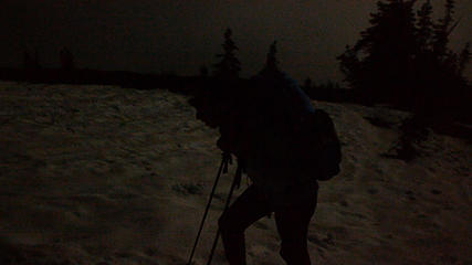 above the clouds 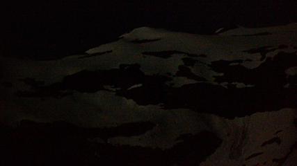 ohanepecosh valley head 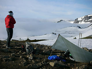 morning after unplanned bivy 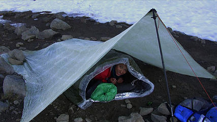 unplanned bivy setup  goat hair 2 above Panhandle Gap 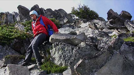 scramble to the saddle 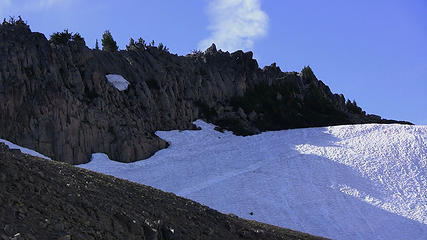 ridge above Panhandle Gap 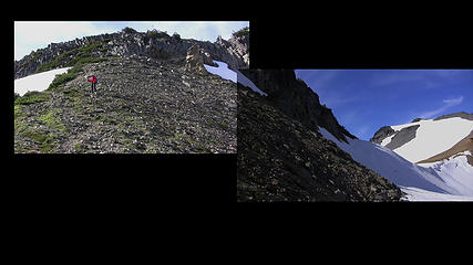 from the saddle composite  Rainier from the scramble 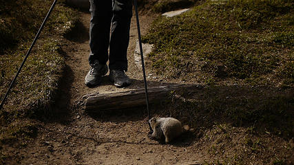 attack the pole 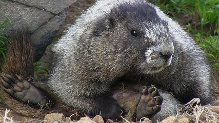 nursing marmot mom 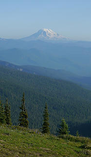 Adams from a dry spot on the Cowlitz 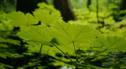 green at last before White River
|
| Back to top |
  
|
|
Go Jo
of the lykkens

Joined: 08 Jun 2003
Posts: 2248 | TRs | Pics
Location: Around The Bend |
|
Go Jo
of the lykkens
|
 Mon Aug 15, 2011 12:52 am |
|
|
Wow, tough cookie is an understatement. What an experience to have in life, thx for sharing it.
|
| Back to top |
|
|
Tigerotor77W
Member

Joined: 16 May 2009
Posts: 776 | TRs | Pics
Location: Charleston, SC |
Awesome report. I've been meaning to post up a question about how people get starting hiking -- I feel like it's not something that one "just experiments with on their own," and reading your report kind of makes me think that family is usually the first introduction. It was nice to read about this trip -- seems worthwhile overall, even given the few issues that came up!
|
| Back to top |
|
|
oregoncrna
Member
Joined: 14 Aug 2011
Posts: 14 | TRs | Pics
|
Thanks for your report. We have a permit to do the Wonderland Trail beginning September 9th. I'm hoping the problematic areas are less problematic by then.
Since you are the most recent traveller, can you tell me:
1) What nighttime temps were (I sleep cold and need plan appropriately)?
2) How adequate you think the bear poles were (I'd like to avoid the weight of a bear canister)?
Thanks for posting great pictures. Good luck next time!
|
| Back to top |
|
|
silence
Member

Joined: 25 Apr 2005
Posts: 4420 | TRs | Pics
|
|
silence
Member
|
Mon Aug 15, 2011 7:24 am |
|
|
great effort .. the moonlight must have been trippy ..
glad you ran into kelsie and ken and told them about the gap so there would be no surprises .. i told her i prob wouldn't have used an ice axe either .. in ice i'm not sure how much help one would be anyhow .. but i'm pretty sure they have yak trax
PHOTOS
FILMS
Keep a good head and always carry a light bulb. Bob Dylan
PHOTOS
FILMS
Keep a good head and always carry a light bulb. Bob Dylan
|
| Back to top |
|
|
williswall
poser
Joined: 30 Sep 2007
Posts: 1968 | TRs | Pics
Location: Redmond |
| oregoncrna wrote: | | Since you are the most recent traveller, can you tell me:
1) What nighttime temps were (I sleep cold and need plan appropriately)?
2) How adequate you think the bear poles were (I'd like to avoid the weight of a bear canister)? |
I can only tell you about one night. We crossed the Gap area in the moonlight and it was very pleasant. However, we slept at 6800' and it had to be close to freezing, considering the snow conditions. Hopefully you won't sleep that high. As for poles, they are up in all the camps except Indian Bar, where they have left a large bear bucket, so you can leave your canister at home. Also, everyone is still using the shelter at Indian Bar as only one little section of one campsite has melted out as of yet.
|
| Back to top |
|
|
williswall
poser
Joined: 30 Sep 2007
Posts: 1968 | TRs | Pics
Location: Redmond |
| Tigerotor77W wrote: | | I've been meaning to post up a question about how people get starting hiking -- I feel like it's not something that one "just experiments with on their own," and reading your report kind of makes me think that family is usually the first introduction. |
I never did any hiking (grew up in Maine) until I moved to the Northwest in the early 80s. I started day hiking when I was 30, then did the WT in 1986 as my first backpack. So in my case I did just "experiment on my own", but for my kids of course it was an introduction from me.
|
| Back to top |
|
|
Hiker Mama
Member

Joined: 25 Jun 2006
Posts: 3451 | TRs | Pics
Location: Lynnwood |
Wow, what an amazing accomplishment, despite not reaching your goal!
|
| Back to top |
|
|
yaki
Member

Joined: 26 May 2010
Posts: 151 | TRs | Pics
Location: The Other Side of the Mountains |
|
yaki
Member
|
Mon Aug 15, 2011 2:25 pm |
|
|
I always enjoy reading your trip reports. I'll be interested to learn more about your by-pass route of Panhandle Gap. You're daughter is a trooper and is going to have some great memories from these trips.
Glad to hear Bobbi is doing well. I've been thinking about her. 
|
| Back to top |
|
|
Tigerotor77W
Member
Joined: 16 May 2009
Posts: 776 | TRs | Pics
Location: Charleston, SC |
| williswall wrote: | | I never did any hiking (grew up in Maine) until I moved to the Northwest in the early 80s. I started day hiking when I was 30, then did the WT in 1986 as my first backpack. So in my case I did just "experiment on my own", but for my kids of course it was an introduction from me. |
Interesting. I'll post up the question eventually... don't want to sidetrack this thread.
|
| Back to top |
|
|
oregoncrna
Member
Joined: 14 Aug 2011
Posts: 14 | TRs | Pics
|
Good to know. Your trip sounded epic!
|
| Back to top |
|
|
oregoncrna
Member
Joined: 14 Aug 2011
Posts: 14 | TRs | Pics
|
| williswall wrote: | | I am going to write up a detailed report on my site about this option, as being able to safely bypass the Gap is something great for hikers (who are willing to go off trail) to have in their trail arsenal. |
Let us know when you have posted this information.
Thanks!
|
| Back to top |
|
|
bobbi
stillaGUAMish

Joined: 13 Jul 2006
Posts: 8012 | TRs | Pics
Location: olympics! |
|
bobbi
stillaGUAMish
|
Sat Aug 20, 2011 7:52 pm |
|
|
hey there!
i am back from my very own amazing wonderland trail adventure!
while snacking south of Emerald Ridge heading towards Devil's Dream, mtngrl and Ken were heading towards South Puyallup River Camp.
they mentioned about your Panhandle adventure! so happy to hear you and your daughter managed to hunker down in safety!
Irene and i were more in awe at the weight of your packs!
thanks for all your info prior to my heading out on the WT!
bobbi ૐ
"Today is your day! Your mountain is waiting. So
get on your way!" - Oh, the Places Youll Go! By Dr. Seuss
bobbi ૐ
"Today is your day! Your mountain is waiting. So
get on your way!" - Oh, the Places Youll Go! By Dr. Seuss
|
| Back to top |
|
|
|
|


