| Previous :: Next Topic |
| Author |
Message |
Prosit
Member


Joined: 08 May 2011
Posts: 130 | TRs | Pics
|
|
Prosit
Member
|
 Tue Aug 23, 2011 8:31 pm |
|
|
Pocket Peak (7056')
Pocket Peak is perhaps best known as the strikingly steep rock pyramid lying to the east across the Silesia valley when viewed from Winchester Lookout or Mt Larrabee. Along with Rapid Peak and Middle Peak, it occupies an area less renown and seldom visited, but it is also an area of spectacular views, beautifully exposed rock, and the kind of no boot path, pristine landscape that inspires the sense of truly exceptional wilderness that I felt there.
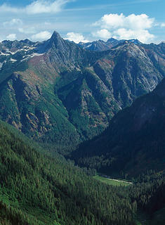 Pocket Peak above Silesia valley from the approach to Mt Larrabee 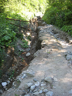 Nesakwatch Road washout as I entered 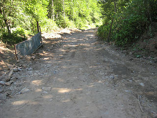 Nesakwatch Road washout as I exited 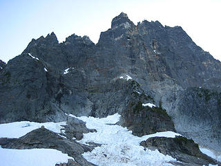 Mt Slesse from the propeller cairn 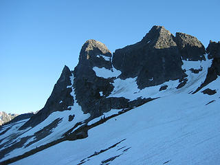 Labour Day Summit and Station D - the slopes below are traversed to the shaded ridge at distant left 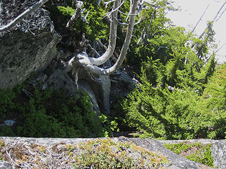 Looking down into the gully/cleft 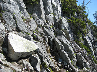 Looking up at the ramp 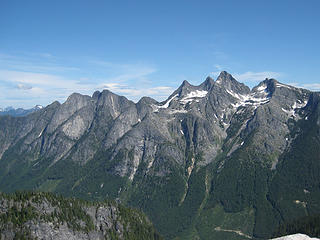 Mt Rexford and the Illusion Peaks 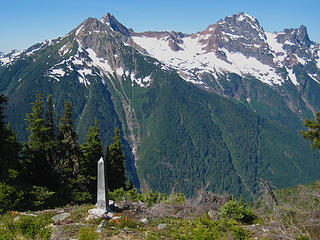 Monument 56, the Pleiades, Mt Larrabee, and the Border Peaks 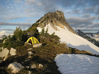 Camp on the East Ridge of Pocket Peak 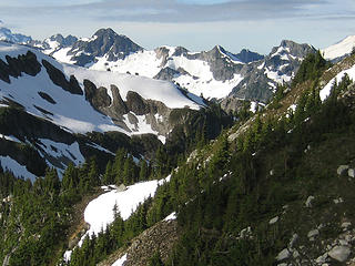 Always nice to have a view of the Bosoms in the morning 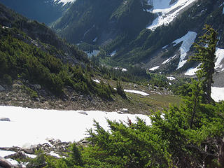 Pocket Lake and the slopes to descend on the south side of the East Ridge 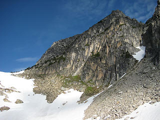 Looking up at Pocket Peak and the South Rib from the southeast basin 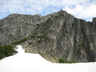 Approaching the South Rib 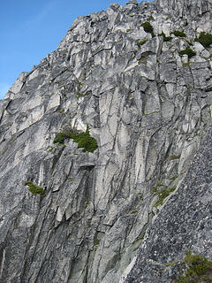 Looking up toward the western end of the mountain - the gully system is just beyond the foreground rock at lower right 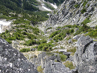 Looking down from the summit crest at the hidden heather gully, and the broader slope it leads to higher up. The South Rib is on the left and the main gulley system is well to the right of the heather on the other side of the scrub trees and is bordered by the steep rock face at upper right 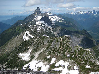 Mt Slesse 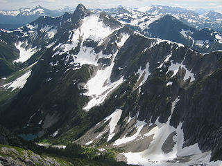 Rapid Peak 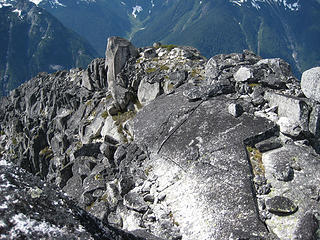 The summit crest looking west from the true summit 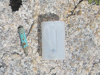 Pencil stub and empty film canister found on summit 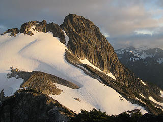 Pocket Peak in evening light
|
| Back to top |
  
|
|
Dayhike Mike
Bad MFKer
Joined: 02 Mar 2003
Posts: 10958 | TRs | Pics
Location: Going to Tukwila |
Awesome adventure!
Truly excellent write-up of the route on an oft-viewed, but rarely visited peak.
Thanks for all of the great details. I will definitely have to visit this one myself someday. 
"There is only one basic human right, the right to do as you damn well please. And with it comes the only basic human duty, the duty to take the consequences." -P.J. O'Rourke
"Ignorance is natural. Stupidity takes commitment." -Solomon Short
"There is only one basic human right, the right to do as you damn well please. And with it comes the only basic human duty, the duty to take the consequences." -P.J. O'Rourke
"Ignorance is natural. Stupidity takes commitment." -Solomon Short
|
| Back to top |
|
|
Tom_Sjolseth
Born Yesterday

Joined: 30 May 2007
Posts: 2652 | TRs | Pics
Location: Right here. |
This area is on my radar. Thanks for the report. When I go, I will remember to bring a summit register with me.
|
| Back to top |
|
|
Nietzsche's Horse
Equine Philosopher

Joined: 16 Aug 2010
Posts: 92 | TRs | Pics
Location: Seattle |
I really enjoyed this report, from a neglected area. It was respectful, curious, informative, and thoughtful--some of the same qualities which helped you reach the summit safely after encountering your initial impasse.
It was also quite the coincidence that you posted it just as I was reviewing this older report from cross-valley Silesia Ridge.
I am glad you had such a great time. Thanks for sharing some of your experience with this write-up.
"Trails are like that: you're floating along in a Shakespearean Arden paradise and expect to see nymphs and fluteboys, then suddenly you're struggling in a hot broiling sun of hell in dust and nettles and poison oak... just like life." - Kerouac
"Trails are like that: you're floating along in a Shakespearean Arden paradise and expect to see nymphs and fluteboys, then suddenly you're struggling in a hot broiling sun of hell in dust and nettles and poison oak... just like life." - Kerouac
|
| Back to top |
|
|
Gimpilator
infinity/21M

Joined: 12 Oct 2006
Posts: 1684 | TRs | Pics
Location: Edmonds, WA |
An eloquent write-up. This is a very interesting area that is rarely visited. I really enjoy hearing about it when someone goes out, determined to climb an obscure and remote peak. Nice job!
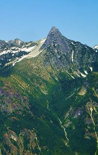 Beau's shot of Pocket during our Larrabee climb.
|
| Back to top |
|
|
Magellan
Brutally Handsome

Joined: 26 Jul 2006
Posts: 13116 | TRs | Pics
Location: Inexorable descent |
|
Magellan
Brutally Handsome
|
Tue Aug 23, 2011 10:17 pm |
|
|
|
| Back to top |
|
|
dicey
custom title

Joined: 11 May 2004
Posts: 2870 | TRs | Pics
Location: giving cornices a wider berth |
|
dicey
custom title
|
Tue Aug 23, 2011 10:18 pm |
|
|
Wow, and super cool.
Very surprised to see a TR for this peak.
|
| Back to top |
|
|
puzzlr
Mid Fork Rocks

Joined: 13 Feb 2007
Posts: 7220 | TRs | Pics
Location: Stuck in the middle |
|
puzzlr
Mid Fork Rocks
|
Tue Aug 23, 2011 11:05 pm |
|
|
Your report was very fun to read, with enough details to let me follow along on Google Earth. Congrats for making the summit. I'm glad there are remote areas like this.
|
| Back to top |
|
|
beaudaddy
Coast To Cascades

Joined: 25 Feb 2010
Posts: 401 | TRs | Pics
Location: Tulalip, WA |
|
beaudaddy
Coast To Cascades
|
Wed Aug 24, 2011 12:28 am |
|
|
Your report felt refreshing to me... Thank you for taking the time in providing all the detail. It's such a beautiful peak!!!
|
| Back to top |
|
|
iron
Member

Joined: 10 Aug 2008
Posts: 6392 | TRs | Pics
Location: southeast kootenays |
|
iron
Member
|
Wed Aug 24, 2011 6:59 am |
|
|
awesome report and great story telling. any thoughts of what kind of climb this would be in early summer with snow still lingering?
|
| Back to top |
|
|
BirdDog
Member
Joined: 09 Jan 2007
Posts: 1067 | TRs | Pics
Location: Seattle |
|
BirdDog
Member
|
Wed Aug 24, 2011 7:38 am |
|
|
Very nice write up, interesting read. Great to see TR's on seldom visited places. Congrats on sumitting!
"There can be no greater issue than that of conservation in this country."
Teddy Roosevelt August 6, 1912
"There can be no greater issue than that of conservation in this country."
Teddy Roosevelt August 6, 1912
|
| Back to top |
|
|
Yana
Hater

Joined: 04 Jun 2004
Posts: 4212 | TRs | Pics
Location: Out Hating |
|
Yana
Hater
|
Wed Aug 24, 2011 8:41 am |
|
|
Thanks for the wonderful report!
I have had Pocket Peak on the brain for many months now.
PLAY SAFE! SKI ONLY IN CLOCKWISE DIRECTION! LET'S ALL HAVE FUN TOGETHER!
PLAY SAFE! SKI ONLY IN CLOCKWISE DIRECTION! LET'S ALL HAVE FUN TOGETHER!
|
| Back to top |
|
|
Stefan
Member

Joined: 17 Dec 2001
Posts: 5091 | TRs | Pics
|
|
Stefan
Member
|
Wed Aug 24, 2011 9:14 am |
|
|
awesome! I so enjoy people reporting on very very seldom areas!
thanks!
So you went to Rapid Peak too? How was the traverse?
Did you continue on to Middle Peak?
|
| Back to top |
|
|
Prosit
Member
Joined: 08 May 2011
Posts: 130 | TRs | Pics
|
|
Prosit
Member
|
Wed Aug 24, 2011 7:42 pm |
|
|
Thanks for your comments everyone. Fun to share this one.
| Quote: | | Any thoughts of what kind of climb this would be in early summer with snow still lingering? |
The heather gully is southwest facing, so it should melt out sooner rather than later. I think it would go in early season as long as the ledge isn't too stuffed with snow. If the gully is snow, you'd want to be comfortable on sustained, very steep snow.
| Quote: | | So you went to Rapid Peak too? How was the traverse?
Did you continue on to Middle Peak? |
I didn't climb Rapid this time. I understand that the long west ridge involves a lot of sidehilling rather than easy ridgecrest travel but is not too difficult. There are two ways to get from Rapid to Middle, one high and one low. In 1995, I went low and encountered one class 3-4 move.
|
| Back to top |
|
|
anyludes
Member

Joined: 08 Feb 2009
Posts: 10 | TRs | Pics
Location: South Hill, WA |
|
anyludes
Member
|
Wed Aug 24, 2011 11:23 pm |
|
|
Excellent report. Thanks.
|
| Back to top |
|
|
|
|
You cannot post new topics in this forum
You cannot reply to topics in this forum
You cannot edit your posts in this forum
You cannot delete your posts in this forum
You cannot vote in polls in this forum
|
Disclosure: As an Amazon Associate NWHikers.net earns from qualifying purchases when you use our link(s). |


 Going into the relatively unknown is harder to do than it used to be. Good for you persevering and reaching the summit.