theCougAbides
Member


Joined: 12 Apr 2007
Posts: 34 | TRs | Pics
Location: Snoquamlie, WA |
I finished a 2 day climb of Mount Daniel via the SE Ridge today. Awesome climb, I highly recommend it for those comfortable with exposure and scrambling. The weather was perfect, although a little cold this morning at Peggys Pond.
It took 2.5 hours to get to Peggys Pond from the Tucquala Meadows Trailhead. I knew I was ahead of schedule, so I took it slow. Camp was set up above the pond, and I got water from the stream to the north of the pond. I know I had an urge to swim in Peggys Pond, so I figured other people did to, and opted to avoid the water there. The bugs at and near the pond are pretty bad, 98% DEET is recommended. Since it only took 2.5 hours to get there, I could have hiked up past the pond onto the SE Ridge, where there are a few tent spots. But I didnt bring enough fuel to melt snow, and only a 1 liter bottle for water, so I stayed near the stream. A little past sunset, the bugs to go bed, and I was able to take my sleeping pad out under the stars for a few hours of star gazing. Very nice.
In the morning, I left camp at 7:45. The hill directly west of the pond turns into a ridge, and there is a trail heading up. As the hill turns into the ridge, the exposure increases. A slip off either side could be fatal, but the footing is sound. Eventually, you end up at the saddle just south of the East Peak, between the East Peak and what I will call the South East Mini Peak. Right now, there are two ways to get there: by the normal ridge route over rock, or by the snow route across the snowfield SE of the East Peak. I went up the rocky ridge, as I was unsure of whether the snow route would get me to where I wanted to go.
When you hit that small saddle south of the East Peak, its only about 30-45 minutes to the West Peak, which is the true summit. From that saddle, traverse the scree/snow SW of the East Peak. In times, the footing wasnt good, and I considered turning back, but it was only for 10 feet or so. That traverse leads you to another saddle, this one between the Middle and East Peaks. From there, head up the Middle Peak, then across to the West Peak. Youve made it!
From Peggys Pond to the West Peak took 2.5 hours up, 1 hour 25 minutes down, with 50 minutes spent at the summit alone. It wasnt until I was back on the SE ridge that I saw somebody else headed up. I could have spent probably another hour up there alone, but I had run out of water and was thirsty. On the way down, I chose to take the snow from the saddle south of the East Peak. It was much faster, and I could have glissaded the snow almost all the way to Peggys Pond, but was not sure of the route around a corner.
I hope this helps someone plan this wonderful trip. Mount Daniel is a very fun climb, with class 3 scrambling, glissades, snow traverses, and beautiful high mountain lakes, all leading to the top of King County and a 7900 foot mountain with 360 degree views. Glacier Peak, Baker, Rainier, Adams and Stuart are all easily identified from the summit on a clear day. A great 2 days, and the perfect activity to get my mind off of life, the internet, and work. Oh, there is a summit register, but no pencil or pen! Hopefully somebody reads this and remedies that situation.
I forgot to charge my cameras battery before I left, so I only got a few pics:
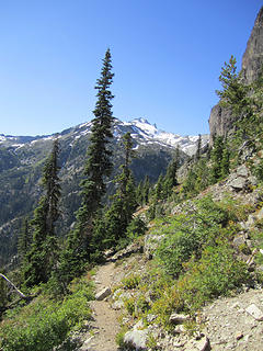 View of Daniels from the Peggy's Pond Trail 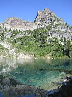 Peggy's Pond, Cathedral Rock 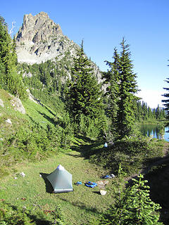 Camp, Cathedral Rock, Peggy's Pond 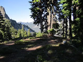 Toilet with a view 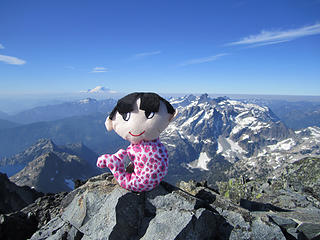 Merman at the summit (inside joke) 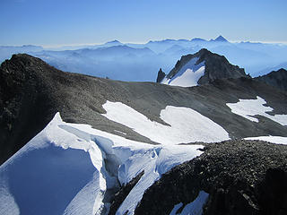 Middle Peak on the very left, East Peak on the right, Stuart in the background. Taken from the summit. 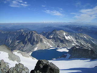 View from summit, looking north at Glacier Peak. Lynch Glacier and it's lake in the foreground.
|


