| Previous :: Next Topic |
| Author |
Message |
Sultan Guy
Member


Joined: 22 Jul 2008
Posts: 353 | TRs | Pics
Location: Now reinforced with Concrete |
Not many TRs from me this year as I chose to focus mainly on paddling over the spring and summer months which were fine with the late snow melt. However having just returned from a two week sea kayaking trip to British Columbia I was amped to get out in the local backcountry. Fortunately I have been running regularly all summer so relied on that for aerobic fitness.  Initially I had no intentions of this being a solo hike. But a funny thing happened. I started the week off with a half dozen names of potential companions. As the week progressed the Nos kept coming back but the weather forecast kept getting better. Not sure when I would have the available time and the weather window I made the decision to go for it but be extra careful!
  Like many other hikers I have long gazed up or over at Ragged Ridge and wondered what it was like up there. Arguably the least seldom visited area of Wild Sky. One guidebook states Ragged Ridge, west of the North Fork Skykomish River, is one of the most remote and impenetrable areas still remaining on the west flank of the Cascades. When I read that about an area it goes on my list! There are scant TRs on this area and most focus on the few small lakes. Beta on the peaks is almost nonexistent.
  While on Nine Lives Peak (5,110) last October(https://www.nwhikers.net/forums/viewtopic.php?t=7987040&highlight=sultan), I carefully studied the Ragged Ridge area with an eye towards some type of Grand Traverse. Some definite cliffy sections but it looked like it might go. I also really wanted to climb Bushwhack Peak (5,145) near NLP which I missed last year due to weather.
DAY 1-Reiter Road to small unnamed lake at head of Deer Creek (4,400)
Since this was a one way trip I left my car at work in Sultan and got a ride with a coworker up Reiter Road. Reiter Road is currently closed not far past the Lake Isabel TH due to washouts from past winter storms. I found it strange to hear busy holiday traffic on Hwy 2 while I walked nearby on a totally deserted paved road. Started walking at 3 PM. Was thinking of camping somewhere along Deer Creek Flats road but since the evening was so nice decided to go on up to my first lake. The cross country travel from the Deer Creek Flats road (2,000) up to 4,000 was surprisingly easy. No brush, nice thick second growth woods, beautiful cascading stream. Hit the 4,400 lake at 7:15. Several great campsites here.
While on Nine Lives Peak (5,110) last October(https://www.nwhikers.net/forums/viewtopic.php?t=7987040&highlight=sultan), I carefully studied the Ragged Ridge area with an eye towards some type of Grand Traverse. Some definite cliffy sections but it looked like it might go. I also really wanted to climb Bushwhack Peak (5,145) near NLP which I missed last year due to weather.
DAY 1-Reiter Road to small unnamed lake at head of Deer Creek (4,400)
Since this was a one way trip I left my car at work in Sultan and got a ride with a coworker up Reiter Road. Reiter Road is currently closed not far past the Lake Isabel TH due to washouts from past winter storms. I found it strange to hear busy holiday traffic on Hwy 2 while I walked nearby on a totally deserted paved road. Started walking at 3 PM. Was thinking of camping somewhere along Deer Creek Flats road but since the evening was so nice decided to go on up to my first lake. The cross country travel from the Deer Creek Flats road (2,000) up to 4,000 was surprisingly easy. No brush, nice thick second growth woods, beautiful cascading stream. Hit the 4,400 lake at 7:15. Several great campsites here.
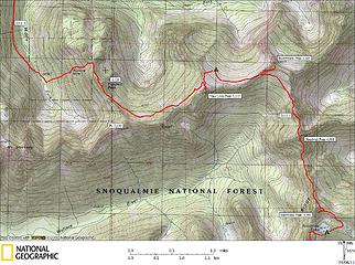
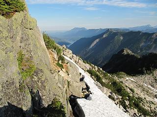
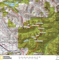 Ragged Ridge Traverse overview 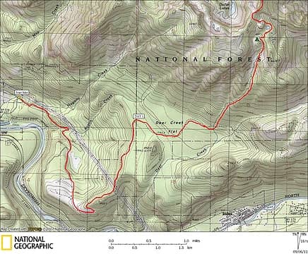 Ragged Ridge Traverse 1 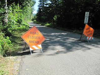 Reiter Road closed 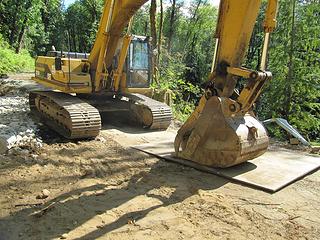 Don't want someone to steal this plate 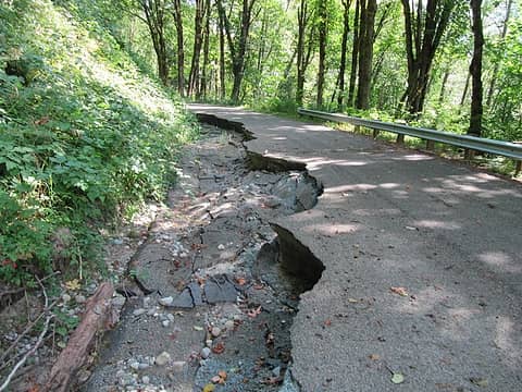 Lots more work to do 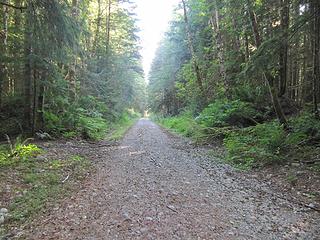 Deer Creek Flats Rd. 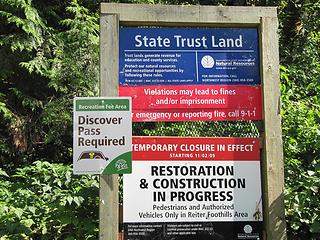 Pass needed for a "Temporary Closure". DNR needs your money! 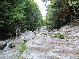 Upper Deer Creek 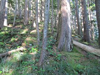 Great off trail hiking 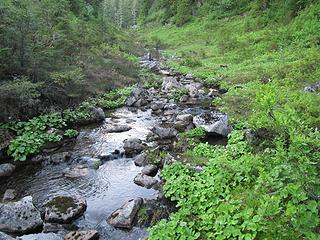 Deer Creek below lake 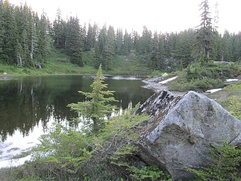 Unnamed lake at head of Deer Creek 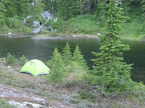 Campsite 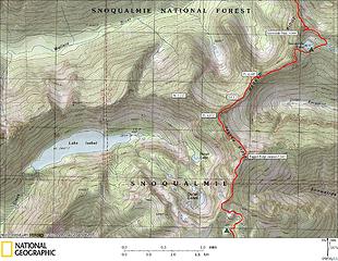 Ragged Ridge Traverse 2 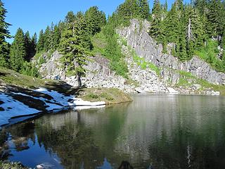 North Star Creek pots 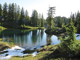 More North Star Creek pots 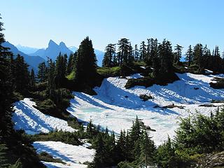 Frozen pot 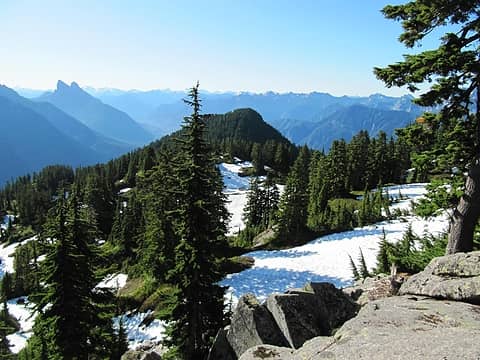 Crest near south end of Ragged Ridge 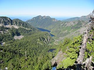 Lake Isabel and Heart Lake 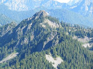 Snowslide Peak from summit of Ragged Ridge 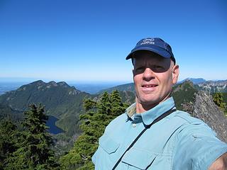 Ragged Ridge summit 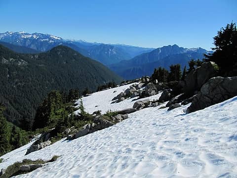 View from Ragged towards Spire Mtn. 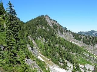 Pt. 4,973 from Ragged 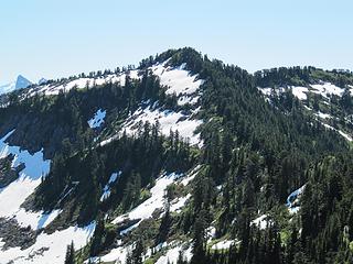 Ragged from Pt. 4,973 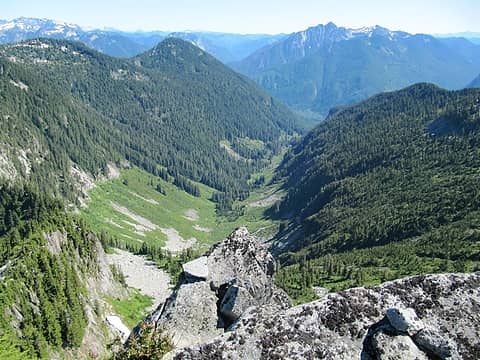 View from Pt. 4,973 down Excelsior Creek 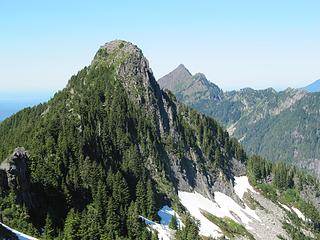 Point 5,137 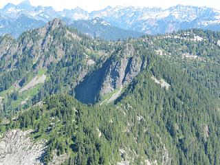 View from Pt. 4,973 NE. Snowslide Peak on left. Lake is hidden behind middle peak. 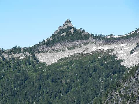 Bushwhack Peak from S 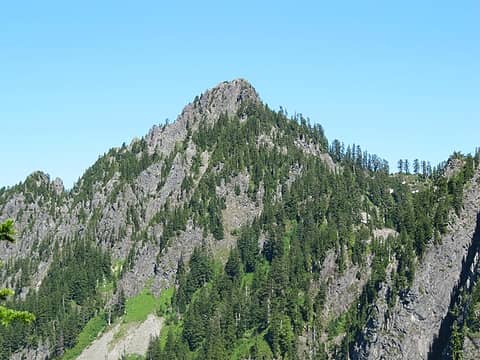 Snowslide Peak from SW. I traversed the other side. 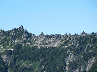 Rock horns on Sultan divide 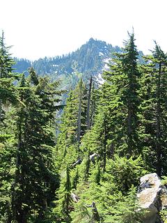 Looking back on Pt. 4,973. I followed the ridge up the left skyline and then down in the foreground. 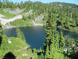 Snowslide Lake 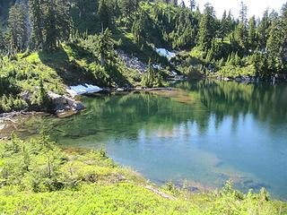 Swim time! 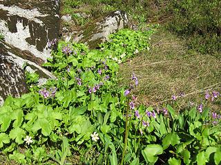 Flowers 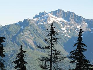 Gunn Peak massif 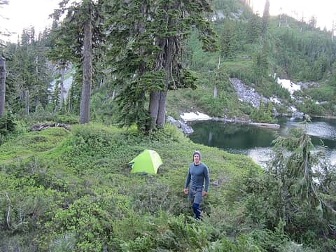 Campsite  Getting down proved easier then getting around the final minor sub-summit that was blocking me from the enormous open boulder field below Bushwhack Peak. Finally after some very physical work in the grueling heat I reached the boulder field.
Reaching this boulder field was a huge relief because I knew there was an easy way over the ridge into the Sultan drainage. Crossing the half mile boulder field was unbelievably hot. It was angled southwest into the peak of the afternoon heat. Some hikers may not like boulder fields but after all the brush they were a welcome sight to me. It is unnerving when they shift slightly as you step on them, making me quote Aaron Ralston Geologic time, includes now.
Getting down proved easier then getting around the final minor sub-summit that was blocking me from the enormous open boulder field below Bushwhack Peak. Finally after some very physical work in the grueling heat I reached the boulder field.
Reaching this boulder field was a huge relief because I knew there was an easy way over the ridge into the Sultan drainage. Crossing the half mile boulder field was unbelievably hot. It was angled southwest into the peak of the afternoon heat. Some hikers may not like boulder fields but after all the brush they were a welcome sight to me. It is unnerving when they shift slightly as you step on them, making me quote Aaron Ralston Geologic time, includes now.  Dropped my pack at the divide and gazed up at Bushwhack Peak (5,145). Bushwhack Peak has been a dream of mine for years. Driving in from Olney Pass you can just catch a glimpse of this incredible knife shaped peak. For years I have wondered what that peak was like. Unlike all my previous peaks on this traverse this one is in the Beckey CAG. Just listed as Pt. 5,145. I am not sure where the name Bushwhack comes from. Not on the USGS maps. The CAG states the first known ascent was made in 1978. This peak is completely vertical on three sides with some outstanding looking climbing routes. A steep but not that exposed Class 2-3 route leads to the summit from the south. What a view from here! I searched for an eventually found a very old rusted metal tea box. The lid was so rusty that when I pried it open it shattered. Inside were some small scraps of paper. With trembling fingers I attempted to open these flat. Some disintegrated into pieces as soon as I touched them. I did get a few open but the writing had long since faded. I made out a few characters. A date that was 1979 and another that read 1985. Something about a USGS map WRONG!!! Peak 5,145 and all the way up the South Fork Sultan Not sure what that is about. Note that the Mt. Stickney 7.5 minute series was not published until 1989. Did these early guys use the 15 minute series and there was an error? I tried to read some names but was getting dizzy from squinting so hard. Mark Dale was the only one for sure I could make out. I carefully put these treasures back in the metal box as if they were sacred scrolls. Later at home I would read in the CAG that Mark Dale, Gary Gordon, and Mike Mittendorf made the third known ascent in April 1979. No other info in the CAG or that I could find on the web regarding later ascents.
Made camp in the same place I camped the previous year, in the high broad basin to the east of Nine Lives Peak. Took a nice bath and lay naked in the tent to escape the bugs and the heat as there was no shade here. Within minutes of the sun going down I was putting on all the clothes I brought to stay warm.
Dropped my pack at the divide and gazed up at Bushwhack Peak (5,145). Bushwhack Peak has been a dream of mine for years. Driving in from Olney Pass you can just catch a glimpse of this incredible knife shaped peak. For years I have wondered what that peak was like. Unlike all my previous peaks on this traverse this one is in the Beckey CAG. Just listed as Pt. 5,145. I am not sure where the name Bushwhack comes from. Not on the USGS maps. The CAG states the first known ascent was made in 1978. This peak is completely vertical on three sides with some outstanding looking climbing routes. A steep but not that exposed Class 2-3 route leads to the summit from the south. What a view from here! I searched for an eventually found a very old rusted metal tea box. The lid was so rusty that when I pried it open it shattered. Inside were some small scraps of paper. With trembling fingers I attempted to open these flat. Some disintegrated into pieces as soon as I touched them. I did get a few open but the writing had long since faded. I made out a few characters. A date that was 1979 and another that read 1985. Something about a USGS map WRONG!!! Peak 5,145 and all the way up the South Fork Sultan Not sure what that is about. Note that the Mt. Stickney 7.5 minute series was not published until 1989. Did these early guys use the 15 minute series and there was an error? I tried to read some names but was getting dizzy from squinting so hard. Mark Dale was the only one for sure I could make out. I carefully put these treasures back in the metal box as if they were sacred scrolls. Later at home I would read in the CAG that Mark Dale, Gary Gordon, and Mike Mittendorf made the third known ascent in April 1979. No other info in the CAG or that I could find on the web regarding later ascents.
Made camp in the same place I camped the previous year, in the high broad basin to the east of Nine Lives Peak. Took a nice bath and lay naked in the tent to escape the bugs and the heat as there was no shade here. Within minutes of the sun going down I was putting on all the clothes I brought to stay warm.
 Ragged Ridge Traverse 3 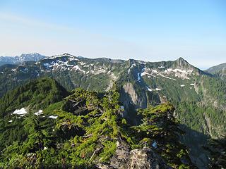 From Snowslide Peak. Ragged Ridge on left. Pt. 4,973 in middle. Pt. 5,137 on right. 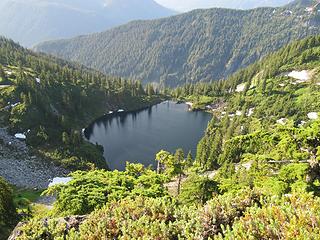 Snowslide Lake from Snowslide Peak 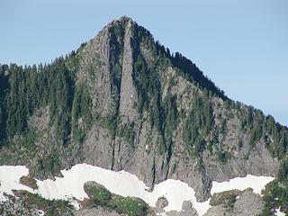 Close up of the striking east face of Pt. 5,137 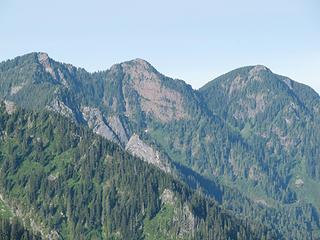 Backside of Zekes, Pinta, and Nina Peaks 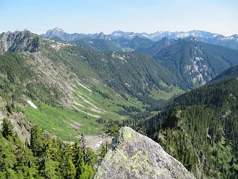 From Headwall Peak down Salmon Creek valley 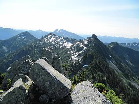 From Headwall Peak looking S- Snowslide Peak is prominent 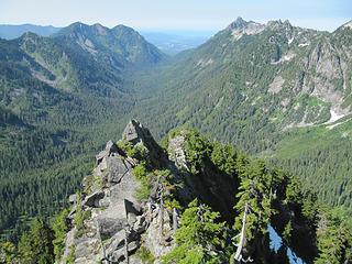 From Headwall Peak down the Wallace River 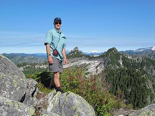 From Headwall Peak looking N 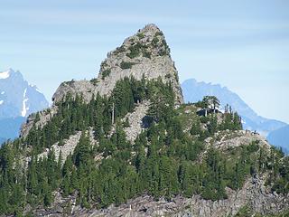 Bushwhack Peak-south face 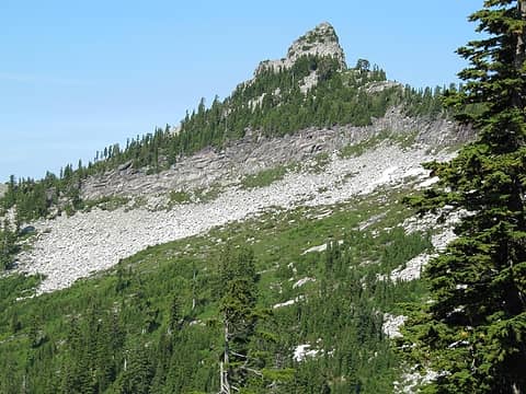 Boulder field below summit 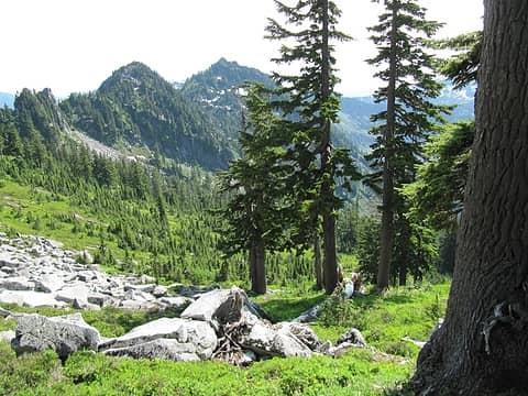 View from Sultan divide back towards Headwall Peak 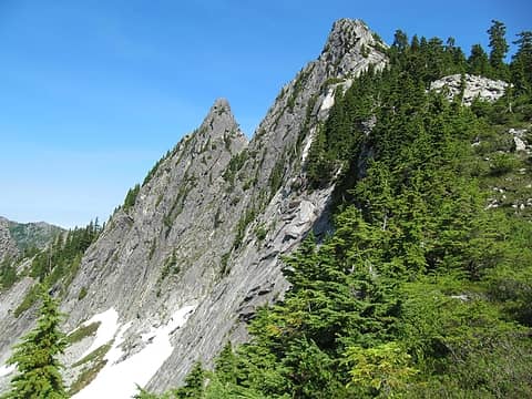 West face Bushwhack Peak 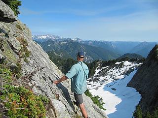 Wee bit of exposure getting up 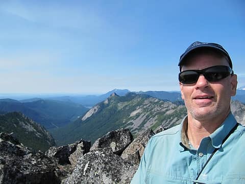 Happy Bushwhack summit 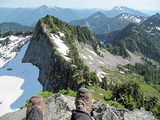 View to the east 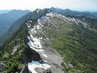 View towards Mt. Stickney 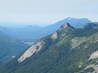 Spada Lake, Static Peak, and Mt. Pilchuck in distance 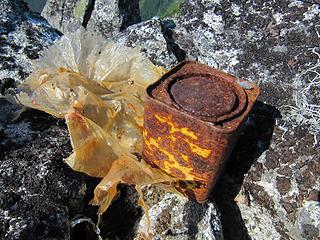 The Bushwhack summit register 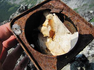 Sacred scrolls? 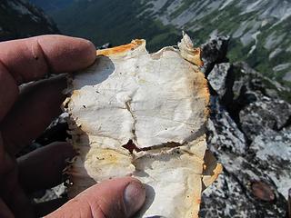 222 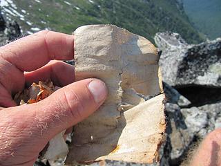 220 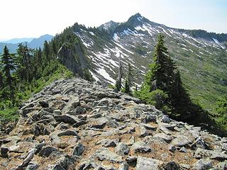 Sultan/Wallace divide with Nine Lives Peak 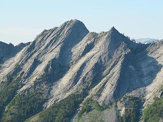 Fallacy Peak and Tang Tower 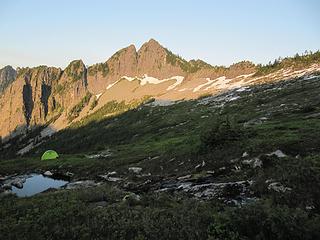 Bushwhack from the west 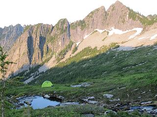 My last high camp 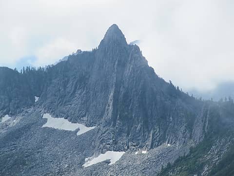 Bushwhack Peak-closeup  At the South Fork, South Fork crossing there was a strong downdraft of cold air and no insects of any kind. I laid in the shade on cool rocks looking up at the blue sky not quite ready for my 72 hours of solitude to end. At Olney Pass I got a ride after two minutes with the first pickup truck. Sitting in the back watching the miles fly by I found myself grinning from ear to ear. What a great traverse!
 View from NLP towards Spada 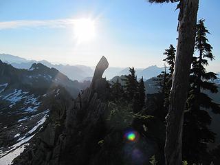 Nine Lives Peak 7:30 AM 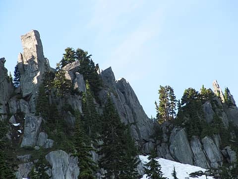 Even more horns 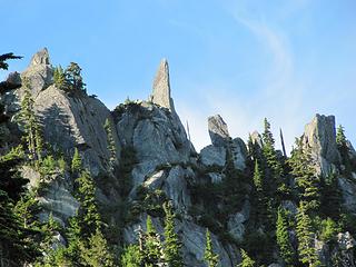 This horn looks phallic 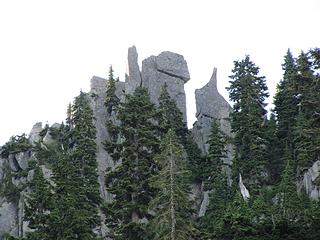 More horns 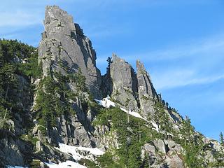 Pt. 5,030 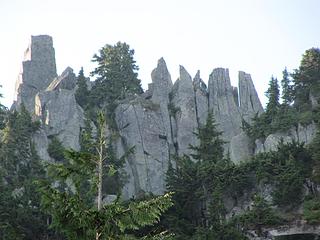 Horns 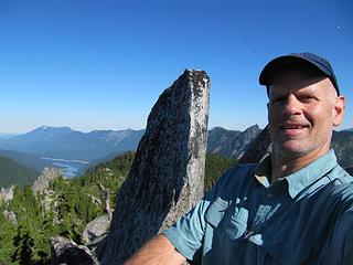 Prospect Peak 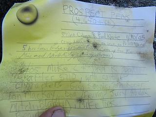 Register 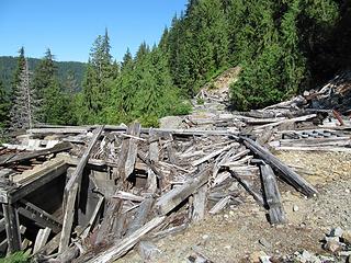 Another crappy old mine picture 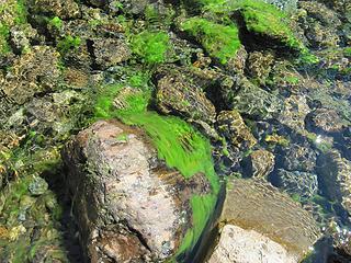 Weird green algae in stream 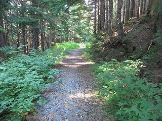 Is this a normal trail? 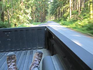 FREE RIDE!
Any worthwhile expedition can be planned on the back of an envelope- H. W. Tilman
 ozzy ozzy
Any worthwhile expedition can be planned on the back of an envelope- H. W. Tilman
ozzy
|
| Back to top |
  
|
|
Backpacker Joe
Blind Hiker

Joined: 16 Dec 2001
Posts: 23956 | TRs | Pics
Location: Cle Elum |
What an incredible adventure. Great pics and a great story. Thanks SG.
"If destruction be our lot we must ourselves be its author and finisher. As a nation of freemen we must live through all time or die by suicide."
Abraham Lincoln
"If destruction be our lot we must ourselves be its author and finisher. As a nation of freemen we must live through all time or die by suicide."
Abraham Lincoln
|
| Back to top |
|
|
Hulksmash
Cleaning up.

Joined: 20 Apr 2008
Posts: 7113 | TRs | Pics
Location: Arlington |
|
Hulksmash
Cleaning up.
|
 Wed Sep 07, 2011 6:01 pm |
|
|
Wow! 
"Bears couldn't care less about us....we smell bad and don't taste too good. Bugs on the other hand see us as vending machines." - WetDog
Albuterol! it's the 11th essential
"Bears couldn't care less about us....we smell bad and don't taste too good. Bugs on the other hand see us as vending machines." - WetDog
Albuterol! it's the 11th essential
|
| Back to top |
|
|
Mike Collins
Member

Joined: 18 Dec 2001
Posts: 3096 | TRs | Pics
|
Thanks for showing the photo of Prospect Peak register. I forgot that I had climbed it twice.
|
| Back to top |
|
|
Riptide Rush
Member

Joined: 21 Sep 2010
Posts: 99 | TRs | Pics
Location: Everett |
Wow what a great trip! I loved the ancient artifacts you found on Bushwack Peak! And the horns on 9 lives looked pretty cool too!
Your 72 hours of solitude looked pretty awesome! Thanks for the report! It was a great read!!
|
| Back to top |
|
|
Gil
Member

Joined: 29 Sep 2004
Posts: 4062 | TRs | Pics
|
|
Gil
Member
|
Wed Sep 07, 2011 6:31 pm |
|
|
Best I've read in a while -- a real exploration!
Friends help the miles go easier.
Klahini
Friends help the miles go easier.
Klahini
|
| Back to top |
|
|
Scrooge
Famous Grouse

Joined: 16 Dec 2001
Posts: 6966 | TRs | Pics
Location: wishful thinking |
|
Scrooge
Famous Grouse
|
Wed Sep 07, 2011 7:49 pm |
|
|
Lake Isabel and Heart Lake Campsite Wee bit of exposure getting up Sacred scrolls? Bushwhack Peak-closeup Pt. 5,030
Something lost behind the ranges. Lost and waiting for you....... Go and find it. Go!
Something lost behind the ranges. Lost and waiting for you....... Go and find it. Go!
|
| Back to top |
|
|
n16ht5
Member
Joined: 21 Jun 2010
Posts: 592 | TRs | Pics
|
|
n16ht5
Member
|
Thu Sep 08, 2011 1:07 am |
|
|
you rock. awesome report mayn
|
| Back to top |
|
|
Justus S.
Member
Joined: 17 Nov 2004
Posts: 1298 | TRs | Pics
Location: WA |
Great Traverse indeed!!! That area is one of my favorites since it is so remote/rugged yet so close to home. I was fortunate to get up Ragged Ridge Pk (tr) and 5137 before the road closures on the flats. I have been wanting to do a some of the other peaks for a long time. Thanks for posting the TR, I'm making a mental bookmark:)
|
| Back to top |
|
|
tmatlack
Member
Joined: 21 Aug 2007
Posts: 2854 | TRs | Pics
|
|
tmatlack
Member
|
Thu Sep 08, 2011 2:10 am |
|
|
Awesome. You are the off-trail king! Everytime I drive US2 eastbound I look up in those valleys and say, "No one goes there....evxcept SG!"
Tom
|
| Back to top |
|
|
Redwic
Unlisted Free Agent

Joined: 23 Feb 2009
Posts: 3292 | TRs | Pics
Location: Going to the Prom(inence) |
|
Redwic
Unlisted Free Agent
|
Thu Sep 08, 2011 3:24 am |
|
|
60 pounds lighter but not 60 points brighter.
|
| Back to top |
|
|
Sky Hiker
Member
Joined: 03 Feb 2007
Posts: 1469 | TRs | Pics
Location: outside |
Nice trip reprt. Been there a few times very nice area and lives up to it's name. Can't believe they are proposing a trail up there but everyone has a dream.
|
| Back to top |
|
|
John Morrow
Member

Joined: 03 Apr 2007
Posts: 1526 | TRs | Pics
Location: Roslyn |
What an awesome idea/adventure! My favorite TR of 2011 thus far.
| Sky Hiker wrote: | | Nice trip reprt. Been there a few times very nice area and lives up to it's name. Can't believe they are proposing a trail up there but everyone has a dream. |
Some places ought to be left trailless to provide for such adventures and solitude. I think we have plenty of trail in the wild country, we could use more in the urban/suburban, though!
Tell me, what is it you plan to do with your one wild and precious life?-Mary Oliver
A nation that continues year after year to spend more money on military defense than on programs of social uplift is approaching spiritual doom.
― MLK Jr.
Tell me, what is it you plan to do with your one wild and precious life?-Mary Oliver
A nation that continues year after year to spend more money on military defense than on programs of social uplift is approaching spiritual doom.
― MLK Jr.
|
| Back to top |
|
|
cascadetraverser
Member

Joined: 16 Sep 2007
Posts: 1407 | TRs | Pics
|
Wow, an awesome rarely traversed area close to home. Good for you SG, to try something near and dear rather than one of the grand traverses in the GPW or NCNP. I remember reading an article long ago in Pack and Paddle by John Roper doing a similiar route, but other than he, haven`t heard of anyone doing that trip. Great job; like the philosophical quotes as well.....
|
| Back to top |
|
|
silence
Member

Joined: 25 Apr 2005
Posts: 4420 | TRs | Pics
|
|
silence
Member
|
Thu Sep 08, 2011 7:53 am |
|
|
so inspiring .. in many ways .. thx!!
PHOTOS
FILMS
Keep a good head and always carry a light bulb. Bob Dylan
PHOTOS
FILMS
Keep a good head and always carry a light bulb. Bob Dylan
|
| Back to top |
|
|
|
|
You cannot post new topics in this forum
You cannot reply to topics in this forum
You cannot edit your posts in this forum
You cannot delete your posts in this forum
You cannot vote in polls in this forum
|
Disclosure: As an Amazon Associate NWHikers.net earns from qualifying purchases when you use our link(s). |


