| Previous :: Next Topic |
| Author |
Message |
Gary-n-Jan
Member


Joined: 25 Aug 2009
Posts: 56 | TRs | Pics
|
Muncaster Basin has been one of our objectives for some time now. For a various reasons we have had to postpone our plans each year. Finally, this September things worked out for Jan, her brother Jeff and I to attempt this trip.
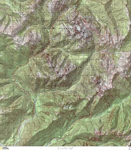
Our plan was to enter from the north via Martins Park and Rustler Creek, then exit to the south via Fire Creek. The following map shows our general route and each of our camps.
The closure of a six mile section of the Graves Creek road for repairs added additional complexity to the trip. Before leaving Port Angeles, we learned the road was scheduled open on 9/15/11, the day we planned to exit the mountains.
 Jan, her brother Jeff and I made a 6 day trip into Muncaster Basin. This is a high alpine basin located between the 2 forks of the Quinault River. Our route was clockwise, starting at the N. Fork trailhead,and continuing to the Low Divide, From here, we followed the way-trail to Martins Park. At this point we left established trails and headed cross country via Rustler Creek to Muncaster Basin. This route proved to be challenging and rewarding. The beauty and solitude we experienced in Muncaster Basin was well worth the effort to get there. The exit route down Fire Creek presented a unique set of challenges. This group of pictures is a compilation of our collective efforts to document this trip, photo credits are noted. Although many people helped us plan this trip, our biggest thanks go to the Elk and other inhabitants of the Rustler Creek drainage. They showed us the way through some difficult and confusing terrain. Without their help, by the tracks they left, we would not have completed this route. 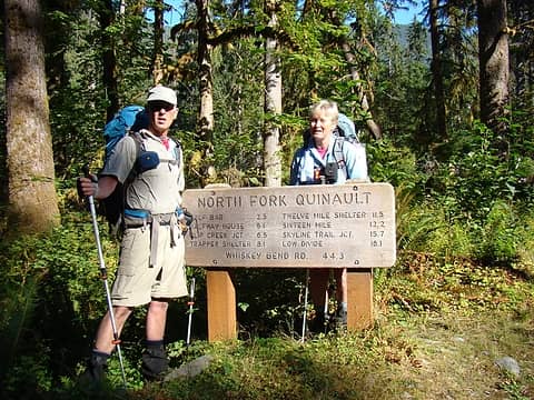 Jeff and Jan at the trailhead. We planned to hike to Sixteen Mile Camp this day. The last time we traveled this trail was the fall of 2008. On that trip we encountered the damage caused by the previous winter's storms. On this trip, we saw the results of the Park's efforts to restore the route. 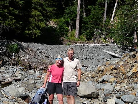 Jan and Gary at Wild Rose Creek.(photo; Jeff) 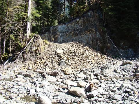 The rebuilt trail at Wild Rose Creek. Evidence of the rope ladder is still visible to the right of the big tree. 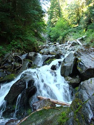 A waterfall along the way. We took advantage of many of these side streams to replenish our water supply and to wash the sweat off our faces. 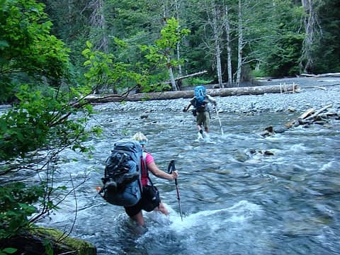 Crossing the North Fork of the Quinault at Sixteen Mile Camp. 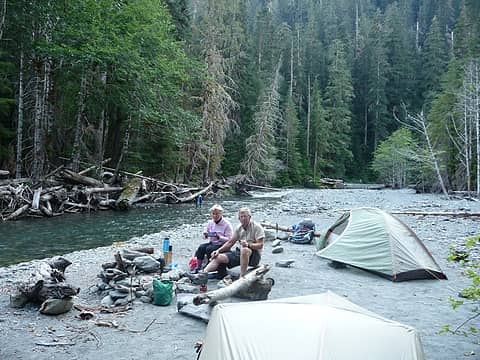 We had a luxurious stream-front campsite gratis a previous party. From the forensic evidence, our guess was it was likely one of the trail crews. (photo: Jeff) 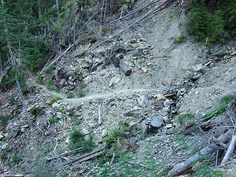 Day 2. Another rebuilt section of washed out trail in one of the gullies along the way to Low Divide. 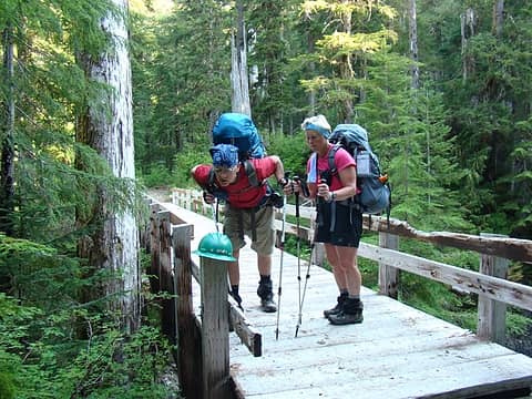 Jeff and Jan checking out an artifact at one of the bridges (or is it a trail crewman's hardhat?????) 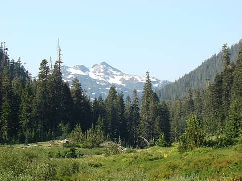 Approaching the Low Divide. 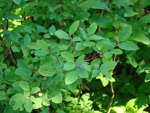 Blueberries near Low Divide. We only found them at lower elevations (elev. approx. 3,000'). 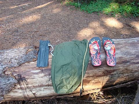 The Lost and Found Dept. at Low Divide. Hopefully the rightful owners will claim their possessions before winter sets in........ 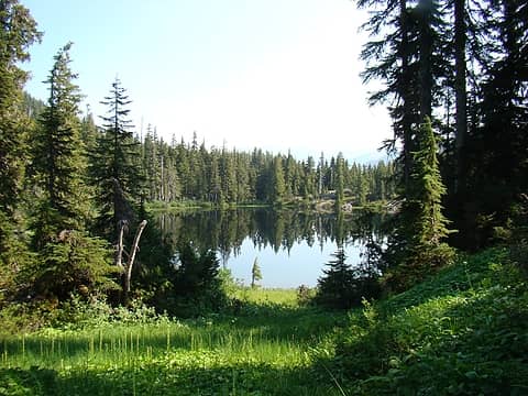 Lake Margaret, just north of Low Divide. 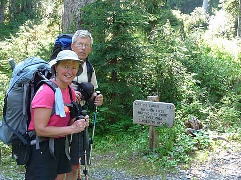 Near Lake Margaret the trail to Martins Park takes off. This would be our access to the high country. (photo: Jeff) 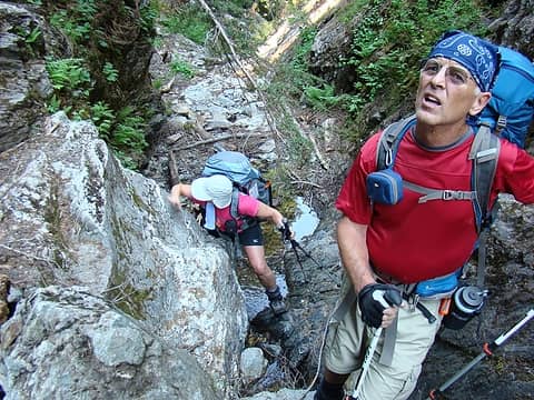 There are a couple steep sections on this trail. Jan and Jeff making their way up through one of these.  There are also some beautiful open meadows 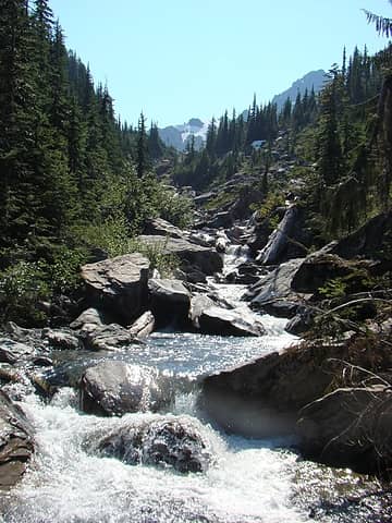 After crossing the creek, we followed it up into lower Martins Park. 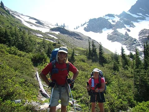 Starting the final climb to the lakes in upper Martins Park. 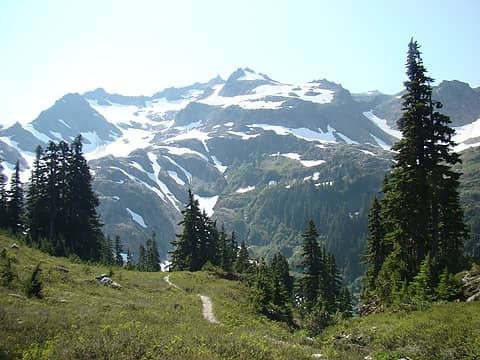 Mt Christie 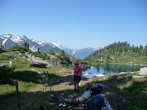 Enjoying a shady break at upper Martins Lake. (Photo: Jeff) 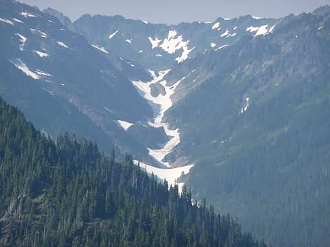 The Elwha Snow Finger from Martins Park. It's still full of snow! 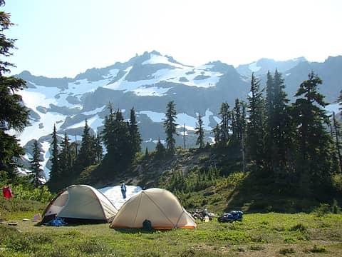 Our campsite at Martins Park, for night 2. Mt Christie in the background. 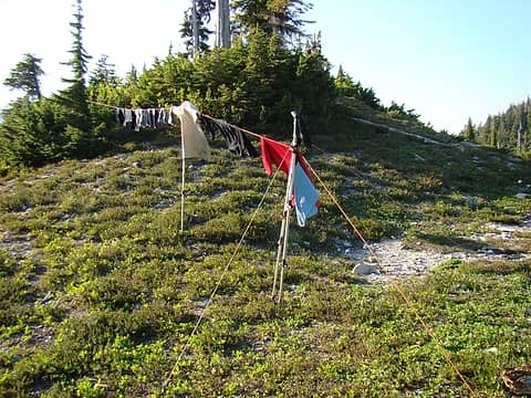 The warm afternoon temps provided a good opportunity to do our wash. Our improvised cloths line. 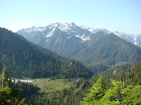 The lower meadows on the route to Martins Park. Mt Seattle in the background. 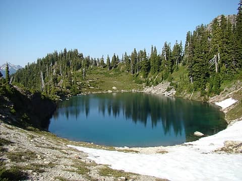 Upper Martins Lake. 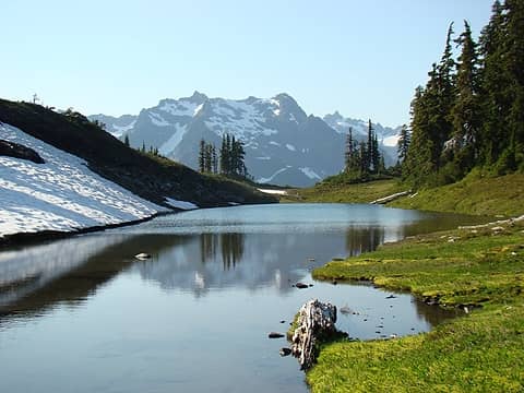 Lower Martins Lake, Mt Seattle in the background. 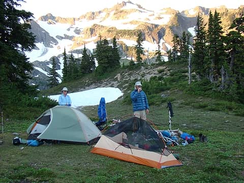 Day 3; Morning coffee at Martins Park 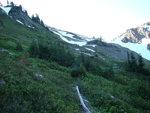 The branch in the foreground is pointing the way to the uncertain route ahead. 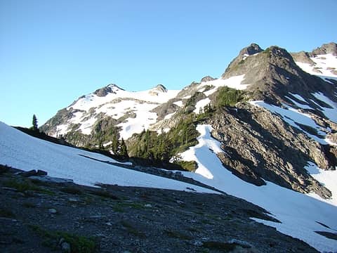 Christie Col with the mountain in the background. 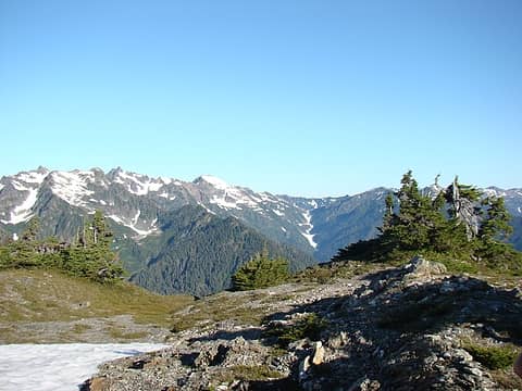 We climbed to the summit climber's left of the Col. The views from here were fantastic! This picture is looking west towards the Elwha Snowfinger and adjacent terrain. 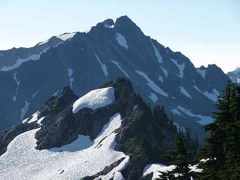 This view is looking east towards Mt Delabarre from the same high point. 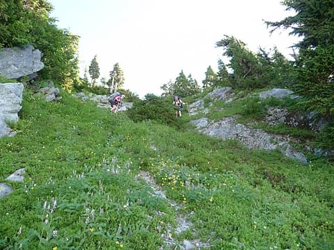 We descended from the jagged ridge line to gentler terrain. Gary and Jan carefully dropping down this steep, slippery slope. (photo: Jeff) 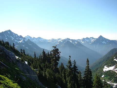 Our first good view of the route ahead. Mt. Delabarre on the left, Mt. Muncaster on the right. Muncaster Basin is stretched between these two peaks. This is we're headed. 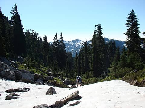 After descending from the ridge line, we traveled through a series of benches and talus slopes to the flanks of Mt. Delabarre. Jan and Jeff on one of the benches. 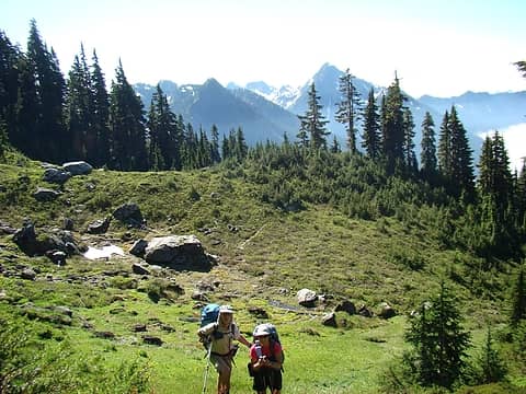 More easy terrain. 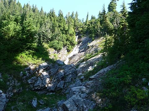 As we approached Delabarre, the easy travel was interrupted by more challenging sections. 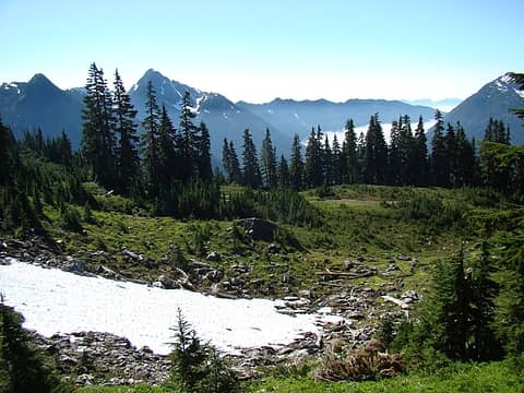 This was the last meadow we crossed before starting our descent to Rustler Creek. 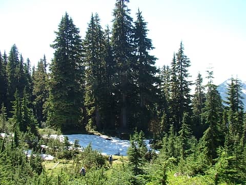 We explored several exits from the meadow in the previous photo, each dead ended in impassably steep terrain. Finally, Jeff found a route down a steep gulley past the snow patch. 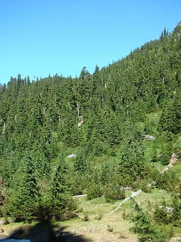 Looking back up our exit from the meadows above. 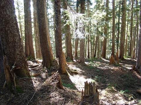 From this point we traveleded through old growth forest to near the confluence of the two major branches of Rustler Creek. Some sections were open old growth forests. 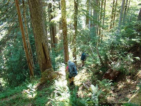 Other sections were complicated by the lush underbrush. 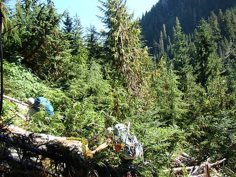 As we neared Rustler Creek, we came to a band of cliffs. This forced a decision to either traverse down stream towards the confluence of the two branches of Rustler Creek, or attempt to bushwhack upstream through dense vegetation to advance our route. We decided to head upstream. 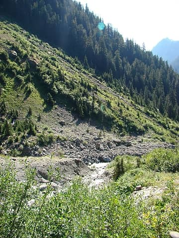 After 'shwacked our way through a couple hundred yards of Slide Alder, we exited at this feeder stream. We refreshed ourselves in the cool waters then continued through moderate terrain to Rustler Creek. 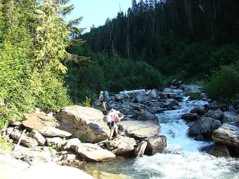 Jan and Jeff climbing into welcome shade. 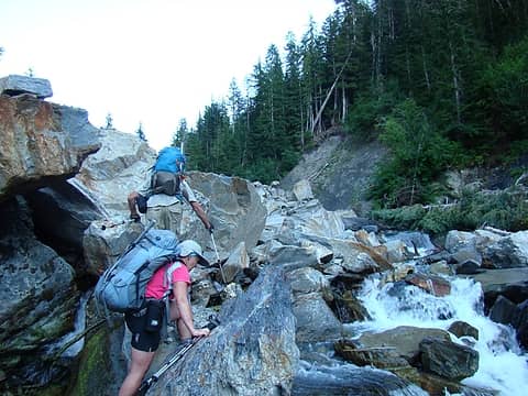 As we continued upstream, the terrain become more challenging. We were thrilled to be be able to stay near the creek. 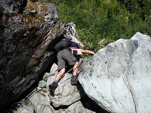 Gary climbing one of the steeper boulders. (photo: Jan). 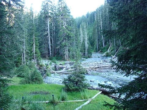 We knew eventually the terrain would mellow out and the valley would widen. This was our first view of "Rustler Creek Flats", we hoped to find a campsite in this area. 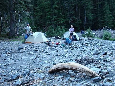 We found an excellent site for night 3. As evidenced in the foreground, we were not the first group to stay here this year. 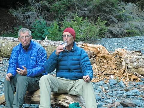 Fearing possibile of snake bite, Jeff and I vaccinated ourselves against this potential (photo: Jan). 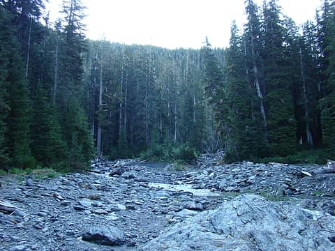 Day 4; After leaving camp, we had easy travel to warm up our cold, stiff muscles. 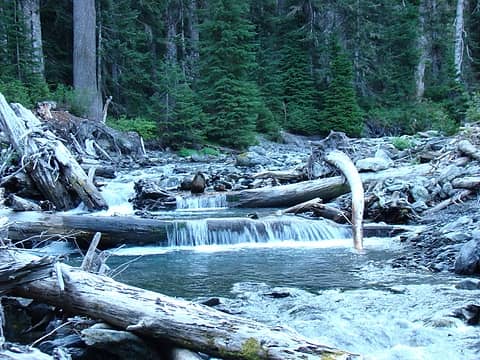 Rustler Creek 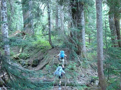 As we encountered obstacles along the creek, we ascended through moderate old growth terrain to work our way around them. 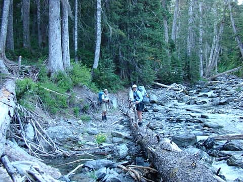 Each time we were rewarded with safe passage back to the creek. 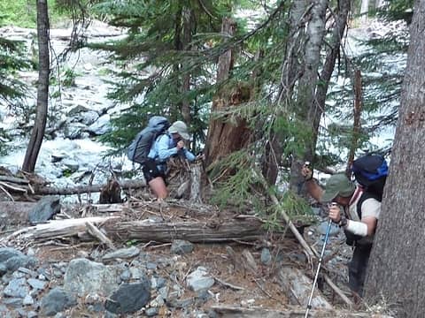 At this point a slide blocked upstream travel. We ascended a rugged slope to a bench high above the water. We could see the route ahead of us on this side of the creek was impassible. Our only choice was to drop back to Rustler Creek and look for a place to cross. (photo: Jeff) 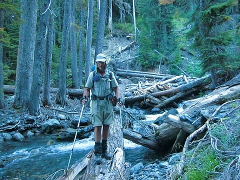 At the bottom of our descent, we found safe way to across Rustler Creek. This allowed us to continue towards the high country. Jeff walking the high log . (photo: Jan) 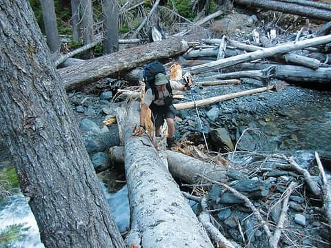 Gary crossing the less challenging lower route. (Photo, Jan) 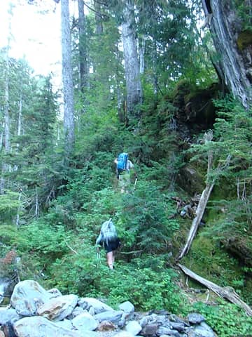 After crossing Rustler Creek, we climbed steep, but passable terrain. 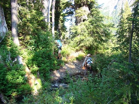 After some effort, we arrived at this stream. The cold water was refreshing. 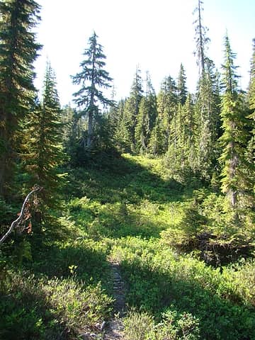 Soon after, we found this major game trail . We followed it upwards through a series of benches and moderate climbs. 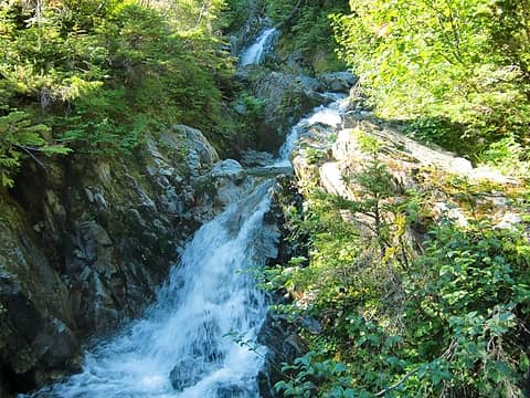 Our route was interlaced with several creek crossings. 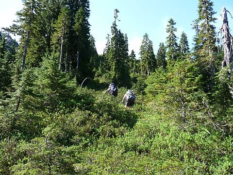 Eventually the route left the creek and steepened. 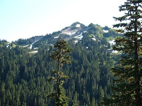 Our first view of the high country of the Muncaster environs. This peak is June 10th. 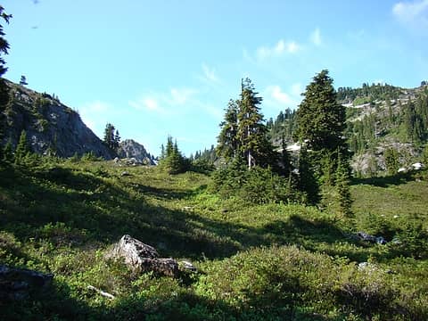 Finally, the forest transitioned into open alpine meadows. 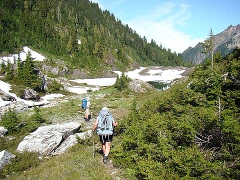 Jan and Jeff arriving at "Mushroom Lake". Although this lake is only at about elev. 4350', it was still mostly snow covered. 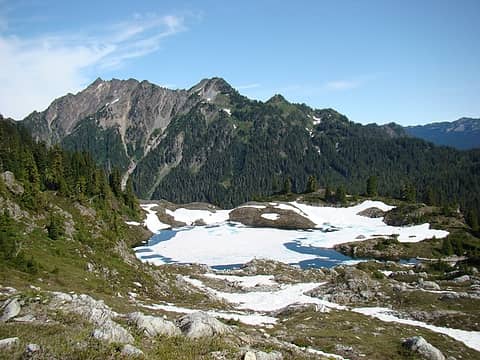 Mushroom Lake with Mt. Delabarre in the background. 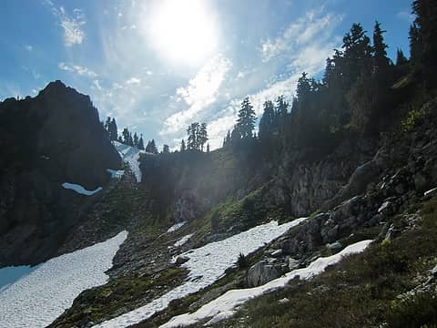 Later in the afternoon, we climbed into the south end of the basin scouting our route for the next day. The steep terrain encouraged us to explore further for an easier route. 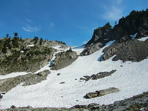 As we descended, we found a potential exit route. Some later map work at camp confirmed this the right way to go. 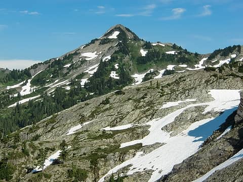 June 10th Peak 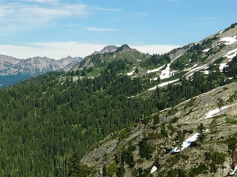 "Grudger Basin", north of June 10th Peak 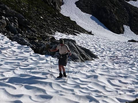 The suncups on the steeper snowfields gave us an opportunity to refine our mogul skiing technique. (photo; Jan) 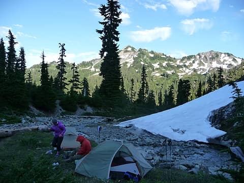 Our campsite for night 4. June 10th Peak in the background. 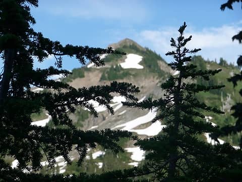 Evening in the alpine. 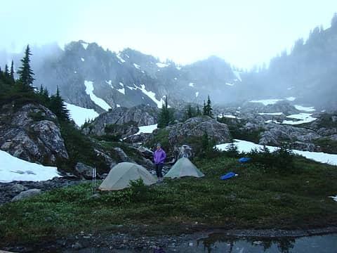 Day 5: We awoke to moist marine air from an approaching front rolling up out of Rustler Creek into the basin. 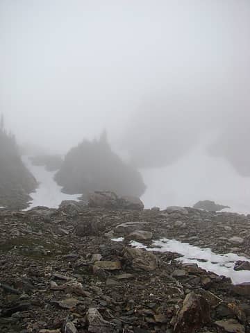 We were glad we had done some scouting yesterday. This picture is looking up our planned exit from the basin. 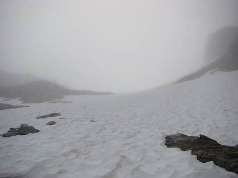 The final climb to the top of the exit slope. 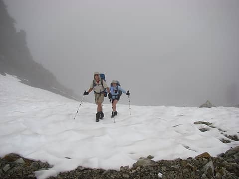 Jan and Jeff arriving at the col. 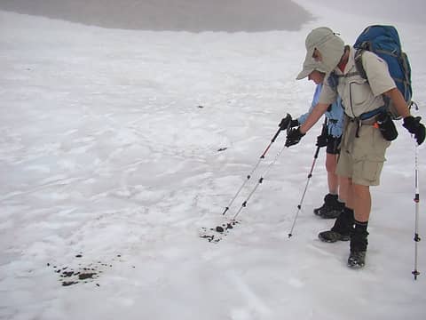 The flat upper basin was obviously popular with the local Elk herd. These flat slopes were covered with their tracks and droppings. 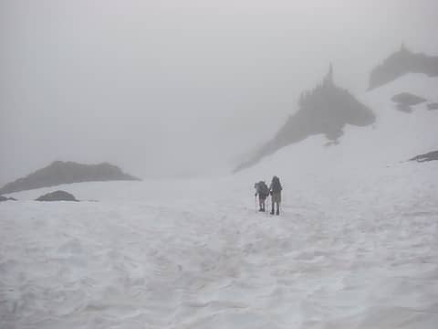 Climbing towards the next col. 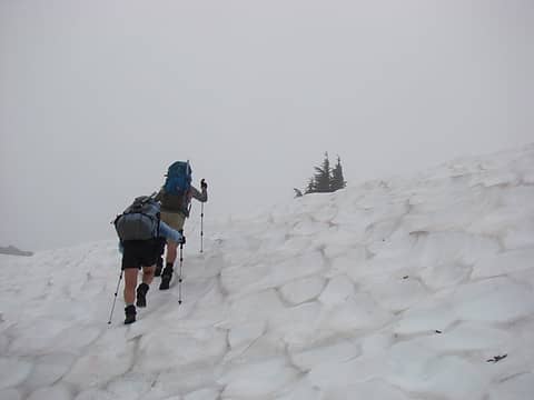 Not much further! 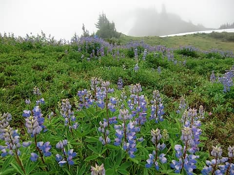 At the col we were greeted with an abundance of wildflowers (Photo: Jan). 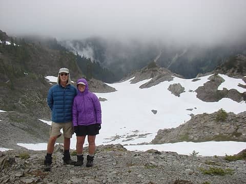 Jan and Jeff with our ascent route in the background. We had climbed from our campsite to the col in middle of the picture, then continued up to where this picture was taken. 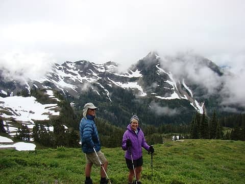 We waited at the col for almost 3 hours for the marine layer to subside. This is one of our first views of Muncaster Basin. 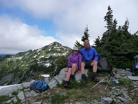 We had hoped to be able to travel north to June 10th Peak before heading south into the Muncaster Basin. Unfortunately, due to the persistent marine layer the sky did not clear early enough for us to do this. Jan and Gary with June 10 in the background. (Photo; Jeff) 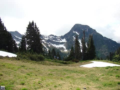 After lunch, we headed south into the main section of Muncaster Basin. Mt Muncaster is the tallest peak in the background. 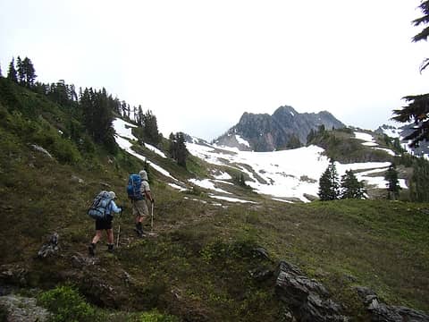 Again, we found major elk trails to follow. 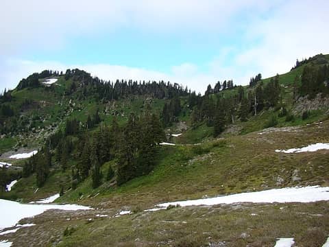 Looking back at our route from the col in the upper-center of the picture. 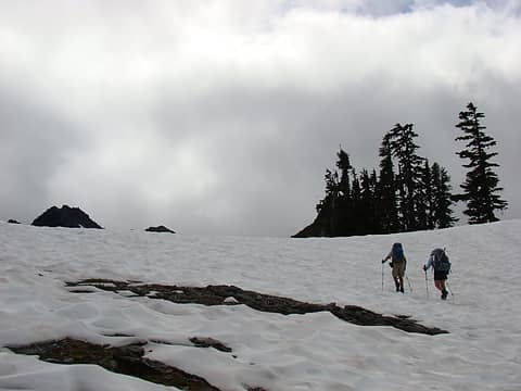 More September snow! 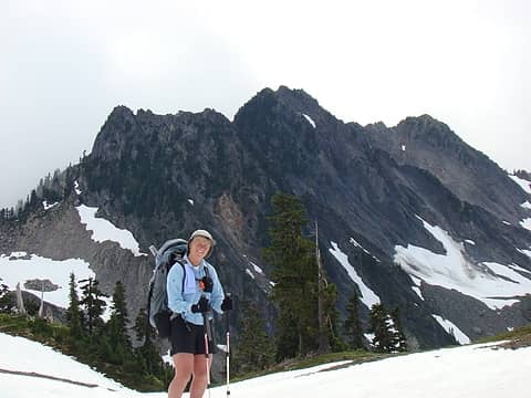 Jan found several faces in the rock ridge in the background. How many do you see? 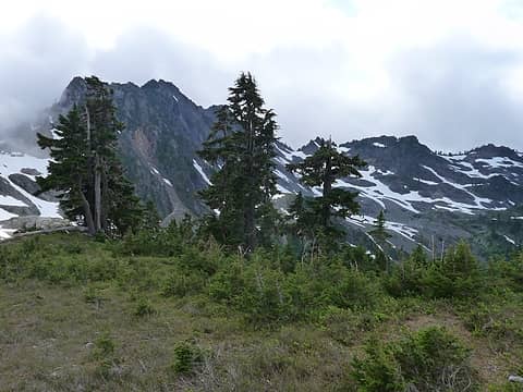 The route ahead through the upper basin. 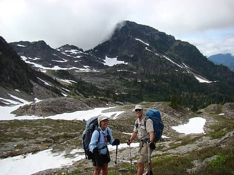 Mt Muncaster and the upper basin 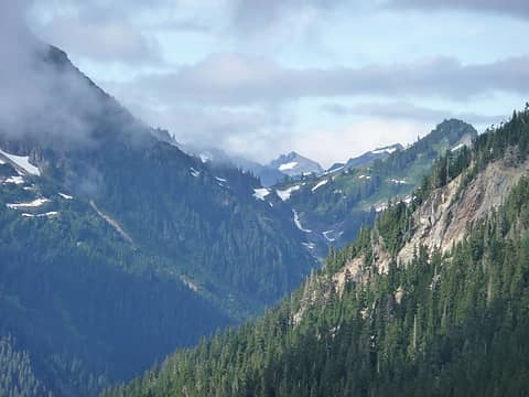 This shot is looking back at Christie Col, the start of our off trail travels 3 days ago. 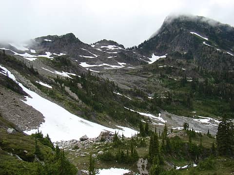 We continued south through moderate terrain towards Mt Muncaster. 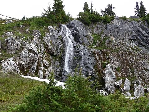 One of many waterfalls in the basin. 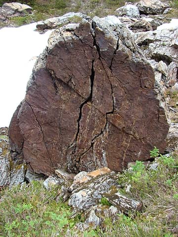 This fractured boulder was unique to others in this area, it caught our attention. 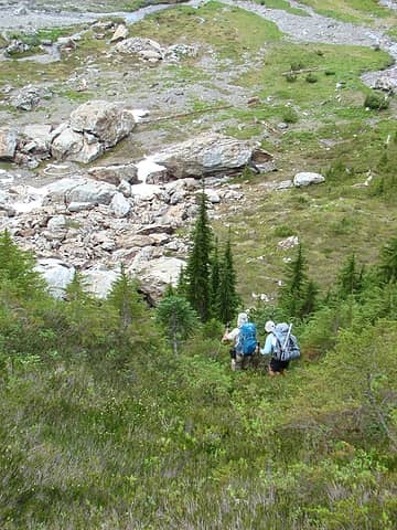 We had to descend into the lower basin in order to continue our route towards Mt Muncaster. 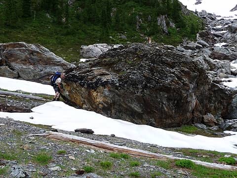 I tried my best to move this one out of our way. Eventually we had to hike around it! 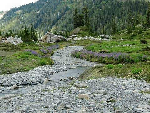 More September wildflowers in the lower basin. 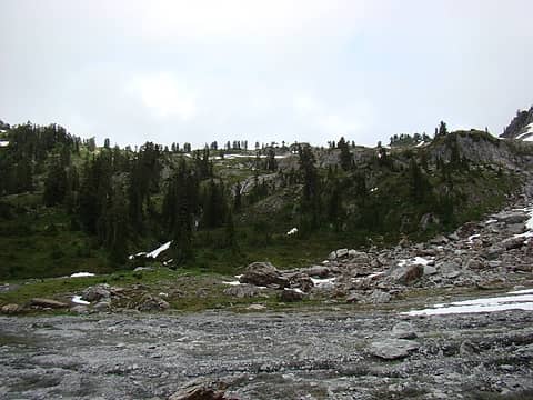 Looking back up the slopes we had just descended. 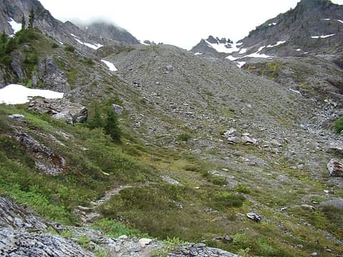 Our route ahead, another great game trail to follow. 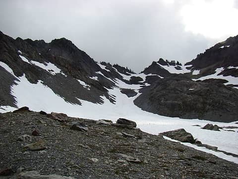 Our camp for night 5 would be on this rocky knoll. There was a great creek nearby. 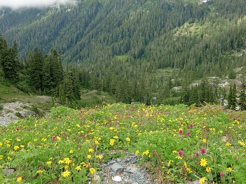 More wildflowers near camp. 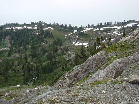 Looking back into Muncaster Basin from camp. 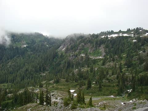 Looking further north into the basin from camp. 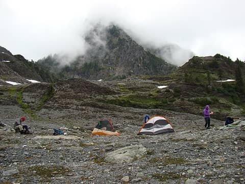 As the evening temps cooled, the fog returned. Mt Muncaster gradually disappeared into the mist. 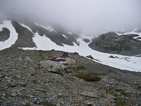 Pretty soon all we will have to look at is each other! 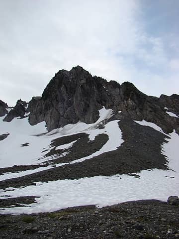 Jan found the debris from the previous night's event. It was a combination of ice and rockfall from this peak. The main debris pile can be seen near the center of the picture. 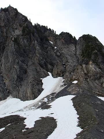 A closer look at the ice and rock debris. 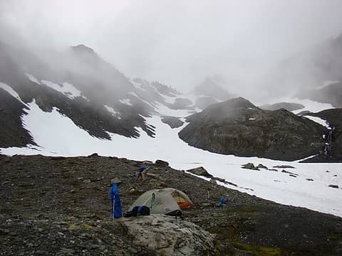 Day 6: We awoke to somewhat improved visibility. 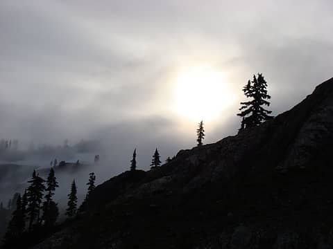 The sun trying to burn through the dense marine layer. 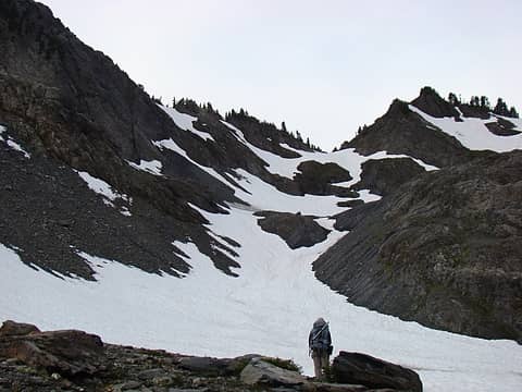 Jan checking out the route ahead as Jeff and I finish packing up. 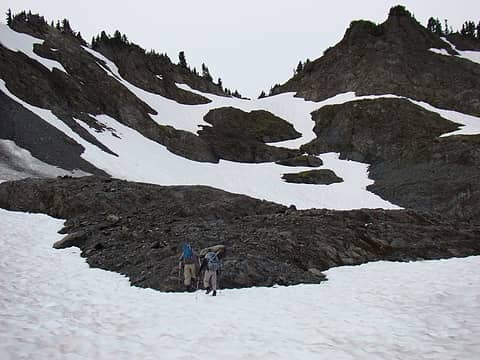 We climbed through mixed rock and snow towards the col. This would lead us to the Fire Creek drainage and our route home. 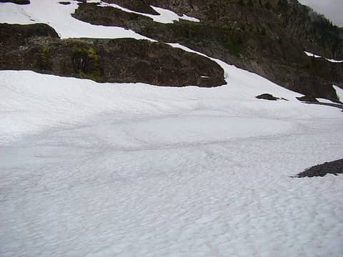 The lake in the upper basin at about elev. 4,800 ft., still frozen solid. 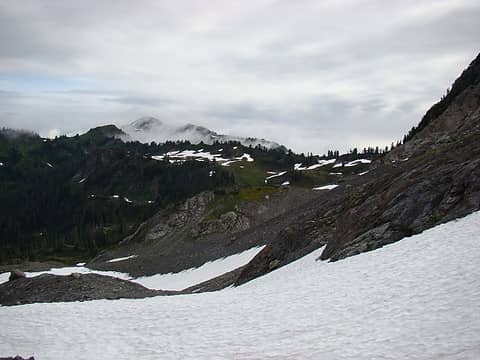 A last view of Muncaster Basin, June 10th peak in the distance. 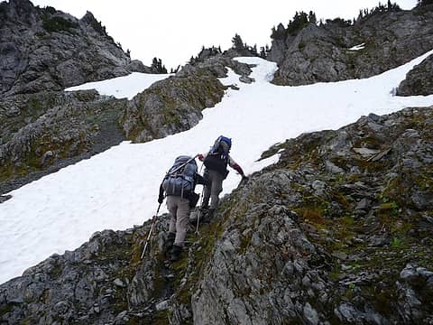 The route steepened as we climbed higher in the basin (photo: Jeff) 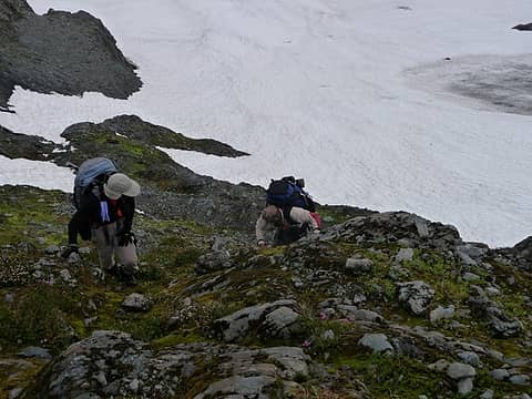 The final steep rock section had a series of ramps which provided a safe route through this difficult section (photo: Jeff). 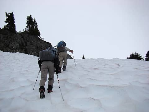 The final climb to the col was up this steep snow section. Our micro spikes proved handy for this section. 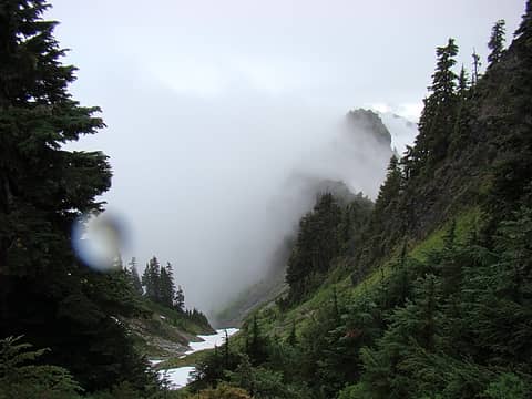 Our first view of upper Fire Creek Basin. 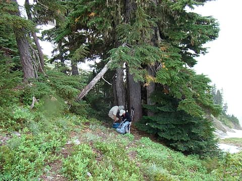 As we crossed the col, we were greeted by light rain. These trees provided welcome shelter to transition from uphill to downhill travel. 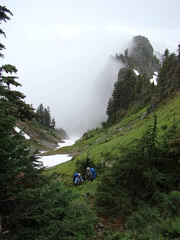 Once more, the elk showed us the way to go. Jan and Jeff on another great trail. 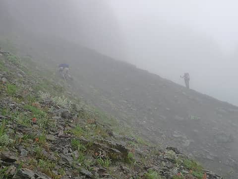 This descent would present a number of challenges. The first of which was some steep, hard scree near the top of a potentially long slide to an uncertain landing. We crossed it carefully in the wet conditions (photo: Jeff). 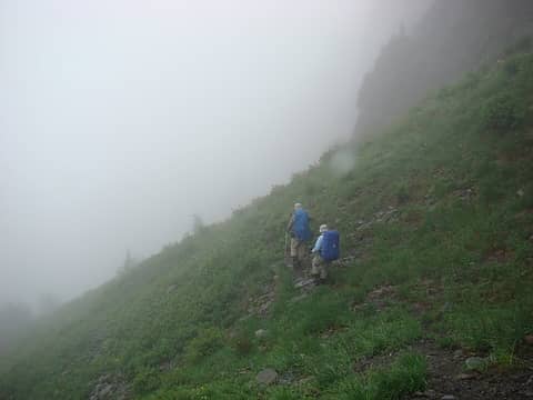 Back on the "trail". 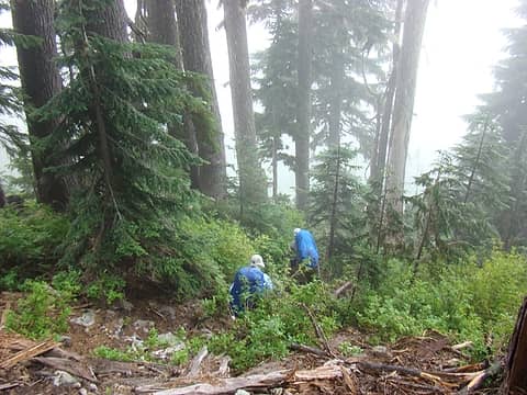 The route eventually lead us to a steep forested section. Again, we followed the game trails rather than our instincts. 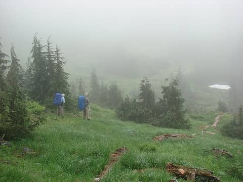 The trail lead us to this meadow, our instincts would have lead us to a cliff. 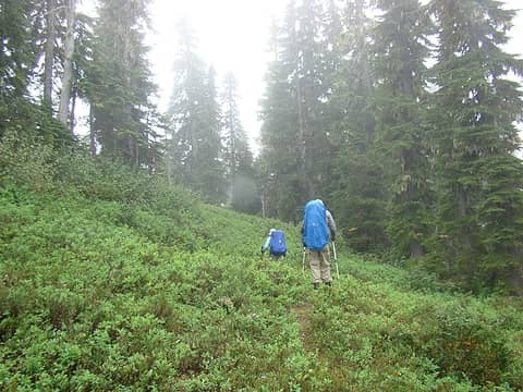 The next section would be a series of benches ........ 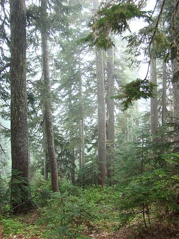 Separated by forested sections. 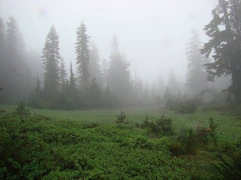 The final bench 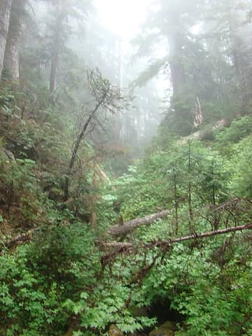 This steep gulley was an important find. The terrain on both sides would have been difficult at best. 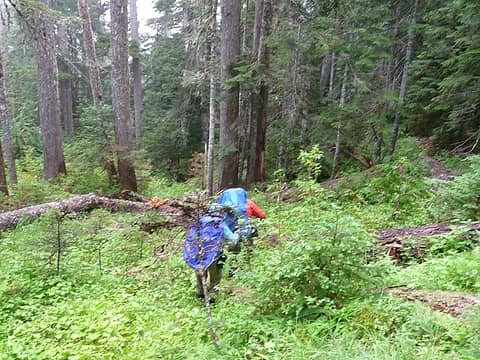 From this point we carefully descended a couple thousand feet through steep, wet, slippery forest. The travel was slower than we had anticipated. (photo: Jeff) 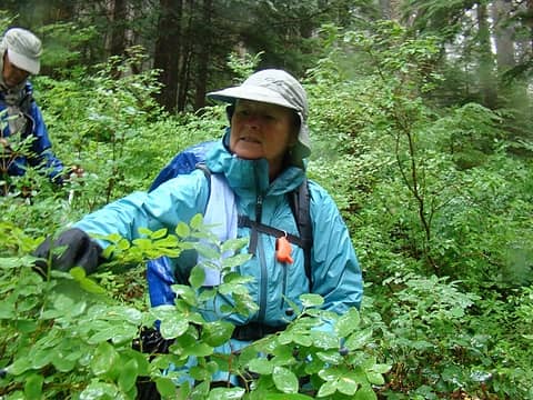 Again, at about elev 3,000 ft we encountered lush patches of blueberries. Jan enjoying berries on the go. 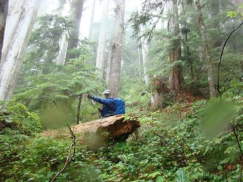 Let's keep going down! 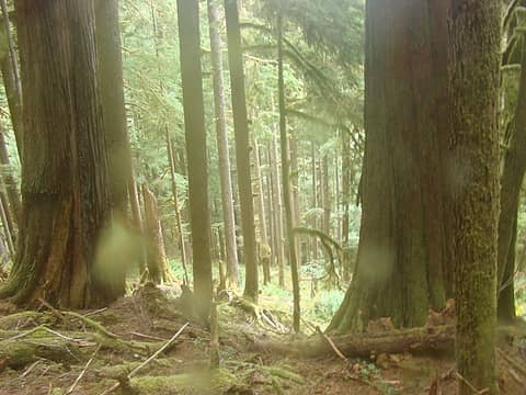 Good call Jeff 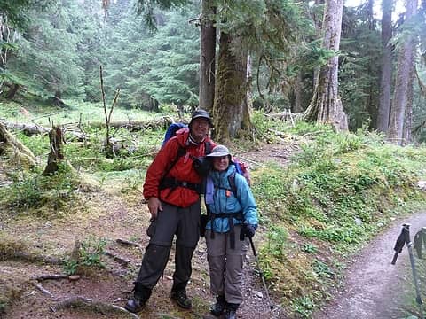 Finally back on the East Fork Trail!! (Photo; Jeff) 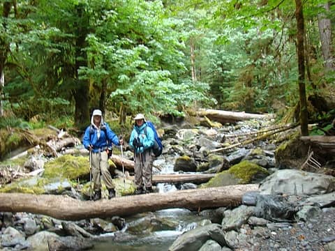 Fire Creek! 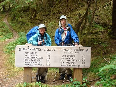 But how far is it back to the truck? Best guess ............ 10 miles. 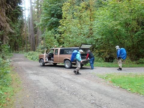 After a short walk down a long road, we ran into Barry, the "East Fork Camp Host". He volunteers up here every summer, mostly at his own expense. He acknowledged the road had opened only hours earlier. He kindly gave us a ride all the way back to our truck. He talked nonstop about his love for ONP and the Quinault River Valley. His help saved us hours of walking and potentially a very late return home. This was the perfect end to a perfect trip. PERFECT!!
|
| Back to top |
  
|
|
Magellan
Brutally Handsome

Joined: 26 Jul 2006
Posts: 13116 | TRs | Pics
Location: Inexorable descent |
|
Magellan
Brutally Handsome
|
 Sun Sep 25, 2011 10:13 pm |
|
|
Very cool trip.  Those elk trails are amazing. Those elk trails are amazing.
|
| Back to top |
|
|
Ancient Ambler
Member

Joined: 15 May 2007
Posts: 1092 | TRs | Pics
Location: Bainbridge Island |
So much for my plan to start working very early this AM! I've been looking forward to your TR, and the wait was definitely worth it. What a great trip you guys had. Really enjoyed your engaging account and looking at your excellent photos. Quite a lot of snow has melted since my trip to Delabarre from Martins Park in late July, and looking at your photos of that portion of the route, I'd say we probably had it easier travelling that section in snow. I really like the route you chose to get to Mushroom Lake from the flanks of Delabarre. Sounds like a stimulating test of your superb route-finding skills. Amazing how much snow remains at the lake at such a low elevation. You guys are really getting out there this year. Thanks so much for sharing your adventure with us.
|
| Back to top |
|
|
silence
Member

Joined: 25 Apr 2005
Posts: 4420 | TRs | Pics
|
|
silence
Member
|
Mon Sep 26, 2011 7:08 am |
|
|
having a preview yesterday .. you already know what i think .. pure awesomeness 
PHOTOS
FILMS
Keep a good head and always carry a light bulb. Bob Dylan
PHOTOS
FILMS
Keep a good head and always carry a light bulb. Bob Dylan
|
| Back to top |
|
|
Barefoot Jake
Professional Bum

Joined: 05 Sep 2010
Posts: 564 | TRs | Pics
Location: Olympic Peninsula |
Epic Adventure. Making us 'Young Guys' look bad 
|
| Back to top |
|
|
boomheist
Member

Joined: 25 Jul 2009
Posts: 55 | TRs | Pics
Location: tacoma |
Excellent report. It's now been five years but I remember that area well, though you sure had ten times the snow we did and our trip was in August. That Rustler Creek route seems to be the way to go. It seems you came down Fire Creek right down the creek valley? Were you on the north or south side of the creek? When we did that route we came up Fire Creek and we ended up coming over all the ridges and knobs to the north, which got pretty interesting, then we traversed under some peaks to the creek. I would guess you came down the steep meadows a ways then crossed the creek beneath those steep slabs to the north, but that's just a guess. Great trip!
|
| Back to top |
|
|
Trail Angel
Member

Joined: 21 Aug 2007
Posts: 611 | TRs | Pics
Location: Wallowas!! |
dang, you guys are hard core!!
I was exhausted just looking at the pics!
Job well done
|
| Back to top |
|
|
Phil
Member

Joined: 02 Jul 2003
Posts: 2025 | TRs | Pics
Location: Shoreline, WA |
|
Phil
Member
|
Mon Sep 26, 2011 1:52 pm |
|
|
I think I just found my favorite TR of the year, thank you!
I love how you guys post the map with route, too.
|
| Back to top |
|
|
Dayhike Mike
Bad MFKer
Joined: 02 Mar 2003
Posts: 10958 | TRs | Pics
Location: Going to Tukwila |
Ditto! This is a great trip! True adventure in some really wild country.
Thanks for sharing the details and pics of your adventure with us!
"There is only one basic human right, the right to do as you damn well please. And with it comes the only basic human duty, the duty to take the consequences." -P.J. O'Rourke
"Ignorance is natural. Stupidity takes commitment." -Solomon Short
"There is only one basic human right, the right to do as you damn well please. And with it comes the only basic human duty, the duty to take the consequences." -P.J. O'Rourke
"Ignorance is natural. Stupidity takes commitment." -Solomon Short
|
| Back to top |
|
|
Parked Out
Member

Joined: 18 Sep 2011
Posts: 508 | TRs | Pics
Location: Port Angeles, WA |
Geez Gary, after reading your report I feel like I've barely gotten away from the parking lot with my little ramblings. Great story and great adventure! Glad you were able to keep the snakes at bay.
|
| Back to top |
|
|
Lotus54
Member

Joined: 17 Oct 2010
Posts: 381 | TRs | Pics
Location: Port Angeles |
|
Lotus54
Member
|
Mon Sep 26, 2011 6:16 pm |
|
|
Blaine D. & I were going to go into Muncaster basin this week.
But a flyover a bit ago convinced me there was more snow than I wanted to make it fun.
I've been on some of that route, but I'm going to look through all the pics carefully.
Looks like fun!
Mark
|
| Back to top |
|
|
RichP
Member

Joined: 13 Jul 2006
Posts: 5633 | TRs | Pics
Location: here |
|
RichP
Member
|
Mon Sep 26, 2011 8:00 pm |
|
|
That is some really wild country. It looks like a trip that will be in your memory for a long time.
|
| Back to top |
|
|
Gary-n-Jan
Member
Joined: 25 Aug 2009
Posts: 56 | TRs | Pics
|
We are appreciative of all the replies to this post. I'll try to respond to the questions and comments ............
| Ancient Ambler wrote: | | So much for my plan to start working very early this AM! Quite a lot of snow has melted since my trip to Delabarre from Martins Park in late July, and looking at your photos of that portion of the route, I'd say we probably had it easier travelling that section in snow. I really like the route you chose to get to Mushroom Lake from the flanks of Delabarre. . |
Sorry if the post interfered with your work day, I'll try to be more considerate in the future.
We normally find it easier to travel on snow, especially if we are on skis!
Your TR on the Delabarre trip had me wishing I was with you two.
I think we were extremely lucky on the route we chose. I had concerns about what we would encounter in Rustler Creek after the huge snow year. Major avalanche debris, or a large landslide could easily have resulted in an impassible roadblock. Guess we were lucky.............
| silence wrote: | | having a preview yesterday .. you already know what i think .. pure awesomeness |
Thanks Kath .............
| BarefootJake wrote: | | Epic Adventure. Making us 'Young Guys' look bad |
Some words we try to live by .. "You don't stop doing things because you get older, You get older because you stop doing things." We just try to keep doing...........
| boomheist wrote: | | It seems you came down Fire Creek right down the creek valley? Were you on the north or south side of the creek? I would guess you came down the steep meadows a ways then crossed the creek beneath those steep slabs to the north, but that's just a guess. Great trip! |
I carried a copy of your TR on our trip, very helpful, thank you!
From the col, we descended to the right of the creek to the first flat meadows. At this point, we crossed to the left side of Fire Creek.
From here, we used the creek (on our right) and the ridge line (on our left) as "Handrails" for our descent. We picked the easiest terrain on a "case by case basis" on the way down. We ended up several hundred yards upstream of the confluence of Fire Creek with the E. Fork.
| Parked Out wrote: | | Geez Gary, after reading your report I feel like I've barely gotten away from the parking lot with my little ramblings. Great story and great adventure! Glad you were able to keep the snakes at bay. |
Your modesty is only exceeded by what you have done this summer in the mountains. I have enjoyed reading about your adventures.
We try to make sure we have adequate medical supplies for every eventuality.................
| Lotus54 wrote: | | Blaine D. & I were going to go into Muncaster basin this week.
But a flyover a bit ago convinced me there was more snow than I wanted to make it fun.
I've been on some of that route, but I'm going to look through all the pics carefully.
Looks like fun!
Mark |
I included the N Fork trail shots to show the results of Blaine's work to restore it. Jan and I ran into him and his crew in Sept., 2008 downstream of Wild Rose Creek on our return from our Skyline trip. They were headed in to work on this section. We had a lengthy conversation about how the trail to Low Divide was being rebuilt....
Thanks to you also for the info I gained from your TR of your 1975 travels. They added confidence that our planned route might go. Glad we didn't encounter some of the challenges you guys experienced.
Gary
|
| Back to top |
|
|
Lotus54
Member
Joined: 17 Oct 2010
Posts: 381 | TRs | Pics
Location: Port Angeles |
|
Lotus54
Member
|
Fri Sep 30, 2011 1:03 pm |
|
|
| Gary-n-Jan wrote: | As we approached Delabarre, the easy travel was interrupted by more challenging sections. |
Same spot!
We headed down right at this place, then hit the old trail going upstream.
Except for the avalanche area, it was pretty good going.
Oh yeah, I think the axe is still there.
You didn't happen to see one at this spot, did you?
Looking back up where he left the axe (well, that is my memory anyway)
Mark
|
| Back to top |
|
|
Phil
Member
Joined: 02 Jul 2003
Posts: 2025 | TRs | Pics
Location: Shoreline, WA |
|
Phil
Member
|
Fri Sep 30, 2011 1:56 pm |
|
|
Brilliant now-versus-then shots!
|
| Back to top |
|
|
|
|
You cannot post new topics in this forum
You cannot reply to topics in this forum
You cannot edit your posts in this forum
You cannot delete your posts in this forum
You cannot vote in polls in this forum
|
Disclosure: As an Amazon Associate NWHikers.net earns from qualifying purchases when you use our link(s). |


