| Previous :: Next Topic |
| Author |
Message |
Matt
Tea, Earl Grey, Hot


Joined: 30 Jan 2007
Posts: 4307 | TRs | Pics
Location: Shoreline |
|
Matt
Tea, Earl Grey, Hot
|
 Sun Feb 26, 2012 12:09 am |
|
|
Exceeding the Daylight on Chokwich & West Twin
Date: January 11, 2012
Destination: Chokwich 5662 & West Twin Peak 5840 (USGS Bedal)
Party: Matt, Dicey, Yana, Gabriel, Lindsay
The trip ascended Chokwich Peak and the west summit of Twin Peaks, approaching from Perry Creek. We used the same route reported in Stefans trip report.
We hiked up Perry Creek, then continued east to the 5450 high point on the ridge above Perrys headwater basin. This point is actually a Y-shaped junction between the ridges extending north to Forgotten, south to Twin Peaks, and east to Chokwich. From there we took the east branch down to a col and back up to Chokwich. Later, returning back to the Perry Creek side, we traversed south and up to the Twin Peaks col and climbed West Twin Peak.
For ease of reference, I am assigning names to the features where we spent most of the day:
The long north-south ridge at the head of Perry Creek connecting Twin Peaks & Forgotten is TwinGotten Ridge.
The 5450 junction point is ChokTwin Point.
The col between ChokTwin Point & Chokwich is Chokwich Col.
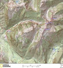 Chokwich & West Twin Track  Elevation Profile 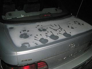 Frosty handprints still on the car from Seattle 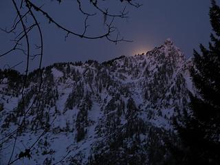 Moon setting behind Hall Peak, from the Dickerman/Perry connector trail 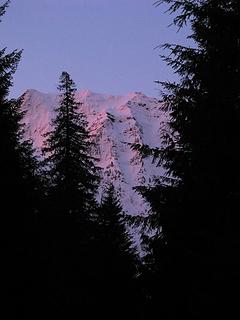 Pink dawn on Big Four from the Perry Creek Road 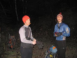 Cookies at the Perry Creek trailhead 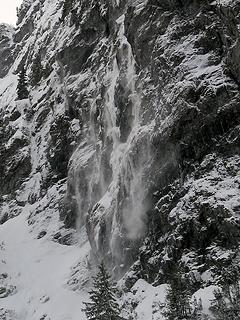 Little spindrift avalanches off the east cliffs of Dickerman 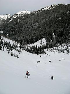 Hiking snowfields out up from Perry Creek 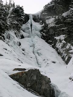 Suggestive ice formation (it was the women, not the men, who pointed out the anatomical analogy) 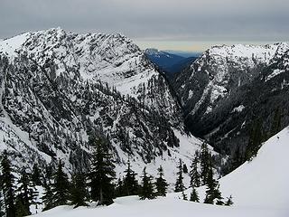 Looking back at the Perry Creek valley between Dickerman & Stillaguamish 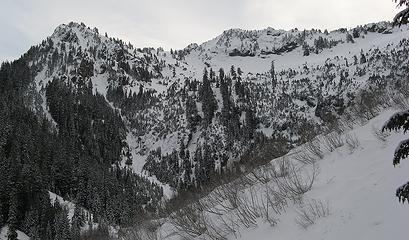 Route up the ridge angling below rock bands from right middle up to center top, then over the high point in the center 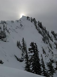 Clouded sun behind the corniced crest 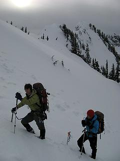 Kicking steps up toward the crest 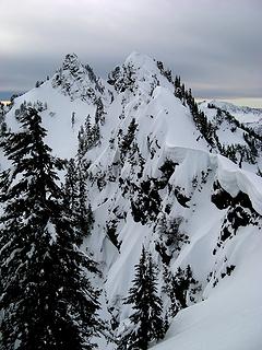 Wildly corniced east side of the crest 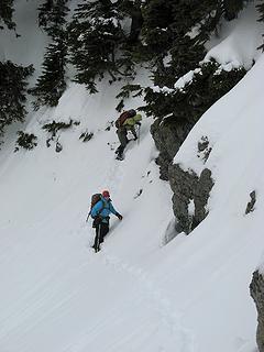 Getting around a steep outcrop 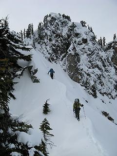 Working down the ridge, with ChokTwin Point behind 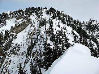 A bit of an arête, with Chokwich ahead 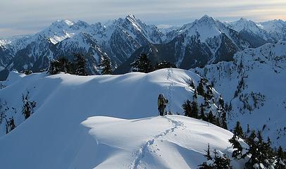 Yana arriving on Chokwich 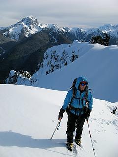 Dicey arriving on Chokwich, with Sloan beyond 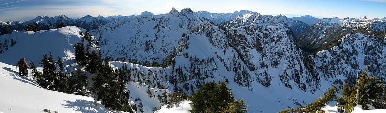 Looking back at the terrain from Chokwich: Twin Peaks is at upper center, Perry Creek is at left, the ridge we descended to get across the dividing wall is right in the middle (below Twin Peaks) 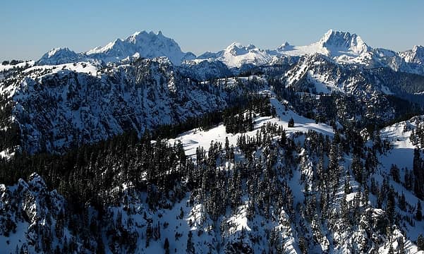 Three Fingers crest 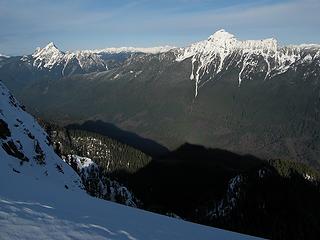 Shadow of Chokwich on the Sauk Valley below Pugh 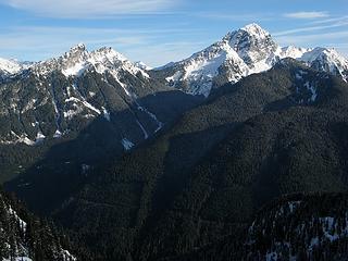 Bedal, Sloan, and Slodal 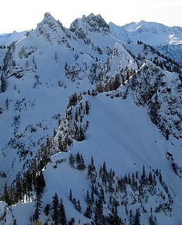 Twin Peaks, and our approach ridge 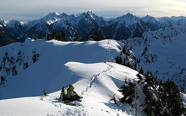 Lunch & Monte Cristo Group 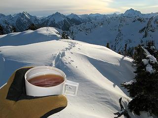 Chokwich summit tea  Camera Fall  Summit Dance 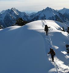 Departing Chokwich 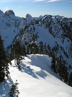 Gotta climb back up across that 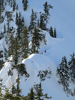 Our tracks on the connector 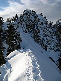 Re-crossing the arête 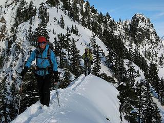 On the arête (Yana needs a brighter jacket) 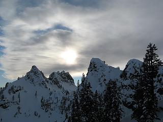 Suncloud over Twin Peaks 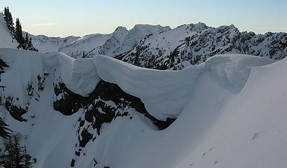 Looking over the cornice line to Big Four & Dickerman 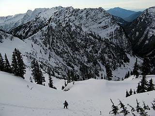 Dropping back to our snowshoes on the Perry Creek side 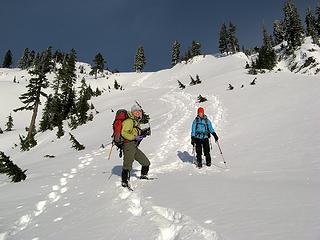 Sunshine! 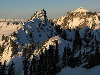 ChokTwin Point, Chokwich, and the tip of Sloan 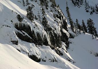 Hiking past walls of icicles 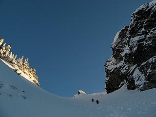 Approaching the col 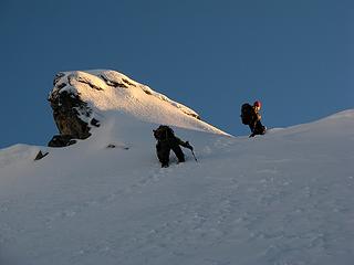 Crossing into sunlight 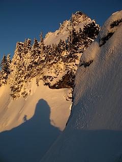 My shadow from the col onto East Twin 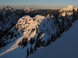 Late light on Forgotten, Whitechuck, ChokTwin Point, Chokwich & Sloan 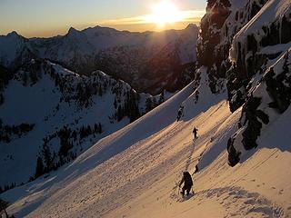 Traversing below West Twin 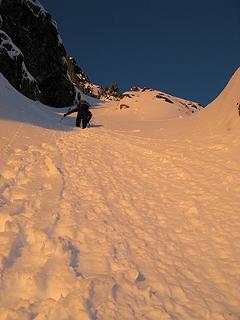 Dicey leading up the gully to the summit area 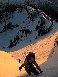 Yana ascending the gully 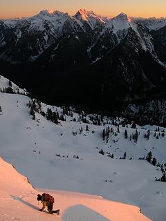 Turning a steep corner 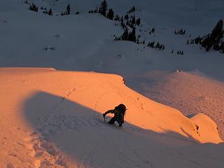 Climber in the last orange light 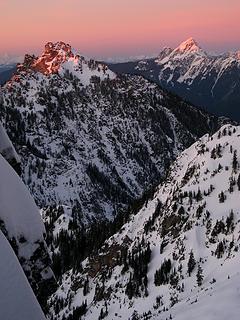 View through the notch: Forgotten & Whitechuck 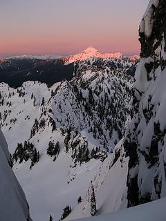 View through the notch: ChokTwin Point & Chokwich in shadow, Pugh in alpenglow 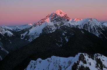 Sloan 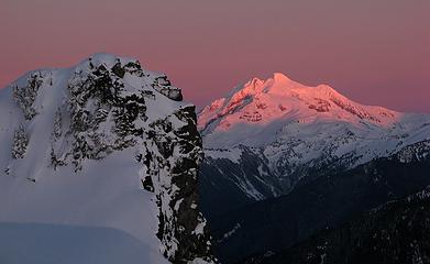 East Twin & Glacier 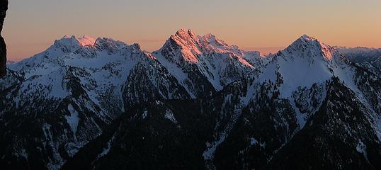 Monte Cristo Peaks 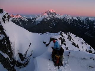 Gearing up 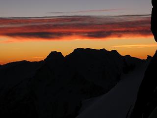 Sun gone behind Big Four 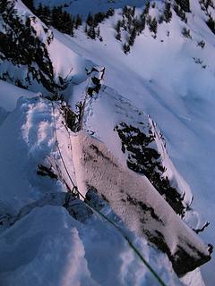 Looking down the belay line 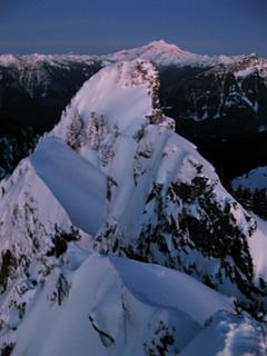 Summit View looking east 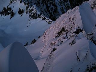 Looking north down to our tracks 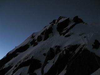 Diceys light near the summit 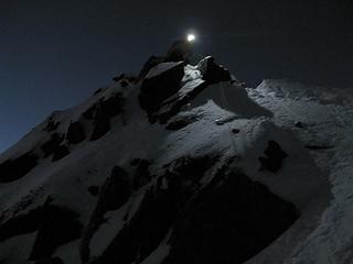 Dicey descending 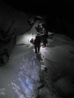 Packing our gear at the notch 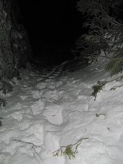 Down into darkness 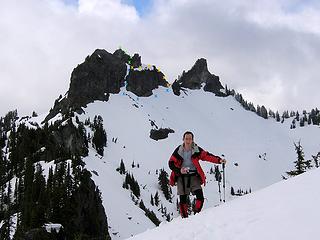 Twin Peaks summits from the south. Yellow line is summer route. Blue line is winter route. Green line is summit finish for either. 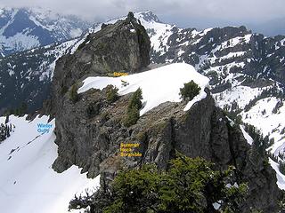 West Twin summit and routes viewed from East Twin. 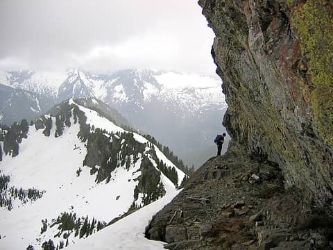 The ramp that cuts around the eastern fin of West Twin. 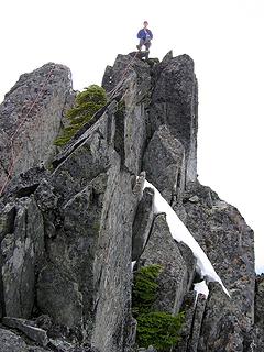 West Twin summit without snow 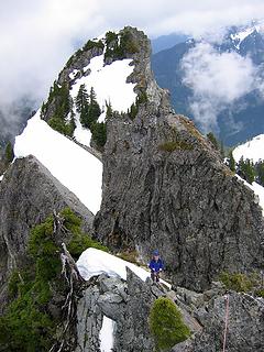 Looking down at the West Twin belay 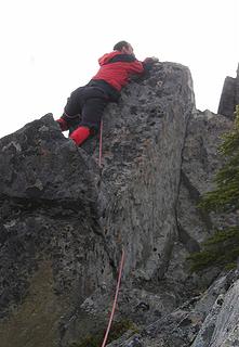 Awkward with or without snow
As beacons mountains burned at evening. J.R.R. Tolkien
As beacons mountains burned at evening. J.R.R. Tolkien
|
| Back to top |
  
|
|
yukon222
Member

Joined: 12 Mar 2007
Posts: 1893 | TRs | Pics
|
|
yukon222
Member
|
Sun Feb 26, 2012 9:09 am |
|
|
Another stellar trip by you and your crew! I really like how you always take the time to snap pics throughout the entire adventure - even at tricky spots where photography is difficult. The full picture set tells the complete story of the day.
Well done!!
|
| Back to top |
|
|
Magellan
Brutally Handsome

Joined: 26 Jul 2006
Posts: 13116 | TRs | Pics
Location: Inexorable descent |
|
Magellan
Brutally Handsome
|
Sun Feb 26, 2012 10:30 am |
|
|
Awesome adventure right in the middle of winter.  Another high quality trip report Matt. Thanks for writing it up. Another high quality trip report Matt. Thanks for writing it up.
|
| Back to top |
|
|
BarbE
Member

Joined: 28 Jul 2006
Posts: 1153 | TRs | Pics
|
|
BarbE
Member
|
Sun Feb 26, 2012 3:33 pm |
|
|
Many of Matt's TR's inspire to follow in his footsteps. Most of them, including this one will stay out of reach for most of us.
How exciting to live vicariously through his story telling and pictures.
Thanks Matt, for another great one! 
|
| Back to top |
|
|
puzzlr
Mid Fork Rocks

Joined: 13 Feb 2007
Posts: 7220 | TRs | Pics
Location: Stuck in the middle |
|
puzzlr
Mid Fork Rocks
|
Sun Feb 26, 2012 4:27 pm |
|
|
Evening in winter scares me, and I hurry down before dark. You seem to thrive on winter climbs well beyond dusk! I think I'll do these some sunny September.
|
| Back to top |
|
|
iron
Member

Joined: 10 Aug 2008
Posts: 6392 | TRs | Pics
Location: southeast kootenays |
|
iron
Member
|
Sun Feb 26, 2012 5:25 pm |
|
|
hooray for the return of the summit sunset series!
and yes, anatomically pretty close 
|
| Back to top |
|
|
popzeus
Member

Joined: 18 Apr 2011
Posts: 136 | TRs | Pics
Location: Kenmore, WA |
|
popzeus
Member
|
Sun Feb 26, 2012 8:40 pm |
|
|
Wow, that looks like an awesome day (and night).
You parked at the Dickerman TH? Is the MLH open again?
|
| Back to top |
|
|
Matt
Tea, Earl Grey, Hot
Joined: 30 Jan 2007
Posts: 4307 | TRs | Pics
Location: Shoreline |
|
Matt
Tea, Earl Grey, Hot
|
Sun Feb 26, 2012 11:44 pm |
|
|
| popzeus wrote: | | You parked at the Dickerman TH? Is the MLH open again? |
Sorry, I'm catching up on previous trip reports, so this was on 1/11/12. Currently the road is closed a the Deer Creek gate.
| puzzlr wrote: | | Evening in winter scares me, and I hurry down before dark. You seem to thrive on winter climbs well beyond dusk! |
If I have to descend in the dark, I prefer winter, because there are tracks in the snow to follow.
And I do enjoy sunset summits. But the other explanation is that I'm just slow; Stefan's group did this same trip plus East Twin in much less time.
As beacons mountains burned at evening. J.R.R. Tolkien
As beacons mountains burned at evening. J.R.R. Tolkien
|
| Back to top |
|
|
Yana
Hater

Joined: 04 Jun 2004
Posts: 4212 | TRs | Pics
Location: Out Hating |
|
Yana
Hater
|
Mon Feb 27, 2012 10:35 am |
|
|
Great trip report as always, Matt!
I particularly enjoyed the feature names and the comparison photographs from your 2004 trip!
PLAY SAFE! SKI ONLY IN CLOCKWISE DIRECTION! LET'S ALL HAVE FUN TOGETHER!
PLAY SAFE! SKI ONLY IN CLOCKWISE DIRECTION! LET'S ALL HAVE FUN TOGETHER!
|
| Back to top |
|
|
Mike Collins
Member

Joined: 18 Dec 2001
Posts: 3096 | TRs | Pics
|
|
| Back to top |
|
|
Go Jo
of the lykkens

Joined: 08 Jun 2003
Posts: 2248 | TRs | Pics
Location: Around The Bend |
|
Go Jo
of the lykkens
|
Mon Feb 27, 2012 1:34 pm |
|
|
Fantastic write-up of what sounds to be a great mountain experience!
|
| Back to top |
|
|
popzeus
Member
Joined: 18 Apr 2011
Posts: 136 | TRs | Pics
Location: Kenmore, WA |
|
popzeus
Member
|
Mon Feb 27, 2012 4:04 pm |
|
|
| Matt wrote: | | popzeus wrote: | | You parked at the Dickerman TH? Is the MLH open again? |
Sorry, I'm catching up on previous trip reports, so this was on 1/11/12. Currently the road is closed a the Deer Creek gate. |
No, my bad, it is the first thing written in your report. I was too mesmerized by that slide show...  Even if I could get to the trailhead, doing this in the snow is a bit above my comfort level. Maybe after I have a bit more experience under my belt.
A very inspiring trip report nonetheless.
Even if I could get to the trailhead, doing this in the snow is a bit above my comfort level. Maybe after I have a bit more experience under my belt.
A very inspiring trip report nonetheless.
|
| Back to top |
|
|
|
|
You cannot post new topics in this forum
You cannot reply to topics in this forum
You cannot edit your posts in this forum
You cannot delete your posts in this forum
You cannot vote in polls in this forum
|
Disclosure: As an Amazon Associate NWHikers.net earns from qualifying purchases when you use our link(s). |


