| Previous :: Next Topic |
| Author |
Message |
cartman
Member


Joined: 20 Feb 2007
Posts: 2800 | TRs | Pics
Location: Fremont |
|
cartman
Member
|
 Sun Apr 08, 2012 5:46 pm |
|
|
This easily accessible peak has had numerous parties turn back due to route-finding problems, weather, confusion as to which is the true summit or other concerns in the past few years. I'd attempted it nine years ago and turned around on the north ridge because of weather and time.
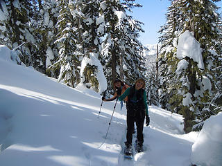
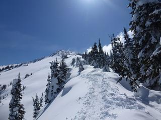
Recruiting Matt, Greg, Suzanne, Barry, Barb, and Elle, along with canine compatriots Gusto and Izzy, we started at the Lanham Lake TH and made good time under mostly blue skies to frozen Lanham Lake, 4140'. Jim Hill was shrouded in clouds, but here is what we would have seen (photos taken on the return):
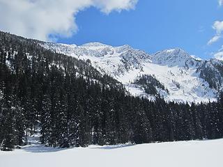 Jim Hill from Lanham Lake 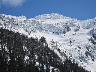 Jim Hill true summit 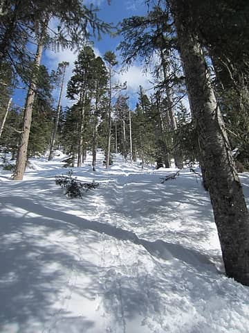 Up to the North Ridge 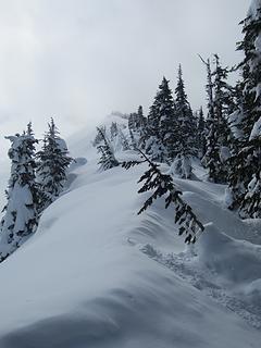 Jim Hill North Ridge 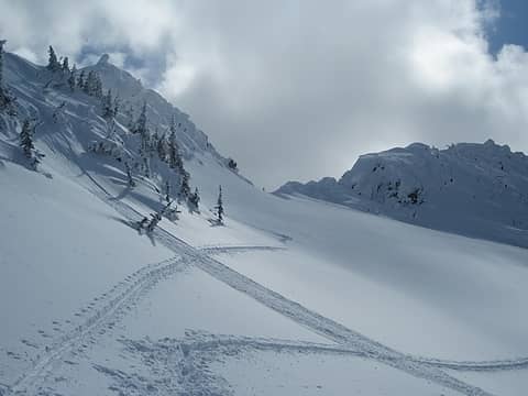 Col between false and true summits 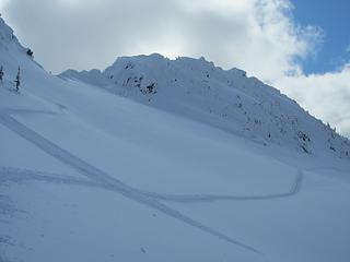 Our route 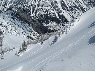 Others waiting below false summit 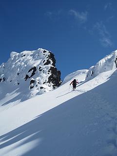 Matt approaching the col 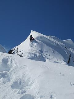 Matt on the nose 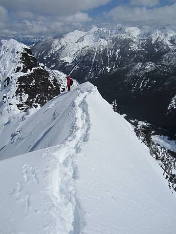 The Arete 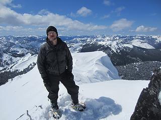 Jim Hill summit 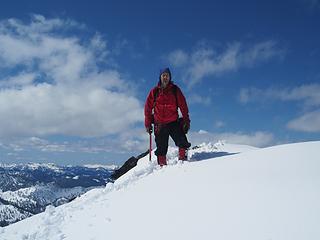 Matt on Jim Hill summit 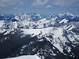 Baring group on L, Fernow group on R  Dickerman area and Sloan 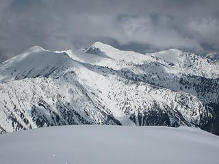 Rock, Howard, Mastiff 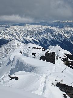 Arrowhead center L, Nason Ridge behind 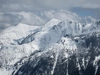 Middle Chiwaukum 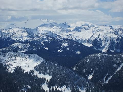 Daniel, Hinman 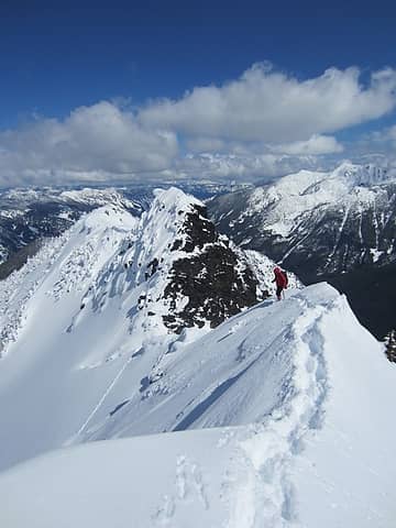 Matt descending the nose 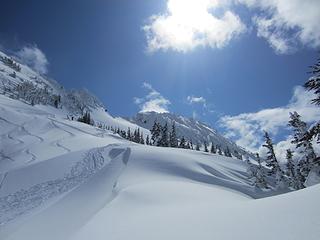 Last views from the ridge
|
| Back to top |
  
|
|
Matt
Tea, Earl Grey, Hot

Joined: 30 Jan 2007
Posts: 4307 | TRs | Pics
Location: Shoreline |
|
Matt
Tea, Earl Grey, Hot
|
Sun Apr 08, 2012 6:10 pm |
|
|
Date: April 7, 2012
Destination: Jim Hill Mtn (USGS Stevens Pass), 6765 feet, 2085P
Party: Matt, cartman, Greg L, Sadies Driver, MiddleE, Snowdog, BarbE, (and dogs Gusto & Isabel)
Capsule description of the route:
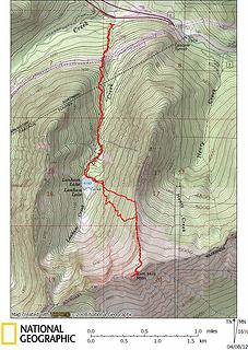
Park at Steven Pass Nordic area. 3000 ft. Follow trail to Lanham Lake, 4143. Turn left and go ESE to col on Jim Hills north ridge 5500. Turn right and follow ridge south to just below the eastern false summit, 6450. Cross snowfield at lowest angle to 6600-foot col. Follow crest west to summit 6765.
 Jim Hill route track 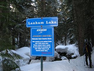 Snowshoers! Dont walk on the groomed road. 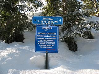 Seriously, keep your dirty snowshoes off of the groomed road. 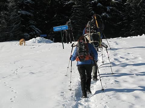 Follow these signs to Lanham Lake; dont even think of using the road. 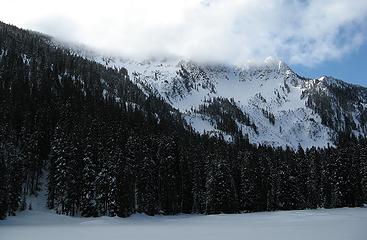 Clouded summit from Lanham Lake 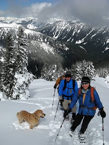 On the north ridge of Jim Hill 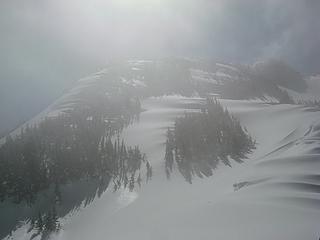 Hazy view above 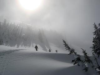 Sun trying to burn through 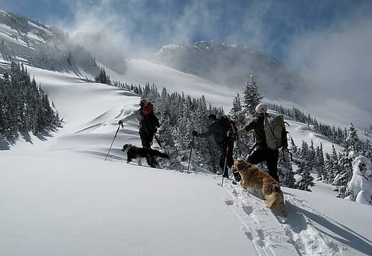 The col and summit come into sight above the ridge 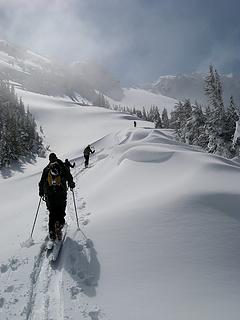 Further up toward the col 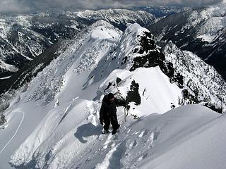 Eric on the crest nearing the summit 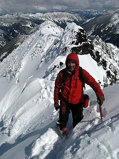 Me near the top of the ridge 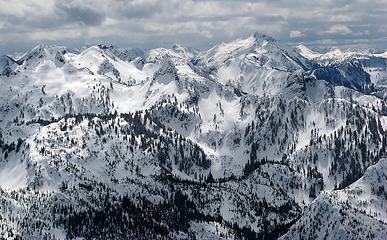 Lots of peaks south of us 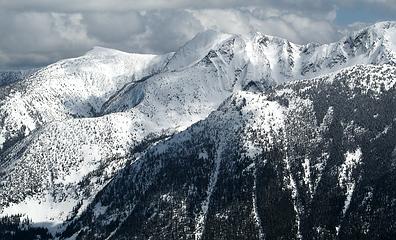 Middle Chiwaukum 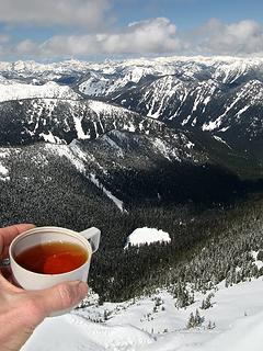 Summit tea and Lanham Lake 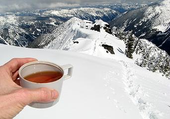 Summit tea looking back down the summit ridge 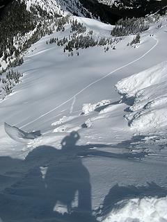 My shadow looking back down at some skiers standing where our group separated 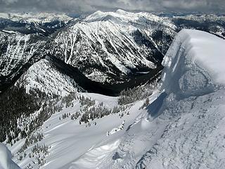 Looking off the summit ridge to the approach ridge (with Howard & Mastiff beyond) 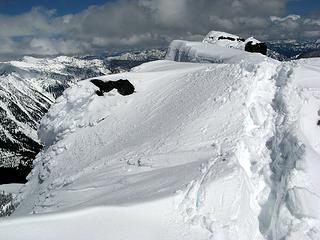 Tracks atop the summit ridge 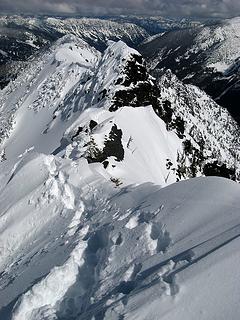 Further down the ridge 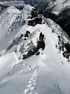 Tracks cutting around some rock outcrops and onward to the arete 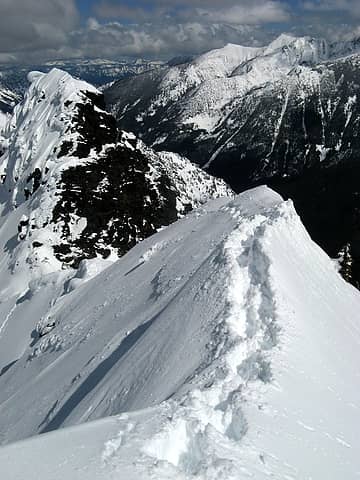 The arête section 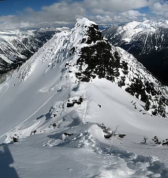 Stitched shot of our tracks on the ridge and up to the col 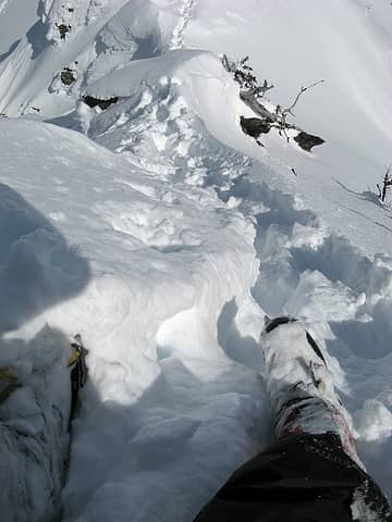 Boot shot 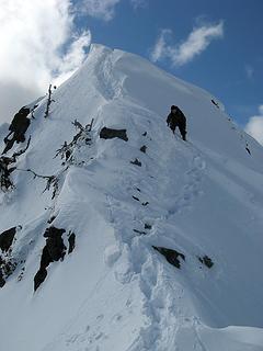 Eric descending the steeper nose 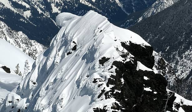 The arête and odd cornice on the false summit 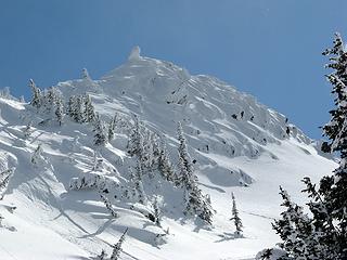 False summit from below 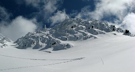 Wild lighting and clouds behind the false summit 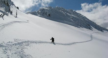 Eric returning across the snowfield below the col 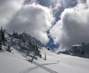 Col between the summits and between the clouds (foreground tracks are skiers, ours traversed lower and barely visible coming up the far side to the col) 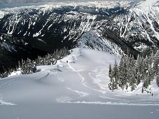 Eric heading back down the approach ridge 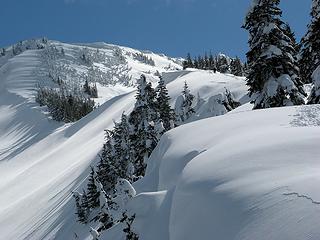 Further down the approach ridge 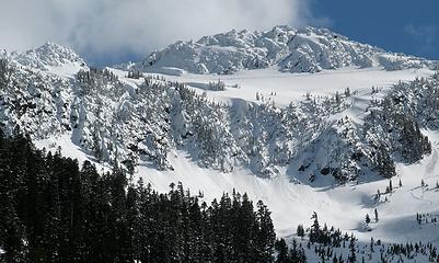 Jim Hill summit area viewed from Lanham Lake 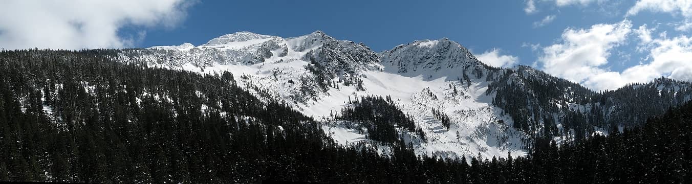 Pan of Jim Hill from Lanham Lake with many ski tracks
As beacons mountains burned at evening. J.R.R. Tolkien
As beacons mountains burned at evening. J.R.R. Tolkien
|
| Back to top |
|
|
Redwic
Unlisted Free Agent

Joined: 23 Feb 2009
Posts: 3292 | TRs | Pics
Location: Going to the Prom(inence) |
|
Redwic
Unlisted Free Agent
|
Sun Apr 08, 2012 7:16 pm |
|
|
60 pounds lighter but not 60 points brighter.
|
| Back to top |
|
|
BarbE
Member

Joined: 28 Jul 2006
Posts: 1153 | TRs | Pics
|
|
BarbE
Member
|
Sun Apr 08, 2012 7:28 pm |
|
|
Glad you and Matt persevered and made the summit.  It looked pretty daunting from our viewpoint. The beautiful ridge walk made up for not reaching the summit.
Love the Arete shot!
A few more pics.
It looked pretty daunting from our viewpoint. The beautiful ridge walk made up for not reaching the summit.
Love the Arete shot!
A few more pics.
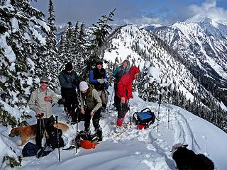 finally at the ridge 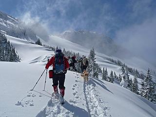 starting up the ridge 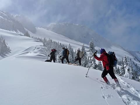 Jim Hill April 8 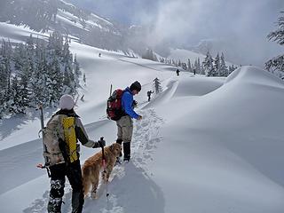 clouds obscure the summit 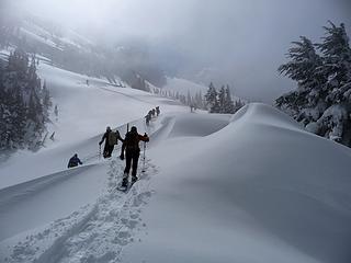 walking into the clouds.. 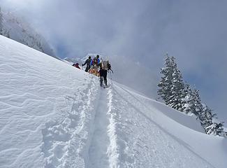 ...and into the light 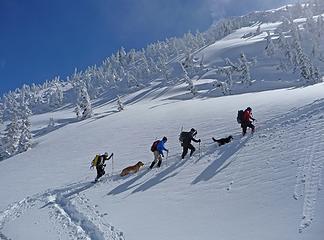 on a mission 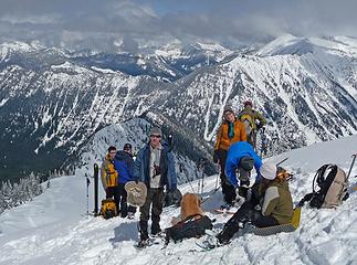 lunch stop, our destination for the day 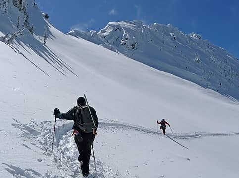 Matt and Eric continue 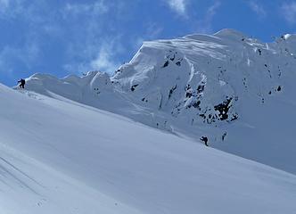 almost at the col 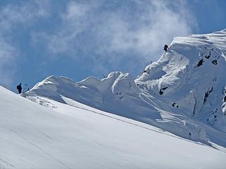 Cartman getting ready, Matt climbing 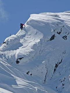 Matt climbs first obstacle 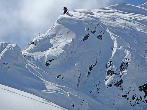 Matt on top of the nose 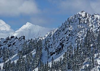 Middle Chiwaukum 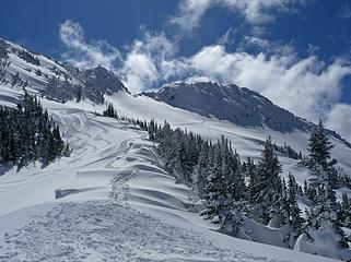 last look back
|
| Back to top |
|
|
EastKing
Surfing and Hiking

Joined: 28 Mar 2007
Posts: 2082 | TRs | Pics
Location: 77 miles from Seattle! |
|
EastKing
Surfing and Hiking
|
Sun Apr 08, 2012 7:29 pm |
|
|
Awesome shots! Great choice for the day!
YouTube | SummitPost
Saw the depths of despair. Now I am salvaging what time I have left on Earth.
YouTube | SummitPost
Saw the depths of despair. Now I am salvaging what time I have left on Earth.
|
| Back to top |
|
|
Middle E
no more moustache

Joined: 10 Feb 2008
Posts: 432 | TRs | Pics
Location: Seattle, WA |
|
Middle E
no more moustache
|
Sun Apr 08, 2012 7:41 pm |
|
|
A great ridge walk on a beautiful day. Just a few added pics....
 Barb and Suzanne 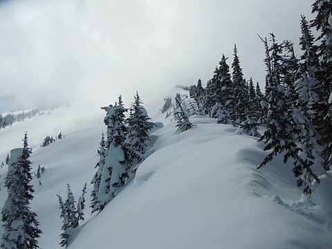 Finally the ridge 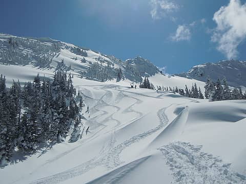 Tracks 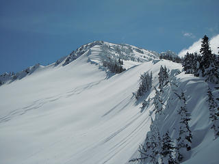 Tracks
pithy yet insightful signature
pithy yet insightful signature
|
| Back to top |
|
|
raising3hikers
Member
Joined: 21 Sep 2007
Posts: 2344 | TRs | Pics
Location: Edmonds, Wa |
Looks like it was a fun trip. Looks very interesting getting to the top, glad it worked out. It was definitely the right conditions yesterday to get some good stuff done!
|
| Back to top |
|
|
Magellan
Brutally Handsome

Joined: 26 Jul 2006
Posts: 13116 | TRs | Pics
Location: Inexorable descent |
|
Magellan
Brutally Handsome
|
Sun Apr 08, 2012 8:32 pm |
|
|
A couple of calendar-worthy shots in there.
|
| Back to top |
|
|
iron
Member

Joined: 10 Aug 2008
Posts: 6392 | TRs | Pics
Location: southeast kootenays |
|
iron
Member
|
Sun Apr 08, 2012 9:55 pm |
|
|
good stuff guys. way to get this peak in its condition-window.
|
| Back to top |
|
|
RichP
Member

Joined: 13 Jul 2006
Posts: 5633 | TRs | Pics
Location: here |
|
RichP
Member
|
Sun Apr 08, 2012 10:03 pm |
|
|
Nice!!
|
| Back to top |
|
|
puzzlr
Mid Fork Rocks

Joined: 13 Feb 2007
Posts: 7220 | TRs | Pics
Location: Stuck in the middle |
|
puzzlr
Mid Fork Rocks
|
Sun Apr 08, 2012 10:34 pm |
|
|
Lot's of great shots from this trip, but this one stands out for me. The snow patterns are amazing, and I like the composition with the strong diagonal line of trees.
|
| Back to top |
|
|
Matt
Tea, Earl Grey, Hot
Joined: 30 Jan 2007
Posts: 4307 | TRs | Pics
Location: Shoreline |
|
Matt
Tea, Earl Grey, Hot
|
Mon Apr 09, 2012 12:29 am |
|
|
I added my photos above.
BarbE, I really like your photos. The group looks so colorful going up, and you did a great job of showing all the bright shapes of the snow, tracks, and clouds.
Thank you also for the photos of Eric and me ascending the summit ridge.
As beacons mountains burned at evening. J.R.R. Tolkien
As beacons mountains burned at evening. J.R.R. Tolkien
|
| Back to top |
|
|
cartman
Member
Joined: 20 Feb 2007
Posts: 2800 | TRs | Pics
Location: Fremont |
|
cartman
Member
|
Mon Apr 09, 2012 8:35 am |
|
|
Barb, my thanks also for the action shots up high.
| Matt wrote: | Eric on the crest nearing the summit |
This shot shows that our group's stopping point was not that great, though that was not as apparent from below, and given the conditions worked out OK. The cornice overhanging the slope shows why the trees on that slope were stunted and a number of them were bent downslope. Probably the false summit calves off cornices regularly enough to cause this. The skiers stopped here to regroup as well. For future travelers, there are good places lower on the ridge if wanting a place to stop for a break.
|
| Back to top |
|
|
Type E
Member

Joined: 19 Aug 2006
Posts: 1381 | TRs | Pics
|
|
Type E
Member
|
Mon Apr 09, 2012 9:13 am |
|
|
Good work everyone. the route has a much different character in Winter than in late Summer when I was there. Looks to be a very popular destination for skiers.
E
|
| Back to top |
|
|
Snowdog
Member

Joined: 21 Jul 2006
Posts: 1028 | TRs | Pics
Location: on (& off) the beaten path |
|
Snowdog
Member
|
Mon Apr 09, 2012 5:00 pm |
|
|
Lovely day to be out in the mountains, that is for sure! Glad we 'put' two of our group on top, though they really put themselves there.  Wish I'd used my zoom to better capture the action higher up, but I couldn't see a thing in the screen, being blinded by the sun an' all.
Having dogs with us may have been a problem on the ridge as well, and without crampons I feel we made the right call.
Wish I'd used my zoom to better capture the action higher up, but I couldn't see a thing in the screen, being blinded by the sun an' all.
Having dogs with us may have been a problem on the ridge as well, and without crampons I feel we made the right call.
 most pleasant ridge 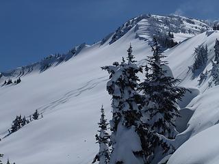 purdy ski tracks back into Henry Creek drainage
'we don't have time for a shortcut'
'we don't have time for a shortcut'
|
| Back to top |
|
|
|
|
You cannot post new topics in this forum
You cannot reply to topics in this forum
You cannot edit your posts in this forum
You cannot delete your posts in this forum
You cannot vote in polls in this forum
|
Disclosure: As an Amazon Associate NWHikers.net earns from qualifying purchases when you use our link(s). |


 The group I was with that day were at Lennox Mountain (TR to follow soon). Your comments regarding the morning cloud cover was interesting... our group virtually did not see a cloud in the sky until we reached open slopes midday. And when we did finally see clouds they first seemed to be contained around the Cascade Crest (i.e. closer to where you were) and especially around the Enchantments.... areas east of our location. Later, the clouds moved into every area near us, albeit not much so. But overall I bet the weather worked out for most people outdoors that day.
Good job on what looks like a great peak.
The group I was with that day were at Lennox Mountain (TR to follow soon). Your comments regarding the morning cloud cover was interesting... our group virtually did not see a cloud in the sky until we reached open slopes midday. And when we did finally see clouds they first seemed to be contained around the Cascade Crest (i.e. closer to where you were) and especially around the Enchantments.... areas east of our location. Later, the clouds moved into every area near us, albeit not much so. But overall I bet the weather worked out for most people outdoors that day.
Good job on what looks like a great peak. 


