| Previous :: Next Topic |
| Author |
Message |
Gimpilator
infinity/21M


Joined: 12 Oct 2006
Posts: 1684 | TRs | Pics
Location: Edmonds, WA |
Since the submissions are down this time of year, here's one from the end of the summer.
A video by Bryan:
Short Version
Bryan and I took the escalator to Marmot Pass. Our original plan was to do Buckhorn Mountain with the possible add-on of Iron Mountain but in the end we didn't stop until we got to Mount Worthington. By then it was getting late in the day so we dropped down directly into the Big Quilcene valley and went home.
Long Version
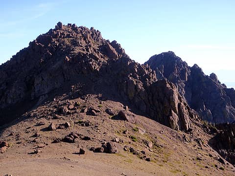
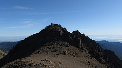
Bryan and I took the escalator to Marmot Pass. From there we failed to find the boot path up onto west shoulder of Buckhorn Mountain. We found ourselves directly west of the mountain on the Tubal Cain trail. Instead of backtracking we ascended east off-trail until we joined up with the boot path. This took us to the large boulders at the summit area. An easy scramble allowed access to the highest point.
 Both Buckhorns  Puget Sound And Hood Canal  West Buckhorn Summit  Graywolf And Baldy 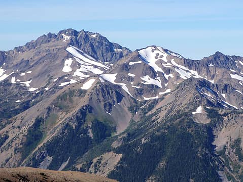 Mystery, Hal Foss, And Fricaba 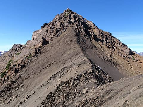 West Buckhorn From The East 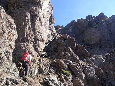 Scrambling Up East Buckhorn 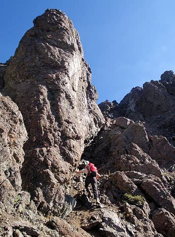 Scrambling Up East Buckhorn 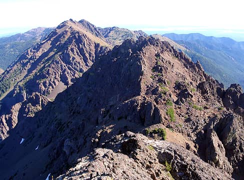 Worthington And Iron Seen From East Buckhorn 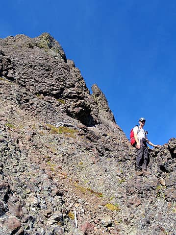 On The East Face Of East Buckhorn 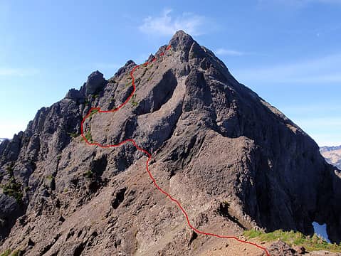 Our Route On East Buckhorn 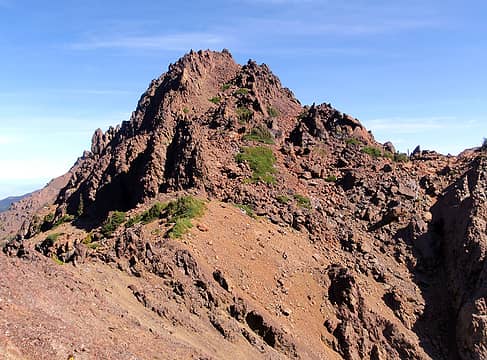 Iron Mountain 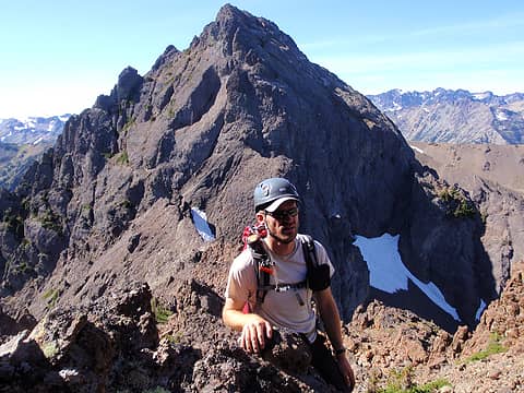 East Buckhorn Seen From Iron 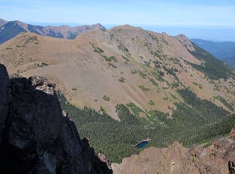 Buckhorn Lake Below 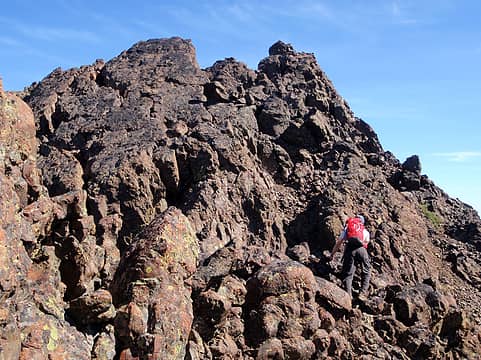 Near The Summit 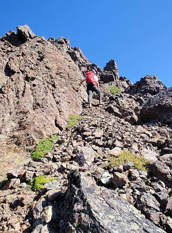 Gully On The South Face 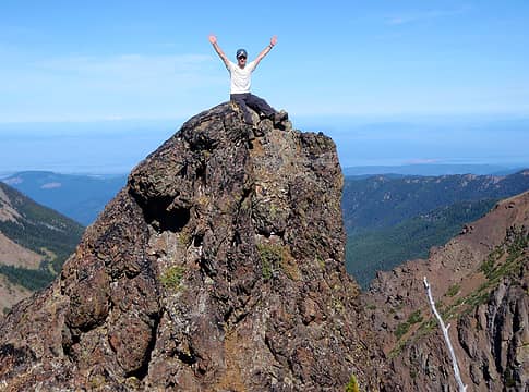 Iron Summit Knob 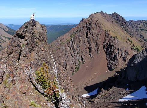 Iron Summit And Mount Worthington 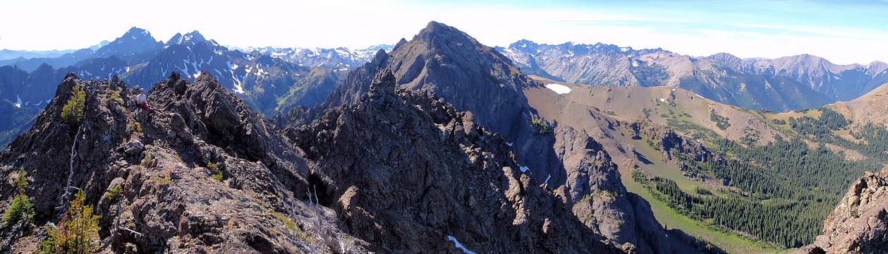 Iron Summit Panorama 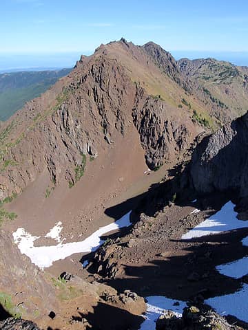 Worthington And The Basin Below 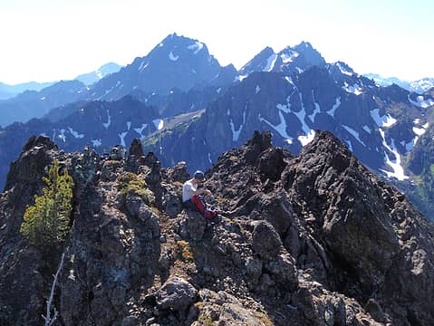 False Summit Seen From Summit 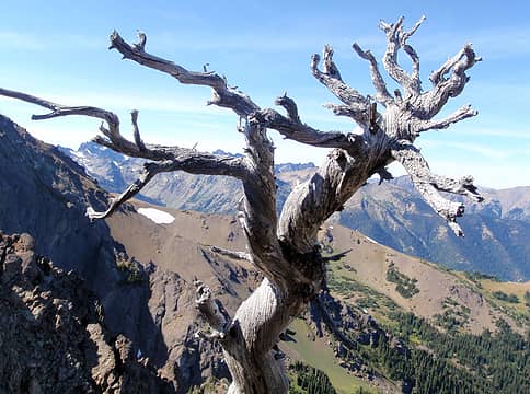 Gnarled Tree 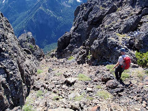 Gully On The South Face 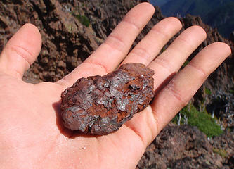 Iron Ore On Iron Mountain 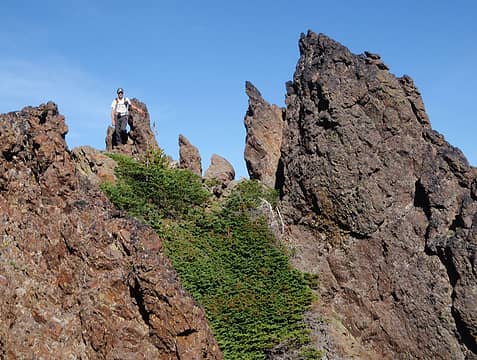 Ridge Crest And Spires 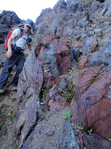 Red Iron Vein 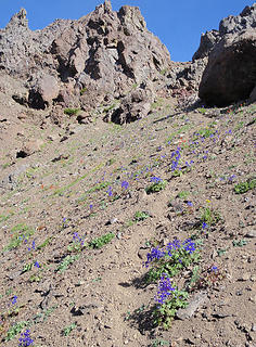 Lupine Below Iron/Worthington Saddle 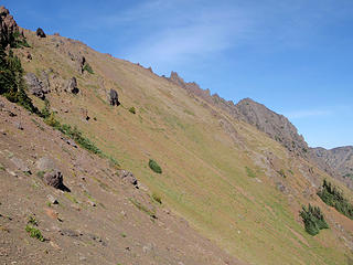 Southern Slopes Of Worthington 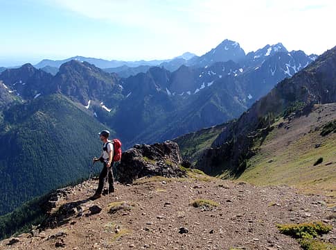 High On Worthington 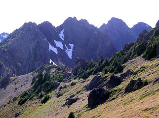 Looking Back At Iron And The Buckhorns 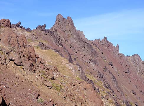 The Summit Formation 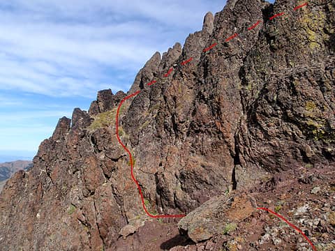 The Easy Way 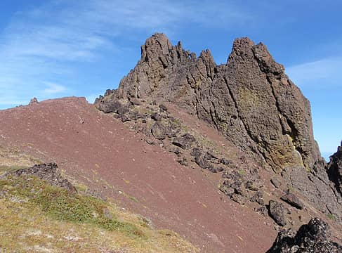 Summit Fin 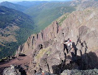 Scrambling Up To The Summit 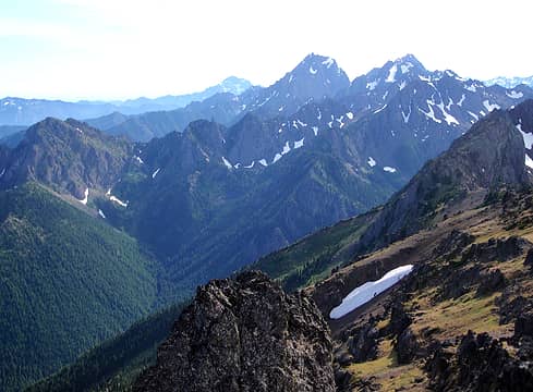 Big Quilcene Valley 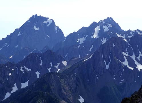 Constance And Inner Constance 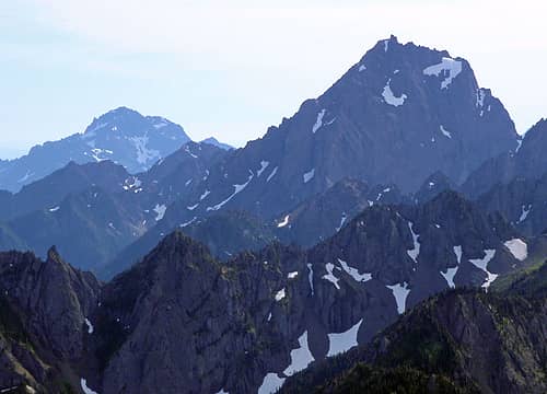 The Brothers And Constance 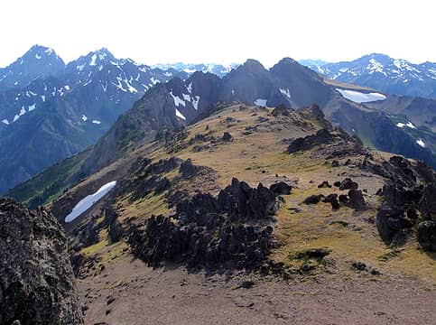 From Constance To Mystery And Everything In Between 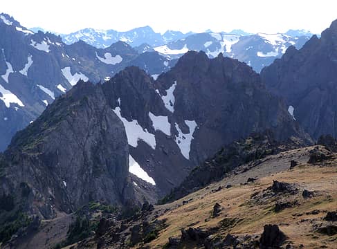 Iron Seen From Worthington Summit 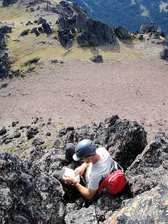 Bryan Signing In 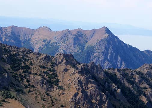 Peak B And Tyler 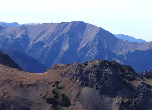 Graywolf 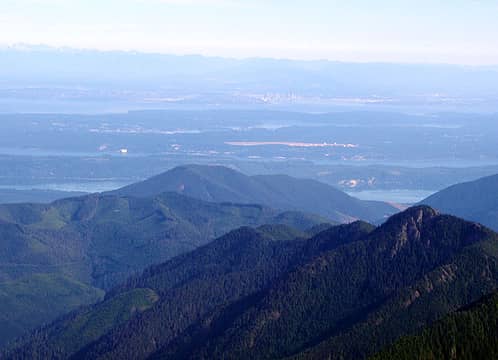 Seattle 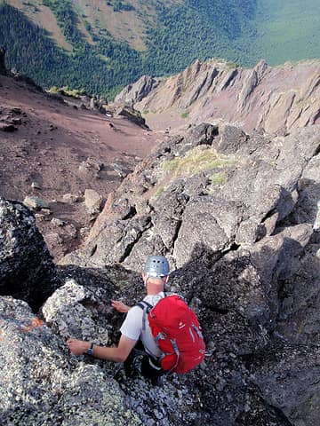 Scrambling Down 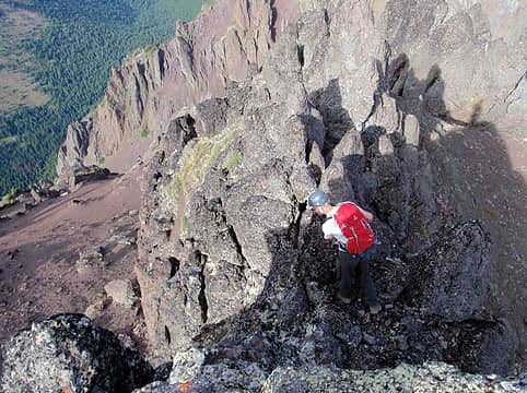 Scrambling Down 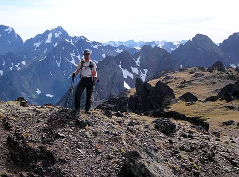 One Last Shot Before We Go Down 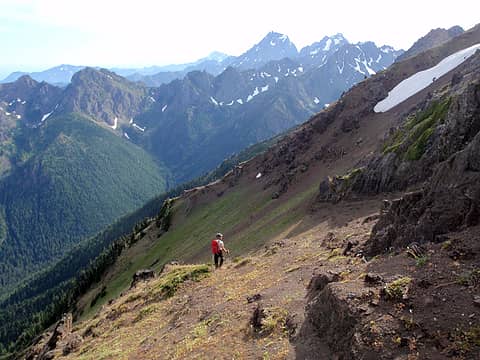 Nice Slopes Before It Got Nasty 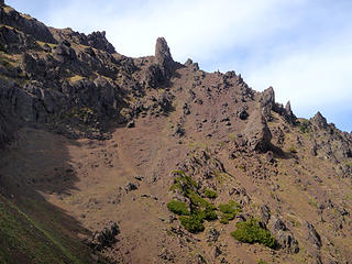 Looking Back Up At The Narrow Summit Fin
|
| Back to top |
  
|
|
Bryan K
Shameless Peakbagger

Joined: 29 Sep 2005
Posts: 5129 | TRs | Pics
Location: Alaska |
|
Bryan K
Shameless Peakbagger
|
 Wed Mar 21, 2012 10:03 am |
|
|
This was really an amazing trip!!!! It had so much to offer as far as terraine, views, challenges and teamwork.
 Buckhorn Mt 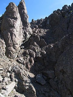 Up NE Buckhorn 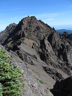 Iron Mt 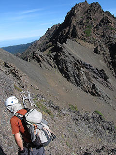 Traversing to Iron Mt 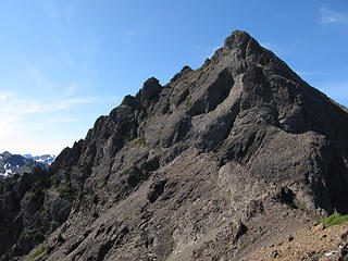 NE Buckhorn. We came down the left face 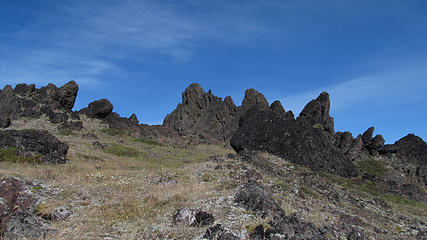 Mount Worthington (4) 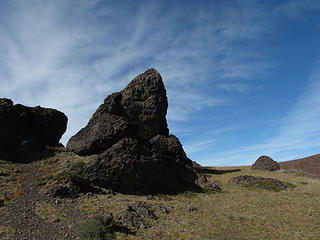 On the way to Worthington 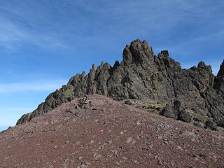 Mount Worthington (2) 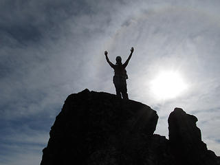 Adam on the summit of Mt Worthington
|
| Back to top |
|
|
Redwic
Unlisted Free Agent

Joined: 23 Feb 2009
Posts: 3292 | TRs | Pics
Location: Going to the Prom(inence) |
|
Redwic
Unlisted Free Agent
|
Wed Mar 21, 2012 10:41 am |
|
|
60 pounds lighter but not 60 points brighter.
|
| Back to top |
|
|
IanB
Vegetable Belayer

Joined: 21 Jul 2010
Posts: 1062 | TRs | Pics
Location: gone whuljin' |
|
IanB
Vegetable Belayer
|
Wed Mar 21, 2012 11:56 am |
|
|
"Forget gaining a little knowledge about a lot and strive to learn a lot about a little." - Harvey Manning
|
| Back to top |
|
|
Dayhike Mike
Bad MFKer
Joined: 02 Mar 2003
Posts: 10958 | TRs | Pics
Location: Going to Tukwila |
Great information! Thank you so much for posting...
I will be trying this exact traverse sometime this season! 
"There is only one basic human right, the right to do as you damn well please. And with it comes the only basic human duty, the duty to take the consequences." -P.J. O'Rourke
"Ignorance is natural. Stupidity takes commitment." -Solomon Short
"There is only one basic human right, the right to do as you damn well please. And with it comes the only basic human duty, the duty to take the consequences." -P.J. O'Rourke
"Ignorance is natural. Stupidity takes commitment." -Solomon Short
|
| Back to top |
|
|
Dayhike Mike
Bad MFKer
Joined: 02 Mar 2003
Posts: 10958 | TRs | Pics
Location: Going to Tukwila |
| Gimpilator wrote: | The Easy Way |
Is this showing your route off of Iron?
"There is only one basic human right, the right to do as you damn well please. And with it comes the only basic human duty, the duty to take the consequences." -P.J. O'Rourke
"Ignorance is natural. Stupidity takes commitment." -Solomon Short
"There is only one basic human right, the right to do as you damn well please. And with it comes the only basic human duty, the duty to take the consequences." -P.J. O'Rourke
"Ignorance is natural. Stupidity takes commitment." -Solomon Short
|
| Back to top |
|
|
Gimpilator
infinity/21M
Joined: 12 Oct 2006
Posts: 1684 | TRs | Pics
Location: Edmonds, WA |
| Dayhike Mike wrote: | | Is this showing your route off of Iron? |
Actually that's the best way up the east side of the summit block of Worthington. Starting below the southwest face of the summit fin, descend a few feet to the left of the ridge crest. Scramble 10 feet up an easy crack and then follow the top of the fin to the summit.
Unfortunely I didn't take a lot of photos descending from Iron. Our route was somewhat circuitous as we avoided the more exposed spots. May be Bryan will post some photos of it later today.
|
| Back to top |
|
|
Fletcher
Member

Joined: 29 Jul 2009
Posts: 1870 | TRs | Pics
Location: kirkland |
|
Fletcher
Member
|
Wed Mar 21, 2012 2:09 pm |
|
|
Really cool report. I did East Buckhorn last summer and thought how cool it looked to continue West from there. It is a really unique place.
|
| Back to top |
|
|
Dayhike Mike
Bad MFKer
Joined: 02 Mar 2003
Posts: 10958 | TRs | Pics
Location: Going to Tukwila |
| Gimpilator wrote: | | Actually that's the best way up the east side of the summit block of Worthington |
Ahh, gotcha. I see the same grassy/heathery patch in the scrambling down pics. That makes more sense.
"There is only one basic human right, the right to do as you damn well please. And with it comes the only basic human duty, the duty to take the consequences." -P.J. O'Rourke
"Ignorance is natural. Stupidity takes commitment." -Solomon Short
"There is only one basic human right, the right to do as you damn well please. And with it comes the only basic human duty, the duty to take the consequences." -P.J. O'Rourke
"Ignorance is natural. Stupidity takes commitment." -Solomon Short
|
| Back to top |
|
|
cartman
Member

Joined: 20 Feb 2007
Posts: 2800 | TRs | Pics
Location: Fremont |
|
cartman
Member
|
Wed Mar 21, 2012 2:22 pm |
|
|
"Solid" use of a day. Ya gotta be peakbaggers to be traversing all that Olympic junk.
BTW, the spiny plant you grabbed onto was likely juniper. Heather is soft.
|
| Back to top |
|
|
Gimpilator
infinity/21M
Joined: 12 Oct 2006
Posts: 1684 | TRs | Pics
Location: Edmonds, WA |
| cartman wrote: | | BTW, the spiny plant you grabbed onto was likely juniper. Heather is soft. |
Thank you for the correction. I think you're right, it was juniper.
|
| Back to top |
|
|
Bryan K
Shameless Peakbagger
Joined: 29 Sep 2005
Posts: 5129 | TRs | Pics
Location: Alaska |
|
Bryan K
Shameless Peakbagger
|
Wed Mar 21, 2012 6:03 pm |
|
|
I posted some pics and I'll look on my computer when I get home to see if I have anymore.
|
| Back to top |
|
|
Phil
Member

Joined: 02 Jul 2003
Posts: 2025 | TRs | Pics
Location: Shoreline, WA |
|
Phil
Member
|
Thu Mar 22, 2012 7:54 am |
|
|
Nice report, especially at this time of year. How did the route look from Worthington to the saddle south of Tull canyon? The drop from Tull saddle to Quilcene trail is easy as I recall.
|
| Back to top |
|
|
Gimpilator
infinity/21M
Joined: 12 Oct 2006
Posts: 1684 | TRs | Pics
Location: Edmonds, WA |
Phil - To answer your question, I think it would have been easy to traverse further west before dropping down. For the people who are planning to do these peaks in the future, it's probably better to do it that way. We just descended from Worthington because we were making it up as we went along and didn't know any better.
|
| Back to top |
|
|
|
|


