| Previous :: Next Topic |
| Author |
Message |
Matt
Tea, Earl Grey, Hot


Joined: 30 Jan 2007
Posts: 4307 | TRs | Pics
Location: Shoreline |
|
Matt
Tea, Earl Grey, Hot
|
 Sun Apr 29, 2012 12:12 am |
|
|
Date: April 28, 2012
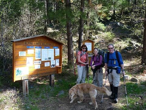
Destination: Icicle Ridge7029 (USGS Cashmere)
Party: Matt, yana, Steph Abegg, cartman, Schmidt Altibabe, Sadies Driver, Middle E, BarbE (and Gus the dog)
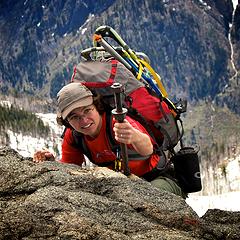
We followed the 4th of July Trail up to the summit of Icicle Ridge, departing from the trail in its upper reaches to proceed more directly up snow to the summit.
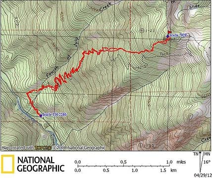 Icicle Ridge GPS Track 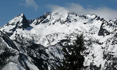 Cashmere 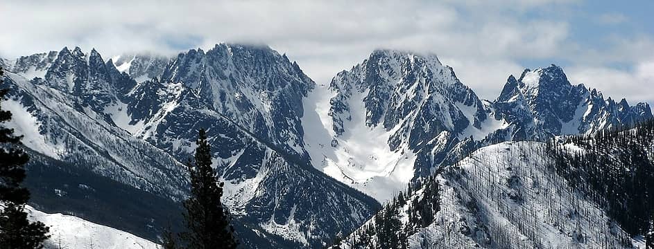 Dragontail, Colchuck & Argonaut come into view 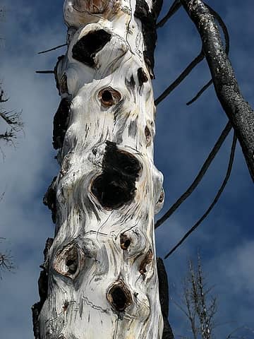 Gnarly silver tree trunk 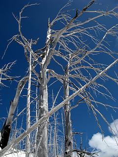 More silver trees 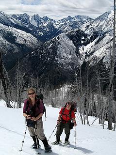 Hiking up onto the higher slopes 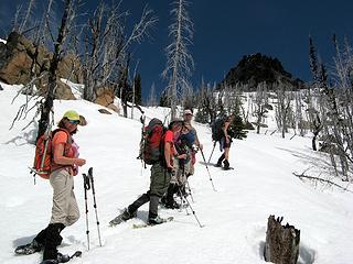 Summit rocks up above us 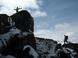 Steph & Yana at the summit 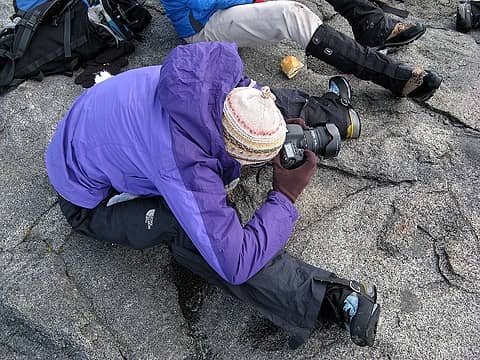 Summit arrival photography 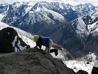 Barb pulling herself up 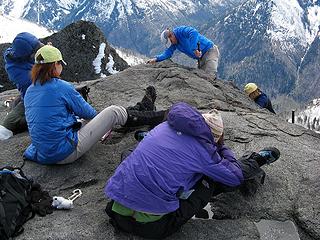 Barry & Suzanne arriving 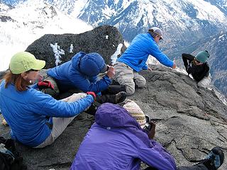 Tisha arriving 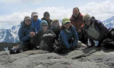 Everyone on top 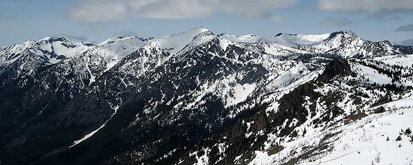 Grindstone, Frigid, Big Lou & Big Jim 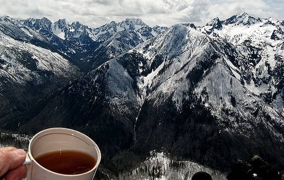 Summit tea with the Stuart Range and Cashmere 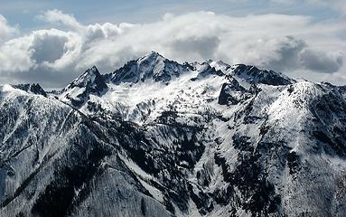 Cashmere backed by clouds 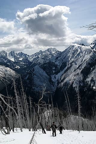 Descending with Stuart wearing a high crown of cloud 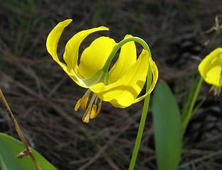 Glacier lily with yellow stamens 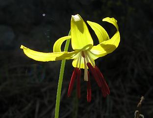 Glacier lily with red stamens 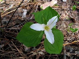 Trillium
As beacons mountains burned at evening. J.R.R. Tolkien
As beacons mountains burned at evening. J.R.R. Tolkien
|
| Back to top |
  
|
|
StephAbegg
Member

Joined: 12 Jan 2010
Posts: 172 | TRs | Pics
Location: Bellingham, WA |
Thanks Matt for organizing this trip. The sunny east side was a good choice for a day forecasted to be cloudy and maybe even rainy on the west side.
I've also posted a trip report on my website: http://www.stephabegg.com/home/tripreports/washington/northcascades/icicleridge
Everyone had their own summiting form...
 Yana, "Grip and crimp" 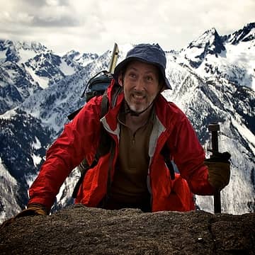 Matt, "Mantle R, pull L" 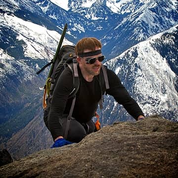 Eric, "Slab purist" 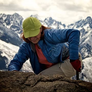 Barb, "Knee works well" 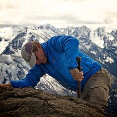 Barry, "Hauling over" 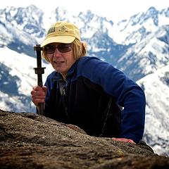 Suzanne, "Pull R, mantle L" 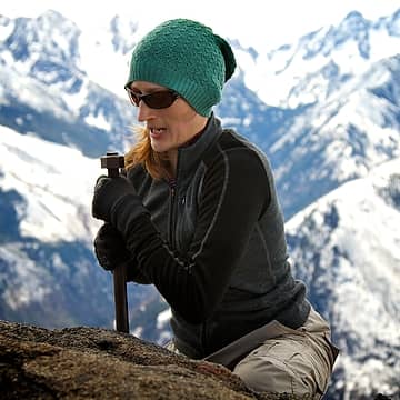 Tisha, "Hang on!"  Billy, "Swing it" 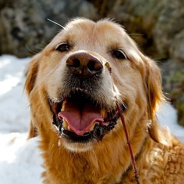 Gus, "They left me just below so I wouldn't show them all up" 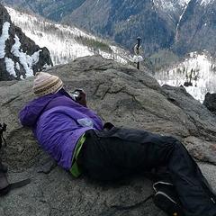 Steph, "Get up first to take more photos" 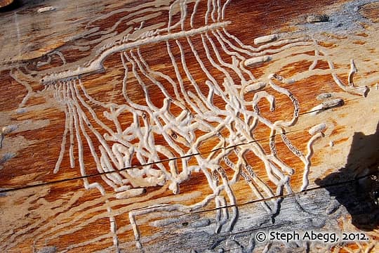 wood worm art  group photo on 7029 ft high point 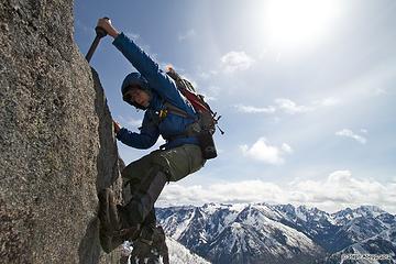 crux summit move 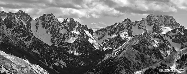 Dragontail, Colchuck, Argonaut, Sherpa, Stuart to the S to SW. 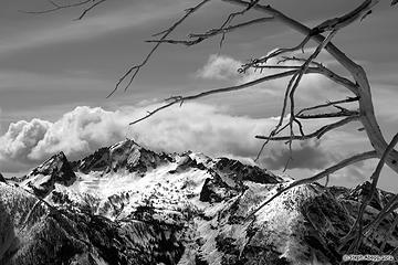 Cashmere Mountain dominates the view to the W
|
| Back to top |
|
|
Yana
Hater

Joined: 04 Jun 2004
Posts: 4212 | TRs | Pics
Location: Out Hating |
|
Yana
Hater
|
Sun Apr 29, 2012 8:33 am |
|
|
Thanks for the trip reports and great photos, Matt and Steph.
It was very nice to experience summer-like conditions for once. I carried a bunch of unnecessary stuff to the top but oh well. This was my first hike in over a month so I'll just call it training weight. 
PLAY SAFE! SKI ONLY IN CLOCKWISE DIRECTION! LET'S ALL HAVE FUN TOGETHER!
PLAY SAFE! SKI ONLY IN CLOCKWISE DIRECTION! LET'S ALL HAVE FUN TOGETHER!
|
| Back to top |
|
|
RichP
Member

Joined: 13 Jul 2006
Posts: 5634 | TRs | Pics
Location: here |
|
RichP
Member
|
Sun Apr 29, 2012 10:00 am |
|
|
I had to kick steps in deep snow to reach that iron bolt last May 1st; looks like the snowpack is on its way out quicker than last year.
|
| Back to top |
|
|
BarbE
Member

Joined: 28 Jul 2006
Posts: 1153 | TRs | Pics
|
|
BarbE
Member
|
Sun Apr 29, 2012 11:07 am |
|
|
An interesting and fun route, quite a change from the summer trail's easy switch backs and flower filled meadows.
Perfect temps and excellent company. 
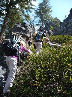 scramble 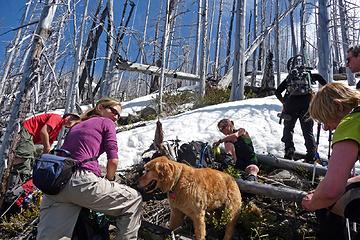 first break 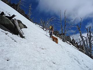 up 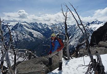 Enchantment backround 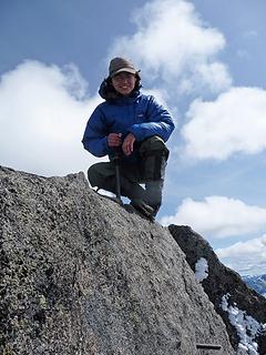 Yana shows... 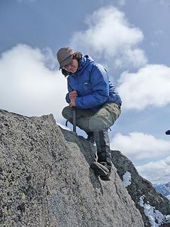 how ... 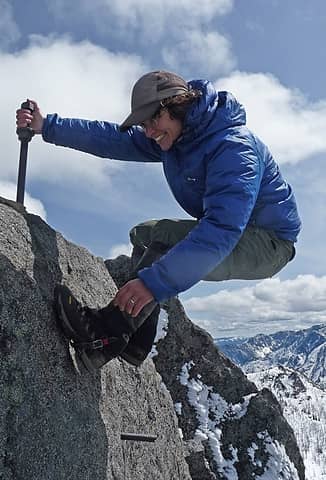 easy... 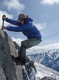 this... 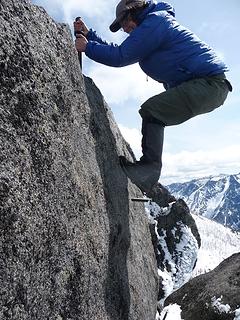 ..is 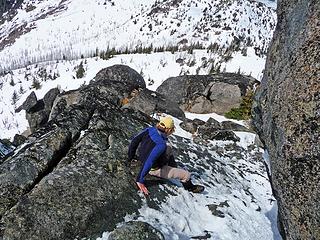 another sitz method 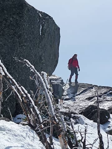 Matt leaves summit block 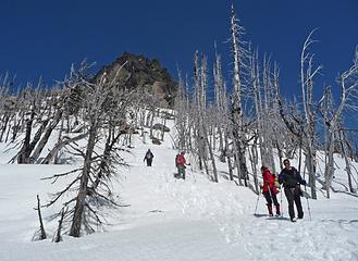 leaving the summit 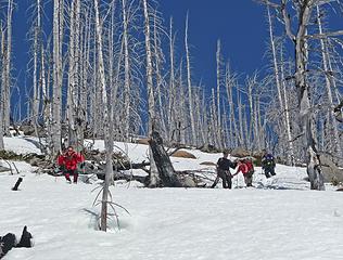 post holing through the silver forest
|
| Back to top |
|
|
Sadie's Driver
Sadie's Driver

Joined: 24 Apr 2006
Posts: 1763 | TRs | Pics
Location: Welcome Pass |
| RichP wrote: | | I had to kick steps in deep snow to reach that iron bolt last May 1st; looks like the snowpack is on its way out quicker than last year. |
And none-too-soon, Rich! It was a GLORIOUS day out the Icicle.
Our four were the last to leave for the summit.
 Third wave heading up . . . 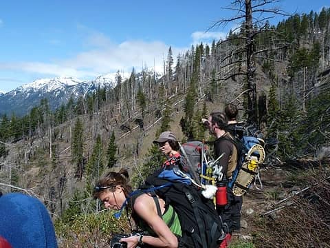 Crew is stil on dirt - this was a half dirt/half snow day 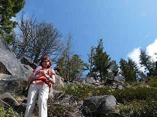 A little scramble route for us 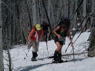 Barb and Steph heading up 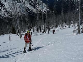 Steep little ridge . . . . 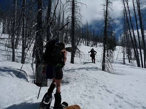 Up we go 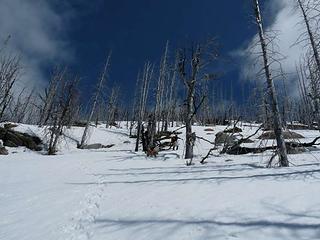 Gusto and Barry heading up to the top of the ridge 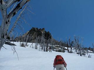 Our destination ahead 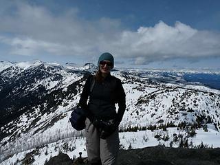 Tish on the summit 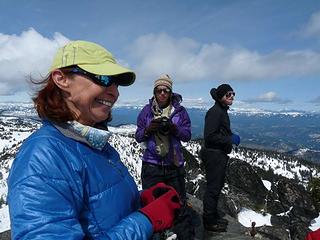 Barb, Steph and Eric on the summit 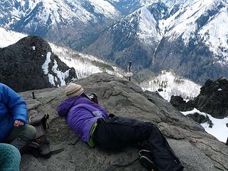 Steph, what are you doing? 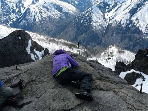 Now what is Steph doing??? 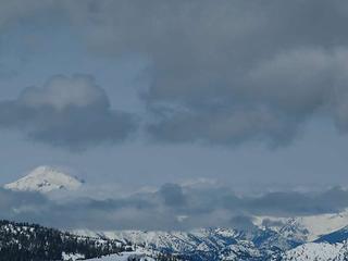 Glacier from the summit 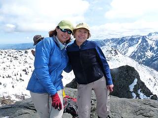 Barb and the Driver on the summit 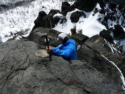 Barry dropping down off of the summit 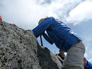 Barb lowering from the summit 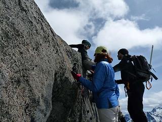 Tish doing it HER way off of the summit 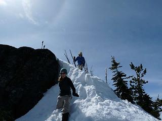 Tish and Barb coming down off the summit block 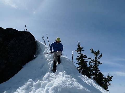 Barbara practicing the "sitz" descent 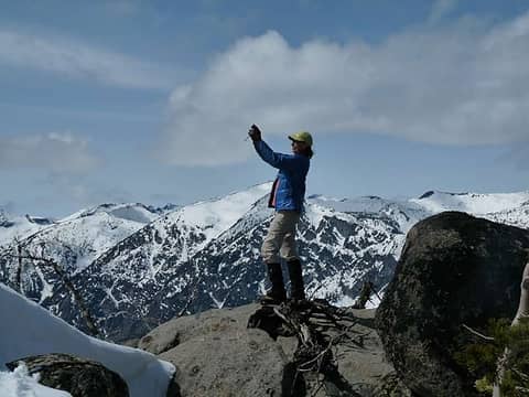 Poser 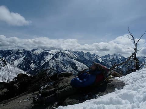 Yana Enchantingly sunning herself 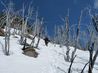 Eric heading down from the top of the ridge 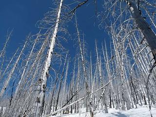 Silver trees, blue sky and snow . . . | Matt wrote: | | (and Gus the dog) |
 Gus has a problem with that . . . he's more than "just" a dog!!! Gus has a problem with that . . . he's more than "just" a dog!!!  (but he does appreciate your sandwich.) (but he does appreciate your sandwich.)
Four-paw buddy lets me tag along!
Four-paw buddy lets me tag along!
|
| Back to top |
|
|
Matt
Tea, Earl Grey, Hot
Joined: 30 Jan 2007
Posts: 4307 | TRs | Pics
Location: Shoreline |
|
Matt
Tea, Earl Grey, Hot
|
Sun Apr 29, 2012 11:59 am |
|
|
| Sadie's Driver wrote: | Umm, Matt, about this:
| Matt wrote: | | (and Gus the dog) |
Gus has a problem with that . . . he's more than "just" a dog!!! (but he does appreciate your sandwich.) |
Why would you think that being identified as "the dog" is a lower staus? Maybe being the dog is a noteworthy rank, and all the rest are just a bunch of people.
As beacons mountains burned at evening. J.R.R. Tolkien
As beacons mountains burned at evening. J.R.R. Tolkien
|
| Back to top |
|
|
Middle E
no more moustache

Joined: 10 Feb 2008
Posts: 432 | TRs | Pics
Location: Seattle, WA |
|
Middle E
no more moustache
|
Sun Apr 29, 2012 12:21 pm |
|
|
I came up here last October for the first time, but the summit block was entirely covered in rime ice so I didn't try to clamber up. At least now I've been on the very summit!
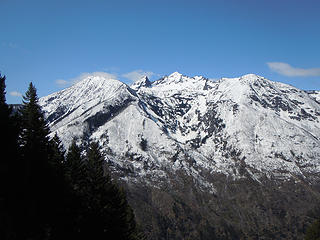 View of Cashmere 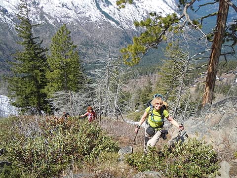 Climbing up 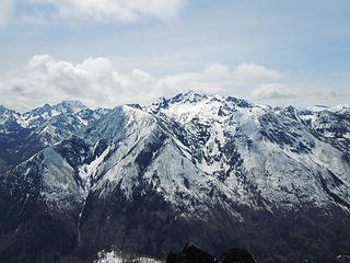 Mt. Cashmere from Icicle Ridge 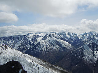 Enchantments from Icicle Ridge 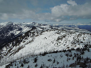 North to Big Jim from Icicle Ridge 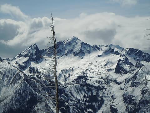 Mt. Cashmere 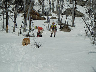 Barb and Suzanne on the descent
pithy yet insightful signature
pithy yet insightful signature
|
| Back to top |
|
|
Hiker Mama
Member

Joined: 25 Jun 2006
Posts: 3451 | TRs | Pics
Location: Lynnwood |
|
| Back to top |
|
|
cartman
Member

Joined: 20 Feb 2007
Posts: 2800 | TRs | Pics
Location: Fremont |
|
cartman
Member
|
Mon Apr 30, 2012 7:44 am |
|
|
A great trip with a fine group, definitely picked the right place for sun. Running into Oyvind, Tobae and Khanh at the TH just shows that great minds think alike.
Despite its readily accessible location, several of us had never done Icicle; it had a fun little finish to the top. Great views of Cashmere and the 'chants.
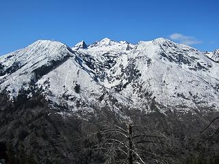 Cashmere 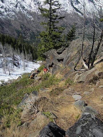 Scrambling the ridge 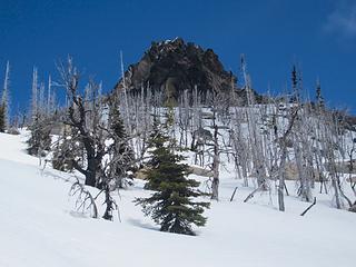 Icicle 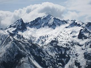 Cashmere closeup 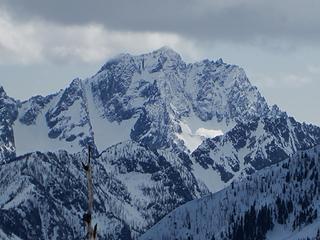 Stuart 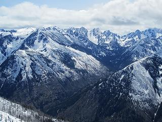 Enchantments 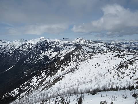 Big Lou, Big Jim 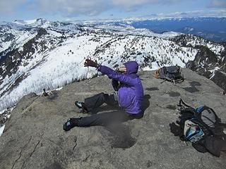 Steph and Billy 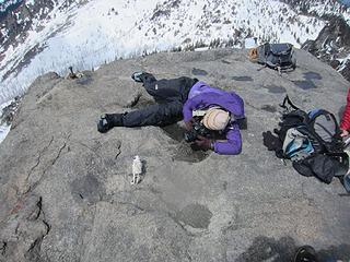 Gotcha
|
| Back to top |
|
|
JimK
Member

Joined: 07 Feb 2002
Posts: 5606 | TRs | Pics
Location: Ballard |
|
JimK
Member
|
Mon Apr 30, 2012 10:54 am |
|
|
Looks like a fun time was had by all. Matt, we noticed the same red color on the few glacier lilies seen around the corner from you on the Icicle Ridge Trail.
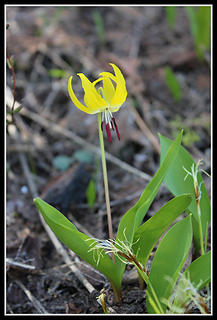 Glacier Lily
|
| Back to top |
|
|
tigermn
Member

Joined: 10 Jul 2007
Posts: 9242 | TRs | Pics
Location: There... |
|
tigermn
Member
|
Mon Apr 30, 2012 6:30 pm |
|
|
Wonder how much longer before it becomes a posthole fest up there before it thaws out? Did that trail once in the summer. Never tried it with snow. Looks interesting though.
|
| Back to top |
|
|
the Zachster
Member

Joined: 17 Jan 2007
Posts: 4776 | TRs | Pics
Location: dog training |
Great report and photos everyone! I especially liked Steph's summit style shots! I'm hoping the snow will stick around a little while longer so I can get up there. It's a little too hot for the dog when the snow is gone.
"May I always be the kind of person my dog thinks I am"
"May I always be the kind of person my dog thinks I am"
|
| Back to top |
|
|
Matt
Tea, Earl Grey, Hot
Joined: 30 Jan 2007
Posts: 4307 | TRs | Pics
Location: Shoreline |
|
Matt
Tea, Earl Grey, Hot
|
Mon Apr 30, 2012 11:36 pm |
|
|
Thanks to everyone for all the photos, especially Stephs photos of each person arriving and BarbEs sequence of Yana descending off the edge.
While we were on the Icicle Ridge summit, I found myself wondering how the lookout had managed to fit there. The top was basically a big squared-off rock with vertical edges on all sides. The anchors were right at the edges, so it seemed there would be no space to step out of the lookout anywhere. I also wondered about two anchor posts that stood on a disconnected rock about 10 feet lower down. What did they have to do with the lookout, and how would one even connect from one spot to the other?
cartman's photo showing almost the entire squared off top of the rock 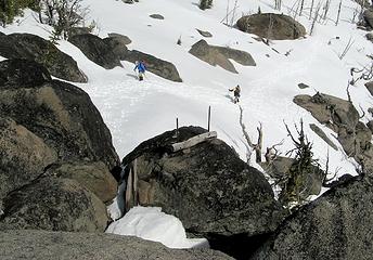 Anchors on a rock below the lookout 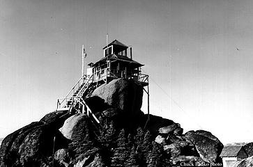 Established with a camp in 1914, this D-6 cupola cabin, built in 1929, was being staffed at the time of this 1963 photo, but was destroyed only 3 years later!
As beacons mountains burned at evening. J.R.R. Tolkien
As beacons mountains burned at evening. J.R.R. Tolkien
|
| Back to top |
|
|
terpene
Member
Joined: 07 Feb 2010
Posts: 5 | TRs | Pics
|
|
terpene
Member
|
Tue May 01, 2012 7:08 am |
|
|
The red anthers on the glacier lilies is not that unusual. The anthers can be white, red, yellow, or purple, but they're all the same species. This could change with future DNA studies.
|
| Back to top |
|
|
|
|
You cannot post new topics in this forum
You cannot reply to topics in this forum
You cannot edit your posts in this forum
You cannot delete your posts in this forum
You cannot vote in polls in this forum
|
Disclosure: As an Amazon Associate NWHikers.net earns from qualifying purchases when you use our link(s). |


