| Previous :: Next Topic |
| Author |
Message |
pasayten
Class of 65...


Joined: 18 Aug 2011
Posts: 536 | TRs | Pics
Location: Winthrop, WA |
|
pasayten
Class of 65...
|
 Thu May 17, 2012 10:27 pm |
|
|
Had a great hike in the sun today to Tiffany Mtn via the Freezeout Ridge Trail. You can get all the way up Boulder Creek to the Freezeout Trailhead... and not a foot farther... I was the first rig to make it to the trailhead for hiking this year... I have been scouting it the last 3 weeks... lol...
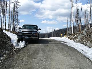 Freezeout Ridge Trailhead 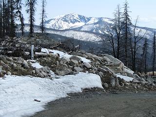 Bald Mtn from Trailhead 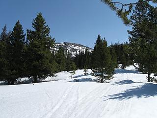 Tiffany Mtn From Freezeout 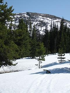 The Goal... Tiffany Mtn 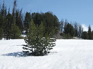 Along Freezeout trail 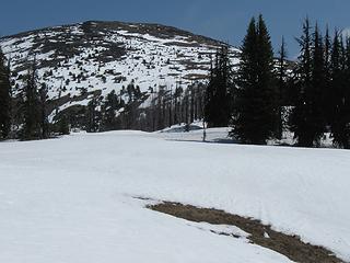 Tiffany Mtn ahead 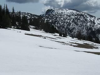 Clark Peak from Freezeout Trail 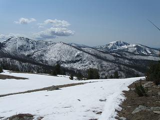 Near Tiffany trail fork looking south at Baldy 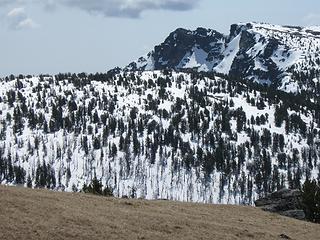 Clark Peak 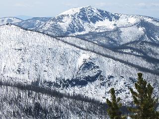 Bald Mtn from Freezeout Trail 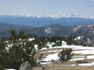 Chewuch Basin and Cascades 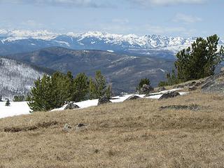 Looking West 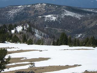 Looking Back To Trailhead And Road 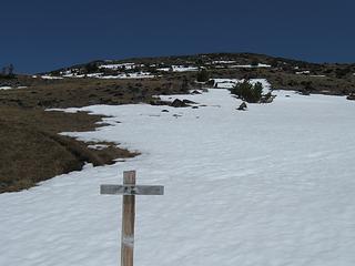 Fork To Tiffany Mtn 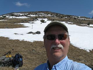 Tiffany In Background 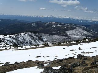 Cascades In Background 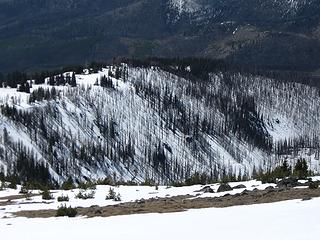 Freezeout Ridge 
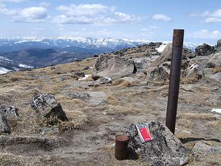 More Register 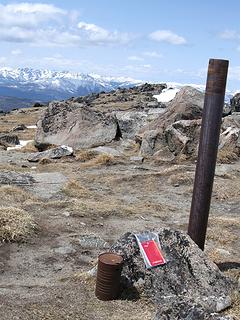 Tiffany Peak Register 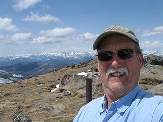 A Good Day In The Sun 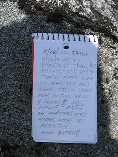 Logged Into The Register 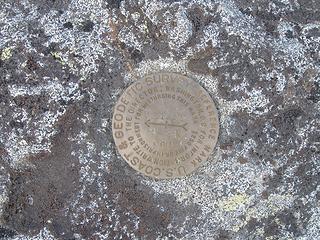 USGS Benchmark At Tiffany 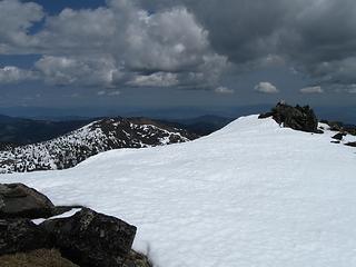 Looking Southeast 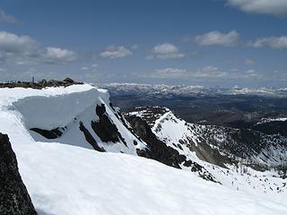 Looking At Tiffany Mtn 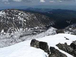 Looking Southeast With Middle Tiffany At Left 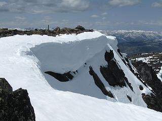 Cool Snow Cornice On Tiffany 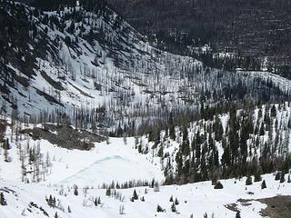 Frozen Little Tiffany 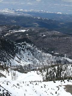 Little Tiffany 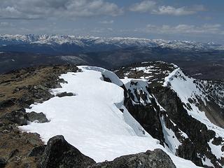 Pasayten In Background 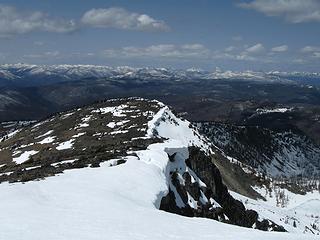 Looking North 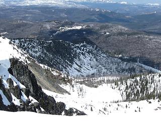 Little Tiffany Lake Frozen 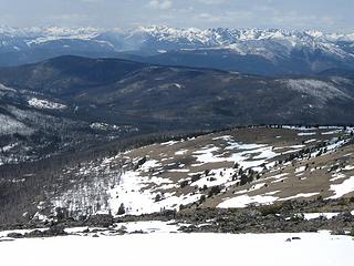 Looking northwest from Tiffany... Burning up Eightmile 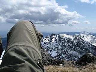 Nap Time Looking South 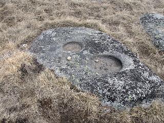 Cool Erosion In Rock 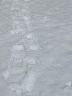 My Snowshoe Tracks 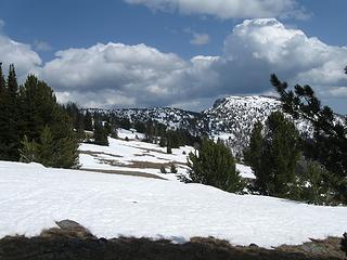 Looking east along Freezeout Ridge 
|
| Back to top |
  
|
|
Magellan
Brutally Handsome

Joined: 26 Jul 2006
Posts: 13116 | TRs | Pics
Location: Inexorable descent |
|
Magellan
Brutally Handsome
|
Thu May 17, 2012 10:34 pm |
|
|
Such a nice hike.  I remember watching the (something) fire from up there. Another time it was icicles on Halloween. Gotta take the kids up this year. I remember watching the (something) fire from up there. Another time it was icicles on Halloween. Gotta take the kids up this year.
|
| Back to top |
|
|
Backpacker Joe
Blind Hiker

Joined: 16 Dec 2001
Posts: 23956 | TRs | Pics
Location: Cle Elum |
Thanks for the TR P. What's all that white stuff?
"If destruction be our lot we must ourselves be its author and finisher. As a nation of freemen we must live through all time or die by suicide."
Abraham Lincoln
"If destruction be our lot we must ourselves be its author and finisher. As a nation of freemen we must live through all time or die by suicide."
Abraham Lincoln
|
| Back to top |
|
|
RichP
Member

Joined: 13 Jul 2006
Posts: 5634 | TRs | Pics
Location: here |
|
RichP
Member
|
Fri May 18, 2012 10:15 am |
|
|
Nice! Several years ago I was able to continue on the road all the way to Conconully and then the Iron Gate TH on Memorial Day Weekend.
Did it look like there was still a ton of snow after the Freezeout Ridge TH?
|
| Back to top |
|
|
pasayten
Class of 65...
Joined: 18 Aug 2011
Posts: 536 | TRs | Pics
Location: Winthrop, WA |
|
pasayten
Class of 65...
|
Fri May 18, 2012 10:30 am |
|
|
| RichP wrote: | | Nice! Several years ago I was able to continue on the road all the way to Conconully and then the Iron Gate TH on Memorial Day Weekend.
Did it look like there was still a ton of snow after the Freezeout Ridge TH? |
Yes, there was a lot of snow after the cattle guard at the Freezeout Tailhead. The road drops back down into a valley there and it is a shaded backside, and then climbs back up towards Tiffany Meadows area.
The road to Baldy is at a fork about 3-4 miles earlier than the Freezeout TH. It was open and looked clear for quite a ways up the hill to Baldy Pass, but then looked snow covered near the pass. I have not scouted that one out yet this year... 
|
| Back to top |
|
|
RichP
Member
Joined: 13 Jul 2006
Posts: 5634 | TRs | Pics
Location: here |
|
RichP
Member
|
Fri May 18, 2012 10:37 am |
|
|
|
| Back to top |
|
|
silence
Member

Joined: 25 Apr 2005
Posts: 4420 | TRs | Pics
|
|
silence
Member
|
Fri May 18, 2012 10:44 am |
|
|
plez enlighten me .. i've never heard of this mountain ... so did you go in from winthrop or conconully (i had to go to summitpost)?
btw .. jealous ..great hike and pix
PHOTOS
FILMS
Keep a good head and always carry a light bulb. Bob Dylan
PHOTOS
FILMS
Keep a good head and always carry a light bulb. Bob Dylan
|
| Back to top |
|
|
pasayten
Class of 65...
Joined: 18 Aug 2011
Posts: 536 | TRs | Pics
Location: Winthrop, WA |
|
pasayten
Class of 65...
|
Fri May 18, 2012 11:16 am |
|
|
From Winthrop... Drive straight thru town (at the 4 way stop) and the road circles around and becomes the East Chewuch Rd... keep going... by the Lake Pearrygin turnoff... by the Chewack River Ranch... and then just BEFORE the bridge that goes back across the Chewuch River, take a right at the paved Boulder Creek Road/Snppark turnoff... Continue on paved road to nice curving concrete bridge over Boulder Creek... mark oodometer here if you wish... you have 15 miles to go...
Keep right at the Y after the bridge and this is Boulder Creek Rd (paved for awhile). After about 4 miles or so of paved rd, bear right at Y (do not go up First Butte Rd) and drop a little to cross a small bridge... dodge little downed tree... pavement ends... Dirt road continues to follow Boulder Creek drainage... After about 10 miles, bear left at Y and cross cattle guard and continue up this creek which goes to Freezeot TH and Tiffany Meadows... Do not go right where the road crosses a bridge and doubles back which is the Baldy Pass/Conconully Rd. About 4 more miles to Freezeout TH and cattle guard area to turnaround and park. Snow prevents further travel anyway.
Will be a total of about 15 miles from the start/beginning at the bottom at the Boulder Creek curved concrete bridge where you may have set your odometer to the Freezeout TH.
Less than a 3 mile hike to an 8200ft mountain... 
|
| Back to top |
|
|
silence
Member
Joined: 25 Apr 2005
Posts: 4420 | TRs | Pics
|
|
silence
Member
|
Fri May 18, 2012 5:29 pm |
|
|
thx for the directions!!!
PHOTOS
FILMS
Keep a good head and always carry a light bulb. Bob Dylan
PHOTOS
FILMS
Keep a good head and always carry a light bulb. Bob Dylan
|
| Back to top |
|
|
wildernessed
viewbagger

Joined: 31 Oct 2004
Posts: 9275 | TRs | Pics
Location: Wenatchee |
Nice, pretty awesome to be able to get up there all ready. Time to start heading North.
Living in the Anthropocene
Living in the Anthropocene
|
| Back to top |
|
|
wamtngal
Member

Joined: 13 Jun 2004
Posts: 2382 | TRs | Pics
Location: somewhere |
|
wamtngal
Member
|
Fri May 18, 2012 8:17 pm |
|
|
Mmm, very nice. I need to get up to Tiffany this year.
Opinions expressed here are my own.
Opinions expressed here are my own.
|
| Back to top |
|
|
beaudaddy
Coast To Cascades

Joined: 25 Feb 2010
Posts: 401 | TRs | Pics
Location: Tulalip, WA |
|
beaudaddy
Coast To Cascades
|
Sun May 20, 2012 5:23 pm |
|
|
Nice!!! Has anyone on here gone to Middle Tiffany and Rock Mountain from the ridge that connects Tiffany and Clark. Maybe drop down to Honeymoon pass and head northeast? How is the terrain?
|
| Back to top |
|
|
pasayten
Class of 65...
Joined: 18 Aug 2011
Posts: 536 | TRs | Pics
Location: Winthrop, WA |
|
pasayten
Class of 65...
|
Sun May 20, 2012 9:35 pm |
|
|
| beaudaddy wrote: | | Nice!!! Has anyone on here gone to Middle Tiffany and Rock Mountain from the ridge that connects Tiffany and Clark. Maybe drop down to Honeymoon pass and head northeast? How is the terrain? |
I have not done that route, but after the snow clears from the backside of Tiffany and the trail to Honeymoon would be open, it looked not too difficult to head up the ridge slope at the pass to Rock and Middle Tiffany. I had looked at that as a possibility last July 26th, 2011 when I hiked Tiffany. Never posted pictures for that trip... Thinking the more common route is to come in from the Tiffainy Lake TH... :-)
|
| Back to top |
|
|
D. Inscho
Not bored yet...

Joined: 28 Feb 2010
Posts: 973 | TRs | Pics
Location: Bellingham,WA |
|
D. Inscho
Not bored yet...
|
Tue May 22, 2012 7:05 am |
|
|
| beaudaddy wrote: | | Nice!!! Has anyone on here gone to Middle Tiffany and Rock Mountain from the ridge that connects Tiffany and Clark. Maybe drop down to Honeymoon pass and head northeast? How is the terrain? |
There is an old stock driveway that drops to Honeymoon pass from the saddle north of Tiffany summit; it also provides easy access to Little Tiffany lake. Cross-country travel to Rock and middle Tiffany is through open grasslands.
One can also access the Mutton Creek trail from Whistler pass via an old lookout trail leading south off of Tiffany summit. Easy and beautiful loop. See TR for more detail.
Thanks for the report and pictures of a favorite place Pasayten!
http://david-inscho.smugmug.com/
The key to a successful trip is to do the planning during work hours. -- John Muir
My most memorable hikes can be classified as 'Shortcuts that Backfired'. --Ed Abbey
http://david-inscho.smugmug.com/
The key to a successful trip is to do the planning during work hours. -- John Muir
My most memorable hikes can be classified as 'Shortcuts that Backfired'. --Ed Abbey
|
| Back to top |
|
|
Kim Brown
Member

Joined: 13 Jul 2009
Posts: 6899 | TRs | Pics
|
Headed to Tiffany this summer to do a tour of fire ecology; of all the fires around there, biologists are excited about Tiffany's recovery.
Thanks for the photos.
"..living on the east side of the Sierra world be ideal - except for harsher winters and the chance of apocalyptic fires burning the whole area."
Bosterson, NWHiker's marketing expert
"..living on the east side of the Sierra world be ideal - except for harsher winters and the chance of apocalyptic fires burning the whole area."
Bosterson, NWHiker's marketing expert
|
| Back to top |
|
|
|
|


