| Previous :: Next Topic |
| Author |
Message |
Moose
Member


Joined: 19 Sep 2010
Posts: 271 | TRs | Pics
|
|
Moose
Member
|
 Mon May 28, 2012 2:02 pm |
|
|
I completely underestimated this trip in two important ways - difficulty and beauty. A well-maintained trail graded at an average of 10% sounds like a cakewalk compared to some of the climber's trails we have in the PNW, right? Unfortunately in 100+ temperatures even walking from the car to the air-conditioned visitor's center feels pretty miserable.
I also underestimated the beauty of the Grand Canyon. I know how stupid that must sound, but I've always been more of a snow/ice person and have never had any desire to experience desert hiking. But after three days of walking through box canyons surrounded by 4,000' cliffs and standing beneath crystal clear waterfalls hidden within caverns of rock that formed over 2 billion years ago, I find that I am forced to eat my words.
Day 1: South Kaibab TH to Bright Angel CG (-4,740', 6.9 mi)
We started a little after 6 am. This trail has little to no shade and no water sources. We reached the Black Bridge that spans the Colorado River at 11 am and it was 102 degrees. We spent the rest of the day soaking in Bright Angel Creek along with the rest of the campers and several deer.
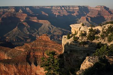 Staring out at our destination from Mather Point 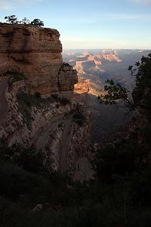 Sunrise on the South Kaibab Trail 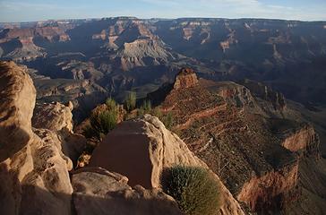 View from Ooh Ahh Point 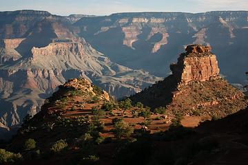 Looking down toward Cedar Ridge 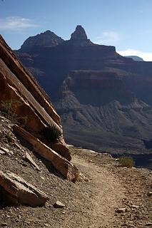 Zoroaster Temple 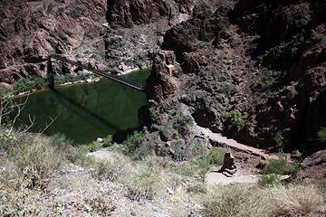 First glimpse of the Black Bridge 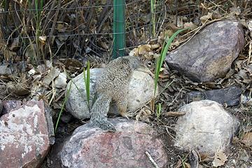 Even the squirrels were too hot to do anything but marinate 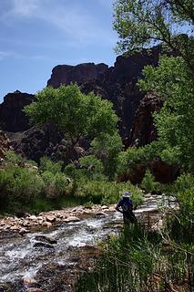 Cooling off in Bright Angel Creek 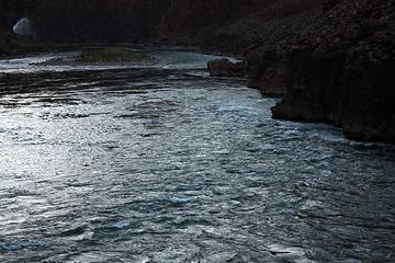 We didn't know it at the time, but that geyser in the upper LH corner was actually a burst in the pipeline and in 2 days, water would be cut off from all campgrounds in the inner gorge 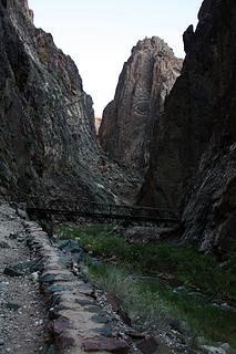 Heading into "The Box" 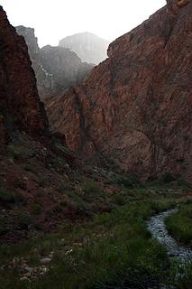 Streams of sunlight 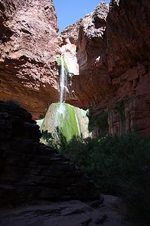 First sighting of Ribbon Falls 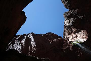 Photo taken while laying on a cool rock ledge 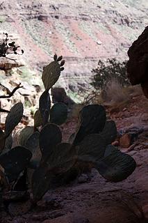 Note to self: walking into a cactus hurts 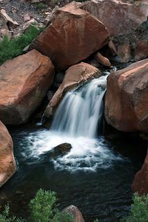 Lame attempt at slow shutter speeds w/o tripod 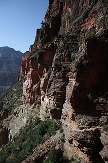 N. Kaibab Trail cut into the canyon walls 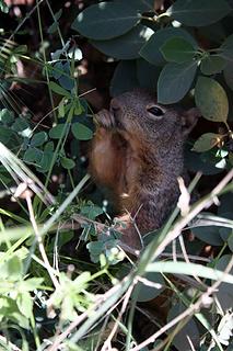 Squirrel stuffing his face 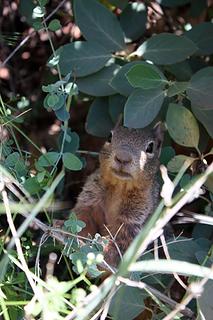 Squirrel staring contest 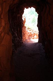 Blessed shade in the Supai Tunnel 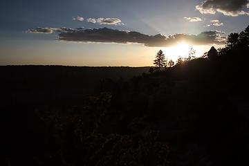 Sunset at the North Rim
|
| Back to top |
  
|
|
Backpacker Joe
Blind Hiker

Joined: 16 Dec 2001
Posts: 23956 | TRs | Pics
Location: Cle Elum |
Great pics. Nicely done. 
"If destruction be our lot we must ourselves be its author and finisher. As a nation of freemen we must live through all time or die by suicide."
Abraham Lincoln
"If destruction be our lot we must ourselves be its author and finisher. As a nation of freemen we must live through all time or die by suicide."
Abraham Lincoln
|
| Back to top |
|
|
Akula
Member

Joined: 04 Nov 2005
Posts: 477 | TRs | Pics
Location: Somewhere in middle America |
|
Akula
Member
|
Mon May 28, 2012 5:25 pm |
|
|
I did this several years ago, and I to was totally amazed with the scenery. Thanks for sharing.
Twenty years from now you will be more disappointed by the things that you didn't do than by the ones you did do. So throw off the bowlines. Sail away from the safe harbor. Catch the trade winds in your sails. Explore, dream, discover. -- Mark Twain
Twenty years from now you will be more disappointed by the things that you didn't do than by the ones you did do. So throw off the bowlines. Sail away from the safe harbor. Catch the trade winds in your sails. Explore, dream, discover. -- Mark Twain
|
| Back to top |
|
|
John Mac
old retiree

Joined: 12 Mar 2012
Posts: 106 | TRs | Pics
Location: S. King |
|
John Mac
old retiree
|
Mon May 28, 2012 9:42 pm |
|
|
Glad to hear you have developed an appreciation for Southwest beauty. Brown down there can be just as good as green and white here. I love the SW.
How miserable are the idle hours of the ignorant man. Ariosto
How miserable are the idle hours of the ignorant man. Ariosto
|
| Back to top |
|
|
Riptide Rush
Member

Joined: 21 Sep 2010
Posts: 99 | TRs | Pics
Location: Everett |
Beautiful pictures! Looks like heaven, a really warm heaven!
Nice squirrel shots too
|
| Back to top |
|
|
mbtigger
Sherpa Da

Joined: 14 Apr 2011
Posts: 697 | TRs | Pics
Location: Sucking the dry air |
|
mbtigger
Sherpa Da
|
Wed May 30, 2012 8:15 am |
|
|
There have been discussions about doing this one spring break when the younger kinder can carry more stuff....
|
| Back to top |
|
|
Moose
Member
Joined: 19 Sep 2010
Posts: 271 | TRs | Pics
|
|
Moose
Member
|
Fri Jun 01, 2012 1:37 pm |
|
|
Thanks everyone!
mbtigger, this would be a great trip to do with the kids. Most likely there will be drinkable water at all campgrounds (though the pipeline is old and breaks occasionally) and the corridor trails were the best trails I've ever hiked (maintenance-wise). I saw lots of kids playing in the river near Bright Angel Trail. Seems like there would be a lot for them to do...though I'd recommend going in late April or early May to avoid the hottest weather.
|
| Back to top |
|
|
bobbi
stillaGUAMish

Joined: 13 Jul 2006
Posts: 8012 | TRs | Pics
Location: olympics! |
|
bobbi
stillaGUAMish
|
Fri Jun 01, 2012 3:11 pm |
|
|
what a great hike! awesome photos!
permit required? was it a hassle to get a permit? how did you get back to the south rim, (if you did)?
bobbi ૐ
"Today is your day! Your mountain is waiting. So
get on your way!" - Oh, the Places Youll Go! By Dr. Seuss
bobbi ૐ
"Today is your day! Your mountain is waiting. So
get on your way!" - Oh, the Places Youll Go! By Dr. Seuss
|
| Back to top |
|
|
Moose
Member
Joined: 19 Sep 2010
Posts: 271 | TRs | Pics
|
|
Moose
Member
|
Mon Jun 04, 2012 7:55 am |
|
|
| bobbi wrote: | | permit required? was it a hassle to get a permit? how did you get back to the south rim, (if you did)? |
Yes, a permit is required...and is a huge hassle to get (don't know anything about the other trails, but this applies to the popular corridor trails). My friend applied for permits for 3 years before finally getting one. It's like the permitting process for the Wonderland Trail and the Enchantments combined. Interestingly, GCNP actually keeps track of how many times you apply and whether you've gotten a permit before - it affects your chances.
We were originally going to do a Rim to Rim to Rim, hiking back to the S. Rim from the N. Rim along the same trail system, but we adjusted our plans because of the heat as well as some other minor medical issues and took the TransCanyon shuttle back. It's a 5 hr drive and $85pp, and the company only accepts check and cash. A stupid policy IMO, but they were kind enough to give us a lift based on our promise to pay them back when we got home (as I typically don't carry $100 in cash while backpacking).
|
| Back to top |
|
|
|
|


