| Previous :: Next Topic |
| Author |
Message |
Perry
Member


Joined: 09 Aug 2007
Posts: 158 | TRs | Pics
Location: Mount Vernon |
|
Perry
Member
|
 Thu Jul 12, 2012 9:55 pm |
|
|
July 6th I started a 4 day leisurely hike on the upper Dungeness River. I took 3 of my packgoats: Chelan, Zermatt, and Hershey.
Friday we went first to Camp Handy, then continued up the trail about 1/3 mile to the junction with the trail to Boulder shelter & Marmot pass. That section of trail gains about 200 ft. We continued on the upper Dungeness trail, which traverses back down toward the river, and is the much less used trail. This section of trail goes through a couple nice grassy meadows.
1 ¾ miles from the junction is a log bridge going across the Dungeness River to the west side. Its a medium sized log. The goats with their panniers are fairly wide. The railing support posts were close enough to the log that I needed to take the panniers off the goats. I then led the goats across the bridge and carried the gear across & put it back on them.
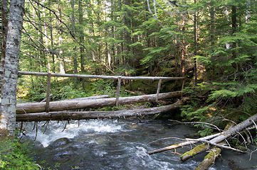 upper log bridge over Dungeness 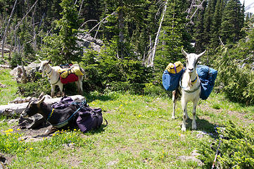 lunch break 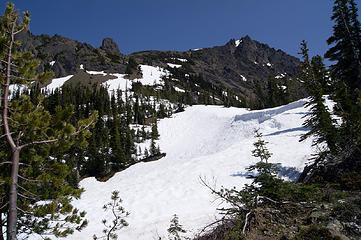 Charlia way trail 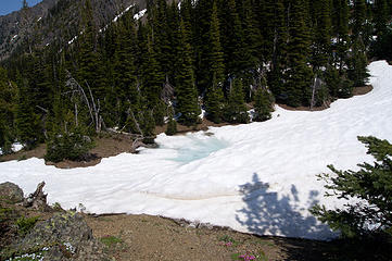 pond on Charlia way trail 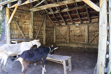 checking out Boulder shelter 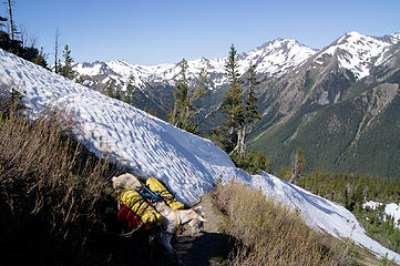 looking back at first snow drift 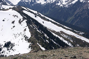 looking south toward Marmot Pass 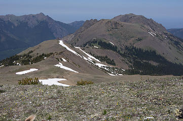 looking north from Buckhorn shoulder 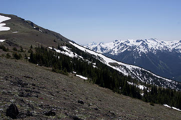 looking south toward Buckhorn
|
| Back to top |
  
|
|
ranger rock
One of the boys

Joined: 14 Dec 2011
Posts: 2550 | TRs | Pics
|
Nice TR, it looks like buckhorn is snow free to the summit.
|
| Back to top |
|
|
silence
Member

Joined: 25 Apr 2005
Posts: 4420 | TRs | Pics
|
|
silence
Member
|
Fri Jul 13, 2012 6:58 am |
|
|
wow .. what a load .. do you have to carry food for the goats? how do you keep them from eating stuff like heather along the way? what are panniers? what about animal encounters .. like mountain goats? and bear?
lunch break  btw when we went up the heather creek trail a couple of years ago .. before they cleaned up the trail (some serious avy debris to get thru) and fixed the bridges .. this was only a log with a rope stretched across ..the whole set up looked too scary for me so i just forded .. but robert took the log .. it ended up being very precarious .. since the rope ended up having a lot of slack esp in the middle (too late to turn around by then) .. anyhow nice to see they put in a handrail
upper log bridge over Dungeness
PHOTOS
FILMS
Keep a good head and always carry a light bulb. Bob Dylan
PHOTOS
FILMS
Keep a good head and always carry a light bulb. Bob Dylan
|
| Back to top |
|
|
bobbi
stillaGUAMish

Joined: 13 Jul 2006
Posts: 8012 | TRs | Pics
Location: olympics! |
|
bobbi
stillaGUAMish
|
Fri Jul 13, 2012 7:07 am |
|
|
bobbi ૐ
"Today is your day! Your mountain is waiting. So
get on your way!" - Oh, the Places Youll Go! By Dr. Seuss
|
| Back to top |
|
|
RodF
Member

Joined: 01 Sep 2007
Posts: 2593 | TRs | Pics
Location: Sequim WA |
|
RodF
Member
|
Fri Jul 13, 2012 7:58 am |
|
|
Hi, Perry!
Silence, the log Robert took across Heather Creek is the lower log in Perry's photo. We installed the new footlog above it, and it embodies a part of Olympics history - it's actually a white pine from the ghost forest on the hillside south of the crossing, many still standing as snags since blister rust arrived in the Olympics, swept through in the 1940s and killed all the mature white pine. This was part of two WTA work parties led by Mace in 2009-10 to reopen the trail for the first time in ~15 years.
"of all the paths you take in life, make sure a few of them are dirt" - John Muir
"the wild is not the opposite of cultivated. It is the opposite of the captivated - Vandana Shiva
"of all the paths you take in life, make sure a few of them are dirt" - John Muir
"the wild is not the opposite of cultivated. It is the opposite of the captivated - Vandana Shiva
|
| Back to top |
|
|
tigermn
Member

Joined: 10 Jul 2007
Posts: 9242 | TRs | Pics
Location: There... |
|
tigermn
Member
|
Fri Jul 13, 2012 8:03 am |
|
|
Thanks for the report. Always enjoy your reports with the goats. Also for some of the information up those trails. I've never probed up there but was trying to figure out a good day hike option from the Upper Dungeness trailhead. Whether to go up Heather, towards Boulder Shelter or some combination in between or even a different way up to Marmot Pass. Sounds like still some snow on that route.
|
| Back to top |
|
|
Perry
Member
Joined: 09 Aug 2007
Posts: 158 | TRs | Pics
Location: Mount Vernon |
|
Perry
Member
|
Fri Jul 13, 2012 9:19 am |
|
|
Silence, the goats do carry some nice comforts for me like: a thick Exped sleeping pad, 2 person tent and a camp stool. To some extent the loads just look bulky, for example I dont compress my sleeping bag much.
The goats dont eat much. I do often have them carry a small amount of pelleted feed. Mostly, they just browse on grass & brush
sort of like a deer walking through. panniers is simply a name for the saddle bags the goats carry. They just hang from the cross-buck saddle.
Ive never had a problem with mountain goats or bears. Ive had mountain goats approach within about 100 ft a couple of times.
Hi Rod, thanks for the history; and all the trail work that your crew does.
|
| Back to top |
|
|
|
|
You cannot post new topics in this forum
You cannot reply to topics in this forum
You cannot edit your posts in this forum
You cannot delete your posts in this forum
You cannot vote in polls in this forum
|
Disclosure: As an Amazon Associate NWHikers.net earns from qualifying purchases when you use our link(s). |


 what a great route!
  i too love your photos but my favorite is this gem