| Previous :: Next Topic |
| Author |
Message |
iron
Member


Joined: 10 Aug 2008
Posts: 6392 | TRs | Pics
Location: southeast kootenays |
|
iron
Member
|
 Wed Jul 11, 2012 12:37 am |
|
|
after tackling the mighty jim hill the day before, hotpantz and i headed out to the indian creek/white river trailhead. well, first we stopped at the 59er for some shakes. bonus points to the guy working the register that complimented my legs: "man, do you workout? you're legs are so huge!" fun times.
we arrived at the trailhead around 8:30pm. most of the campsites along the road were full, so we camped at the car. well, just away from the car. it felt like cheating. here, in a beautiful spot, with only a handful of cars, no people, no bugs, perfect temps. and then, trying to place how something like that is even possible in a world with BILLIONS of people. amazing. WA rocks.
a leisurely start of 830 had us heading out on the beautiful indian creek trail. many memories were jogged for me as this was the location of my first ever backpack trip back in 2005. the white river area was also the site of some therapeutic rehab while i was recovering from a broken hip.
for those considering between the white river trail or indian creek trail to get up towards the PCT - take the indian creek trail. it's so pleasant.
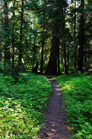 fine place for a morning stroll 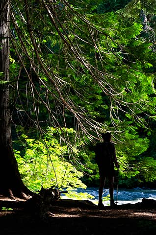 reflecting on the raging white river 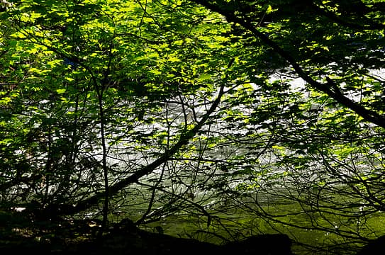 photosynthesis 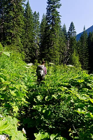 typical scene in the indian creek / white river areas 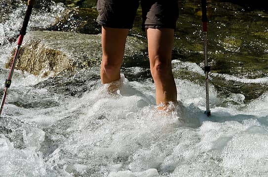 fording the creek off of mt david 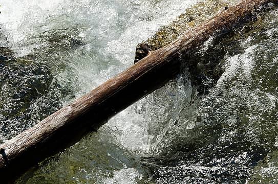 vortex 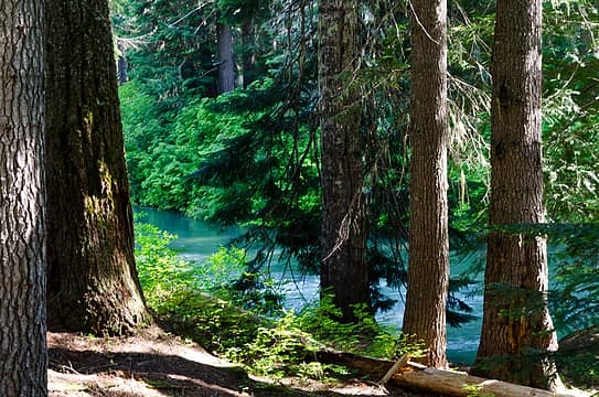 unreal color 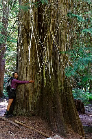 tree hugging 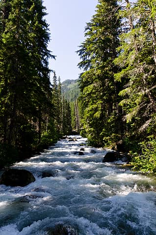 indian "creek" 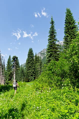 open fields 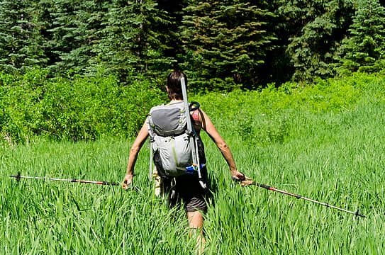 playing in the grass 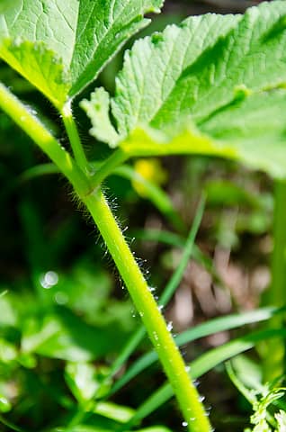 soft hairs 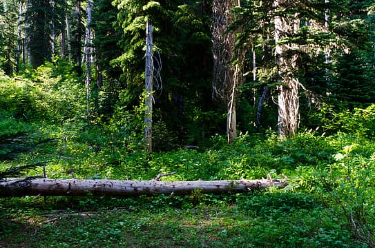 where to leave the indian creek trail 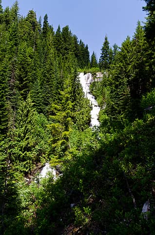 airplane lake creek 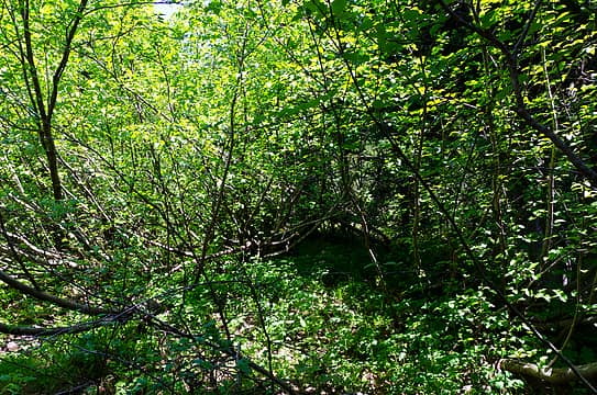 umm, let's go right 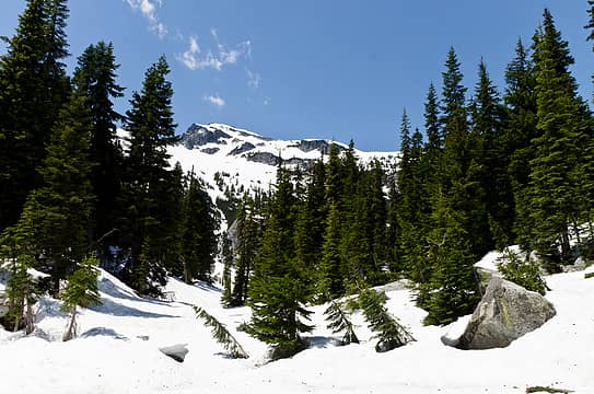 saul as seen from the outlet of airplane lake 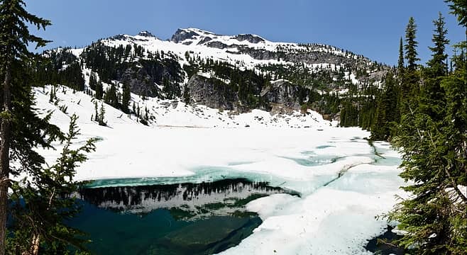 airplane lake and saul 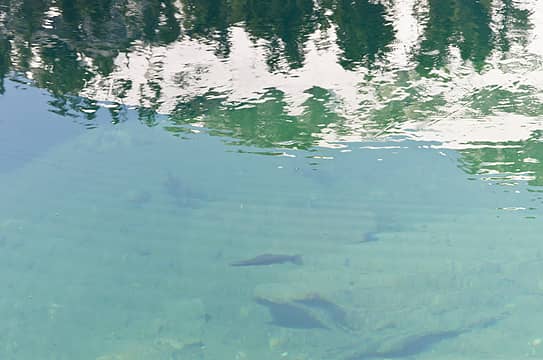 fishy 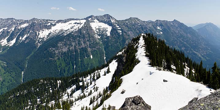 view from airplane peak 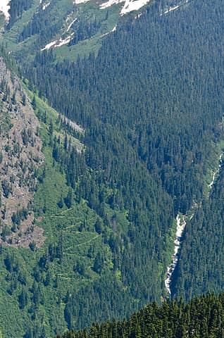 trail going up to boulder pass 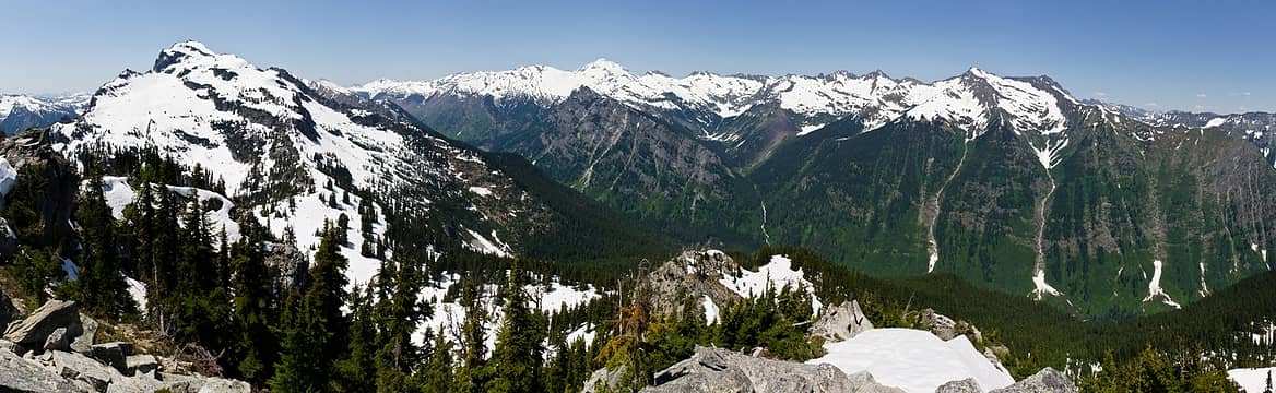 at saddle, saul on L, YES! peak center, clark on right 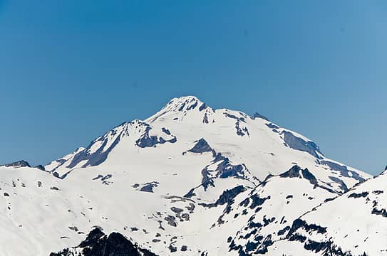 YES! peak 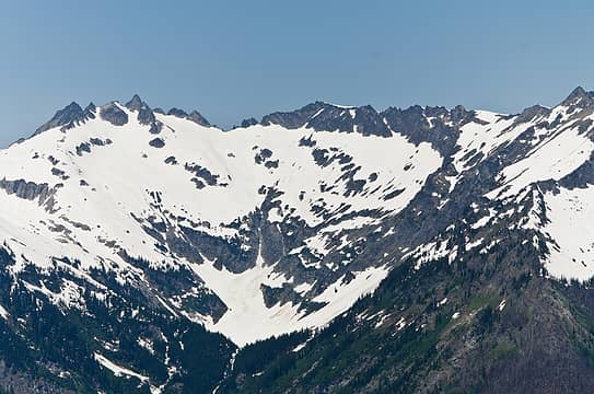 tenpeak and thunder basin 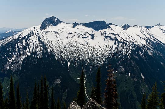 david and poets 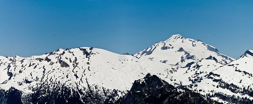 kololo and YES! peak 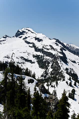 saul 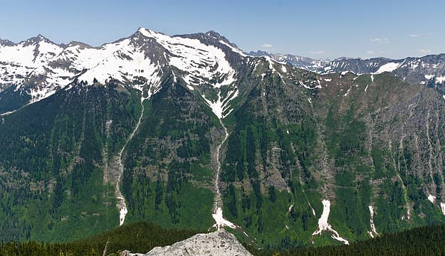 white river valley 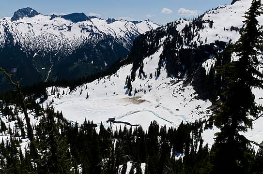 airplane lake 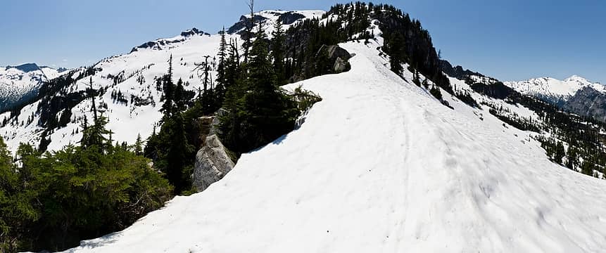 ridge heading towards saul 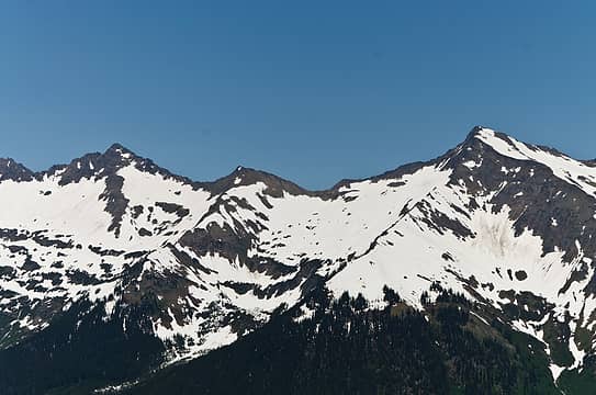 luahna and clark 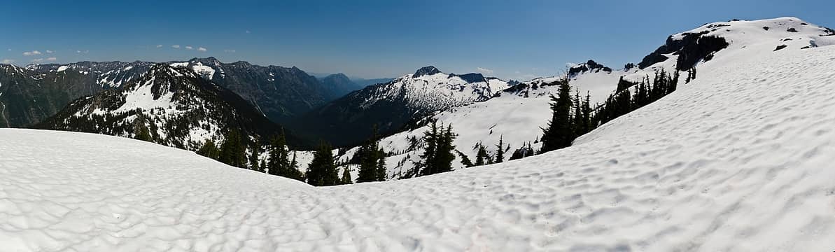 ridge to summit of saul 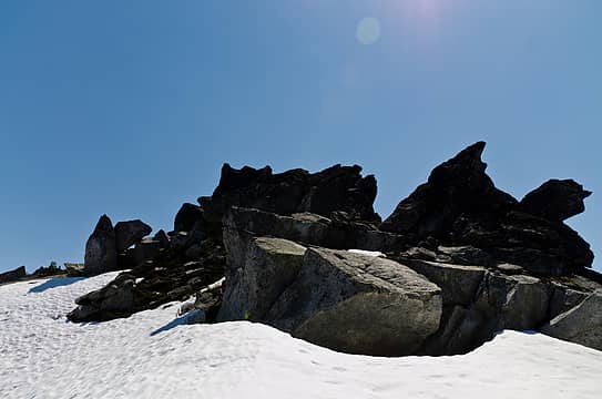 summit rocks  what will i see? 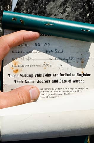 been here awhile 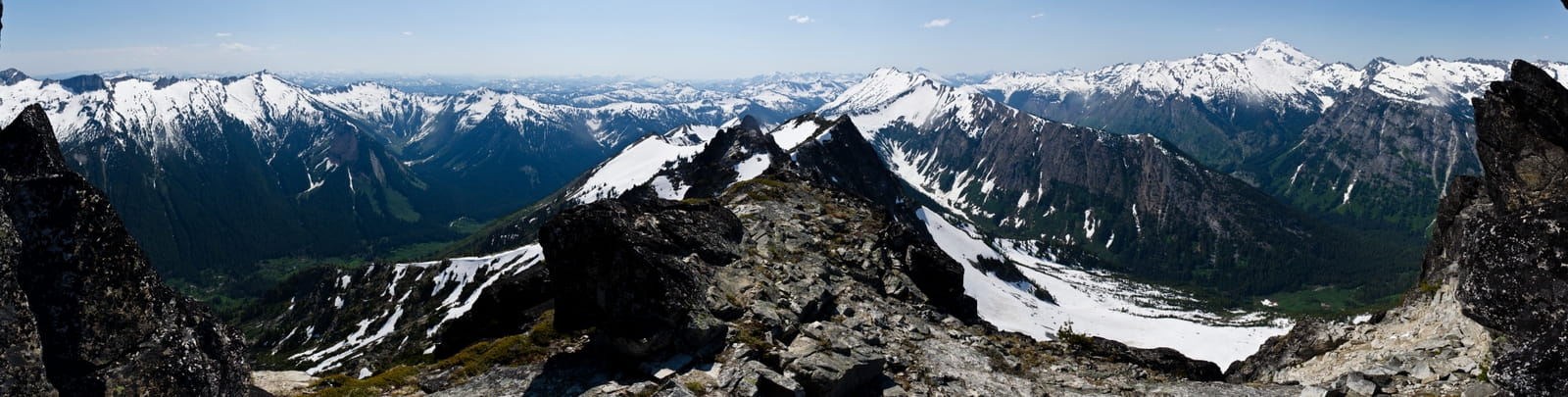 indian creek through white river 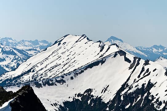 indian head 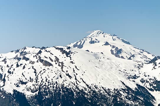 kololo, glacier gap, and YES! peak 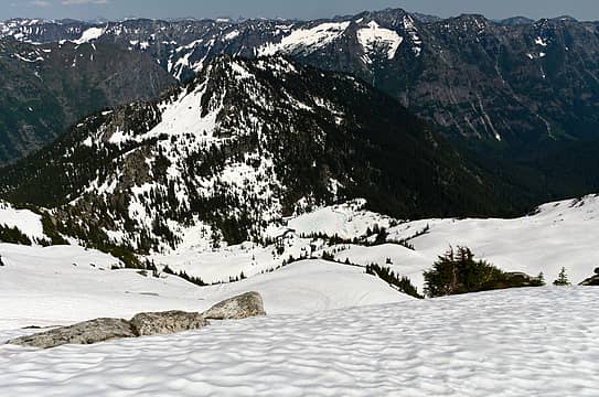 route down to the lake, airplane peak above 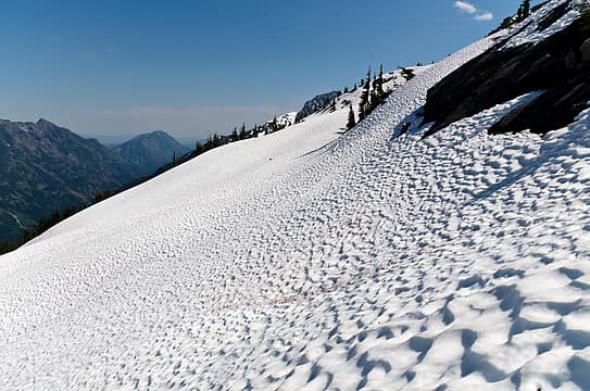 sun cups forming 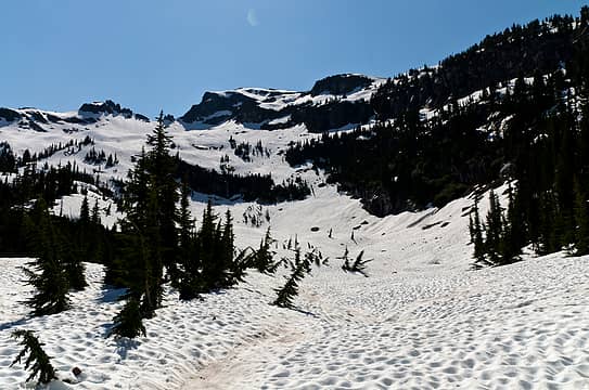 my route down 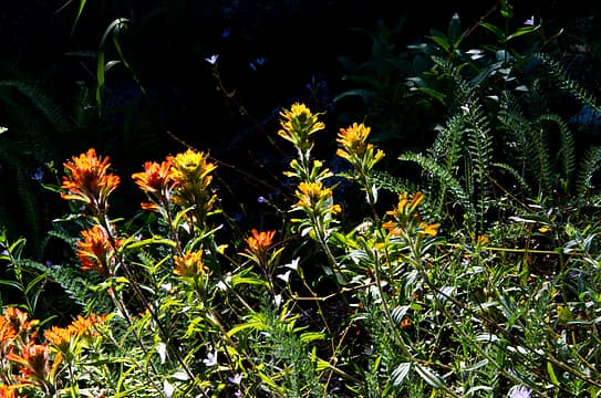 shades of paint 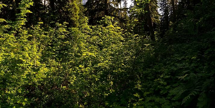 only 100' to go, eh? 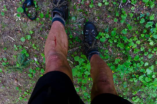 a few battle scars 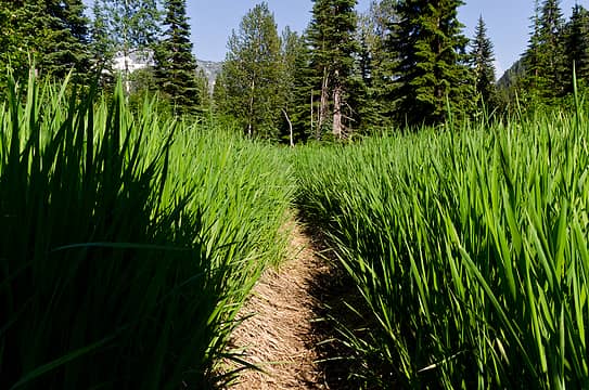 what it feels like for your feet 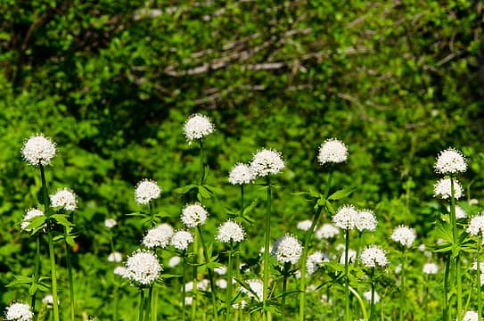 puffballs 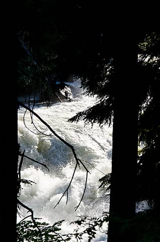 raging torrent
|
| Back to top |
  
|
|
wildernessed
viewbagger

Joined: 31 Oct 2004
Posts: 9275 | TRs | Pics
Location: Wenatchee |
 Very nice back there in the fall also. I was looking at Jim Hill from Signal a few weeks ago, and thought maybe now would be a good time to do it, but maybe not looking at your TR from there. Very nice back there in the fall also. I was looking at Jim Hill from Signal a few weeks ago, and thought maybe now would be a good time to do it, but maybe not looking at your TR from there.
Living in the Anthropocene
Living in the Anthropocene
|
| Back to top |
|
|
HitTheTrail
Member

Joined: 30 Oct 2007
Posts: 5460 | TRs | Pics
Location: 509 |
| iron wrote: | fishy |
Some trip . Guess I went to the wrong lake fishing. I have penciled in a late summer trip. The time I went there it was still iced over also.
|
| Back to top |
|
|
Justus S.
Member

Joined: 17 Nov 2004
Posts: 1298 | TRs | Pics
Location: WA |
Great area to visit. Thanks for reminding me of my trip up. I really liked the views from Saul. The lake is pretty too in the fall.
|
| Back to top |
|
|
Nietzsche's Horse
Equine Philosopher

Joined: 16 Aug 2010
Posts: 92 | TRs | Pics
Location: Seattle |
| iron wrote: | | bonus points to the guy working the register that complimented my legs: "man, do you workout? you're legs are so huge!" fun times. |
Two questions:
1.) Did Hotpantz flash her wedding band in response, and give him a look which said, in no uncertain terms, "Hand's Off...He's Mine!"?
2.) Does a blushing "Iron" turn to rust in the face of such flattery?
"Trails are like that: you're floating along in a Shakespearean Arden paradise and expect to see nymphs and fluteboys, then suddenly you're struggling in a hot broiling sun of hell in dust and nettles and poison oak... just like life." - Kerouac
"Trails are like that: you're floating along in a Shakespearean Arden paradise and expect to see nymphs and fluteboys, then suddenly you're struggling in a hot broiling sun of hell in dust and nettles and poison oak... just like life." - Kerouac
|
| Back to top |
|
|
raising3hikers
Member
Joined: 21 Sep 2007
Posts: 2344 | TRs | Pics
Location: Edmonds, Wa |
Had no idea those peaks had such great views. Definitely looks like a good trip, thanks for the report
|
| Back to top |
|
|
klar
Member
Joined: 07 Jul 2010
Posts: 60 | TRs | Pics
|
|
klar
Member
|
Wed Jul 11, 2012 8:09 pm |
|
|
sweet spot!
best sign ever .....
I wish I could write as mysterious as a cat. Edgar Allan Poe
I wish I could write as mysterious as a cat. Edgar Allan Poe
|
| Back to top |
|
|
b00
Member

Joined: 29 Sep 2003
Posts: 1144 | TRs | Pics
|
|
b00
Member
|
Wed Jul 11, 2012 10:13 pm |
|
|
did you see fast feet and my names in the register.
i love those john gilbert lists of bearings, i've seen them on a few peaks.
:>)
ps - nice legs, good blood shot :>)
|
| Back to top |
|
|
iron
Member
Joined: 10 Aug 2008
Posts: 6392 | TRs | Pics
Location: southeast kootenays |
|
iron
Member
|
Wed Jul 11, 2012 10:19 pm |
|
|
yes, would have been nice to see that sign. guess i didn't go far enough on the indian creek trail.
wood: i saw many names, yours included. you're da man.
|
| Back to top |
|
|
Snowdog
Member

Joined: 21 Jul 2006
Posts: 1028 | TRs | Pics
Location: on (& off) the beaten path |
|
Snowdog
Member
|
Thu Jul 12, 2012 8:40 am |
|
|
| iron wrote: | | all i saw were rock walls, waterfalls, and discontinuities. |
My new favorite word! discontinuities- perfect!
We had similar issues locating and staying on the 'path'(I use that term loosely) up to airplane lake. We had same beta about downed logs too. There are LOTS of downed logs in da woods!
Even Isabel had trouble finding the trail- 
'we don't have time for a shortcut'
'we don't have time for a shortcut'
|
| Back to top |
|
|
silence
Member

Joined: 25 Apr 2005
Posts: 4420 | TRs | Pics
|
|
silence
Member
|
Thu Jul 12, 2012 9:24 am |
|
|
sweet trip and climb ..
PHOTOS
FILMS
Keep a good head and always carry a light bulb. Bob Dylan
PHOTOS
FILMS
Keep a good head and always carry a light bulb. Bob Dylan
|
| Back to top |
|
|
DIYSteve
seeking hygge

Joined: 06 Mar 2007
Posts: 12655 | TRs | Pics
Location: here now |
|
DIYSteve
seeking hygge
|
Thu Jul 12, 2012 9:32 am |
|
|
Love that place! Indian Creek is way to go.
Iron, did you see any names in the register (besides Jonathan Pryce and Anita and me) who did the Indian Head HR? It's a very cool route and deserves of more attention. If anyone is interested, PM me for details (and be prepared for a couple hours of exposed 3rd class scrambling).
There's a good reason for that sign. When we did the Indian Head HR a few years ago, somebody (likely an angler) had spray painted orange blobs on hundreds of trees along the route. Disgusting.
|
| Back to top |
|
|
HitTheTrail
Member
Joined: 30 Oct 2007
Posts: 5460 | TRs | Pics
Location: 509 |
| BigSteve wrote: | |
There's a good reason for that sign. When we did the Indian Head HR a few years ago, somebody (likely an angler) had spray painted orange blobs on hundreds of trees along the route. Disgusting. |
Actually, once you spot this sign the boot path is rather easy to follow. Just follow all the scrape marks on trees and rocks where the FS tried to remove the spray paint.
|
| Back to top |
|
|
|
|
You cannot post new topics in this forum
You cannot reply to topics in this forum
You cannot edit your posts in this forum
You cannot delete your posts in this forum
You cannot vote in polls in this forum
|
Disclosure: As an Amazon Associate NWHikers.net earns from qualifying purchases when you use our link(s). |


