| Previous :: Next Topic |
| Author |
Message |
pasayten
Class of 65...


Joined: 18 Aug 2011
Posts: 536 | TRs | Pics
Location: Winthrop, WA |
|
pasayten
Class of 65...
|
 Sat Jul 07, 2012 5:39 pm |
|
|
I always wanted to check out the Falls Creek area in Winthrop where I live, so I figured Friday would be a good day. I set my sights on Obstruction Peak based on a 2008 trail report here on the board by Stefan... also to take a peak over the hill at Crystal lake and the Disaster Creek area...
I hit the trailhead at 8am... about 12 miles of nice paved road all the way to the end...
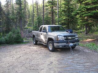 Fall Creek trailhead 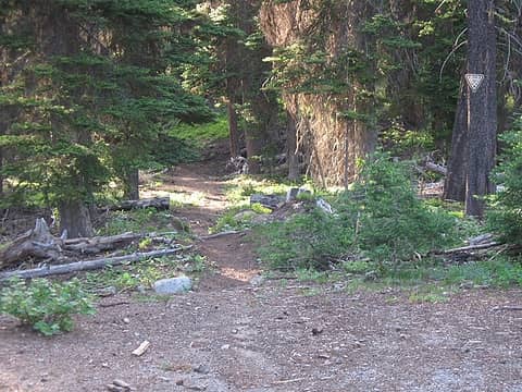 Trail heading out 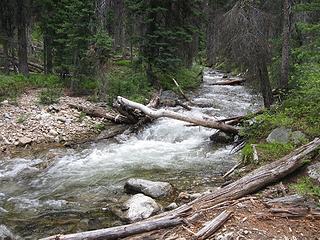 Need a good log crossing 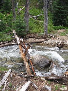 This is where I crossed the creek 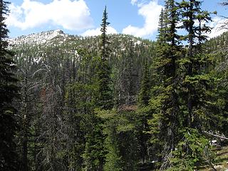 My goal is coming into view 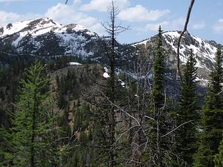 Connecting ridge to Birch Mtn 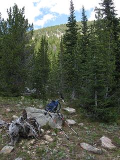 Old trail ended... now cross-country up to the top 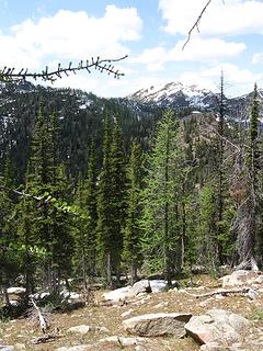 Birch Mtn in distance 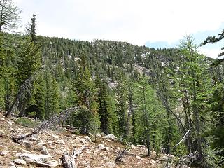 Can see the upper part of the ridge that connects to Obstruction Peak 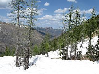 Snow well consolidated and easy to walk on 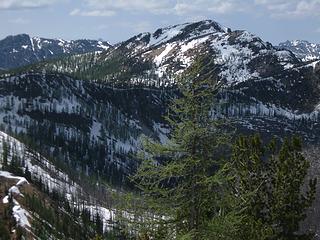 Birch Mtn 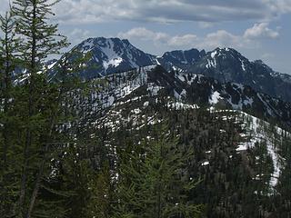 Big Craggy and West Craggy coming into a good view 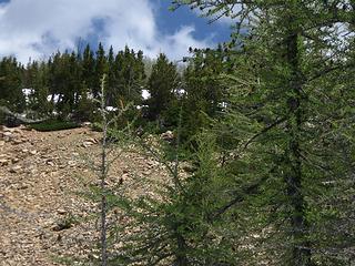 Obstruction Peak up there somewhere... lol... 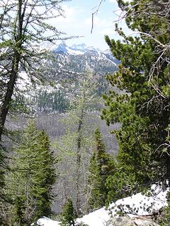 Climb got steep in a few places 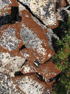 Sure a lot of ladybugs 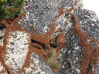 Rock painted with ladybugs  Ladybug closeup  They were clustered everywhere on a small section of the rocks at the very top of Obstruction Peak  You can usually always find a "convention" of ladybugs on many of the peaks around the Methow Valley in the spring and early summer. This picture was taken on Obstruction Peak in July 2012. Access via the Falls River drainage.  Crystal Lake and Disaster Creek headwaters 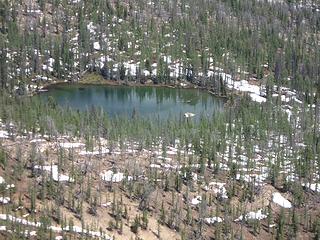 Zoomin to Crystal Lake 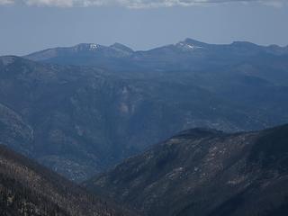 Looking east towards Tiffany, Middle Tiffany, and Clark 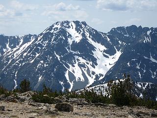 Big Craggy Mtn across from Obstruction Peak 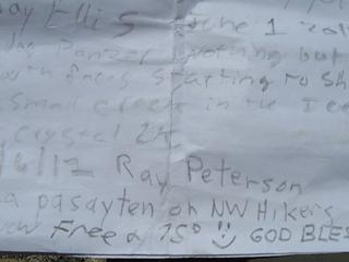 I added my name to the register 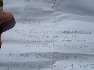 Peak register 4  Peak register 3  Peak register 2 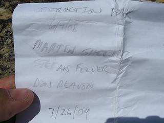 Peak register on Obstruction Peak 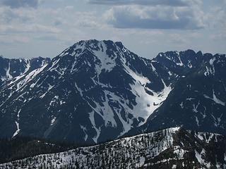 Big Craggy Mtn 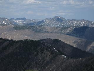 2 labels Looking out over riges that hold Kidney & Halfmoon lakes 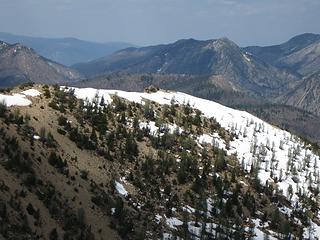 Ridge connecting to Obstruction Peak from north 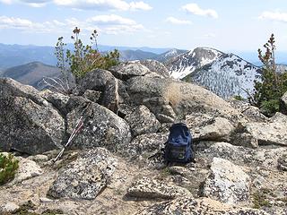 Looking southeast... Mt Barney... 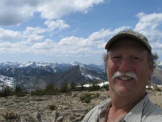 Happy but tired 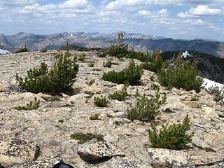 Looking northerly 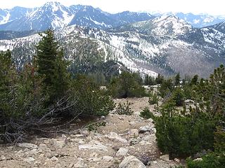 Down... Birch Mtn to right 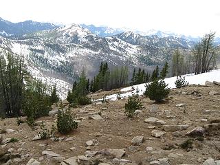 Heading down... open country in the higher elevations... 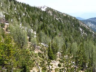 This ridge continues on to Mt. Barney 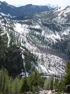 Heading back down... 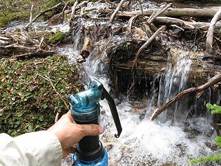 Filtering andf refilling my water bottles 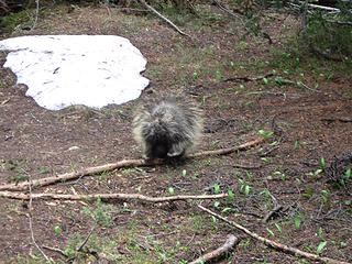 Just strolling along... 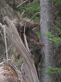 Whoa... I am going to climb the tree... 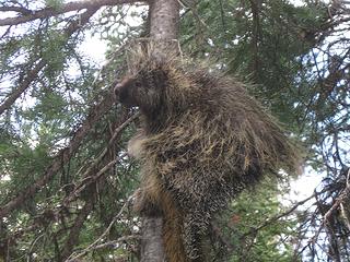 Came across this critter on the hike back from Obstruction Peak along a trail in the Fall River drainage. We stared at each other for awhile, and then he figured that maybe he should climb a tree... :-)
|
| Back to top |
  
|
|
Tangeman
ride the storm

Joined: 24 Oct 2010
Posts: 485 | TRs | Pics
Location: Cascadia |
|
Tangeman
ride the storm
|
Sat Jul 07, 2012 5:54 pm |
|
|
Nice! Any idea what the trail to crystal lake is like? And is the "Falls Creek TH" at the end of Falls Creek Road?
"Civilization is a nice place to visit, although I wouldn't want to live there."
My photos
"Civilization is a nice place to visit, although I wouldn't want to live there."
My photos
|
| Back to top |
|
|
pasayten
Class of 65...
Joined: 18 Aug 2011
Posts: 536 | TRs | Pics
Location: Winthrop, WA |
|
pasayten
Class of 65...
|
Sat Jul 07, 2012 5:58 pm |
|
|
I have heard that the trail to Crystal Lake is covered by numerous blow downs... Somebody had mentioned 299... lol... The Disaster Creek Basin looks like it really got fried in the fire...
Recent USFS report...
Crystal Lake 517
Snow free to a quarter mile past the wilderness boundary. Hundreds of down trees have not been cleared. The first 2 miles of trail are very brushy.
6/15/12
I was toying with using this route as an alternate route to the lake for the future...  Yes, the Fall Creek trailhead is at the end of the road...
|
| Back to top |
|
|
wildernessed
viewbagger

Joined: 31 Oct 2004
Posts: 9275 | TRs | Pics
Location: Wenatchee |
 Nice, we were thinking of going up there and into all the lakes, we had thoughts of just taking it up the gut from Black Lake, this might be easier. Nice, we were thinking of going up there and into all the lakes, we had thoughts of just taking it up the gut from Black Lake, this might be easier. 
Living in the Anthropocene
Living in the Anthropocene
|
| Back to top |
|
|
pasayten
Class of 65...
Joined: 18 Aug 2011
Posts: 536 | TRs | Pics
Location: Winthrop, WA |
|
pasayten
Class of 65...
|
Thu Jul 12, 2012 2:28 pm |
|
|
|
| Back to top |
|
|
BeyondLost
Crazy Bob

Joined: 07 Jul 2007
Posts: 3601 | TRs | Pics
Location: Whidbey Island, WA |
| pasayten wrote: | | I finally reached the top at 1pm... Getting slow in my old age... |
Shoot, you're just a kid.  Nice trip and pics. Enjoyed it.
|
| Back to top |
|
|
silence
Member

Joined: 25 Apr 2005
Posts: 4420 | TRs | Pics
|
|
silence
Member
|
Thu Jul 12, 2012 3:34 pm |
|
|
cool stuff .. keep em coming from your side of the crest
PHOTOS
FILMS
Keep a good head and always carry a light bulb. Bob Dylan
PHOTOS
FILMS
Keep a good head and always carry a light bulb. Bob Dylan
|
| Back to top |
|
|
|
|


