| Previous :: Next Topic |
| Author |
Message |
Schroder
Member


Joined: 26 Oct 2007
Posts: 6717 | TRs | Pics
Location: on the beach |
|
Schroder
Member
|
 Sat Jul 28, 2012 2:38 pm |
|
|
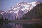
The North Fork Sauk Road (49) opened last Friday so Hanzsek suggested we head over to Lake Byrne for a few classic photos of Glacier Peak. Since it's been a couple of years since this trail has seen many people, we decided to allow 3 days - camp near Sunup Lake the first night, the second at Byrne & the third day back out. I didn't expect this to be an epic hike.
We got a reasonably early start at 8:30 and from the looks of the trailhead, it was a good thing. It was pretty brushy in the flat area but as soon as we hit the slope the brush disappeared and the trail looked in good shape. The first mile went pretty fast until we hit the first giant blowdown. There didn't seem to be an easy way around it so we ended up pushing our packs underneath it and crawling through.
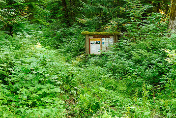 Trailhead 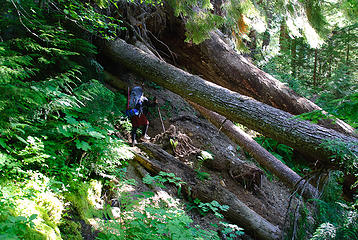 First blowdown 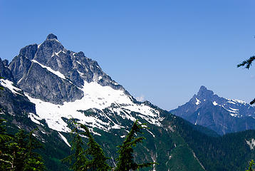 Pugh 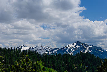 Red & Black Mountains 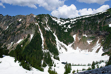 Round Lake 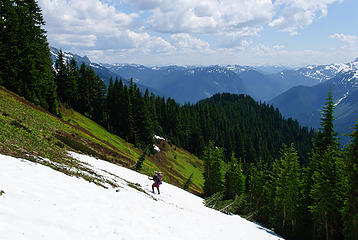 Heading down from Round Lake cutoff 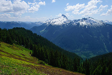 Sloan & Bedal Peaks 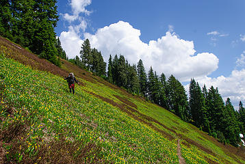 there's the trail! 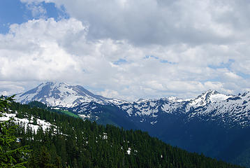 first glimpse of Glacier Peak 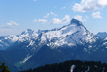 Kyes, Monte Cristo, Cadet, Sloan 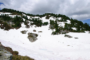 Sunup Lake 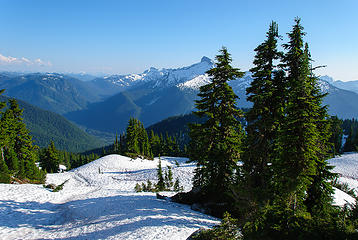 North Fork Sauk Valley 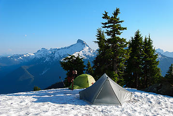 camp above Sunup Lake 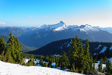 view from camp 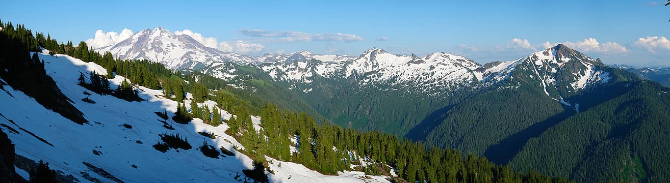 Glacier to Red Mountain pan 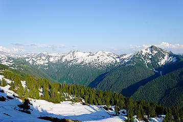 Kololo to Red 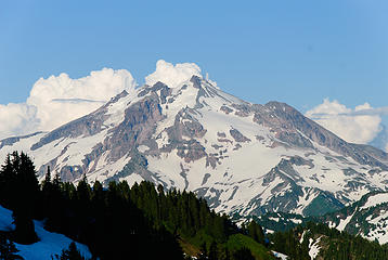 Glacier Peak 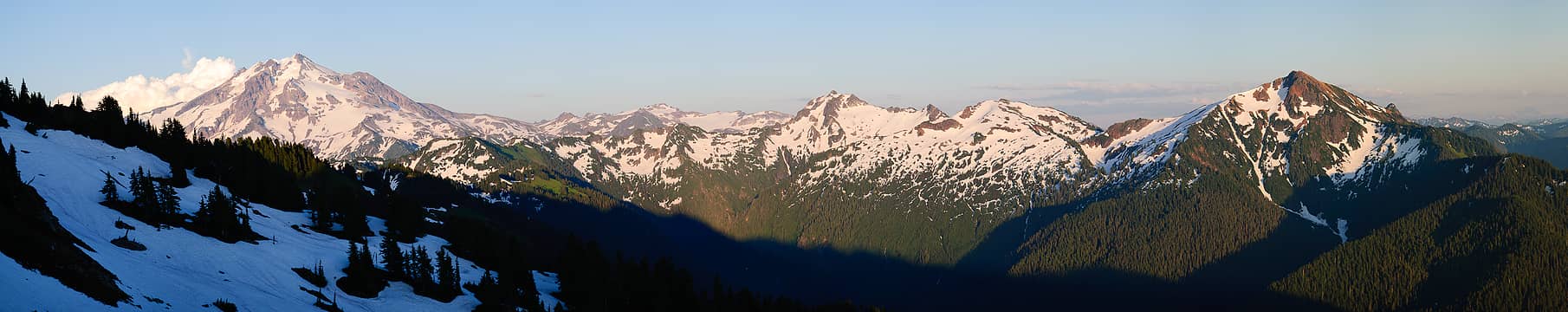 Glacier to Red Mountain pan 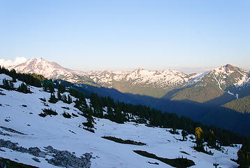 tomorrow's terrain 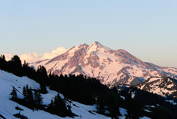 Glacier sunset 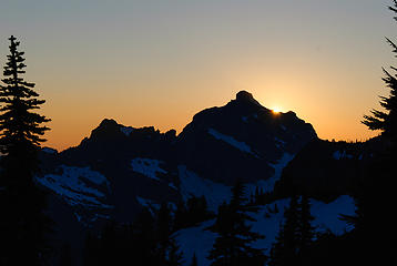 Pugh sunset 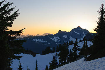 Pugh & Three Fingers 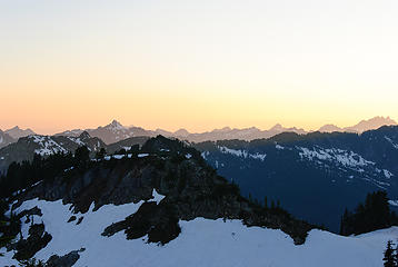 view west 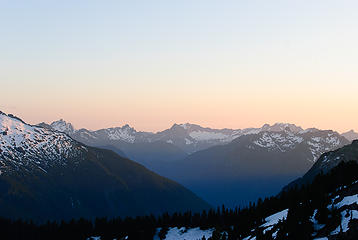 Del Campo to Hall Peak 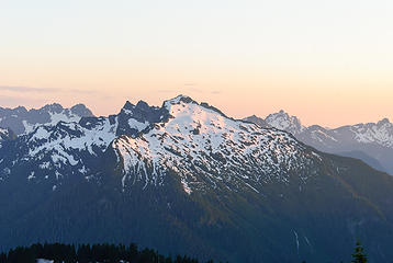 Addison Ridge, Bedal, Del Campo, Morning Star 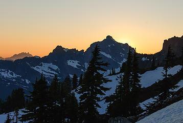 Pugh & Three Fingers 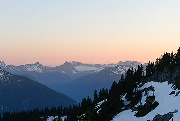 Morning Star, Sperry, Vesper, Big Four 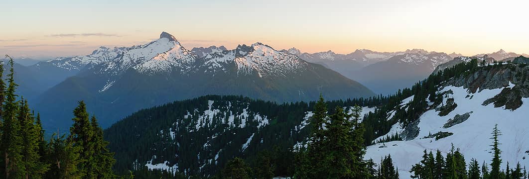 pan south 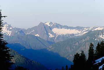 Morning Star, Sperry, Vesper 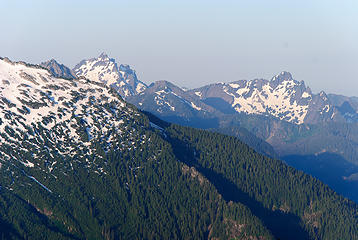 Del Campo, Morning Star 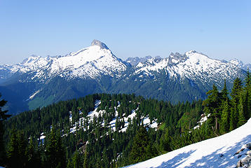 Sloan & Bedal in the morning 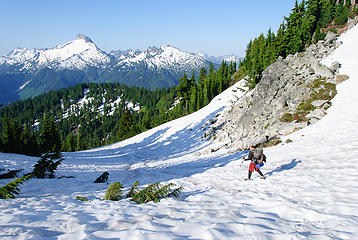 descending from Sunup Lake 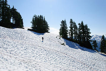 traversing the first basin 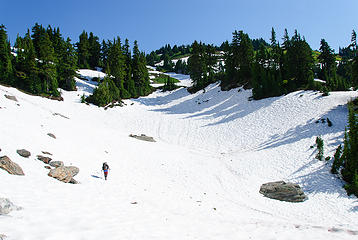 traversing the first basin 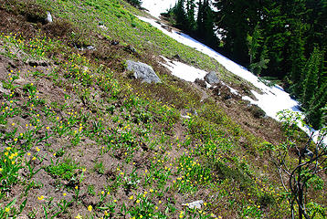 that's the trail 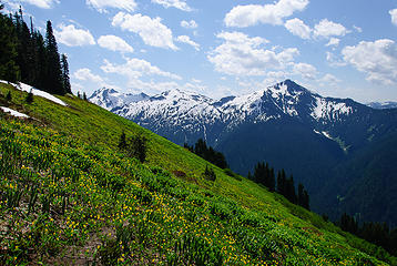 the meadow 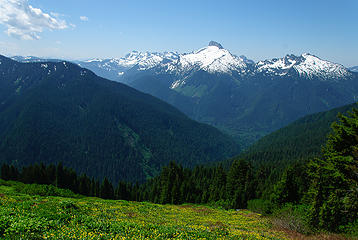 Monte Cristo group, Sloan, Bedal 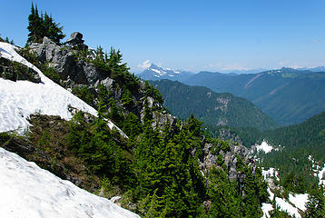 Point 5923 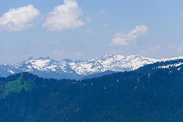 view north 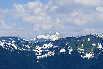 Dome Peak 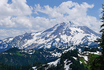 Glacier from Pt 5923 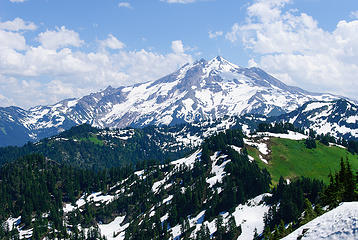 Glacier from Pt 5923 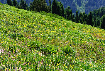 back at the meadow 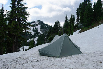 second camp 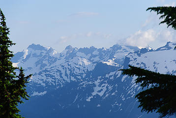 Kyes, Monte Cristo, Cadet 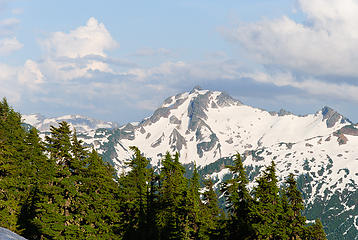 Black Mountain  Sloan in the morning 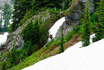 last view of Chris 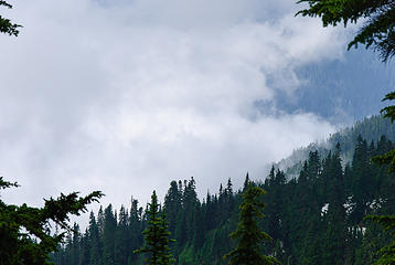 cloud watching 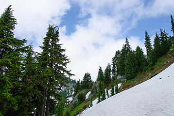 cloud watching 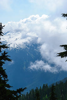 clouds hammering Sloan 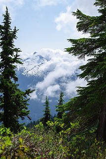 Sloan into view briefly 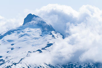 Sloan 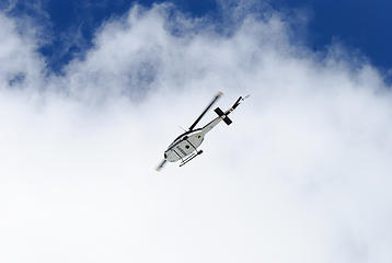 help's finally here 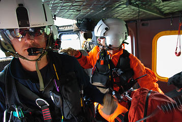 rescue 1 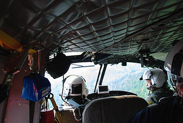 rescue 2 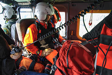 rescue 3 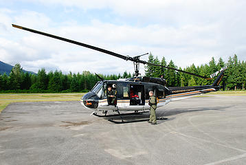 rescue 4 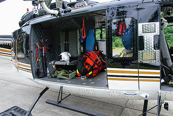 rescue 5 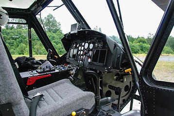 rescue 6
|
| Back to top |
  
|
|
JimK
Member

Joined: 07 Feb 2002
Posts: 5606 | TRs | Pics
Location: Ballard |
|
JimK
Member
|
Sat Jul 28, 2012 2:45 pm |
|
|
I'm glad to see you are home writing this report. I hope all turned out okay. By the way, some very nice photos.
|
| Back to top |
|
|
contour5
Member

Joined: 16 Jul 2003
Posts: 2963 | TRs | Pics
|
|
contour5
Member
|
Sat Jul 28, 2012 3:05 pm |
|
|
Yikes. "Last view of Chris" is one ominous title...
The pictures are about 256 million shades of awesome.
Hope Chris is ok...
|
| Back to top |
|
|
silence
Member

Joined: 25 Apr 2005
Posts: 4420 | TRs | Pics
|
|
silence
Member
|
Sat Jul 28, 2012 3:12 pm |
|
|
OMG! .. what the heck happened??? i hope chris is ok .. send him our best ..
PHOTOS
FILMS
Keep a good head and always carry a light bulb. Bob Dylan
PHOTOS
FILMS
Keep a good head and always carry a light bulb. Bob Dylan
|
| Back to top |
|
|
Schroder
Member
Joined: 26 Oct 2007
Posts: 6717 | TRs | Pics
Location: on the beach |
|
Schroder
Member
|
Sat Jul 28, 2012 4:16 pm |
|
|
Narrative added.
Chris made it down in blazing speed, otherwise I'd still be sitting in the clouds up there. 
|
| Back to top |
|
|
silence
Member
Joined: 25 Apr 2005
Posts: 4420 | TRs | Pics
|
|
silence
Member
|
Sat Jul 28, 2012 4:53 pm |
|
|
so glad you made it out ok .. was it a break or a sprain?
PHOTOS
FILMS
Keep a good head and always carry a light bulb. Bob Dylan
PHOTOS
FILMS
Keep a good head and always carry a light bulb. Bob Dylan
|
| Back to top |
|
|
Schroder
Member
Joined: 26 Oct 2007
Posts: 6717 | TRs | Pics
Location: on the beach |
|
Schroder
Member
|
Sat Jul 28, 2012 4:59 pm |
|
|
Something like a torn meniscus, from my own diagnosis. I declined going to the E.R. so I'm going to try to see a orthopedist next week.
|
| Back to top |
|
|
silence
Member
Joined: 25 Apr 2005
Posts: 4420 | TRs | Pics
|
|
silence
Member
|
Sat Jul 28, 2012 5:00 pm |
|
|
i feel your pain .. and understand about the er .. rest .. do you want the name of a good orthopedic surgeon?
PHOTOS
FILMS
Keep a good head and always carry a light bulb. Bob Dylan
PHOTOS
FILMS
Keep a good head and always carry a light bulb. Bob Dylan
|
| Back to top |
|
|
touron
Member
Joined: 15 Sep 2003
Posts: 10293 | TRs | Pics
Location: Plymouth Rock |
|
touron
Member
|
Sat Jul 28, 2012 5:15 pm |
|
|
Touron is a nougat of Arabic origin made with almonds and honey or sugar, without which it would just not be Christmas in Spain.
|
| Back to top |
|
|
the Zachster
Member

Joined: 17 Jan 2007
Posts: 4776 | TRs | Pics
Location: dog training |
Yikes!  I saw your report before you added the narrative...it wasn't what I expected! Sounds like a bum accident that could happen to any of us at any time. I'm really glad this had a safe outcome. Hope the knee recovers quick. And despite the wild ending and some really challenging navigation, you got some great pics! Thanks for sharing your story. I saw your report before you added the narrative...it wasn't what I expected! Sounds like a bum accident that could happen to any of us at any time. I'm really glad this had a safe outcome. Hope the knee recovers quick. And despite the wild ending and some really challenging navigation, you got some great pics! Thanks for sharing your story.
"May I always be the kind of person my dog thinks I am"
"May I always be the kind of person my dog thinks I am"
|
| Back to top |
|
|
Jim Dockery
Member

Joined: 12 Sep 2007
Posts: 3092 | TRs | Pics
Location: Lake Stevens |
Dang, could'a been me on Broken Top a couple weeks ago. !@#$ happens to the best of us  . Glad you got out ok, good luck with the recovery. Great pics btw . . Glad you got out ok, good luck with the recovery. Great pics btw .
|
| Back to top |
|
|
David¹
Token Canadian

Joined: 25 Jul 2002
Posts: 3040 | TRs | Pics
Location: The Great White North |
|
David¹
Token Canadian
|
Sat Jul 28, 2012 5:36 pm |
|
|
Lost Creek Ridge strikes again!
That trail is much tougher than it first appears, glad everything worked out in the end.
SAR
|
| Back to top |
|
|
Backpacker Joe
Blind Hiker

Joined: 16 Dec 2001
Posts: 23956 | TRs | Pics
Location: Cle Elum |
Im so glad you made it out of there Schroder. I certainly hope that youll heal up quickly. Good luck with that.
"If destruction be our lot we must ourselves be its author and finisher. As a nation of freemen we must live through all time or die by suicide."
Abraham Lincoln
"If destruction be our lot we must ourselves be its author and finisher. As a nation of freemen we must live through all time or die by suicide."
Abraham Lincoln
|
| Back to top |
|
|
Popcorn
Member
Joined: 20 Aug 2008
Posts: 151 | TRs | Pics
Location: Another Place |
|
Popcorn
Member
|
Sat Jul 28, 2012 7:46 pm |
|
|
So glad you made it back in one piece, Shroder. What horrible luck.
Haven't been up to Lake Byrne in decades--used to be accessible via Kennedy Hot Springs, of course, but...BTW, is the old Whitechuck road open to bicycles? Quark used to update the group, but I haven't seen one her Whitechuck road updates in a while.
|
| Back to top |
|
|
Hanzsek
Member

Joined: 13 Sep 2009
Posts: 37 | TRs | Pics
Location: Snohomish |
|
Hanzsek
Member
|
Sat Jul 28, 2012 9:32 pm |
|
|
Never having been involved in a rescue situation before, I didn't know exactly what to expect. What I witnessed was impressive. Everyone involved was courteous, skilled and professional - the rangers at the Verlot RS, Snohomish County SAR director Glenn Bergstrom, and of course, the helicopter crew. My sincere thanks to all.
|
| Back to top |
|
|
|
|


