| Previous :: Next Topic |
| Author |
Message |
Sadie's Driver
Sadie's Driver


Joined: 24 Apr 2006
Posts: 1763 | TRs | Pics
Location: Welcome Pass |
  Little bastards found us! Little bastards found us!   We were heavily armed . . . . with DEET and anything else we could slap on - - - still managed to get chewed on . . . must have been all of those flowers out there!
Tish and I almost simultaneously came up with the idea of doing Garland, both of us thought of it as more of a Fall hike. But the distance and elevation gain seemed agreeable - and the chance for some decent views made this a real possibility. We just didn't plan on inviting the little bastards along!
We got a bit of a late start on this little adventure . . . something about missing boots . . . .
We were heavily armed . . . . with DEET and anything else we could slap on - - - still managed to get chewed on . . . must have been all of those flowers out there!
Tish and I almost simultaneously came up with the idea of doing Garland, both of us thought of it as more of a Fall hike. But the distance and elevation gain seemed agreeable - and the chance for some decent views made this a real possibility. We just didn't plan on inviting the little bastards along!
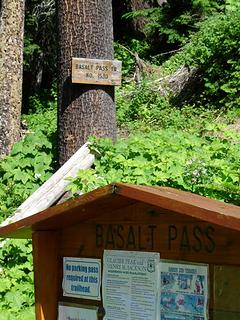
We got a bit of a late start on this little adventure . . . something about missing boots . . . .   Joining the blood donor group: Tish, Darryl, Barry, the "other" Suzanne, Gus, and the Driver. It was almost 11:00 a.m. before we got rolling and it was starting to heat up. (Anything above 70 is heating up for me!) To get to the Basalt Ridge trailhead - head towards Lake Wenatchee, turn east at the fork in the road and go to the Chiwawa Rd. - about 9.5 miles and then turn right on the Chikamin Road (dirt road here) for almost 6 miles. The road is in very good condition. There isn't much parking at the trailhead, but we figured no one else would be crazy enough to be doing this trip on a potentially hot summer day - and there is no water along the way.
There was one other car at the trailhead. There is a creek right at the start as you make your way up (and I do mean up) the trail through the trees. Joining the blood donor group: Tish, Darryl, Barry, the "other" Suzanne, Gus, and the Driver. It was almost 11:00 a.m. before we got rolling and it was starting to heat up. (Anything above 70 is heating up for me!) To get to the Basalt Ridge trailhead - head towards Lake Wenatchee, turn east at the fork in the road and go to the Chiwawa Rd. - about 9.5 miles and then turn right on the Chikamin Road (dirt road here) for almost 6 miles. The road is in very good condition. There isn't much parking at the trailhead, but we figured no one else would be crazy enough to be doing this trip on a potentially hot summer day - and there is no water along the way.
There was one other car at the trailhead. There is a creek right at the start as you make your way up (and I do mean up) the trail through the trees.
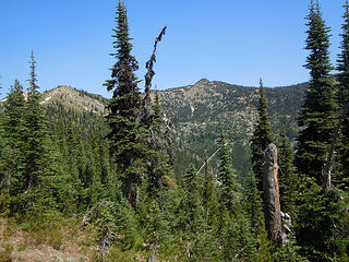
 Trailhead 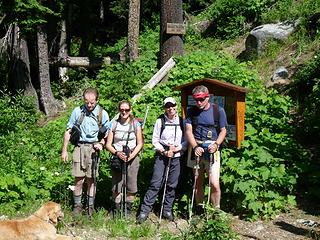 Hmmm - not everyone is paying attention to the photo op! 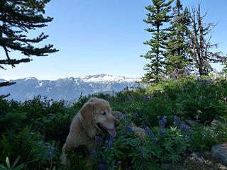 Flower-boy 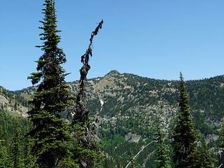 Our destination - Garland - off in the distance 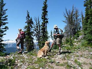 Snack break - one of the best parts of the trip!  Heavens no, you keep going. You give up a little gain when you drop to the backside (west side) of a little bump on the ridge and then head back up. Heavens no, you keep going. You give up a little gain when you drop to the backside (west side) of a little bump on the ridge and then head back up.
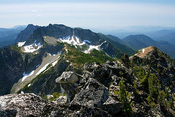
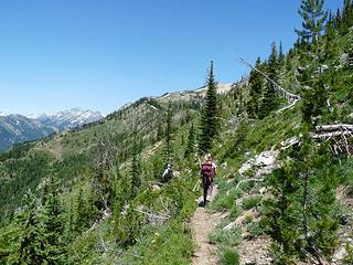 Heading north on the Basalt Ridge trail - lovely flowers on the western slope 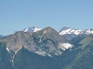 Looking north in the vicinity of Phelps 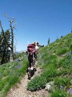 Basalt Ridge Trail 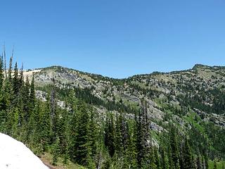 Looking from Basalt Ridge over to the east-west ridge we would take to Garland (the bump to the right) 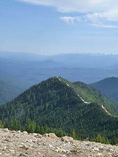 Basalt Ridge with snow patches 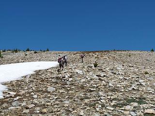 Heading up more of Basalt Ridge 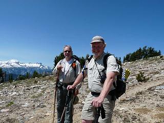 Mid-life Hiker and friend (on their way back from Rampart) 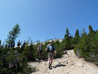 Ridge walk from Basalt to Garland 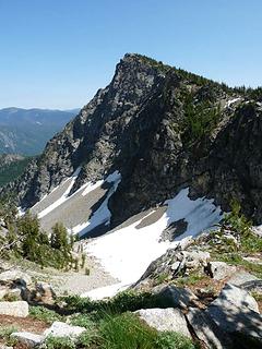 Looking to Garland from ridge to the west 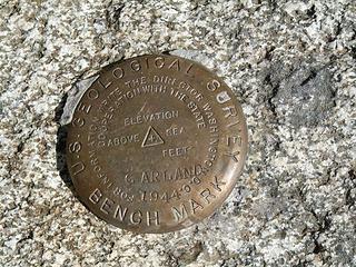 Benchmark on gop of Garland (we DID find a summit register of sorts) 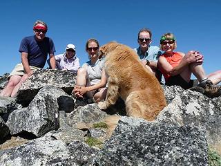 Group shot on summit of Garland - Gus hogging the view! Gorgeous day! 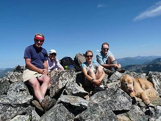 Barry, Suzanne R, Tish, Darryl and Gus 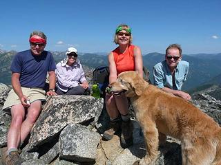 Barry, Suzanne R, the Driver, Darryl & Gus 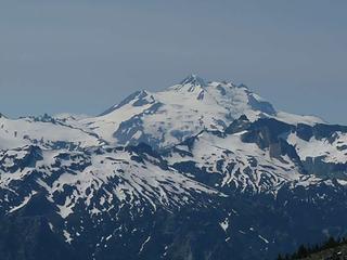 Glacier looming 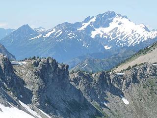 Northern end of Basalt Ridge with stuff behind 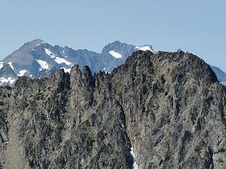 Rampart to the north and west of Garland along Basalt Ridge  The bugs were still ferocious, but we managed to make it back down without incident.
A lovely ridge walk and expansive views. Not as many Larch as there is over near Fifth of July and Larch Lakes - but likely quite decent in the Fall.
Total gain: 4800'
Miles: 12
Gear: Poles only (although I took spikes since we sure needed them on 7-Fingered Jack last weekend; and Tish brought her ice ax! Everyone else was much more in tune with the conditions! The bugs were still ferocious, but we managed to make it back down without incident.
A lovely ridge walk and expansive views. Not as many Larch as there is over near Fifth of July and Larch Lakes - but likely quite decent in the Fall.
Total gain: 4800'
Miles: 12
Gear: Poles only (although I took spikes since we sure needed them on 7-Fingered Jack last weekend; and Tish brought her ice ax! Everyone else was much more in tune with the conditions!  )
Great trip - except for the uninvited little bastards! Oh, and the wonderful One-hour traffic jam between Index and Sultan. )
Great trip - except for the uninvited little bastards! Oh, and the wonderful One-hour traffic jam between Index and Sultan.  We got back to the car a little after 6:00 p.m. - but didn't get back to Seattle until almost 9:30! Ugh. Thanks, all! We got back to the car a little after 6:00 p.m. - but didn't get back to Seattle until almost 9:30! Ugh. Thanks, all! 
Four-paw buddy lets me tag along!
Four-paw buddy lets me tag along!
|
| Back to top |
  
|
|
Middle E
no more moustache

Joined: 10 Feb 2008
Posts: 432 | TRs | Pics
Location: Seattle, WA |
|
Middle E
no more moustache
|
 Mon Jul 30, 2012 3:13 pm |
|
|
In spite of the thirsty mosquitoes and the scorching (for Seattleites) 70 degree temperatures, this turned out to be a gem of a hike and a fine ridge run. The trail heading southeast from Basalt Ridge (passing below the summit of Garland) is little used and barely visible, and there was no obvious bootpath to the summit. This seems surprising, given the splendid 360 degree views to be had. There was some debris on the summit suggesting this was once a lookout site, and a miniature register was tucked almost invisibly inside a plastic film canister (with one signature from Sept. 2011). Based on previous trip reports this is a colorful hike in larch season, though the larch are not as plentiful as in other nearby locations. All in all a fine trip!
 Garland in the distance 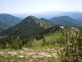 Ridge to route to Garland 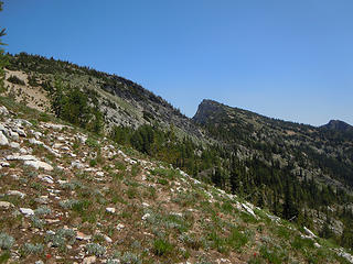 Garland (center) 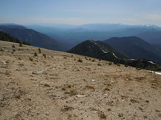 Pumice slope 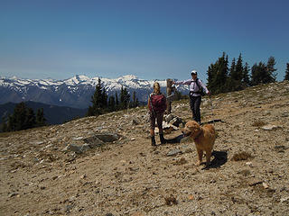 Tish and Suzanne R and Gus 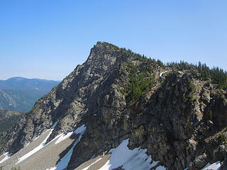 Garland 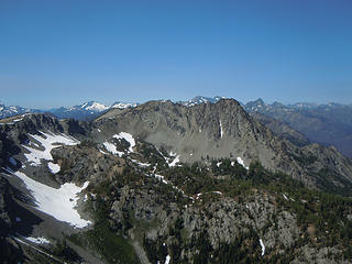 Rampart and Devils Smokestack 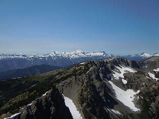 Glacier Pk and others 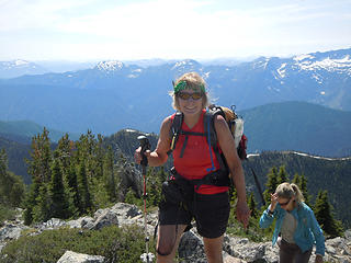 Suzanne and Tish on Garland 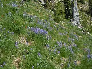 Lupines in bloom
pithy yet insightful signature
pithy yet insightful signature
|
| Back to top |
|
|
GaliWalker
Have camera will use

Joined: 10 Dec 2007
Posts: 4930 | TRs | Pics
Location: Pittsburgh |
|
GaliWalker
Have camera will use
|
Mon Jul 30, 2012 6:39 pm |
|
|
| Middle E wrote: | | this turned out to be a gem of a hike and a fine ridge run |
The section north all the way to 5th of July is incredible, with fantastic views of Glacier Peak and the Chiwawas. One of my favorite ridge runs.
 Looking back at the ridge, from 5th of July
|
| Back to top |
|
|
|
|
You cannot post new topics in this forum
You cannot reply to topics in this forum
You cannot edit your posts in this forum
You cannot delete your posts in this forum
You cannot vote in polls in this forum
|
Disclosure: As an Amazon Associate NWHikers.net earns from qualifying purchases when you use our link(s). |


