| Previous :: Next Topic |
| Author |
Message |
Matt
Tea, Earl Grey, Hot


Joined: 30 Jan 2007
Posts: 4307 | TRs | Pics
Location: Shoreline |
|
Matt
Tea, Earl Grey, Hot
|
 Thu Aug 09, 2012 10:50 pm |
|
|
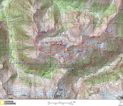
Peaks: Red Face 7141, Indian 7133, Sublime Ridge Points 7087 & 6874 (USGS Mt. Redoubt)
Dates: July 26-30, 2012
Party: Matt, Dicey, cartman
The original plan: Hike to Tapto Lakes via Hannegan Pass & Whatcom Pass. Climb Red Face & Indian. Take Whatcom-Redoubt High Route and Ruta Lake High Route to Bear Peak. Return via (reputedly very brushy) Chilliwack Trail.
What actually happened: Didn't go to Bear. Instead went only a few miles up the Whatcom-Redoubt High Route. But what a few miles it was!
We took the name "Sublime Ridge" from the following quote, describing the southern end of the Whatcom-Redoubt High Route.
"Now we were beginning some of the best ridgetop travel to be found anywhere in the range; broad ridges, gentle summits, walking on a carpet rarely as high as 6'. Our route took us over Pk 6874' (554'P) and Pk 7087' (687'P). Not only was the travel great, but the views were sublime with the full expanse of Challenger and its satellites front and center, and close below some of the finest lake basins I've ever seen." Mitch Blanton, August 2001
 GPS Track 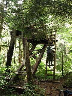 Platform for the cable car 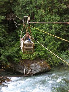 Cable Car over the Chillwack River 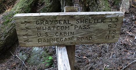 Junction at Brush Creek 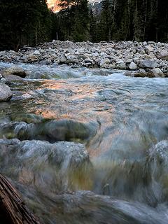 Alpenglow reflected in Brush Creek 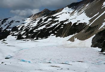 Tapto Lakes & Redface from camp 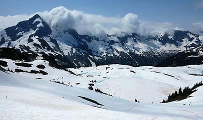 Tapto Lakes and clouds over Easy Ridge 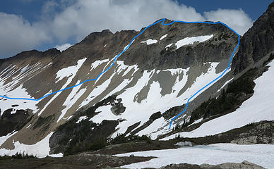 Red Face Mountain Route 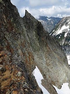 Steep back side of Red Face 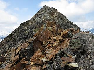 On the east ridge of Red Face 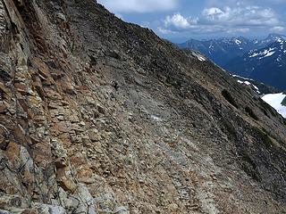 1 label Crossing the nasty sloping benches (see Dicey?) 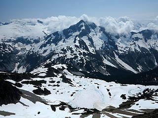 Challenger, Whatcom, Tapto Lakes, and clouds 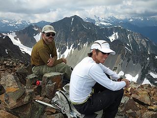 Eric & Carla on Red Face, with Indian Mountain behind 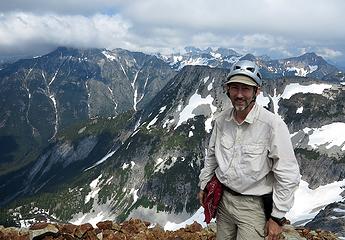 Me on Red Face, with Bear Mountain behind 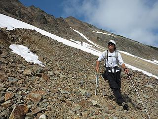 Dicey & cartman glad to be down on the lower-angled talus 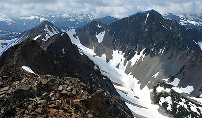 Route to Indian, viewed from Red Face 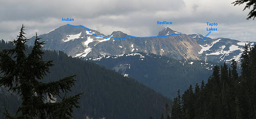 Route to Indian, viewed from 6.6 miles away at Hannegan Pass 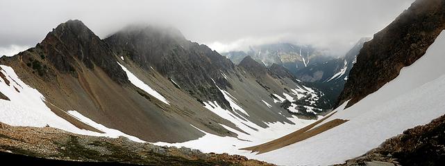 Walking across the Red Face Indian Col 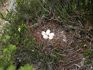 Nest on the back side of Indian sub-summit 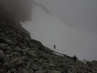 On easier terrain below Indian, such fine Cascades weather 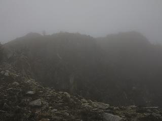 Dicey arriving at Indian summit 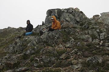 cartman & Dicey enjoying Indian summit 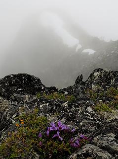 Indian summit view 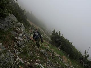 Heading back behind the sub-summit 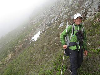 Is Dicey smiling or grimacing? 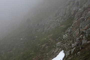 Cartman looks rather dim 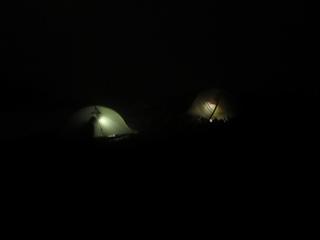 Finally in tents at 1130pm 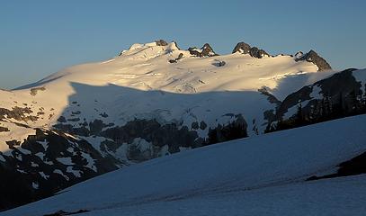 Pointy shadow of Whatcom on Challenger 8:12pm 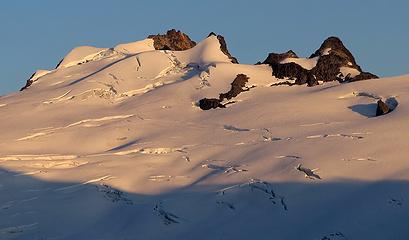 Challenger summit area, 8:21pm 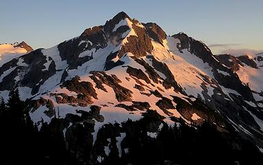 Whatcom sunset 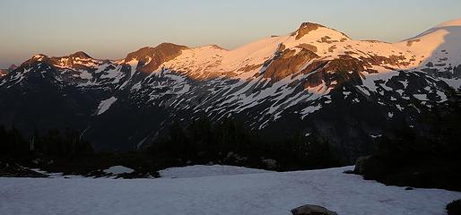 Wiley Ridge 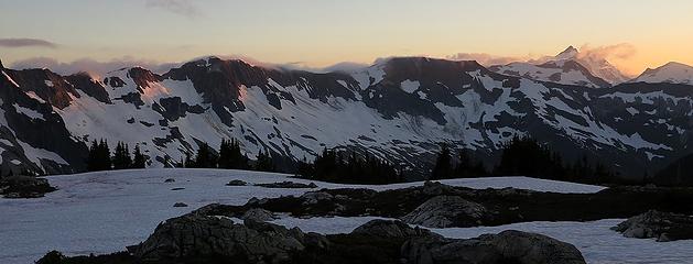 Clouds still remain on Easy Ridge 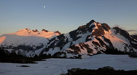 Challenger, Whatcom & Moon, 8:34pm 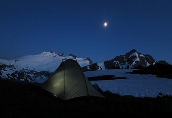 View or Eric's tent out the door of our tent, 9:31pm 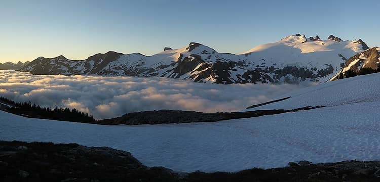 Tapto Morning above the clouds 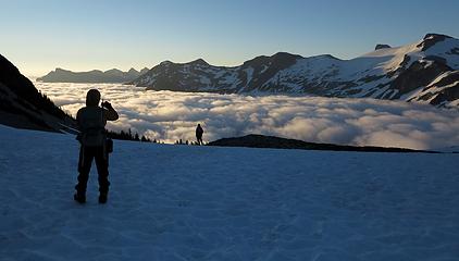 Hiking out above the clouds 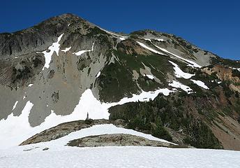 Point 7087 from Middle Lakes we followed the snow ramps up rightward, then back left 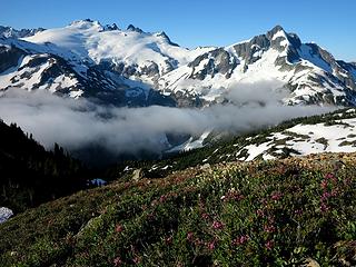 Red & yellow heather with Whatcom Pass peaks 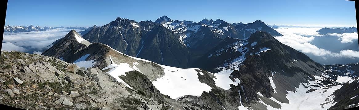 Chilliwack River to Little Beaver, with Sublime Ridge foreground, Bear & Redoubt background 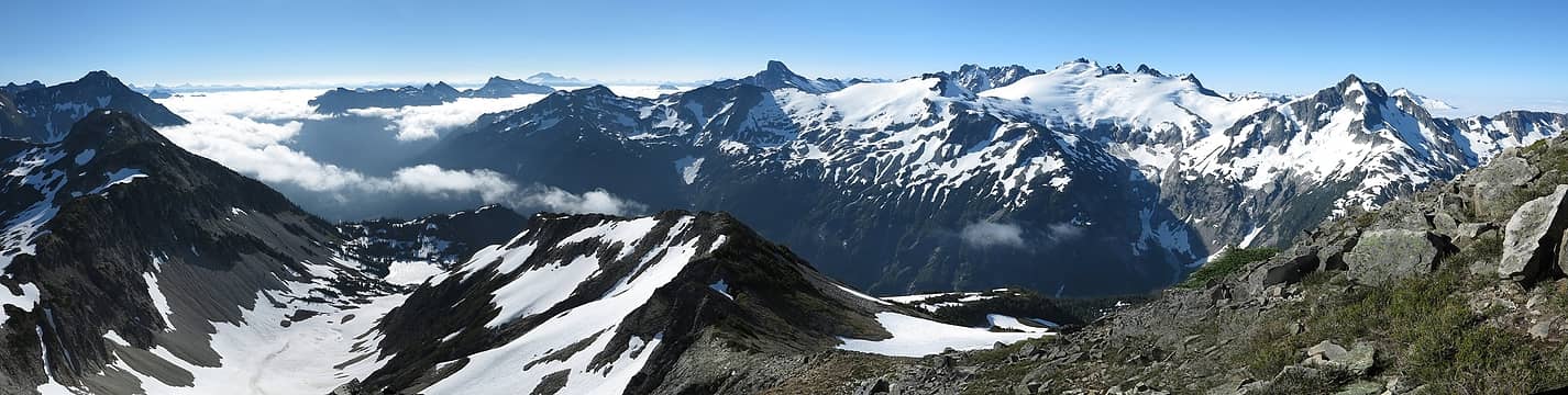 Little Beaver to Whatcom Pass, with lots of Pickets 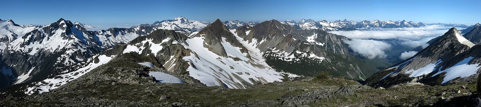 Whatcom Pass to Chilliwack River, with Red Face & Indian foreground, and all the Baker area peaks behind 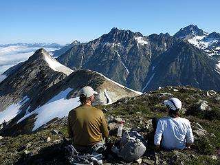 cartman & Dicey 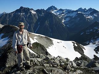 Me with Bear, Redoubt, & the other Chillwack peaks 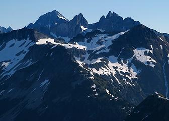 Col of the Wild (between NW & SE Mox) 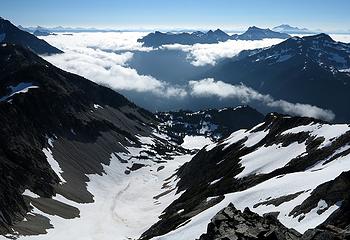 East Lakes & the Prophet Range 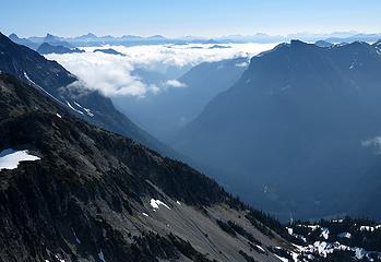 Looking up Little Beaver under the receding skirt of clouds 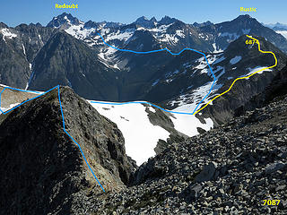 Route to 6874, and the high route beyond 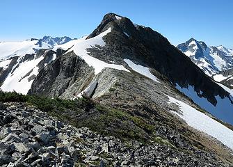 Coming down off Point 7087 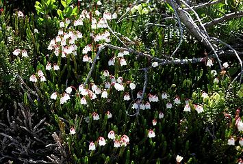 White heather along the way 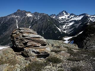 An interesting rock along the way 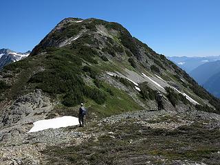 Last col before Point 6874 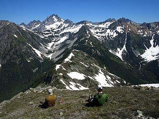 Enjoying the grandstand view of Redoubt 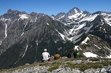 And Bear also 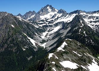 Redoubt & its satellites above Indian Creek Cirque 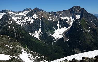 Rusty & Rustic above Pass Creek Cirque 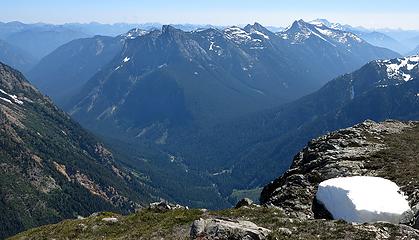 Nice view of Beaver Pass 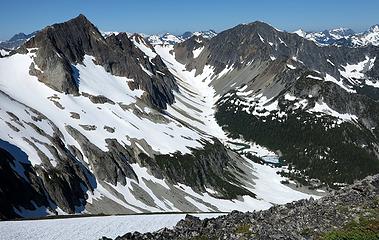 Red Face & Indian, with Reveille Lakes 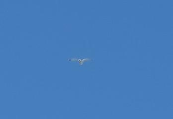 Gull? 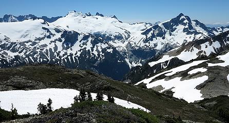 Hike with a view 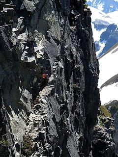 Different definition of a wallflower (looking down a gap in the ridge) 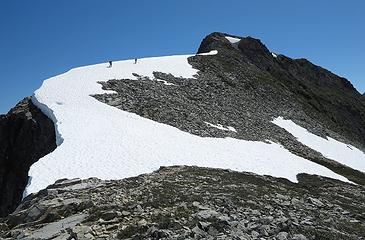 Re-ascending Point 7087 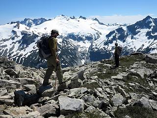 Just some more hiking with a view 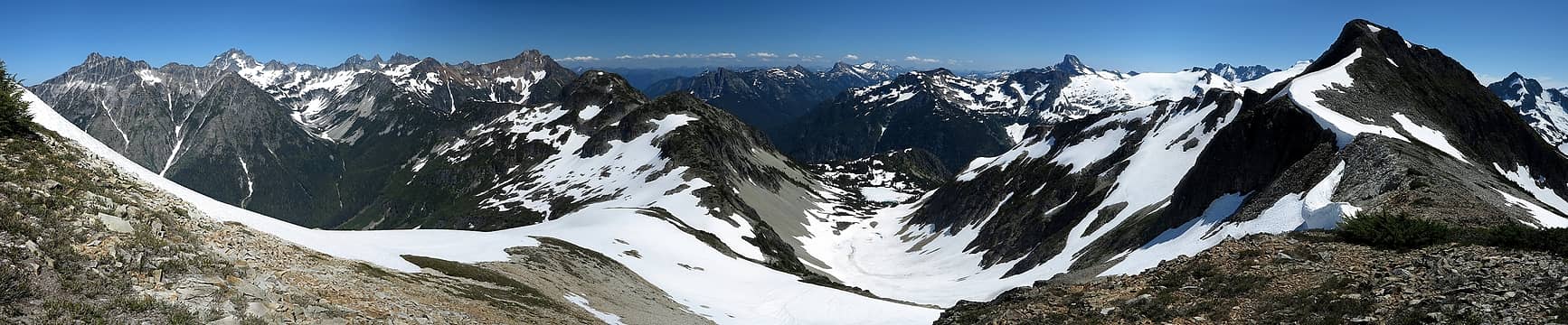 On the ridge above East Lakes 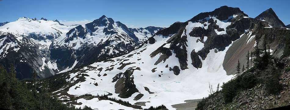 Descending to Middle Lakes 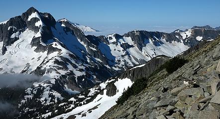 1 label Ptarmigan with a view of Whatcom Pass, on the way to 7087 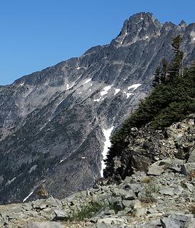 1 label Ptarmigan with a view of Bear Mtn, on the way to 6784 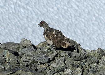 Ptarmigan somewhat ruffled after being chased by photographers 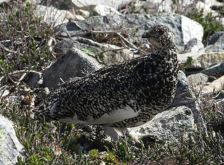 Ptarmigan near camp, letting us get close so its chicks can run away and hide 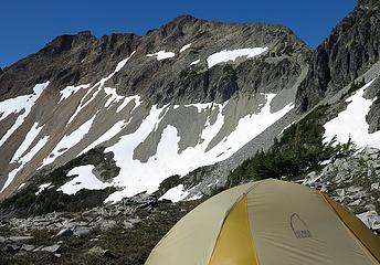 Last view of our high camp. 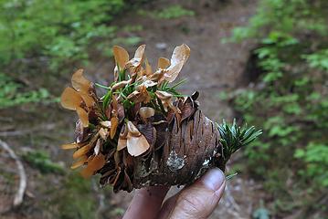 Sprouting pinecone 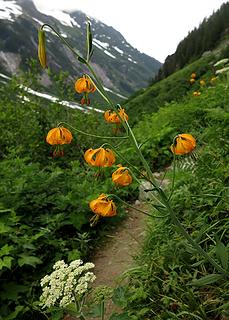 Tiger Lilies 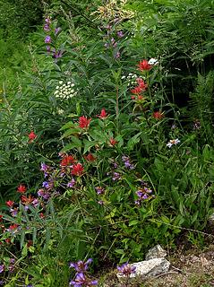 Mixed flower garden 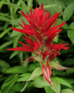 Paintbrush 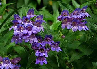 I don't know what these are called 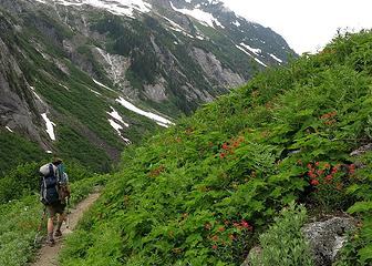 Hiking past flower gardens
As beacons mountains burned at evening. J.R.R. Tolkien
As beacons mountains burned at evening. J.R.R. Tolkien
|
| Back to top |
  
|
|
Backpacker Joe
Blind Hiker

Joined: 16 Dec 2001
Posts: 23956 | TRs | Pics
Location: Cle Elum |
Really wonderful pics Matt. I wish you guys had done it later in the summer so I could see more lakes, but nicely done.
"If destruction be our lot we must ourselves be its author and finisher. As a nation of freemen we must live through all time or die by suicide."
Abraham Lincoln
"If destruction be our lot we must ourselves be its author and finisher. As a nation of freemen we must live through all time or die by suicide."
Abraham Lincoln
|
| Back to top |
|
|
Gregor
Gregor

Joined: 15 May 2007
Posts: 117 | TRs | Pics
|
|
Gregor
Gregor
|
Fri Aug 10, 2012 6:36 am |
|
|
Fantastic pictures Matt
I especially liked that one of Cartman in the cable car. Classic!
|
| Back to top |
|
|
DIYSteve
seeking hygge

Joined: 06 Mar 2007
Posts: 12655 | TRs | Pics
Location: here now |
|
DIYSteve
seeking hygge
|
Fri Aug 10, 2012 8:18 am |
|
|
Nice  Ring-billed Gulls are pretty common in that area
|
| Back to top |
|
|
joker
seeker

Joined: 12 Aug 2006
Posts: 7953 | TRs | Pics
Location: state of confusion |
|
joker
seeker
|
Fri Aug 10, 2012 8:41 am |
|
|
Wow - great set of photos and inspiring report. That traverse looks fantastic.
Geez, how did that happen?  Glad to know you guys have at least some appearances of being mortal. Glad to know you guys have at least some appearances of being mortal.
|
| Back to top |
|
|
RichP
Member

Joined: 13 Jul 2006
Posts: 5634 | TRs | Pics
Location: here |
|
RichP
Member
|
Fri Aug 10, 2012 9:17 am |
|
|
I can now understand why cartman was still feeling this hike during our outing the following weekend.
Looks like a tough but rewarding trip. I've never heard of this area before.
|
| Back to top |
|
|
twodogdad
Member

Joined: 21 Nov 2006
Posts: 846 | TRs | Pics
Location: seattle |
| Matt wrote: | 1 label Crossing the nasty sloping benches (see Dicey?) |
I can see Dicey's cap & bells.
Nice excursion, fellas. Matt, your photos justify the exertions of hauling a camera.
N
|
| Back to top |
|
|
Magellan
Brutally Handsome

Joined: 26 Jul 2006
Posts: 13116 | TRs | Pics
Location: Inexorable descent |
|
Magellan
Brutally Handsome
|
Fri Aug 10, 2012 2:32 pm |
|
|
Really wonderful trip report Matt.
|
| Back to top |
|
|
raising3hikers
Member
Joined: 21 Sep 2007
Posts: 2344 | TRs | Pics
Location: Edmonds, Wa |
Thanks for sharing your trip to that area. That area has me very interested. Beautiful pics as always
|
| Back to top |
|
|
EastKing
Surfing and Hiking

Joined: 28 Mar 2007
Posts: 2082 | TRs | Pics
Location: 77 miles from Seattle! |
|
EastKing
Surfing and Hiking
|
Fri Aug 10, 2012 7:45 pm |
|
|
Awesome Matt! Truely awesome!!!!!
YouTube | SummitPost
Saw the depths of despair. Now I am salvaging what time I have left on Earth.
YouTube | SummitPost
Saw the depths of despair. Now I am salvaging what time I have left on Earth.
|
| Back to top |
|
|
Hiker Mama
Member

Joined: 25 Jun 2006
Posts: 3451 | TRs | Pics
Location: Lynnwood |
Wow, you guys, just fabulous!
|
| Back to top |
|
|
cascadetraverser
Member

Joined: 16 Sep 2007
Posts: 1407 | TRs | Pics
|
Great trip; awesome area!
|
| Back to top |
|
|
iron
Member

Joined: 10 Aug 2008
Posts: 6392 | TRs | Pics
Location: southeast kootenays |
|
iron
Member
|
Tue Nov 06, 2012 1:27 pm |
|
|
great report matt. looks like a truly stellar area. when you want to go back, let me know... 
|
| Back to top |
|
|
cartman
Member
Joined: 20 Feb 2007
Posts: 2800 | TRs | Pics
Location: Fremont |
|
cartman
Member
|
Tue Nov 06, 2012 1:41 pm |
|
|
| Matt wrote: | | We took the name "Sublime Ridge" from the following quote, describing the southern end of the Whatcom-Redoubt High Route.
"Now we were beginning some of the best ridgetop travel to be found anywhere in the range; broad ridges, gentle summits, walking on a carpet rarely as high as 6'. Our route took us over Pk 6874' (554'P) and Pk 7087' (687'P). Not only was the travel great, but the views were sublime with the full expanse of Challenger and its satellites front and center, and close below some of the finest lake basins I've ever seen." Mitch Blanton, August 2001 |
I've taken to giving a name to any peak that doesn't have one on the USGS or that I haven't heard of before. After reading Mitch's TR, I had this one named before leaving for the trip--and it was even better than expected. Sublime Ridge was my favorite summit of the year.
7087 was harder to come up with a name, but settled on Spirit Peak in keeping with the theme for the area.
A loop hiker I encountered on Copper Ridge a few months after this trip said the trail up the Chilliwack to Indian Camp has now been brushed out, as well as the sections up Brush Creek to Whatcom Pass.
|
| Back to top |
|
|
LadyÆsa
Surefooted Spitfire
Joined: 16 Oct 2012
Posts: 671 | TRs | Pics
Location: Custer, Whatcom County, WA |
|
LadyÆsa
Surefooted Spitfire
|
Tue Nov 06, 2012 1:52 pm |
|
|
Beautiful shots, looks like a wonderful hike!
"We have one chance, one chance, to get everything right. We have one chance, one chance, and if we're lucky we might." One Chance, Modest Mouse
"We have one chance, one chance, to get everything right. We have one chance, one chance, and if we're lucky we might." One Chance, Modest Mouse
|
| Back to top |
|
|
|
|
You cannot post new topics in this forum
You cannot reply to topics in this forum
You cannot edit your posts in this forum
You cannot delete your posts in this forum
You cannot vote in polls in this forum
|
Disclosure: As an Amazon Associate NWHikers.net earns from qualifying purchases when you use our link(s). |


