| Previous :: Next Topic |
| Author |
Message |
Texaco
Member


Joined: 07 Aug 2012
Posts: 50 | TRs | Pics
|
|
Texaco
Member
|
 Sun Aug 12, 2012 5:51 pm |
|
|
MY GOALS FOR THE TRAVERSE:
1. Speed. My goal was to move thru the route as quickly as possible. I had already taken quite a bit of time off work this summer, so I really couldnt take much more time off for The Traverse. No problem, I figured I could make the most of newly acquired conditioning.
Regardless, I have never been the type of hiker that likes to linger very long in one place.
2. Ultralight. I had been using the same gear for quite some time. A trip like this would have typically seen me packing somewhere around 40 pounds. With my ultralight gear overhaul I was able to get my weight down to 18 pounds at the start of the hike, and finish somewhere around 12 pounds.
3. Solo. Im not primarily a solo hiker, but when speed is at issue, I dont want to feel like Im putting pressure on a fellow sojourner to keep up. The solo aspect would also allow for some much needed reflection, as well as a more intense sensation of living in the moment on a route that is supposed to be the epitome of mountain panoramas.
4. Informed. I went to great ends to be as informed as possible about the route and the history behind the area. Hopefully this TR will serve others as I try to include all the advice, pictures, and waypoints I can muster. Another desire I have in trying to share my experience is to be as realistic as possible about the challenges the Bailey Range Traverse has to offer. I am comfortable with the risks I accepted on this route, but Im not one to ice over the REAL dangers that it presents. One thing to note in particular is that this route is not a hike, but a mountaineering traverse (maybe Im splitting hairs here, but I think its worth discussing). Many folks begin this journey with very incorrect assumptions, the most common being that they are going on a hike similar to what they have always experienced on trail in the Olympics. There are three aspects that would hint that this is not the case:
- there is no constructed trail for 15 miles (and much of the time no discernable trail whatsoever). Note that I did NOT say no maintained trail. Many sections of trail in Olympic were built, or constructed, but are no longer maintained, but at least they were dug or blasted at some point into the side of the mountain. I believe this is a major distinction to be aware of on The Traverse.
- there are multiple sections of the route that involve Class 3, AND Class 4 climbing albeit on pretty solid rock. Believe me there are MANY places you DO NOT want to fall along this route.
- and finally there are segments of snow travel along the route with poor run out that could require quick self arrest with an ice axe.
5. Photography. Although I wanted to move through the route quickly, I also wanted to make time for a significant amount of photos.
THE ROUTE:
I had always figured that I would attempt to do the traverse solo. That meant that I would either need to get assistance from someone to help me drop a car off at the exit point, and then drop me off a the entry point, or as a second option I could swap vehicles with another group heading in the opposite direction.
My wife and kids were going to be making an extended trip back down to see family in August, so I was planning on getting some serious hiking wedged into the schedule. Since my wife was the only realistic way I could pull off the pain in the butt car drop, I would have to find someone to do the car swap with.
I scored on the car swap option through a connection from work. Dale had been hoping to do the route with his four buddies for many years, and was making the final plans for doing the traverse with them in August. They were going to do the traditional direction from Sol Duc, and out the North Fork Quinault. Yikes! That meant I would need to do the backwards route, and traverse from south to north. No worries
should make for a fun challenge!
One week prior to heading out, the trail reports were not good for the North Fork Quinault. I managed to talk directly with one of the Rangers at the Quinault ranger station, who reported that the latest info he had on the Sixteen Mile river crossing was that in was moving swiftly, and was chest deep!
With this kind of beta we decided to switch our route to the Elwha. The report we had for this track was not necessarily positive. I believe Ancient Amblers TR from a week prior used words such as: high, very fast, white water, and raging torrents! Oh well! At least it was not chest deep like the Quinault, and on the positive side, the stream will have had another two weeks to fall down into better shape since that report. It was still an unknown, but even in its condition two weeks prior, was in far better shape than the Quinault.
You can view and download my waypoints here
THE PLAN:
Thurday, August 2, 4pm (had to work till 1pm): Elwha TH to Chalet Camp
Friday, August 3: Chalet Camp to site at Dodwell-Rixon Pass
Saturday, August 4: Dodwell-Rixon Pass to Eleven Bull
Sunday, August 5: Eleven Bull to High Divide (or hike out to car late)
Monday, August 6: High Divide to Sol Duc TH
Dale (the lead of the group I was crossing coming from the opposite direction) was taking a more typical pace on the route. They would leave two days before I did, and then have two days longer than I did to get out. Our plan was to cross each other somewhere on the Southern Bailey Range.
GEAR:
Pack: ULA Ohm 2.0, Tarptent Notch, Bag: Mountain Hardwear Speed, Pad: Neo Xlite S, Stove: Trail Designs Caldera Keg, Fuel: Esbit, Sawyer Squeeze water filter, GPS: inReach + iPhone (Gaia GPS App), Montbell Hoody, Camp Corsa Axe, Yaktrax, Camera (Lumix FZ 150), Bose Headphones (not ultralight, I know, but absolutely the eleventh essential for me), plus other camp essentials = base weight of 12 pounds.
FOOD:
Breakfast: made myself with recipes from trailcooking.com, this is a great resource for freezer bag meal recipes (2-Sarahs Fattening Berry Coconut Oatmeal, 2-Cheesy Bacon Grits), 4-Starbucks Via, 4-Tablespoon Coffeemate Creamer
Trail Snacks: 8-Clif Shot Bloks
Lunch: 4-Pro Bars, 4-Builders Bars
Dinner: 4-Mountain House Dinners removed from the vacpac bags, put into freezer bags, 4-candy bars
I have used a cozy that I made out of Reflectix material from Home Depot for years that I place the freezer bag meals in for fast cooking.
Total Food Weight = 5.5 pounds
Total Weight = 17.5 pounds
I did not carry water for most of the route, which saved me quite a bit of effort on the trip as a whole. The Sawyer Squeeze has been a great addition to my gear in this regard, since I try to stop every 5 miles at a stream, drink my fill, empty the filter, and move on.
THURSDAY, AUGUST 2:
I awoke that morning to the sound of my phone pinging from an email receipt. It was my permit for the trip from the WIC in PA
or so I thought. The forecast for the trip weekend looked to be the best yet of the whole summer, which had made for an enormous flood of calls for reservations and permits at the WIC. I had waited until Monday to start the process of getting a permit and reservations, since we had not decided for sure on our route until seeing the updated trail conditions at the beginning of the week. I opened the permit to see typed in the middle of it: this is not a permit, come to the WIC before 2pm today to pick up the real permit, or this reservation will be cancelled. Bummer
I was already stressed about trying to zip over to the trailhead from Silverdale as fast as possible, and hopefully avoid a night hike into camp on the Upper Elwha
headlamp moved to front pocket of pack.
Work couldnt be over soon enough as the day drug on, and by 1pm I was flying out the door. One stop for some food, and I was off to Port Angeles.
It did not go over well that I did not have a bear canister
Dale and I were planning on crossing somewhere during our respective traverses over the southern Bailey range. Since bear canisters would not be a requirement for the rest of their journey down the Elwha at this point, I would take one of their bear canisters thereby saving me (and them) two pounds of dead weight on the Elwha segment of the trip. (I know, a whole whopping two pounds
but Im fully indoctrinated into the ultralight obsession now!).
The Ranger reluctantly documented the plan on my permit and sent me on my way. He stated that he did not believe anyone had completed the entire traverse yet this year, and wished me a safe journey.
It was a beautiful drive the rest of the way from the WIC to Whiskey Bend. The bits and pieces of leftover clouds from the latest low-pressure system were washing up and over the high peaks to the south like the last gurgles of water trickling out of a bathtub. Bluebird was all that remained in their absence. The timing could not have been more perfect for a stroll around the Park. I pulled into the trailhead by 3:15, and after checking for Dales car keys and mine a dozen times to assure they were in my pack, I hit the trail by 3:40 pm.
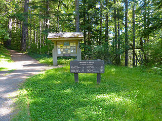 Whiskey Bend TH 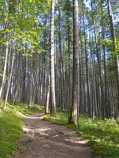 Lower Elwha 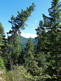 Lower Elwha 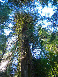 Lower Elwha just beyond Lillian River 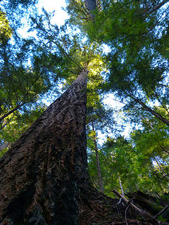 Lower Elwha just beyond Lillian River 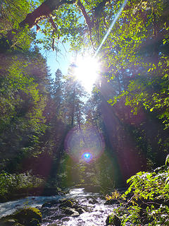 Lower Elwha, peacock 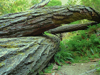 Lower Elwha, dog pile 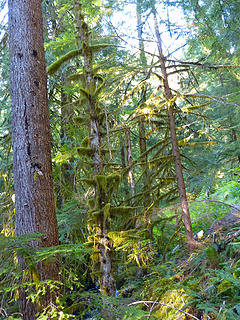 Lower Elwha, moss 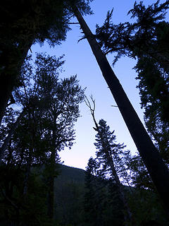 Lower Elwha, silhouette 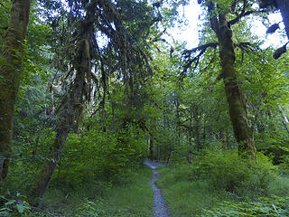 Lower Elwha chlorophyll 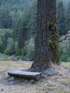 Camp Logbench (Elkhorn) 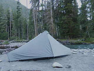 Camp Sandy, Chateau Camp, Camp 1, 16.4 miles up the Elwha River trail 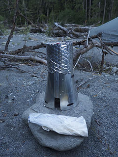 My "stove." Trail Designs Caldera Keg w/Esbit for fuel. Basically just a Foster's beer can sitting in a wind shield. Worked amazingly well! 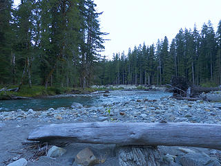 Tame Elwha, Chateau Camp, Camp 1, 16.4 miles up the Elwha River trail 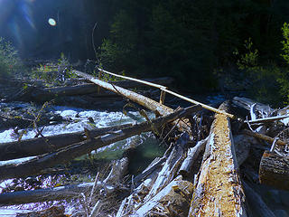 Hayes River trail re-route 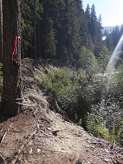 Hayes River trail re-route 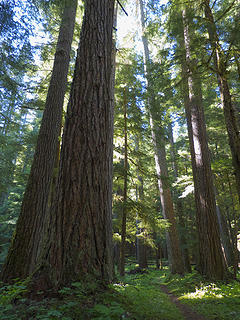 Perspective, below Chicago Camp 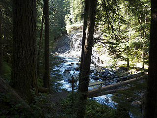 Foot log across the Upper Elwha 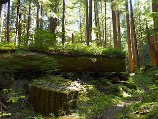 Nursery, below Chicago Camp 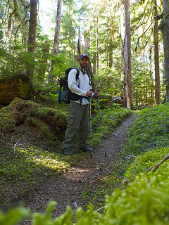 Oops! Stay off the fragile understory, idiot! On the way to Chicago Camp, Day 2. 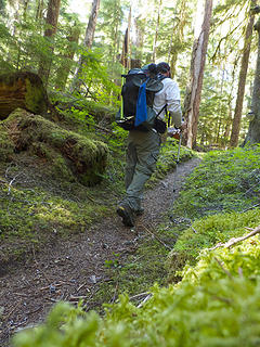 Cheesy Action Shot below Chicago Camp 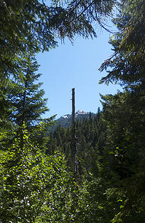 Ostracized, Elwha Basin Way Trail 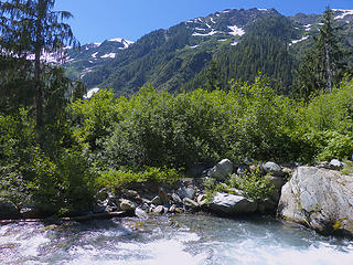 Elwha river ford in Elwha Basin 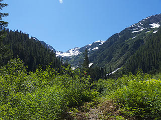 Only flagging the whole trip, this way to the mountians?gee thanks, never would have guessed! 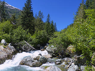 View upstream in Elwha Basin. 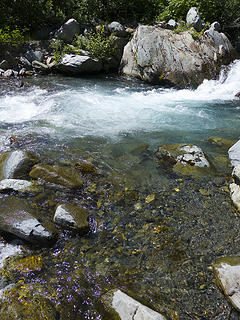 First hurdle to the bailey range, elwha basin crossing. It was waist deep (Aug 3). 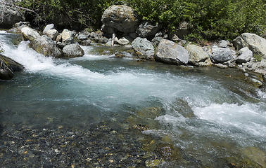 On the good side...looking back across the Elwha Basin river crossing. It was waste deep in the white water. 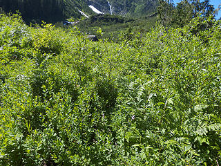 Hike ends, traverse begins...nemisis number one: well watered vegetation 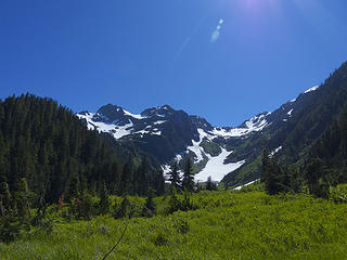 The tease...clear trail in meadow heading up to snow finger. 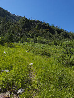 Initial gorge bypass way trail 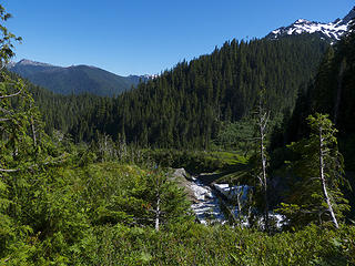 Base of the spur that rises between the a gorge coming down from the Elwha snow finger and a creek descending from the eastern slope of Mount Queets. 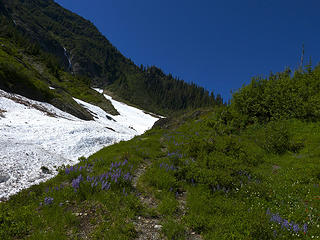 Bypass way trail following up towards the top of the spur, eastern slope of Mount Queets rising to the left 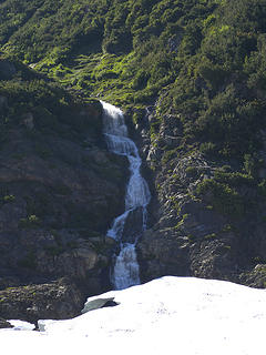 Waterfall plunging down Mount Queets 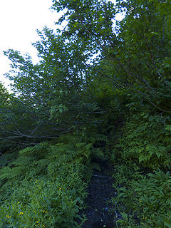 Gorge bypass way trail. Works better with a running start! 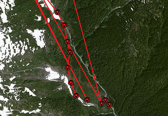 The route I took along the bypass way trail around the Elwha gorge, documented by my InReach satellite transponder 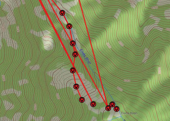 The route I took along the bypass way trail around the Elwha gorge, documented by my InReach satellite transponder 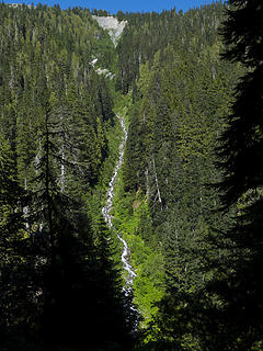 Bailey waterfall on the opposite side of the gorge. 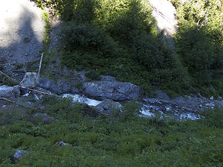 Headwaters of the Elwha. Can you find the cairn? It's in there! 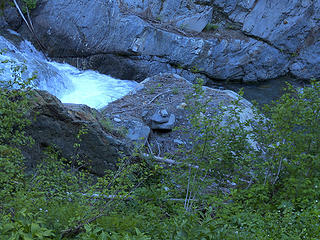 Close up of cairn marking the beginning of the gorge bypass trail for travelers heading out the Elwha/Quinault 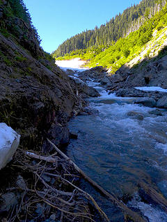 Headwaters of the Elwha 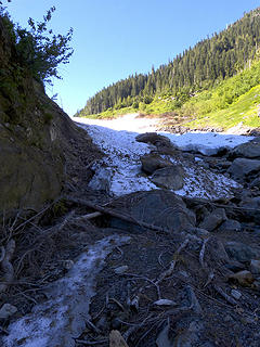 Elwha Snow Finger Terminus 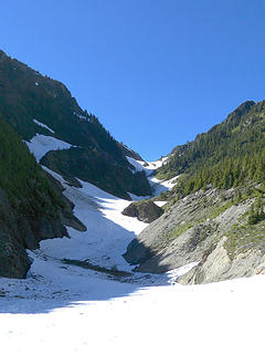 Elwha snow finger from its terminus 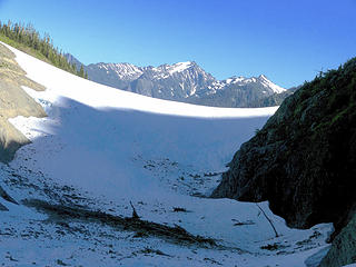 The Snow Hump 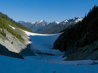 Snow Hump in shadows 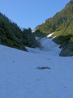 Halfway up the Elwha Snow Finger 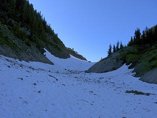 Upper third of the Elwha Snow Finger 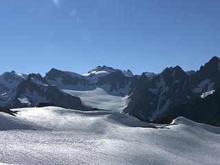 Olympus from Queets Basin 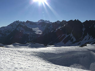 Summer Meringues in Queets Basin 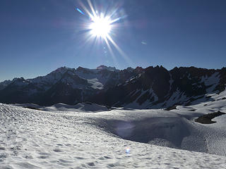 Sun over lingering snow pack in Queets Basin 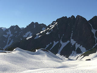 Rolling sea of snow in the Southern Bailey Range 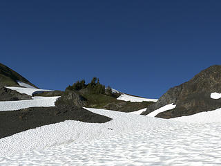 Camp 2 - Saddle between Mount Barnes and Peak 5833 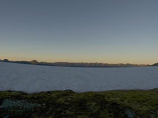 Cool sky...view east from the saddle 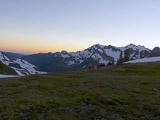 Cool sky...Oympus at sunset 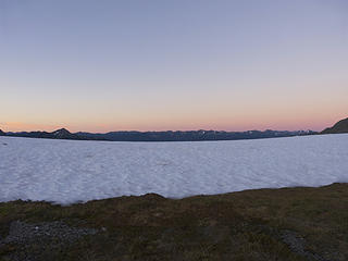 Warm sky...view east from the saddle 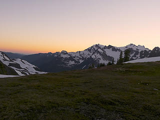 Warm sky...Olympus at sunset 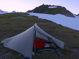 Camp 2 in Saddle between Mt. Barnes and Peak 5833 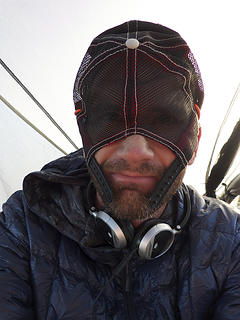 I'm Batman... 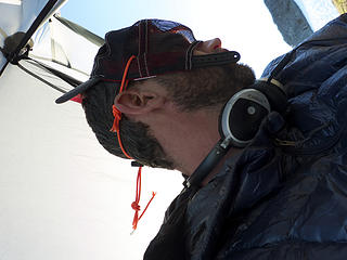 Complete with drawstring! 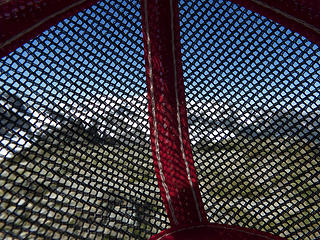 Batcam 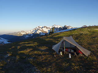 Tarptent Notch (and Olympus) 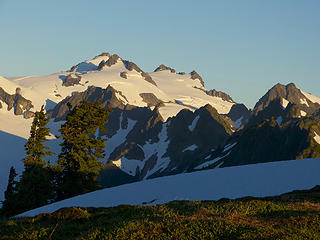 Good mornin' Oly'! 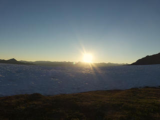 Theme of the traverse: sun! 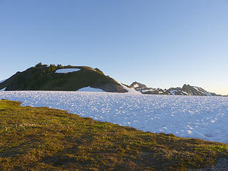 Peak 5833 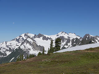 Moon over olympus massif 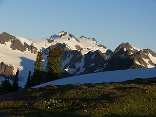 Sunrise on Olympus 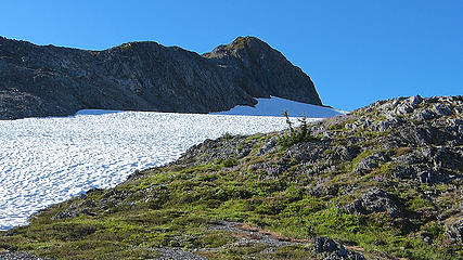 Summit of Mount Barnes 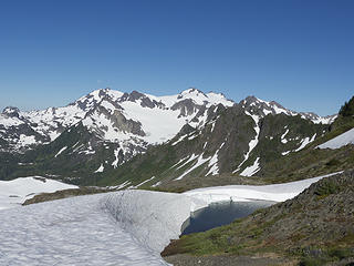 Tarn below 5833 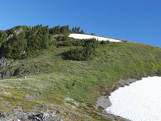 Continuing up 5833 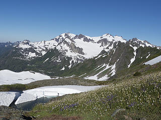 Tarn below meadow on 5833 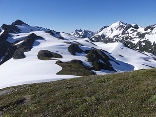 Barnes, Dodwell-Rixon, Queets 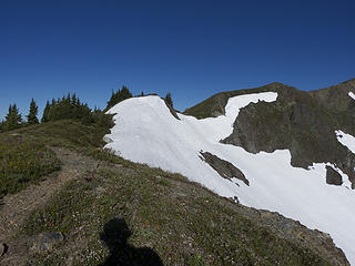 My melon on 5833 trail 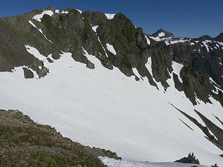 Optional class 5 route to bear pass 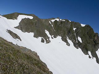 Peak 5833 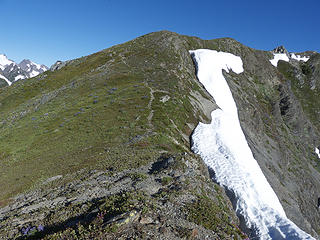 Trail up 5833 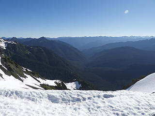 Goldie River Basin 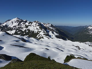 Summer vs Winter in Queets Basin 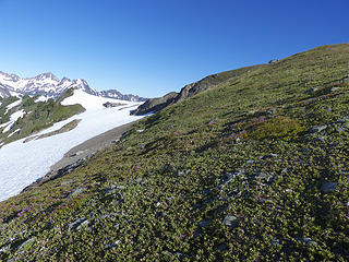 Bear Pass 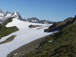 Closer to Bear Pass 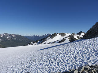 View from Bear Pass 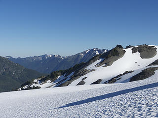 Wishful thinking? Eleven Bull Basin in middle of photo, my goal for days end. 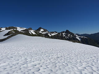 Bear Glacier, Bailey ridge crest in distance 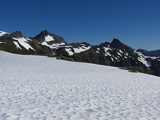 Peak 6193 (Mt Childs) and Ragamuffin 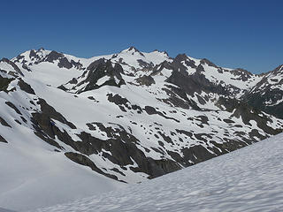 Olympus from Bear Glacier 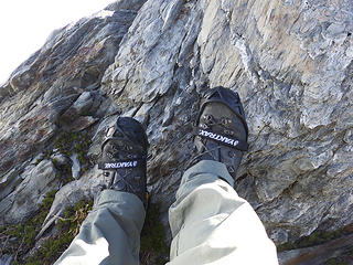 Yaktrax on 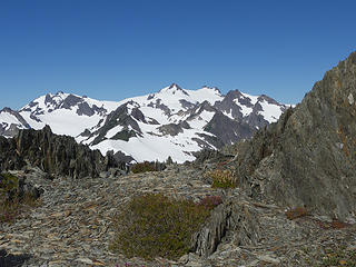 On ridge heading towards Mt Childs (6193) 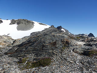 Looking north along ridge to Mt Childs 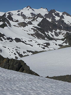 Olympus from ridge 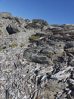 Trail along ridge 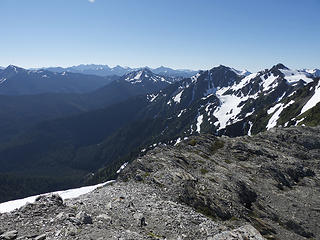 Looking south alonge ridge 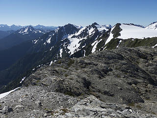 Ridge, Bear Glacier, 5833, Mt Barnes 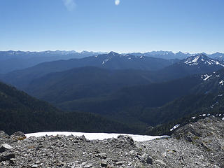 Goldie River Basin 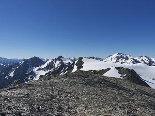 Queets, Bear Glacier, 5833, Mt Barnes 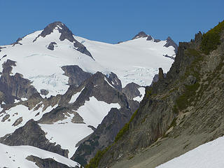 Olympus against the Bailey Range 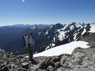 Poser 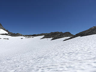 Traversing on snow and rock (N47 48 25.9, W123 35 14.3) 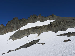 Sharp needle peaks south of Mt Childs mentioned in OCG 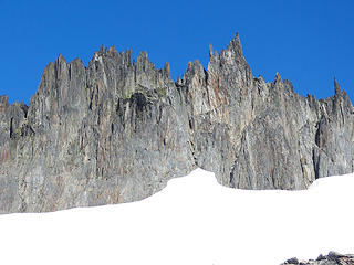 More Needles 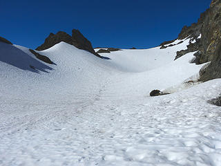 Snow-filled canyon (N47 48 37.4, W123 35 3.6) 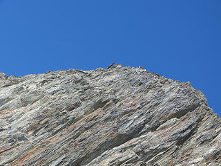 thrity five degrees 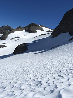 Rock outcropping (N47 48 50.9, W123 34 53.9), and low point in the ridge (N47 48 47, W123 34 51.3) just to the right of this peak 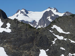 Mount Olympus, smiling 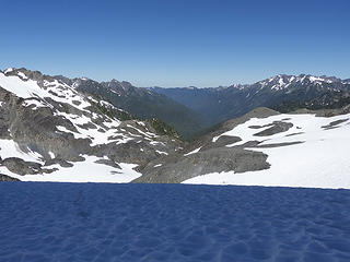 View to the Hoh river valley beyond the low point in the ridge 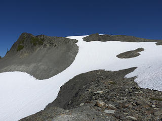 Peak 6073 N47 49 16.3, W123 34 25.8) 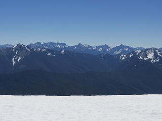 View east from the top of 6073 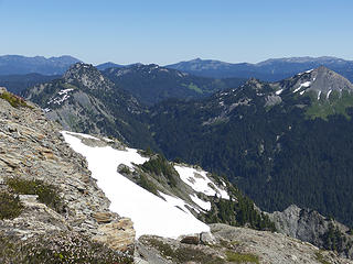 Ludden-Scott saddle from 6073 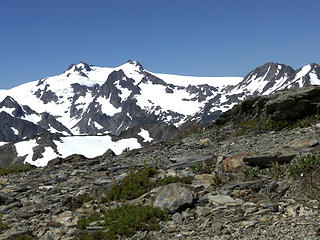 Oly from 6073 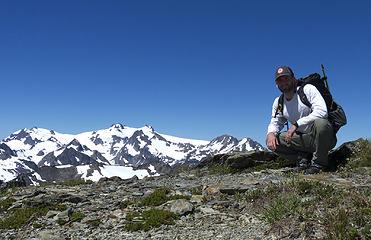 me and oly 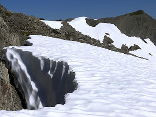 Optional route to Goldie River thru the little void to the left 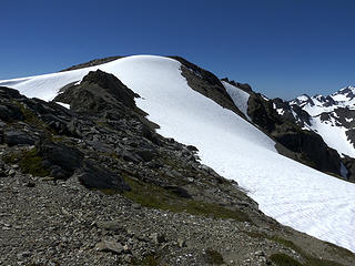 Snow at on this summit is the top of the snow slope N47 49 36.6, W123 34 16.3), leading to Lone Tree Pass 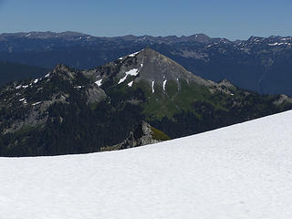 Mt Scott from the top of snow slope above lone tree pass 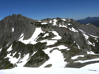 Pulitzer and lone tree pass from top of the snow slope 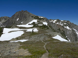 Trail to Lone Tree Pass 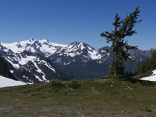 The LonelyTree 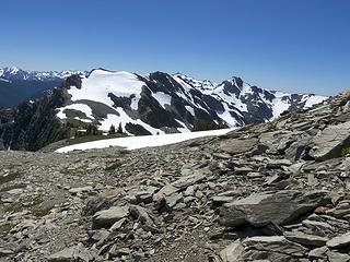 Looking back at the snow slope that led down to Lone Tree Pass, glad I didn't have to plod up that snow slope 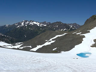 Upper Ferry Basin 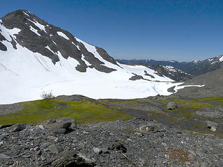 Pulitzer and Pulitzer Lake 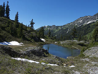 Lake Billy Everett, Stephen Peak Traverse in background 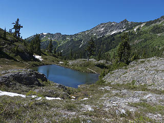 OCG Stephen Peak Traverse in Yellow 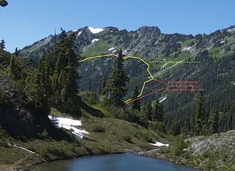 Close-up, OCG Stephen Peak Traverse in Yellow (I went a bit higher up ~5400 ft) 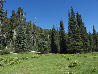 Meadow above Cream Lake 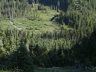 Cream Lake thru the sticks, I walked thru that mess 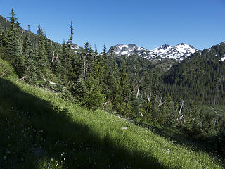 Working back over to the gully from Cream Lake 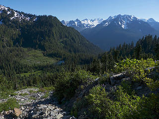 Looking down gully to Cream Lake 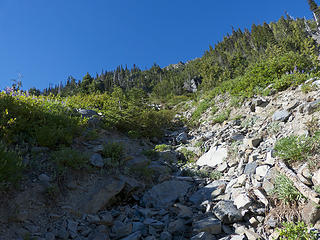 Looking up steep gully 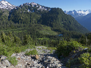 Looking down gully 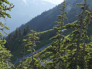 Spur in distance trail at center 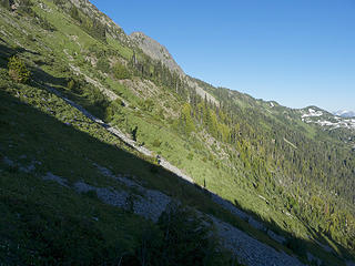 Looking back across first top section of Stephen Peak traverse 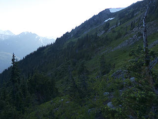 Upper portion of Stephen Peak Traverse, trail can be seen right of center, heading towards spur ridge SW of Peak 5978 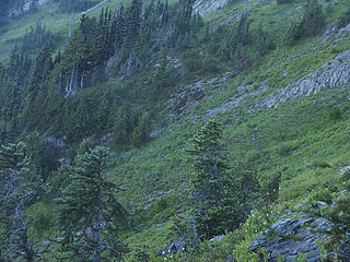 Close up of trail 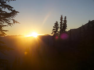 Just in the nick of time at "camp," bottom of trail coming down Peak 5978 Spur 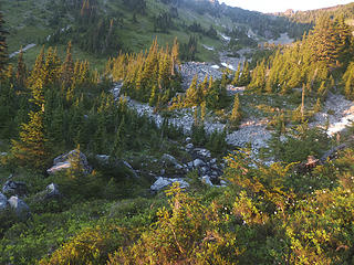 Water hole: mosquito incubator at the bottom of the spur 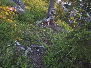 Godsend of a one person tent site 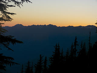 Sunset at "One Bull" Basin 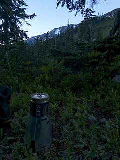 Dinner is served, my Caldera Keg stove in action with Esbit cubes for fuel  Stephen Peak Traverse Detail - Topo 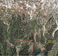 Stephen Peak Traverse Detail - Satellite 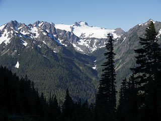 Olympus from One Bull 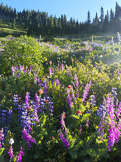 Peak flower season trail to 11 bull 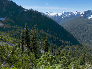 Looking back at the the draw below the Spur ridge 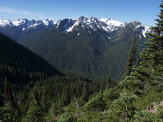 The Draw 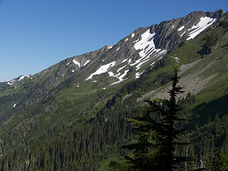 Slopes leading to Eleven Bull 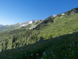 And closer to Eleven Bull 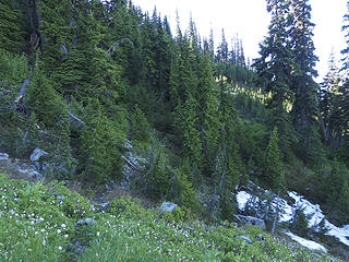 Bushwhacking...again 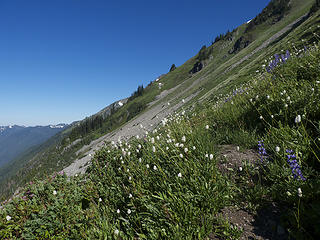 And closerer to Eleven Bull 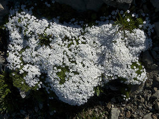 Flower collage of the United States 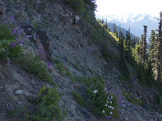 Looking back at first gully crossing 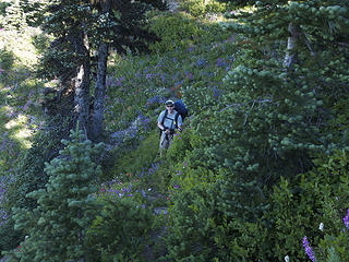 Suckers, first humans since the Elwha 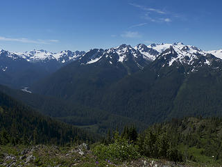 Looking back towards Southern Bailey's 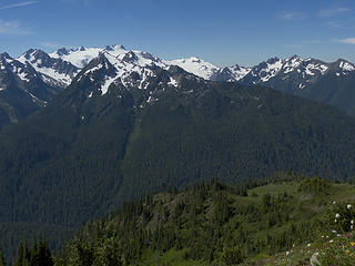 Eleven Bull below Olympus 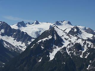 Olympus 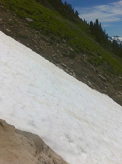 Snow-filled gully 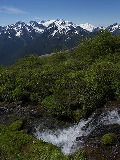 Watering hole above Eleven Bull 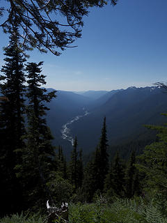 Looking down the Hoh 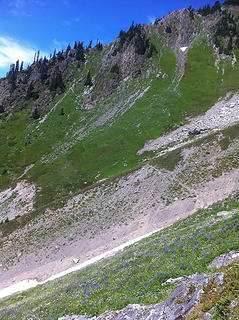 The final gully and climb up towards Boston Charlies 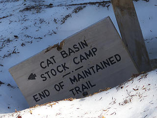 Back on maintained trail 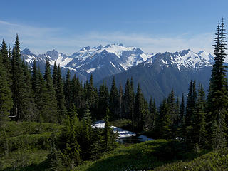 Close to High Divide 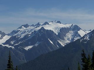 Olympus 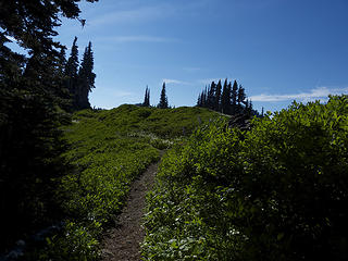 Almost on top of High Divide, also where I ran out of steam for the first time during the traverse 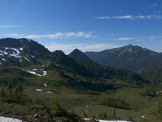 Sol Duc Park, almost to the parking lot 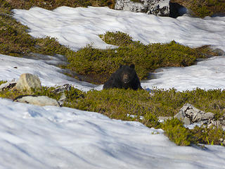 First non-insect animal the whole trip, right above Heart Lake 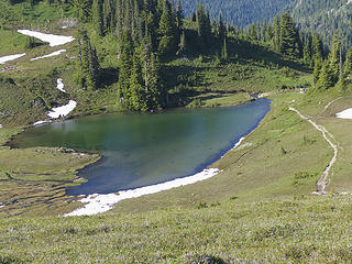 Huge crowd at Heart Lake, glad to have taken the road less traveled by 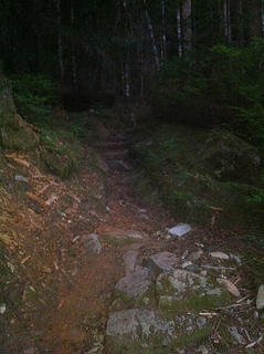 The long walk to the car down the Sol Duc 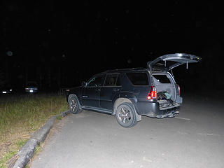 My car! 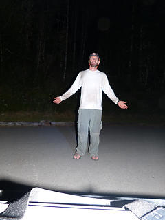 I did it! 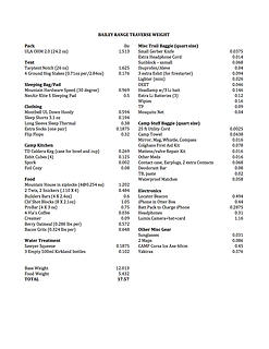 Bailey Range Gear
|
| Back to top |
  
|
|
contour5
Member

Joined: 16 Jul 2003
Posts: 2963 | TRs | Pics
|
|
contour5
Member
|
Sun Aug 12, 2012 6:47 pm |
|
|
Cool story, Texas.
I also started hiking with found gear and a serious lack of real information. (actually I grew up with the guidebooks floating around, but my family never hiked- just collected books.)
Great trip report so far; please, do go on...
|
| Back to top |
|
|
silence
Member

Joined: 25 Apr 2005
Posts: 4420 | TRs | Pics
|
|
silence
Member
|
Mon Aug 13, 2012 7:50 am |
|
|
looking forward to more Tex ... great storytelling ... love the background and detailed trip report .. funny we have a similar cozy we made years ago for our freezer bag meals too
we have tried to go light as well but still .. with ice axe, pons, clothing (we take a light puffy and shell and extra socks and shirts), food (for two -- we've been making freezer-bag meals for a long time), stove, down bags, etc plus cameras .. we just can't get the weight down on extended trips to under 35 lbs at the start ..
btw .. we just took the sawyer out this past weekend .. swapping it for our old msr ... but not liking it too much .. you really need running water to fill the bladder and thinking about late season now that isn't always ez to find .. i know .. you can fill it with a cup but that's a pain .. but yeah it's a lot lighter and with our new lighter packs and summer tent (we ended up camping on snow and froze) ... we did manage to lose some additional weight
PHOTOS
FILMS
Keep a good head and always carry a light bulb. Bob Dylan
PHOTOS
FILMS
Keep a good head and always carry a light bulb. Bob Dylan
|
| Back to top |
|
|
trestle
Member

Joined: 17 Aug 2008
Posts: 2093 | TRs | Pics
Location: the Oly Pen |
|
trestle
Member
|
Mon Aug 13, 2012 7:53 am |
|
|
Great TR, please continue.
"Life favors the prepared." - Edna Mode
"Life favors the prepared." - Edna Mode
|
| Back to top |
|
|
that.one.guy.dave
Member
Joined: 06 Oct 2010
Posts: 26 | TRs | Pics
|
Tex,
Great write up. As I mentioned in one of your previous post my buddy and I are heading over to climb Olympus and then meet up with the Bailey Range at Blizzard Pass and head back coutner clockwise to the Hoh. I hope to get to read more of your trip report before we leave on Wednesday evening.
I'm amazed by the weight of your pack. I'm trying to get mine down and my weight without food is down to 25lbs, but I just can't get through that barrier.
Thanks for your write up, desciriptions, and notes. They are very helpful. Looking forward to seeing the next sections.
-D
|
| Back to top |
|
|
Texaco
Member
Joined: 07 Aug 2012
Posts: 50 | TRs | Pics
|
|
Texaco
Member
|
Mon Aug 13, 2012 9:25 am |
|
|
c5: I guess reading about hiking is better than nothing for your fam...glad you decided to live the trail guides
silence: If I can get my base weight down below 12 pounds, anyone can. You have to get super-nerdy about it, though, and break out the spreadsheet, and scale! Start by getting the big 3 (tent, pack, bag) down below 1.5 lbs each. You can do it...even with ice axe, crampons, camera, etc., I agree that the Sawyer is more of a pain, but it's worth it for the weight savings. I only use the large bags to make the most of those stagnant pools when necessary...using a cup is a great idea, though, I'll have to try that.
|
| Back to top |
|
|
Texaco
Member
Joined: 07 Aug 2012
Posts: 50 | TRs | Pics
|
|
Texaco
Member
|
Mon Aug 13, 2012 9:50 am |
|
|
Dave: I would say 25 lbs for that kind of a trip is not too shabby! I would definitely hit 20 lbs by the time I added helmet, 30m rope, harness, and basic crevasse rescue gear. Sounds like a cool route. Are you guys taking the Hoh Lake trail on the exit?
|
| Back to top |
|
|
that.one.guy.dave
Member
Joined: 06 Oct 2010
Posts: 26 | TRs | Pics
|
We'll be taking the Hoh in and out to avoid the use of two cars. I'm sure the Hoh trail is so nice that I will have to see it twice 
|
| Back to top |
|
|
Magellan
Brutally Handsome

Joined: 26 Jul 2006
Posts: 13116 | TRs | Pics
Location: Inexorable descent |
|
Magellan
Brutally Handsome
|
Mon Aug 13, 2012 10:55 am |
|
|
Excited to read the rest of the story. 
|
| Back to top |
|
|
HumpnoocheeGirl
Member

Joined: 03 Feb 2011
Posts: 335 | TRs | Pics
Location: Grays Harbor |
Awesome pics and reporting......please continue 
|
| Back to top |
|
|
Texaco
Member
Joined: 07 Aug 2012
Posts: 50 | TRs | Pics
|
|
Texaco
Member
|
Mon Aug 20, 2012 7:41 pm |
|
|
|
| Back to top |
|
|
mtn-mick
Member
Joined: 21 Aug 2012
Posts: 2 | TRs | Pics
|
|
mtn-mick
Member
|
Tue Aug 21, 2012 2:02 pm |
|
|
Great narrative & detail. Bringing back many memories of my previous Bailey Range adventures---Keep it coming!
|
| Back to top |
|
|
Barefoot Jake
Professional Bum

Joined: 05 Sep 2010
Posts: 564 | TRs | Pics
Location: Olympic Peninsula |
Good to see UL in the Baileys.
|
| Back to top |
|
|
Texaco
Member
Joined: 07 Aug 2012
Posts: 50 | TRs | Pics
|
|
Texaco
Member
|
Tue Aug 21, 2012 2:55 pm |
|
|
Yep, I agree...I'm an ultralight believer now. From day 1 I could not even feel that I had a pack on. Got a few great tips from you on gear, Jake. My back and feet thank you...
|
| Back to top |
|
|
Barefoot Jake
Professional Bum
Joined: 05 Sep 2010
Posts: 564 | TRs | Pics
Location: Olympic Peninsula |
| Texaco wrote: | | My back and feet thank you... |
What bladder are you using for your Sawyer Squeeze?
|
| Back to top |
|
|
|
|
You cannot post new topics in this forum
You cannot reply to topics in this forum
You cannot edit your posts in this forum
You cannot delete your posts in this forum
You cannot vote in polls in this forum
|
Disclosure: As an Amazon Associate NWHikers.net earns from qualifying purchases when you use our link(s). |


