| Previous :: Next Topic |
| Author |
Message |
Josh Journey
a.k.a Josh Lewis

Joined: 01 Nov 2007
Posts: 4836 | TRs | Pics
|
For a better formatted trip report, see the one on my website.
"Take risks not to escape life, but to prevent life from escaping."
"Good things take time, great things happen all at once!"
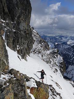
After 5 attempts on Mount Zekes I finally decided to give it a break for a while, which once the longest day of the year came around I figured that it would be the right time to make another attempt. Fortunately I was right this time, but it certainly did not come easily.
The first few attempts I didn't even get close to the summit, although the Second attempt I came pretty close but I did not want to go beyond the Point of No Returns (missing the final bus). The second time was the hardest of the Zeke's attempt, but I can safely say the 2nd hardest was this time.
View larger size in new window
A Rough Beginning
Early in the morning I meet Mark at the Everett bus station excited to finally get the job finished. On the bus ride to Gold Bar I would have said "This is it" but I remember all the other times, after all "Never say Never". Getting off the bus we begin the bike ride along highway 2, then turn off onto Reiter road which goes to the "trailhead" of this peak.
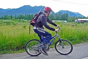 Mark and Mount Zekes 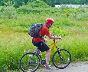 Me Biking Along Highway 2 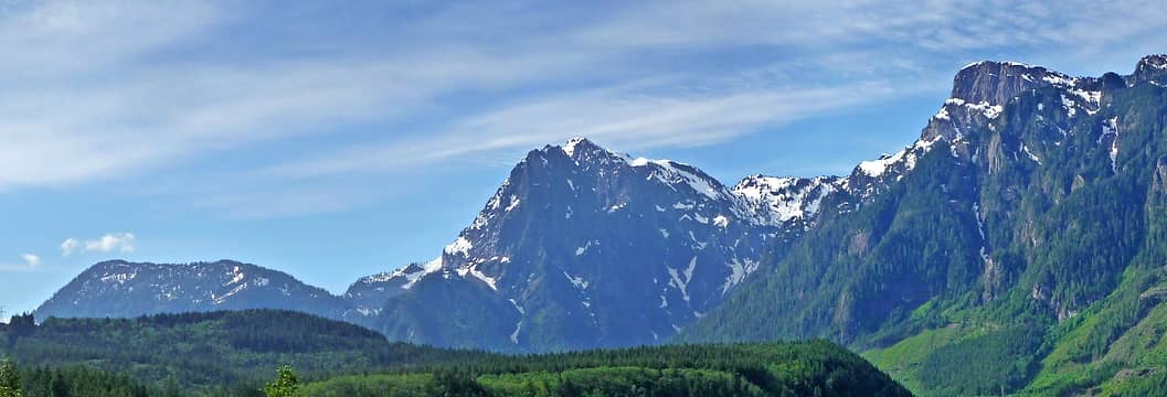 Philadelphia, Index, and Mount Persis Panorama 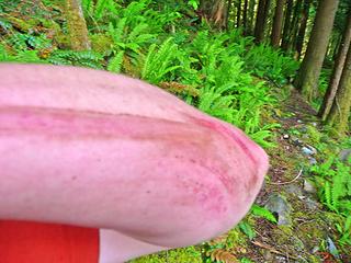 One of the Scrapes from the Slide 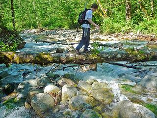 Mark Crossing the Log  Getting a Little Wet 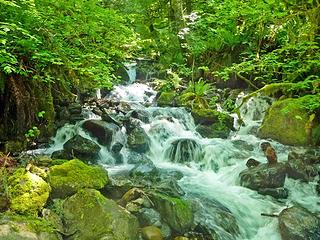 One of the Many Creeks 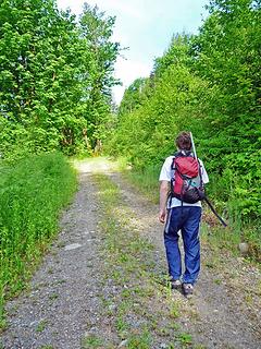 Mark walking alone the road 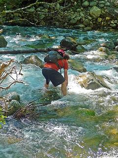 The Creek Crossing  Devils Club and Thorny Plants 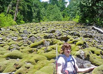 Mark with the boulder field 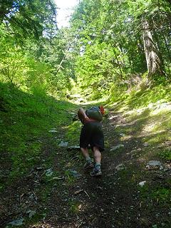 On the Lower Section of the Gully 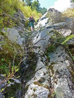 Class 4 Section 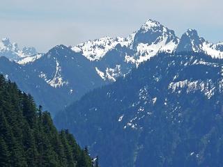 Palmer Mountain's North Face 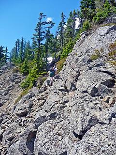 Mark Scrambling near the Summit 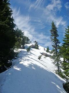 The Pathway to the Summit 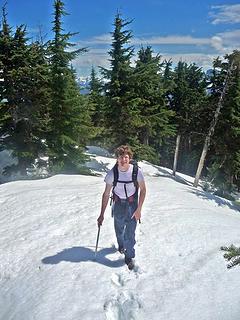 Mark Approaching the Summit 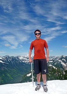 Finally on the Summit 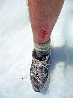 Scrape 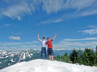 Celebrating on the Summit 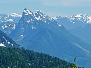 Mount Baring to the South 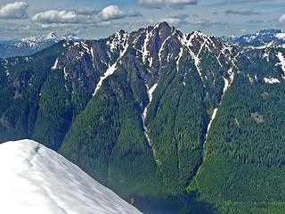 Mount Stickney's South Face 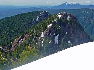 Mount Zekes other Summits 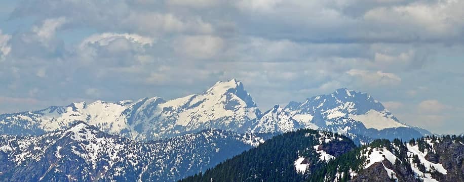 Three Fingers and White Horse 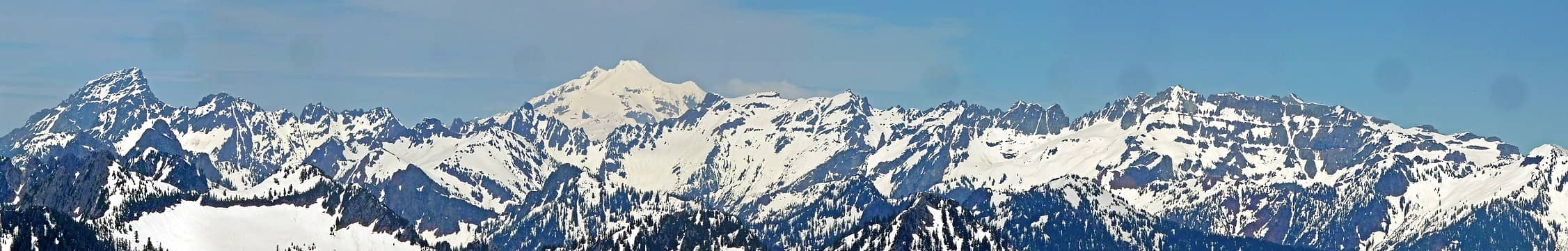 East Mountain Loop Highway 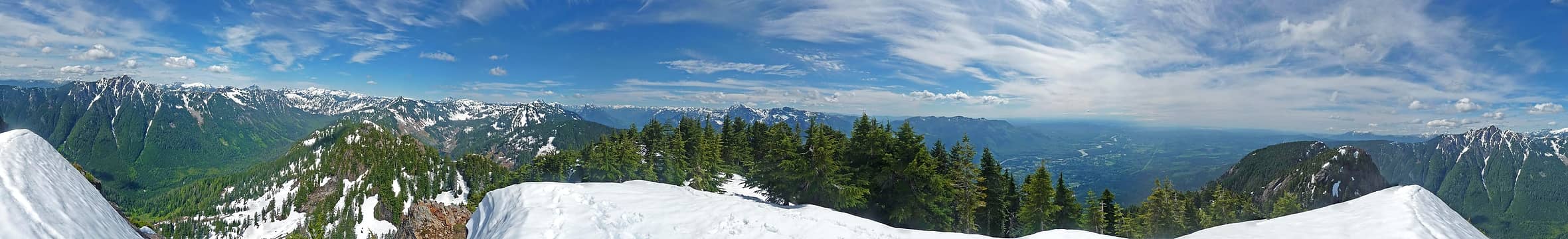 Mount Zekes Summit Panorama 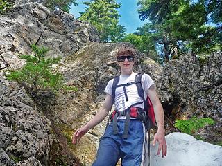 Mark Below the Scramble Section 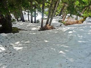 The Woods Below 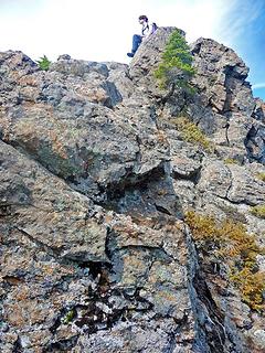 Mark on the Edge 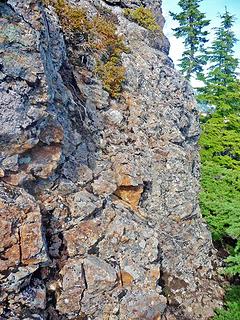 Class 4 Section 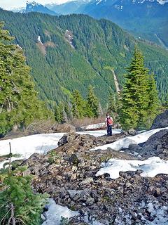 Mark Heading Down 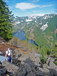 Mark and Lake Isabel 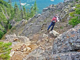 Heading into Class 3 Terrain 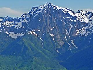 Mount Index's North Face 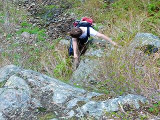 Mark Descending the Crux 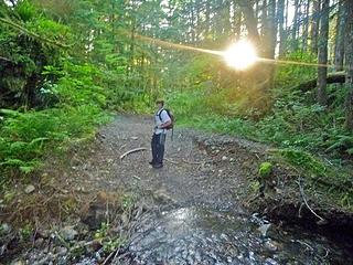 Mark with the Sunset 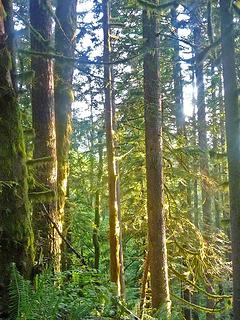 Sun Light on the Trees
|
| Back to top |
  
|
|
evergreenhiker
Hiking Specialist

Joined: 13 Nov 2004
Posts: 367 | TRs | Pics
Location: Gold Bar |
Hi Josh,
Fun reading your story in getting Zekes. I just moved to Gold Bar this last summer and now thinking about going after this one. I found a couple of other reports and those guys climbed up from Lake Isabel. Did you try this on one of your failed attempts?
I'm thinking I may go in from Isabel as I've never seen the lake. Kill two birds with one stone.
The alpine world is my church.
The alpine world is my church.
|
| Back to top |
|
|
SultanHiker
Member

Joined: 04 Aug 2014
Posts: 78 | TRs | Pics
Location: Washington |
I'm also interested in getting up there. I was at Isabel 20 years ago when you could still 4x4 up quite a ways (after driving across an interesting section of May Creek). But now I want to get on top Zekes. I often wondered if you could climb the west ridge from the Wallace Falls trails... Although, it may be hard to get to the true summit from that direction. I have dreams of tackling all 3 major summits in one trip even if it means an overnight. Maybe Josh will reply...
|
| Back to top |
|
|
Josh Journey
a.k.a Josh Lewis
Joined: 01 Nov 2007
Posts: 4836 | TRs | Pics
|
| evergreenhiker wrote: | | I found a couple of other reports and those guys climbed up from Lake Isabel. Did you try this on one of your failed attempts? |
Here's the only two report's for Zekes that I know of (both from the 90's):
http://www.rhinoclimbs.com/usgsindex.htm
https://www.wta.org/go-hiking/trip-reports/tripreport-1999030603
I attempted the neighbor Ragged Ridge on September 14th, 2011 via Lake Isabel. We got to the lake, however I recall a lot of brush. Perhaps the season, side of the lake we were on, and the fact that it was wet/cold/cloudy made us turn around.
| SultanHiker wrote: | | I often wondered if you could climb the west ridge from the Wallace Falls trails... Although, it may be hard to get to the true summit from that direction. I have dreams of tackling all 3 major summits in one trip even if it means an overnight. |
John Roper describes his descent to Wallace Falls:
| John Roper wrote: | | As we descended the WNW ridge of "Nina" toward Wallace River, a clearcut reached up to grab us with tight second-growth at about 4200 feet. After muscling and grunting through this, we were embarrassingly happy and surprised to hit motorcycle tracks at 3700 feet on a well-grown-over logging road that shows up on the old 1957 15' Index quad.
We followed this road 2100 vertical feet down to a bend east at 1600 feet, then cut right through timber down to the Wallace River, and boulder-hopped to the opposite bank just above the lower (main) falls, picking up the popular trail here. We were back to the cached car just before dark, 9 hours and 15 minutes en route. Good trip. |
- Source
I took a photo of the Wallace Falls upper route as seen from Sky Rocket Couloir:
 Nina's WNW ridge
|
| Back to top |
|
|
SultanHiker
Member
Joined: 04 Aug 2014
Posts: 78 | TRs | Pics
Location: Washington |
Thanks Josh!
I always wondered how they got the 3 names. And a traverse doesn't seem out of the question now. I might add that to my list this year.
|
| Back to top |
|
|
evergreenhiker
Hiking Specialist
Joined: 13 Nov 2004
Posts: 367 | TRs | Pics
Location: Gold Bar |
Thanks Josh! I definitely will be checking Isabel route out once it melts out a bit more. Looks like the reports you found are the same ones I found.
The alpine world is my church.
The alpine world is my church.
|
| Back to top |
|
|
Nancyann
Member

Joined: 28 Jul 2013
Posts: 2318 | TRs | Pics
Location: Sultan Basin |
|
Nancyann
Member
|
 Thu Mar 22, 2018 11:59 am |
|
|
It is not necessary to boulder-hop across across the Wallace River if you are following John Ropers route Josh mentioned. There is a new bridge across the top of Upper Wallace easily accessed from the DNR road above the falls.
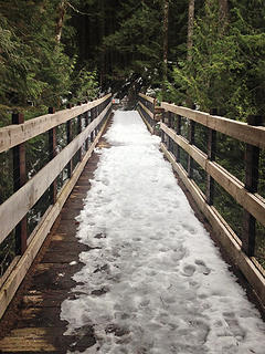 Bridge over the Upper Wallace  May Creek crossing 3/21/18
|
| Back to top |
|
|
evergreenhiker
Hiking Specialist
Joined: 13 Nov 2004
Posts: 367 | TRs | Pics
Location: Gold Bar |
Cool to hear about the new bridge!
The alpine world is my church.
The alpine world is my church.
|
| Back to top |
|
|
Nancyann
Member
Joined: 28 Jul 2013
Posts: 2318 | TRs | Pics
Location: Sultan Basin |
|
Nancyann
Member
|
Thu Mar 22, 2018 6:04 pm |
|
|
DNR has posted a big sign at the east end of the bridge warning not to proceed any further, but we have spent quite a bit of time exploring up there and have never seen anyone at all. 
|
| Back to top |
|
|
evergreenhiker
Hiking Specialist
Joined: 13 Nov 2004
Posts: 367 | TRs | Pics
Location: Gold Bar |
I explored the other side of the bridge last weekend. Killer area to explore! I took both forks and discovered another more fainter one not far from the bridge that headed up towards Zekes. I will investigate this more. This may be an exit route from the climb.
Then I went back over and took another old road that goes up the valley between Zekes and Stickney. Only went back a mile or so and took a short bushwack down to the river to scout it out as a possible exit route after I attempt Zekes. The recent logging above the falls has created a pretty nice viewpoint of the area. I will be heading back soon to explore more.
The alpine world is my church.
The alpine world is my church.
|
| Back to top |
|
|
Nancyann
Member
Joined: 28 Jul 2013
Posts: 2318 | TRs | Pics
Location: Sultan Basin |
|
Nancyann
Member
|
Fri Apr 06, 2018 8:57 pm |
|
|
Glad that you were able to get up there and snoop around, evergreenhiker!
Actually, the one that heads towards Zekes is one that we have been working on lately for a fun winter project. No one had been through there for quite some time and we had to break through a lot of sticker bushes at the start.
I was up the other one next to the Wallace River earlier in the week. I turned around where the trail gets close to the river due to sticker bushes, blowdowns and deep snow, but it has great potential. Lots to explore up that way.😊
|
| Back to top |
|
|
SultanHiker
Member
Joined: 04 Aug 2014
Posts: 78 | TRs | Pics
Location: Washington |
Regarding the other trail to the north... 5 years ago i went up that way to explore an alternate route to Stickney. I followed the old road (bypassing one stretch of half mile that was choked out by saplings and brush). It dead ends and becomes a bushwack nightmare (assuming you wanted to go farther up the valley). There is a spur road that heads up stickney (on some of the maps) that has lots of downed trees. My kids were tired from the previous day's hike and didn't want to climb the obstacles. Anyway... Not part of a Zeke's discussion, but just thought I'd let people know that there isn't much out there. Someone from this site DID summit Stickney from this approach. I forget who... Think it was in the snow, too.
I'm definitely looking forward to trip reports on Zekes. It's on my list for this year or next...
|
| Back to top |
|
|
|
|
You cannot post new topics in this forum
You cannot reply to topics in this forum
You cannot edit your posts in this forum
You cannot delete your posts in this forum
You cannot vote in polls in this forum
|
Disclosure: As an Amazon Associate NWHikers.net earns from qualifying purchases when you use our link(s). |


