| Previous :: Next Topic |
| Author |
Message |
Kismet
Member


Joined: 27 Aug 2012
Posts: 9 | TRs | Pics
|
|
Kismet
Member
|
 Thu Sep 20, 2012 11:35 pm |
|
|
Last Friday was my 40th birthday  . The summer had been busy and adventure-filled. After a long week back in the cubicle, a week which followed the summers final big vacation, I was not overly excited to celebrate a day which felt like so many others. Appreciative of all the well wishes from family and friends, I left work a little late, content with a quiet jog and visit to the rock gym, a huge piece of ice cream cake, and plans for a hike on Saturday to celebrate 40 years.
With the ongoing wildfires, my husband and I decided to keep the hike simple and close to home, closer to Portland. From our house, looking towards Washington, we have amazing views of various Cascade Mountains. Over the last few years, particularly in the spring on clear visibility days, my attention also gravitates towards the lower snowy peaks as I wonder if skiers are safely playing on them. I've never been to these lower peaks. So, for my 40th, we decided to explore these peaks in southwest Washington, specifically Silver Star Mountain. . The summer had been busy and adventure-filled. After a long week back in the cubicle, a week which followed the summers final big vacation, I was not overly excited to celebrate a day which felt like so many others. Appreciative of all the well wishes from family and friends, I left work a little late, content with a quiet jog and visit to the rock gym, a huge piece of ice cream cake, and plans for a hike on Saturday to celebrate 40 years.
With the ongoing wildfires, my husband and I decided to keep the hike simple and close to home, closer to Portland. From our house, looking towards Washington, we have amazing views of various Cascade Mountains. Over the last few years, particularly in the spring on clear visibility days, my attention also gravitates towards the lower snowy peaks as I wonder if skiers are safely playing on them. I've never been to these lower peaks. So, for my 40th, we decided to explore these peaks in southwest Washington, specifically Silver Star Mountain.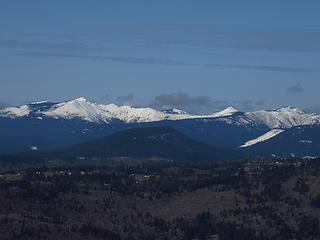 April 2012 from Angel's Rest
Sturgeon Rock, Silver Star, Little Baldy
Anybody ski this? 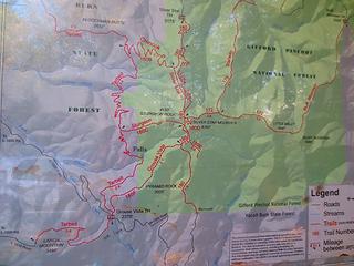 Trailhead Map 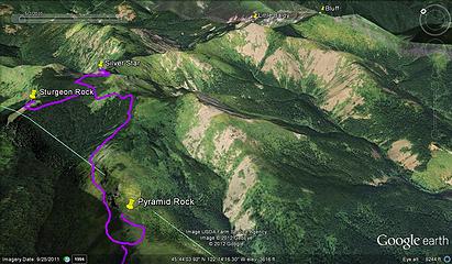 Approximate route (not from real wavepoints) 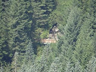 From afar, perhaps a bridge near the Hidden Falls on the Tarbell Trail. 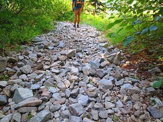 Rocks, rocks & more rocks 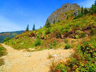 Straight for Silver Star 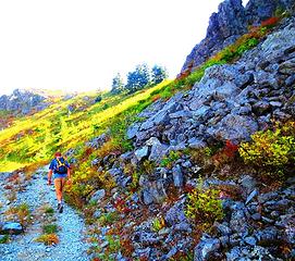 To Star Mountain First 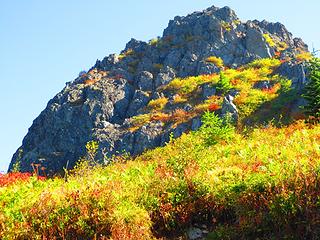 Hiking past Pyramid on the way to Silver Star  Large cairn piles 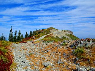 Silver Star Mountain 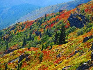 Fall 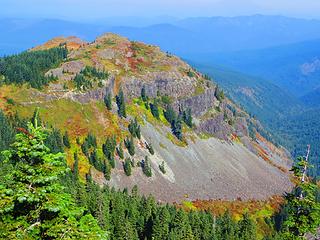 Ed's trail comes up to here 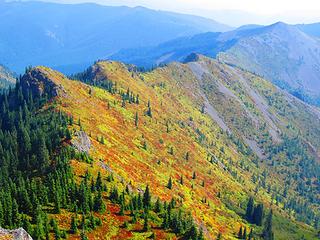 Towards Little Baldy 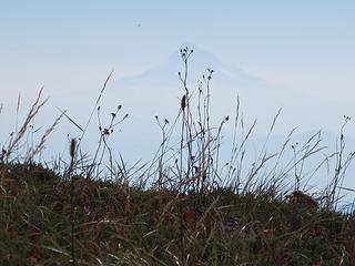 Hood through the haze 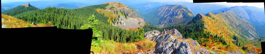 Stitching - missed a few too many spots 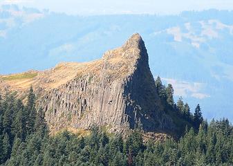 Sturgeon Rock is supposed to look like a sturgeon 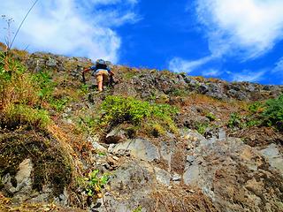 Heading up the loose rock 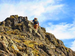 Not the Best Rock on Sturgeon 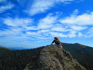 Somewhere along the ridge, the highest point of Clark County. 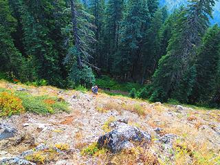 Might be a simpler trail along the entire E-W ridge. This is where we left the main trail to go up.  We went around to the SE side of Pyramid and through some beargrass to find our way up. On the way down through the beargrass, my husband almost ran into a spider which looked impressive but turned out to be harmless. We went around to the SE side of Pyramid and through some beargrass to find our way up. On the way down through the beargrass, my husband almost ran into a spider which looked impressive but turned out to be harmless.
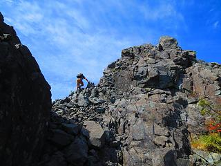 Easy Scramble up the Pyramid 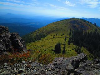 Old Roads 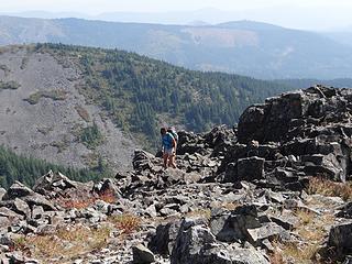 The rock was good here. 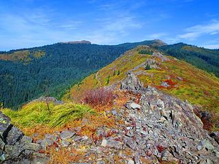 Top of Pyramid Rock 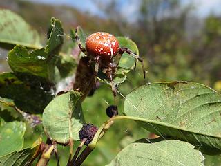 Shamrock Spider. According to the Audobon's Field Guide to Insects & Spiders, it eats its web each day and re-builds it in a tent of leaves. 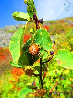 Hungry at the time since it made me dream of hamburgers and blueberry milkshakes... 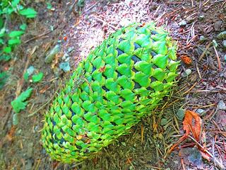 Unripe 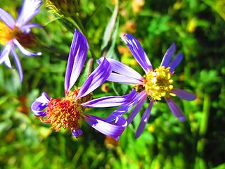 Still Hanging On 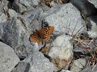 At first we thought it might be a Pearl Crescent butterfly but they live mostly in North America EXCEPT the Pacific states. Maybe it was lost. 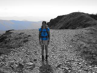 Blue. Experimenting with the new camera 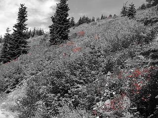 Red. Experimenting with the new camera 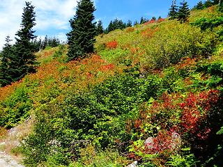 Red. Experimenting with the new camera
|
| Back to top |
  
|
|
|
|
You cannot post new topics in this forum
You cannot reply to topics in this forum
You cannot edit your posts in this forum
You cannot delete your posts in this forum
You cannot vote in polls in this forum
|
Disclosure: As an Amazon Associate NWHikers.net earns from qualifying purchases when you use our link(s). |


