| Previous :: Next Topic |
| Author |
Message |
iron
Member


Joined: 10 Aug 2008
Posts: 6392 | TRs | Pics
Location: southeast kootenays |
|
iron
Member
|
 Tue Aug 28, 2012 1:35 pm |
|
|
years ago, tvashtar and mr. brooks climbed dome and sinister on their way out of the ptarmigan traverse. instead of a standard exit, they opted to head out via the hanging gardens, remarking: "if ever there is an elysian fields for mountain people, this is it."
 intrigued, i placed the idea on my back burner. having been in some of the areas near the hanging gardens, i knew what kind of potential it offered. hotpantz and her brother who was visiting us (we'll call him hotbro) trusted me enough to head out on a route i wasn't fully sure would work. not only that, the part of the route in question was on day 4.5 out of 6, with a return flight the next day. gotta love blind trust!
here is the quick summary:
day 1: trinity TH to phelps creek basin to fortress/chiwawa saddle. climb chiwawa, descend to 5240+ (miners) lake.
day 2: miners lake to valley to PCT. PCT N to miners ridge trail to lady camp. climb plummer, descend to bags and head to image lake camp.
day 3: image lake to canyon lake trail. attempt climb of sitting bull (left crampons with packs), continue on to canyon lake and then up to totem pass.
day 4: climb bannock in the morning. traverse from totem pass to hanging gardens. descend ross pass around N shelf of bannock down to bannock lakes. hike up to upper bannock lakes.
day 5: hike up between saddle bow/bannock saddle and drop to PCT. PCT to cloudy pass cutoff trail and climb cloudy and north star. head down to lower lyman lake.
day 6: hike the lyman lakes up and over spider gap and back to phelps creek TH. walk road for a bit and cut down to trinity TH.
the total trip was about 75 miles and 26,000' gain. while modest in average steepness, the trip offered lots of really flat walking followed by sections of incredibly steep vegetated slopes. hotbro remarked, several tiems, how surprised he was that plants could grow on something so steep; he lives in denver. we hiked between 8-10 hrs each day, with only day 5 feeling a bit late. each evening we were treated with a swim, whether in the relatively warm waters of image lake (awesome!) or the ice cube waters of miners lake or lyman lakes. wildflowers, while missing some of the early season cohorts, were still near peak. bugs were virtually a non-factor and the weather mostly held steady, with the exception of some clouds and cool temps towards the end of the trip. overall, it was a truly special trip. prior to it, i didn't care what happened to my body when i die (burn me and toss me out, i thought). i know now where i am to be taken.
day 1
after arriving in seattle from iceland only 12hrs earlier, we dragged hotbro out of the house at 6am and were at trinity and ready to roll around 9am. the TH lot was maybe 1/3 full as we set off under increadibly pleasant temperatures. we turned off the trail to head towards chiwawa basin en route to the fortress/chiwawa saddle. this basin is wonderful. if you like spider meadows and haven't been to chiwawa basin, i highly recommend it. flowers everywhere. no bugs. and running water every few minutes. what's not to love?
intrigued, i placed the idea on my back burner. having been in some of the areas near the hanging gardens, i knew what kind of potential it offered. hotpantz and her brother who was visiting us (we'll call him hotbro) trusted me enough to head out on a route i wasn't fully sure would work. not only that, the part of the route in question was on day 4.5 out of 6, with a return flight the next day. gotta love blind trust!
here is the quick summary:
day 1: trinity TH to phelps creek basin to fortress/chiwawa saddle. climb chiwawa, descend to 5240+ (miners) lake.
day 2: miners lake to valley to PCT. PCT N to miners ridge trail to lady camp. climb plummer, descend to bags and head to image lake camp.
day 3: image lake to canyon lake trail. attempt climb of sitting bull (left crampons with packs), continue on to canyon lake and then up to totem pass.
day 4: climb bannock in the morning. traverse from totem pass to hanging gardens. descend ross pass around N shelf of bannock down to bannock lakes. hike up to upper bannock lakes.
day 5: hike up between saddle bow/bannock saddle and drop to PCT. PCT to cloudy pass cutoff trail and climb cloudy and north star. head down to lower lyman lake.
day 6: hike the lyman lakes up and over spider gap and back to phelps creek TH. walk road for a bit and cut down to trinity TH.
the total trip was about 75 miles and 26,000' gain. while modest in average steepness, the trip offered lots of really flat walking followed by sections of incredibly steep vegetated slopes. hotbro remarked, several tiems, how surprised he was that plants could grow on something so steep; he lives in denver. we hiked between 8-10 hrs each day, with only day 5 feeling a bit late. each evening we were treated with a swim, whether in the relatively warm waters of image lake (awesome!) or the ice cube waters of miners lake or lyman lakes. wildflowers, while missing some of the early season cohorts, were still near peak. bugs were virtually a non-factor and the weather mostly held steady, with the exception of some clouds and cool temps towards the end of the trip. overall, it was a truly special trip. prior to it, i didn't care what happened to my body when i die (burn me and toss me out, i thought). i know now where i am to be taken.
day 1
after arriving in seattle from iceland only 12hrs earlier, we dragged hotbro out of the house at 6am and were at trinity and ready to roll around 9am. the TH lot was maybe 1/3 full as we set off under increadibly pleasant temperatures. we turned off the trail to head towards chiwawa basin en route to the fortress/chiwawa saddle. this basin is wonderful. if you like spider meadows and haven't been to chiwawa basin, i highly recommend it. flowers everywhere. no bugs. and running water every few minutes. what's not to love?
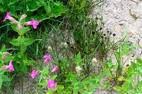
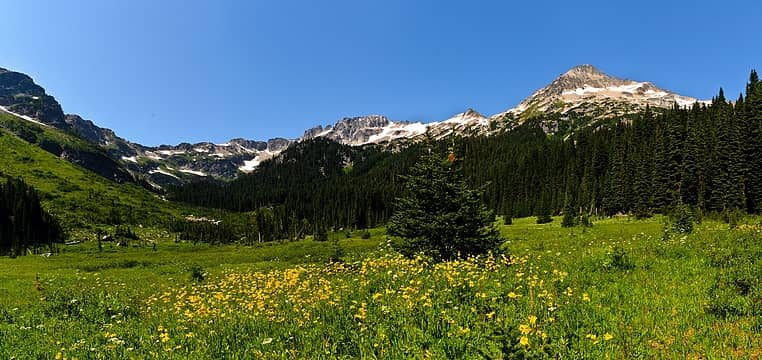 chiwawa basin 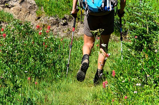 all trails should be like this 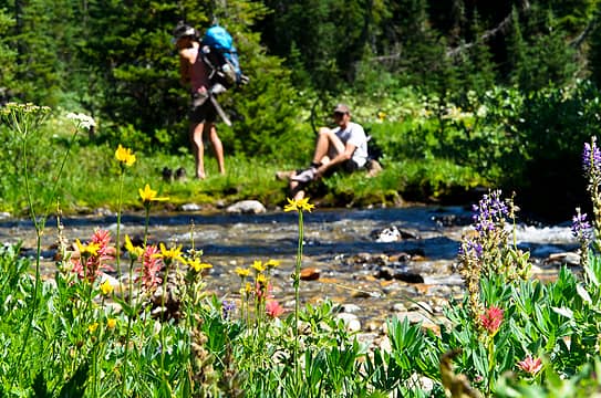 flowery crossing 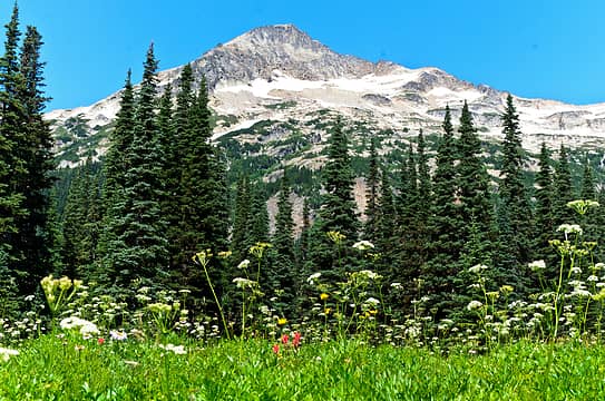 chiwawa 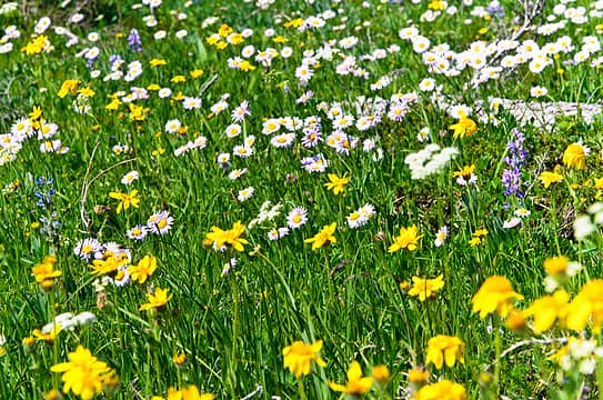 the start of flower overload 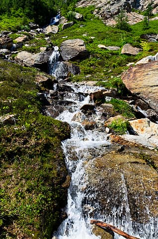 beauty flowing from fortress/chiwawa saddle 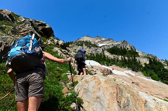 up the slabs we go 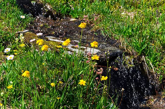 black moss 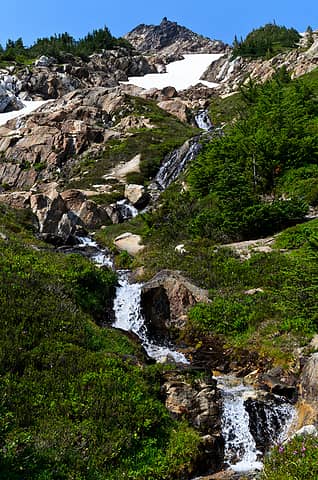 more water 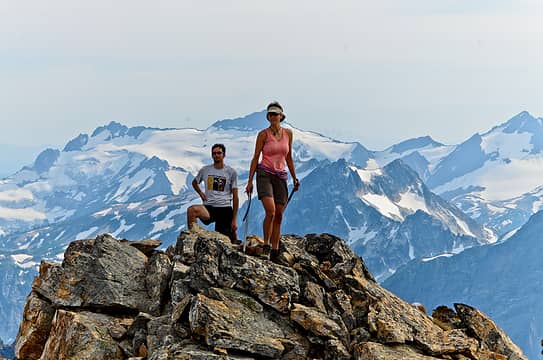 on top of poodle peak 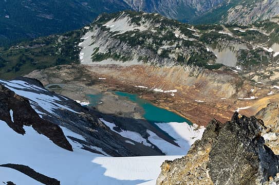 lyman lakes below and only 4 days away 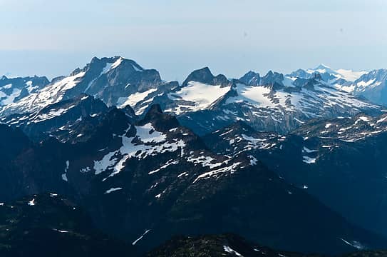 dome and sinister with sitting bull in the foreground 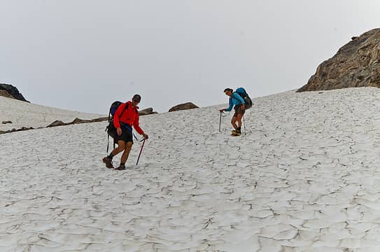 crampon time  i knew i left this somewhere  let's hope the fuel drained elsewhere  former work shelter  don't forget the fuel canister 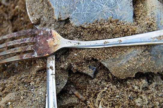 made in the USA - you know it's old! 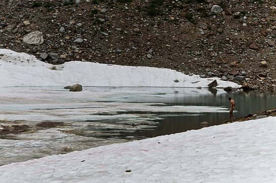 a chilly dip 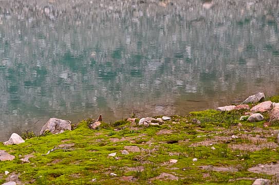 rippled reflections 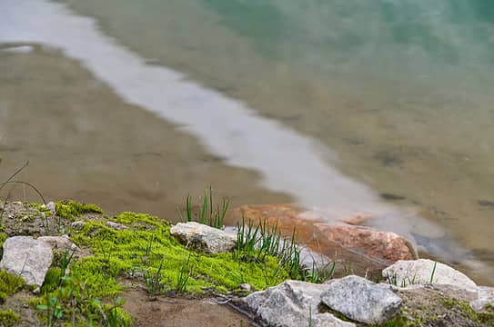 plant life trying to take hold 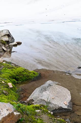 snowy reflection 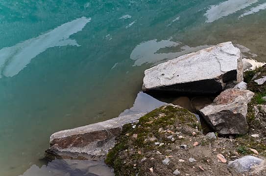 happy rock 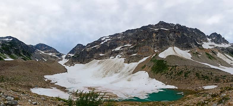 our icebox of a campsite on night 1 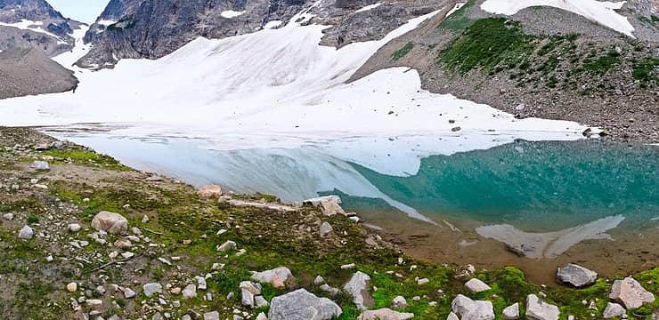 glassed over tarn on night 1  we packed up and walked down the valley, staying mostly E of the creek. many tributary creeks twist and wind in this area before giving into gravity and forming one larger creek. a new avi path must have ripped through earlier in the year, evident by the new piles of trees scattered about.
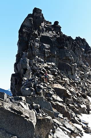
 black flowers 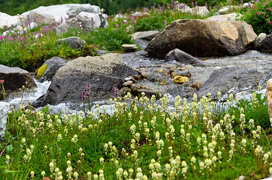 flowers everywhere 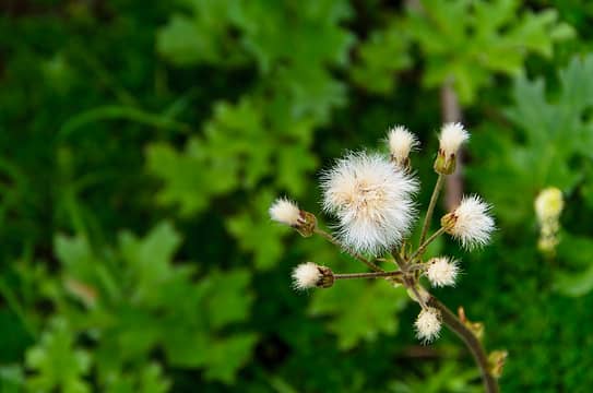 fuzzy 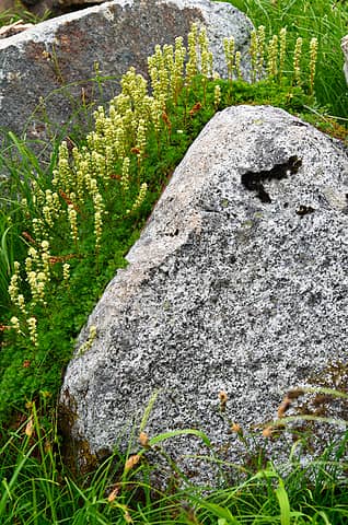 flower roller coaster rock 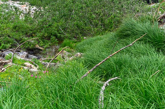 beautiful long grass 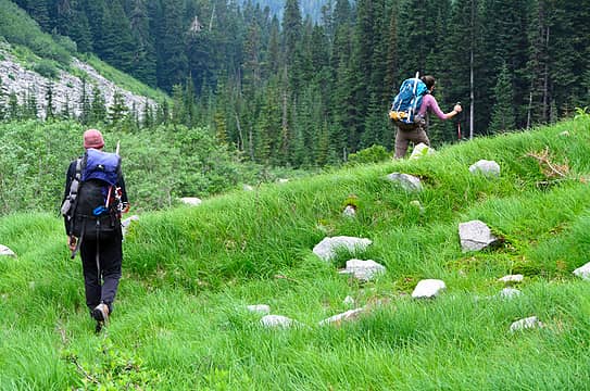 down valley we go 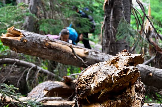 aw, snap 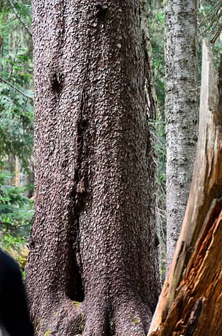 texturized 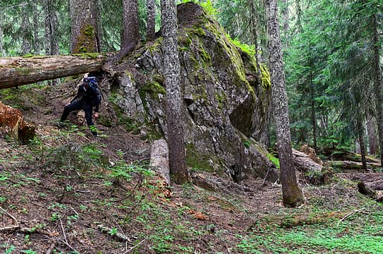 boulder bridge 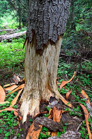 bear activity everywhere 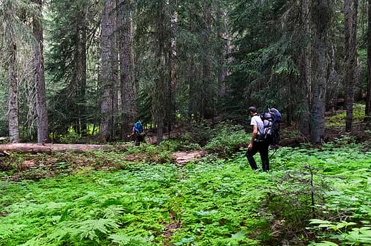 green understory 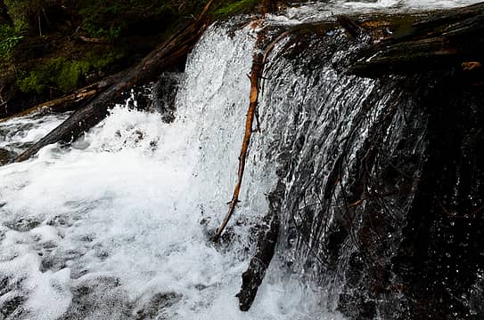 mini falls 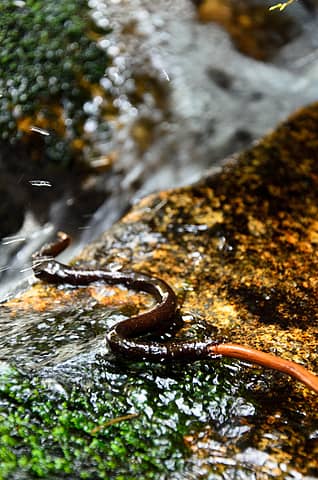 a snake or a stick? 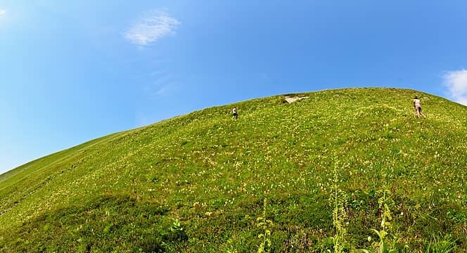 heading up plummer 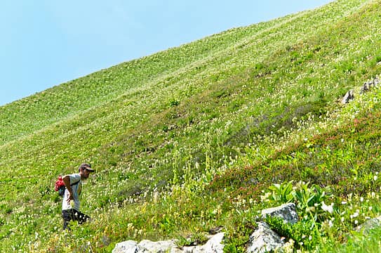 hotbro heading up 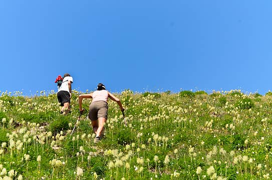 bro and sis 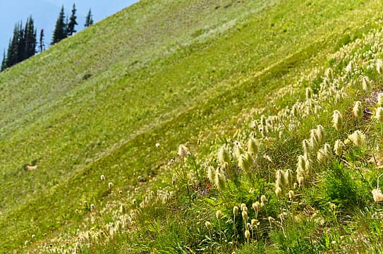 the first of thousands 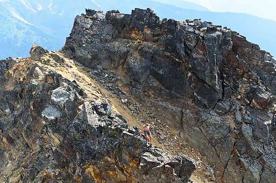 a scrambly section to the summit of plummer 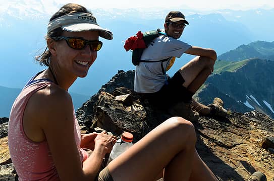 summit shot 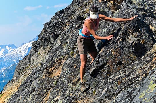 coming down from plummer 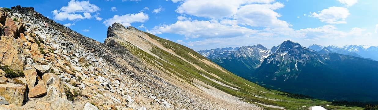 colorful slopes of plummer 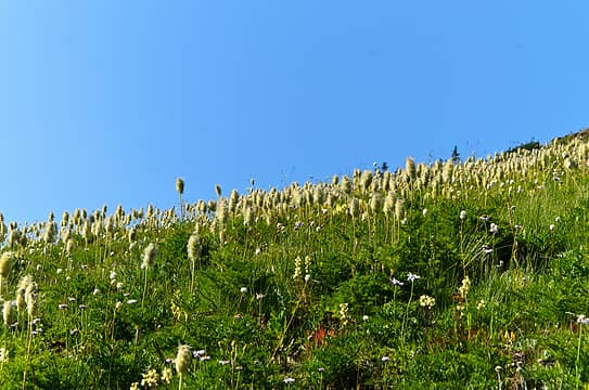 many mouse on a stick 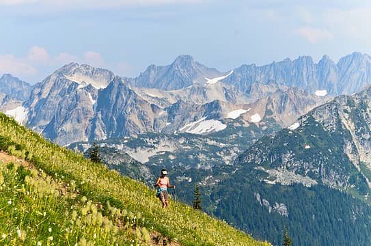 flowers in an otherwise rugged world 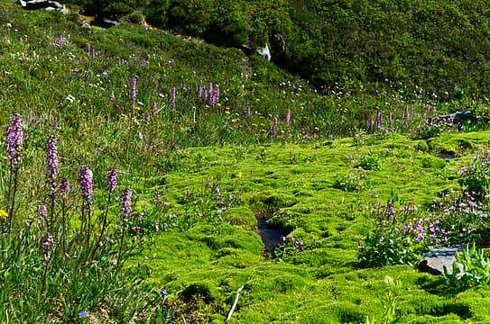 glorious mossy and flowery creeklet 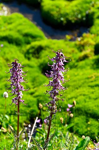 elephant's head 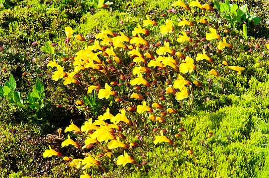 happy yellow guys 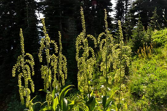 false hellebore climbing up 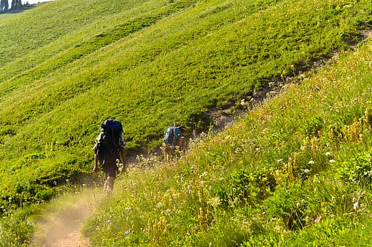 leaving me in the dust 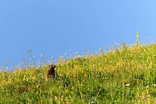 a stuffed marmot (or is he real?) 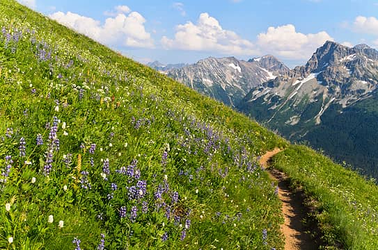 quite the trail walk 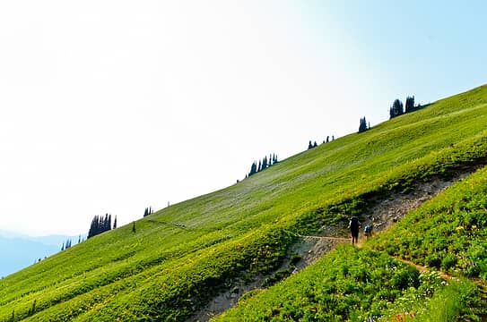 lupines litter the hillsides ahead 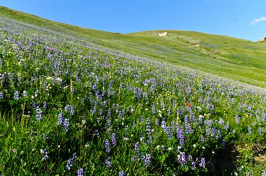 lupine!!! 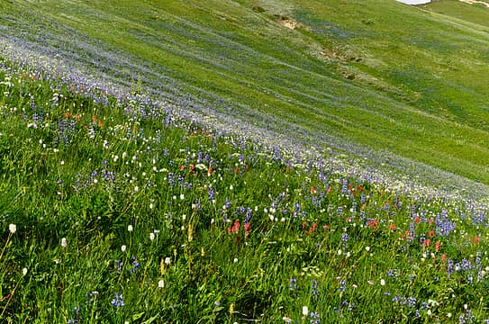 flower density through the roof 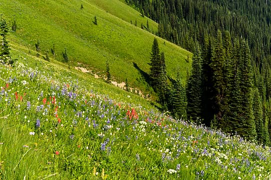 gotta love bright green hillsides 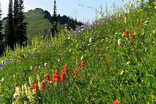 more flowers 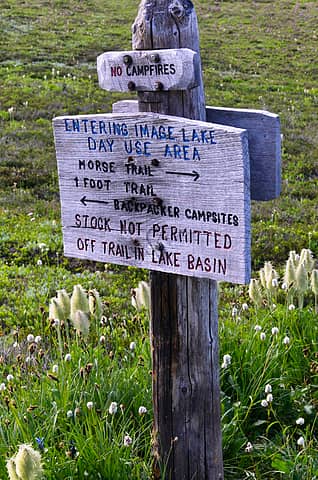 well maintained sign 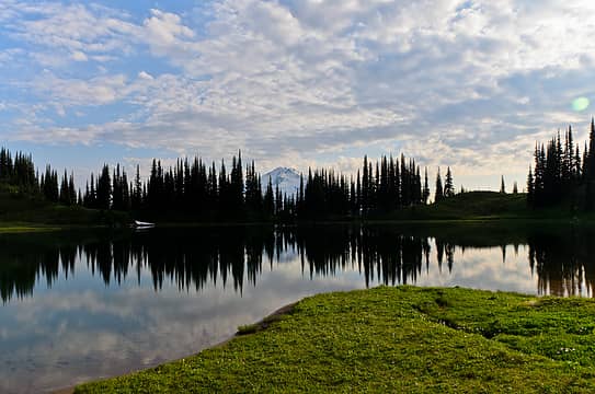 a little different this time without the snow 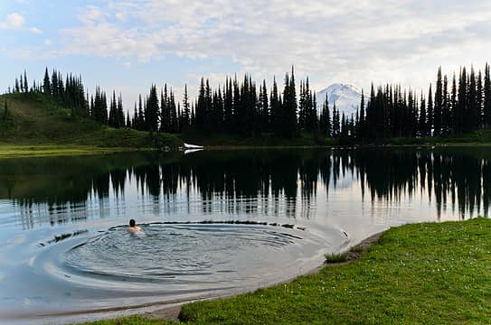 splish splash i was taking a bath 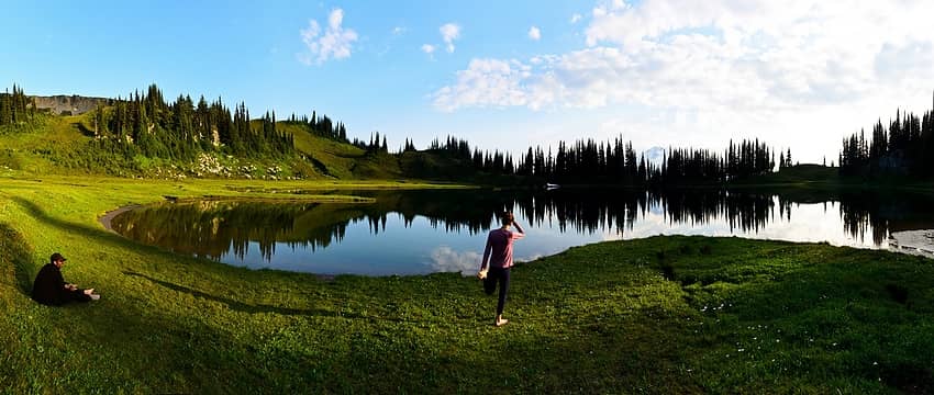 a good stretch at image lake 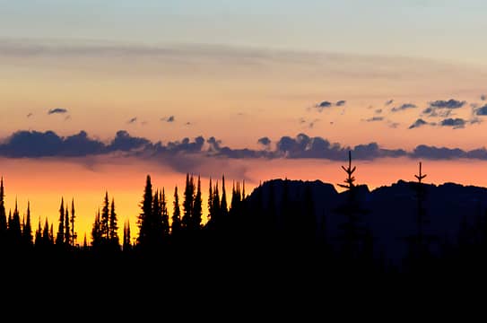 the horizon is on fire 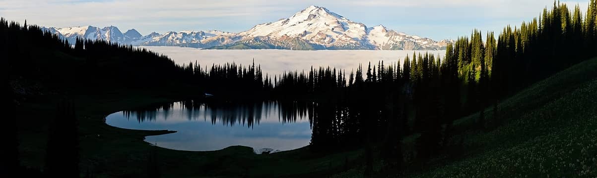 morning inversion at image lake 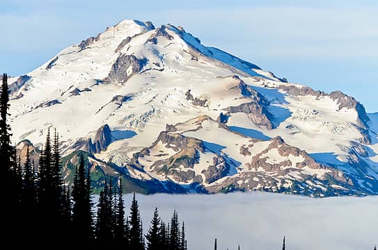 morning light on YES! peak 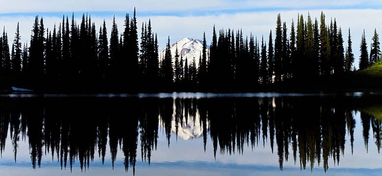 blue streak in the sky 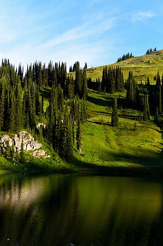 green reflections 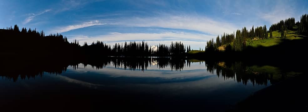 great sky reflection 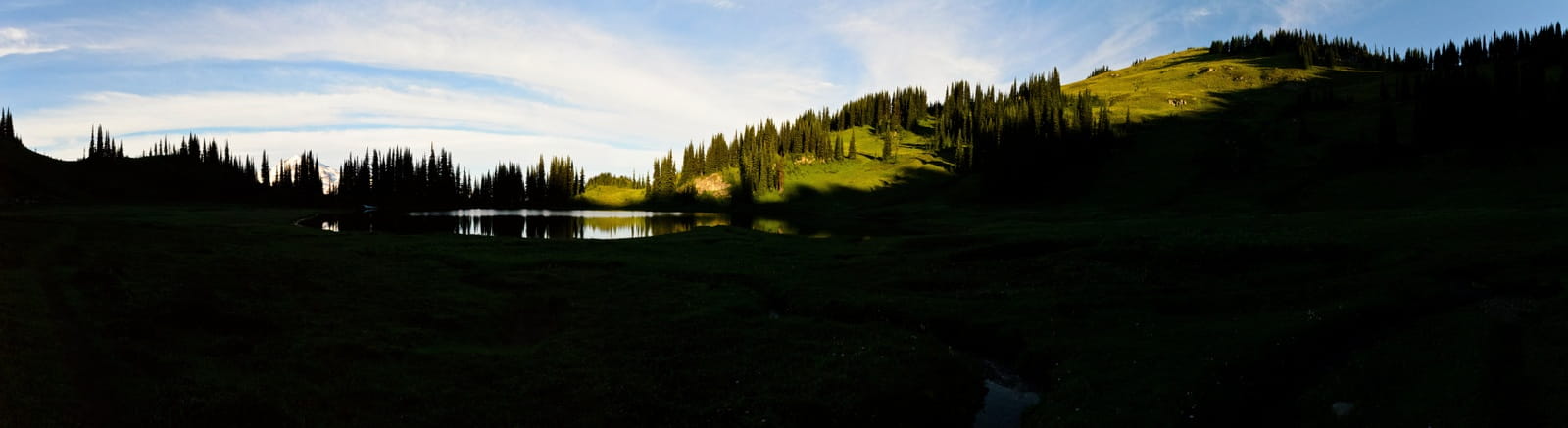 green hills 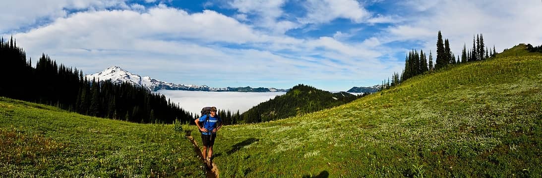 rising above the clouds 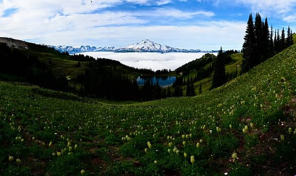 last look at image lake 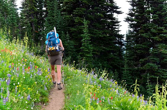 more miserable trail to walk 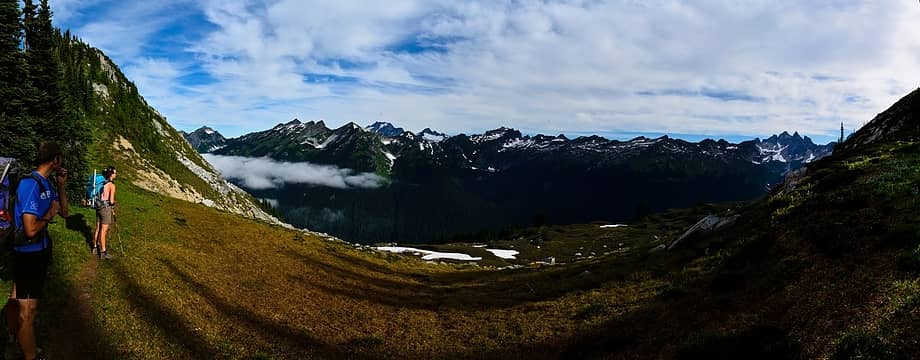 surveying the route to canyon lake 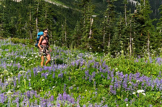 smiling lupines 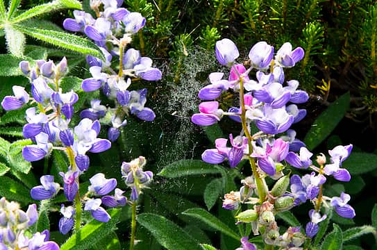 spidery pink and purple lupines  a few large trees 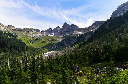 approaching sitting bull basin 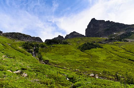 sitting bull, centered, from below 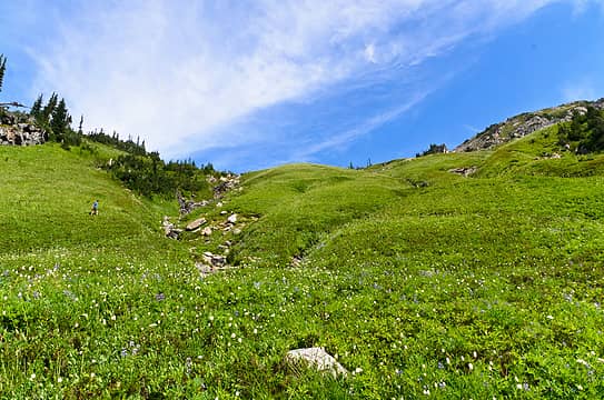 just way too many flowers again 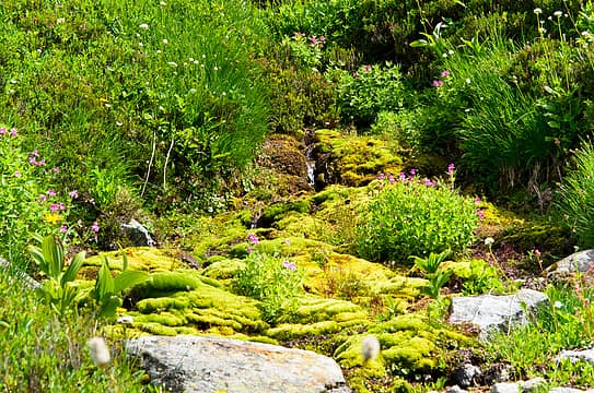 another beautiful mossy section near a creek 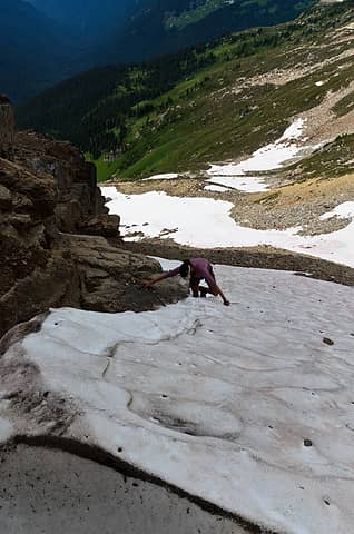 testing out the moat 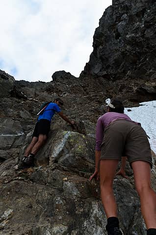 let's try the right edge instead 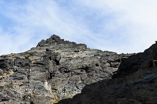 view looking towards the summit of sitting bull 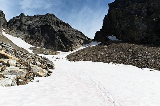 retreating 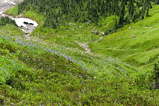 back down through the flowers 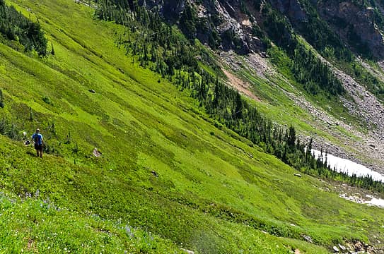 and some bright green fields 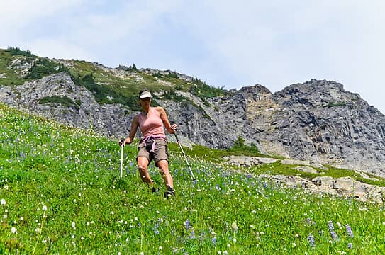 more steep 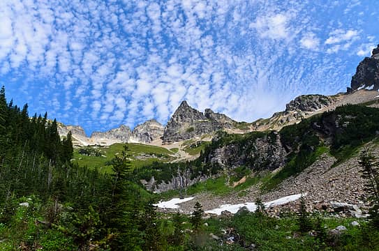 great clouds on sitting bull 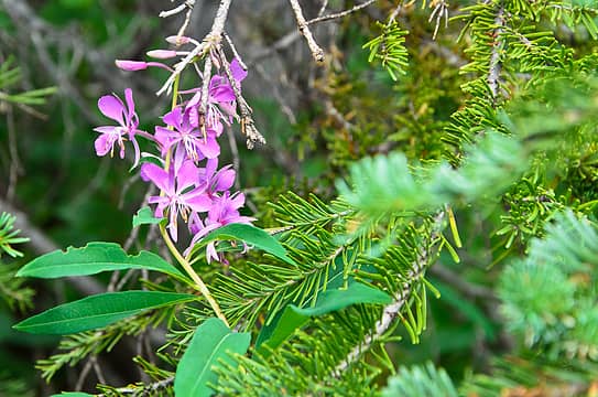 random flower in a tree 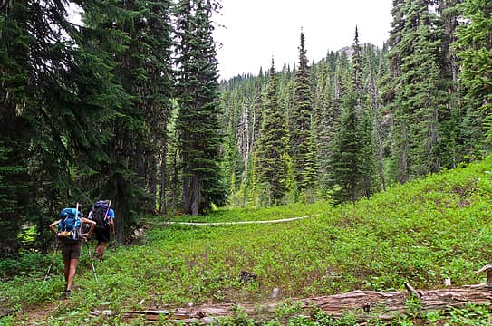 pressing on towards canyon lake 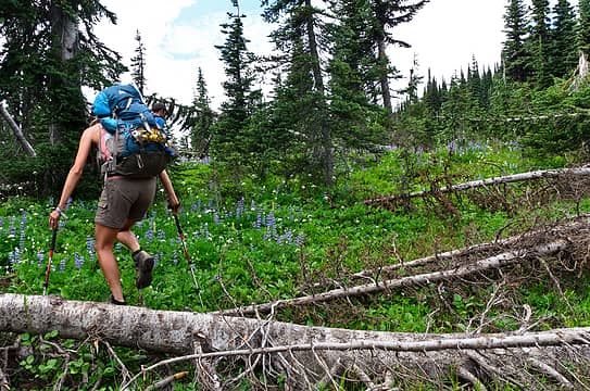 where the trail starts to go bad  the result of clearing the trail 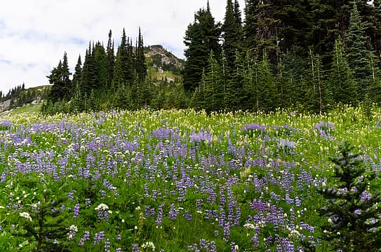 a segregated field of lupine and mouse on a stick 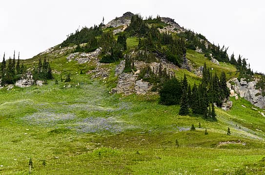 a bump with lots of lupine below 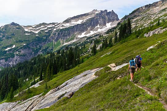 canyon lake, almost in sight 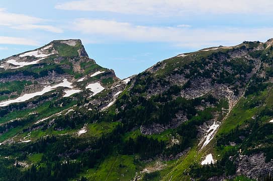 totem pass 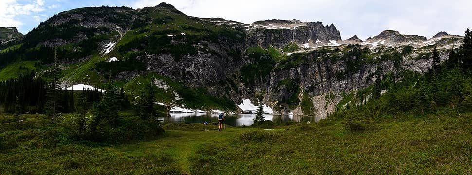 totem pass, bannock mtn, and canyon lake 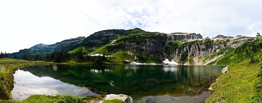 canyon lake 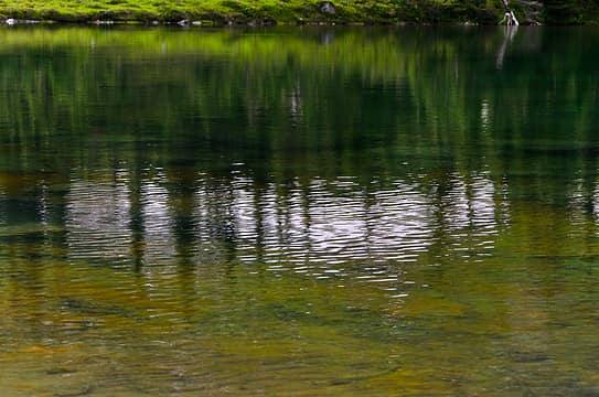 cornucopia of colors 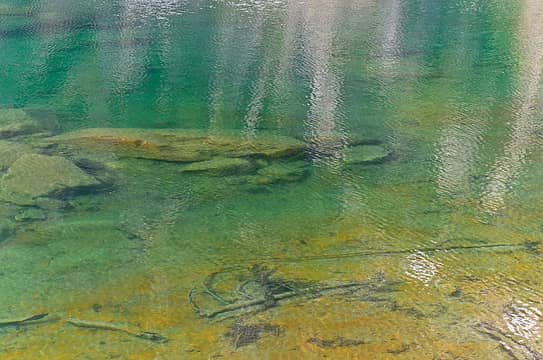 looks good for a swim 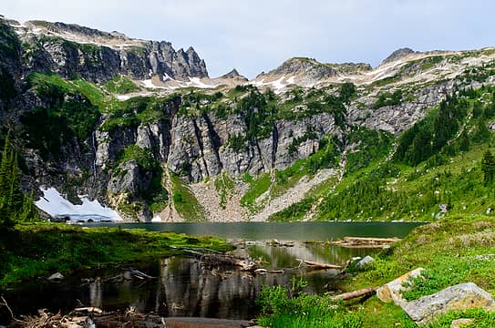 crossing canyon lake outlet 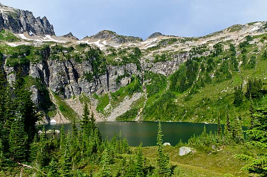 what a gloriously green gem 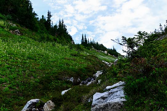 totem pass in the near future 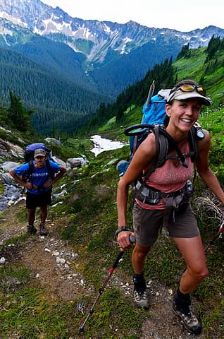 happy times 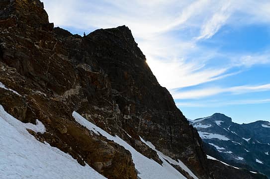 north face of pt 7078 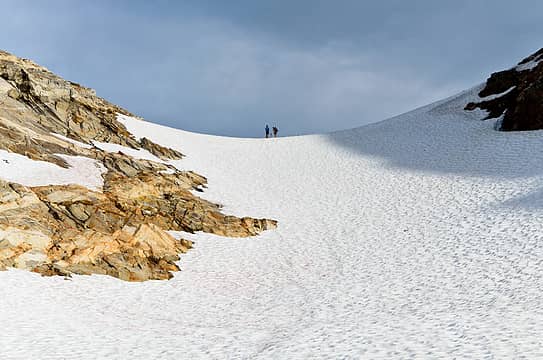 hanging at totem pass, looking south 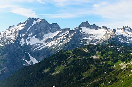 dome, sinister, and the hanging gardens! 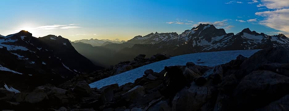 fading light on dome and sinister 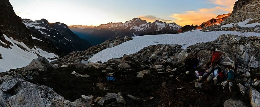 dinner time at totem pass 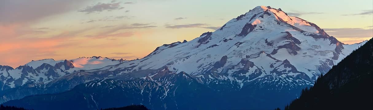 alpenglow on kololo and YES! peak
|
| Back to top |
  
|
|
iron
Member
Joined: 10 Aug 2008
Posts: 6392 | TRs | Pics
Location: southeast kootenays |
|
iron
Member
|
Tue Aug 28, 2012 1:35 pm |
|
|
day 4
today was the day. the day of whether we could find a way around to bannock lakes. the day we would reach the hanging gardens. such potential for highs and lows. times like this make me quite nervous, though very silently and internalized. no matter what, we would make it to the hanging gardens; if we had to turn back, i would have been okay with it.
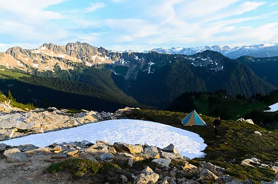 looking back towards plummer and miners ridge 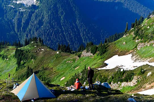 breakfast 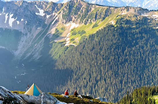 taking in the views 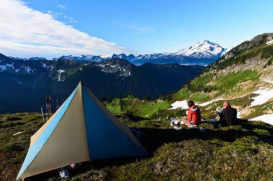 still enjoying breakfast 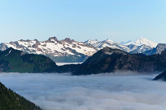 another inversion, this time to the N 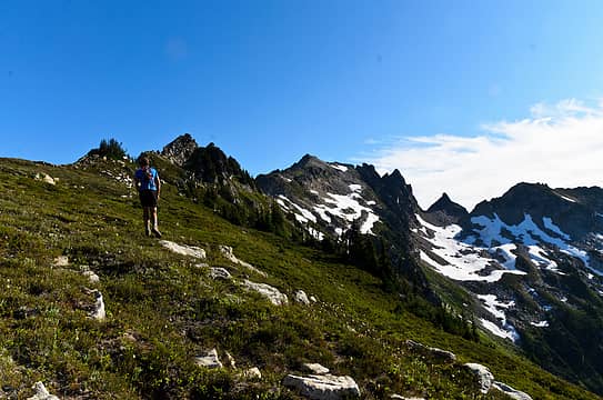 heading up towards bannock 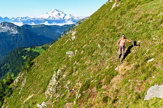 steep sidehilling 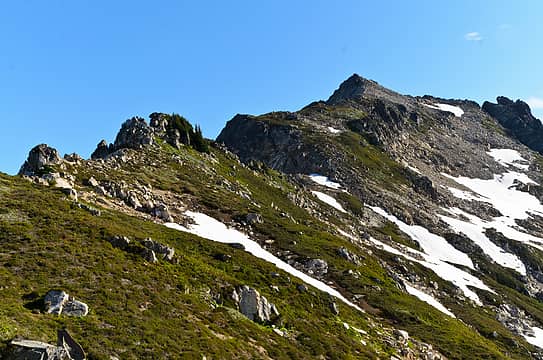 bannock, false summit 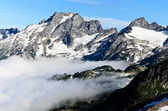 dome and sinister with the hanging gardens in the inversion 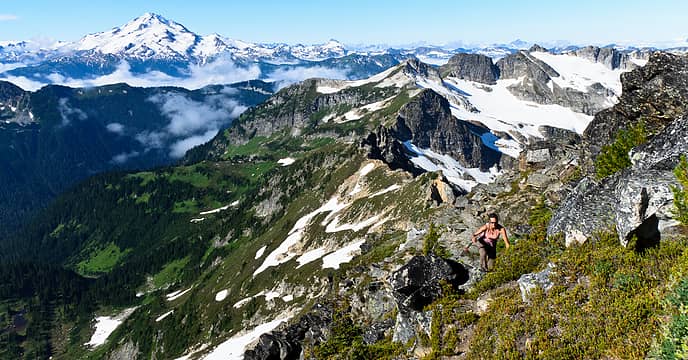 making our way up with bath lakes HR behind and to the right 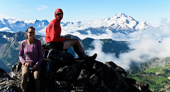 chillin on bannock 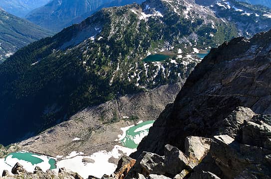 all four bannock lakes 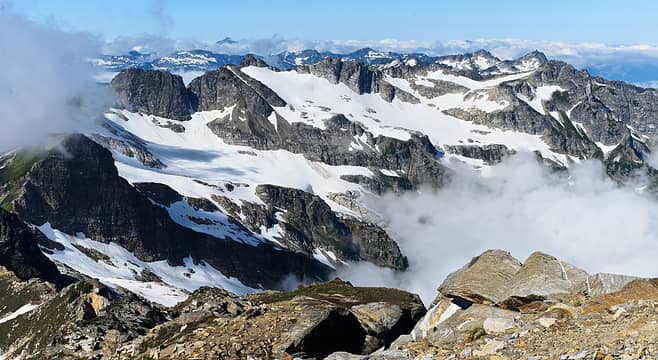 bath lakes HR 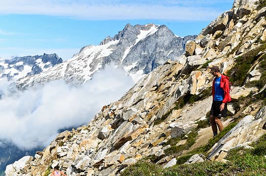 hotbro and dome 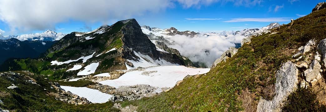 looking back at camp 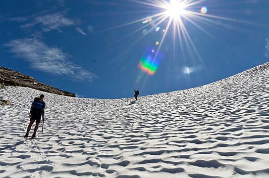 descending from totem pass 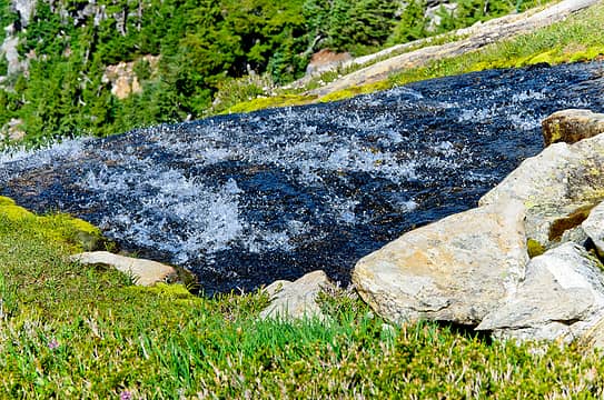 bubbling slab creek 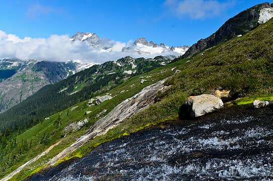 leave my ashes here, please 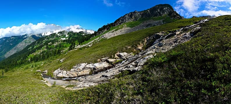 great slab waterfall in front of the hanging gardens 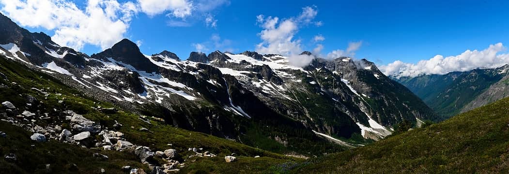 traversing to hanging gardens, looking back at bath lakes HR 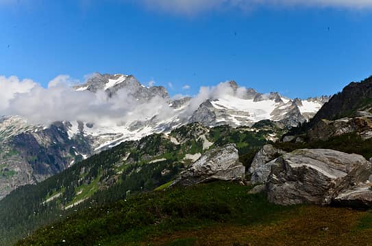 hanging gardens getting tangibly close 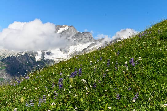 lupines, clouds, and dome 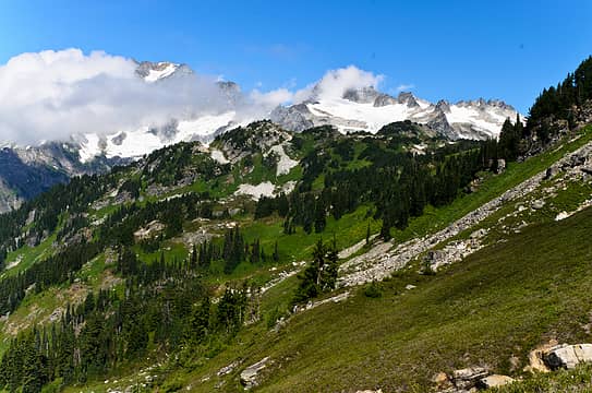 minutes away now 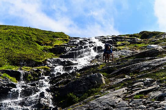 descending a waterfall slab 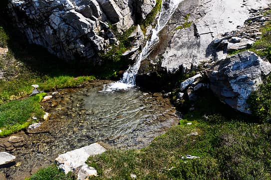 the perfect bathing spot 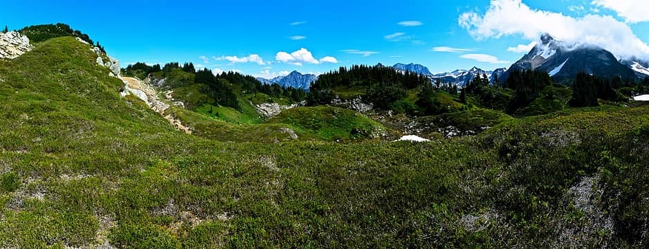 bumpy hanging gardens 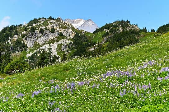 flowers in the garden 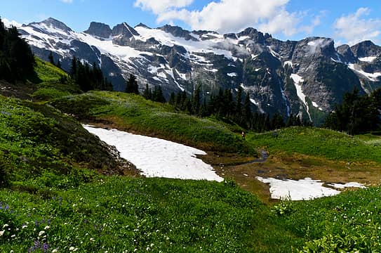 looking back towards bath lakes HR 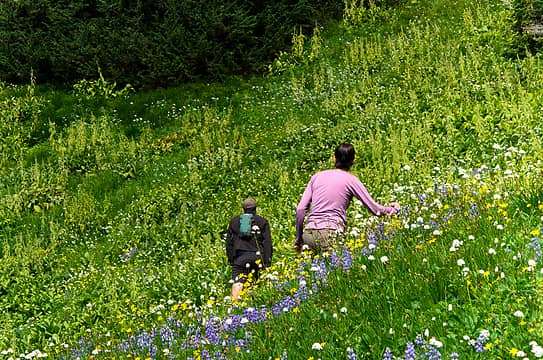 garden-like yet? 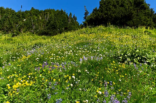 umm, yep 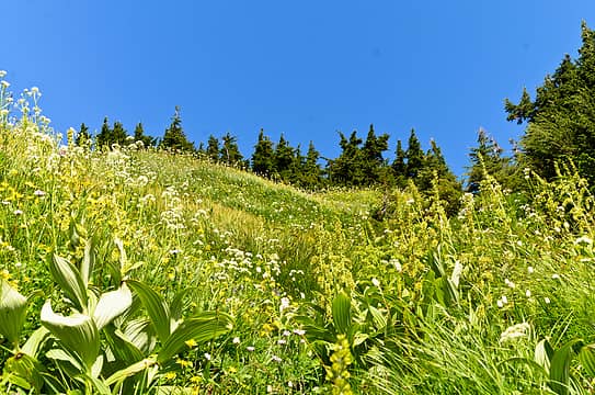 hiking through the hellebore 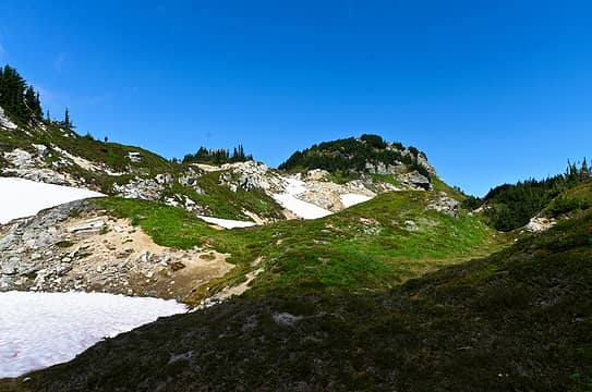 entering the gardens 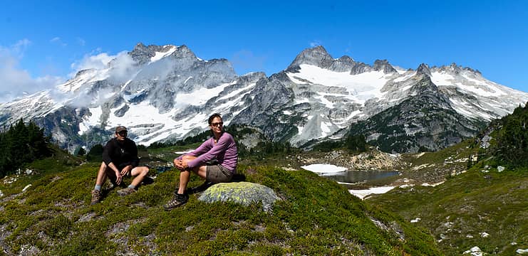 miserable spot for a lunch 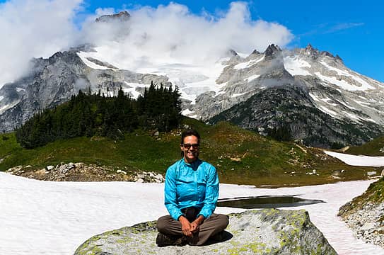 happy pose in a happy place 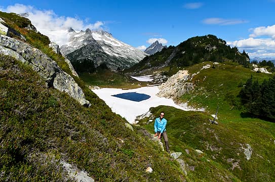 as nice a tarn as i can picture 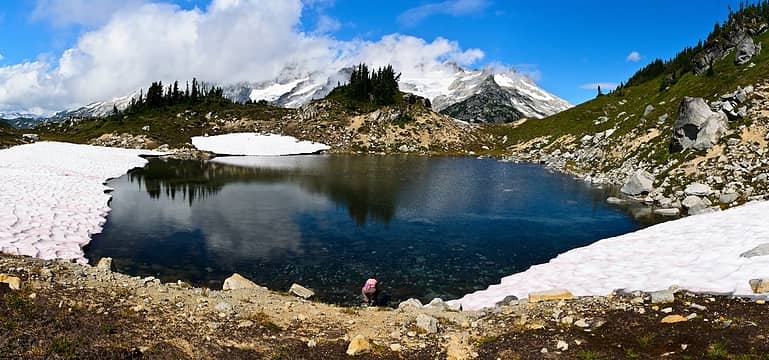 pretty sweet tarn with views of dome and sinister 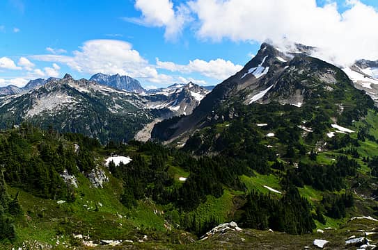 looking towards bonanza, saddle bow, and our route to get into bannock lakes 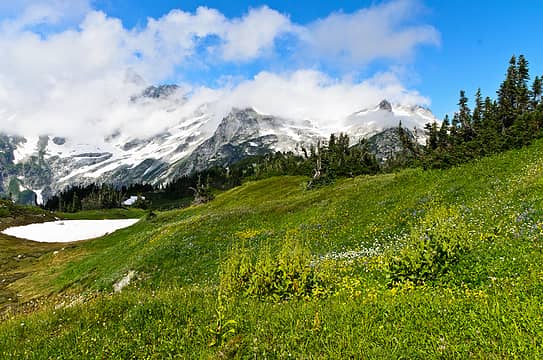 flowers and granite giants 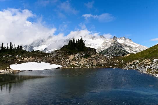 wow! 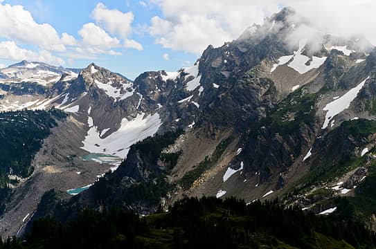 the shelf we took to access bannock lakes 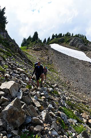 working towards the shelf 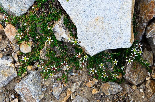 pretty little star flowers 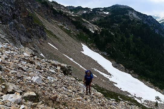 that wasn't so bad 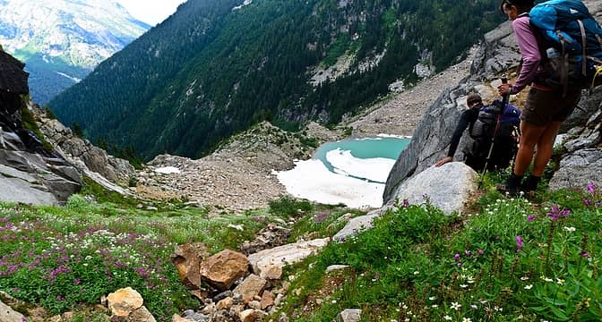 steep descent down to bannock lakes 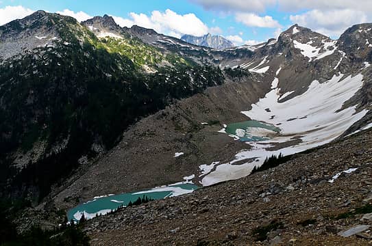 lower bannock lakes 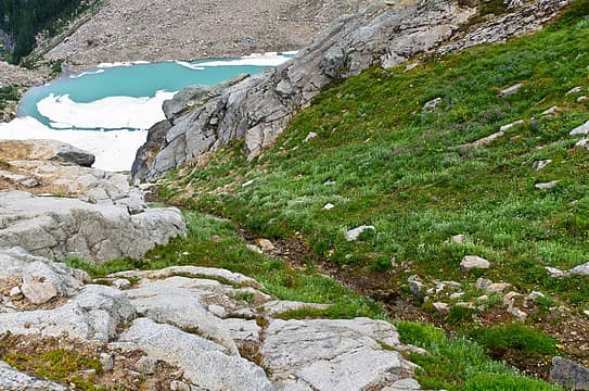 our descent creek 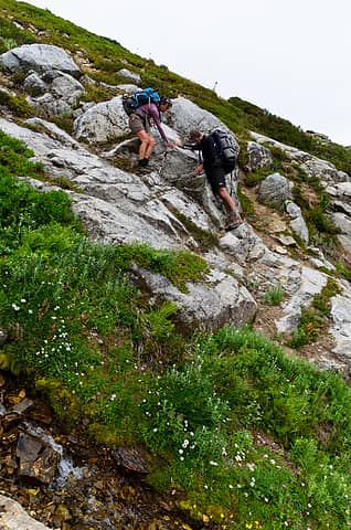 first, negotiating some slabs 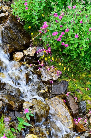 life flourishing near the creek 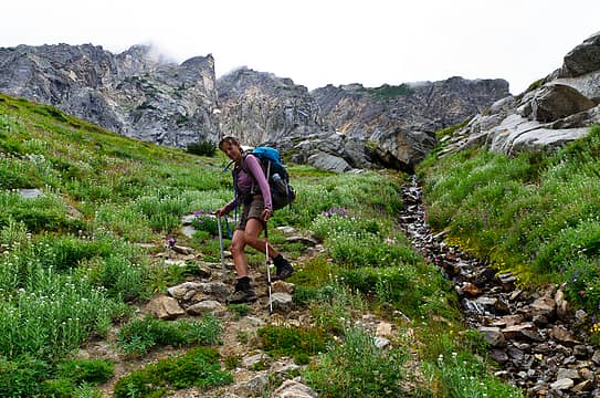 down we goeth 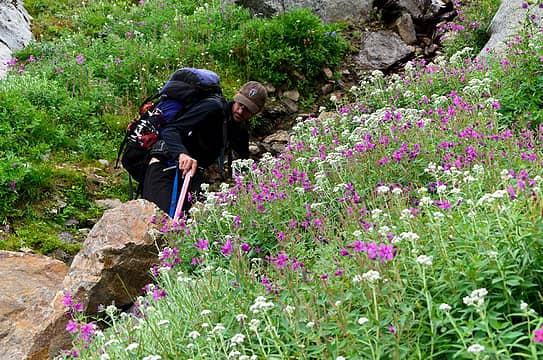 another horrible spot to have to hike through 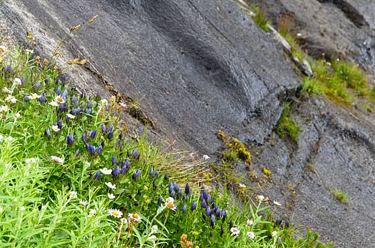 nothing like an accent slab for the flowers 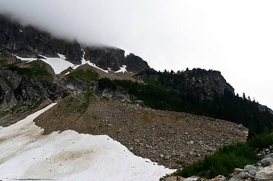 our route followed the dark green line left of center 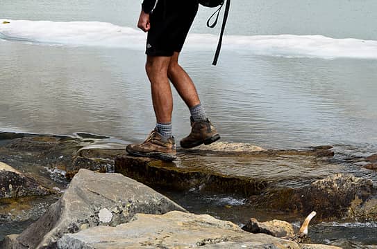 crossing the bannock lake outlet 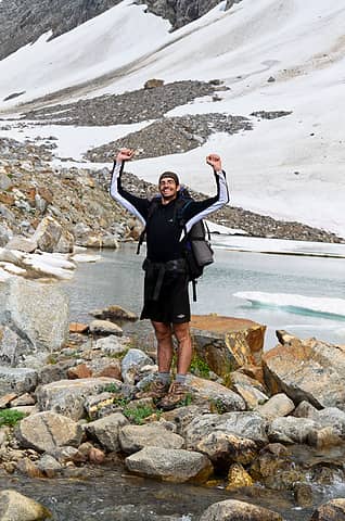 raise your arms if you're sure 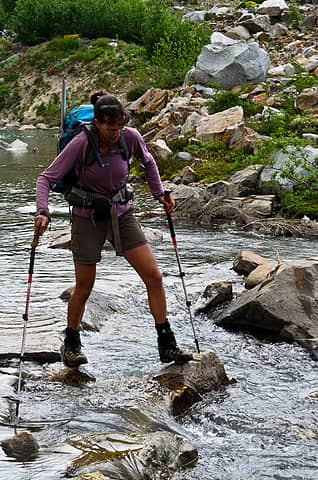 crossing the bannock lake outlet 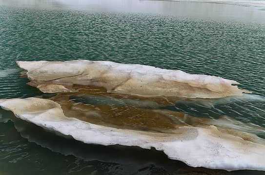 a floater  we could see this odd reflection from way high above 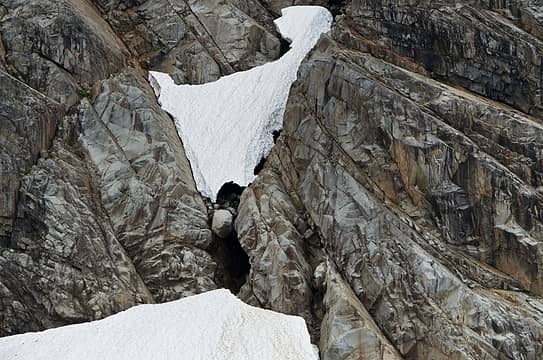 a rock in a hard place 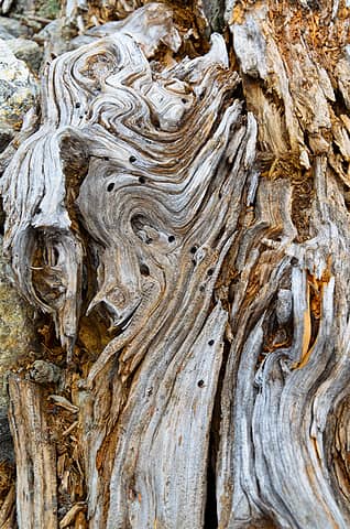 old fallen tree 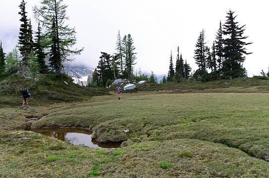 i wonder if we can find somewhere to camp 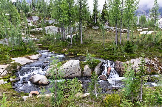 upper bannock outlet 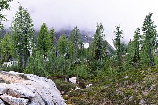 larches in the mist 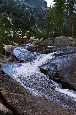 upper bannock outlet 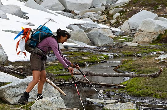 stream crossing with a prayer flag 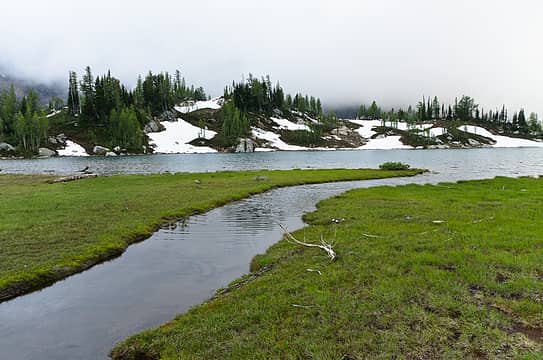 upper bannock 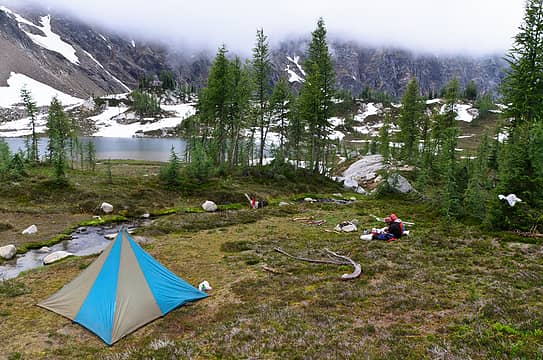 pretty nice campsite 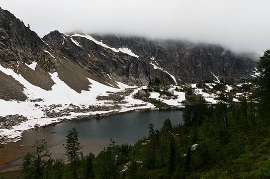 upper bannock 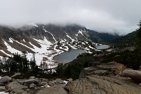 upper bannocks 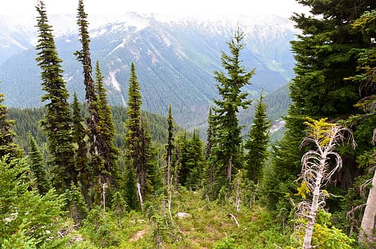 now down to the pct 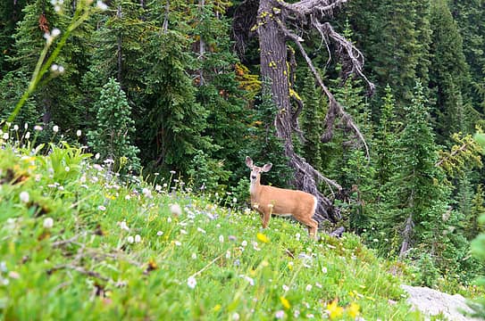 she wasn't the least bit concerned of our presence 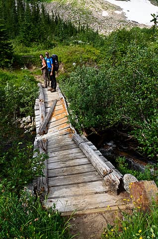 a fun house bridge 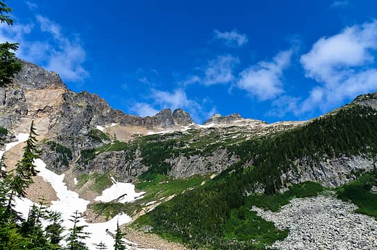 back side of sitting bull from PCT 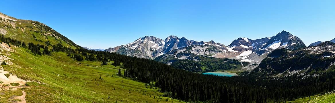 lyman lakes from cloudy pass 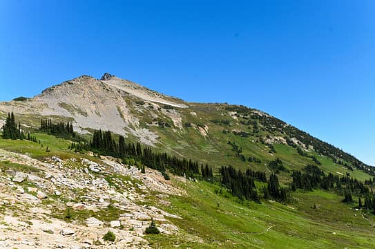 cloudy peak 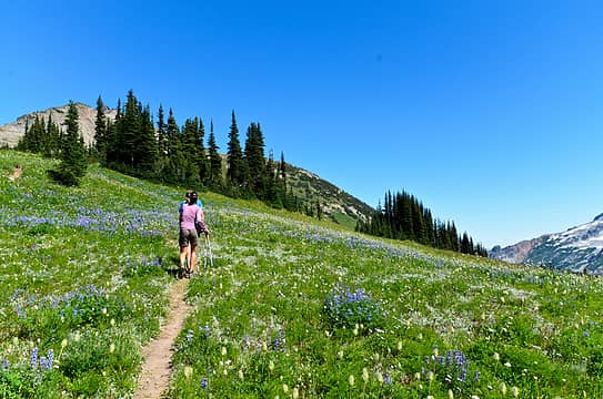 more brilliant meadows en route to cloudy peak from cloudy pass 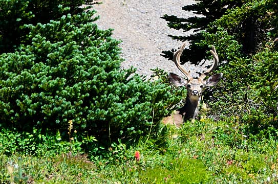 again, not very afraid 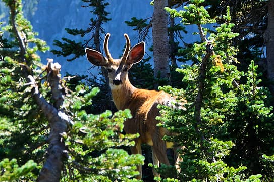 nor was his younger friend 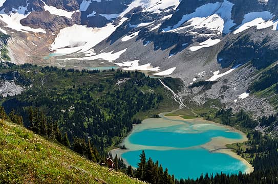 lyman lakes 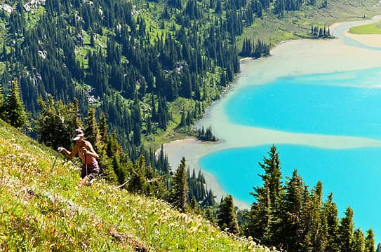 photoshopped? nah. this is real. 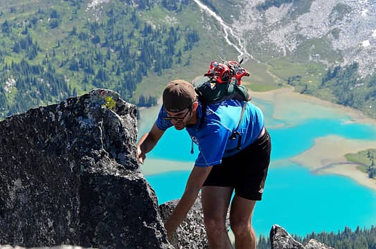 nearing the summit of cloudy 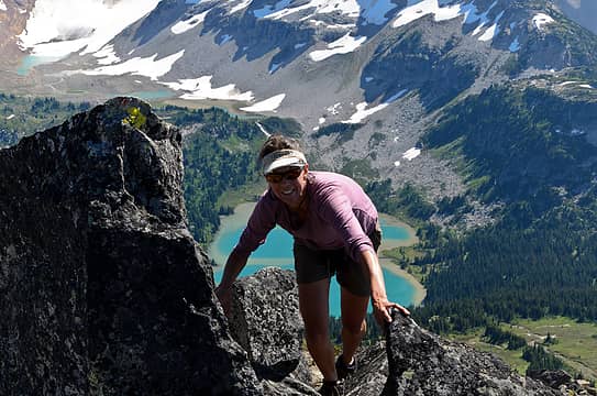 nearing the summit of cloudy  . .
 coming around north star's false summit 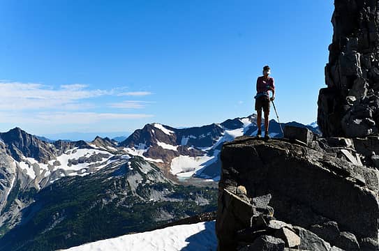 a ledge on north star 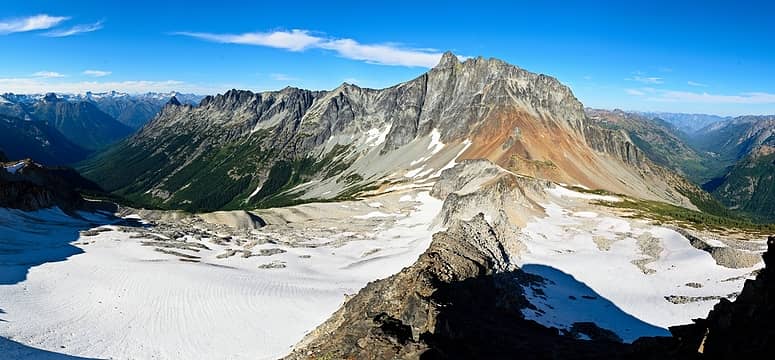 bonanza from north star, where steph was climbing only minutes earlier 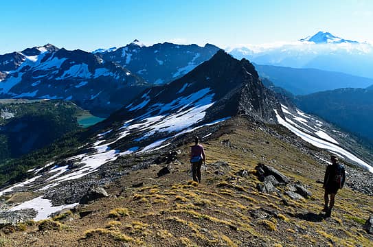 heading back and hoping to make camp before dark 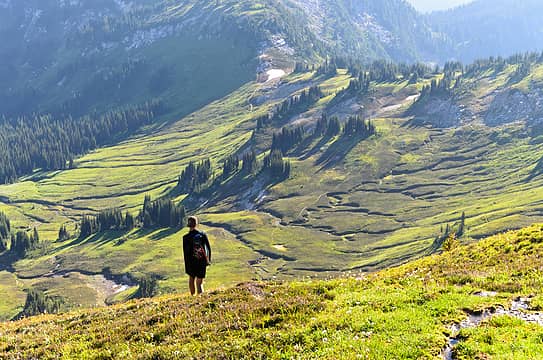 the hills are alive 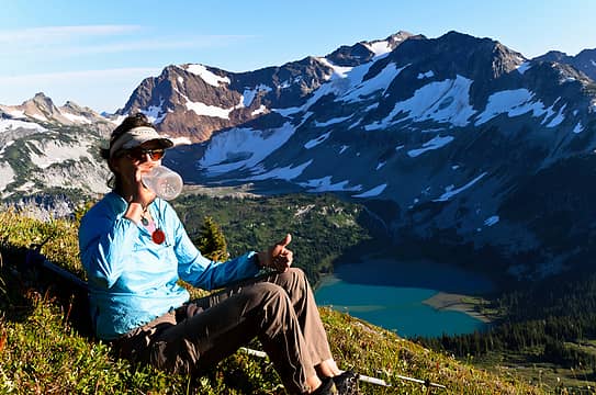 my thoughts exactly 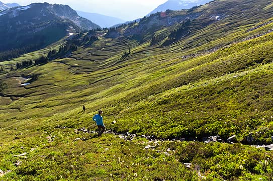 heading back towards cloudy pass 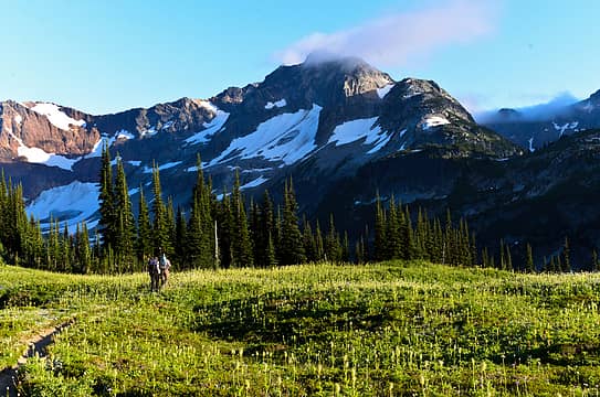 down towards the lake 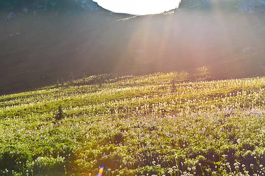 good night mice 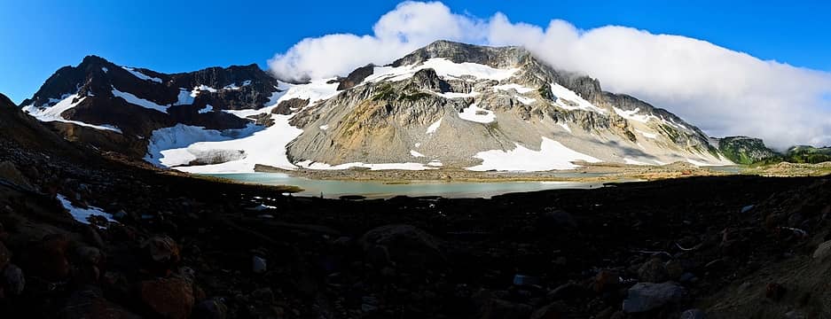 chiwawa is happily lit up 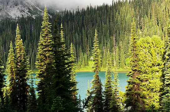 lyman lake is nearly perfect 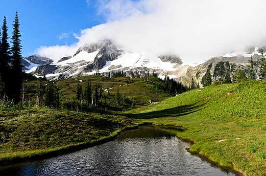 a little tarn on a side trail 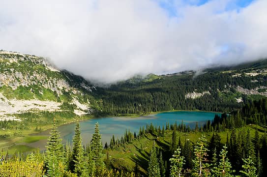 beautiful 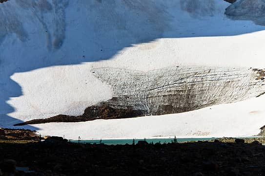 glacier terminus 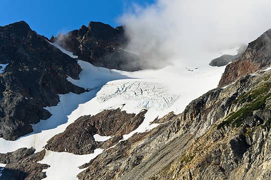 upper glacier 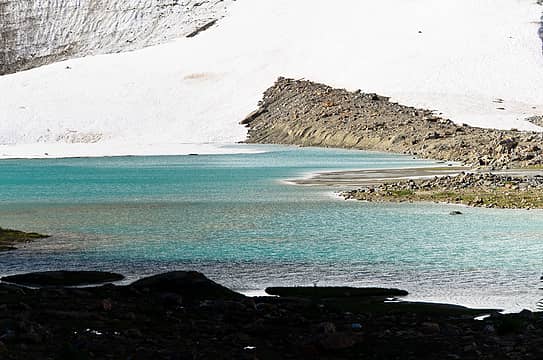 so many colors 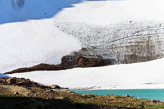 i see why it's so colorful 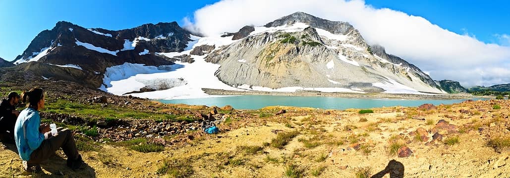 a fine rest at upper lyman lake 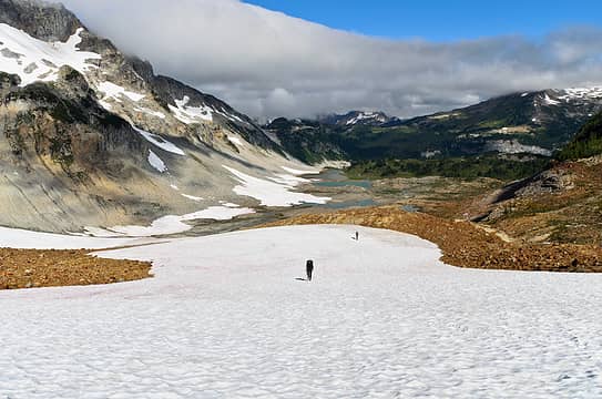 only a little more up for the trip 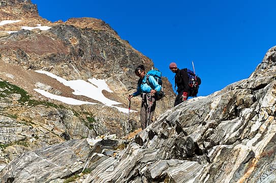 coming down from the gap 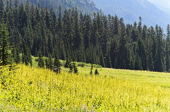 into spider meadows 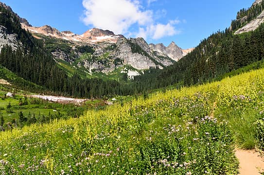 a beautiful way to end the trip 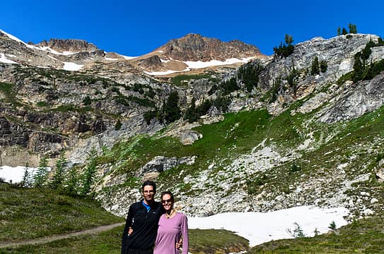 brother and sister
|
| Back to top |
|
|
Tom_Sjolseth
Born Yesterday

Joined: 30 May 2007
Posts: 2652 | TRs | Pics
Location: Right here. |
Sounds like a great trip, iron and co. That Hanging Gardens is a neat place, especially Blue Lake.
I look forward to the rest of the saga.
|
| Back to top |
|
|
Magellan
Brutally Handsome

Joined: 26 Jul 2006
Posts: 13116 | TRs | Pics
Location: Inexorable descent |
|
Magellan
Brutally Handsome
|
Tue Aug 28, 2012 4:00 pm |
|
|
Super cool trip iron.  You really know how to link them up. Looking forward to pictures. You really know how to link them up. Looking forward to pictures.
|
| Back to top |
|
|
Randy
Cube Rat

Joined: 18 Dec 2001
Posts: 2910 | TRs | Pics
Location: Near the Siamangs |
|
Randy
Cube Rat
|
Tue Aug 28, 2012 4:10 pm |
|
|
Nice to read these kind of reports with adventure and exploring involved. Looking forward to the pictures.
|
| Back to top |
|
|
RichP
Member

Joined: 13 Jul 2006
Posts: 5633 | TRs | Pics
Location: here |
|
RichP
Member
|
Tue Aug 28, 2012 4:44 pm |
|
|
Excellent! I've always wanted to visit hanging gardens since reading about it in the Beckey Guide. Looking forward to the pics.
|
| Back to top |
|
|
raising3hikers
Member

Joined: 21 Sep 2007
Posts: 2344 | TRs | Pics
Location: Edmonds, Wa |
I'm glad your trip went well, too bad about Saddle Bow. Can't wait for the pics in that not very often visited place. Hope to see the meadow pic with 100,000 mouse on sticks
|
| Back to top |
|
|
don b
Member
Joined: 22 Feb 2006
Posts: 369 | TRs | Pics
|
|
don b
Member
|
Tue Aug 28, 2012 5:51 pm |
|
|
|
| Back to top |
|
|
Stefan
Member

Joined: 17 Dec 2001
Posts: 5091 | TRs | Pics
|
|
Stefan
Member
|
Wed Aug 29, 2012 9:10 am |
|
|
75 miles and no mention of blisters in 6 days?
all three of you are amazing for covering that amount of ground. You sure were in a very pretty area!
|
| Back to top |
|
|
iron
Member
Joined: 10 Aug 2008
Posts: 6392 | TRs | Pics
Location: southeast kootenays |
|
iron
Member
|
Wed Aug 29, 2012 9:19 am |
|
|
i started to get blisters during the first 7 miles of trail. i was using my new crocs which have little grippy nubs under the ball of the foot. not cool. had it not been for them, i probably would have logged 30+ miles on my crocs. hopefully the nubs wear out soon.
|
| Back to top |
|
|
iron
Member
Joined: 10 Aug 2008
Posts: 6392 | TRs | Pics
Location: southeast kootenays |
|
iron
Member
|
Fri Sep 07, 2012 9:24 am |
|
|
|
| Back to top |
|
|
ragman and rodman
Member

Joined: 28 Apr 2005
Posts: 1219 | TRs | Pics
Location: http://rgervin.com/ |
Epic...
|
| Back to top |
|
|
Bright River
goslowgofar
Joined: 21 Aug 2007
Posts: 223 | TRs | Pics
Location: above the pogonip |
Wow! thanks for the photos.
I believe that this route in part was named and published as PTARMIGAN TRAVERSE SOUTH in the l970s.
The Original party came in through Bath Lakes and Canyon Lakes, and exited out through downey Creek after climbing Dome, Spire, Gunsight, and Agnus( new route). they saw nobody for 9 days.
I particularily liked the ridge and gardens south of Dome and Plummer peak area. Now I get to see it again. thanks!!
did yousee anybody else after you went off trail?
..-and rest thee by many brooks and hearthsides without misgiving. Rise free from care before the dawn and seek adventures. Let the noon find thee by other lakes, and the night overtake thee everywhere at home. HDT
..-and rest thee by many brooks and hearthsides without misgiving. Rise free from care before the dawn and seek adventures. Let the noon find thee by other lakes, and the night overtake thee everywhere at home. HDT
|
| Back to top |
|
|
iron
Member
Joined: 10 Aug 2008
Posts: 6392 | TRs | Pics
Location: southeast kootenays |
|
iron
Member
|
Fri Sep 07, 2012 1:18 pm |
|
|
between image lake and almost cloudy pass, we saw no one. best part of the trip for sure.
|
| Back to top |
|
|
Ingunn
Hiking Viking
Joined: 01 Feb 2008
Posts: 1751 | TRs | Pics
Location: Redmond |
|
Ingunn
Hiking Viking
|
Fri Sep 07, 2012 1:39 pm |
|
|
Wonderful, wonderful, wonderful. Thank you.
|
| Back to top |
|
|
|
|
You cannot post new topics in this forum
You cannot reply to topics in this forum
You cannot edit your posts in this forum
You cannot delete your posts in this forum
You cannot vote in polls in this forum
|
Disclosure: As an Amazon Associate NWHikers.net earns from qualifying purchases when you use our link(s). |


