b00
Member


Joined: 29 Sep 2003
Posts: 1144 | TRs | Pics
|
|
b00
Member
|
 Wed Oct 03, 2012 10:28 pm |
|
|
gunn + tailgunner 5842 + wing 5760 9-30-2012
 neher-man strolling over to tailgunner tarn - wing and merchant peaks rise in the background  discussing the second amendment and enjoying our constitutional on _____ (name that peak) 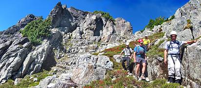 correct notch directly above us 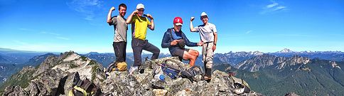 these guys are giving you a hint about which summit they are on. they are showing you their ____s --- ps - good thing i was not in that picture or i would have to be showing off my derringers  tailgunner summit - dan walks away while neher-man, scott and iron enjoy the views of: gunn left, merchant center, baring right  iron shows us how to wing it to wing peak  iron winging ut  these guys are giving you a hint about which summit they are on. they are showing you their ____s -- -- ps- be careful, they might take off
|


