Mtn Dog
Technohiker


Joined: 01 Aug 2004
Posts: 3336 | TRs | Pics
Location: Bellevue, WA |
|
Mtn Dog
Technohiker
|
 Mon Oct 08, 2012 9:40 pm |
|
|
Here's a tribute to all my fellow NWHikers who were also hiking, backpacking, and climbing north of Rainy Pass over the weekend. I'm sure I walked by you, yielded the trail to you, maybe even told you how far it was to the Snowy Lakes using my GPSr. Here's to you!
LEG PWR and I couldn't have asked for better weather for a hike in an area we never get to see enough of. We started hiking at 10:40 AM and passed several parties on the way to Cutthroat Pass. At the pass there were four mountain bikers with their bikes taking a lunch break and bike tracks on the Cutthroat Lake trail up to the fork. The traverse to Granite Pass gave some of the 2,000' elevation gain back right at the pass but also opened up a whole sea of new views to the north across the Swamp Creek Valley. Golden Horn and Tower Mtn dominate the view north while the Needles and Delancy Ridge lead your eyes to the Pasayten in the east. Methow Pass loomed in the distance so we continued on, reaching our goal at 3:00 PM. We meandered around taking pics and then started the long walk back. On the way out we passed a bunch of backpackers making their way in hoping to reach Snowy Lakes while campsites were still available. Returning to Cutthroat Pass brought alpenglow across the peaks to the south and last light was enough to return to the car without headlamps by 7:00 PM, dropping the last 5 miles in 90 mins. From the trail I could see the helicopter getting water from Rainy Lake and dumping it on the smoldering fire near Lewis Lake. I also saw a headlamp on the Maple Pass Trail across the way at the same time.
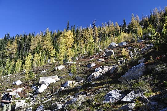 Slopes up to Cutthroat Pass 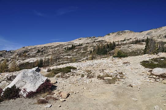 HIlls above Cutthroat Pass 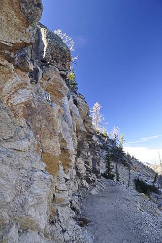 Lit up Larch 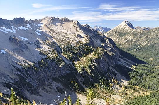 Expansive views awaited... 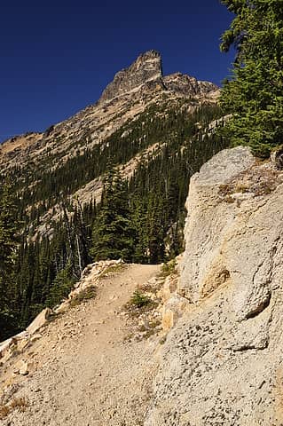 Towering over the trail 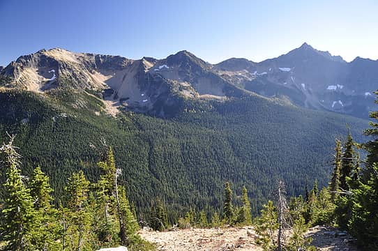 Porcupine Peak 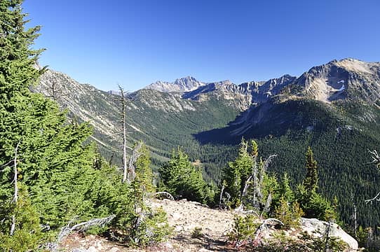 Silverstar Mtn over Granite Pass 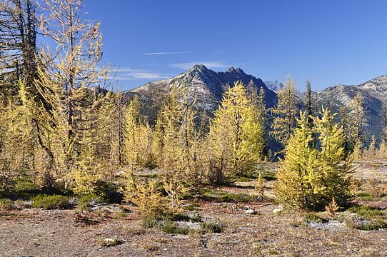 Mebee Pass & Jack Mtn 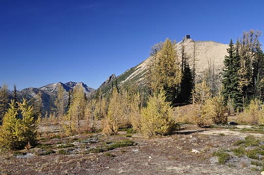 Azurite Peak & Golden Horn 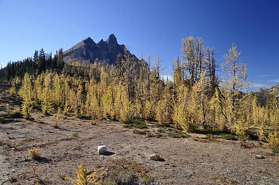 Mt Hardy from Methow Pass 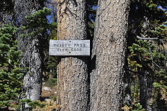 High enough for Larches 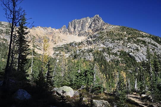 Tower Mtn from near Methow Pass 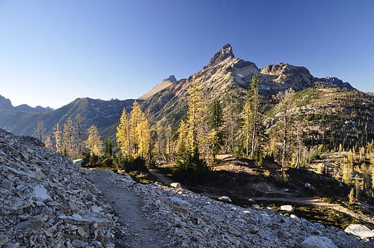 Peaks and Passes 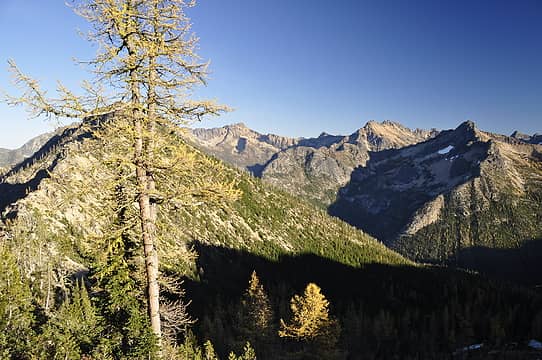 Snagtooth & Kangaroo Ridges 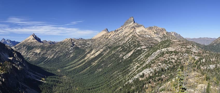 Hardy - Golden Horn - Tower 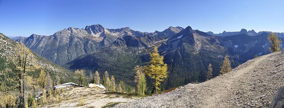 Silverstar to Liberty Bell 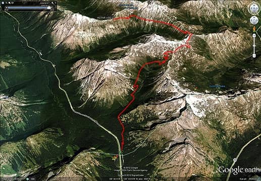 Google Earth GPSr Track 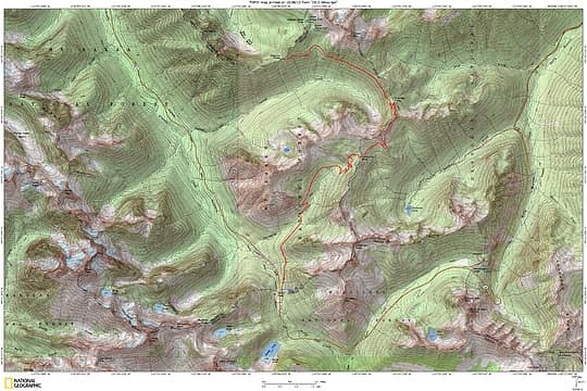 TOPO! Map
Footprints on the sands of time will never be made sitting down.
Footprints on the sands of time will never be made sitting down.
|


