| Previous :: Next Topic |
| Author |
Message |
boot up
Old Not Bold Hiker


Joined: 12 Dec 2006
Posts: 4745 | TRs | Pics
Location: Bend Oregon |
|
boot up
Old Not Bold Hiker
|
 Sun May 12, 2013 9:58 pm |
|
|
Lots of chatter here on the awful, unhikeable results of terraforming a road into a trail. (and yes its an odd use of money in these tight times)
I totally agree that people should avoid this trail.
after all, we only saw 7 people all day, on a beautiful day, on a meandering trail with lots of variety, when literally a few hundred yards down the road, a knee crunching, brutal climb of Mailbox trail was overflowing.
Yup, you don't want to hike this ugly trail.
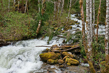 View up Granite creek from new log bridge. Granite Lakes, new trail, WA 05/11/13 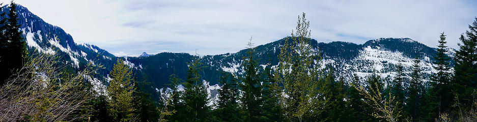 Panorama from Thompson lk trail intersection. Granite Lakes, new trail, WA 05/11/13 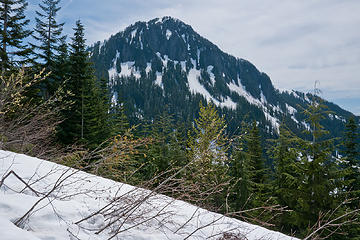 view from Thompson fork.
Granite Lakes trail 5/11/13 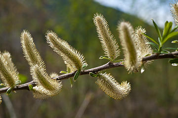 Granite Lakes trail 5/11/13
Feeling fuzzy  Personally, I like its bit of micro roller coastering and winding at the bottom, giving me a chance to use a variety of muscle groups, versus a road climb that just grinds and grinds straight up, then pounds straight down.
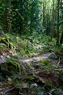 Granite Lakes trail 5/11/13
Lower terraformed road into trail. 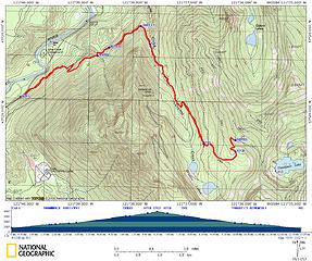 Granite Lakes trail 5/11/13
12.8miles RT
3035 feet elevation gain
3968 feet max elevation
839 feet parking
9.5 hours car to car. 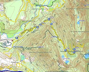 Granite Lakes trail 5/11/13
12.8miles RT
3035 feet elevation gain
3968 feet max elevation
839 feet parking
9.5 hours car to car. 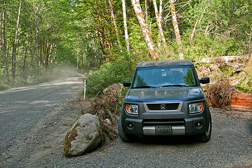 Granite Lakes trail 5/11/13
really dusty parking. 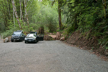 Trailhead parking. It won't be this uncrowded for long. Nasty dusty though.
Granite Lakes trail 5/11/13 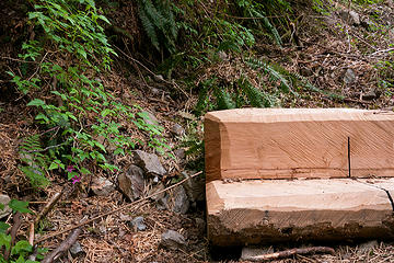 Lots of these benchs down low.
Granite Lakes trail 5/11/13 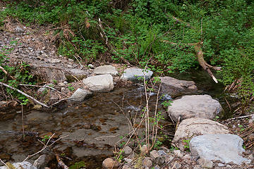 Lower small crossings were better groomed than upper crossings. Granite Lakes trail 5/11/13 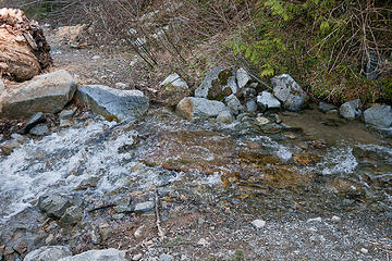 Upper crossings are less groomed.
Granite Lakes trail 5/11/13 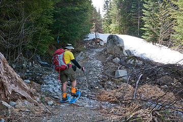 Northwest Spring snowshoeing is a challenge. Granite Lakes trail 5/11/13 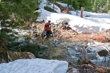 Jack be nimble, jack be quick.
Granite Lakes trail 5/11/13 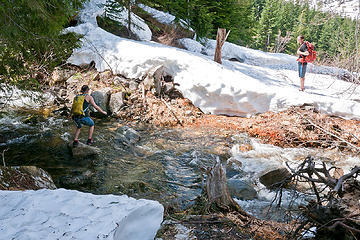 Gotta be young and nimble and already have wet feet for this crossing. Granite Lakes trail 5/11/13 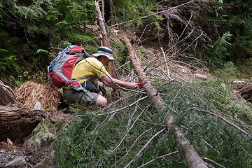 Granite Lakes trail 5/11/13
John at work. 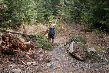 Granite Lakes trail 5/11/13
John, finishing one of his clearing projects. 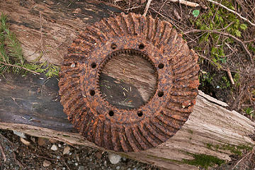 Granite Lakes trail 5/11/13
Did any lose this? :-) 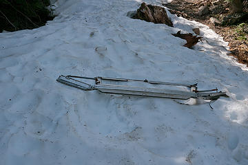 Artifact?
Granite Lakes trail 5/11/13 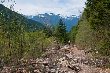 Granite Lakes trail 5/11/13
Land of Lost Wallets....where I found John's. 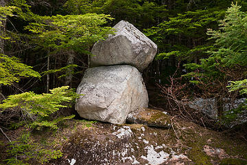 Angry Hiker proof cairn.
Granite Lakes trail 5/11/13 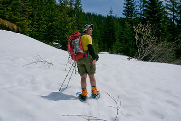 John at upper Thompson lake fork.
Granite Lakes trail 5/11/13 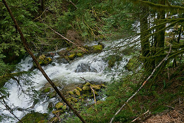 Granite creek from the trail.
Lakes trail 5/11/13 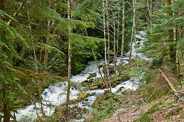 Granite creek from the trail.
Lakes trail 5/11/13 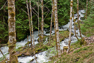 Granite creek from the trail.
Lakes trail 5/11/13 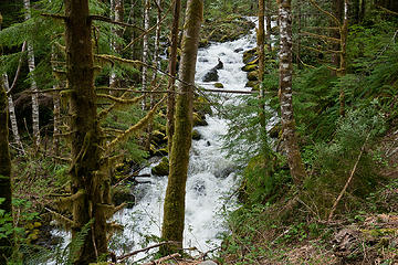 Granite creek from the trail.
Lakes trail 5/11/13 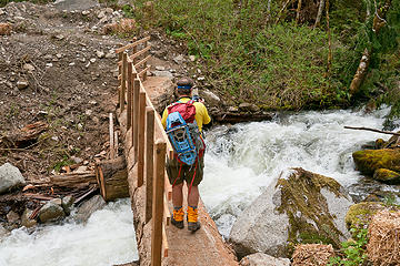 John crossing the bridge.
Granite Lakes trail 5/11/13 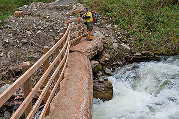 John on the bridge.
Granite Lakes trail 5/11/13  Looking up Granite creek from the trail.
Granite Lakes trail 5/11/13 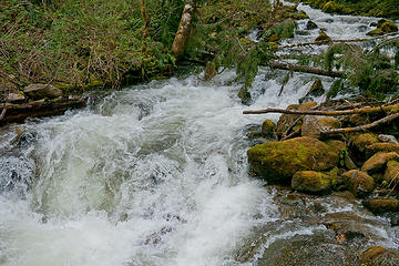 Granite creek from log bridge.
Granite Lakes trail 5/11/13 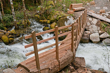 A well done bridge.
Granite Lakes trail 5/11/13 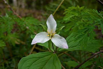 Lone Trillium on hike.
Granite Lakes trail 5/11/13 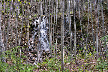 Waterfall grid,
Granite Lakes trail 5/11/13 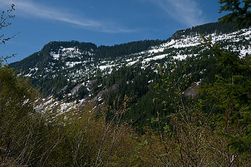 Nice views from the trail.
Granite Lakes trail 5/11/13 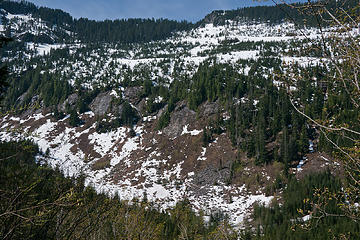 The wall, across from the trail.
Granite Lakes trail 5/11/13 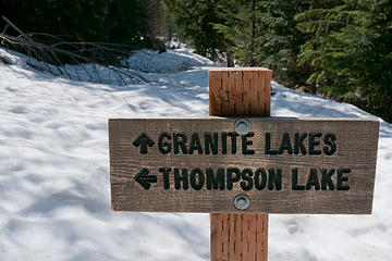 Signage.
Granite Lakes trail 5/11/13 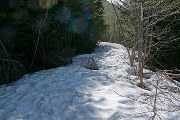 Lower fork to Thompson Lake, near Granite Lakes.
Granite Lakes trail 5/11/13 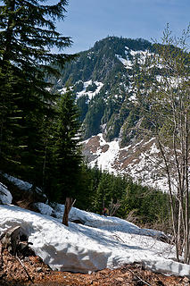 Onward to lakes... for some.
Granite Lakes trail 5/11/13 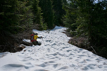 John on snowshoe roller coaster.
Granite Lakes trail 5/11/13 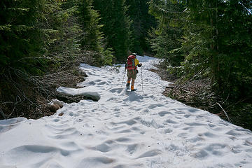 John heading up.
Granite Lakes trail 5/11/13 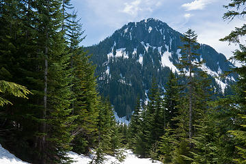 View down upper trail.
Granite Lakes trail 5/11/13 view from Thompson fork.
Granite Lakes trail 5/11/13 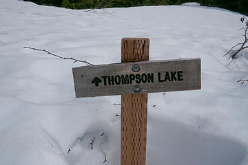 Thompson lake fork.
Granite Lakes trail 5/11/13 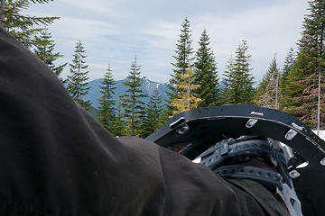 Lunch boot shot.
Granite Lakes trail 5/11/13 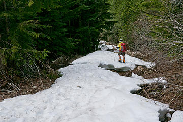 John heading down Patches.
Granite Lakes trail 5/11/13 Granite Lakes trail 5/11/13
Feeling fuzzy 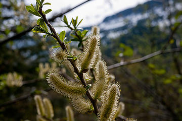 Granite Lakes trail 5/11/13
Spring buds 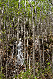 Granite Lakes trail 5/11/13
Verticals with falls. 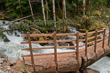 Granite Lakes trail 5/11/13
Another angle on the new bridge over Granite creek. 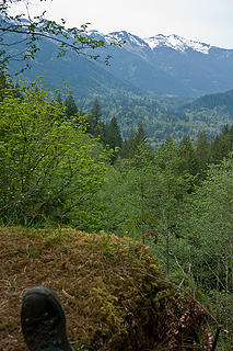 Granite Lakes trail 5/11/13
Nicely located lower bench with a view. 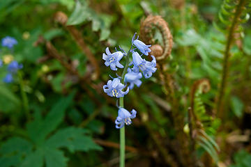 Granite Lakes trail 5/11/13
Blue flowers 
|
| Back to top |
  
|
|
whitebark
Member

Joined: 08 Jul 2005
Posts: 1864 | TRs | Pics
Location: Seattle |
I'm certainly not one of the haters. I hiked up the Granite Creek trail a week ago, and found I rather liked the road-to-trail conversion work that was done on it. The guy who did the conversion was a true artist with the backhoe.
|
| Back to top |
|
|
tigermn
Member

Joined: 10 Jul 2007
Posts: 9242 | TRs | Pics
Location: There... |
|
tigermn
Member
|
Mon May 13, 2013 6:24 am |
|
|
Other than the few hours the wallet was lost and the point where I postholed one leg through into a hole around some rocks with snow melting below (I think I was too focused on looking for the wallet to pay attention to where I was walking on the way down), it was a fun trip. Would have liked to try and push on to the cabin (or the lake) but for many reasons it wasn't in the cards on this day.
|
| Back to top |
|
|
The Angry Hiker
SAR Blacklistee

Joined: 13 Jun 2008
Posts: 2890 | TRs | Pics
Location: Kentwila |
| boot up wrote: | | I totally agree that people should avoid this trail.
after all, we only saw 7 people all day, on a beautiful day, on a meandering trail with lots of variety, when literally a few hundred yards down the road, a knee crunching, brutal climb of Mailbox trail was overflowing. |
You guys just got lucky. Here's what the trail looks like on a normal day:
|
| Back to top |
|
|
tigermn
Member
Joined: 10 Jul 2007
Posts: 9242 | TRs | Pics
Location: There... |
|
tigermn
Member
|
Mon May 13, 2013 9:48 am |
|
|
| The Angry Hiker wrote: | | You guys just got lucky. Here's what the trail looks like on a normal day:
|
Based on the number of cars at the Mailbox trailhead when I drove by about 07:30AM I suspect that is what the Mailbox peak trail did look like last Saturday. 
|
| Back to top |
|
|
The Angry Hiker
SAR Blacklistee
Joined: 13 Jun 2008
Posts: 2890 | TRs | Pics
Location: Kentwila |
Don't get me started on Mailbox. I was there the weekend before last and I easily passed 200 people in the first mile down from the summit. I've never seen anything like it, on any I-90 hike. At one point, the trail was clogged with a group of at least 30 people, just standing around like turds waiting for someone to come along with a plunger. Flip flops and tennis shoes were everywhere. On 3 separate occasions, I had to direct people back to the trail after they missed a switchback and started wandering off into the woods.
Whoever had the bright idea to put another trail on that mountain had their head up their wazoo. The last thing Mailbox needs is more morons. I'm surprised SAR doesn't have a permanent HQ up there.
|
| Back to top |
|
|
tigermn
Member
Joined: 10 Jul 2007
Posts: 9242 | TRs | Pics
Location: There... |
|
tigermn
Member
|
Mon May 13, 2013 10:24 am |
|
|
| The Angry Hiker wrote: | | Don't get me started on Mailbox. I was there the weekend before last and I easily passed 200 people in the first mile down from the summit. I've never seen anything like it, on any I-90 hike. At one point, the trail was clogged with a group of at least 30 people, just standing around like turds waiting for someone to come along with a plunger. Flip flops and tennis shoes were everywhere. On 3 separate occasions, I had to direct people back to the trail after they missed a switchback and started wandering off into the woods. |
Imagine 200 people (or even 20) on that summit? I'm beginning to cherish the near 30 minutes of solo summit time I had about 5 years ago on my one and only trip up there.
|
| Back to top |
|
|
The Angry Hiker
SAR Blacklistee
Joined: 13 Jun 2008
Posts: 2890 | TRs | Pics
Location: Kentwila |
I imagine it looked like Alki Beach. Whenever someone asked me how much snow was up there, I told them they wouldn't see any snow under all the people.
It was so much nicer back when people couldn't find the trailhead.
|
| Back to top |
|
|
cascadeclimber
Member

Joined: 04 Sep 2006
Posts: 1427 | TRs | Pics
|
| tigermn wrote: | | The Angry Hiker wrote: | | Don't get me started on Mailbox. I was there the weekend before last and I easily passed 200 people in the first mile down from the summit. I've never seen anything like it, on any I-90 hike. At one point, the trail was clogged with a group of at least 30 people, just standing around like turds waiting for someone to come along with a plunger. Flip flops and tennis shoes were everywhere. On 3 separate occasions, I had to direct people back to the trail after they missed a switchback and started wandering off into the woods. |
Imagine 200 people (or even 20) on that summit? I'm beginning to cherish the near 30 minutes of solo summit time I had about 5 years ago on my one and only trip up there. |
Due to the crowds, parking issues, litter, bags of turd, and other detritus, I enjoy these I-90 hikes far more in the crappy weather of Jan-March than I do in the summer. I've all but given up entirely on Mt. Si from April-September.
Sad.
|
| Back to top |
|
|
boot up
Old Not Bold Hiker
Joined: 12 Dec 2006
Posts: 4745 | TRs | Pics
Location: Bend Oregon |
|
boot up
Old Not Bold Hiker
|
Mon May 13, 2013 12:36 pm |
|
|
I don't suppose the current situation of no signage at the Granite lakes trailhead will continue.  After they put up a sign with "lakes" in the name, then the trail will really go the hell in a handbasket, being swarmed by people, and parking will stretch for miles along the dusty Mid fork road.
I feel more "coralled" going up a unrelenting road blasted straight up a mountain than a meandering trail. I was suprised to see so much windfall on such a new trail (part of my decision for leaving the saw home) and I notice that people were already tromping down alternate routes around the naturally placed windfall, versus the manmade meanderings.
John compared tracks from doing the straight road walk to doing all this meandering. To the point down low, with most of the curviness, where the shortcut trail cuts in, he go 2.70 miles vs the old 2.66 miles. Hard to believe all these Hard Core Hikers are whining about that difference.
But again, I say.....yes, let's continue to bad mouth this trail....pleeeeez.
Note, there is no "no bicycles" sign and it is not Wilderness, so mtn bikes are not poaching and are perfectly legal at this time. If this is too tough for someone to mtn bike, and they need that straight graded logging road, then they are not real mtn bikers, but are hikers that happen to be riding a mtn bike occasionally.
It is ideal mtn bike single track. Curvy enough to be interesting and encourage keeping speed down lower, but good sight lines. Good brakes required, as it should be. Just enough technical to make it interesting.
Of course if you are a hiker just wanting to use a bike to get further up a trail faster....that is a different story.
After they put up a sign with "lakes" in the name, then the trail will really go the hell in a handbasket, being swarmed by people, and parking will stretch for miles along the dusty Mid fork road.
I feel more "coralled" going up a unrelenting road blasted straight up a mountain than a meandering trail. I was suprised to see so much windfall on such a new trail (part of my decision for leaving the saw home) and I notice that people were already tromping down alternate routes around the naturally placed windfall, versus the manmade meanderings.
John compared tracks from doing the straight road walk to doing all this meandering. To the point down low, with most of the curviness, where the shortcut trail cuts in, he go 2.70 miles vs the old 2.66 miles. Hard to believe all these Hard Core Hikers are whining about that difference.
But again, I say.....yes, let's continue to bad mouth this trail....pleeeeez.
Note, there is no "no bicycles" sign and it is not Wilderness, so mtn bikes are not poaching and are perfectly legal at this time. If this is too tough for someone to mtn bike, and they need that straight graded logging road, then they are not real mtn bikers, but are hikers that happen to be riding a mtn bike occasionally.
It is ideal mtn bike single track. Curvy enough to be interesting and encourage keeping speed down lower, but good sight lines. Good brakes required, as it should be. Just enough technical to make it interesting.
Of course if you are a hiker just wanting to use a bike to get further up a trail faster....that is a different story.
|
| Back to top |
|
|
cascadeclimber
Member
Joined: 04 Sep 2006
Posts: 1427 | TRs | Pics
|
There is a subset of the hiking population that accepts a flatter, longer trail as 'easier' and prefers such. I don't quibble their opinion and offer that there is a plethora of trails suitable for such folks, including new Mt. Si, Cascade Pass, Ingalls Pass, Snow Lake, new West Tiger 3, Chirico, etc.
And just the same, there is a group for whom hiking is largely training for other activities, like mountaineering, triathlons, etc. I count myself in this group and we tend to do a lot of vertical and look for steep, 'unfixed' trails, like the old Mailbox trail, the old Si trail, the old Kamikaze falls trail, etc. For my part, a trail made of crush rock, placed rocks (Chirico), and/or rock-hard dirt play hell on knees and ankles (he says nursing yet another dislocation courtesy the poorly placed rocks on Chirico); I much prefer mud to a sidewalk-like substrate.
I like to believe there's plenty of terrain out there to accommodate both (generalized) user groups, but of late it seems like some folks have decided that there's only one sort of 'good' trail, and have been 'fixing' all the 'bad' trails that some of us actually prefer and seek out. Purposely introducing meanders into otherwise direct routes will certainly please some, but not all users.
Sorry for the threadjacking!!
|
| Back to top |
|
|
tigermn
Member
Joined: 10 Jul 2007
Posts: 9242 | TRs | Pics
Location: There... |
|
tigermn
Member
|
Mon May 13, 2013 1:20 pm |
|
|
| boot up wrote: | | Of course if you are a hiker just wanting to use a bike to get further up a trail faster....that is a different story. |
Or someone who just wanted to slog or push a bike up (on the steeper parts) and fly down the 4+ miles after going to further reaches beyond, you might not be able to fly down as fast as you could when it was a long/straight road.
Before the trail conversion the bike was more economical for rattling off the first (and last) 4 miles or so up the trail to extend your range.
But you are right. If you are a true mountain biker it should at least be a little more interesting/varied now than it was before.
I guess the next question is how long before the no bikes sign goes up.
An analogy is when it was road it would be like taking your nice new racing road bike on the Burke Gilman or Sammamish River trail (snoozer).
|
| Back to top |
|
|
boot up
Old Not Bold Hiker
Joined: 12 Dec 2006
Posts: 4745 | TRs | Pics
Location: Bend Oregon |
|
boot up
Old Not Bold Hiker
|
Mon May 13, 2013 2:12 pm |
|
|
| cascadeclimber wrote: | | For my part, a trail made of crush rock, placed rocks (Chirico), ....
Sorry for the threadjacking!! |
Now you are getting dangerously close to one of my pet peeves, where they cover a perfectly good trail with ankle and knee twisting, what I call "dinosaur teeth". I swear this is just to discourage people from using the trail, or else Cousin Ned got the contract for hauling in trail "gravel" and this is all he had. Kamikaze is a great(awful) example of this. I often avoid that trail just because I think about those teeth.( I have seen a number of people with sprained ankles on that trail). That rock would be ok as a base, if they actualy covered it with smaller fines or dirt, but they don't. It can easily be a decade to even partially fill in, if ever. (check out the DOT yard entrance to Tiger mtn for an example)
OK to thread jack since a big part of this trail is the controversy, and I really am encouraging any negative press I can get for this trail.
|
| Back to top |
|
|
cascadeclimber
Member
Joined: 04 Sep 2006
Posts: 1427 | TRs | Pics
|
| boot up wrote: | | cascadeclimber wrote: | | For my part, a trail made of crush rock, placed rocks (Chirico), ....
Sorry for the threadjacking!! |
Now you are getting dangerously close to one of my pet peeves, where they cover a perfectly good trail with ankle and knee twisting, what I call "dinosaur teeth". I swear this is just to discourage people from using the trail, or else Cousin Ned got the contract for hauling in trail "gravel" and this is all he had. Kamikaze is a great(awful) example of this. I often avoid that trail just because I think about those teeth.( I have seen a number of people with sprained ankles on that trail). That rock would be ok as a base, if they actualy covered it with smaller fines or dirt, but they don't. It can easily be a decade to even partially fill in, if ever. (check out the DOT yard entrance to Tiger mtn for an example)
OK to thread jack since a big part of this trail is the controversy, and I really am encouraging any negative press I can get for this trail. |
The best/worst example of this is Chirico, where it's been littered with uneven, loose, and poorly placed stones as pavers, then the well-intentioned but misguided adopter of the trail spends summer weekends literally sweeping the (soft) duff off it. Along with the duff goes the dirt around the stones, making them stick up even more.
But yes, that Granite Lakes trail is simply awful. My car has been vandalized every time I've parked there, the trail is overgrown with stinging nettles, colonized by Africanized killer bees, and a family of man-eating trolls lives under one of the bridges. Stay away unless you want to be vandalized, stung, and eaten.
Reminds me of one of the caves in southern Indiana named "Small and Dull".

|
| Back to top |
|
|
ranger rock
One of the boys

Joined: 14 Dec 2011
Posts: 2550 | TRs | Pics
|
Nice bridges.. looks like they did a better job there than they do in the Olympics. In the Olypmics they rip out all the car bridges and do not replace them with foot bridges no matter how big the river is.
I'm sure it's better than Mount Si anyway...
|
| Back to top |
|
|
|
|
You cannot post new topics in this forum
You cannot reply to topics in this forum
You cannot edit your posts in this forum
You cannot delete your posts in this forum
You cannot vote in polls in this forum
|
Disclosure: As an Amazon Associate NWHikers.net earns from qualifying purchases when you use our link(s). |


