| Previous :: Next Topic |
| Author |
Message |
Paul M
Member


Joined: 15 Jul 2008
Posts: 371 | TRs | Pics
|
|
Paul M
Member
|
 Mon Jul 08, 2013 10:12 pm |
|
|
Mike C and I summited 8 P2K peaks this past weekend in the northeast corner of the state, starting with Huckleberry and ending with Rogers Benchmark. We left early Friday morning and made the long drive over to Colville and proceeded to reach the summit ridge of Huckleberry by 10 am. From there we went to Addy Mountain, then finally drove over to Calispell Peak where we car camped along Tacoma creek. Saturday morning we drove the horrible summit road to the top then headed north to Ione. From there we did Snyder Hill, followed by Molybdenite, and finally North Baldly. We finished a long Saturday by driving back to Colville and part way up Old Dominion to where the road is washed out (ca 4700ft). Early Sunday morning we walked the 3.2 miles of remaining road to the summit of Old Dominion, then went to Rogers Benchmark before heading back to the west side of the state.
For those P2K aspirants out there my advice is to do these remote NE peaks sooner rather than later as they all involve long logging road approaches (10 - 15 miles one way), some of which are among the worst I have driven on. These roads are getting worse each year meaning the peaks could get longer with more elevation gain at any time. We were pleasantly surprised how green it is over there and how nice the views were on some of the peaks into Canada and Idaho. Additional details regarding current access and conditions as well as a few pictures follow.
Huckleberry Mountain - 5825 ft (P3865). http://www.summitpost.org/huckleberry-mountain/729904. Great newer logging road leads you to about 800 ft and 0.25 directly below the summit ridge. Park here and ascend up though a very recently thinned forest (like days fresh cut). Nice views. After tagging all three summit areas we drove south on a progressively worse road to the summit of Stensgar Mountain. Don't bother with it. The lookout was removed several years ago, and replaced by a number of shinny new comm towers. It is not worth the time and tire abuse to visit. 1.0 mile RT with 800 ft of gain.
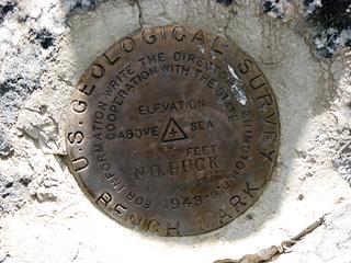 No Huck BM 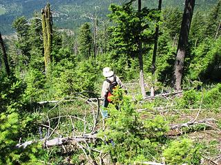 Mike descending thinned slopes from Huckleberry's summit 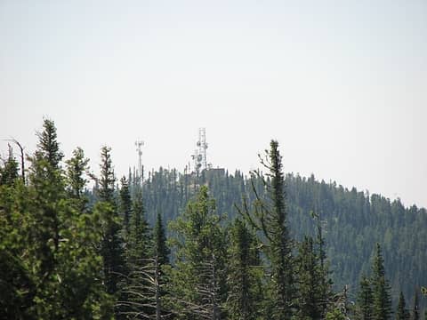 Stensgar summit comm towers (the old lookout has been removed) 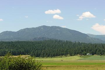 Addy Mountain from south 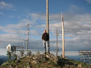 Paul on the summit of Calispell Peak 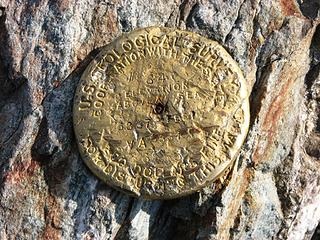 Calispell BM 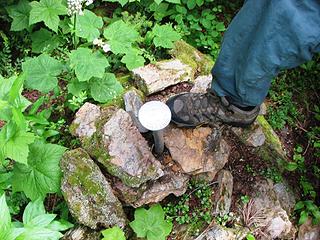 Snyder Hill BM 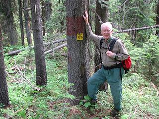 Mike at Snyder Hill summit area 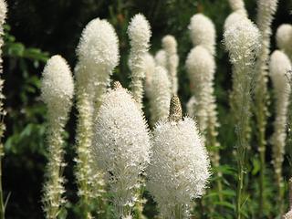 Xerophyllum tenax (Beargrass) on Molybdenite Mountain 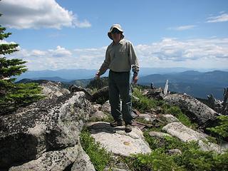 Mike on Molybdenite summit 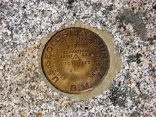 Molybdenite BM 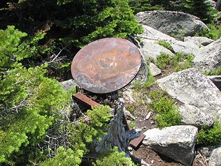 Osborne Firefinder platform on Molybdenite summit 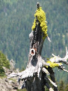 Old telegraph insulator for Molybdenite lookout 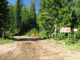 New road work on North Baldy summit road 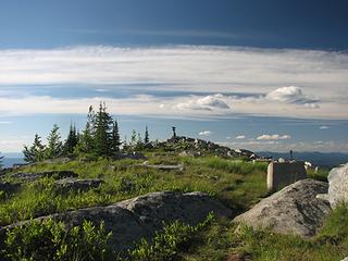 North Baldy summit with old lookout foundation in foreground 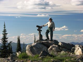 Mike on North Baldy summit 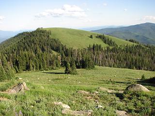 North Baldy summit vista looking south 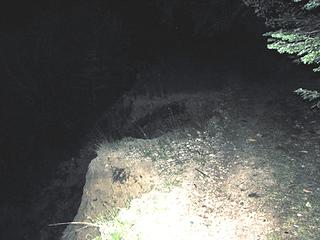 Road washout on Old Dominion 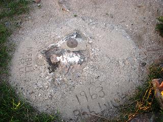 Old Dominion BM 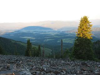 Old Dominion's sunrise shadow over Colville  Interesting structure on top of Old Dominion 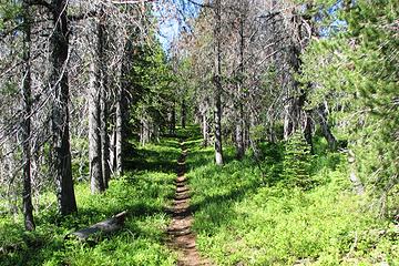 Ridge trail on Rogers Benchmark 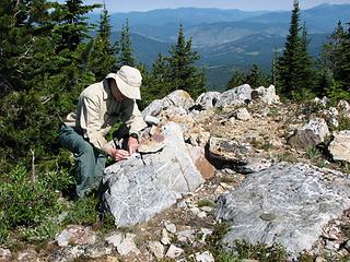 Mike on the summit of Rogers BM
|
| Back to top |
  
|
|
Redwic
Unlisted Free Agent

Joined: 23 Feb 2009
Posts: 3292 | TRs | Pics
Location: Going to the Prom(inence) |
|
Redwic
Unlisted Free Agent
|
Mon Jul 08, 2013 10:29 pm |
|
|
Great trip, Paul & Mike!
I really appreciated the various updates you provided during the trip... although one of your last updates is going to cause me to visit that region again much sooner than I planned.
Seven of those eight P2Ks were former fire lookout sites. The only one which was not is Huckleberry Mountain, probably because nearby Stensgar Mountain had one. I have already visited five of those summits; Huckleberry Mountain and Rogers BM were my favorites, and Old Dominion and Calispell Peak were my least favorites. Too bad you missed seeing the old concrete foundation from the former fire lookout on Snyder Hill (but not at the summit), as that is about the most exciting thing about that peak... I show a photo of it on the SP page.
I still have no idea what that rock structure is at the top of Old Dominion... that peak used to have an actual tower. It sounds like that washout has only worsened, kind of like the Hoh River Trail washout or Pyramid Mountain washout.
I am excited to visit North Baldy... the scenery looks prettier than I would have guessed. What a weird summit cairn!
60 pounds lighter but not 60 points brighter.
60 pounds lighter but not 60 points brighter.
|
| Back to top |
|
|
Redwic
Unlisted Free Agent
Joined: 23 Feb 2009
Posts: 3292 | TRs | Pics
Location: Going to the Prom(inence) |
|
Redwic
Unlisted Free Agent
|
Mon Jul 08, 2013 10:37 pm |
|
|
| Paul M wrote: | | Huckleberry Mountain[/b] - 58258 ft |
LOL... Yowsers! I had no idea something so high-elevation was in our area! 
60 pounds lighter but not 60 points brighter.
60 pounds lighter but not 60 points brighter.
|
| Back to top |
|
|
Paul M
Member
Joined: 15 Jul 2008
Posts: 371 | TRs | Pics
|
|
Paul M
Member
|
Mon Jul 08, 2013 11:19 pm |
|
|
nice catch  fixed. 5825 ft! fixed. 5825 ft!
|
| Back to top |
|
|
PeakJunkie
Member

Joined: 14 Feb 2009
Posts: 22 | TRs | Pics
|
|
| Back to top |
|
|
|
|
You cannot post new topics in this forum
You cannot reply to topics in this forum
You cannot edit your posts in this forum
You cannot delete your posts in this forum
You cannot vote in polls in this forum
|
Disclosure: As an Amazon Associate NWHikers.net earns from qualifying purchases when you use our link(s). |


