| Previous :: Next Topic |
| Author |
Message |
Fletcher
Member


Joined: 29 Jul 2009
Posts: 1870 | TRs | Pics
Location: kirkland |
|
Fletcher
Member
|
 Sat Jul 20, 2013 1:34 am |
|
|
Adam, John and I had big plans this week of linking up Clark, Luahna, and Buck as a 3 day loop beginning at the White River TH and exiting via Little Giant Pass. The thunderstorms that struck the cascades Wednesday night had others plans.
We were hiking up the White River at 11:30 Tuesday morning. The trail was mostly pleasant with a few sections of thick brush where following the trail was slightly challenging.
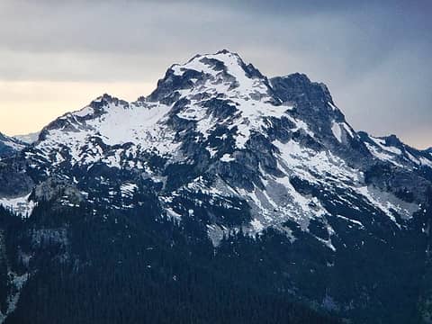
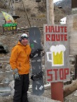
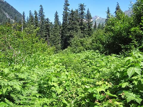 White River Trail 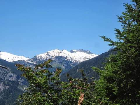 thought this may have been Ten Peak but have no idea 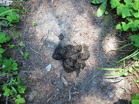 poo 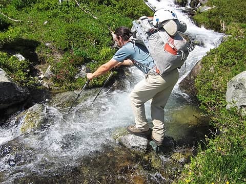 crossing 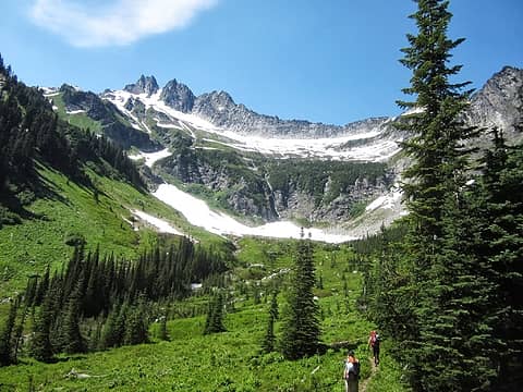 Boulder Creek Basin 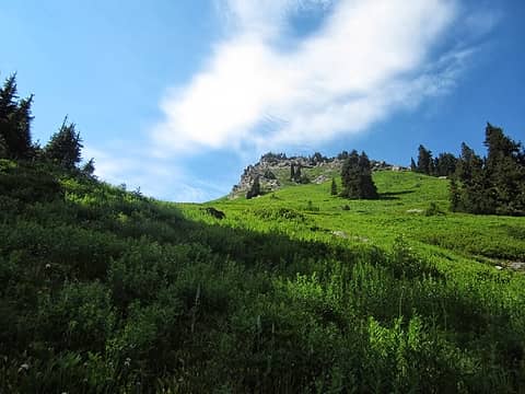 up 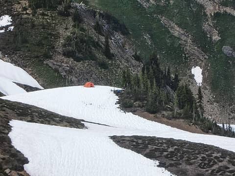 night 1 camp 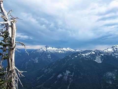 weather moving in 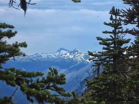 nasty toward Sloan and White 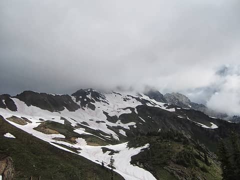 socked in 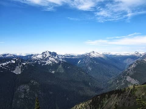 Saul and Indian Head from the ridge 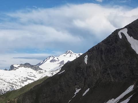 first view of Glacier 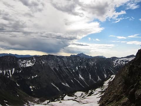 showers to the east 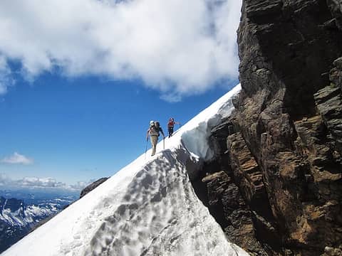 nearing the top of Clark 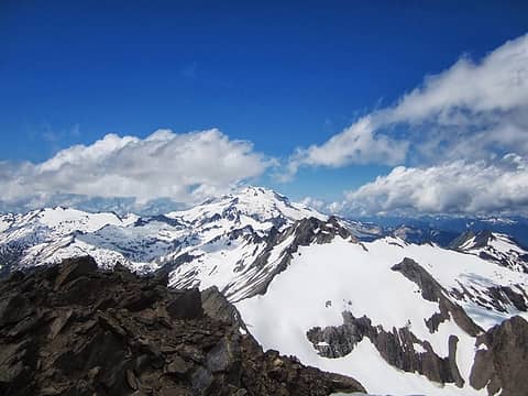 Glacier from the summit 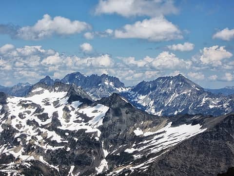 Fernow, 7FJ, Maude, Buck 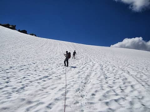 heading down the Walrus 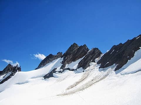 East Clark 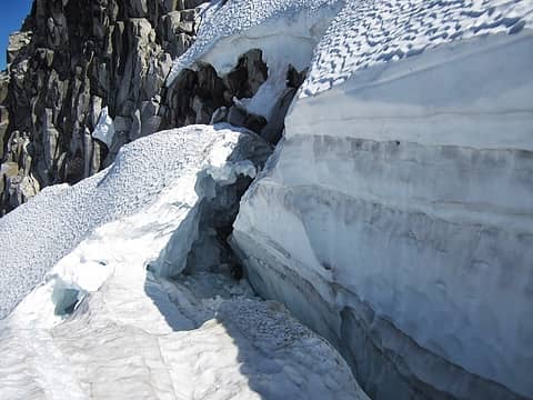 Crevasse Crossing 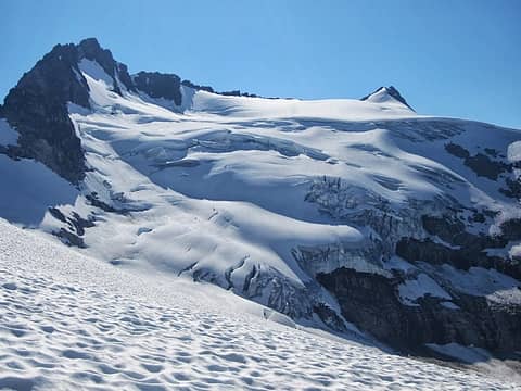 looking back on our route down the glacier 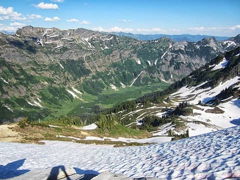 Napeequa 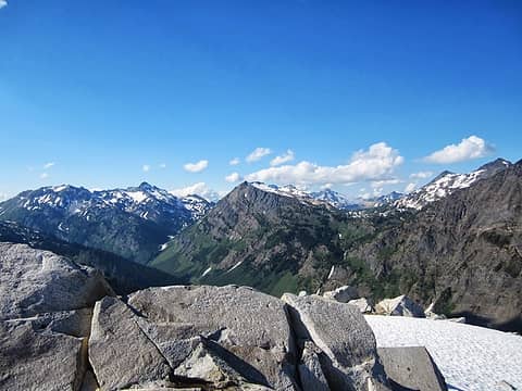 Fortress and Buck 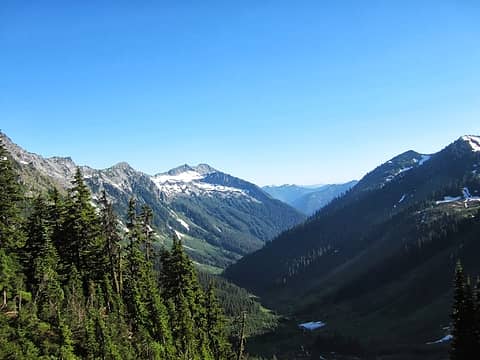 Boulder Creek 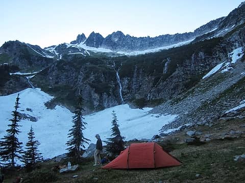 night 2 camp
|
| Back to top |
  
|
|
Gimpilator
infinity/21M

Joined: 12 Oct 2006
Posts: 1684 | TRs | Pics
Location: Edmonds, WA |
 Saul 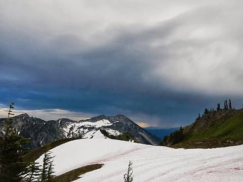 weather 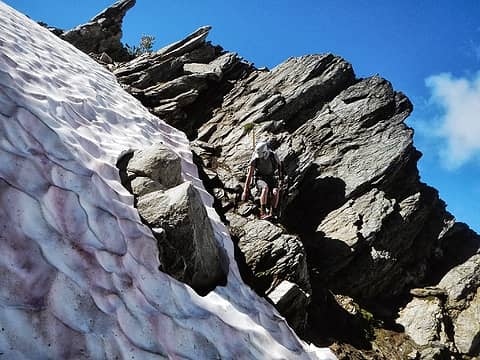 in the gully 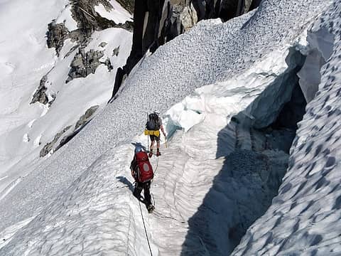 bergshcrund
|
| Back to top |
|
|
raising3hikers
Member

Joined: 21 Sep 2007
Posts: 2344 | TRs | Pics
Location: Edmonds, Wa |
that is a nice glacier route, very scenic! good job guys
|
| Back to top |
|
|
reststep
Member
Joined: 17 Dec 2001
Posts: 4757 | TRs | Pics
|
|
reststep
Member
|
Sat Jul 20, 2013 9:04 am |
|
|
I really enjoyed the report, pictures and video.
Thanks
I think this the first report I have seen from the White River trail that didn't mention how bad the bugs were. 
"The mountains are calling and I must go." - John Muir
"The mountains are calling and I must go." - John Muir
|
| Back to top |
|
|
Gimpilator
infinity/21M
Joined: 12 Oct 2006
Posts: 1684 | TRs | Pics
Location: Edmonds, WA |
That's a good point. Actually, the bugs were extremely bad. The worst I have seen since the Fortress/Chiwawa/Red trip.
|
| Back to top |
|
|
contour5
Member

Joined: 16 Jul 2003
Posts: 2963 | TRs | Pics
|
|
contour5
Member
|
Sat Jul 20, 2013 9:45 am |
|
|
Nice video and photos, cool trip. That creek crossing has mellowed out considerably.
|
| Back to top |
|
|
ree
Member

Joined: 29 Jun 2004
Posts: 4399 | TRs | Pics
|
|
ree
Member
|
Sat Jul 20, 2013 11:32 am |
|
|
Hey, good job you guys! Sorry the weather deterred more ambitious plans. Glad you weren't zapped.
Amazing to see how much the terrain has changed in a month's time. Boulder Basin is looking super sweet. A month ago, it was completely covered in snow.
Eek. That Walrus Glacier is looking a bit choppy.
Lots of fantastic exploring in that area.
|
| Back to top |
|
|
jcocci
Member
Joined: 16 Jul 2009
Posts: 484 | TRs | Pics
Location: Longmont, CO |
|
jcocci
Member
|
Sat Jul 20, 2013 5:00 pm |
|
|
Was still a great trip even though we didn't do our original plan. The lightning was quite a bit unnerving though. It was way too close for comfort and yes the Walrus Glacier was a bit more opened up than we thought it would be, but it was a fun adventure.
|
| Back to top |
|
|
gb
Member
Joined: 01 Jul 2010
Posts: 6309 | TRs | Pics
|
|
gb
Member
|
Sat Jul 20, 2013 8:51 pm |
|
|
Looks like you had fun....except for the lightning that is. Nice to see the Walrus is still moving pretty good.
And thanks but no thanks for the bug beta. I was afraid of that. Perhaps when freezing levels drop late next week things will get better.
|
| Back to top |
|
|
c_moorehead
Member
Joined: 30 Jun 2008
Posts: 16 | TRs | Pics
|
White river valley - death by bugs. Anyone even thinking of going down that trail needs napalm.
|
| Back to top |
|
|
puzzlr
Mid Fork Rocks

Joined: 13 Feb 2007
Posts: 7220 | TRs | Pics
Location: Stuck in the middle |
|
puzzlr
Mid Fork Rocks
|
Sun Jul 21, 2013 12:15 am |
|
|
Nice trip. Don't be fooled by the "sweet" looking Napeequa. Hiking through that long grass when it's covered with dew is like wading in a creek.
|
| Back to top |
|
|
ree
Member
Joined: 29 Jun 2004
Posts: 4399 | TRs | Pics
|
|
ree
Member
|
Sun Jul 21, 2013 7:52 am |
|
|
I kind of agree with Puzzlr. Napeequa Valley is a lot prettier from above. It's brushy and boring down there.
How was Boulder Pass? We had a pretty steep drop off a corniced lip going from Boulder Basin up to to Clark's east ridge. I was wondering if it melted out and was easier.
|
| Back to top |
|
|
Fletcher
Member
Joined: 29 Jul 2009
Posts: 1870 | TRs | Pics
Location: kirkland |
|
Fletcher
Member
|
Sun Jul 21, 2013 10:32 am |
|
|
Boulder Pass was all but melted out. We did encounter a very short section of snow on the north side of the pass on our return but it was avoidable by going over to the trail.
|
| Back to top |
|
|
Jetlag
Member
Joined: 17 Aug 2010
Posts: 1410 | TRs | Pics
|
|
Jetlag
Member
|
Sun Jul 21, 2013 10:55 am |
|
|
Wonderful to read your description and see the pictures and video this morning (!!!) after completing our Dakobed Traverse. Kudos to Fletcher, Adam and John for documenting this adventure!!! We took the same S-shaped route up the Walrus glacier that you took down, and we were camped on the exposed, pumice-laden summit of Butterfly Butte when the lightning strikes began. This two-strike-a-second lightshow with accompanying tent-flattening winds almost ended our trip, as it altered yours. So good to see that you continued on, climbing Clark on a morning when the weather looked iffy, to say the least. We ascended the gentle Pilz glacier the morning you ascended Clark, ready to turn around at any sign that the previous night's level of storm would return. Looking at your pictures of Boulder Basin and comparing them to Ree's and Contour's I am struck by the beauty of this special place and the dramatic seasonal change. I don't know why it took me this long to discover it.
|
| Back to top |
|
|
Jetlag
Member
Joined: 17 Aug 2010
Posts: 1410 | TRs | Pics
|
|
Jetlag
Member
|
Mon Jul 22, 2013 9:28 pm |
|
|
That picture of Fletcher in the crux is cool! We didn't get that close to the rock heading up, staying pretty much mid-glacier in a tight S on the terraces. I hope to see my son's pictures soon so I can better compare routes.
|
| Back to top |
|
|
|
|


