| Previous :: Next Topic |
| Author |
Message |
Jeb
Summit Driven

Joined: 21 Jul 2012
Posts: 251 | TRs | Pics
Location: Seattle |
|
Jeb
Summit Driven
|
 Tue Aug 13, 2013 6:08 pm |
|
|
View larger size in new window
After an awesome peak bagging backpack trip to Gem Lake last weekend, Colin and I were left with a lingering summit fever. We have both been looking at Mount Stuart for years and conditions could not have been better for a summit bid. We hoped to camp in the Ingalls Creek valley or somewhere along the climb but when we arrived at the trailhead at 1030 pm we chose instead to sleep in the truck and make an alpine start.
We were on the trail at 245 am and off to Long's Pass by 4. Stuart was well enough lit by moonlight to make out the wide Cascade Couloir from the pass. The morning light appeared before we reached Ingalls Creek. We both mistakenly believed the trail followed the South side of the creek and we made it about a half mile East before we decided to leave our overgrown path and push through brush and over the creek to the real trail. The trail that leads to the beginning of the Cascade Couloir Route begins at the West edge of a clearing just after a small creek crossing with the remains of an old footbridge.
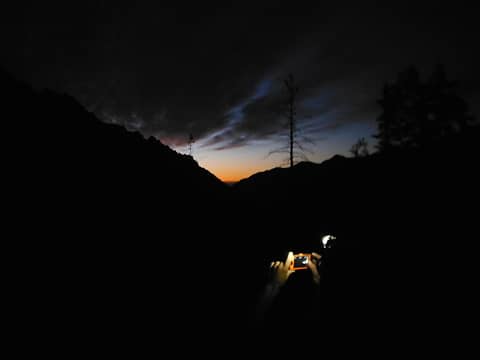 Sunrise in Ingalls Creek Valley 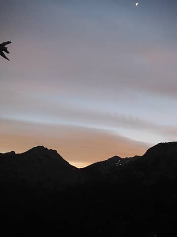 Sunrise in Ingalls Creek Valley 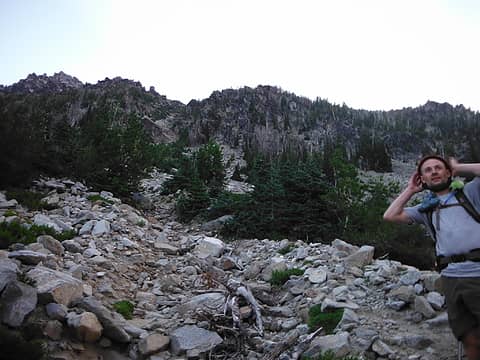 Colin at the base of the Cascade Couloir 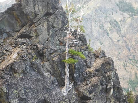 twisted tree 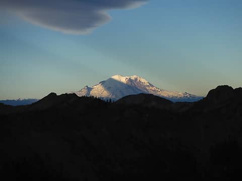 Tahoma 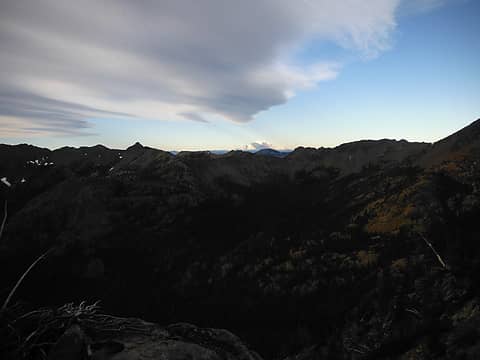 Tahoma 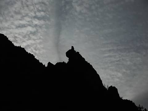 Silouettes 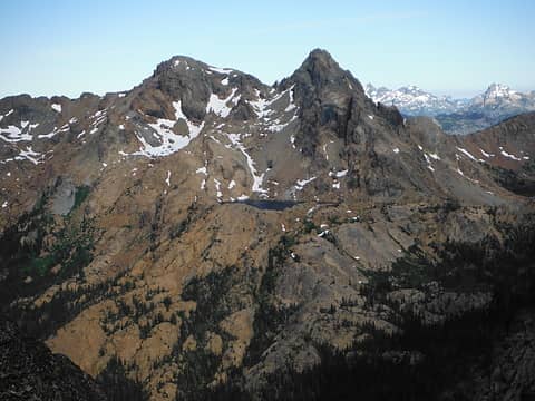 Ingalls Peak, Lake Ingalls 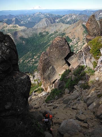 Cascade Couloir 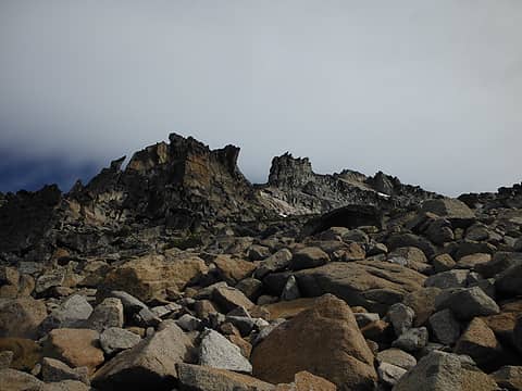 Cascade Couloir 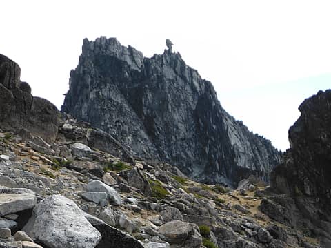 Sherpa Peak 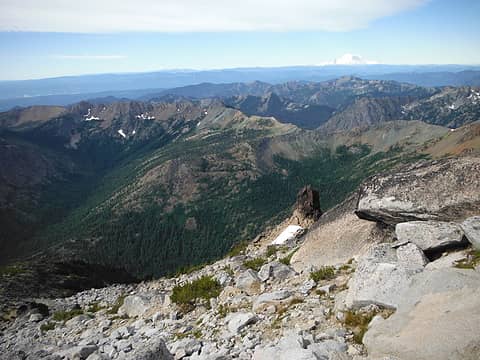 Looking South from Mount Stuart 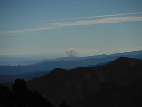 Wenatchee Wildfire 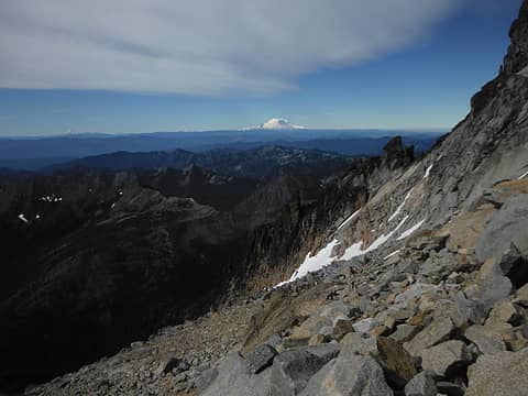 Cascade Couloir 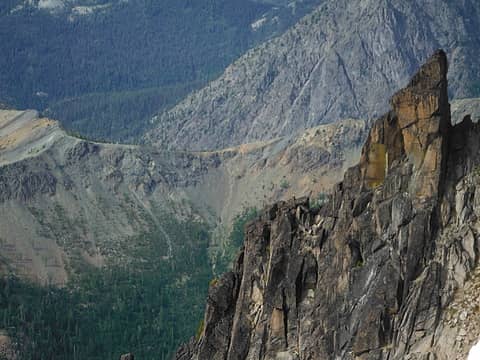 Longs Pass 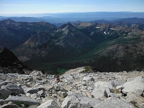 Cascade Couloir 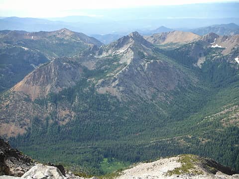 Bills Peak 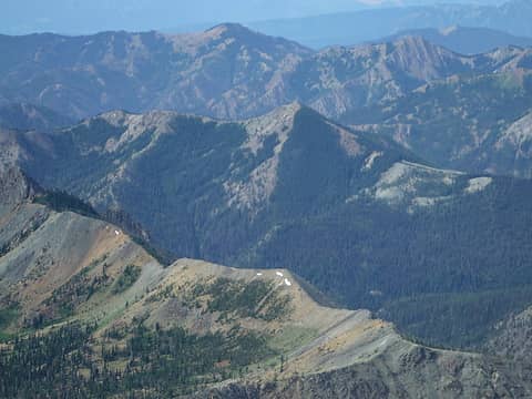 Koppen Mountain 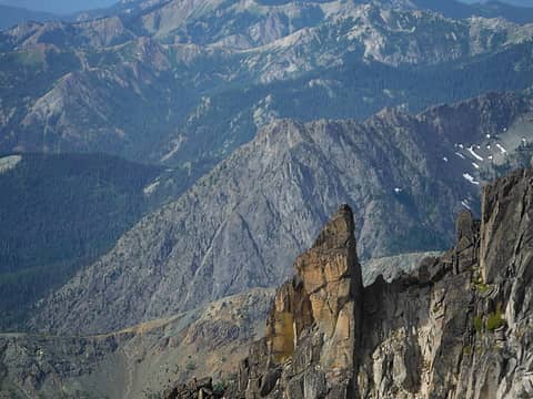 Esmeralda Peak 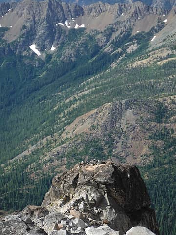 Mount Stuart Bivy 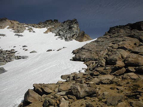 Mount Stuart False Summit 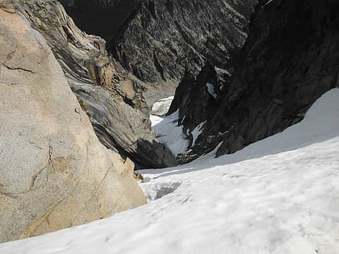 Ice Cliff Glacier 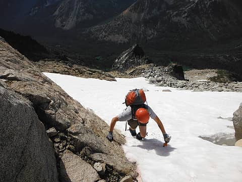 Colin below the false summit 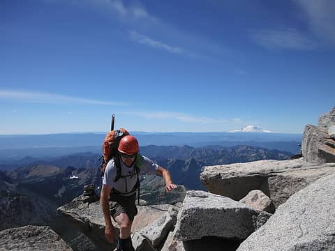 Colin on the false summit 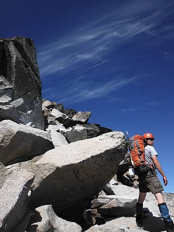 Colin on the false summit 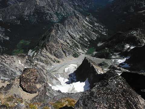 Looking North from the False Summit 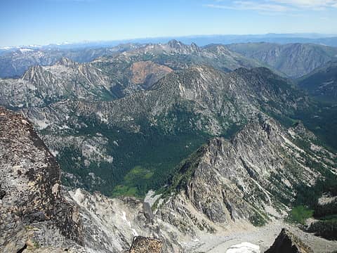 Looking North from the False Summit 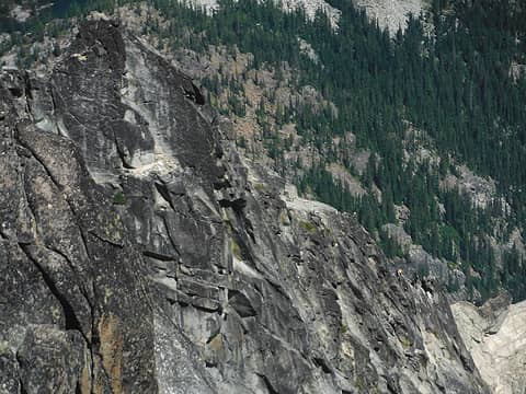 Climbers ascending the North Ridge 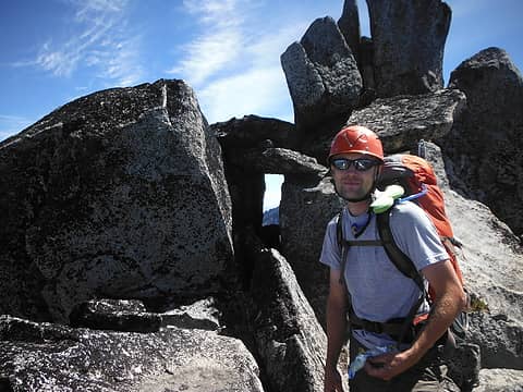 Colin poses by a window in the rock 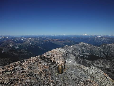 Mom on Stuart 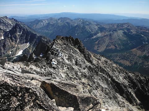 False Summit, our route Mom on Stuart 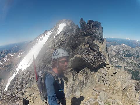 On the false summit of Mount Stuart 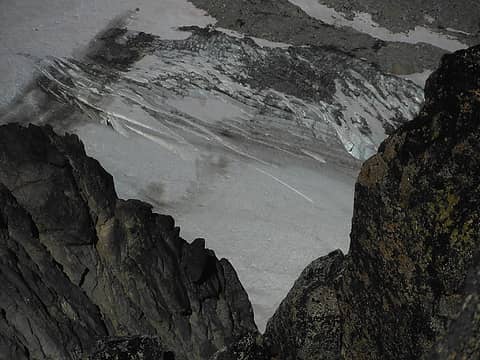 Stuart Glacier 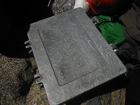 Summit Register 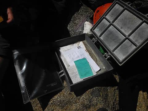 Summit Register 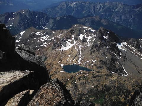 Ingalls Peak, Ingalls Lake from Mount Stuart 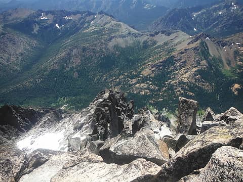 Looking down at our route over Long's Pass from the summit of Mount Stuart 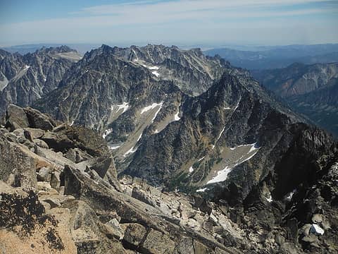 Enchantments 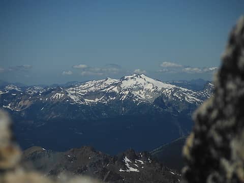 Mount Daniels 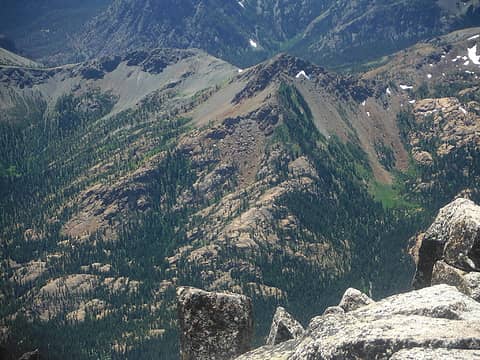 Longs Peak 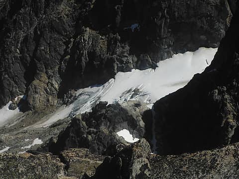 Stuart Glacier 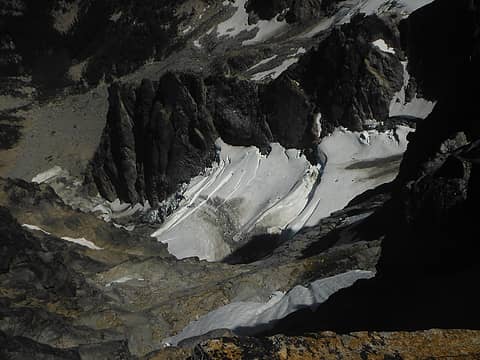 Stuart Glacier 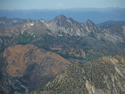 Cashmere Mountain 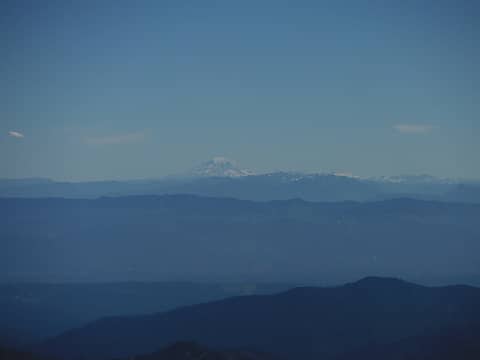 Mount Adams 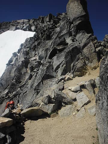 Scrambling down 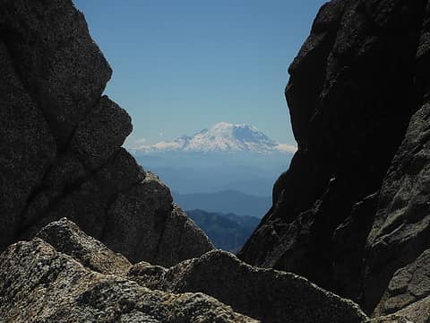 Rainier 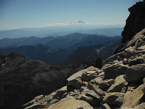 Rainier over our route 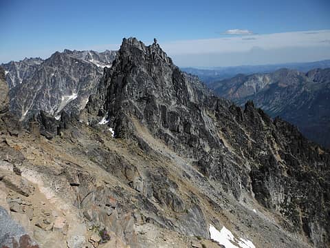 Sherpa Peak, Enchantments 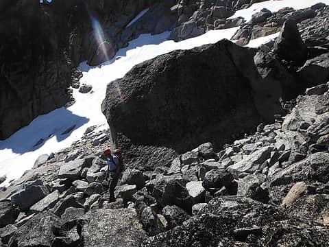 Colin and a massive boulder 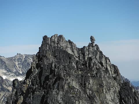 Sherpa Peak 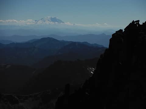 Rainier and rocky sillouettes Colin and a massive boulder 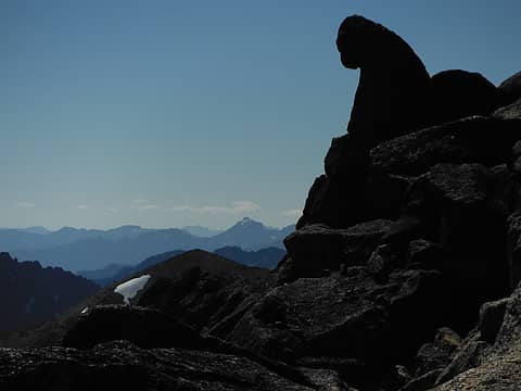 Giant Ape watching over Hibox 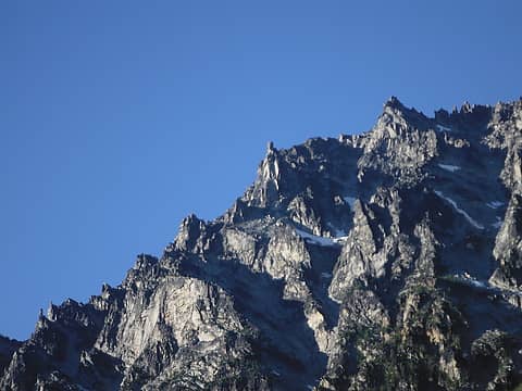 Lady on a throne - Mount Stuart's West Ridge 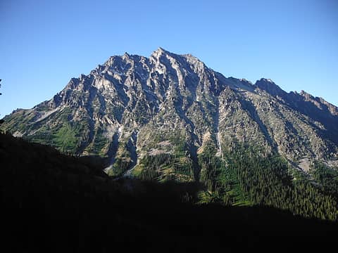 Sun setting on Mount Stuart 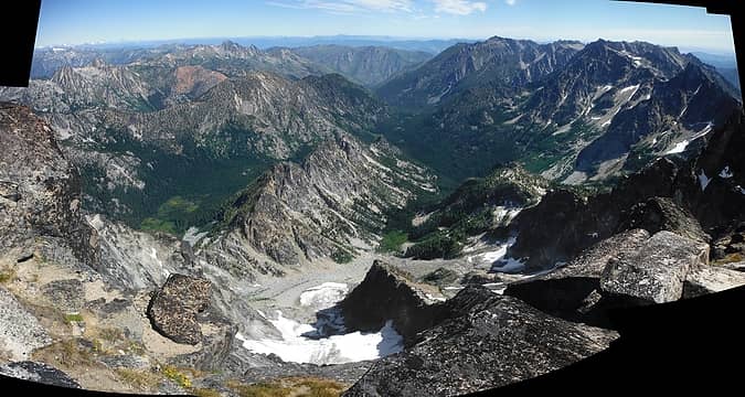 North of Mount Stuart 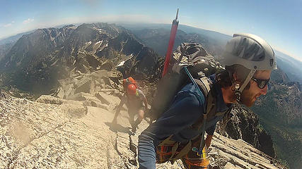 Reaching the Summit of Mount Stuart 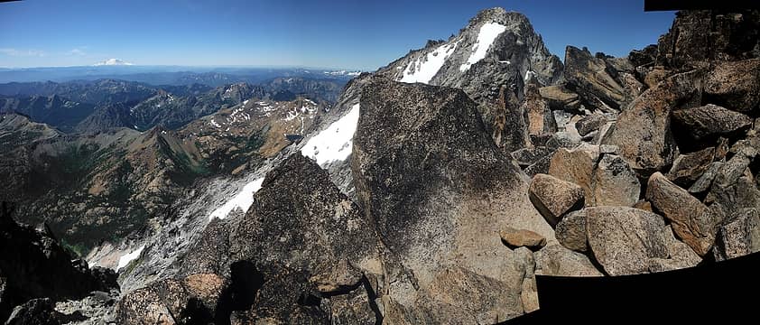 From False Summit 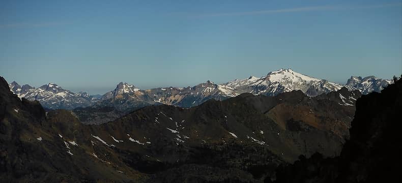 Mount Stuart 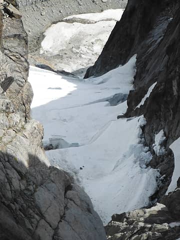 Ice Cliff Glacier 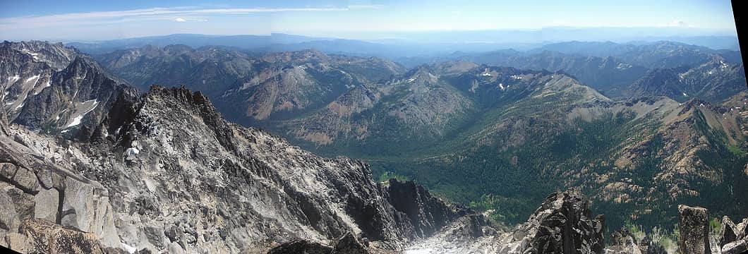 From Mount Stuart Summit  False Summit Pano 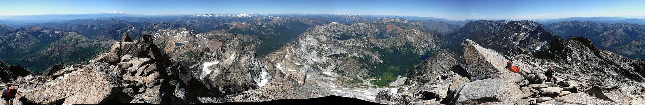 Mount Stuart Summit Pano  Mount Stuart
|
| Back to top |
  
|
|
Magellan
Brutally Handsome

Joined: 26 Jul 2006
Posts: 13116 | TRs | Pics
Location: Inexorable descent |
|
Magellan
Brutally Handsome
|
Tue Aug 13, 2013 6:23 pm |
|
|
Way to tear it up! 
|
| Back to top |
|
|
mbs5380
Member

Joined: 10 Aug 2013
Posts: 2 | TRs | Pics
|
|
mbs5380
Member
|
Wed Aug 14, 2013 9:19 am |
|
|
Great Pics! I did it last year and it was unforgettable. Mount Stuart is one of the most awesome peaks you can stand on without the need for technical skills or climbing gear. It's got a unique combination of incredible relief on almost all sides and a very airy feeling due to the summit poking well above a lot of the nearby surrounding peaks. The big volcanoes just don't give you the same feeling. The only downside is it's such a grueling slog that you don't ever get to spend as much time on the summit as you'd like.
|
| Back to top |
|
|
Jetlag
Member
Joined: 17 Aug 2010
Posts: 1410 | TRs | Pics
|
|
Jetlag
Member
|
Wed Aug 14, 2013 10:46 am |
|
|
Nice TR! I have never climbed the Cascadian this time of year, so it was good to read about the conditions and see the pictures. The word "Mazamas" is probably from the Oregon Climbing Club, organized somewhat like the Seattle Mountaineers. They are still active in Washington's Cascades. I believe they were the first climbers of many of the peaks, including Glacier, and I have run into large parties of Mazamas on the other volcanoes as well.
|
| Back to top |
|
|
ericande
Member
Joined: 05 Jan 2008
Posts: 219 | TRs | Pics
|
|
ericande
Member
|
Wed Aug 14, 2013 10:57 am |
|
|
Thanks for the TR, it's good timing as we are probably heading there this weekend. Do you have photos of the bivy sites at 7000'? Easy to find? If so, I think we may head up early Saturday, make camp there and head up and then out Sunday which would work much better with our work schedules this week.
|
| Back to top |
|
|
Magellan
Brutally Handsome
Joined: 26 Jul 2006
Posts: 13116 | TRs | Pics
Location: Inexorable descent |
|
Magellan
Brutally Handsome
|
Wed Aug 14, 2013 11:01 am |
|
|
In case you aren't joking about the Mazamas...Mazamas history
| Quote: | | 1907 Seattle contingent splits off to form the Mountaineers |
|
| Back to top |
|
|
n16ht5
Member
Joined: 21 Jun 2010
Posts: 592 | TRs | Pics
|
|
n16ht5
Member
|
Wed Aug 14, 2013 12:49 pm |
|
|
love the panos
|
| Back to top |
|
|
Jeb
Summit Driven
Joined: 21 Jul 2012
Posts: 251 | TRs | Pics
Location: Seattle |
|
Jeb
Summit Driven
|
Thu Aug 15, 2013 9:42 am |
|
|
The bivy site on the prominent knob in one of my pics above is around 7000, but from 6000 up there is no shortage of options.
|
| Back to top |
|
|
Fletcher
Member

Joined: 29 Jul 2009
Posts: 1870 | TRs | Pics
Location: kirkland |
|
Fletcher
Member
|
Thu Aug 15, 2013 10:45 am |
|
|
Nice job, Stuart in a day makes for a long day.
|
| Back to top |
|
|
Jeb
Summit Driven
Joined: 21 Jul 2012
Posts: 251 | TRs | Pics
Location: Seattle |
|
Jeb
Summit Driven
|
Sun Aug 18, 2013 8:20 pm |
|
|
Thanks! If anyone needs me I"ll be on wikipedia
|
| Back to top |
|
|
|
|


