| Previous :: Next Topic |
| Author |
Message |
Matt
Tea, Earl Grey, Hot


Joined: 30 Jan 2007
Posts: 4307 | TRs | Pics
Location: Shoreline |
|
Matt
Tea, Earl Grey, Hot
|
 Mon Aug 26, 2013 11:35 pm |
|
|
Party: Matt, mtnmike, (plus a surprise guest and dog)
Itinerary:
Day 1: Hike Meadow Mtn trail to base of Meadow Mtn. Side trip to Meadow Mtn. Camp at headwater basin of Owl Creek.
Day 2: Continue trail to Fire Mountain. Carry over Fire Mtn true summit. Traverse to meet PCT at col above Mica Lake. Camp at Mica Lake.
Day 3: Lime Ridge High Route to Lime, Milk, & Twin Lakes. Side trip to Lime Ridge Point 6662. Camp at Lower Twin Lake.
Day 4: Lime Ridge High Route to Rivord Lake, Lake 5698, & Upper Box Mtn Lake. Side trips to Lime & Box Mtns. Go over Point 6409. Descend basin northwest to camp at Lake 5108.
Day 5: Descend ridge northwest to switchbacks of Lime Creek Road. Hike South Suiattle Road to car at Circle Creek.
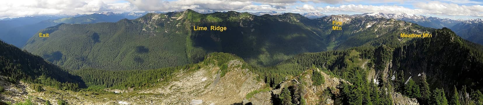 Our route goes across the back side of Meadow, Fire & Lime Mountains 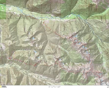 Route Track (courtesy of mtnmike) 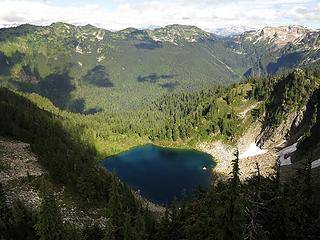 Emerald Lake 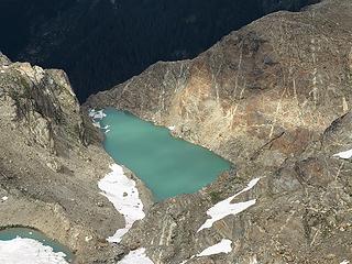 Fire Mtn Lake 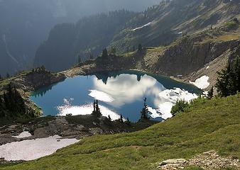 Mica Lake from above 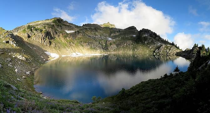 Mica Lake 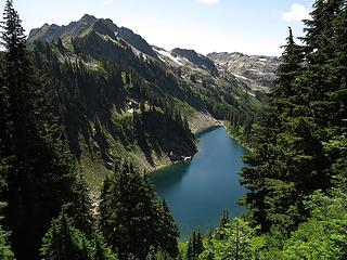 Lime Lake 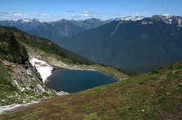 Junction Tarn 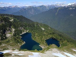 Milk Lakes from above 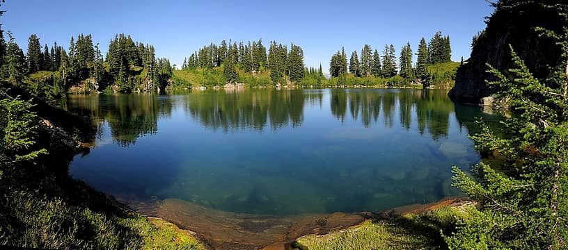 Lower Milk 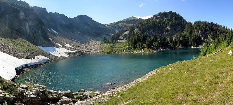 Upper Milk 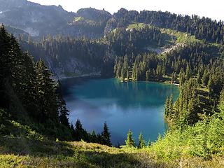 Lower Twin Lake 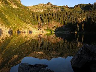 Lower Twin Lake Sunrise 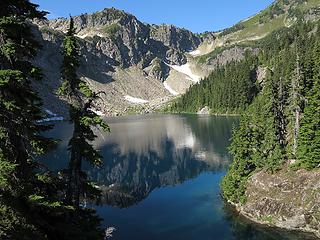 Rivord Lake 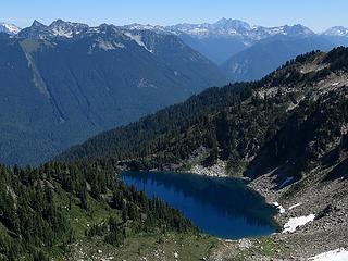 Rivord Lake from above 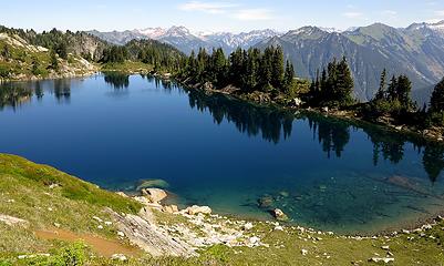 Lake 5698 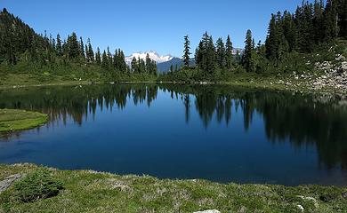 Upper Box Mtn Lake 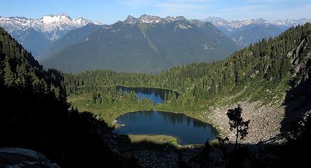 Box Mtn Lakes from Box Mtn 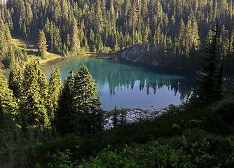 Lake 5108 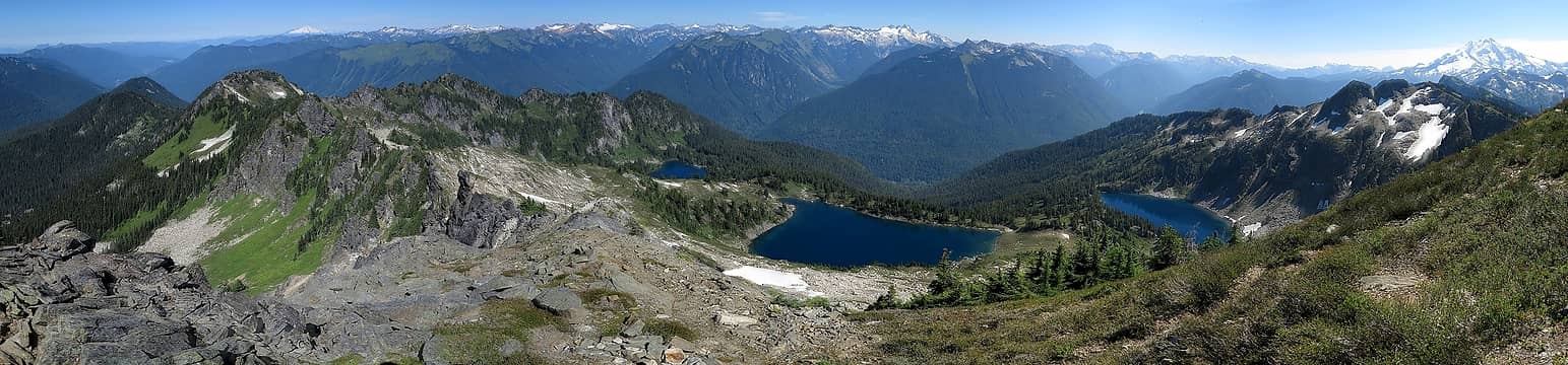 Lower Box Mtn Lake, Lake 5698 & Rivord Lake from Lime Mountain 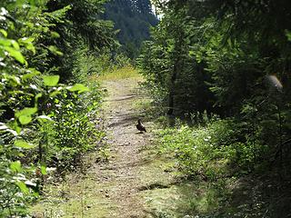 "Trail" that's actually a road (plus grouse) 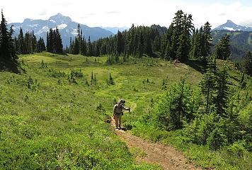 Meadows! 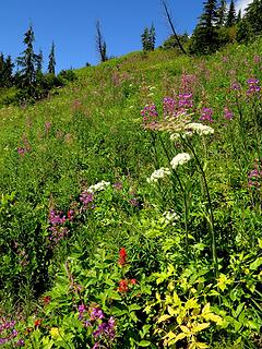 Flowers! 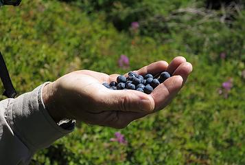 Food! 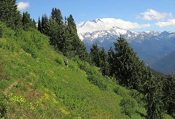 Mountain! 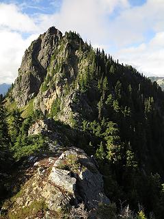 Meadow Mtn summit 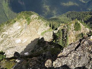 Steep scramble just below the summit 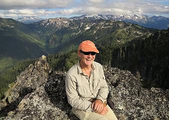 Mike on Meadow Mtn (with more Meadow Mtn & Fire Mtn behind) 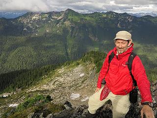 Matt on Meadow Mtn (with Lime Ridge behind) 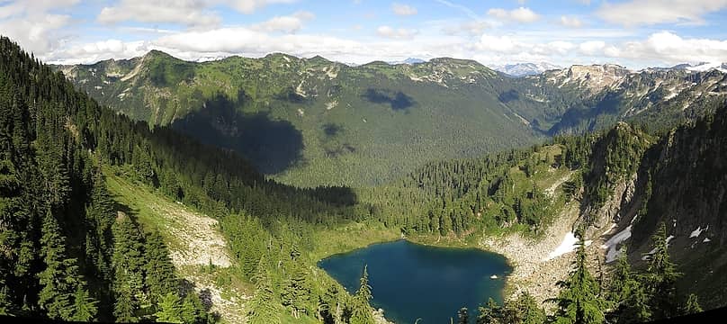 Emerald Lake & Lime Ridge 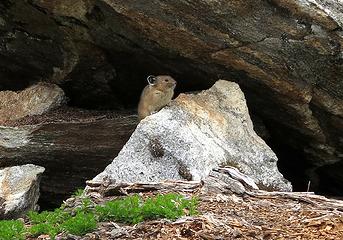 Pika near our packs 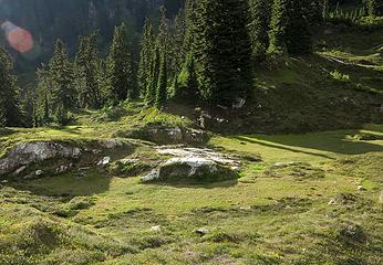 The putting greens of Owl Creek basin 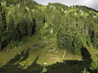 A very green evening 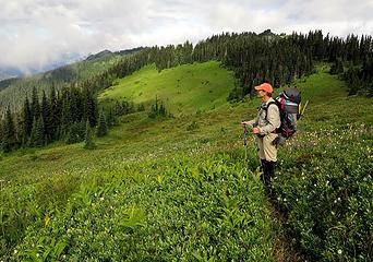 Meadow hiking 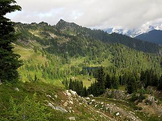 The bench back to Diamond Lake 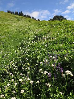 A bit of blue sky appears 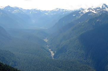 Whitechuck River far below 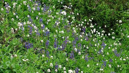 Lupine & bistort 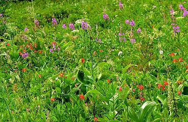 Fireweed & columbine 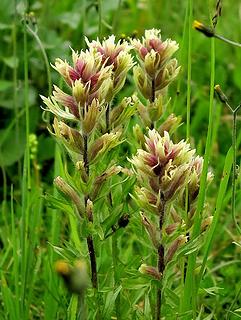 Paintbrush? 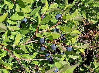 Berries 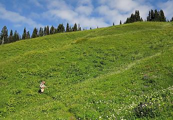 Green, green, green, with a bit of blue & white 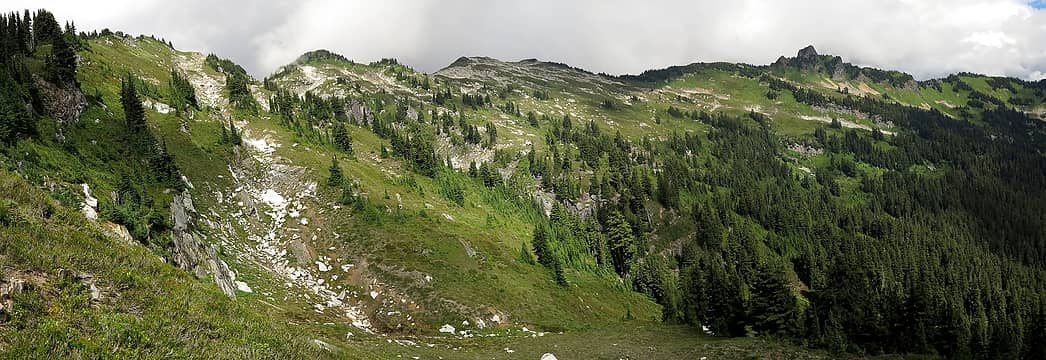 The ridge running up to False Fire 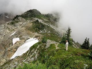 Mike looking from False Fire toward True Fire 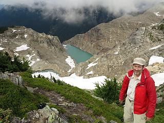 Me on False Fire with Fire Mtn Lakes 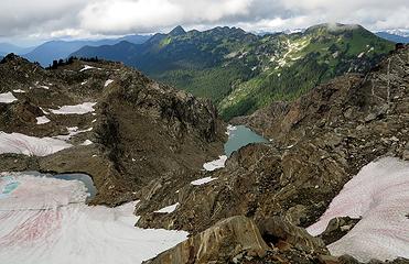 Clouds lift for a view of Lime Ridge 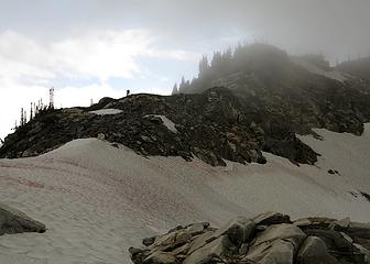 Mike traveling the crest between False & True Fire 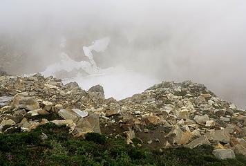 Brief glimpse of another lake in the basin north of True Fire 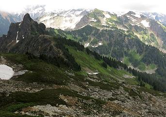 The outcrop blocking the ridge to Fire Creek Pass 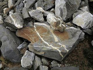 Decorated rocks 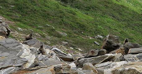 Three Marmots in the Rocks 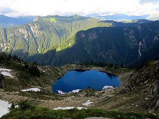 Mica Lake 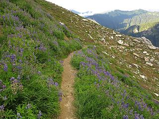 PCT descending to Mica Lake 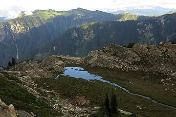 Tarn above Mica Lake 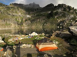 Camp at Mica Lake 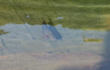 Swimming with the fishes 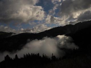 Moonlit clouds above and below us
As beacons mountains burned at evening. J.R.R. Tolkien
 zimmertr zimmertr
As beacons mountains burned at evening. J.R.R. Tolkien
zimmertr
|
| Back to top |
  
|
|
Backpacker Joe
Blind Hiker

Joined: 16 Dec 2001
Posts: 23956 | TRs | Pics
Location: Cle Elum |
Matt youre an animal. What a fantastic trip. 
"If destruction be our lot we must ourselves be its author and finisher. As a nation of freemen we must live through all time or die by suicide."
Abraham Lincoln
"If destruction be our lot we must ourselves be its author and finisher. As a nation of freemen we must live through all time or die by suicide."
Abraham Lincoln
|
| Back to top |
|
|
contour5
Member

Joined: 16 Jul 2003
Posts: 2963 | TRs | Pics
|
|
contour5
Member
|
Tue Aug 27, 2013 8:29 am |
|
|
Nice pictures, Matt. I've been looking at this area; looking forward to the rest of the report!
|
| Back to top |
|
|
Yana
Hater

Joined: 04 Jun 2004
Posts: 4212 | TRs | Pics
Location: Out Hating |
|
Yana
Hater
|
Tue Aug 27, 2013 8:33 am |
|
|
Wowza!
Among others, the photo of Fire Mountain Lake is amazing!
PLAY SAFE! SKI ONLY IN CLOCKWISE DIRECTION! LET'S ALL HAVE FUN TOGETHER!
PLAY SAFE! SKI ONLY IN CLOCKWISE DIRECTION! LET'S ALL HAVE FUN TOGETHER!
|
| Back to top |
|
|
chiwakum
not credible

Joined: 29 Jun 2009
Posts: 980 | TRs | Pics
Location: Ballard |
|
chiwakum
not credible
|
Tue Aug 27, 2013 12:12 pm |
|
|
Your exit ridge route is interesting. I have been considering some variants accessed from FS road 25 using ridges east of your route. This could be a good option after they close FS 26 for construction.
|
| Back to top |
|
|
Schroder
Member

Joined: 26 Oct 2007
Posts: 6722 | TRs | Pics
Location: on the beach |
|
Schroder
Member
|
Tue Aug 27, 2013 12:28 pm |
|
|
great trip
|
| Back to top |
|
|
Magellan
Brutally Handsome

Joined: 26 Jul 2006
Posts: 13116 | TRs | Pics
Location: Inexorable descent |
|
Magellan
Brutally Handsome
|
Tue Aug 27, 2013 2:02 pm |
|
|
Love it! Can't wait for details, Matt.
|
| Back to top |
|
|
puzzlr
Mid Fork Rocks

Joined: 13 Feb 2007
Posts: 7220 | TRs | Pics
Location: Stuck in the middle |
|
puzzlr
Mid Fork Rocks
|
Tue Aug 27, 2013 3:08 pm |
|
|
Such rich colors in the photos. Waiting for more ...
|
| Back to top |
|
|
raising3hikers
Member

Joined: 21 Sep 2007
Posts: 2344 | TRs | Pics
Location: Edmonds, Wa |
Nice
|
| Back to top |
|
|
hikapath
Member
Joined: 13 Apr 2009
Posts: 44 | TRs | Pics
Location: Lochsloy |
|
hikapath
Member
|
Tue Aug 27, 2013 6:57 pm |
|
|
wow--favorite place wish I could still get there--by the way there are two Rivord lakes--the highest lake under Lime Mt is upper Rivord--Bill would probably would not make too big an issue--
|
| Back to top |
|
|
hikapath
Member
Joined: 13 Apr 2009
Posts: 44 | TRs | Pics
Location: Lochsloy |
|
hikapath
Member
|
Tue Aug 27, 2013 9:06 pm |
|
|
As for the name of the upper lake--go to Tabor and Crowder--probably not official but does have history. Second go to the Lakes of Western Washington published by the state--lots of confirmation in there. I have noticed that some recent maps do not label Upper Rivord, and I do find that a bit disturbing. I consider it lack of research on recent creators of these maps--not the first time. Inspiration--good grief that is the same name they have now hung on Talisman in the Enchantments--wonder if it is the same person. Bill was a pretty inspiring person that did a lot for the wilderness there--the decision to name the lakes for him (technically for his father since he was still alive at the time) should not be cast off on a whim or lack of research.--sorry about the rant. By the way those are great photos, bring back some really great memories--would really love to go back there again--thank you from an old man.
|
| Back to top |
|
|
Matt
Tea, Earl Grey, Hot
Joined: 30 Jan 2007
Posts: 4307 | TRs | Pics
Location: Shoreline |
|
Matt
Tea, Earl Grey, Hot
|
Tue Aug 27, 2013 10:25 pm |
|
|
For now, I'm going to stay with the neutral reference to Lake 5698, just using it's elevation number.
I have seen maps with Indigo Lake, but that's clearly wrong, because there's another Indigo Lake named on USGS maps near Circle Peak.
I can see "Upper Rivord" as a possibility, since it's drainage stream merges with Rivord.
However, Tabor & Crowder don't name it, even though they refer to all of the other lakes by name. They refer to it as "the lake close below Lime Mountain." The also refer to the route as the "Rivord Lake High Route," with Rivord lake singular, not plural, so I don't think they intended to apply the "Rivord" name to the 5698-foot lake.
Of course, anyone can personally use whatever name they like.
As beacons mountains burned at evening. J.R.R. Tolkien
As beacons mountains burned at evening. J.R.R. Tolkien
|
| Back to top |
|
|
Matt
Tea, Earl Grey, Hot
Joined: 30 Jan 2007
Posts: 4307 | TRs | Pics
Location: Shoreline |
|
Matt
Tea, Earl Grey, Hot
|
Tue Aug 27, 2013 10:25 pm |
|
|
Something for the fishermen:
As beacons mountains burned at evening. J.R.R. Tolkien
As beacons mountains burned at evening. J.R.R. Tolkien
|
| Back to top |
|
|
KarlK
Member
Joined: 18 Jun 2009
Posts: 584 | TRs | Pics
|
|
KarlK
Member
|
Wed Aug 28, 2013 9:06 pm |
|
|
| Matt wrote: | | For now, I'm going to stay with the neutral reference to Lake 5698, just using it's elevation number. |
Big Frank and I hiked to this lake many times in the early '80s; I'm pretty sure it was known as Upper Rivord in that timeframe. It's certainly Upper Rivord in my mindframe.
It's a magical place.
Question: how was the ridge decent from Lime Ridge on the hike out? I've considered this as an interesting possibility many a time.
|
| Back to top |
|
|
Tom_Sjolseth
Born Yesterday

Joined: 30 May 2007
Posts: 2652 | TRs | Pics
Location: Right here. |
Beautiful. Thanks for the report, Matt.
|
| Back to top |
|
|
|
|
You cannot post new topics in this forum
You cannot reply to topics in this forum
You cannot edit your posts in this forum
You cannot delete your posts in this forum
You cannot vote in polls in this forum
|
Disclosure: As an Amazon Associate NWHikers.net earns from qualifying purchases when you use our link(s). |


