| Previous :: Next Topic |
| Author |
Message |
kite
Member


Joined: 28 Sep 2009
Posts: 1416 | TRs | Pics
Location: Olympia |
|
kite
Member
|
 Thu Aug 29, 2013 10:38 am |
|
|
Long time ago I came over the Tieton Pass and looked down into the Tieton Meadows and thought it would be a cool place to check out someday.... fast forward a few years and I thought it might be a good day to go check out the meadows. After checking out the topo maps online I could see that there must have been a trail there at some time as the map shows part of trial line on the north side of the upper meadow, but it was not continuous? The Garmin GPS map does show the trial and so does the forest service web site along with a several reports on WTA advising against this hike.
Road 1207 has been closed for some time now due to a damaged bridge, so its a 5 mile walk from the closure to the old tail head adding a bit of distance to the hike.
Stashing the bike at the real trail I started off on the trail, quickly coming to the junction 1118 that heads up to Tieton Pass and or Hidden Springs and the PCT, I took the left hand trail 1128. Within few hundred feet you come to the Tieton River. After finding a decent fording spot a bit up river I started to look for the trail up to Bear Creek, after about 1/2 hour searching for the trail and I gave up and had lunch, Oh Well maybe next time for the Bear Creek Mountain trail.
Paying more attention to the trial on the way back to the junction, I did find an overgrown left hand turn that might be what I was looking for.
So for the next 4 or 5 miles I followed a sometimes nice trail but mostly and overgrown, blow-down infested bit of forest floor with a steep hill on one site and a swamp or bog on the other, a few hours of this I started to see some open meadows but no views of Tieton Peak or the Devils Horn due low hanging clouds. I finally lost the trail in a stinky bog, so decided it was time to head back. About half way back I noticed some old flagging and some cut off logs that looked like an old trial heading up the side of the hill, thinking this might be easier that the climbing over or crawling under I have been doing I went up, it was a bit of a scramble but it connected with the 1118 trail just after the junction to Hidden Springs. From there it was an easy walk down to the bike.
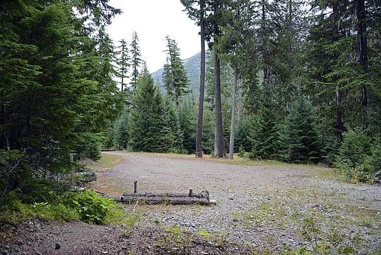 Old trail head 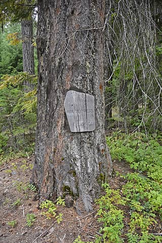 Goat Rocks Wilderness sign 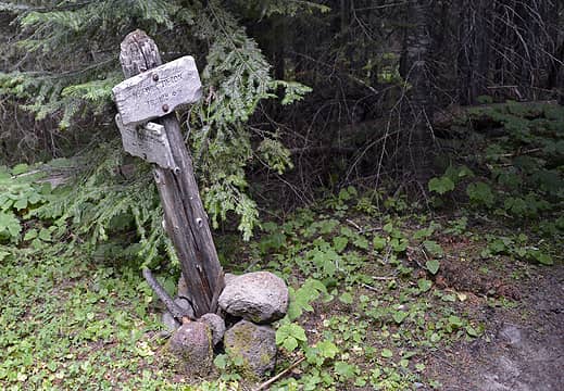 Trail Jucntion 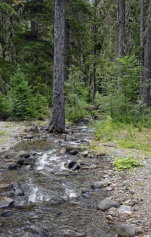 Scatter Creek 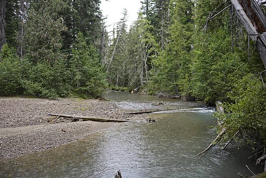 North Fork Tieton River in the rain 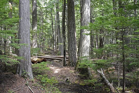 Trail in there some place 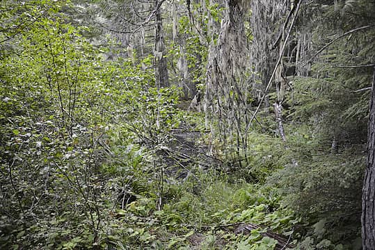 Another deadend 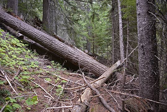 Countless blowdowns 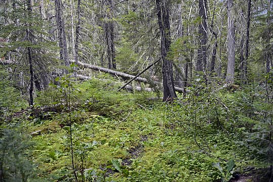 more swamp
|
| Back to top |
  
|
|
HumpnoocheeGirl
Member

Joined: 03 Feb 2011
Posts: 335 | TRs | Pics
Location: Grays Harbor |
|
| Back to top |
|
|
kite
Member
Joined: 28 Sep 2009
Posts: 1416 | TRs | Pics
Location: Olympia |
|
kite
Member
|
Thu Aug 29, 2013 12:46 pm |
|
|
View of Adams from Potato Hill area of the PCT
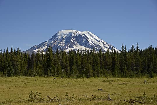 Mount Adams
|
| Back to top |
|
|
graffiti
Member

Joined: 17 Oct 2011
Posts: 287 | TRs | Pics
Location: Olympia, WA |
|
graffiti
Member
|
Thu Aug 29, 2013 6:06 pm |
|
|
So THAT'S what it looks like without snow.
And the meek shall inherit the Earth...um...if that's ok with you.
And the meek shall inherit the Earth...um...if that's ok with you.
|
| Back to top |
|
|
HitTheTrail
Member

Joined: 30 Oct 2007
Posts: 5456 | TRs | Pics
Location: 509 |
I love exploring abandoned trails. Sadly there is a lot more opportunity to do that now. Nice pics. 
|
| Back to top |
|
|
kite
Member
Joined: 28 Sep 2009
Posts: 1416 | TRs | Pics
Location: Olympia |
|
kite
Member
|
Fri Aug 30, 2013 8:48 am |
|
|
| graffiti wrote: | | So THAT'S what it looks like without snow. |
Its was much nicer in the snow, we really should have pushed on a bit further would have found a much nicer camp spot.
|
| Back to top |
|
|
graffiti
Member
Joined: 17 Oct 2011
Posts: 287 | TRs | Pics
Location: Olympia, WA |
|
graffiti
Member
|
Fri Aug 30, 2013 8:59 am |
|
|
I may try and get up there this week.
And the meek shall inherit the Earth...um...if that's ok with you.
And the meek shall inherit the Earth...um...if that's ok with you.
|
| Back to top |
|
|
HumpnoocheeGirl
Member
Joined: 03 Feb 2011
Posts: 335 | TRs | Pics
Location: Grays Harbor |
| kite wrote: | | View of Adams from Potato Hill area of the PCT |
Thanks Kite! We're leaving in the morning, so stinking excited 
|
| Back to top |
|
|
Trailhead
PCT Class of 2012

Joined: 25 Jul 2007
Posts: 444 | TRs | Pics
Location: PDX |
|
Trailhead
PCT Class of 2012
|
Fri Aug 30, 2013 11:59 am |
|
|
| HumpnoocheeGirl wrote: | | I know it's weird, but I have an obsession to go experience Potato Hill |
It's not very scenic unless you like lodgepole forest with little to no views. The Potato Hill area of the PCT is flat and dry. Trail follows an old road bed around the westside of the hill. The camping at Midway Creek is decent.
Have fun!
|
| Back to top |
|
|
HumpnoocheeGirl
Member
Joined: 03 Feb 2011
Posts: 335 | TRs | Pics
Location: Grays Harbor |
Trailhead: thanks for the Midway Creek camping tip 
|
| Back to top |
|
|
HumpnoocheeGirl
Member
Joined: 03 Feb 2011
Posts: 335 | TRs | Pics
Location: Grays Harbor |
| Ski wrote: | | If you want a great view of Potato Hill (and Adams, Rainier, and St. Helens) try the Cispus Peak Trail. There's a little basin below the peak where you can set up a tent near a small tarn. Be sure to bring a water filter and lots of DEET or bug netting.
I always liked the approach trail from the west better. Coming up from the east side (near Jackpot Lake) was brutally buggy. |
Hiya Ski  I just was reading about the Cispus Peak Trail, beautiful pictures. I got the beta for Jug Lake but what about the West approach?
|
| Back to top |
|
|
Ski
><((((°>

Joined: 28 May 2005
Posts: 12831 | TRs | Pics
Location: tacoma |
|
Ski
><((((°>
|
Fri Aug 30, 2013 2:55 pm |
|
|
HumpnoocheeGirl:
At Randle, turn RIGHT (south) onto the #25 road. Drive over the bridge that spans the Cowlitz. In less than a mile, the road forks.
Veer LEFT onto the #23 road.
Turn LEFT onto the #55 road.
At some point the #55 road becomes the #5508 road.
Turn LEFT onto the #5508-023 road.
Make an IMMEDIATE RIGHT onto the #5508-024 road. (easily missed!)
Follow the #5508-024 road to its end.
This is the west end of the #7 Klickitat Trail.
Follow the #7 Klickitat Trail to its junction with the #127 Cispus Peak Trail, a short spur trail of less than a mile that ascends into the basin below Cispus Peak, skirts around the south flank of Cispus and takes you to the summit at 5656 ft.
Buggy route:
From US Hwy 12, turn RIGHT (south) onto the #20 road.
Follow the #20 road just past Jackpot Lake (you can't see the lake from the road).
Just before the road turns to the right (north), there's an old landing where you can park and find the trailhead to the #7 Klickitat Trail.
Again, this is the buggy way, and I wouldn't advise it.
Jackpot Lake was a mosquito-infested trashed-out elk hunting camp the last time I was up there.
If you want a little more adventure, once you're up there you can connect to the #128 Pompey Peak Trail, which skirts around Castle Butte and Twin Sisters. A spectacular area when the lupine is in bloom.
The trail up to the summit of Pompey is easily confused with game traces- I followed one all the way to the top of another peak before I realized I was on the wrong hill.
The view of Rainier and the Cowlitz Valley from Pompey is pretty spectacular, but camping opportunities are slim to none.
Be careful if you go up Pompey- the peak was named for a mule that fell off the trail to its death. Steep is kind of an understatement.
Again, there's a basin below the east face of Cispus where there's a small tarn. Spectacular sunrise views of Adams and Rainier while you make morning tea.
There are two smaller tarns immediately north, and all three are populated by frogs. If you're timing is right (or wrong, depending on your viewpoint) you will be serenaded all night long by frogs in stereo, just in case the mosquitoes aren't enough to provide for a sleepless night.
Did I mention bugs?
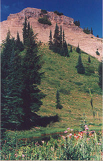 cispus-point-071196
"I shall wear white flannel trousers, and walk upon the beach.
I have heard the mermaids singing, each to each."
"I shall wear white flannel trousers, and walk upon the beach.
I have heard the mermaids singing, each to each."
|
| Back to top |
|
|
Ski
><((((°>
Joined: 28 May 2005
Posts: 12831 | TRs | Pics
Location: tacoma |
|
Ski
><((((°>
|
Fri Aug 30, 2013 3:01 pm |
|
|
btw:
sorry about the thread drift there.
love the report. always wondered if maybe there was a trail over there that wasn't straight up and down. sounds interesting.
can't hike hard gravel road anymore though. any idea if they have plans to repair the bridge?
"I shall wear white flannel trousers, and walk upon the beach.
I have heard the mermaids singing, each to each."
"I shall wear white flannel trousers, and walk upon the beach.
I have heard the mermaids singing, each to each."
|
| Back to top |
|
|
kbatku
Questionable hiker

Joined: 17 Sep 2007
Posts: 3330 | TRs | Pics
Location: Yaquima |
|
kbatku
Questionable hiker
|
Mon Sep 02, 2013 10:37 pm |
|
|
That's the Old Army Trail. It eventually winds up at McCall Basin - at least that's what the people I saw gurgle up out of the brush 35 years ago told me. They were pretty beat, and the trail was virtually non-existent by that point (nearing McCall Basin) 35 years ago, so I can imagine it's pretty much gone now.
It's a really old trail, dating back to the Indian Wars (supposedly) and was used extensively in training troops in WWII (allegedly) but the last time I tried to follow it, I almost got lost on the way out. I thought about just heading up hill like you did, and if I'd have got any loster, I would have.
The bridge repair/replacement isn't making much headway, and if it happens at all it won't be for a long time.
|
| Back to top |
|
|
Pyrites
Member

Joined: 16 Sep 2014
Posts: 1884 | TRs | Pics
Location: South Sound |
|
Pyrites
Member
|
Wed Dec 07, 2016 7:19 pm |
|
|
The trail called on this thread Old Army Trail is shown on the 1971 Pacific Crest National Scenic Trail, Washington, map.
Non-topo, about 1/4" to the mile.
This map highlighted in bold and numbered some side trails and not others. #1118 is one of the highlighted. The Old Army is not.
Keep Calm and Carry On?
Heck No.
Stay Excited and Get Outside!
Keep Calm and Carry On?
Heck No.
Stay Excited and Get Outside!
|
| Back to top |
|
|
|
|


 I've not been this area yet. Of course, now that Conrad Meadows is on fire I want to go there. We are leaving for vacation tomorrow. Gonna hang out around the N/NW side of Mt Adams for a couple of days. I know it's weird, but I have an obsession to go experience Potato Hill
