| Previous :: Next Topic |
| Author |
Message |
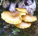
FungiFan
Member

Joined: 09 Sep 2010
Posts: 395 | TRs | Pics
Location: East of the Olympics |
|
FungiFan
Member
|
 Mon Sep 16, 2013 11:20 am |
|
|
We have been up to the Tyler-Gray Wolf ridge once before and had white out fog conditions as a reward. Inspired by several TR's in the area https://www.nwhikers.net/forums/viewtopic.php?t=8005134&highlight=baldy, https://www.nwhikers.net/forums/viewtopic.php?t=8001499&highlight=baldy, https://www.nwhikers.net/forums/viewtopic.php?t=8000237&highlight=baldy and wanting to work further on our off trail and scrambling skills we decided to return to this ridge. This was also a chance to get some beta for returning in the winter for some snowshoeing given Hurricane Ridge is no longer open weekdays. The forecast for the 14th looked good with temps predicted in the low 60's @ ~6000ft which seemed reasonable given the sunny exposure and lack of water up there. It was more like the low to mid 70's with a hot dry wind blowing up from the valleys...
We parked at the end of 2870-270 which remains in good condition. Took the R hand trail from the end of the road which wastes no time getting down to the business of ascending the ridge. It eventually drops you out in meadows below the ridge line, from here it disappears and reappears as you make for the saddle and the views open up.
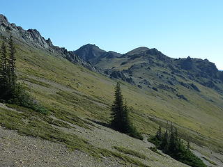 Looking over towards Tyler 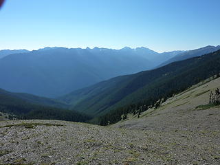 The Mueller Creek drainage 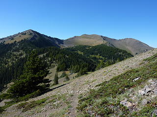 Our route forward 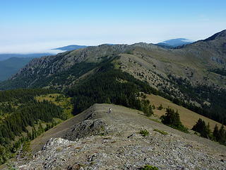 Frog Farm climbing the ridge, marine layer over the Straits of Juan de Fuca 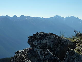 Buckhorn, Constance and Warrior from the ridge 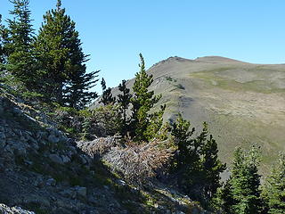 False and true summit of Baldy 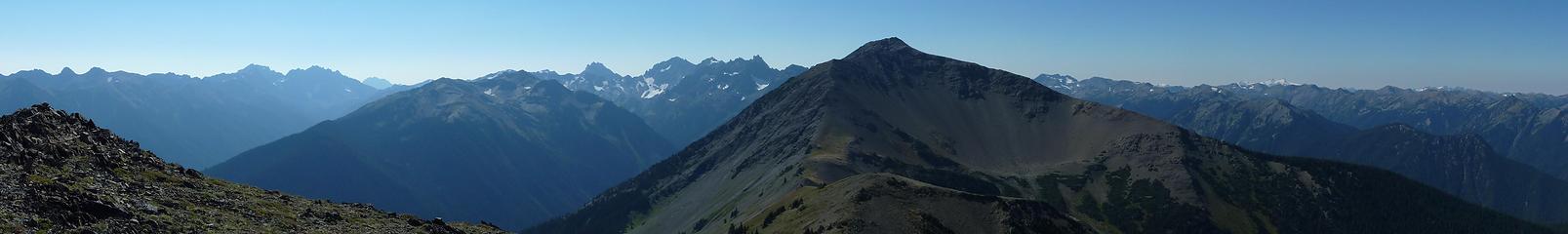 Pano from Baldy, Grey Wolf in foreground 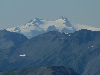 Mt Olympus  )
We retraced our route and dropped down through the meadow to pick up the Baldy/Maynard Burn trail and steeply descended off the ridge. I knew we would close the loop travelling along an old decommissioned FS road, didn't realize there were 2 such roads on the way down so we took a brief foray up the wrong one. It did drop us into a steep gulley with a faint way trailed marked with flagging. Any of you experienced Olympic hikers know where this goes? We returned back to where the trail had dropped us onto the road and quickly found the correct trail and returned to the car. )
We retraced our route and dropped down through the meadow to pick up the Baldy/Maynard Burn trail and steeply descended off the ridge. I knew we would close the loop travelling along an old decommissioned FS road, didn't realize there were 2 such roads on the way down so we took a brief foray up the wrong one. It did drop us into a steep gulley with a faint way trailed marked with flagging. Any of you experienced Olympic hikers know where this goes? We returned back to where the trail had dropped us onto the road and quickly found the correct trail and returned to the car.
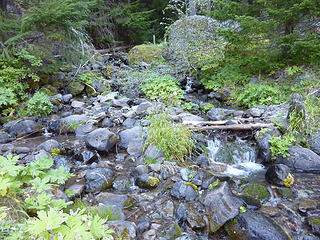 Meuller Creek at the trail crossing
Stupid isn't illegal...but sure comes with consequences.
Famous last words: 'Here, hold my beer and watch this.'
Stupid isn't illegal...but sure comes with consequences.
Famous last words: 'Here, hold my beer and watch this.'
|
| Back to top |
  
|
|
Abert
Member

Joined: 02 Sep 2010
Posts: 588 | TRs | Pics
Location: Sequim |
|
Abert
Member
|
Mon Sep 16, 2013 1:27 pm |
|
|
|
| Back to top |
|
|
RodF
Member

Joined: 01 Sep 2007
Posts: 2593 | TRs | Pics
Location: Sequim WA |
|
RodF
Member
|
Tue Sep 17, 2013 3:08 pm |
|
|
| FungiFan wrote: | | We parked at the end of 2870-270 which remains in good condition. Took the R hand trail from the end of the road... |
This is the Tyler Peak way trail. I prefer climbing it vs Maynard Burn trail, as it offers water at several stream crossings on the way up.
| FungiFan wrote: | | ...the Baldy/Maynard Burn trail and steeply descended off the ridge. I knew we would close the loop travelling along an old decommissioned FS road, didn't realize there were 2 such roads on the way down so we took a brief foray up the wrong one. It did drop us into a steep gulley with a faint way trailed marked with flagging. Any of you experienced Olympic hikers know where this goes? |
It just kind of disappears into the top of an old clearcut, through which one can tortuously bushwack down Mueller Creek if one is foolish like me but which offers its own mossy charms, too.
It's actually one road, brushed out so one can walk it. From the road's switchback, the Lower Maynard Burn Trail drops down to Royal Creek. Most hikers use a way trail which shortcuts the road switchback, rejoining the road just south of Mueller Creek.
"of all the paths you take in life, make sure a few of them are dirt" - John Muir
"the wild is not the opposite of cultivated. It is the opposite of the captivated - Vandana Shiva
"of all the paths you take in life, make sure a few of them are dirt" - John Muir
"the wild is not the opposite of cultivated. It is the opposite of the captivated - Vandana Shiva
|
| Back to top |
|
|
FungiFan
Member
Joined: 09 Sep 2010
Posts: 395 | TRs | Pics
Location: East of the Olympics |
|
FungiFan
Member
|
Wed Sep 18, 2013 9:27 am |
|
|
@Abert. Random luck! Some day I need to spend some time to learn more about photography. We really admire the awesome photos you take in the Olympics.
@RodF. Thanks for the info. We almost carried on but decided to retrace our steps, at worst we would have had to go down the Maynard Burn trail to the RC trail and then road walked back to the car. We have done the ridge from the Maynard Burn trail and would have to agree using the way trail from the end of 270 is preferable. We ran into 2 hikers ~ 14:00 who had come up that route heading to Baldy. They looked hot and tired!
Stupid isn't illegal...but sure comes with consequences.
Famous last words: 'Here, hold my beer and watch this.'
Stupid isn't illegal...but sure comes with consequences.
Famous last words: 'Here, hold my beer and watch this.'
|
| Back to top |
|
|
|
|
You cannot post new topics in this forum
You cannot reply to topics in this forum
You cannot edit your posts in this forum
You cannot delete your posts in this forum
You cannot vote in polls in this forum
|
Disclosure: As an Amazon Associate NWHikers.net earns from qualifying purchases when you use our link(s). |


