| Previous :: Next Topic |
| Author |
Message |
cartman
Member


Joined: 20 Feb 2007
Posts: 2800 | TRs | Pics
Location: Fremont |
|
cartman
Member
|
 Wed Jul 10, 2013 5:13 pm |
|
|
THE INSPIRATION TRAVERSE: Highway 20 to Cascade River Road
Peaks summitted: Tricouni 8102', Primus 8508', Austera 8334', Klawatti 8485', Eldorado 8868'
Glaciers traversed: Borealis, North Klawatti, Klawatti, McAllister, Inspiration, Eldorado
The Inspiration Traverse spans the McAllister Icecap, the largest icecap in the North Cascades, thus the largest continuous span of ice in the lower 48.
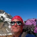
I've had this trip on my mind for several years to do as a true traverse and finally had the opportunity with iron and hotpantz. I've done Eldorado a couple of times and spent four days several years ago to do Dorado Needle and Primus with a basecamp at Eldorado Camp, but this was all new terrain for Mike and Carrie.
Day 0: Colonial Creek CG to Neve Camp
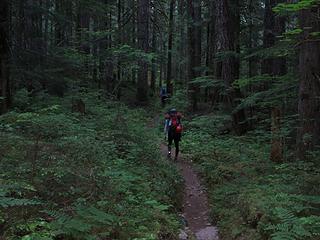
We left Seattle Wednesday afternoon, got permits at Marblemount, left a car at the Eldorado TH and drove up to Colonial Creek CG. Started up the Thunder Creek Trail about 7pm and hiked 2.5 miles to Neve Camp. Nice camp near good water.
Day 1: Neve Camp to Lucky Pass
Left camp at 6am and continued another four miles up easy trail
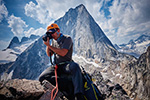
 Early start 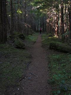 Nice trail 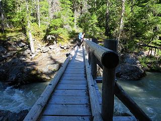 Crossing 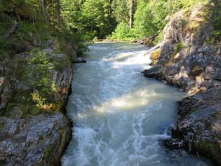 Thunder Creek 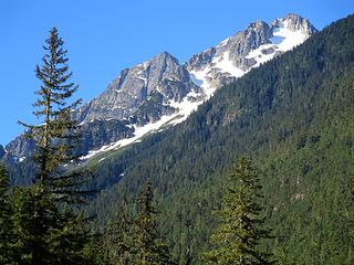 First look 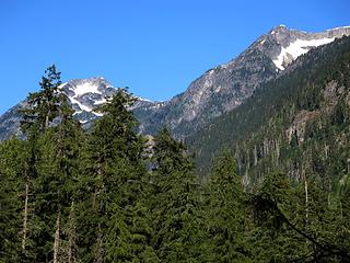 Peaks 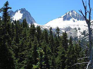 Tricouni and Primus 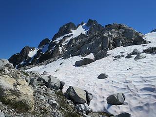 Below Tricouni 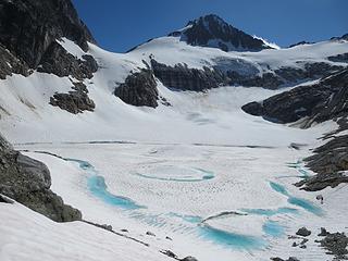 Glacial Lake below Lucky Pass 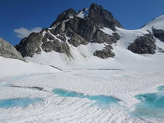 Tricouni and Glacial Lake 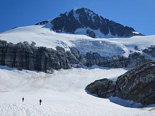 Below Primus 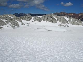 Lake and views 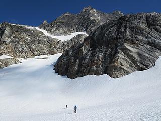 Heading for the direct route to Lucky Pass 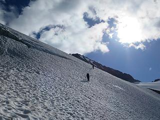 Good route 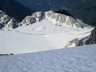 High above the lake 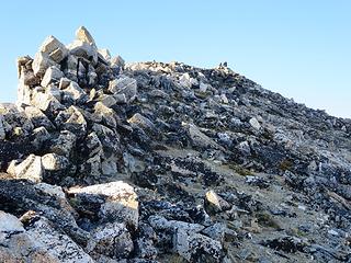 Nearing Tricouni summit 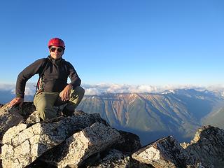 Tricouni summit 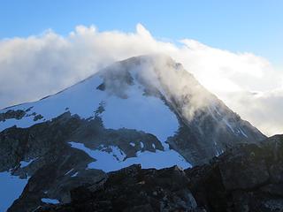 Primus shroud 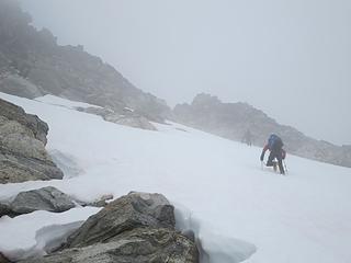 Starting up Primus 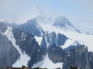 Starting to clear 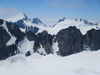 Eldorado to Marble Needle 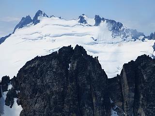 Dorado and Marble Needles 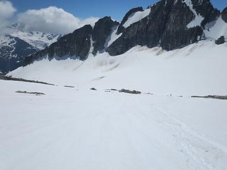 Descending Primus 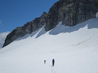 Traversing the North Klawatti Glacier 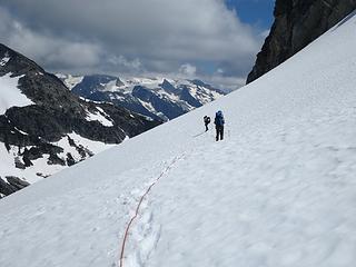 Mike & Carrie enjoy the views 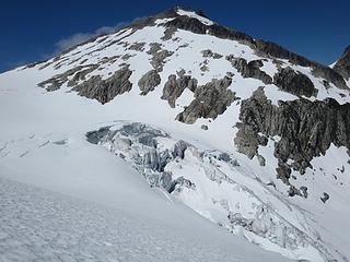 Primus and Icefall 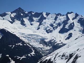 Forbidden to Torment 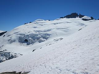 Klawatti and its glacier 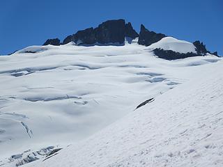 Nunatak 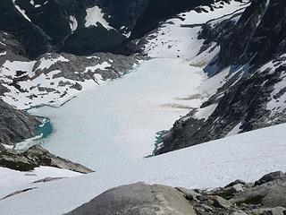 Klawatti Lake 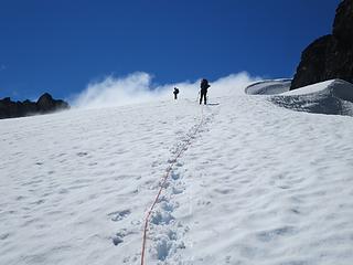 Around Austera Towers 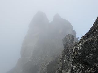 Austera in the mists 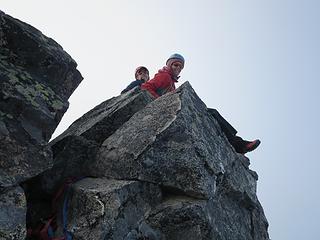 Mike & Carrie on Austera 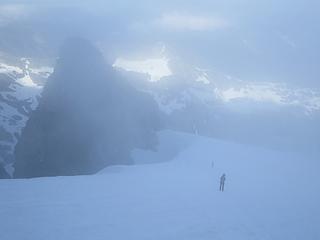 Back to Austera high camp 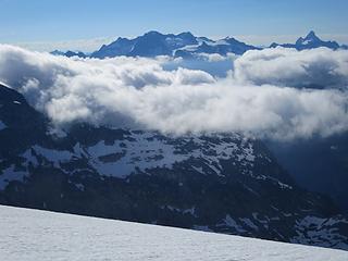 Morning on Logan 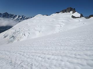 Klawatti morning 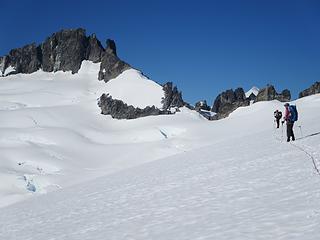 Klawatti and Eldorado peeking above 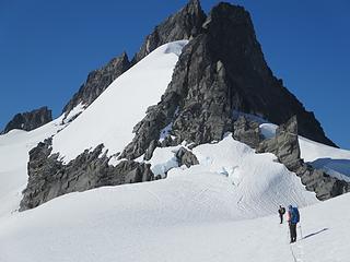 Approaching the wall 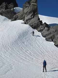 Iron heads up 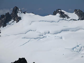 Dorado and Marble closeup 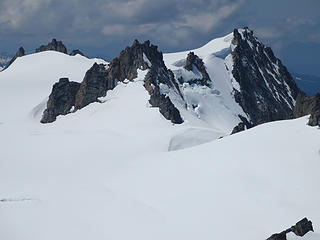 Towers 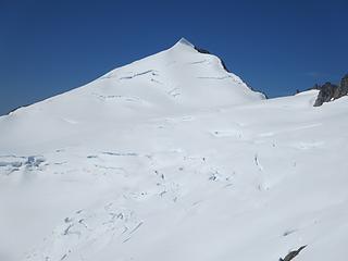 One beautiful mountain 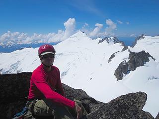 Klawatti summit 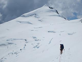 Traversing the Inspiration Glacier 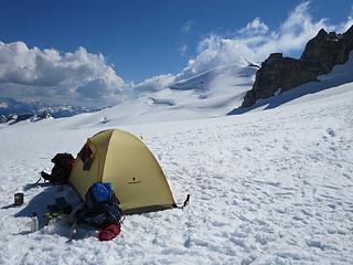 Inspiration Camp 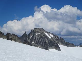 Clouds approaching Klawatti 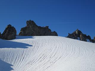 Jetting the Towers 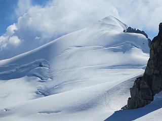 Eldorado 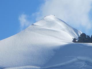 Carrie and Mike summit Eldorado 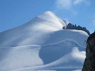 Topping out 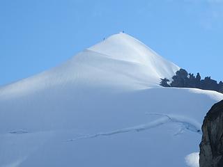 Heading down 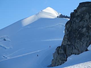 Looking good 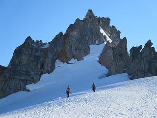 Happy climbers 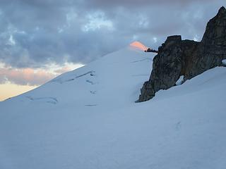 Eldo glow 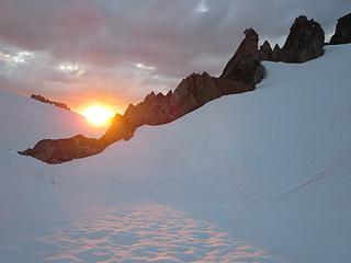 Sunset 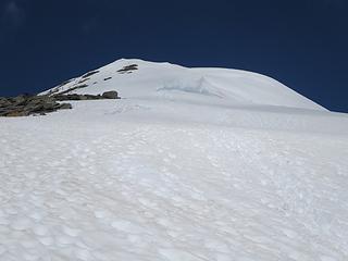 Starting up the ridge 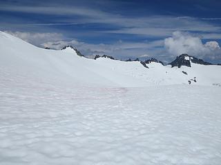 Tepeh Towers and Klawatti 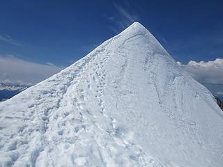 Classic 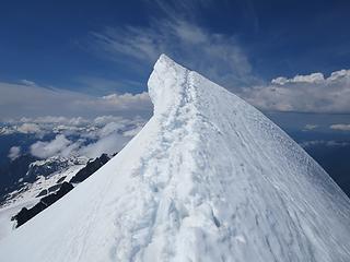 Eldo summit 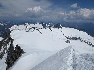 The Inspiration Traverse 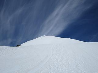 Looking back at Eldorado 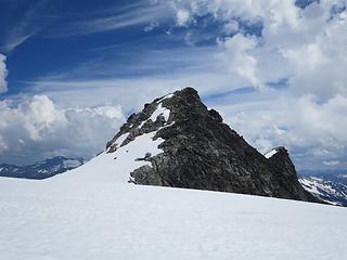 7733 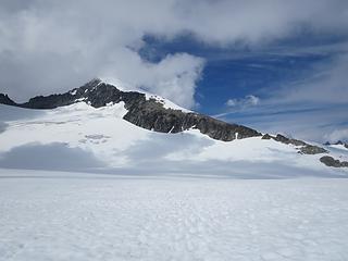 Last look at Eldorado 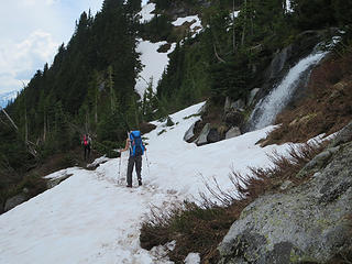 Upper trail 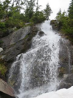 Falls
|
| Back to top |
  
|
|
RichP
Member

Joined: 13 Jul 2006
Posts: 5633 | TRs | Pics
Location: here |
|
RichP
Member
|
Wed Jul 10, 2013 6:13 pm |
|
|
|
| Back to top |
|
|
BirdDog
Member
Joined: 09 Jan 2007
Posts: 1067 | TRs | Pics
Location: Seattle |
|
BirdDog
Member
|
Wed Jul 10, 2013 7:44 pm |
|
|
Beautiful. That's an awesome area up there.
"There can be no greater issue than that of conservation in this country."
Teddy Roosevelt August 6, 1912
"There can be no greater issue than that of conservation in this country."
Teddy Roosevelt August 6, 1912
|
| Back to top |
|
|
chiwakum
not credible

Joined: 29 Jun 2009
Posts: 980 | TRs | Pics
Location: Ballard |
|
chiwakum
not credible
|
Wed Jul 10, 2013 10:47 pm |
|
|
Wow!!! Cool trip. Great work. Awesome pics.
|
| Back to top |
|
|
Roald
Member

Joined: 06 Aug 2007
Posts: 367 | TRs | Pics
Location: Seattle |
|
Roald
Member
|
Wed Jul 10, 2013 10:50 pm |
|
|
Beautiful. Congrats, and thanks for the pics and report. You are hitting it hard this summer!
|
| Back to top |
|
|
hikerbiker
Member

Joined: 29 Sep 2008
Posts: 155 | TRs | Pics
Location: Rock Creek |
Thanks for the photo dump! That's a great traverse; I've done it on skis in May.
BTW I believe the photo of "elusive Moraine Lake" is actually Klawatti Lake.
|
| Back to top |
|
|
wildernessed
viewbagger

Joined: 31 Oct 2004
Posts: 9275 | TRs | Pics
Location: Wenatchee |
 Beautiful ! Beautiful !
Living in the Anthropocene
Living in the Anthropocene
|
| Back to top |
|
|
DIYSteve
seeking hygge

Joined: 06 Mar 2007
Posts: 12655 | TRs | Pics
Location: here now |
|
DIYSteve
seeking hygge
|
Thu Jul 11, 2013 9:23 am |
|
|
Luv that route! It deserves classic status. Nice that conditions allowed you to do the direct route up the Borealis Glacier. FWIW, the longer route that sweeps right then left over cliffs is a lovely walk.
(You might want to check the date range in your post title)
|
| Back to top |
|
|
Jetlag
Member
Joined: 17 Aug 2010
Posts: 1410 | TRs | Pics
|
|
Jetlag
Member
|
Thu Jul 11, 2013 9:41 am |
|
|
Terrific pictures and route description! When I moved to Washington in the late sixties I saw a cover photo of Willi and Jolene Unsoeld on this route with, I think, two of their kids. At that time I had no idea such an icecap existed in the lower 48. Decades later I took my own kids up Eldorado. It would have so neat to have spent a couple more days on the icecap so they could have seen those views back to Eldorado flanked by Marble and Dorado needles. Your shots in that direction are wonderful.
|
| Back to top |
|
|
iron
Member

Joined: 10 Aug 2008
Posts: 6392 | TRs | Pics
Location: southeast kootenays |
|
iron
Member
|
Thu Jul 11, 2013 10:14 am |
|
|
| BigSteve wrote: | | (You might want to check the date range in your post title) |
just depends on how you read dates:
7/3-7 .... (20)13
|
| Back to top |
|
|
cartman
Member
Joined: 20 Feb 2007
Posts: 2800 | TRs | Pics
Location: Fremont |
|
cartman
Member
|
Thu Jul 11, 2013 10:45 am |
|
|
| hikerbiker wrote: | | I believe the photo of "elusive Moraine Lake" is actually Klawatti Lake. |
I believe you are correct, sir. Corrected above.
|
| Back to top |
|
|
Stefan
Member

Joined: 17 Dec 2001
Posts: 5091 | TRs | Pics
|
|
Stefan
Member
|
Thu Jul 11, 2013 11:10 am |
|
|
a most excellent traverse. I am happy you all did it! 
|
| Back to top |
|
|
coho
Member
Joined: 19 Oct 2005
Posts: 208 | TRs | Pics
Location: west sound |
|
coho
Member
|
Thu Jul 11, 2013 11:33 am |
|
|
Hells bells! Gorgeous terrain, sumptuous adventure. Nice work.
|
| Back to top |
|
|
Snowdog
Member

Joined: 21 Jul 2006
Posts: 1028 | TRs | Pics
Location: on (& off) the beaten path |
|
Snowdog
Member
|
Thu Jul 11, 2013 11:36 am |
|
|
| cartman wrote: | Inspiration Camp |
Luv this pic!
Nice trip you guys!
'we don't have time for a shortcut'
'we don't have time for a shortcut'
|
| Back to top |
|
|
Magellan
Brutally Handsome

Joined: 26 Jul 2006
Posts: 13116 | TRs | Pics
Location: Inexorable descent |
|
Magellan
Brutally Handsome
|
Thu Jul 11, 2013 1:01 pm |
|
|
Thanks for taking time to write it up, Eric. That is one sexy traverse.
|
| Back to top |
|
|
|
|


